


Nawigacja
Pobierz tę trasę na swój telefon komórkowy
Mapa
Road bike tour Nesslau - Hemberg - Wattwil - Nesslau

średni
Droga rowerowa
34,71 km
Zeskanuj kod QR i rozpocznij nawigację w aplikacji bergfex.
QR Code
Wędrówki i tropienie

Road bike tour Nesslau - Hemberg - Wattwil - Nesslau

Odległość
34,7 km
Czas trwania
01:50 h
Ascent
507 hm
Poziom morza
611 - 1 108 m

Poziom trudności: 3

Ścieżka do pobrania
Mapa
Road bike tour Nesslau - Hemberg - Wattwil - Nesslau
średni
Droga rowerowa
34,71 km

From Nesslau the route steadily rises and leads over wide, panoramic sections to Hemberg. After a short, often fast descent, the transition to Wattwil follows before the route returns to Nesslau on the...

Opis

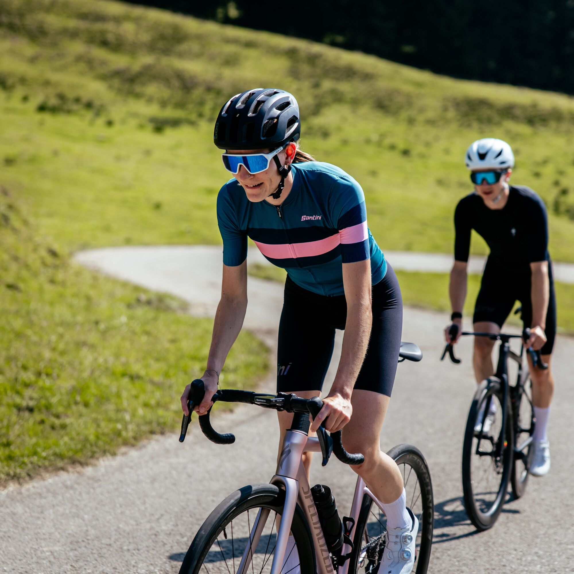
From Nesslau the route steadily rises and leads over wide, panoramic sections to Hemberg. After a short, often fast descent, the transition to Wattwil follows before the route returns to Nesslau on the valley road. The tour is suitable for experienced road cyclists and offers a good mix of elevation, fast sections, and impressive scenery. Particularly appealing is the view of Säntis and the Churfirsten during the ascent.
Trasa
Trasa
Mapa
Road bike tour Nesslau - Hemberg - Wattwil - Nesslau
średni
Droga rowerowa
34,71 km
Wiese
(762 m)
Sąsiedztwo
0,0 km
Nesslau-Neu St. Johann
(759 m)
Stacja kolejowa
0,0 km
Neu St. Johann
(765 m)
Wioska
0,6 km
Rutzenbach
(755 m)
Korytarz/teren
0,8 km
Gäuer
(750 m)
Korytarz/teren
0,9 km
Unterstein
(904 m)
Rozliczenie
3,1 km
Sibold
(967 m)
Rozliczenie
3,2 km
Hof-Aemelsberg
(978 m)
Rozliczenie
3,9 km
Dreibrunnen
(975 m)
Korytarz/teren
3,9 km
Brüssel
(977 m)
Korytarz/teren
4,0 km
Guggenloch
(981 m)
Korytarz/teren
5,2 km
Platten-Guggenloch
(1 008 m)
Korytarz/teren
5,4 km
Sternen
(1 020 m)
Restauracja
5,9 km
Bendel
(1 013 m)
Rozliczenie
5,9 km
Kellen-Bendel
(1 087 m)
Korytarz/teren
7,1 km
Eggli
(1 018 m)
Sąsiedztwo
9,6 km
Oberdorf
(962 m)
Sąsiedztwo
9,9 km
Katholische Kirche St. Johannes der Täufer
(968 m)
Miejsce kultu
10,3 km
Hemberg
(946 m)
Siodełko górskie
10,5 km
Evangelische Kirche
(945 m)
Miejsce kultu
10,5 km
Gasthaus Löwen
(946 m)
Restauracja
10,6 km
Anker
(889 m)
Restauracja
14,5 km
Heiterswil
(883 m)
Rozliczenie
14,6 km
Eggberg
(869 m)
Restauracja
16,7 km
Eggberg
(823 m)
Rozliczenie
16,9 km
Dicken
(770 m)
Rozliczenie
17,6 km
Tüetlisberg
(737 m)
Rozliczenie
18,3 km
Evangelische Kirche
(619 m)
Miejsce kultu
19,4 km
Wattwil
(611 m)
Wioska
19,9 km
Ennetbrugg
(611 m)
Korytarz/teren
20,0 km
Türkisch-Islamisches Zentrum
(613 m)
Miejsce kultu
20,0 km
Fladehüsli
(639 m)
Restauracja
23,0 km
Scheftenau
(636 m)
Rozliczenie
23,3 km
Kappel
(632 m)
Wioska
24,5 km
Ebnat-Kappel
(632 m)
Wioska
25,1 km
Ebnat
(638 m)
Wioska
25,6 km
Gasthaus Sternen
(634 m)
Restauracja
25,9 km
Die Fabrik
(637 m)
Restauracja
26,2 km
Blume
(687 m)
Restauracja
27,8 km
Blomberg
(729 m)
Rozliczenie
29,4 km
Türler
(705 m)
Korytarz/teren
30,1 km
Türli
(735 m)
Korytarz/teren
30,2 km
Krummenau
(713 m)
Wioska
30,4 km
Brunnen
(723 m)
Rozliczenie
30,6 km
Krümmenswil
(732 m)
Stacja gondoli
31,1 km
Kammern
(744 m)
Korytarz/teren
31,8 km
Thurrain
(758 m)
Korytarz/teren
32,3 km
Vor dem Bach-Bühl
(758 m)
Korytarz/teren
32,9 km
Bühl
(759 m)
Korytarz/teren
33,0 km
Bühlerbrugg
(742 m)
Korytarz/teren
33,3 km
Rutzenbach
(755 m)
Korytarz/teren
33,5 km
Neu St. Johann
(765 m)
Wioska
34,0 km
Nesslau-Neu St. Johann
(759 m)
Stacja kolejowa
34,6 km
Wiese
(762 m)
Sąsiedztwo
34,7 km
Informacje o wycieczce

Varied road bike loop from Nesslau over the scenic Hemberg to Wattwil and along the Thur valley back. Ideal for sporty riders.

Technologia
3 / 6
Stan
4 / 6
Krajobraz
5 / 6
Doświadczenie
3 / 6
Najlepsza pora roku
Sty
Lut
Mar
Kwi
Maj
Cze
Lip
Sie
Wrz
Paź
Lis
Gru
Udostępnij trasę
Mapa
Road bike tour Nesslau - Hemberg - Wattwil - Nesslau
średni
Droga rowerowa
34,71 km
Błąd
Wystąpił błąd. Spróbuj ponownie.
Sprzęt

Road-safe racing bike with good tires, bike helmet, weather-appropriate bike clothing in a multi-layer principle, lightweight wind jacket, grippy bike shoes, shatterproof cycling glasses, fingerless gloves, mobile phone and possibly phone holder, GPS device or map material, power bank, water bottle and holder, sufficient drinking water and provisions, small first aid kit, multitool, spare tube or tubeless repair kit, mini pump, chain lock as well as sun and rain protection.

Instrukcje bezpieczeństwa

Traffic can be heavier depending on the time of day when climbing to Hemberg.
Caution in shaded areas: wet spots are common in spring and autumn.
The descent to Wattwil includes some tight curves.

Informacje o przyjeździe
Przybycie
- From the Zurich metropolitan area and central Switzerland: On the A3 at Reichenburg towards Rapperswil and then over the Ricken Pass to Wattwil. Then up the Toggenburg to Nesslau.

- From Eastern Switzerland: From St. Gallen to Herisau and further over the Wasserfluh to Lichtensteig. Or from St. Gallen to Wil, take the Toggenburg exit. Follow the main road to Nesslau.

- From southern Germany: Via Bregenz and St. Margrethen on the A13 to Haag and take the exit towards Toggenburg/Wildhaus. Or via Konstanz to Wil, then take the Toggenburg exit and follow the main road to Nesslau.

Transport publiczny

Take the train to Nesslau-Neu St. Johann.

Parking

Parking spaces are available at Nesslau station. 

Dodatkowe informacje i wskazówki
Poziom trudności

3

Dodatkowe informacje
Toggenburg Tourism

Main Street 104

CH-9658 Wildhaus

Tel: +41 (0)71 999 99 11

Email: info@toggenburg.swiss

Internet: www.toggenburg.swiss

Wskazówki

A short stop in Hemberg is worthwhile – the view into the Neckertal and towards Alpstein is particularly impressive in clear weather.

Wędrówki i tropienie

Wędrówki i tropienie

Wędrówki i tropienie
Ponad 550.000 propozycji wycieczek, szczegółowe mapy i intuicyjny planer tras sprawiają, że aplikacja jest niezbędna dla wszystkich entuzjastów przyrody.
bergfex



