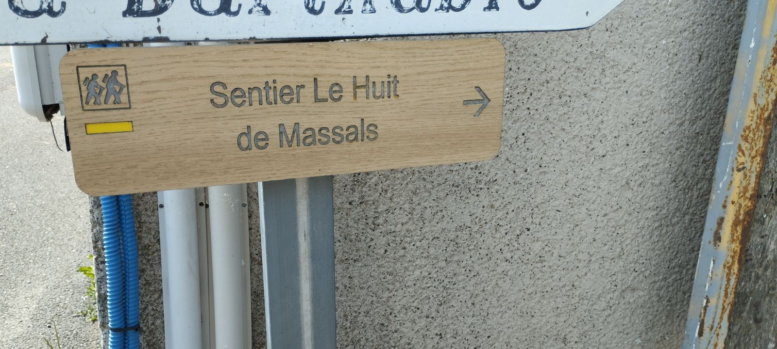
Huit de Massals
ciężki
Nawigacja
Nawigacja
Pobierz tę trasę na swój telefon komórkowy
Huit de Massals
ciężki
Wędrówka
12,26
km
Zeskanuj kod QR i rozpocznij nawigację w aplikacji bergfex.

Wędrówki i tropienie


Huit de Massals
ciężki
Odległość
12,26
km
Czas trwania
03:30
h
Ascent
342
hm
Poziom morza
587 -
796
m
Ścieżka do pobrania
Huit de Massals
ciężki
Wędrówka
12,26
km
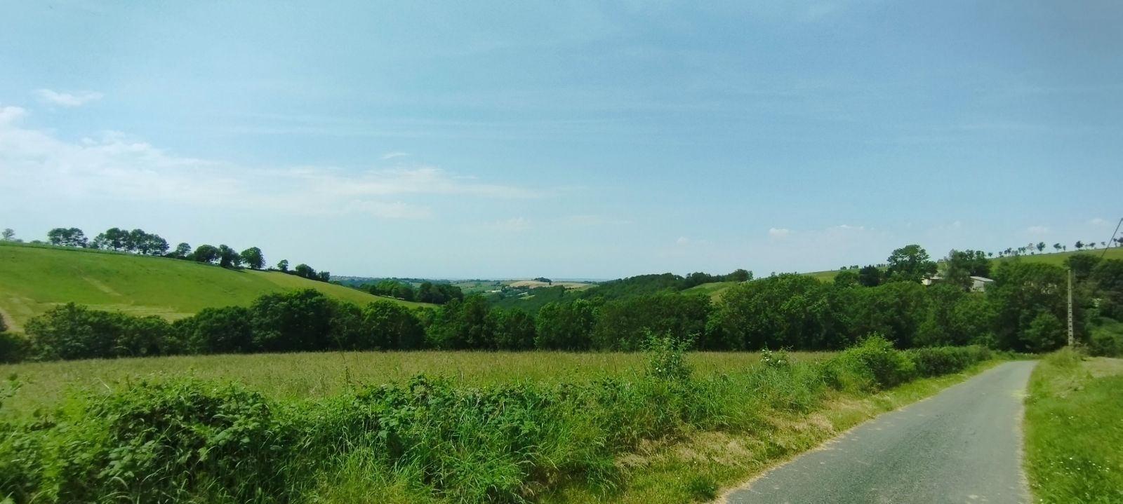
Its panoramic views are far-reaching, particularly at the Montagnarde, the summit of our sector at 802 m, where the entire Pyrenean chain can often be seen.
Until the 1960s, with the "petit Séminaire",...
Opis
Its panoramic views are far-reaching, particularly at the Montagnarde, the summit of our sector at 802 m, where the entire Pyrenean chain can often be seen.
Until the 1960s, with the "petit Séminaire", Massals was a "high place" of education whose reputation was felt far beyond the limits of the Department.
Since 2001, this fine architectural building, consisting of a 15th century castle, a 19th century Gothic chapel and a cloister, has been the property of the Communauté de Communes des Monts d'Alban et du Villefranchois. Today, the chapel has been converted into a small auditorium to host cultural events such as choirs and musical performances.
Trasa
Trasa
Huit de Massals
ciężki
Wędrówka
12,26
km

Sprzęt
Clothing suitable for the season and conditions (cold, hot, humid…)
Hiking shoes appropriate for the terrain (even for children!)
Hiking poles (useful for stability and to relieve joints)
Mobile phone and spare battery
Instrukcje bezpieczeństwa
Before you leave:
Check the general and local weather, making sure there is no precipitation Get information about the approach walk, route height, duration, possible escape routes (IGN map, GPS, guidebook, etc…) Assess possible risks by consulting mountain professionals, refuges, lodges Inform someone close to you about your plan and contact them in case of change: departure and return times, number of participants with each person’s phone number, vehicle(s), parking Avoid going alone, use equipment suitable for the activity, adjusted and in good condition, headlamp, complete first aid kit, survival blanket, etc.In case of emergency, call 112 (European emergency number)
Informacje o przyjeździe
Parking
Parking near the starting point
Dodatkowe informacje i wskazówki
Dodatkowe informacje
APIDAE Tourism data updated on 02/17/2023 by "Tourist Office Vallée du Tarn & Monts de l'Albigeois".
An error on this page? Write to the owner by referencing these details:
Record name: Huit de Massals | Record ID: 4858972 | URL (link) of this Outdooractive page.
An error on this page? Write to the owner by referencing these details:
Record name: Huit de Massals | Record ID: 4858972 | URL (link) of this Outdooractive page.
Nie ma jeszcze recenzji
Popularne wycieczki w okolicy
-
Corniches du Tarn
średniWędrówka 9,13 km -
Trivalle walks and variants
światłoWędrówka 6,92 km -
Path of the Springs
światłoWędrówka 6,93 km -
Camin de Comba Granda
średniWędrówka 11,2 km -
Sentier des Rives
średniWędrówka 9,84 km -
La vallée de la Blaze
średniWędrówka 9,03 km -
La boucle d'Alban
światłoWędrówka 6,09 km -
Sentier de Massalgues
średniWędrówka 10,8 km -
Tour du Tarn riding: Ambialet / Alban
ciężkiJazda konna 26,0 km -
Tour du Tarn on horseback: Paulinet / Mont-Roc
średniJazda konna 15,5 km
Wędrówki i tropienie

Ponad 550.000 propozycji wycieczek, szczegółowe mapy i intuicyjny planer tras sprawiają, że aplikacja jest niezbędna dla wszystkich entuzjastów przyrody.

Nie przegap ofert i inspiracji na następne wakacje
Zapisz się do newslettera
Błąd
Wystąpił błąd. Spróbuj ponownie.
Dziękujemy za rejestrację
Twój adres e-mail została dodana do listy mailingowej.
Wycieczki po całej Europie
Austria
Szwajcaria
Niemcy
Włochy
Słowenię
Francja
Holandia
Belgia
Polska
Liechtenstein
Czechy
Słowacja
Hiszpania
Chorwacja
Bośnia i Hercegowina
Luksemburg
Andorra
Portugalia
Islandia
Wielka Brytania
Irlandia
Grecja
Albania
Macedonia Północna
Malta
Norwegia
Czarnogóra
Mołdawia
Kosowo
Węgry
San Marino
Rumunia
Estonia
Łotwa
Białoruś
Cypr
Litwa
Serbia
Bułgaria
Monako
Dania
Szwecja
Finlandia