






Las Planques

The church of Planches
The Romanesque church of Las Planques owes its name to the construction, in the 12th century, of a plank bridge over the Viaur when feudal power and ecclesiastical authorities disputed...
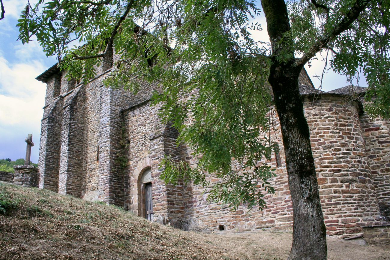
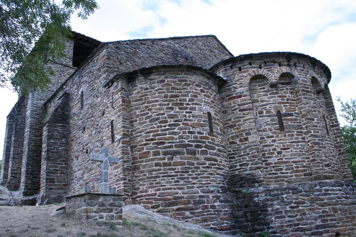
The Romanesque church of Las Planques owes its name to the construction, in the 12th century, of a plank bridge over the Viaur when feudal power and ecclesiastical authorities disputed control of the passage points. Built in the 11th and 12th centuries, it was originally called Notre-Dame de Belmont due to its location on a site considered inviolable, a rocky promontory that seems to rise from the waters of the Viaur. A priory of the famous Benedictine Abbey of Conques (Aveyron), occupied by English “routiers” in 1381, it declined in the 17th century when the valley inhabitants settled on the plateaus where cultivation was less arduous. An evangelical fresco decorates the choir of this bare chapel classified as a historic monument in 1910.

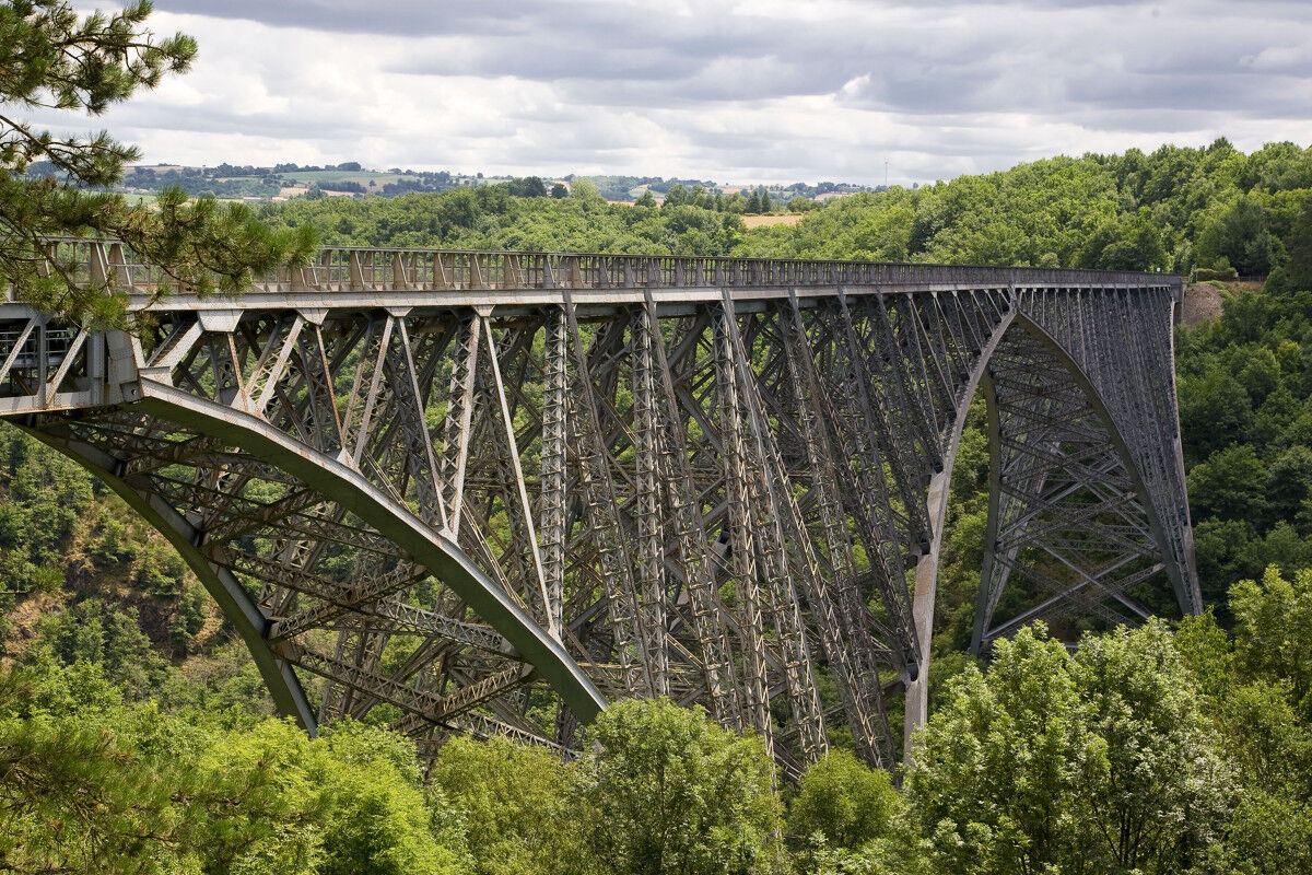

2- Cross the road, continue on the path and turn onto the right trail. Arrive at the bank of the Viaur: on the right, it is possible to make a round trip to directly below the SNCF viaduct, otherwise, cross the gate. Continue along the path in the middle of the meadow. At the Laval fork, turn right. In front of the gate, take the path to the left, cross the stream, follow the house on the right and climb above the hydroelectric plant. Cross the access road, descend to the edge of the Viaur and follow the bank.
3- Pass the old Tanus bridge. Ascend the second path on the left. At the asphalt, turn left, then straight ahead. Cross La Sicardie-Haute, 30 m after turn left onto the path.
4- Follow the bank to the right, ascend in wide zigzags. Descend the Masmajou path to the Viaur footbridge; 150 m after, climb right. Under the church of Las Planques, continue straight ahead ( !> visit the church on the right !).
5- At the calvary near the church, turn left. 100 m after, climb straight ahead. At the second hairpin bend, turn left, climb into the chestnut grove. Leave the path to the right. Pass near the ruins of the hamlet of Cazes, then a small house (La Treille). Cross the footbridge under the ruined tower ( !> Old Tanus !). At the road, at Combefedo, continue straight, pass under the new N88. Turn left. Cross La Moulinarié. At the next crossing, turn right towards the church of Tanus.
Clothing adapted to the season and conditions (cold, hot, humid…)
Hiking shoes suitable for the terrain (even for children!)
Hiking sticks (useful for stability and to relieve joints)
Mobile phone and spare battery
Before leaving:
Check the general and local weather ensuring no precipitation Inform yourself about the approach walk, itinerary height, duration, possible escape routes (IGN map, GPS, guidebook, etc.) Assess possible risks by consulting mountain professionals, refuges, lodges Inform a close contact of your objective and update if changes occur: departure and return times, number of participants with each phone number, vehicle(s), parking Avoid going alone, use equipment compliant with the activity, adjusted and in good condition, headlamp, complete first aid kit, survival blanket, etc.In case of problem
Alert: call 112 (European emergency number)
5 key points to provide when raising alarm:
Where? municipality, place, itinerary, altitude Who? identity, phone number What? type of accident, number of victims, severity, fall dynamics When? accident time Weather? wind, visibilityYou can park in the parking lot of the village church of Tanus.
Parking in front of the Church
Some passages are technical in case of rain.

Popularne wycieczki w okolicy
Tour of Tarn on Horseback
średniJazda konna 502,7 kmTour du Tarn à cheval : Jouqueviel / Sainte-Gemme
ciężkiJazda konna 25,0 kmGR® de Pays des Gorges du Viaur
ciężkiWędrówka 64,8 kmDe Las Planque à Thuriès
ciężkiWędrówka 16,9 kmTour du Tarn on horseback: Sainte-Gemme / Saussenac
ciężkiJazda konna 22,3 kmIn the Footsteps of Jean Jaurès
światłoWędrówka 6,67 kmRondwandeling Naucelle Sauveterre
średniWędrówka 10,0 kmSentier du Ségala
ciężkiWędrówka 44,3 kmLe sentier des Crêtes
ciężkiWędrówka 10,4 kmJouqueviel-le-Tel
ciężkiWędrówka 10,3 km
Wędrówki i tropienie


Nie przegap ofert i inspiracji na następne wakacje
Twój adres e-mail została dodana do listy mailingowej.





