


Sentier des quatre châteaux
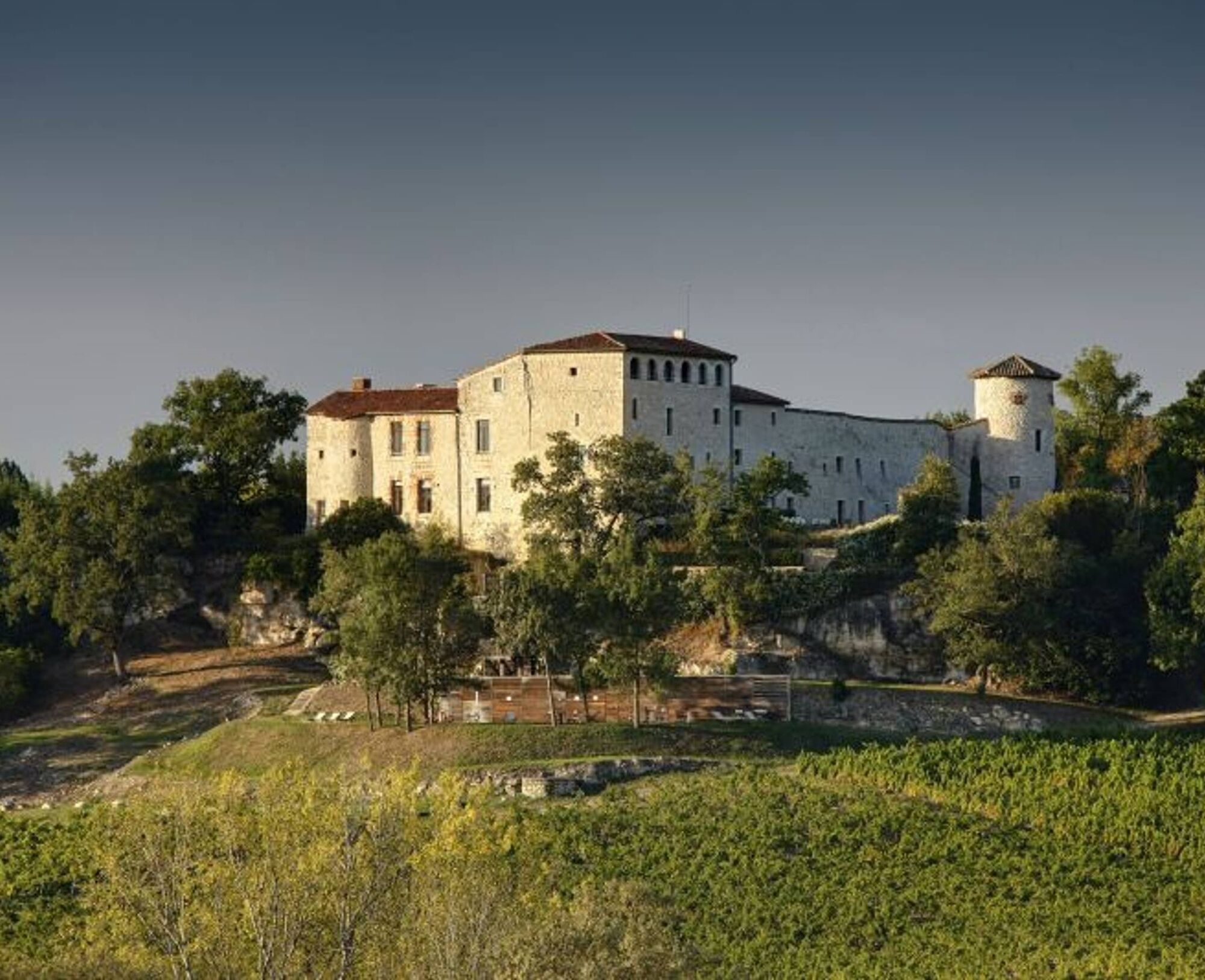
The name of the trail refers to four castles: the Château de la Bonnette, the Château de Linardié, the Château de Saint-Martial, and the most well-known: the Château de Mauriac. The latter is the only...
The name of the trail refers to four castles: the Château de la Bonnette, the Château de Linardié, the Château de Saint-Martial, and the most well-known: the Château de Mauriac. The latter is the only one open to the public. In the 1960s, the painter Bistes bought and completely restored this 15th-century building, which is said to have origins linked to the Templar Guiriaudus de Mauricius.


1. From the town hall, turn left onto Avenue des Vignes. Pass by the church and turn left onto Rue de la Caminade. At the end of the street, go straight ahead. Walk for 250 meters. At the calvary, turn left onto a path. At the end, turn right to reach Devezié. In the hamlet, take the second stony path on the left, which becomes grassy.
2. At the intersection of grassy paths, continue straight ahead, then after 50 meters, at the edge of the thicket, turn right. Go around it on your left side. On the grassy path, continue straight ahead. At the crossing of four grassy paths, go straight. At the road, turn left. Ignore a path on the left.
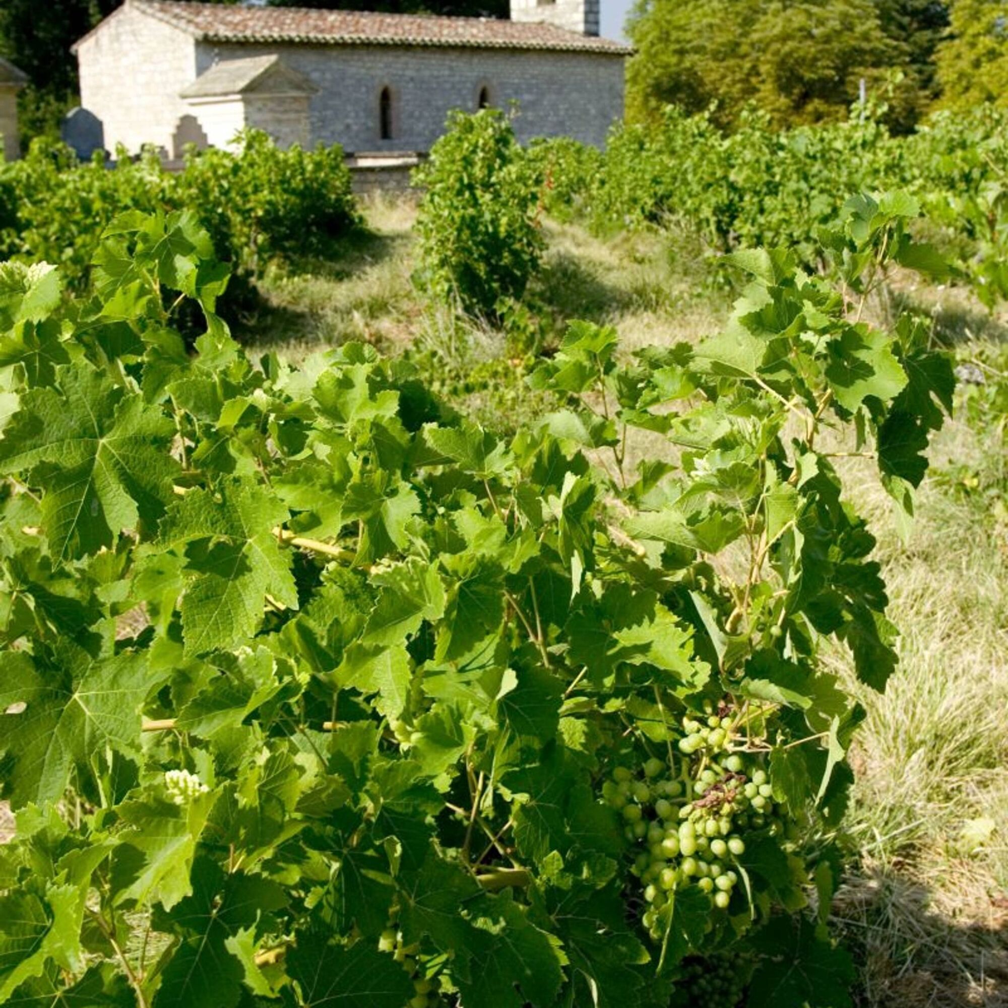
3. At Figayrade, at the corner of a house, turn right onto a path along the vineyards. Continue straight. At the crossing, go straight on the grassy path under the canopy. At RD, turn left. Pass the Fayssac square and then take the first street on the right. Follow the school and descend straight on the grassy path.
4. At the crossroads, turn left. In Le Pouget, at the corner of the first house, turn left. Cross the hamlet. At the calvary, turn right. Cross the RD (be cautious!) and continue straight. After a few meters, the stony path turns sharply left and continues through the vineyards.
5. At the tarmacked path, turn right. Walk for 250 meters, then turn left onto the path. At the crossroads, descend to the left. Continue straight on the stony path. At RD, go straight (be cautious!) towards Gatens. At the fork, turn right then take the left bend. Continue straight. The tarmacked path becomes a grassy path alongside the vineyards.
6. At the first intersection of grassy paths, go straight. At the second intersection, turn sharply right. At the road, go straight towards Maurénié. Facing the hamlet, turn left onto the stony path passing through the woods.
7. Cross the railway. Leave the road to the left and immediately take the fork to the left onto the path that climbs. Continue straight. The path runs alongside the vineyards, enters the woods, follows an embankment, then an agricultural building.
8. At Mauriac, at the road intersection, turn right towards the church and castle (shared path with PR de Vignoble et Châteaux). Continue straight. Pass by the castle. A few meters later, turn left onto the path (rest area on the right).
9. At the crossroads, turn left (leaving Vignoble et Châteaux which goes right). The path emerges onto a road. Continue straight. Ignore a path climbing to the right.
10. At the next intersection (interpretation tablet "Le Gaillac des châteaux"), turn left then immediately right under the SNCF bridge (Vignoble et Châteaux continues left). Continue straight. Pass near a lake. Cross the RD (be cautious!) and climb straight on Rue des Pavillons. Follow alongside the school to return to the starting point.
Medium
Popularne wycieczki w okolicy
- 5,0
Chemin de la Vère au Saint-Hussou
średniWędrówka 14,2 km Bike Route - C3 From Sainte Cécile to the Gaillac vineyard
światłoDroga rowerowa 38,6 kmSentier des dunes de Maraval aux Touardes
średniWędrówka 8,57 kmSentier de Maraval - Variante courte
średniWędrówka 5,02 kmOenorando® La ronde des vignerons
światłoWędrówka 7,84 kmGrain of salt path (Chemin du grain de sel)
średniWędrówka 10,6 kmMountain Biking Trail: Grande Boucle Bastides and Vineyards of Gaillac
ciężkiMountainbike 136,3 kmSentier de Maraval - portion des dunes
światłoWędrówka 1,72 kmSentier de découverte de Les Cabannes "Sur les traces des bâtisseurs"
światłoWędrówka 2,63 kmItinéraire Conques Toulouse - De Saint-Martin-Laguépie à Saint-Sulpice-la-Pointe
średniWędrówka 75,1 km

Wędrówki i tropienie


Nie przegap ofert i inspiracji na następne wakacje
Twój adres e-mail została dodana do listy mailingowej.