


Grain of salt path (Chemin du grain de sel)
This route also features some interesting sights to discover:
The dry hillside of Liversenq (115 ha), on the northern slope of the Grain de Sel, is classified as a natural area of ecological, faunistic,...
The dry hillside of Liversenq (115 ha), on the northern slope of the Grain de Sel, is classified as a natural area of ecological, faunistic, and floristic interest (ZNIEFF). It features dry grasslands with rocky outcrops, hosting a variety of orchids and songbirds such as the Lark, Wood Pigeon, Hoopoe, Water Pipit, and Reed Warbler.
On the plateau of Grain de Sel, you will pass near two concrete trees (private property) built in the 1970s by an artist who envisioned a forest of concrete covered in vegetation. Only two trees were completed.
On the slope leading towards Cordes, a spring once fed the large cistern still located under the road junction at Place de la Bouteillerie in Cordes.
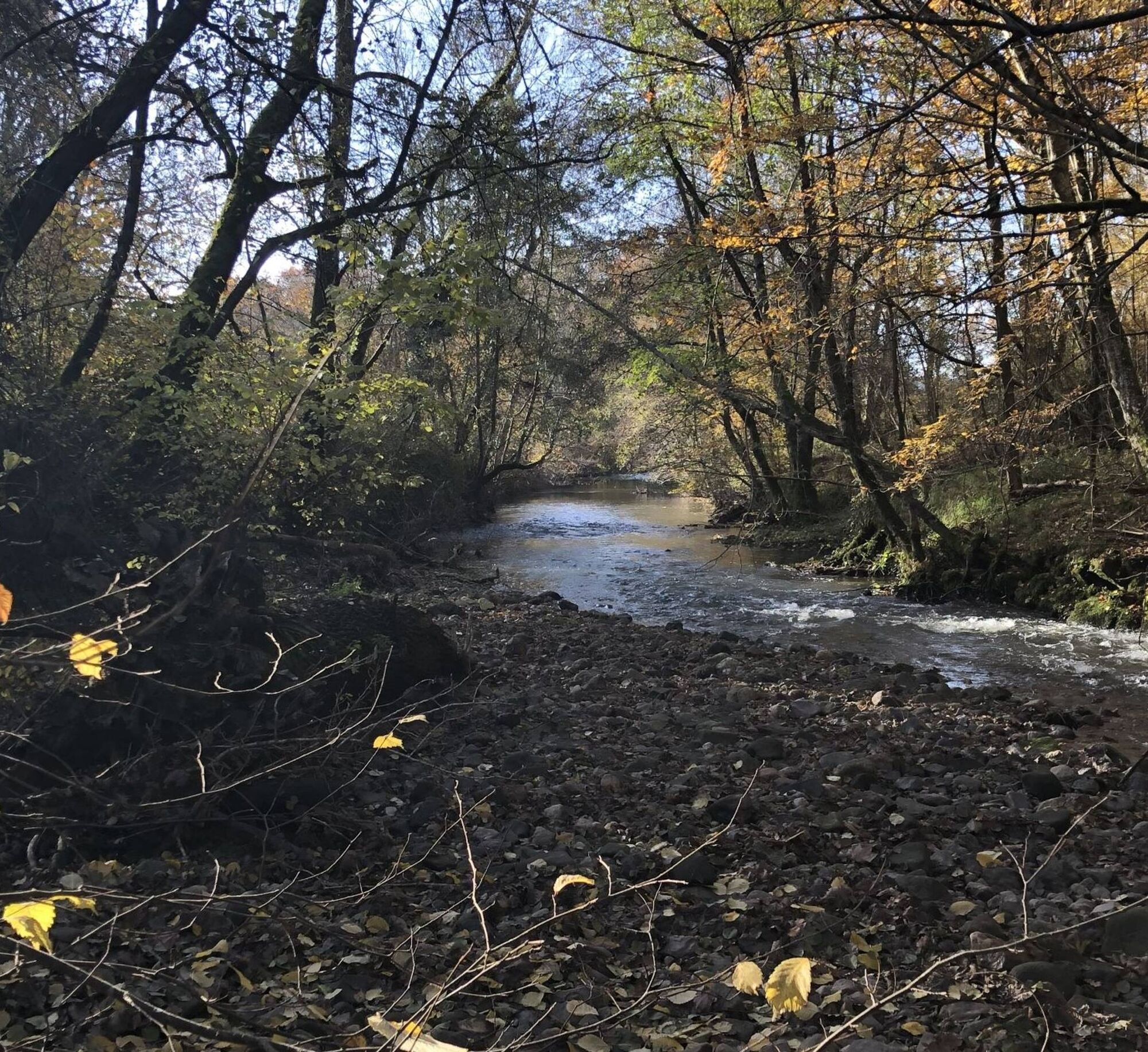
The Cérou valley, a place of passage and agricultural cultivation, has preserved its isolated farms and hamlets, some water mills, and beautiful late 19th-century residences (La Gazelle, La Borie Grande). You will also encounter the remains of the short-lived Carmaux–Vindrac railway (1937-1939). Along the banks of the Cérou River, with observation and patience, you might spot fish and crayfish in the cool, clear waters, as well as herons, coypu, hares, and deer amidst the remarkable trees.
1. Start on the equestrian path that circles the Domaine de la Gazelle. Leave the "Sentier du Cérou" to the right and continue until you reach the paved road. At the road, turn left and after a few meters, continue right onto the dirt path that will lead you through oak woods to the Virac plateau.
2. At the D7 road, turn right (you will join the GR36 here) and walk 500 meters on the GR36 (Caution). Turn right at the "Chemin de la Bouriasse" dead-end sign. Continue for another 500 meters on the road following the "Puech Haut" sign.
3. At the entrance to the property, follow the path on the left between the hedge and the field (respect private property and crops). Then continue left on an old path bordered by trees and limestone walls. Enjoy the beautiful view of the Cérou valley with the village of St-Marcel perched on the hillside to the east, and the arches of the road leading to Mouzieys-Panens to the west. Continue to the paragliding area, cross the field, and follow the left side of the cypress hedge.
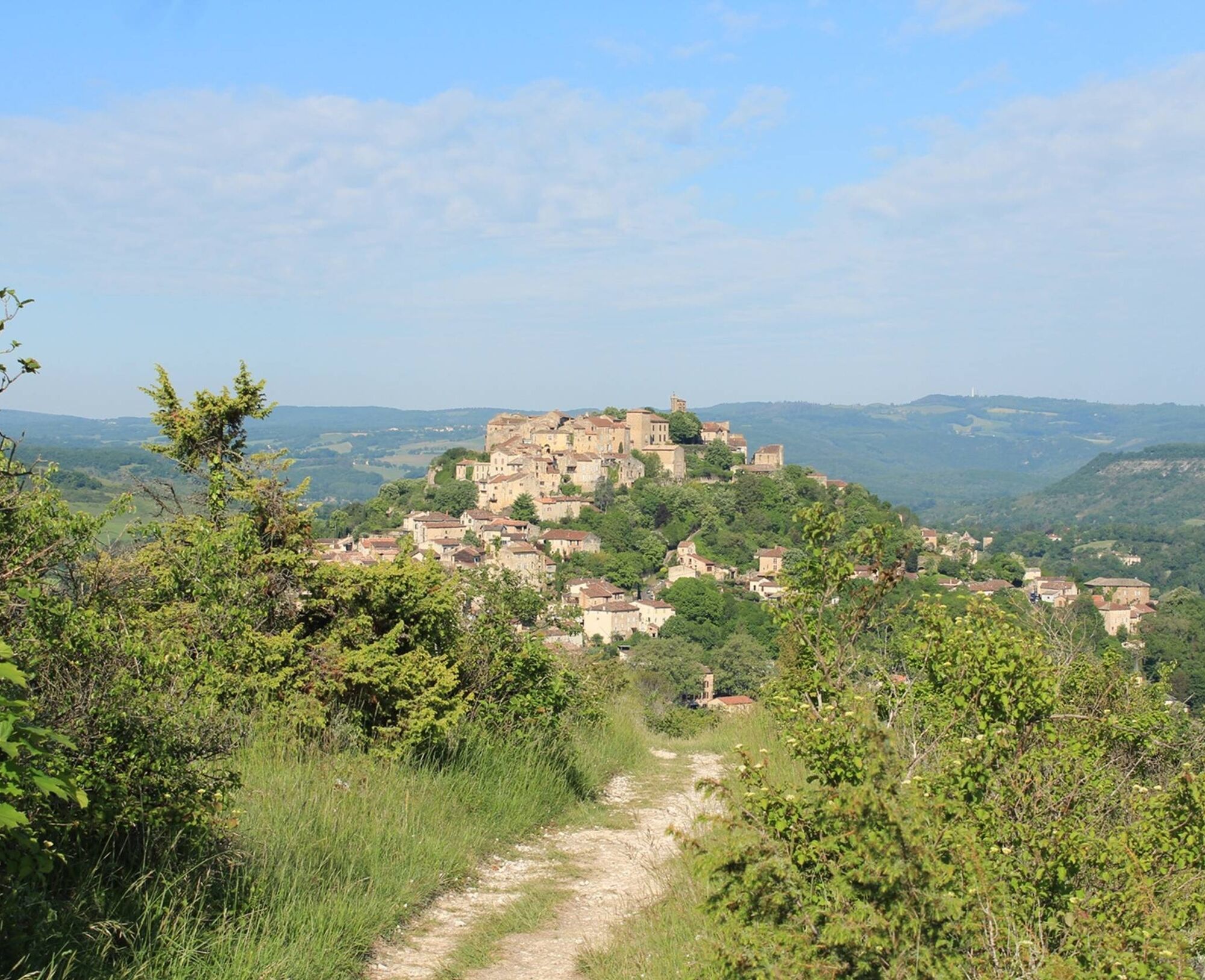
4. Turn right to continue straight on the Chemin du Grain de Sel, which becomes a path further on. You will reach the edge of the plateau. Stop to admire the superb panorama of the medieval city before descending via the small path to the first houses of Cordes. Leave the GR36 heading towards the village and turn right onto the Chemin de Liversenq.
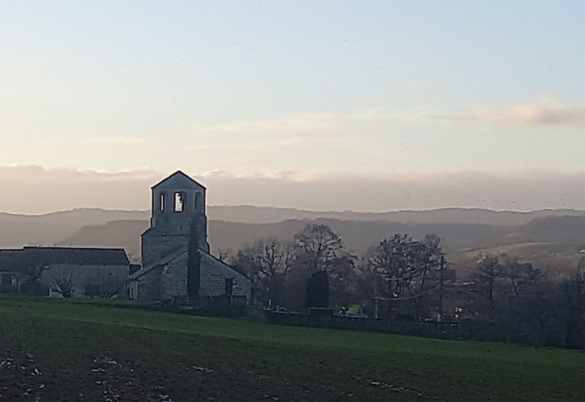
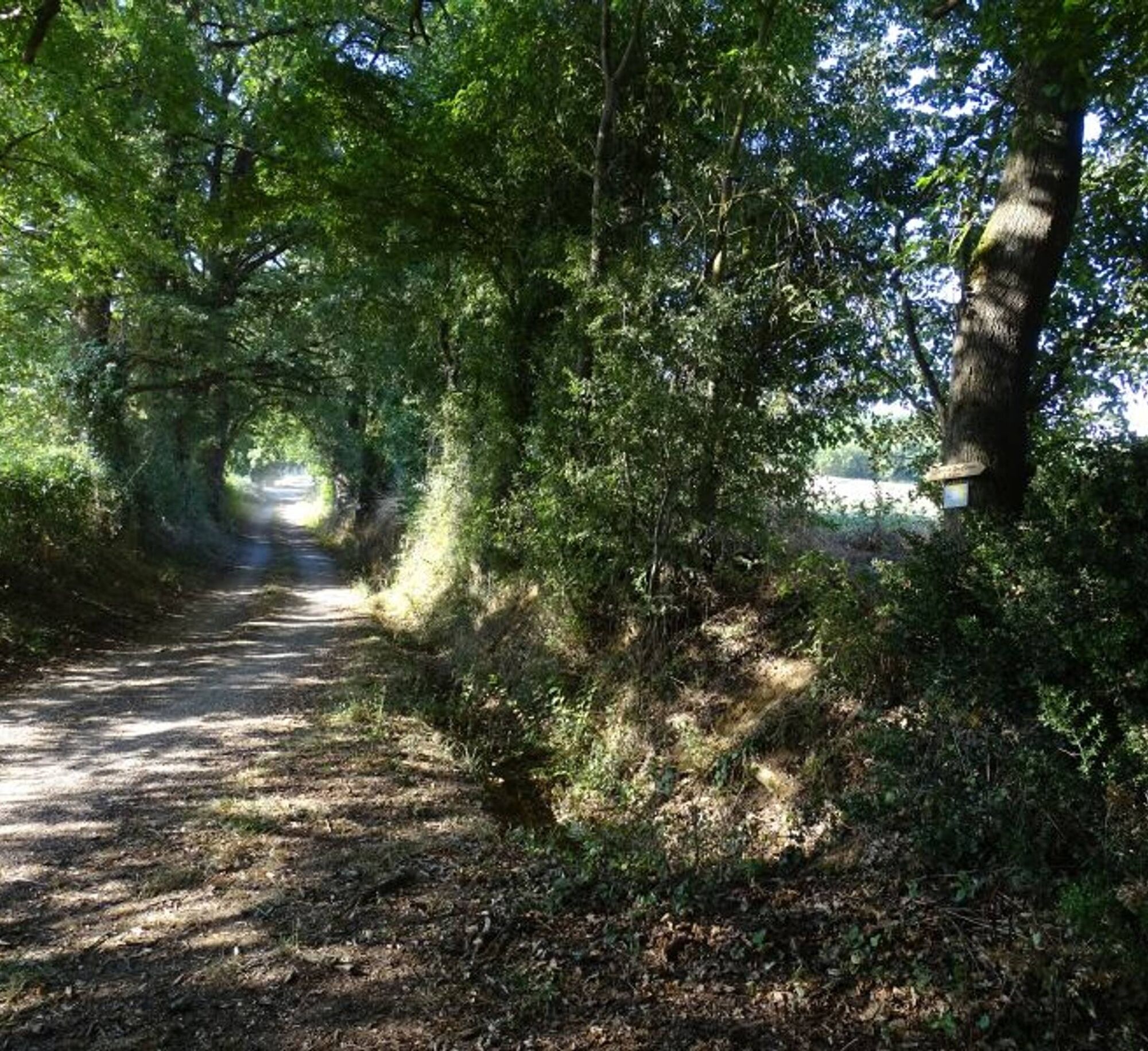
5. Walk 300 meters through the residential area and then take the hillside path. At the end, cross the field to reach the D922. Cross the small parking area and turn right onto the Campes road. After 100 meters, leave the pavement and follow the field before rejoining the road. At the crossroads before the Campes church, turn left. Walk 200 meters, then leave the road to follow a shaded path along the Cérou for 1 kilometer.
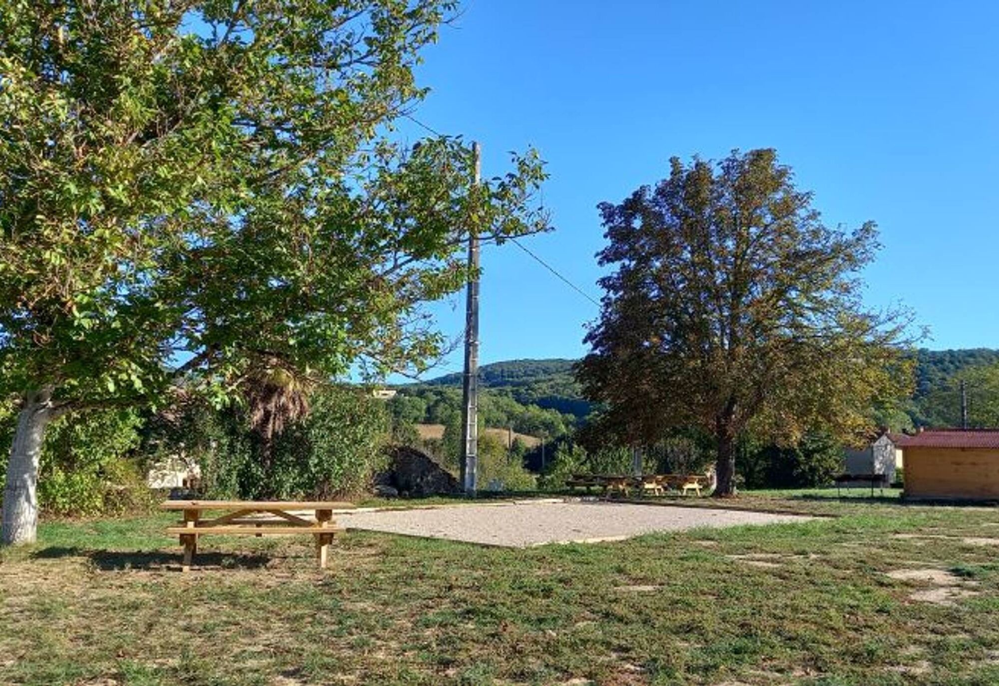
6. Upon reaching the road, turn right, then across from the road, go around the Moulin de Pointe à Pitre by following the thuya hedge. Head back up the Cérou for 200 meters to the hamlet of la Grillotte, then continue right to reach the hikers' parking area.
Medium
Popularne wycieczki w okolicy
-
Œnorando® From vine to olive tree
średniWędrówka 11,4 km -
Sentier de Maraval - Variante courte
średniWędrówka 5,02 km -
Sentier des dunes de Maraval aux Touardes
średniWędrówka 8,57 km -
Sentier de Maraval - portion des dunes
światłoWędrówka 1,72 km -
From the Cérou to the Aveyron
średniWędrówka 10,2 km -
Sentier de découverte de Les Cabannes "Sur les traces des bâtisseurs"
światłoWędrówka 2,63 km -
Chemin de la Vère au Saint-Hussou
średniWędrówka 14,2 km -
Tour du Tarn à cheval : Narthoux / Jouqueviel
ciężkiJazda konna 26,3 km -
Heritage and Health Route
światłoWędrówka 5,62 km -
Vignoble et châteaux
ciężkiWędrówka 17,4 km

Wędrówki i tropienie


Nie przegap ofert i inspiracji na następne wakacje
Twój adres e-mail została dodana do listy mailingowej.