The Roc du Montalet
ciężki
Pobierz tę trasę na swój telefon komórkowy
The Roc du Montalet
ciężki
Wędrówka
18,03
km
Zeskanuj kod QR i rozpocznij nawigację w aplikacji bergfex.

Wędrówki i tropienie


The Roc du Montalet
ciężki
Odległość
18,03
km
Czas trwania
05:30
h
Ascent
516
hm
Poziom morza
794 -
1.243
m
Ścieżka do pobrania
The Roc du Montalet
ciężki
Wędrówka
18,03
km
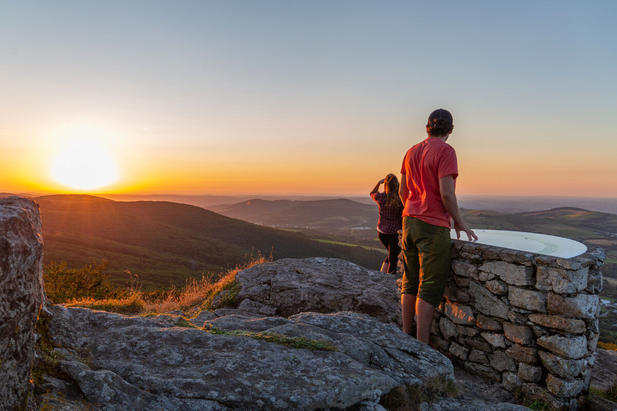
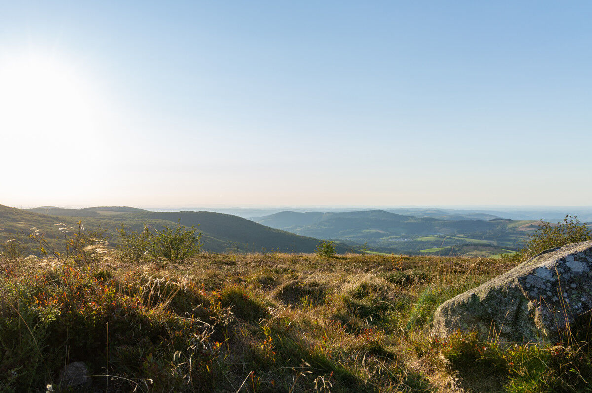
Inspiration at the summit...
A rocky peak, the Roc du Montalet (1,259 m) has always been a place for religious manifestations. First, there were the cults dedicated to divinities and natural phenomena,...
Opis
Inspiration at the summit...
A rocky peak, the Roc du Montalet (1,259 m) has always been a place for religious manifestations. First, there were the cults dedicated to divinities and natural phenomena, the memory of which has been lost. Then, there were the pilgrimages of the Catholic church. In the 18th century, the local people, lacking opportunities for mountain entertainment, confused the first with the second. So much so that after serious abuses, around 1770, the bishop of Castres forbade all processions to Montalet! A new bishop re-established the pilgrimage in 1776, on the condition of not being on the paths after sunset, of separating men from women, and of erecting a cross at the summit. A statue of the Virgin has replaced it since 1882.
A rocky peak, the Roc du Montalet (1,259 m) has always been a place for religious manifestations. First, there were the cults dedicated to divinities and natural phenomena, the memory of which has been lost. Then, there were the pilgrimages of the Catholic church. In the 18th century, the local people, lacking opportunities for mountain entertainment, confused the first with the second. So much so that after serious abuses, around 1770, the bishop of Castres forbade all processions to Montalet! A new bishop re-established the pilgrimage in 1776, on the condition of not being on the paths after sunset, of separating men from women, and of erecting a cross at the summit. A statue of the Virgin has replaced it since 1882.
Trasa
Lacaune
(798 m)
Wioska
0,1 km
Pic de Montalet
(1.259 m)
Szczyt
8,6 km
Les Vidals
(919 m)
Rozliczenie
12,3 km
La Balmette
(824 m)
Sąsiedztwo
16,6 km
La Combe
(833 m)
Sąsiedztwo
17,3 km
L'Élixir de Jouvence
(794 m)
Restauracja
17,7 km
Lacaune
(798 m)
Wioska
17,9 km
Trasa
The Roc du Montalet
ciężki
Wędrówka
18,03
km
À la Maison
(805 m)
Restauracja
0,0 km
Lacaune
(798 m)
Wioska
0,1 km
Peyruc
(815 m)
Sąsiedztwo
0,4 km
Roc des Ecus
(1.074 m)
Szczyt
2,1 km
Plo des Parcs
(1.154 m)
Korytarz/teren
4,4 km
Pic de Montalet
(1.259 m)
Szczyt
8,6 km
Les Vidals
(919 m)
Rozliczenie
12,3 km
Thioys
(874 m)
Rozliczenie
15,2 km
Le Gourp
(863 m)
Sąsiedztwo
15,9 km
La Balmette
(824 m)
Sąsiedztwo
16,6 km
Al Tournal
(807 m)
Sąsiedztwo
16,9 km
Moulin Paradou
(800 m)
Sąsiedztwo
17,3 km
La Combe
(833 m)
Sąsiedztwo
17,3 km
Le Callaret
(823 m)
Sąsiedztwo
17,6 km
L'Élixir de Jouvence
(794 m)
Restauracja
17,7 km
Peyruc
(815 m)
Sąsiedztwo
17,9 km
Lacaune
(798 m)
Wioska
17,9 km
À la Maison
(805 m)
Restauracja
18,0 km

Informacje o trasie
Trasa
Point 1: Behind the statue of the Virgin, go up rue de la Murette; 80 m later, turn left. At the fork, leave the pavement to the right. Continue straight ahead.
Point 2: Take the small path bordered by holly on the left. Cross the road with a quick left-right. Climb the path. At the junction with a trail, continue straight. In front of a private property, the path forks and climbs to the right.
Point 3: At the Roc des Écus, turn left onto the ridge. Move straight ahead. Descend onto a wide track. Enter it on the left. At the first fork at the start of the forest, go left (separating from the GR® de Pays des Monts et Lacs en Haut-Languedoc and GR® de Pays des Hautes Terres d’Oc).
Point 4: At the second fork, bear left. At the crossroads, continue straight.
Point 5: On the road, turn left. At the fork, 200 m later, cross the pavement to climb straight up toward the summit of Montalet.
Point 6: Descend a narrow and steep path, between twisted beeches. Continue straight on the flat moorland.
Point 7: In front of the road, make a sharp left turn (junction with the GR® de Pays des Monts et Lacs en Haut-Languedoc to Lacaune) and descend to the right.
Point 8: At the road, turn right toward Les Vidals. At the stop sign, turn left; 350 m later, turn onto a path on the right. Follow Gandilhou on the right. Descend the path always to the right. At the bottom, follow the curve left, then continue straight. On the road, turn right. At the intersection, turn left toward Thioys. Cross the hamlet.
Point 9: 20 m after the first fork, climb the path through the holly on the left. On the road, turn right; 50 m later, right again. In the descent, turn left twice at the corner of the first left-hand shed. Continue straight. At the first houses of Lacaune, leave the left path. At the intersection, turn right, then immediately left. Facing the tunnel, turn right. Descend to the statue of the Virgin.
Nie ma jeszcze recenzji
Popularne wycieczki w okolicy
- 4,0
LAUZE HIKE
średniWędrówka 9,41 km CAR TOURISTIC ROUTE - MONTS DE LACAUNE
światłoMotorrad 154,6 kmCAR TOURISTIC ROUTE - THE LAKE ROUTE
światłoMotorrad 129,1 kmThe Payrac discovery trail
światłoWędrówka 1,79 kmFrom Laouzas to Montalet
ciężkiWędrówka 15,4 kmPREVERT TRAIL HIKE
światłoWędrówka 4,95 kmTOURIST DRIVING ROUTE - SOMAIL-ESPINOUSE
światłoMotorrad 111,3 kmLe Mont Barre
światłoWędrówka 6,21 kmCycle Route - C4 Around the Laouzas lake by bike
światłoDroga rowerowa 19,8 kmHAUTE VALLEE DE L'AGOUT HIKE
średniWędrówka 17,0 km
Wędrówki i tropienie

Ponad 550.000 propozycji wycieczek, szczegółowe mapy i intuicyjny planer tras sprawiają, że aplikacja jest niezbędna dla wszystkich entuzjastów przyrody.

Nie przegap ofert i inspiracji na następne wakacje
Zapisz się do newslettera
Błąd
Wystąpił błąd. Spróbuj ponownie.Dziękujemy za rejestrację
Twój adres e-mail została dodana do listy mailingowej.
Wycieczki po całej Europie
Austria Szwajcaria Niemcy Włochy Słowenię Francja Holandia Belgia Polska Liechtenstein Czechy Słowacja Hiszpania Chorwacja Bośnia i Hercegowina Luksemburg Andorra Portugalia Islandia Wielka Brytania Irlandia Grecja Albania Macedonia Północna Malta Norwegia Czarnogóra Mołdawia Kosowo Węgry San Marino Rumunia Estonia Łotwa Białoruś Cypr Litwa Serbia Bułgaria Monako Dania Szwecja Finlandia