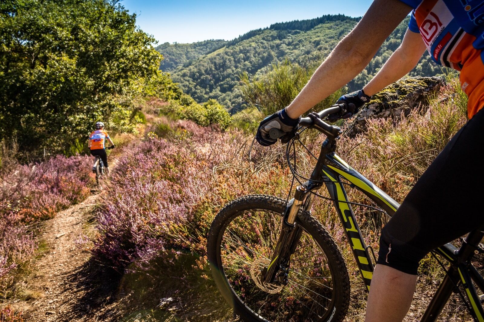
Mountain Bike Hike Albine-Candesoubre via the Ridges
ciężki
Nawigacja
Nawigacja
Pobierz tę trasę na swój telefon komórkowy
Mountain Bike Hike Albine-Candesoubre via the Ridges
ciężki
Mountainbike
43,57
km
Zeskanuj kod QR i rozpocznij nawigację w aplikacji bergfex.

Wędrówki i tropienie


Mountain Bike Hike Albine-Candesoubre via the Ridges
ciężki
Odległość
43,57
km
Czas trwania
05:33
h
Ascent
1 260
hm
Poziom morza
314 -
961
m
Ścieżka do pobrania
Mountain Bike Hike Albine-Candesoubre via the Ridges
ciężki
Mountainbike
43,57
km
Some large agricultural “clearings” have been maintained on small plateaus, notably at the hamlet of Sales.
On the scale of the entire massif, there is a sharp contrast between the two slopes: a humid northern...
Opis
Some large agricultural “clearings” have been maintained on small plateaus, notably at the hamlet of Sales.
On the scale of the entire massif, there is a sharp contrast between the two slopes: a humid northern slope with beech and fir trees, and a Mediterranean southern slope with holm oaks and pubescent oaks. This contrast explains the diversity of environments. The northern slope has many ecological, faunal, and floral interests due to a great diversity of habitats (heaths, peat bogs, forest and mountain agropastoral environments...) and low human impact.
The diversity of environments and their conditions result in botanical wealth with notable plants recorded. Among them, 7 benefit from national protection. This northern slope also has a remarkable breeding population of birds of prey. This situation stems partly from the presence of many suitable nesting sites (wooded and rocky areas that are little frequented), and partly from the proximity of hunting areas (open zones of agropastoral clearings). Several pairs of Northern Goshawk and 3 to 4 pairs of Peregrine Falcon are present. The open areas of the clearings, relatively preserved from intensive agriculture, allow species to persist (Eurasian Skylark and woodlark, Common Linnet, harriers...).
To see:
- Giant interpretation trail (on the GR7)
- Peyremaux rock
- Fountain of the three bishops
- Hamlets and villages
- Nearby: old glass furnace, departmental textile museum, greenway
Trasa
Albine
(318 m)
Wioska
0,1 km
Église Saint-Jean
(332 m)
Miejsce kultu
0,1 km
Roc de Peyremaux
(1 008 m)
Szczyt
9,9 km
Église Notre-Dame
(836 m)
Miejsce kultu
19,1 km
Cantignous
(450 m)
Rozliczenie
25,7 km
Cathalo
(415 m)
Sąsiedztwo
30,8 km
Dressou
(761 m)
Rozliczenie
36,7 km
Trasa
Mountain Bike Hike Albine-Candesoubre via the Ridges
ciężki
Mountainbike
43,57
km
Albine
(318 m)
Wioska
0,1 km
Église Saint-Jean
(332 m)
Miejsce kultu
0,1 km
La Caunette
(327 m)
Sąsiedztwo
0,3 km
La Richarde
(395 m)
Korytarz/teren
0,7 km
Roc de Peyremaux
(1 008 m)
Szczyt
9,9 km
Fontaine des Trois Évêques
(916 m)
Źródło
13,2 km
Bartassade
(867 m)
Korytarz/teren
15,7 km
Sales
(837 m)
Rozliczenie
19,0 km
Église Notre-Dame
(836 m)
Miejsce kultu
19,1 km
Cantignous
(450 m)
Rozliczenie
25,7 km
La Feuillade
(408 m)
Sąsiedztwo
26,3 km
Labastide-Rouairoux
(389 m)
Wioska
29,6 km
Foun Troumpet
(413 m)
Korytarz/teren
30,2 km
Cathalo
(415 m)
Sąsiedztwo
30,8 km
Cantignous
(450 m)
Rozliczenie
31,3 km
Dressou
(761 m)
Rozliczenie
36,7 km
Rabasset
(350 m)
Korytarz/teren
42,2 km
La Caunette
(327 m)
Sąsiedztwo
42,7 km
Moulin Bas
(316 m)
Korytarz/teren
43,1 km
Albine
(318 m)
Wioska
43,3 km
Autor
Dostarczone przez Tarn Tourisme
Wycieczkę Mountain Bike Hike Albine-Candesoubre via the Ridges zapewnia outdooractive.com.

Sprzęt
Mountain Biking as you want! but…
Use the marked trails for your safety and respect the direction of the routes Do not overestimate your abilities and stay in control of your speed Be careful and courteous when overtaking or crossing hikers as pedestrians have priority Check the condition of your mountain bike and plan for supplies and repair accessories If you go alone, leave your route with someone close to you Wearing a helmet is strongly recommended Respect private property and cultivated areas Watch out for agricultural and forestry machinery Close the gates behind you Avoid picking wild flowers, fruits, and mushrooms Do not disturb the peace of wild animals Keep your trash, be discreet and respectful of the environment
Instrukcje bezpieczeństwa
Emergency number: 112
Informacje o przyjeździe
Parking
Greenway parking - Albine
Dodatkowe informacje i wskazówki
Dodatkowe informacje
APIDAE Tourism data updated on 05/12/2021 by "Tarn Tourisme".
An error on this sheet? Write to the owner recalling these references:
Sheet name: Mountain Bike Hike Albine Candesoubre Ridges | Sheet ID: 845867 | URL (link) of this Outdooractive page.
An error on this sheet? Write to the owner recalling these references:
Sheet name: Mountain Bike Hike Albine Candesoubre Ridges | Sheet ID: 845867 | URL (link) of this Outdooractive page.
Nie ma jeszcze recenzji
Popularne wycieczki w okolicy
-
5,0
Les Escaunelles
światłoWędrówka 6,87 km -
Peyremaux rock
ciężkiWędrówka 13,3 km -
HIDDEN HIKING TRAIL
średniWędrówka 17,5 km -
CIT'ART HIKE OF THE HAUTS DE FERRALS
średniWędrówka 15,5 km -
CYCLE LOOP NO.12 - THE ASSAULT ON THE HAUT-LANGUEDOC FROM MINERVE
światłoJazda na rowerze 37,3 km -
OENORANDO® LE CRU LA LIVINIERE
światłoWędrówka 11,5 km -
Hiking: Les clairières de Sales
światłoWędrówka 8,46 km -
LE SENTIER DES MEULIERES
światłoWędrówka 1,02 km -
VÉLOCCITANIE, FROM THE NAUROUZE THRESHOLD TO BÉZIERS
średniJazda na rowerze 236,6 km -
HIKING FÉLINES MINERVOIS VENTAJOU
średniWędrówka 13,7 km

Wędrówki i tropienie

Ponad 550.000 propozycji wycieczek, szczegółowe mapy i intuicyjny planer tras sprawiają, że aplikacja jest niezbędna dla wszystkich entuzjastów przyrody.

Nie przegap ofert i inspiracji na następne wakacje
Zapisz się do newslettera
Błąd
Wystąpił błąd. Spróbuj ponownie.
Dziękujemy za rejestrację
Twój adres e-mail została dodana do listy mailingowej.
Wycieczki po całej Europie
Austria
Szwajcaria
Niemcy
Włochy
Słowenię
Francja
Holandia
Belgia
Polska
Liechtenstein
Czechy
Słowacja
Hiszpania
Chorwacja
Bośnia i Hercegowina
Luksemburg
Andorra
Portugalia
Islandia
Wielka Brytania
Irlandia
Grecja
Albania
Macedonia Północna
Malta
Norwegia
Czarnogóra
Mołdawia
Kosowo
Węgry
San Marino
Rumunia
Estonia
Łotwa
Białoruś
Cypr
Litwa
Serbia
Bułgaria
Monako
Dania
Szwecja
Finlandia