Circuit VTT n°27 Bonnan Vert
światło
Nawigacja
Nawigacja
Pobierz tę trasę na swój telefon komórkowy
Circuit VTT n°27 Bonnan Vert
światło
Mountainbike
8,18
km
Zeskanuj kod QR i rozpocznij nawigację w aplikacji bergfex.

Wędrówki i tropienie


Circuit VTT n°27 Bonnan Vert
światło
Odległość
8,18
km
Czas trwania
00:51
h
Ascent
68
hm
Poziom morza
134 -
198
m
Ścieżka do pobrania
Circuit VTT n°27 Bonnan Vert
światło
Mountainbike
8,18
km
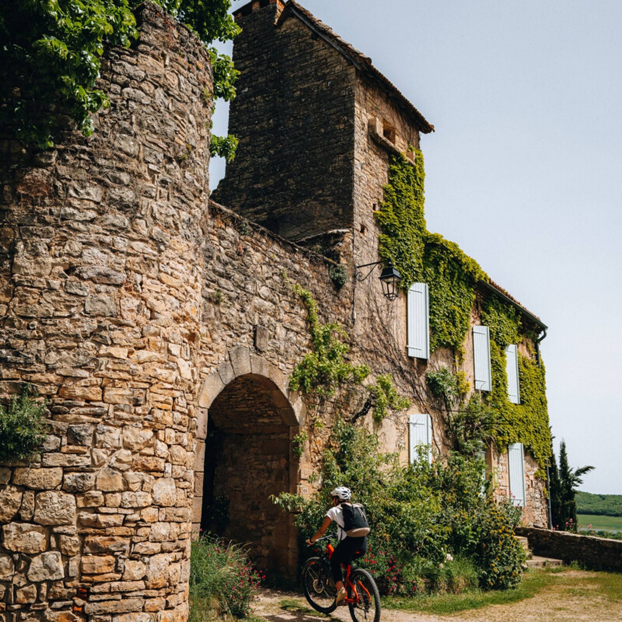
A gentle trail starting from the village of Milhars, known for its stone walls and its feudal castle, built on the remains of a 13th-century castrum and restored in 1630. The castle is situated on a promontory...
Opis
A gentle trail starting from the village of Milhars, known for its stone walls and its feudal castle, built on the remains of a 13th-century castrum and restored in 1630. The castle is situated on a promontory overlooking the Cérou River.
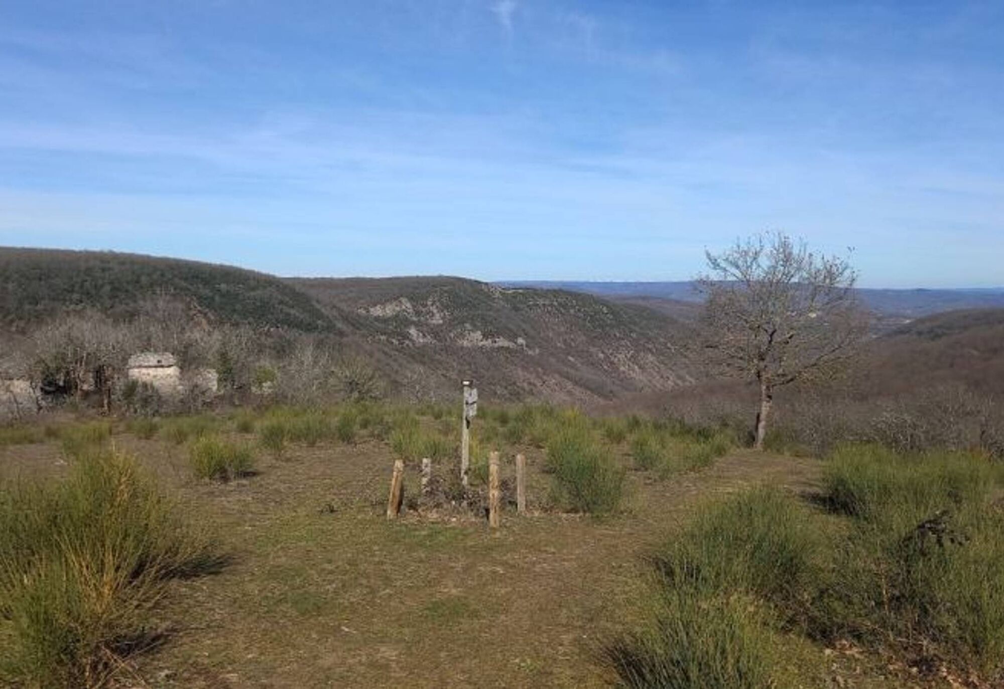
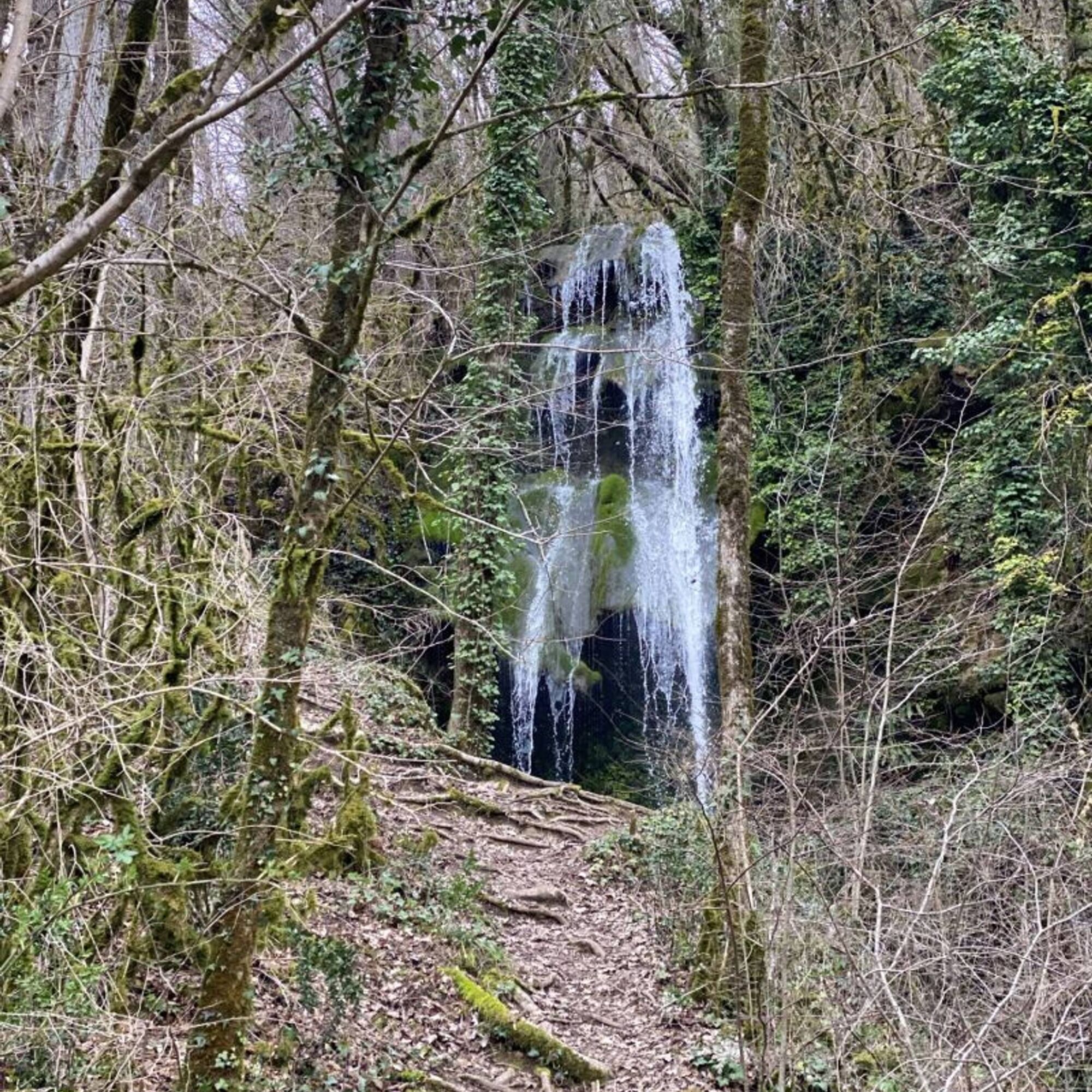
Not far from the village, the Bonnan Valley has been designated as a "Sensitive Natural Area" by the Tarn department. It is a unique and protected site. Here, you can admire a petrified waterfall, which is dry in the summer but cascades 40 meters high during the wet season. You can also observe rare butterflies, dragonflies, orchids, lilies, columbines, and more.
Not far from the village, the Bonnan Valley has been designated as a "Sensitive Natural Area" by the Tarn department. It is a unique and protected site. Here, you can admire a petrified waterfall, which is dry in the summer but cascades 40 meters high during the wet season. You can also observe rare butterflies, dragonflies, orchids, lilies, columbines, and more.
Trasa
Milhars
(138 m)
Wioska
0,0 km
Cascade Pétrifiante de Bonnan
(194 m)
Wodospad
3,8 km
Milhars
(138 m)
Wioska
8,1 km
Trasa
Circuit VTT n°27 Bonnan Vert
światło
Mountainbike
8,18
km
Milhars
(138 m)
Wioska
0,0 km
Cascade Pétrifiante de Bonnan
(194 m)
Wodospad
3,8 km
Milhars
(138 m)
Wioska
8,1 km
Autor
Dostarczone przez Tarn Tourisme
Wycieczkę Circuit VTT n°27 Bonnan Vert zapewnia outdooractive.com.
Informacje o trasie
Trasa
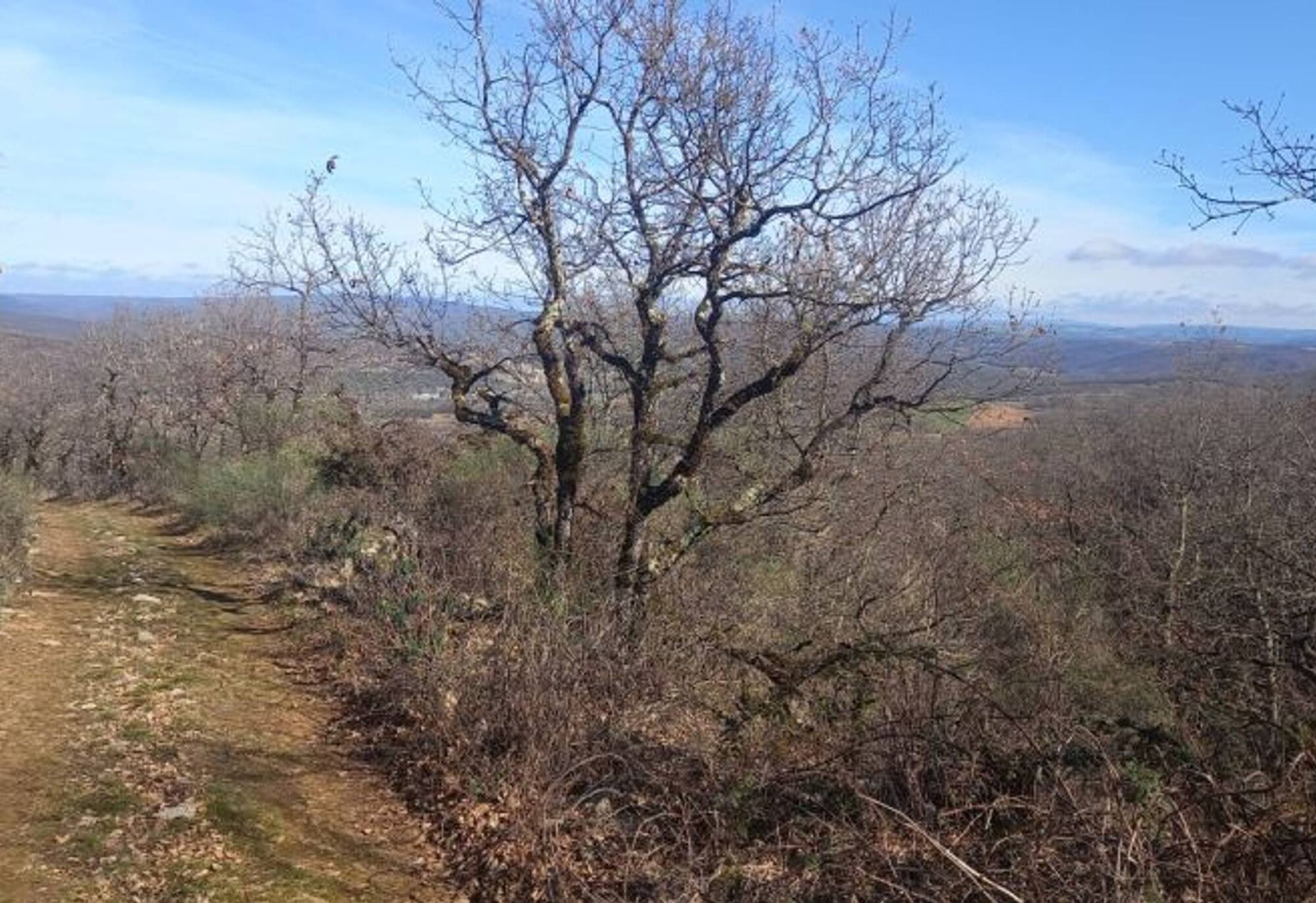
Starting from the village of Milhars, in front of the Town Hall, cross the departmental road and follow the Cérou River to the La Garenne mill. Next, climb along the Bonnan stream in the valley of the same name.
Follow the path to the right, and after passing the Bonnan waterfall (on your right), return along the other side of the loop, which is drier and sunnier. Finally, retrace your steps along the Cérou River, passing under the castle, back to the village and the Town Hall.
Follow the path to the right, and after passing the Bonnan waterfall (on your right), return along the other side of the loop, which is drier and sunnier. Finally, retrace your steps along the Cérou River, passing under the castle, back to the village and the Town Hall.
Dodatkowe informacje i wskazówki
Dodatkowe informacje
Very easy
Nie ma jeszcze recenzji
Popularne wycieczki w okolicy
-
Sentier de Maraval - Variante courte
średniWędrówka 5,02 km -
Sentier des dunes de Maraval aux Touardes
średniWędrówka 8,57 km -
Les Suquets de Penne
światłoWędrówka 10,3 km -
Grain of salt path (Chemin du grain de sel)
średniWędrówka 10,6 km -
Sentier de Maraval - portion des dunes
światłoWędrówka 1,72 km -
From the Cérou to the Aveyron
średniWędrówka 10,2 km -
Sentier de découverte de Les Cabannes "Sur les traces des bâtisseurs"
światłoWędrówka 2,63 km -
Téroundel path (Sentier du Téroundel)
światłoWędrówka 2,58 km -
Cordes heritage trail
średniWędrówka 14,8 km -
Lacapelle Sainte-Lucie circuit
średniWędrówka 11,5 km
Wędrówki i tropienie

Ponad 550.000 propozycji wycieczek, szczegółowe mapy i intuicyjny planer tras sprawiają, że aplikacja jest niezbędna dla wszystkich entuzjastów przyrody.

Nie przegap ofert i inspiracji na następne wakacje
Zapisz się do newslettera
Błąd
Wystąpił błąd. Spróbuj ponownie.
Dziękujemy za rejestrację
Twój adres e-mail została dodana do listy mailingowej.
Wycieczki po całej Europie
Austria
Szwajcaria
Niemcy
Włochy
Słowenię
Francja
Holandia
Belgia
Polska
Liechtenstein
Czechy
Słowacja
Hiszpania
Chorwacja
Bośnia i Hercegowina
Luksemburg
Andorra
Portugalia
Islandia
Wielka Brytania
Irlandia
Grecja
Albania
Macedonia Północna
Malta
Norwegia
Czarnogóra
Mołdawia
Kosowo
Węgry
San Marino
Rumunia
Estonia
Łotwa
Białoruś
Cypr
Litwa
Serbia
Bułgaria
Monako
Dania
Szwecja
Finlandia