
CIRCUIT N°10 DE ROQUEBRUN À VIEUSSAN - SITE VTT-FFC CAROUX EN HAUT-LANGUEDOC
średni
Pobierz tę trasę na swój telefon komórkowy
CIRCUIT N°10 DE ROQUEBRUN À VIEUSSAN - SITE VTT-FFC CAROUX EN HAUT-LANGUEDOC
średni
Mountainbike
34,58
km
Zeskanuj kod QR i rozpocznij nawigację w aplikacji bergfex.


Wędrówki i tropienie





CIRCUIT N°10 DE ROQUEBRUN À VIEUSSAN - SITE VTT-FFC CAROUX EN HAUT-LANGUEDOC
średni
Odległość
34,6
km
Czas trwania
05:05
h
Ascent
877
hm
Poziom morza
82 -
633
m
Ścieżka do pobrania
CIRCUIT N°10 DE ROQUEBRUN À VIEUSSAN - SITE VTT-FFC CAROUX EN HAUT-LANGUEDOC
średni
Mountainbike
34,58
km
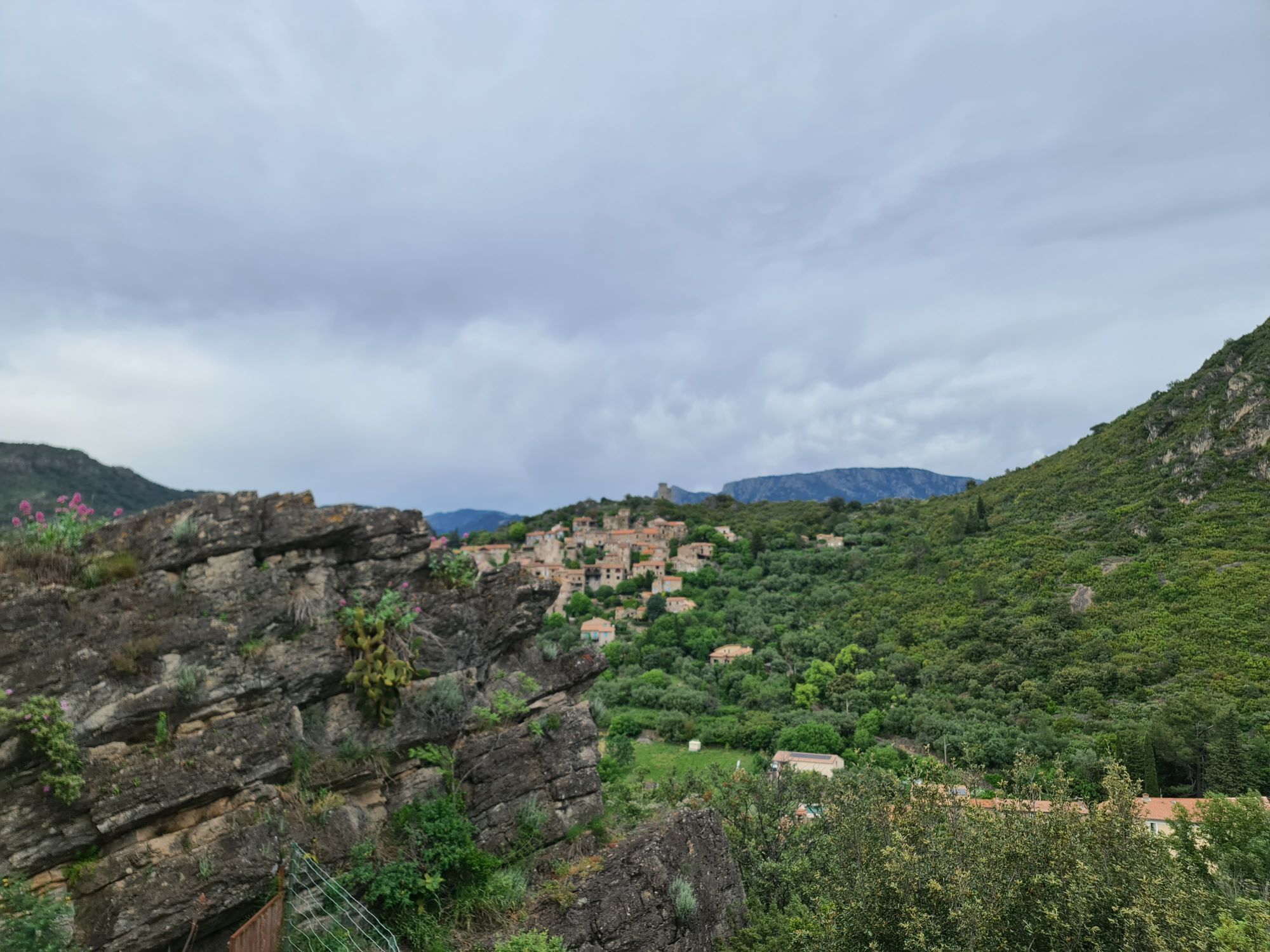
Circuit n°10 De Roquebrun à Vieussan is a demanding outing for experienced mountain bikers looking for a real physical and technical challenge.
From the Esplanade Farret, the route climbs steadily out...
Opis
Circuit n°10 De Roquebrun à Vieussan is a demanding outing for experienced mountain bikers looking for a real physical and technical challenge.
From the Esplanade Farret, the route climbs steadily out of the village, through vineyards and typical garrigue, before tackling steeper tracks and mountain paths towards the Caroux massif.
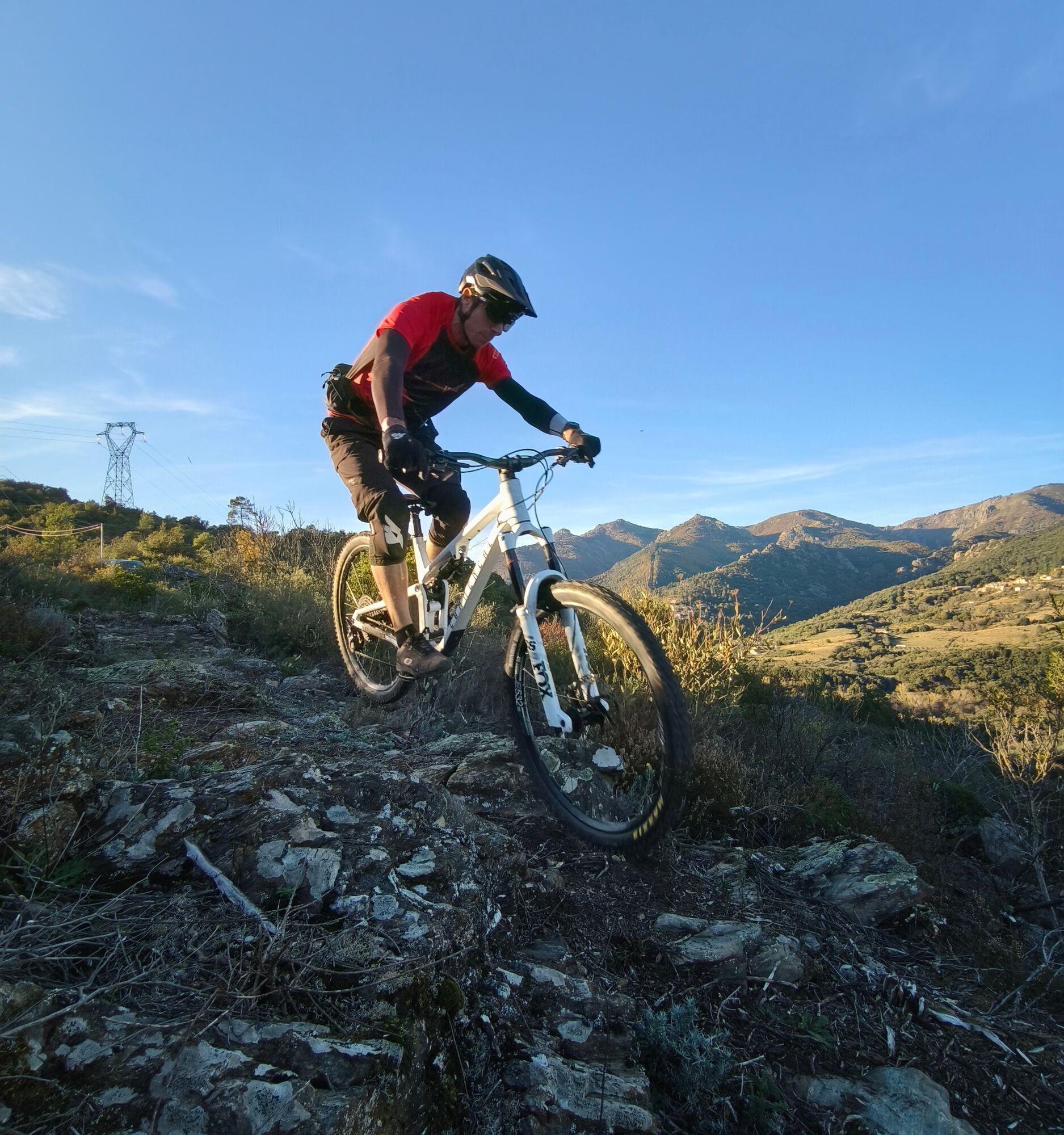
The profile totals 36 km for +1260 m of ascent, with altitudes ranging from 82 m to 628 m, alternating sustained effort on climbs and restarts on rolling sections. The route includes a few road sections to link the different sectors, but the main interest lies in the singletracks and the famous enduro special at Le Pin , a technical and challenging descent that requires braking control, precise trajectories and confidence in your bike.
Allow around 4 hrs 30 depending on pace, breaks and technical level.
This circuit offers a wide variety of landscapes and efforts: ideal for a full day of mountain biking, it requires good preparation, a full-suspension bike recommended, and constant attention to terrain conditions.
From the Esplanade Farret, the route climbs steadily out of the village, through vineyards and typical garrigue, before tackling steeper tracks and mountain paths towards the Caroux massif.
The profile totals 36 km for +1260 m of ascent, with altitudes ranging from 82 m to 628 m, alternating sustained effort on climbs and restarts on rolling sections. The route includes a few road sections to link the different sectors, but the main interest lies in the singletracks and the famous enduro special at Le Pin , a technical and challenging descent that requires braking control, precise trajectories and confidence in your bike.
Allow around 4 hrs 30 depending on pace, breaks and technical level.
This circuit offers a wide variety of landscapes and efforts: ideal for a full day of mountain biking, it requires good preparation, a full-suspension bike recommended, and constant attention to terrain conditions.
Trasa
Roquebrun
(98 m)
Wioska
0,2 km
Laurenque
(224 m)
Rozliczenie
3,5 km
Plaussenous
(539 m)
Rozliczenie
11,2 km
La Baume
(547 m)
Szczyt
15,8 km
Boissezon
(136 m)
Rozliczenie
22,0 km
Ceps
(102 m)
Rozliczenie
26,8 km
Roquebrun
(98 m)
Wioska
34,5 km
Trasa
CIRCUIT N°10 DE ROQUEBRUN À VIEUSSAN - SITE VTT-FFC CAROUX EN HAUT-LANGUEDOC
średni
Mountainbike
34,58
km
Cave
(94 m)
Restauracja
0,1 km
Roquebrun
(98 m)
Wioska
0,2 km
Le Petit Nice
(87 m)
Restauracja
0,2 km
Laurenque
(224 m)
Rozliczenie
3,5 km
Plaussenous
(539 m)
Rozliczenie
11,2 km
La Linière
(538 m)
Rozliczenie
12,7 km
La Baume
(547 m)
Szczyt
15,8 km
Vieussan
(156 m)
Wioska
20,7 km
Boissezon
(136 m)
Rozliczenie
22,0 km
Ceps
(102 m)
Rozliczenie
26,8 km
Roquebrun
(98 m)
Wioska
34,5 km
Autor
Dostarczone przez Hérault Tourismus


Dodatkowe informacje i wskazówki
Dodatkowe informacje
- Suitable bikes: We recommend full-suspension mountain bikes; check brakes, suspension and tires before setting off. Protection: full-face helmet recommended for the La spéciale du Pin; gloves, knee pads and goggles.
- Technique: anticipate the enduro descent; look far ahead, measure braking and choose trajectories on pebbles.
- Weather and terrain: avoid heavy rain; some sections become slippery and dangerous.
Wskazówki
Brown MTB Beacons
https://www.minervois-caroux.com/
Office de Tourisme du Minervois au Caroux
VTT-FFC website
Nie ma jeszcze recenzji
Popularne wycieczki w okolicy
-
4,0
GORGES DE COLOMBIERES HIKE
średniWędrówka 12,0 km -
5,0
HIKING OF THE HÉRIC GORGES VIA THE ORIENTATION TABLE
średniWędrówka 16,3 km -
4,0
CAROUX SUMMIT HIKE
średniWędrówka 7,94 km -
5,0
HIKING ROUTE OF THE TERRASSES DE L'ESPINOUSE
średniWędrówka 16,8 km -
3,0
CYCLE LOOP No. 29 - FROM THE VALLEYS TO THE PEAKS OF HAUT-LANGUEDOC
średniJazda na rowerze 64,3 km -
5,0
PECH BELET HIKE
światłoWędrówka 4,41 km -
5,0
OENORANDO® THE VALLEY OF AROMAS
średniWędrówka 13,7 km -
HERIC GORGES ROAD - MONS LA TRIVALLE
średniWędrówka 9,38 km -
HIKE OF SAINT MICHEL DE MOURCAIROL
średniWędrówka 11,7 km -
HIKING OF THE HÉRIC GORGES VIA THE COL DE BARDOU
średniWędrówka 12,4 km

Wędrówki i tropienie

Ponad 550.000 propozycji wycieczek, szczegółowe mapy i intuicyjny planer tras sprawiają, że aplikacja jest niezbędna dla wszystkich entuzjastów przyrody.

Nie przegap ofert i inspiracji na następne wakacje
Zapisz się do newslettera
Błąd
Wystąpił błąd. Spróbuj ponownie.
Dziękujemy za rejestrację
Twój adres e-mail została dodana do listy mailingowej.
Wycieczki po całej Europie
Austria
Szwajcaria
Niemcy
Włochy
Słowenię
Francja
Holandia
Belgia
Polska
Liechtenstein
Czechy
Słowacja
Hiszpania
Chorwacja
Bośnia i Hercegowina
Luksemburg
Andorra
Portugalia
Islandia
Wielka Brytania
Irlandia
Grecja
Albania
Macedonia Północna
Malta
Norwegia
Czarnogóra
Mołdawia
Kosowo
Węgry
San Marino
Rumunia
Estonia
Łotwa
Białoruś
Cypr
Litwa
Serbia
Bułgaria
Monako
Dania
Szwecja
Finlandia





