


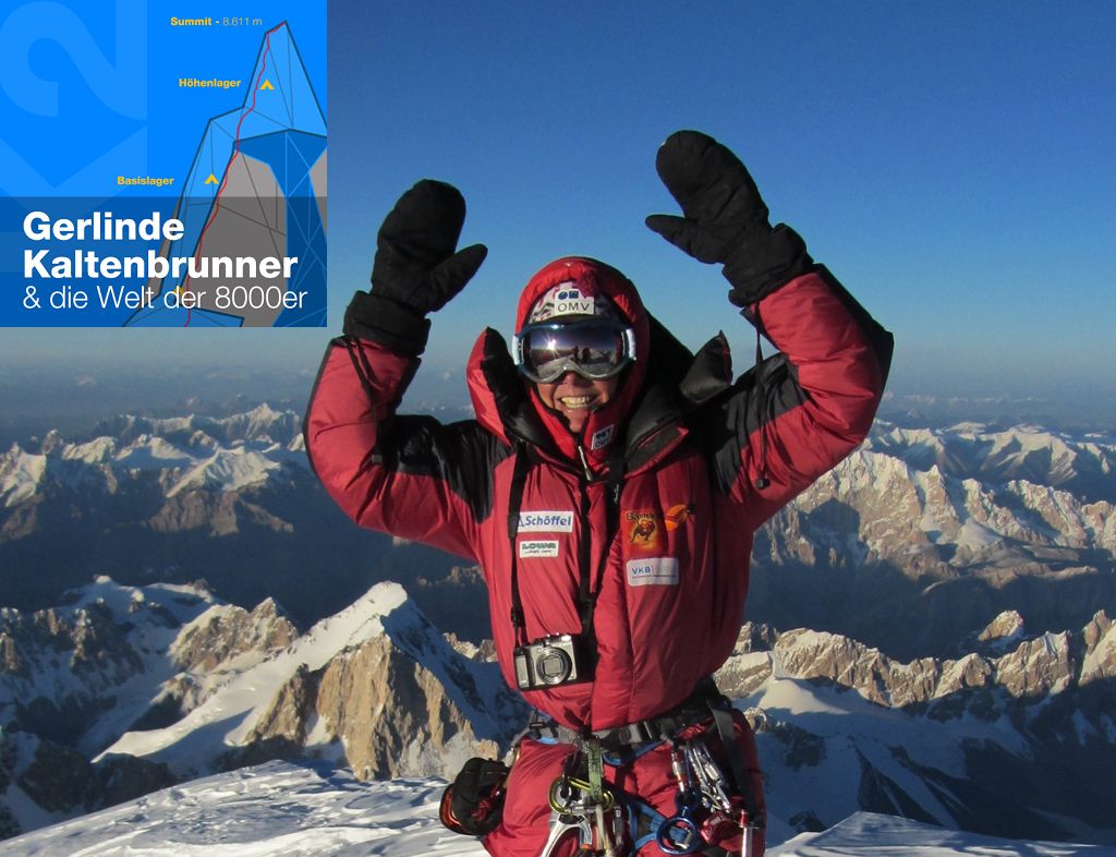
Wanderweg "Zwischen Himmel und Erde - Gerlinde Kaltenbrunner und die Welt der 8000er"
Zdjęcia naszych użytkowników
-
 © Márk János KóródiUtworzono dnia 17.05.2026
 -
 © Thomas BedkeUtworzono dnia 13.05.2026
 -
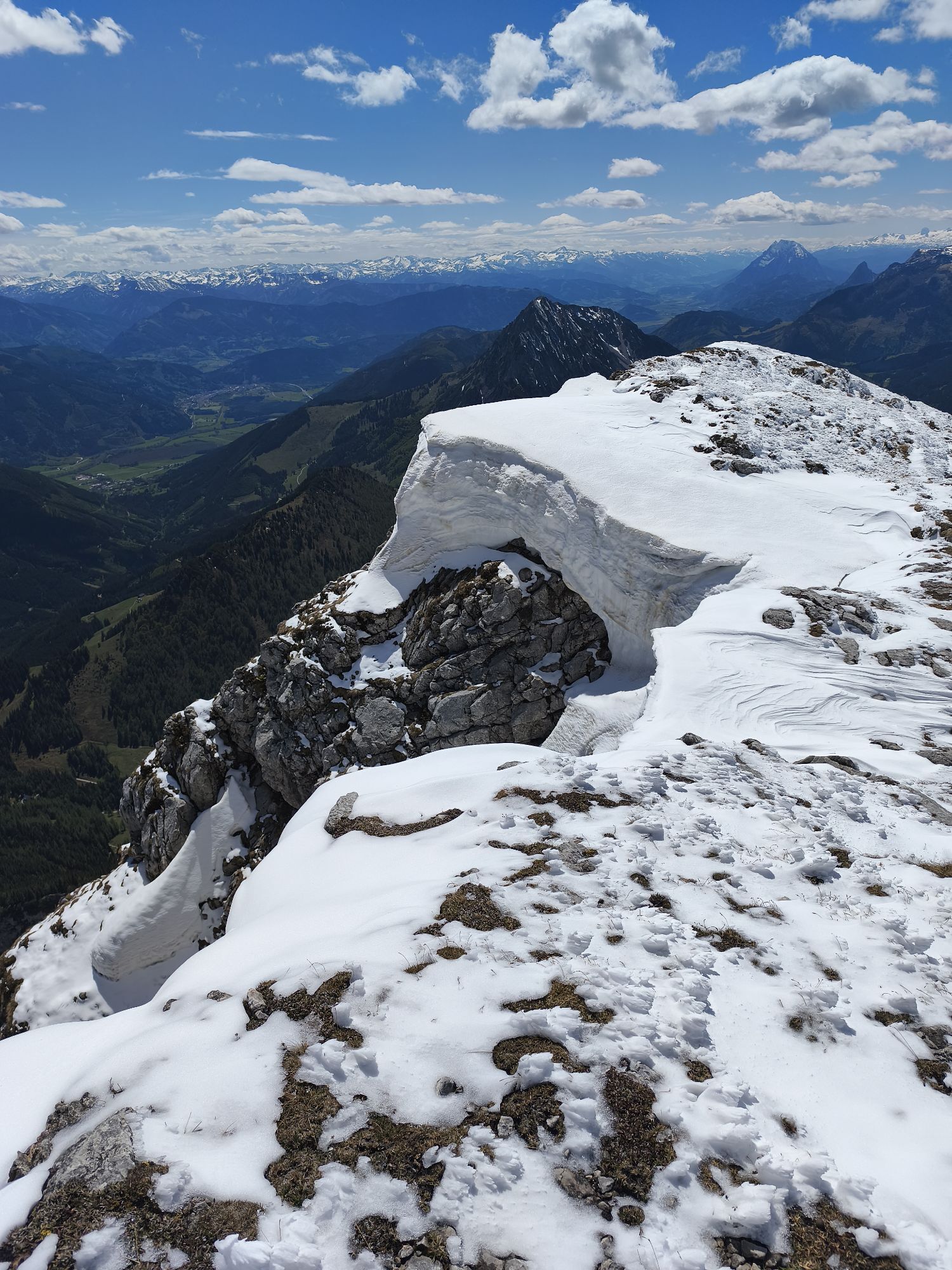
 © Thomas BedkeUtworzono dnia 13.05.2026
 -
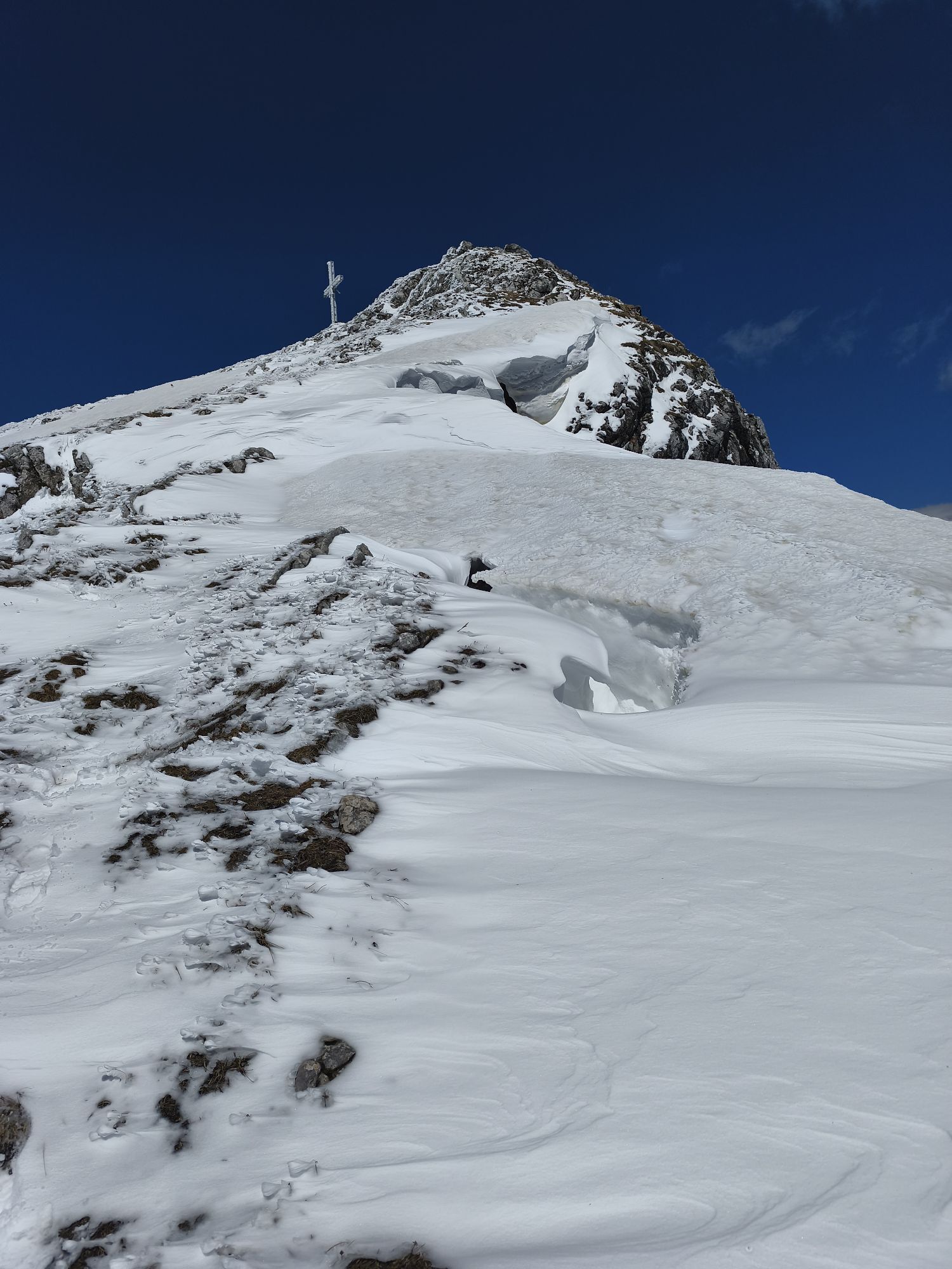
 © Thomas BedkeUtworzono dnia 13.05.2026
 -
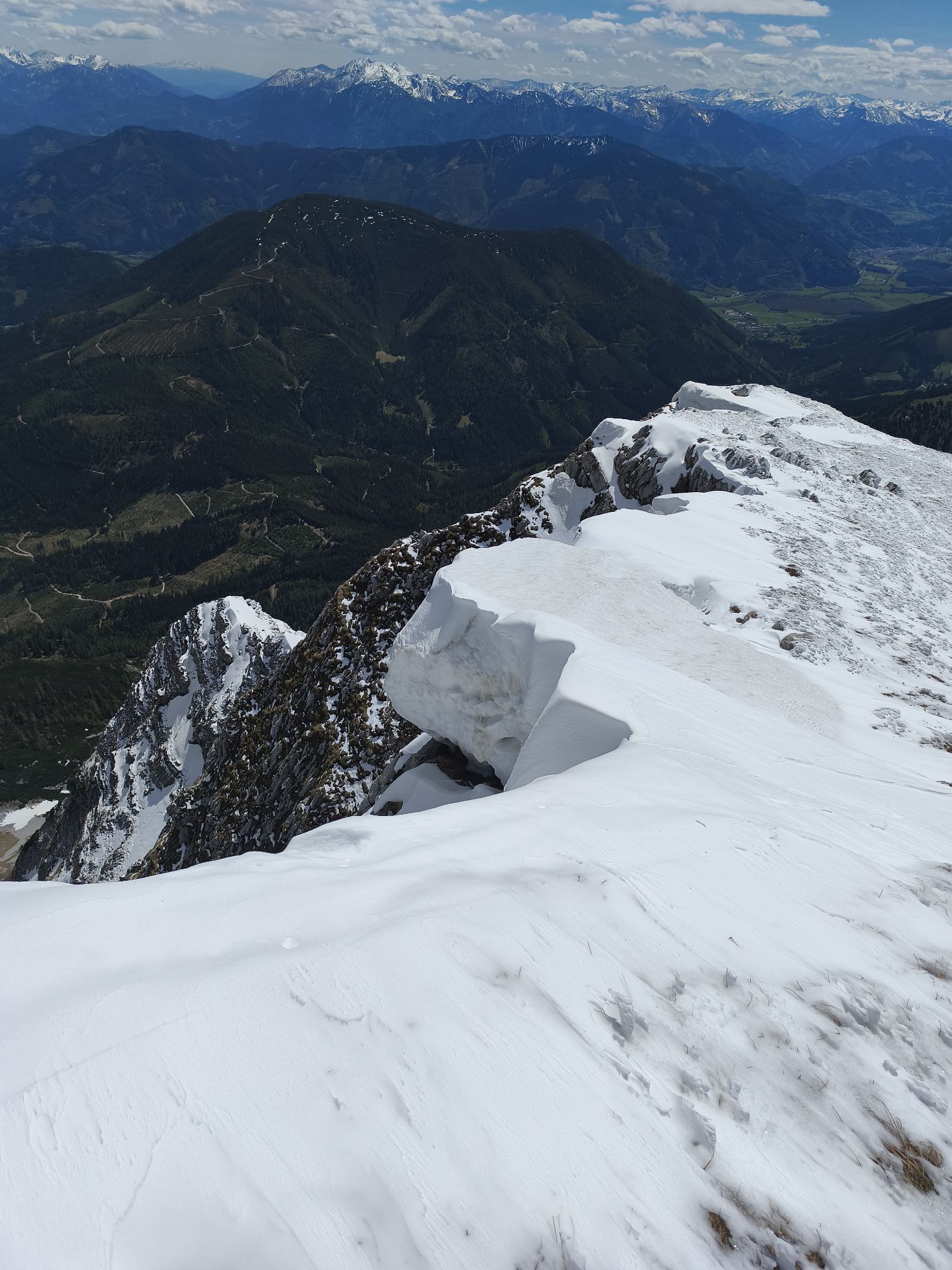
 © Thomas BedkeUtworzono dnia 13.05.2026
 -
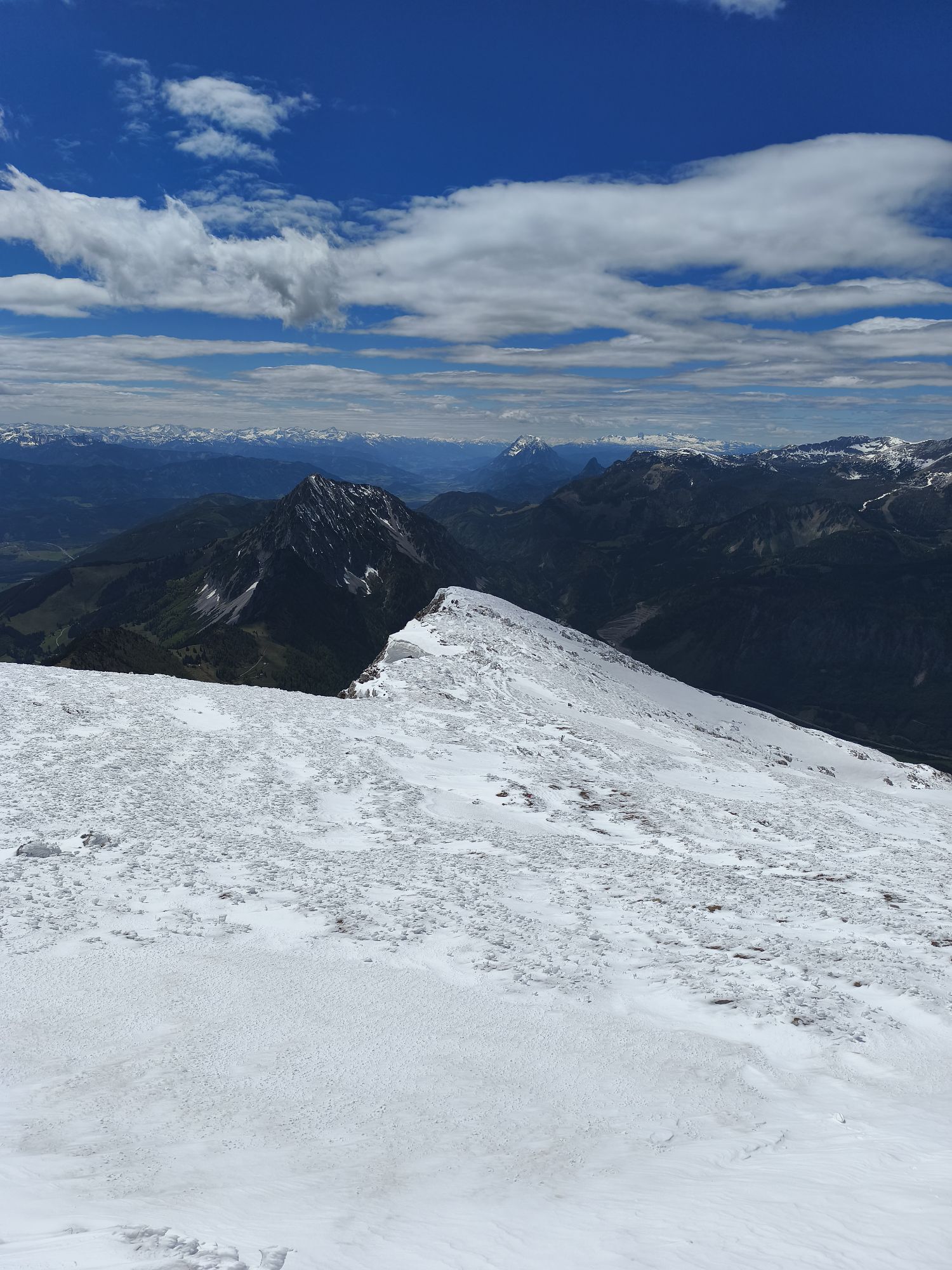
 © Thomas BedkeUtworzono dnia 13.05.2026
 -
 © Thomas BedkeUtworzono dnia 13.05.2026
 -
 © Thomas BedkeUtworzono dnia 13.05.2026
 -
 © Wolfgang BloderUtworzono dnia 29.04.2026
 -
 © RaffaelUtworzono dnia 22.04.2026
 -
 © Wolfgang PatscheiderUtworzono dnia 07.11.2025
 -
 © Edith K.Utworzono dnia 01.11.2025
 -

 © Peter BräuUtworzono dnia 21.09.2025
 -
 © Peter BräuUtworzono dnia 21.09.2025
 -
 © Peter BräuUtworzono dnia 21.09.2025
 -
 © Klaus LehnerUtworzono dnia 12.09.2025
 -
 © Dusica OrozUtworzono dnia 31.08.2025
 -
 © Dusica OrozUtworzono dnia 31.08.2025
 -
 © Dusica OrozUtworzono dnia 31.08.2025
 -
 © Dusica OrozUtworzono dnia 31.08.2025
 -
 © RaffaelUtworzono dnia 29.08.2025
 -
 © RaffaelUtworzono dnia 29.08.2025
 -

 © Jürgen Winter 144Utworzono dnia 19.08.2025
 -
 © Jürgen Winter 144Utworzono dnia 19.08.2025
 -
 © Thomas FerkUtworzono dnia 15.08.2025
 -
 © Thomas FerkUtworzono dnia 15.08.2025
 -
 © Thomas FerkUtworzono dnia 15.08.2025
 -
 © Thomas FerkUtworzono dnia 15.08.2025
 -
 © Thomas FerkUtworzono dnia 15.08.2025
 -
 © Thomas FerkUtworzono dnia 15.08.2025
 -
 © Thomas FerkUtworzono dnia 15.08.2025
 -
 © Thomas FerkUtworzono dnia 15.08.2025
 -
 © Thomas FerkUtworzono dnia 15.08.2025
 -
 © Thomas FerkUtworzono dnia 15.08.2025
 -
 © Thomas FerkUtworzono dnia 15.08.2025
 -
 © Thomas FerkUtworzono dnia 15.08.2025
 -
 © Thomas FerkUtworzono dnia 15.08.2025
 -
 © Thomas FerkUtworzono dnia 15.08.2025
 -
 © Thomas FerkUtworzono dnia 15.08.2025
 -
 © Thomas FerkUtworzono dnia 15.08.2025
 -
 © Thomas FerkUtworzono dnia 15.08.2025
 -
 © Thomas FerkUtworzono dnia 15.08.2025
 -
 © Thomas FerkUtworzono dnia 15.08.2025
 -
 © Stefan Pichlmann 1Utworzono dnia 03.08.2025
 -
 © El_GamsoUtworzono dnia 19.07.2025
 -
 © El_GamsoUtworzono dnia 19.07.2025
 -
 © El_GamsoUtworzono dnia 19.07.2025
 -
 © El_GamsoUtworzono dnia 19.07.2025


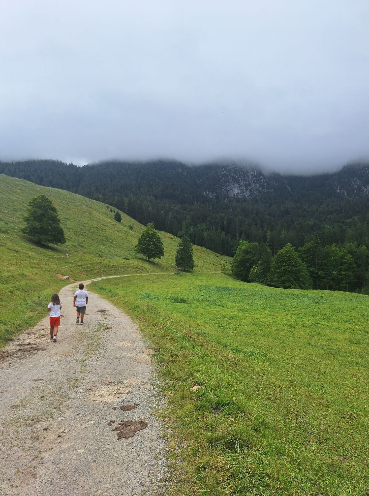


Upload directly at the starting point, as described migrant Cruises "8000" on your smartphone and you will embark on "Expedition" in the mountains of the Pyhrn-Priel region. The trail passes through the...
Upload directly at the starting point, as described migrant Cruises "8000" on your smartphone and you will embark on "Expedition" in the mountains of the Pyhrn-Priel region.
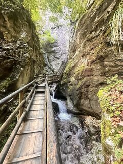
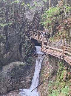
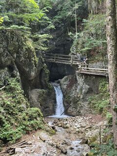
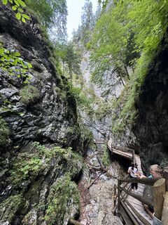
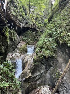
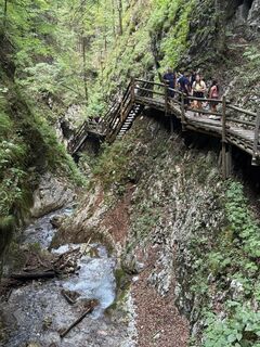
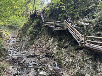
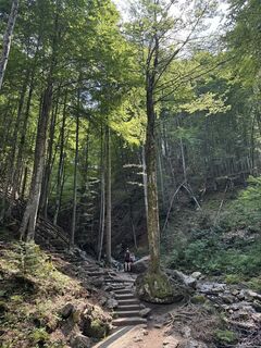
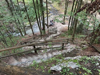
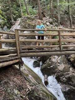
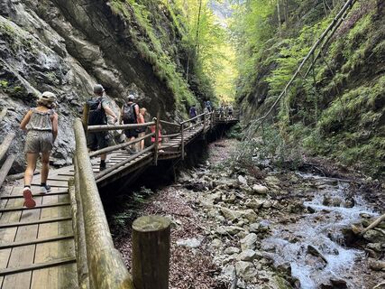
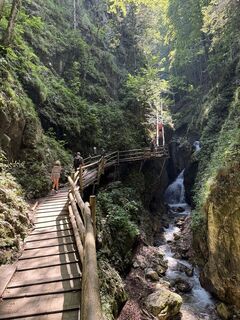
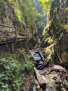
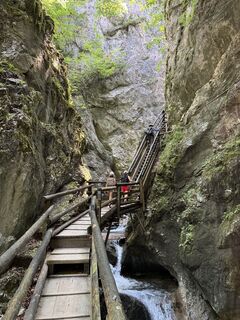
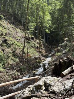
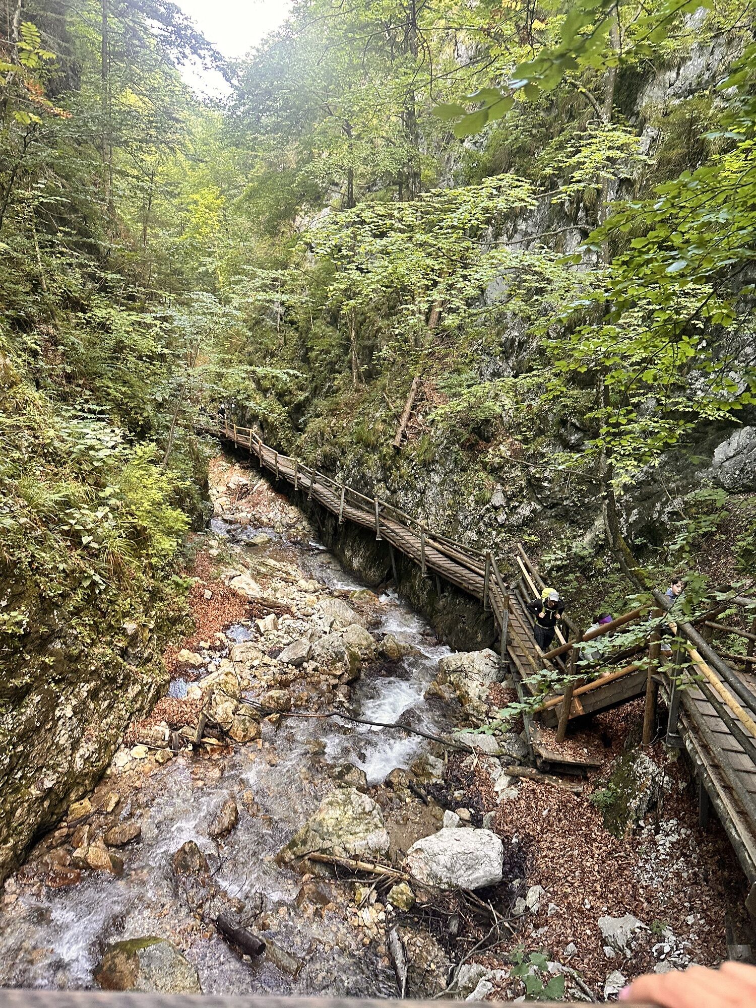
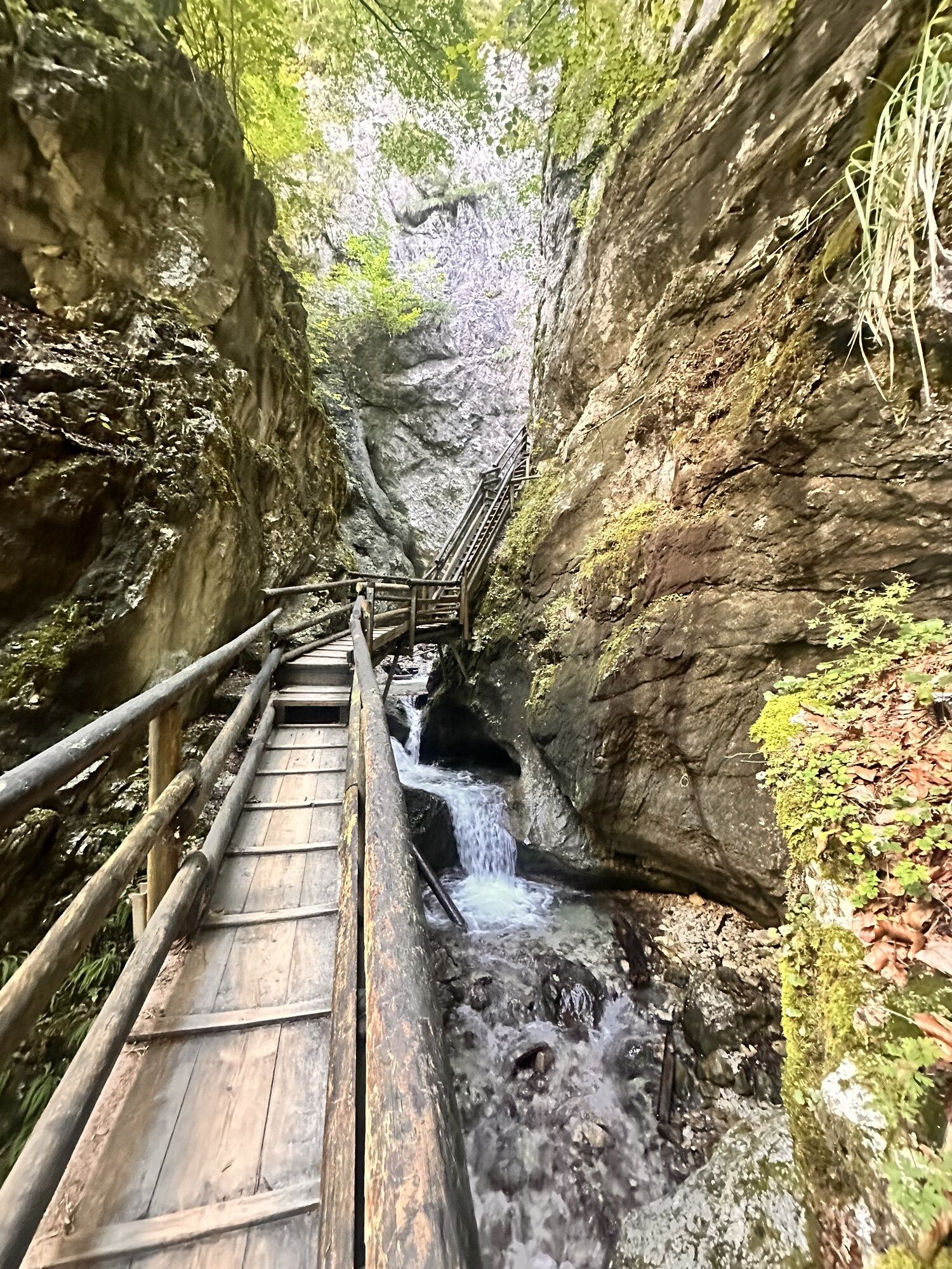
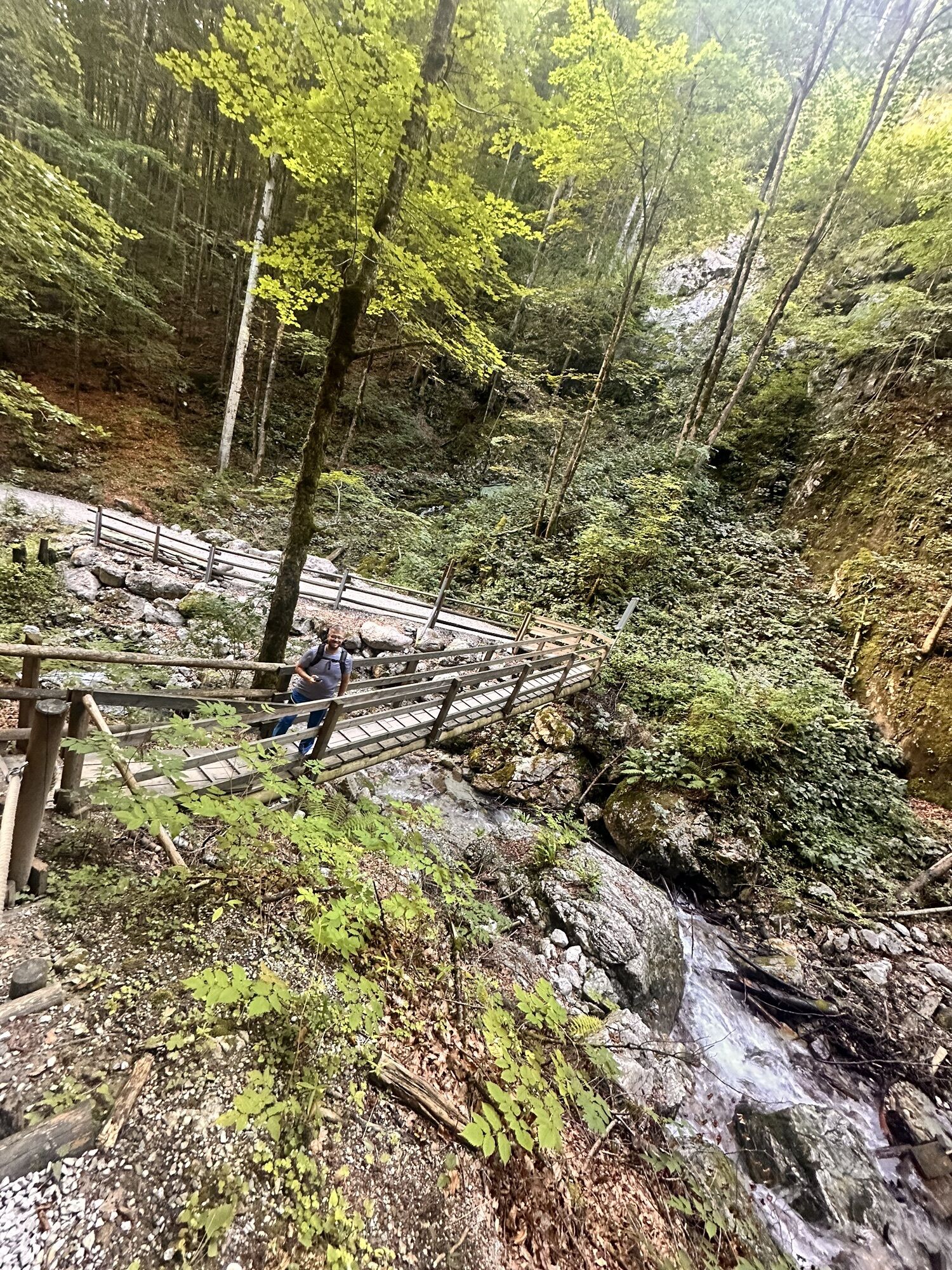
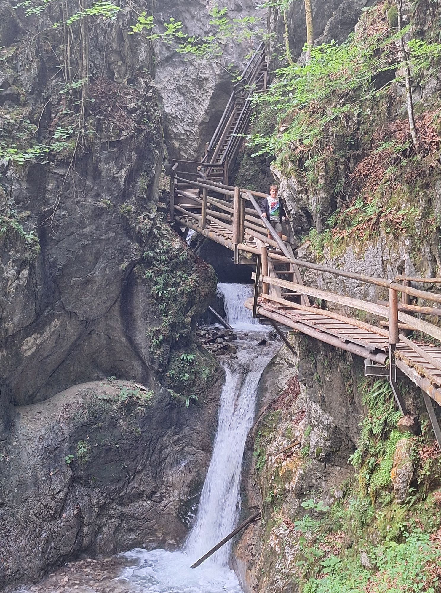
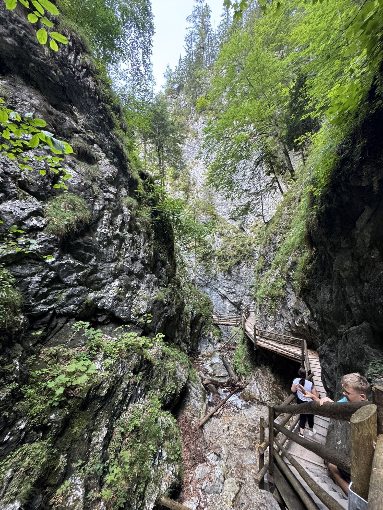
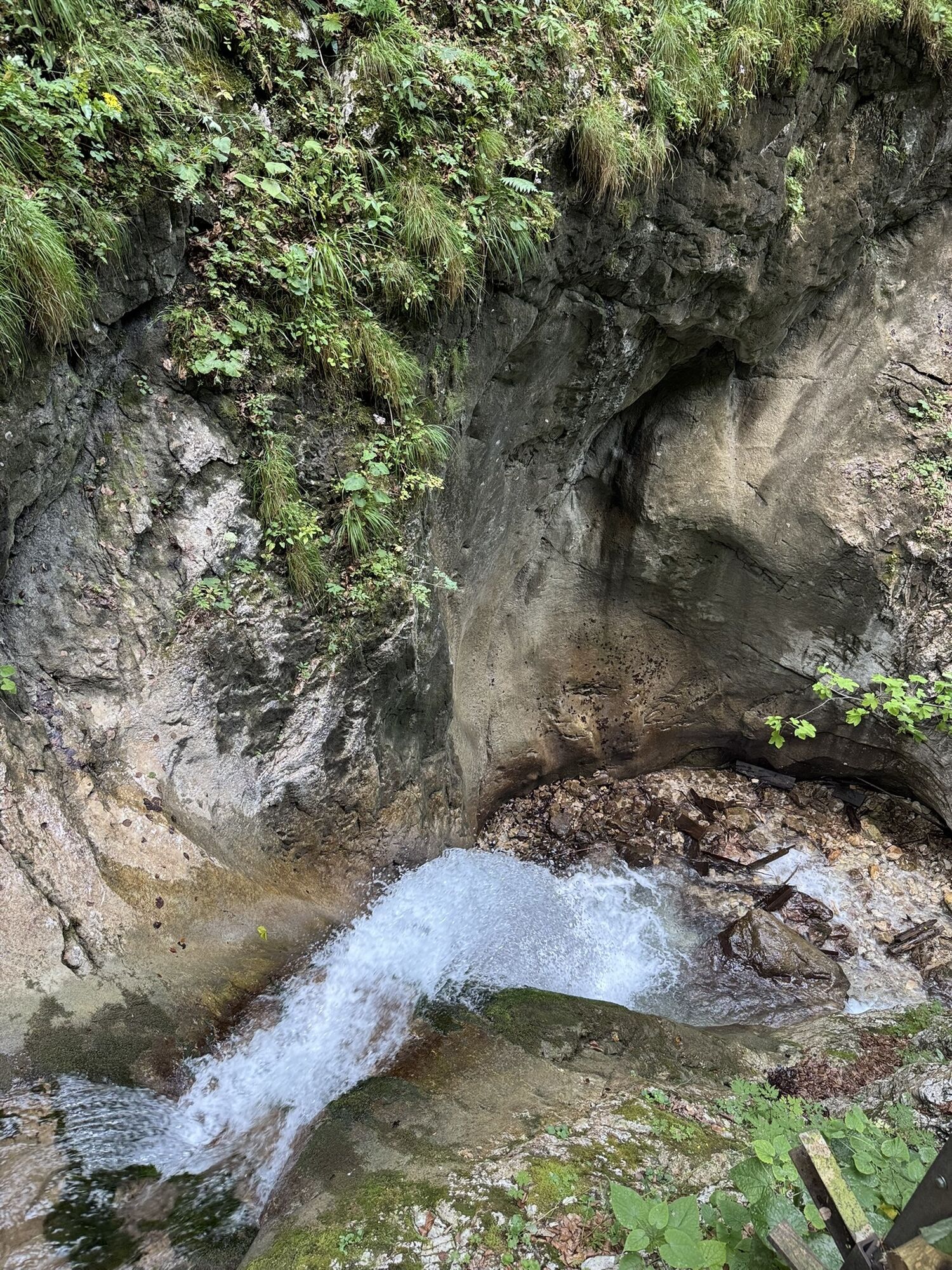
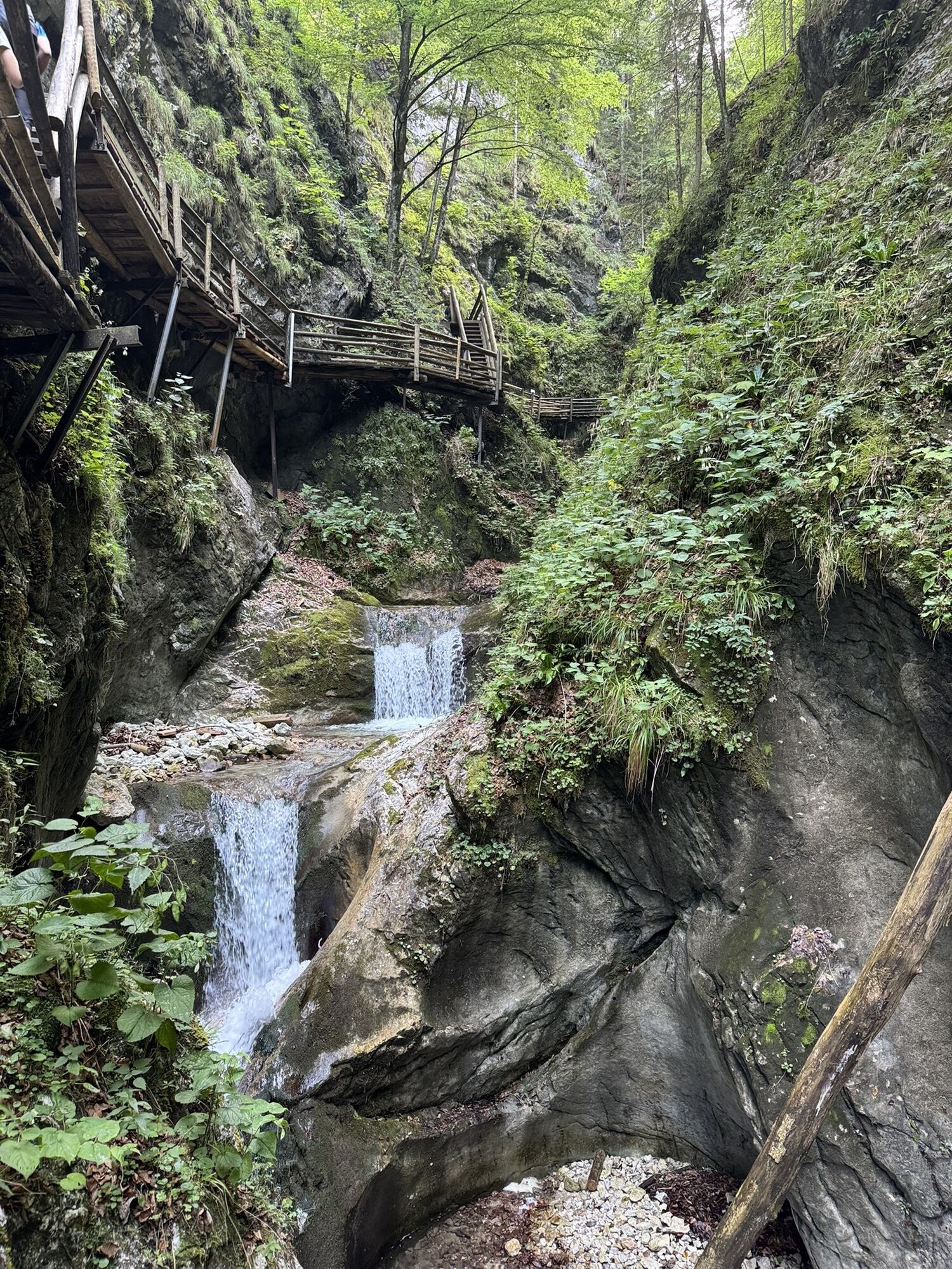
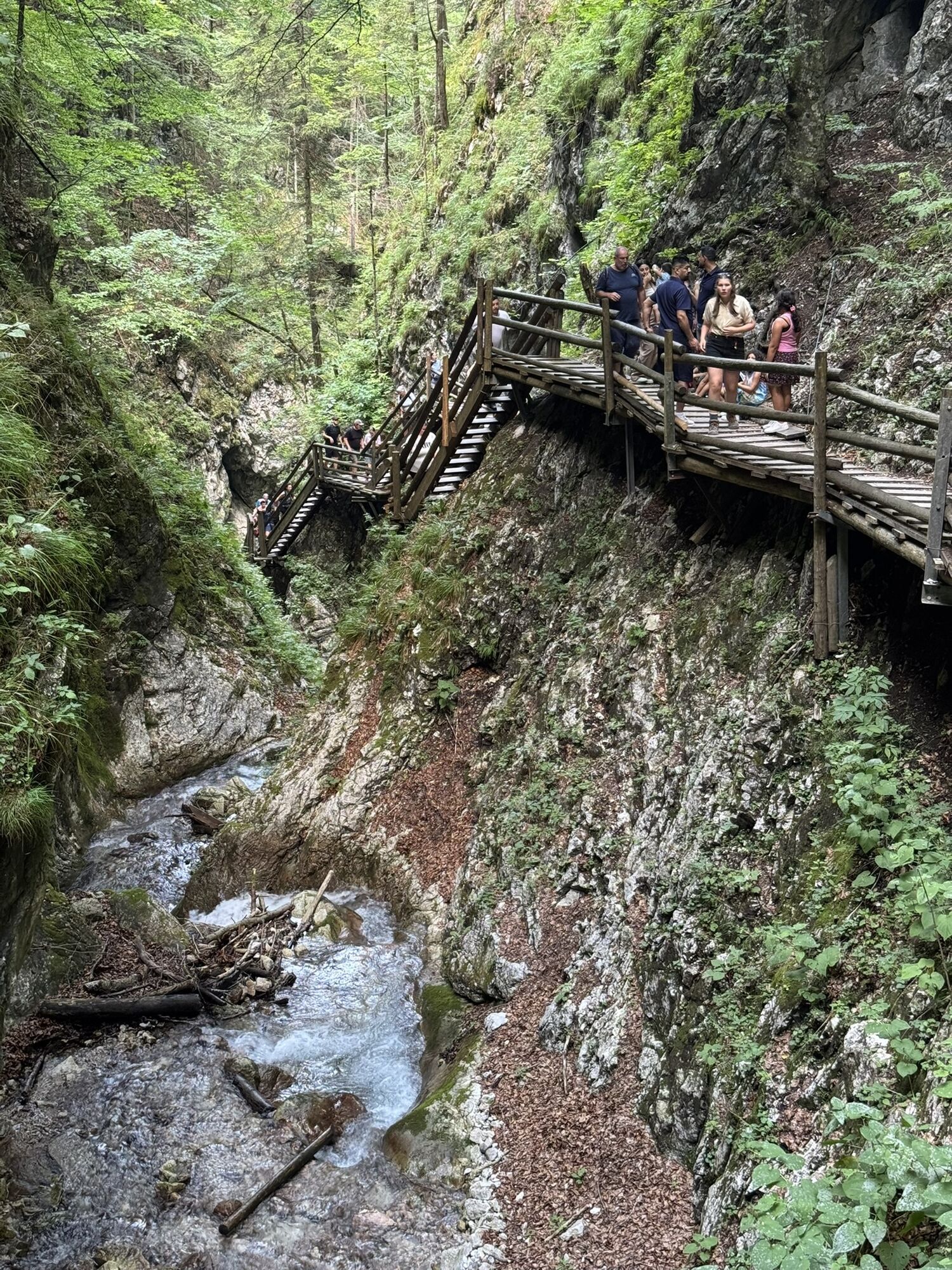
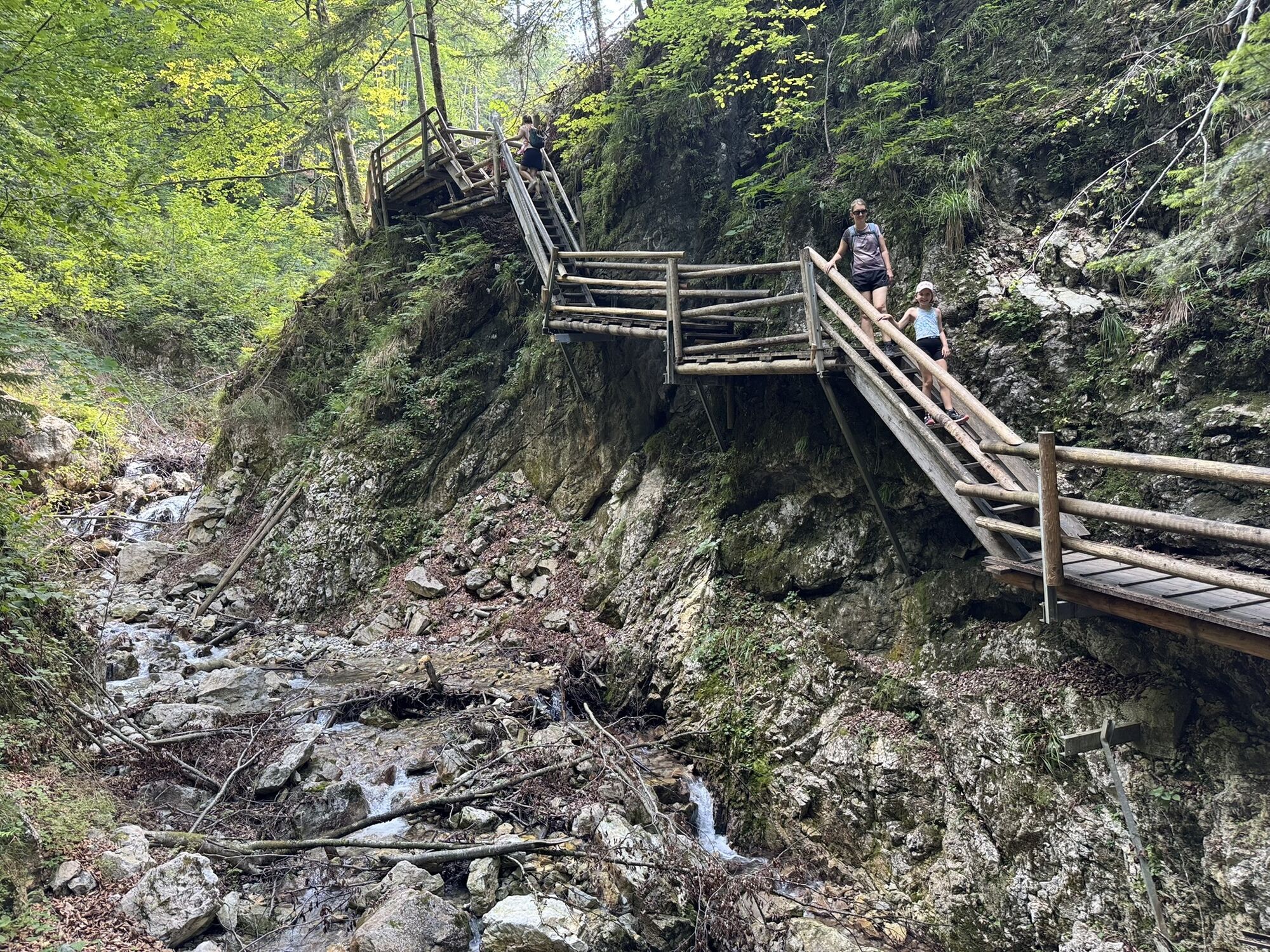
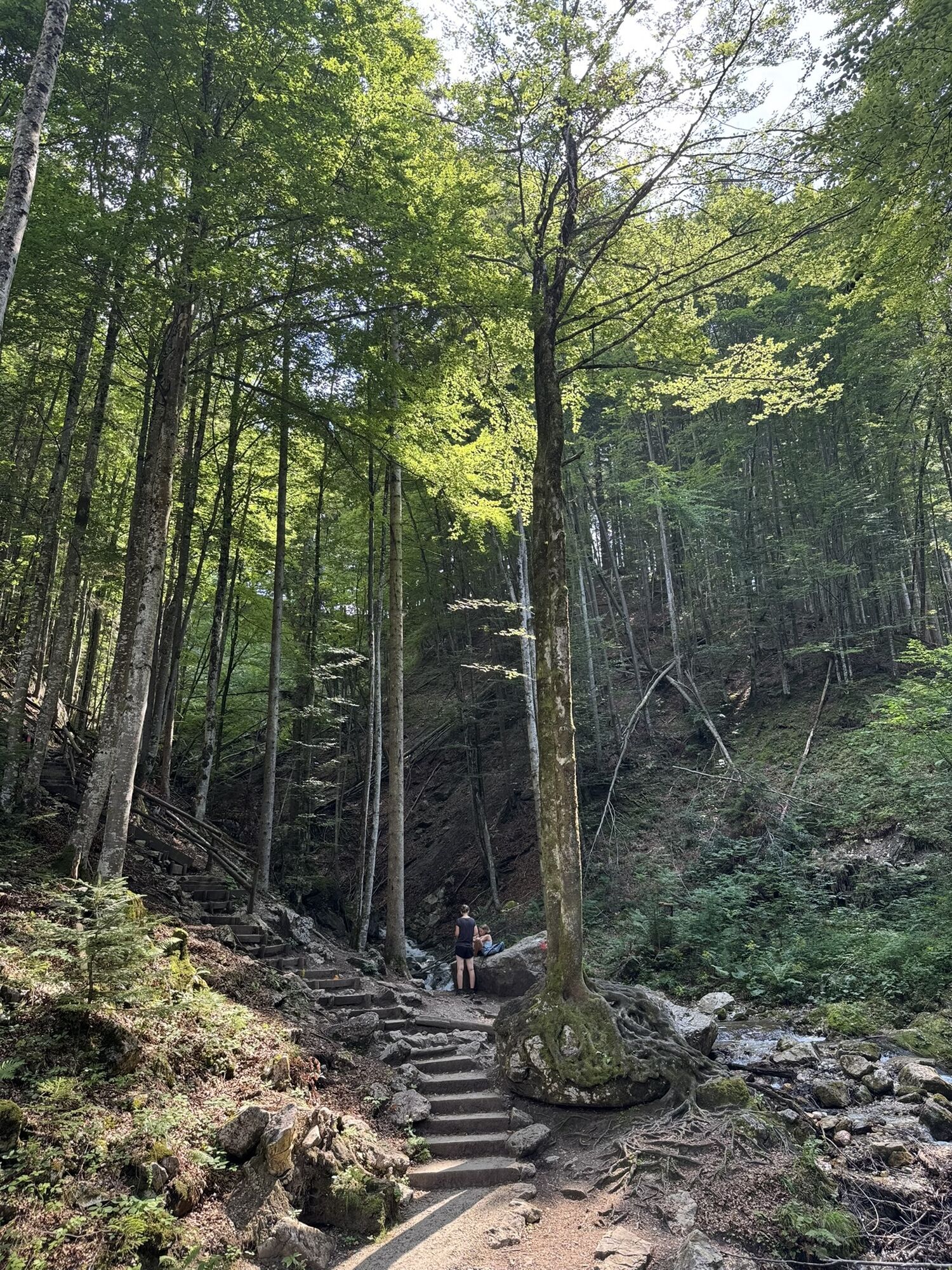
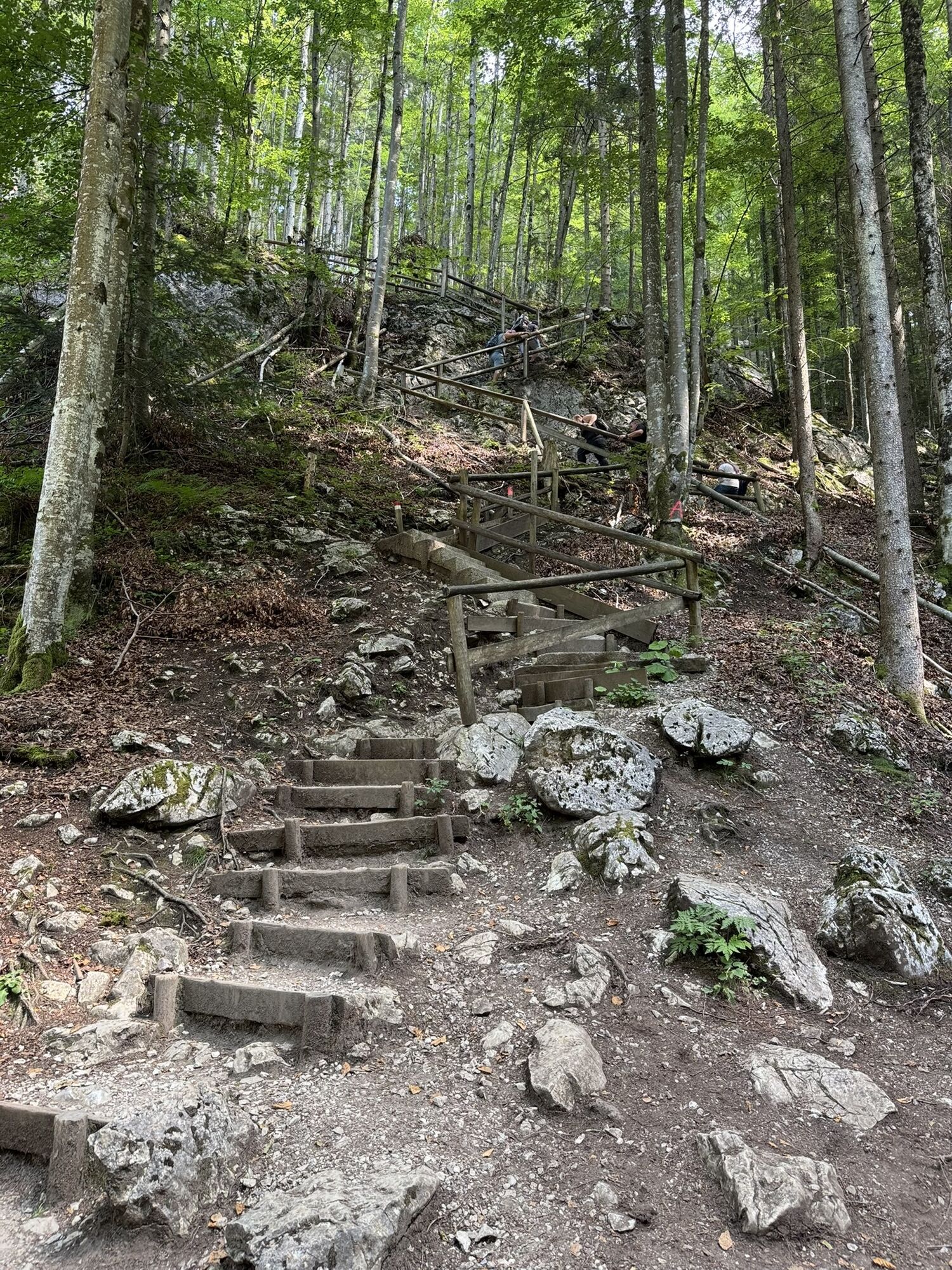
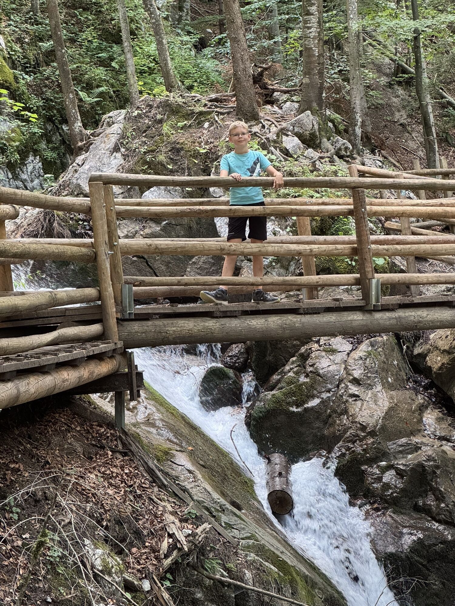
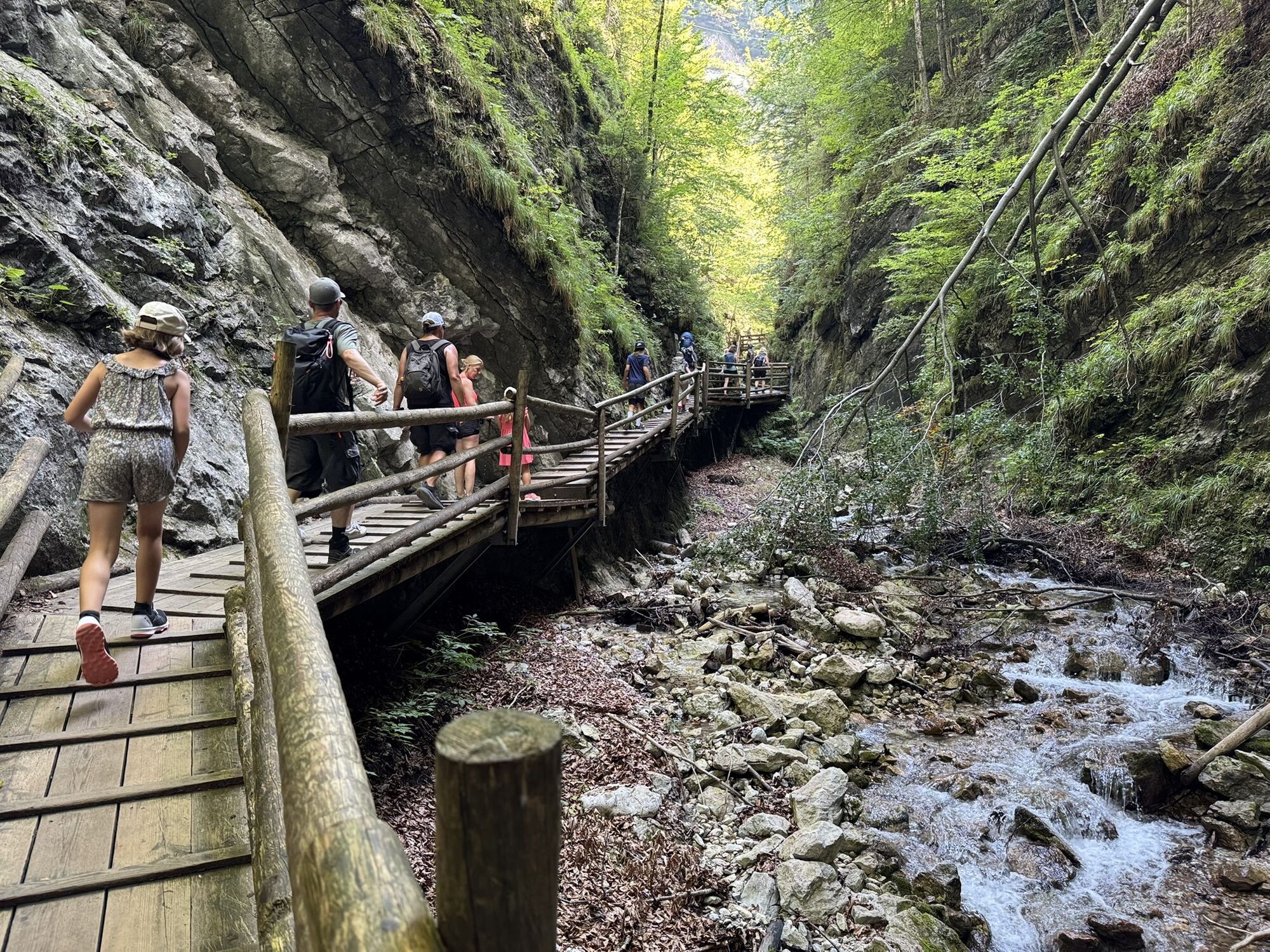
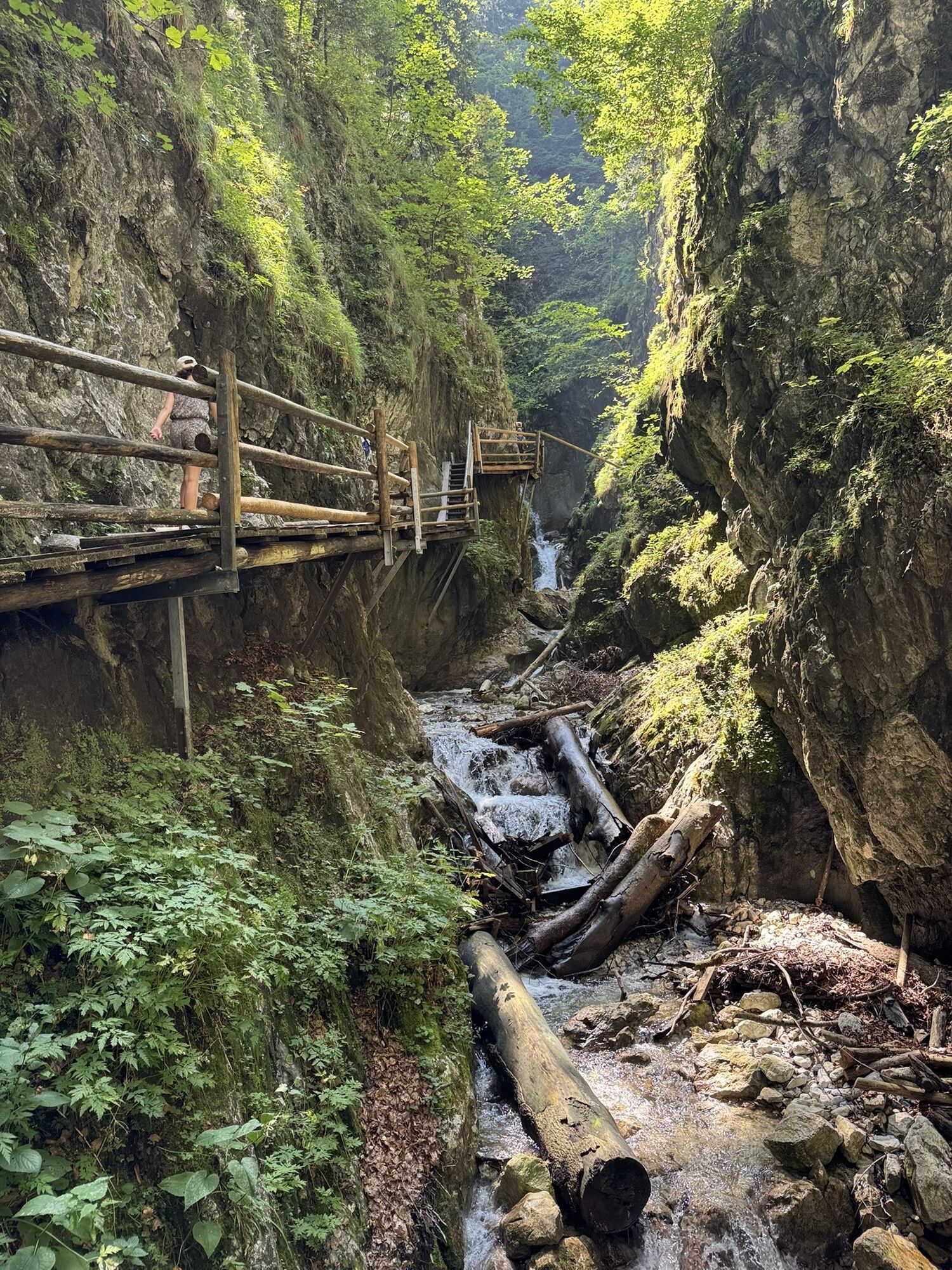
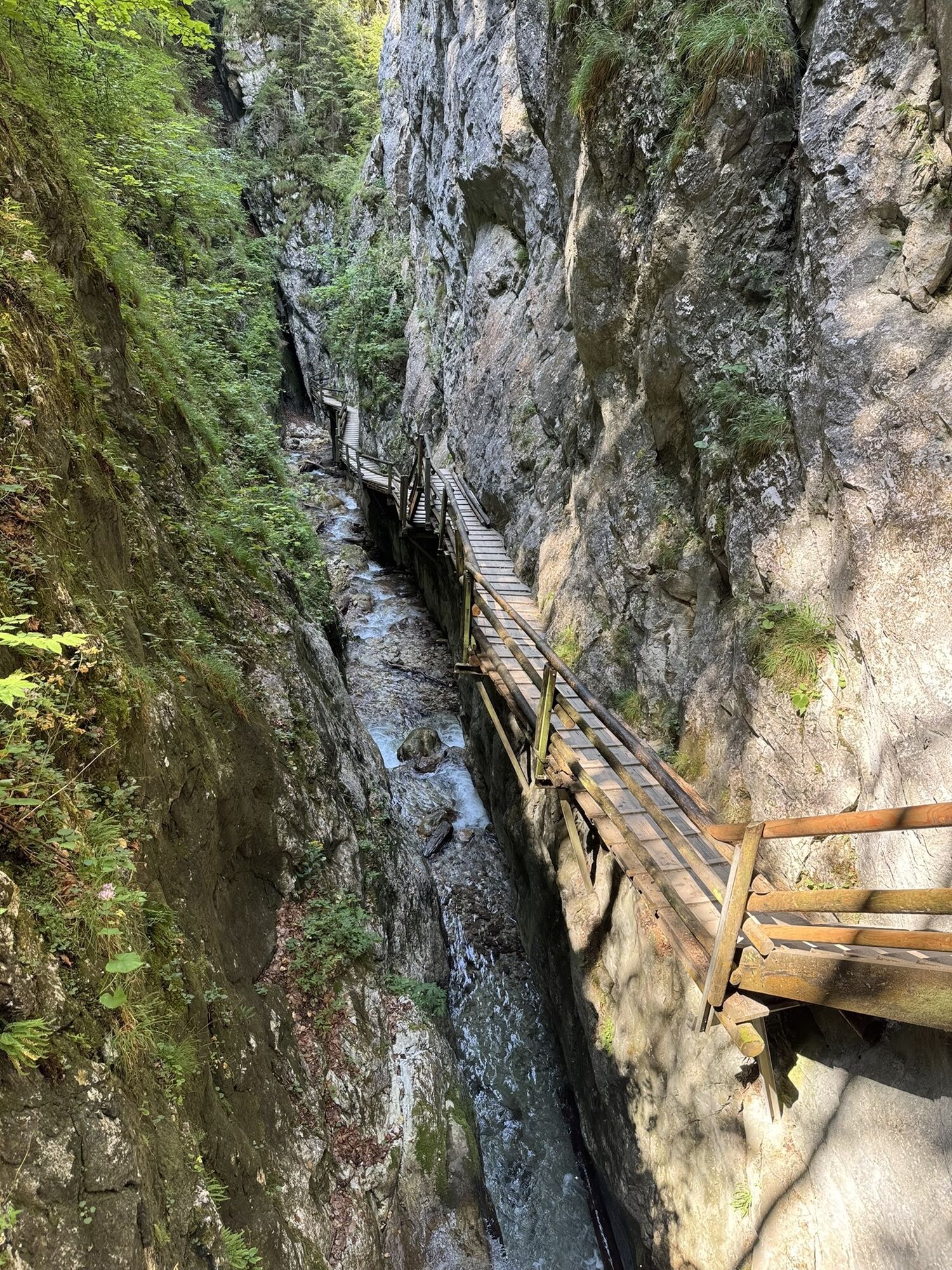
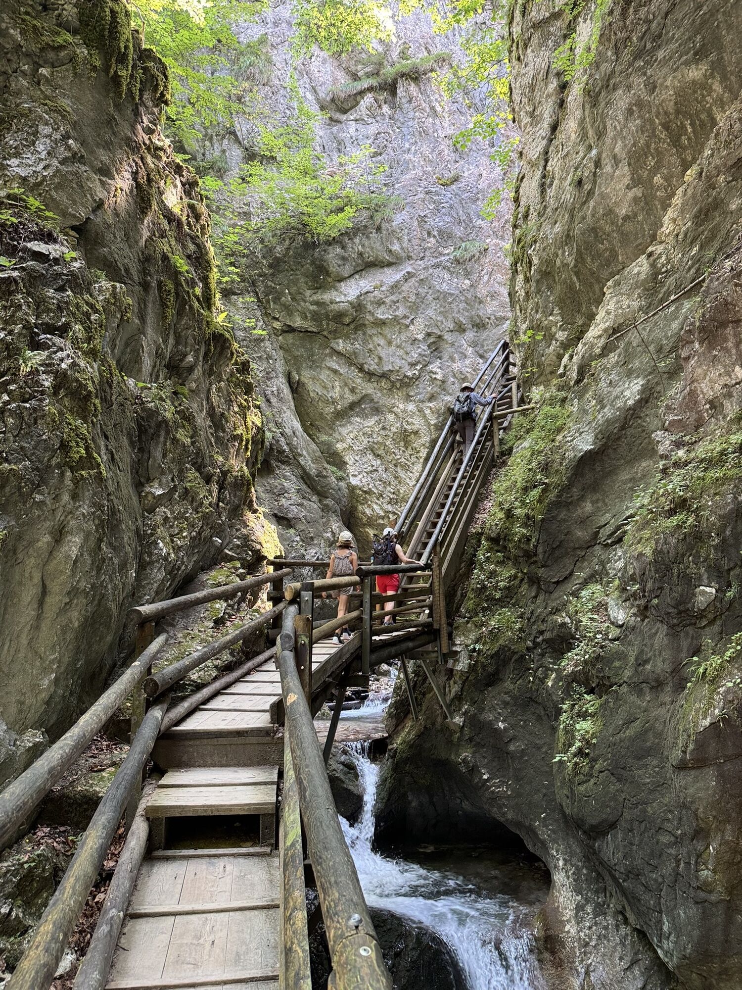
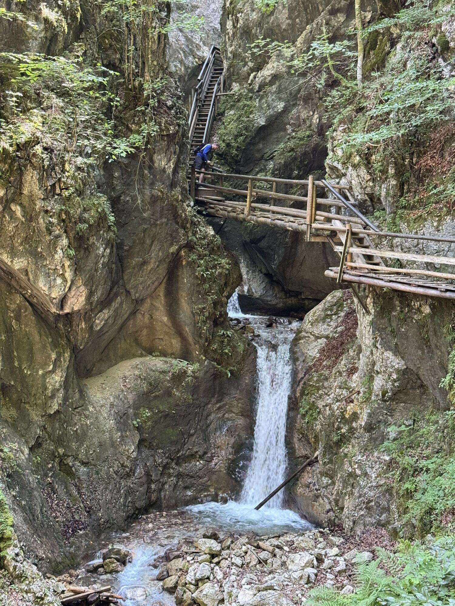
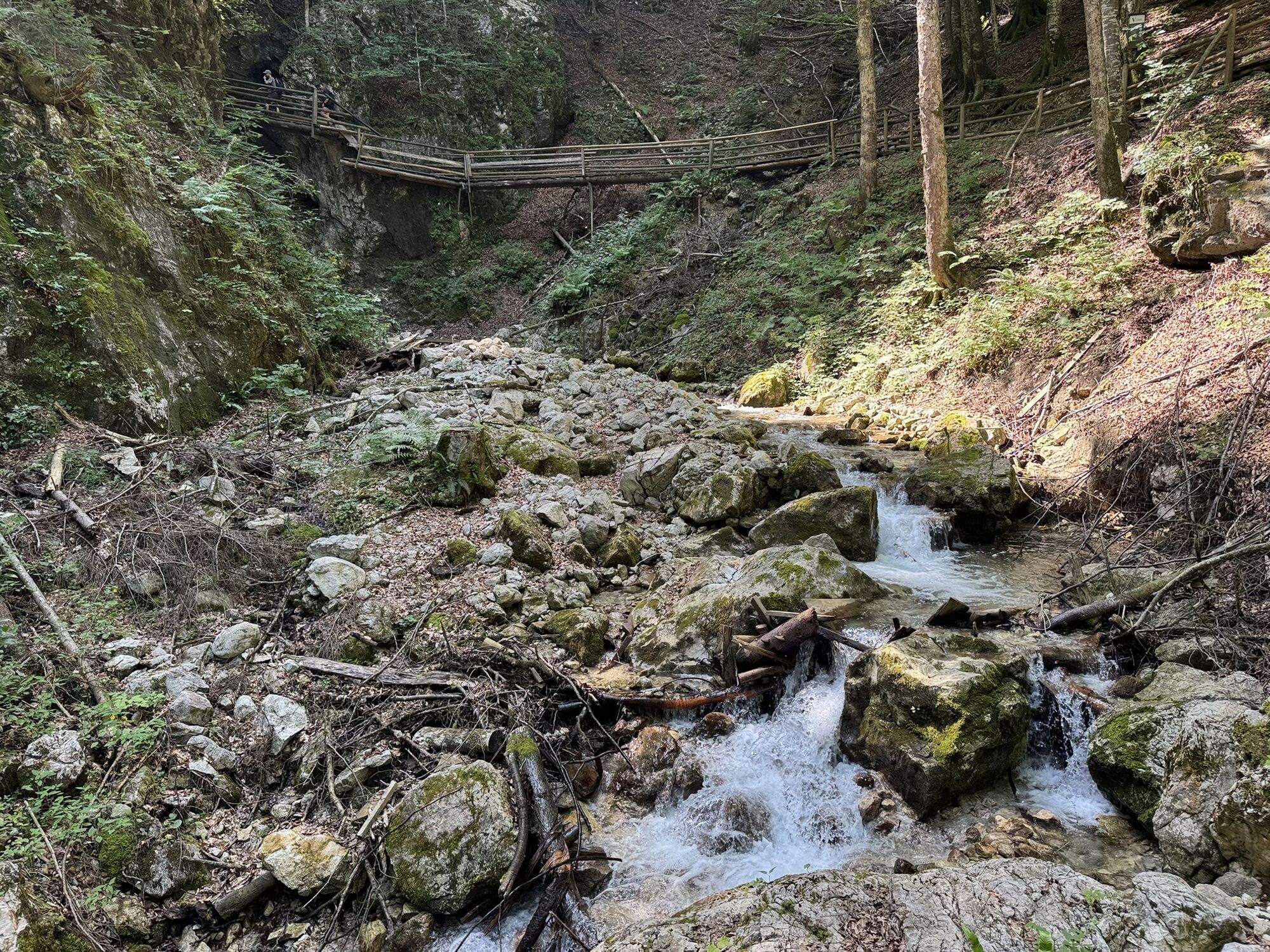
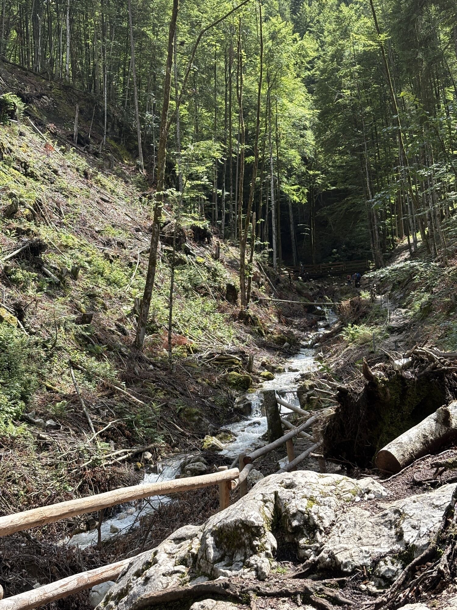
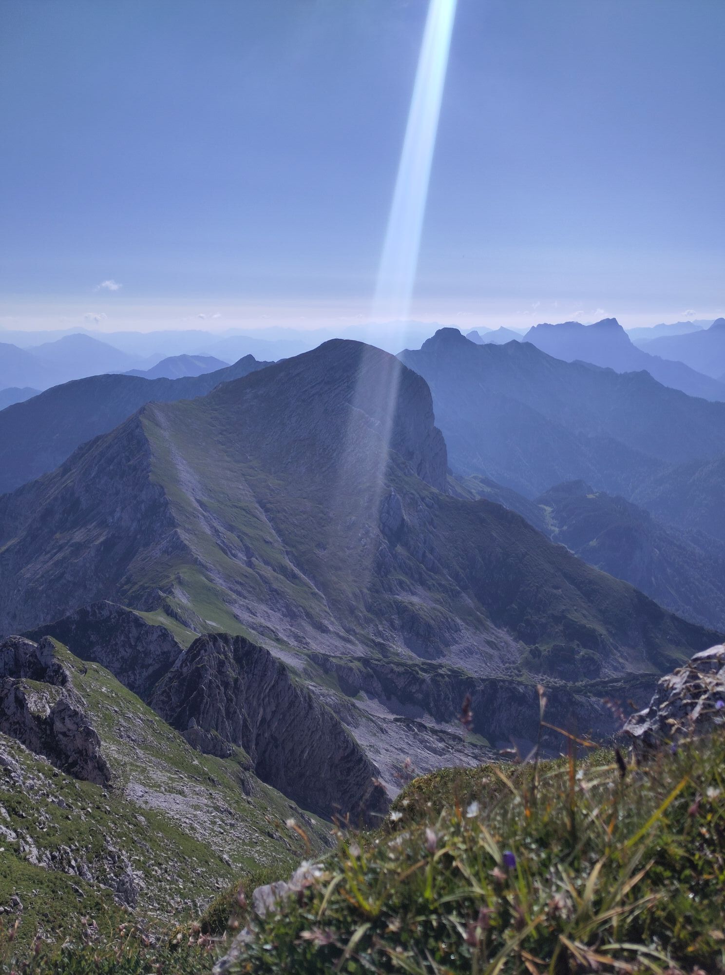
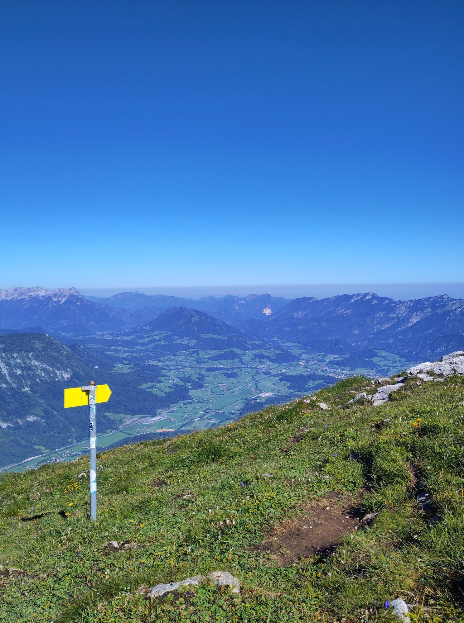
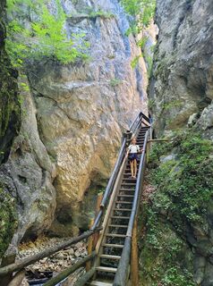
The trail passes through the longest walk gorge of Upper Austria - the Dr. Vogelgesang Gorge - the "base camp" Bosruckhütte and from there to the "high camp" Rohrauerhaus. The hiking app performs good climbers to the summit of the Great Pyhrgas (2244 m).


Tak
Tak
Tak
Kamery internetowe z trasy
-
Gammering - Hahnlgraben
-
Langlaufzentrum Hall Mühlau
-
Bergstation Standseilbahn
-
Gammering - Hahnlgraben
-
Gammering - Hahnlgraben
-
Gammering - Hahnlgraben
-
Gammering - Hahnlgraben
-
Gammering - Hahnlgraben
-
Bergstation Wurzeralm 2
-
Bergstation Wurzeralm 2
-
Bergstation Wurzeralm 2
-
Bergstation Wurzeralm 2
-
Bergstation Wurzeralm 2
-
Bergstation Wurzeralm 2
-
Gammering - Hahnlgraben
-
Bergstation Wurzeralm 2
-
Bergstation Wurzeralm 2
-
Spital am Pyhrn / Genussstubn
-
Trattenbacher GenussStubn
Aktywności na trasie
-

Spital am Pyhrn, Oberösterreich/Österreich
09.05.2026 – Wędrówka -

Spital am Pyhrn, Oberösterreich/Österreich
01.05.2026 – Wędrówka -

Spital am Pyhrn, Upper Austria/Austria
07.12.2025 – Wędrówka -
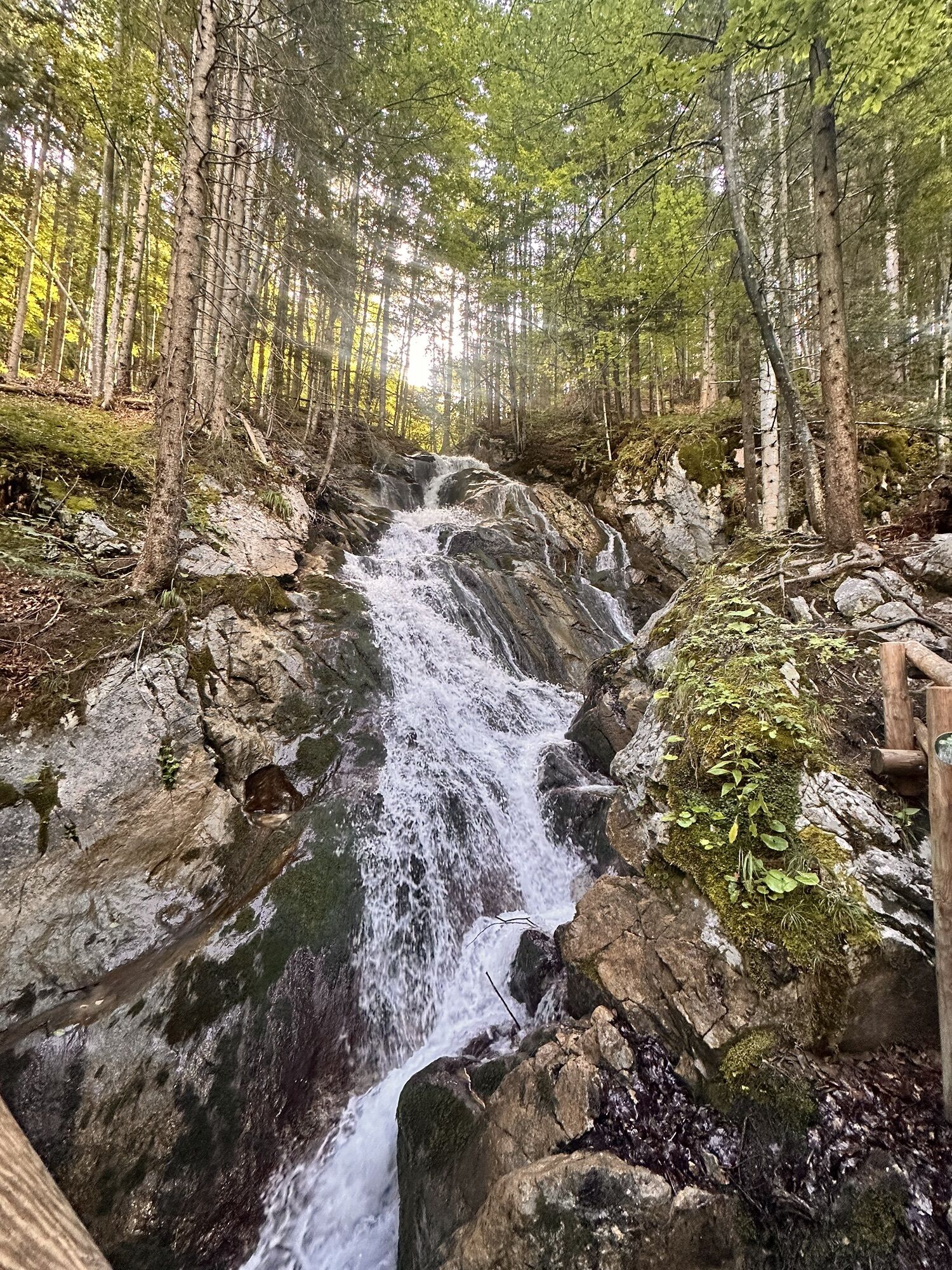
Dr. Vogelgesang Klamm und Bosruckhütte
15.08.2025 – Wędrówka -
Spital am Pyhrn, Oberösterreich/Österreich
22.06.2025 – Wędrówka -

Großer Pyhrgas
14.05.2022 – Wędrówka
Popularne wycieczki w okolicy
-
4,4
Spital am Pyhrn: Wurzeralm - Dümlerhütte - Rote Wand
średniWędrówka 10,1 km -
4,3
Wurzeralm NaturErlebnisWelt - 2 Millionen Jahren in 2 Stunden
Wędrówka 6,09 km -
4,9
Nazogel und Angerkogel
średniWędrówka 10,9 km -
4,2
Rund um den Gleinkersee
Wędrówka 1,70 km -
3,9
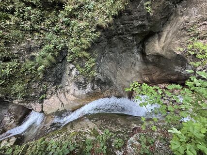
Dr. Vogelgesang-Klamm
światłoWędrówka 2,67 km -
4,5
Von der Bosruckhütte auf den Großen Pyhrgas
ciężkiWędrówka 9,57 km -
4,0
Vorderstoder - Zellerhütte
średniWędrówka 11,1 km -
4,4
Grabneralm und Grabnerstein
średniWędrówka 13,5 km -
3,9
Wurzeralm - Warscheneck
ciężkiWędrówka 12,8 km -
4,8
Warscheneck vom Schafferteich via Zellerhütte
średniWędrówka 15,9 km

Wędrówki i tropienie


Nie przegap ofert i inspiracji na następne wakacje
Twój adres e-mail została dodana do listy mailingowej.