


Upper Austria Mariazellerweg: D: 2nd stage: St. Florian - Haag
Starting from the imposing St. Florian Abbey, we begin this hike by crossing the so-called Jubiläumsallee. The abbey quickly becomes smaller and smaller in the distance and we reach the hill near Kogl,...
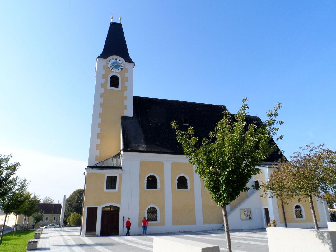
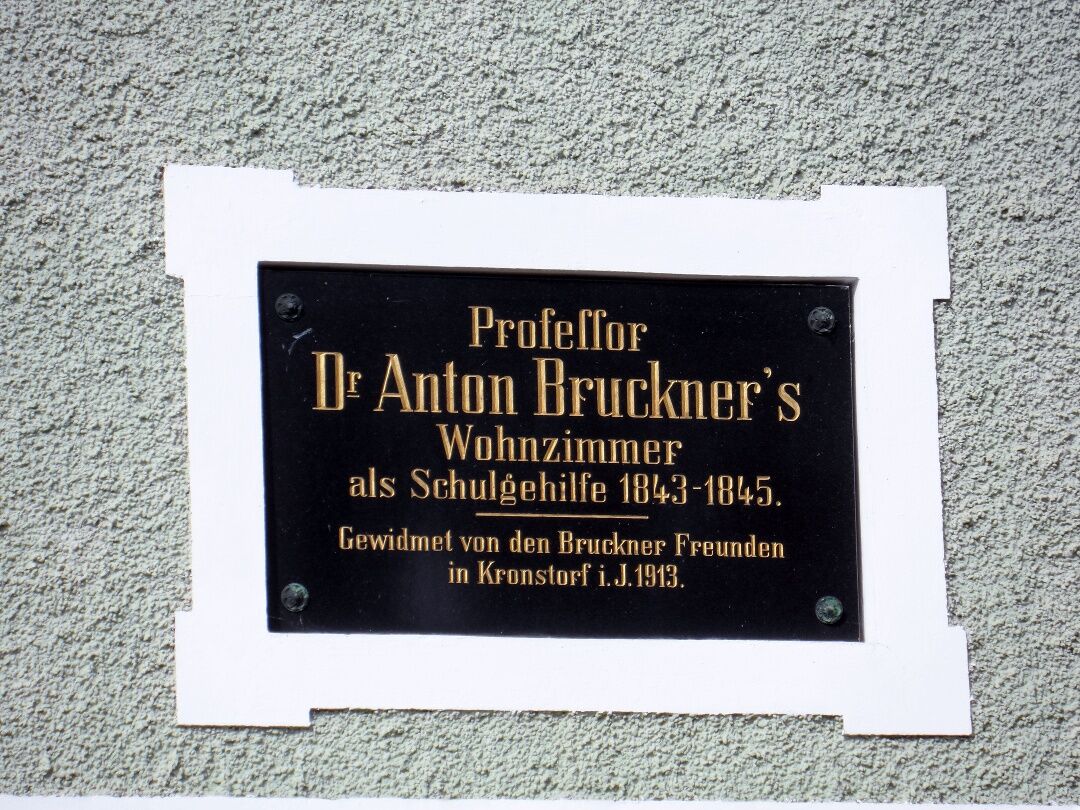
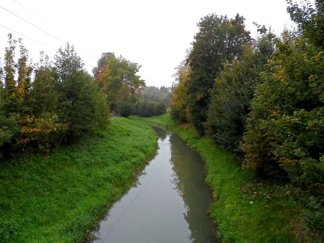
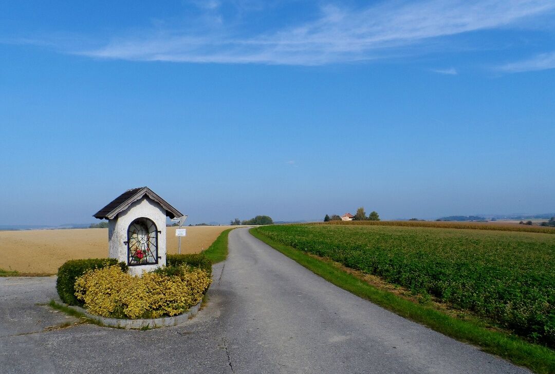
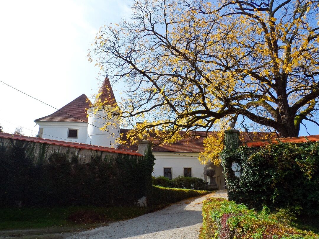
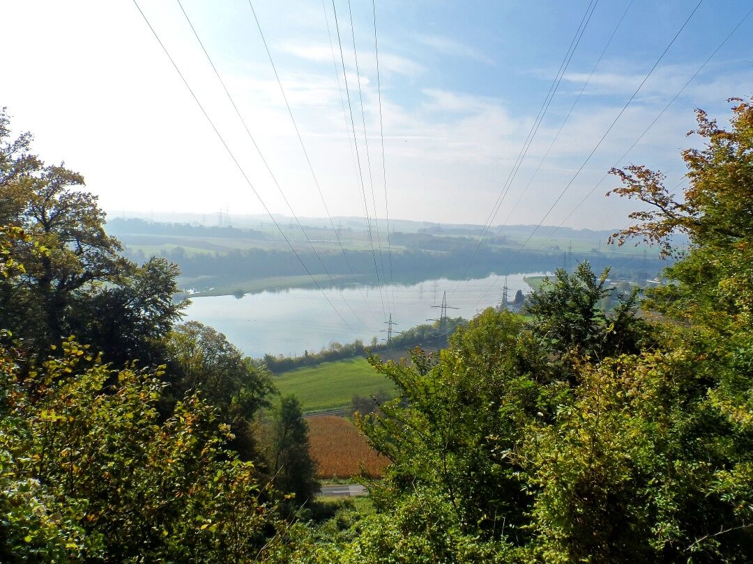
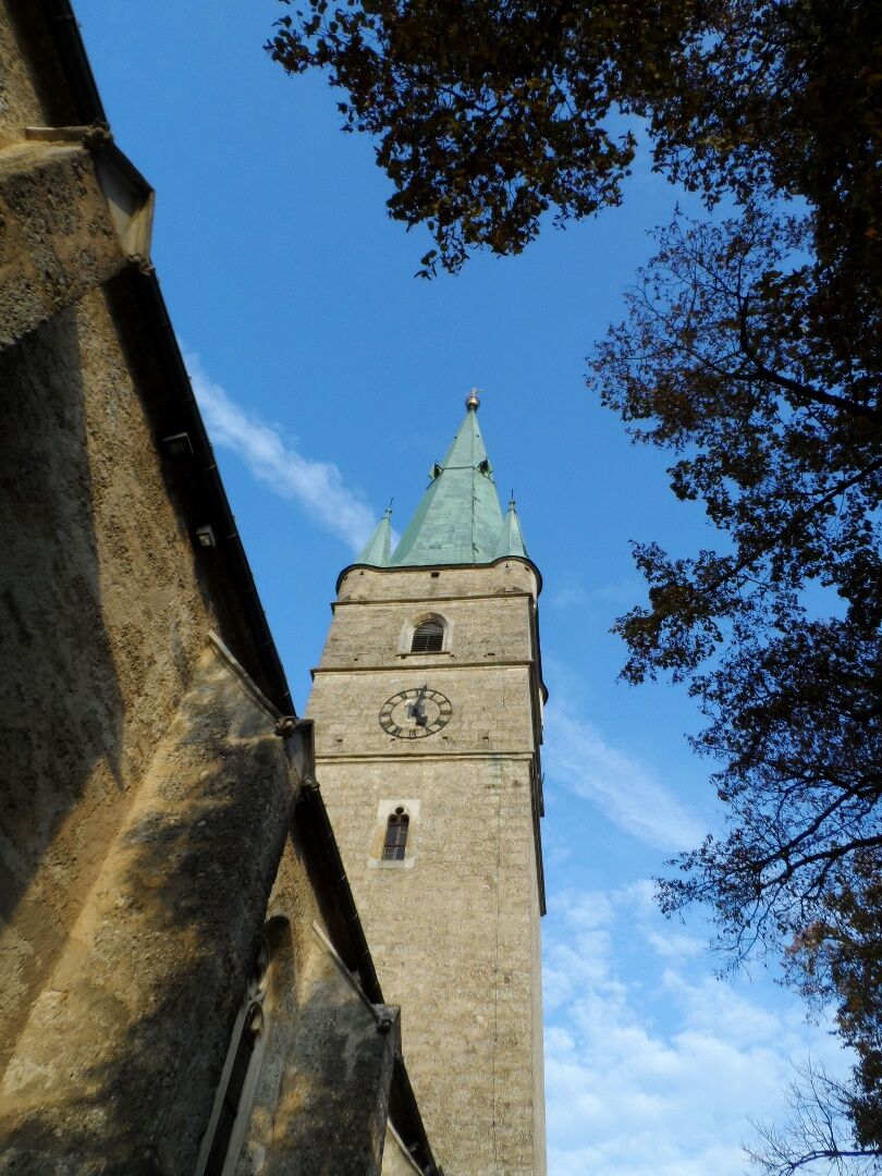
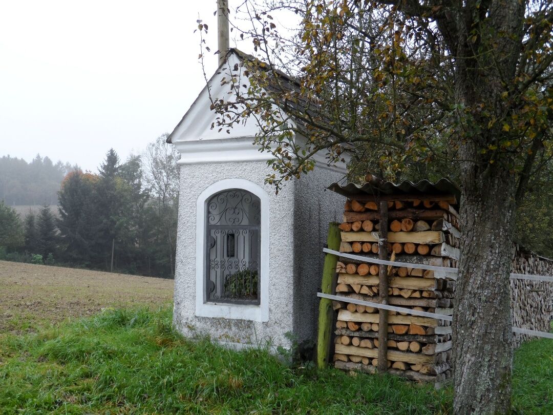
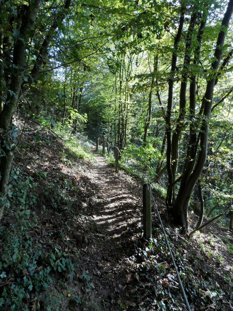
Starting from the imposing St. Florian Abbey, we begin this hike by crossing the so-called Jubiläumsallee. The abbey quickly becomes smaller and smaller in the distance and we reach the hill near Kogl, where there is a lovely rest area and a chapel, as well as an old forest with mighty oaks. At Unterweidlham, we pass the typical local square farms in the gentle hilly landscape and hike along a tree-lined stream to a hamlet with the interesting name "Plank zu Mausbach". Here you will find a chapel and a monument at a crossroads (erected in honor of the 1700th anniversary of the death of the country's patron saint Florian). After a long hike through the sparsely populated areas around St. Florian, we finally reach Hausmanning and from there a beautiful forest path to Hargelsberg. Opposite the parish church of Hargelsberg, dedicated to St. Andrew, there is a beautiful garden with seating that invites weary pilgrims to take a break. Along the Kapellenweg we reach Kronstorf, which is characterized by alluvial forests. The market town has around 3000 inhabitants and was first mentioned in a document in 834 as "Granesdorf". It is interesting to note that the world-famous composer Anton Bruckner spent two years of his life, 1843-1845, as a school assistant in Kronstorf (building directly below the church). We set off again in high spirits and make our way towards Enns. We cross the bridge at the Enns power station and make a pilgrimage into the center of Ernsthofen. The church in Ernsthofen, an early baroque hall church, originally stood on the banks of the Enns, was demolished in 1662 and rebuilt in its present location. Above the church begins a wonderful hiking trail through sparse deciduous woodland, which takes us high above the village of Ernsthofen and gives us great views of the route we have taken so far and the River Enns. After passing several beautiful chapels, the route descends a little later (near Weinzierl) into a hollow, after which the final spurt (unfortunately on the main road) to Haag begins. In the town of Haag, however, the exertions are quickly forgotten at the sight of the late Gothic fortified church built between 1432 and 1485. Particularly active cyclists can round off the day with a visit to the zoo (next to Salaberg Castle).


We leave the St. Florian monastery in a southern direction on circular route no. 4, which we follow on paved country roads via Kogl, Unterweidlham, Oberweidlham to Hausleiten. From there, continue on the bike path until shortly before the village of Winkling, where we turn east and come directly to Hausmanning. We then follow a local hiking trail on the right to the parish church of Hargelsberg, leave the town to the east, pass the Krug Chapel near Pirchhorn and go on until we reach the expressway, where we now follow a field path to the right southwards to an underpass. Through it and then continue straight eastwards to Kronstorf. At the parish church, we meet the Enns cycle path, which we follow via Grub to the Enns river. We cross the river on the power plant bridge and arrive at Ernsthofen. From the parish church, a path leads uphill and then south to Loderleiten. On small roads, you come to Weinzierl and then onward to the heavily trafficked state road L85, which, if staying overnight in Haag, you follow to the town center. Alternatively, from the sewage treatment plant next to the state road, you can follow hiking trail 493 to the city zoo at Haag near Salaberg.
The backpack should really contain only the absolute essentials on a pilgrimage route! A GPS device is very useful for orientation.
Arrival to St. Florian via the A1 exit Asten/St. Florian, exit 160.
From Linz main train station, for example, you can reach St. Florian (St. Florian near Linz Prandtauerstraße) by bus no. 410 towards Niederneukirchen town center.
Parking options for cars are available, for example, in the Meierhof of the St. Florian monastery.
Mostviertel Tourismus GmbH
Töpperschloss Neubruck, Neubruck 2/10, 3283 Scheibbs
T +43/7482/20 444
info@mostviertel.at , www.mostviertel.at
TVB Mariazeller Land
Hauptplatz 13, 8630 Mariazell
Tel.: +43 (0)3882/23 66
Upper Austria Tourism Information
Freistädter Straße 119, 4041 Linz
info@oberoesterreich.at
www.wandern.at
Useful maps:
ÖK 4319 Linz, ÖK 4320 Perg, ÖK 4326 Steyr,
ÖK 4202 Ternberg, ÖK 4203 Waidhofen,
ÖK 4203 Ybbsitz, ÖK 4204 Lunz, ÖK 4210 Mariazell
All at scale 1:50,000 (also available enlarged 1:25,000)
F&B hiking maps 261 (1:50,000), 051 (1:50,000),
052 (1:50,000), 5031 (1:35,000)
Kompass 22 (Mariazell, Ötscher, Erlauftal, 1:25,000),
Kompass 212 (Hochschwab, Mariazell, Eisenwurzen, 1:50,000),
Kompass 202 (around Linz, Mühlviertel, Wels, Steyr, 1:50,000)
Important phone numbers:
Alpine emergency call: 140, International emergency number: 112
Recommended literature:
Pilgrimage routes to Mariazell – West + South volume, www.styriabooks.at
Hiking experience Mariazell Land and Ötscher, www.kral-verlag.at
Pilgrimage routes, www.kral-verlag.at
Popularne wycieczki w okolicy
-
4,1
Auseeweg in Luftenberg an der Donau
światłoWędrówka 9,96 km -
3,7
St. Florian: Millstone Path
światłoWędrówka 8,54 km -
5,0
Danube Cycle Path Stage 3 North Bank: Linz - Grein
światłoKolarstwo długodystansowe 60,4 km -
3,5
Danube bike path stage 3 south bank: Linz - Ardagger
światłoKolarstwo długodystansowe 59,1 km -
4,5
R1.11 3-River-Route
światłoJazda na rowerze 47,1 km -
5,0
Roman Cycle Route / Danube Cycle Path Linz-Mauthausen-Linz
światłoJazda na rowerze 53,6 km -
3,2
Circular hiking trail Steyr - Christkindl - Steyr
średniWędrówka 11,5 km -
4,5
Mauthausen: Healthy Community Hiking Trail
światłoWędrówka 4,55 km -
4,3
Christkindl Pilgrimage Path - In the footsteps of Ferdinand Sertl
światłoWędrówka 8,71 km -
2,9
Sagenweg Luftenberg a.d. Donau
średniWędrówka 12,6 km
Wędrówki i tropienie


Nie przegap ofert i inspiracji na następne wakacje
Twój adres e-mail została dodana do listy mailingowej.