


Winter hiking in Walpersbach


Here a beautiful circular hiking trail invites you to explore the area. On paths and trails along meadows and through forests, you get to know the different districts of Stupfenreith and Klingfurth. The...
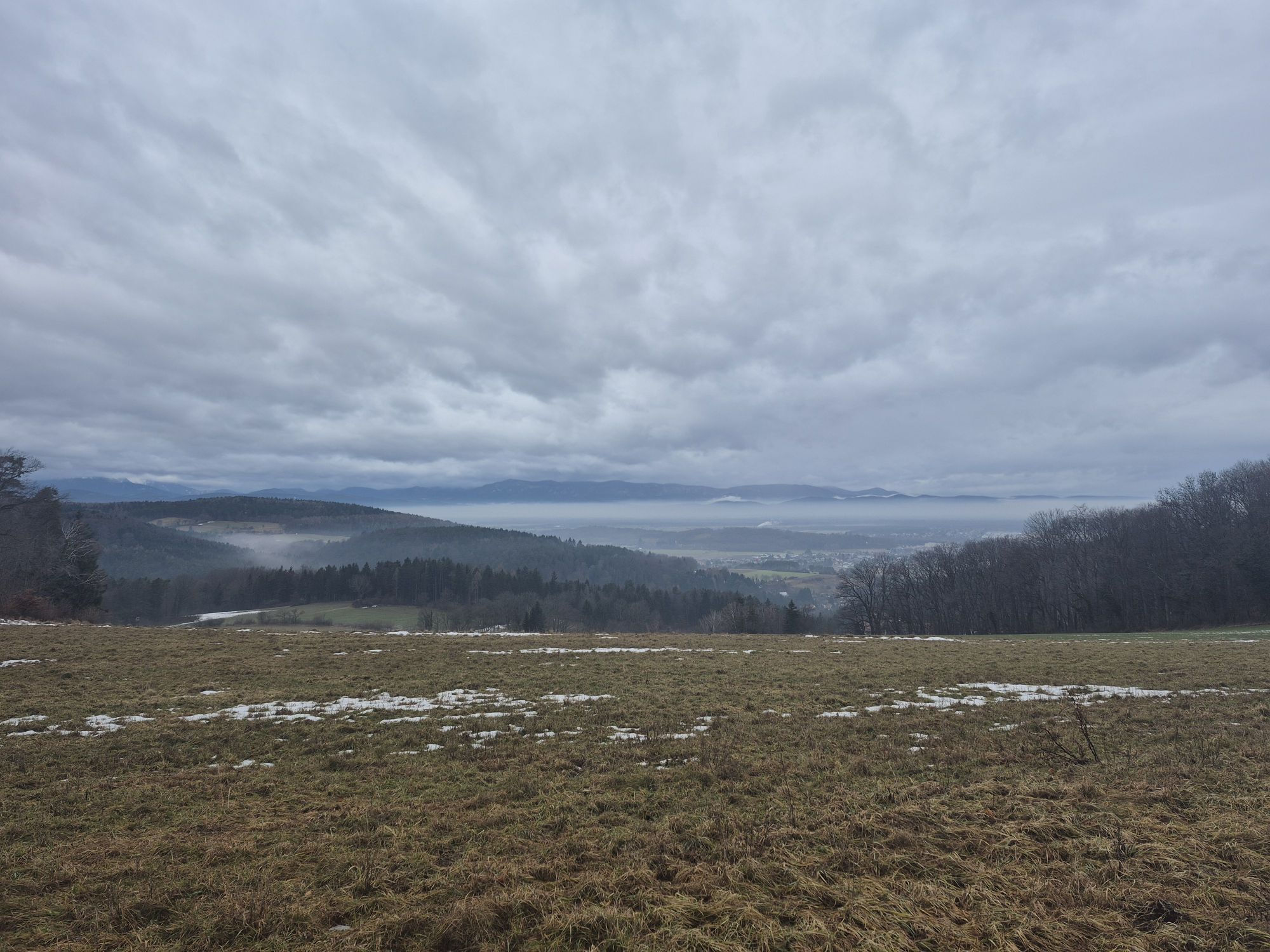
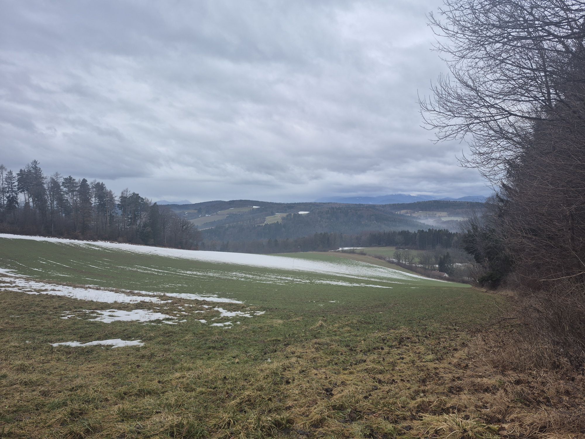
<p>Here a beautiful circular hiking trail invites you to explore the area. On paths and trails along meadows and through forests, you get to know the different districts of Stupfenreith and Klingfurth. The local trail passes several churches and chapels and offers great views, such as at the viewpoint Harrathof/Grafengrab. The circular trail is over 13 km long, with ups and downs, which requires good fitness. This circular hiking trail is not to be missed!</p>

<p>This route description refers to the start via the main road, heading south towards Stumpfenreith. Since it is a circular hiking trail, you can also start in the opposite direction.</p><p>The starting point is the parish church. Turn left onto the main road and then right onto Steinbergstraße. Follow this to the intersection, turn right there and immediately left again (Am Steinberg). Continue on the road until it becomes a path, which you follow straight ahead without turning off. At the fork keep left and then immediately turn right onto a path. Follow this path straight ahead, passing a chapel, until you reach another path. This leads to Stupfenreith. Keep left on the road through the village and then turn left onto the Schramml dirt road. Follow the road, at the next fork turn right first and then left again. Keep following the road until you reach an asphalt road. Take this road towards Klingfurth, turn left there, pass a church, and at the next intersection turn right. Then turn left onto a hiking trail and keep left at the next fork. Then turn right, walk a bit, and then turn left again. Continue straight ahead until you reach the hiking trail again. Follow the trail and turn left at the fork. After about 300 meters turn left and continue straight until you reach an asphalt road (Schauerleiten). Stay on this road for about 1.8 km and then turn right up a path. Follow this path until a road branches off to the left leading to a street (Enterstein). Continue on this street until a path branches off left again leading back to the starting point, the parish church.</p>
<p>Always take appropriate <strong>maps</strong> with you. Wear sturdy <strong>shoes</strong> suitable for the route, bring sun and rain protection, as well as water and a snack. Take your <strong>mobile phone</strong> with you and save the mountain rescue emergency number: 140</p><p>Don't forget <strong>headwear and gloves</strong>, and in any case avoid hypothermia!</p>
<p>Your hikes in the Vienna Alps should be a completely pleasant and safe experience. Please therefore observe the following:</p><p><strong>Preparation</strong></p><p>Special caution is advised in winter. Make sure when choosing the route that it matches your experience and fitness. Check the weather forecast in advance. Always go out equipped (e.g. cap, gloves, etc.). Keep in mind that it gets dark as early as 4:00 pm in winter.</p><p>Check whether the huts and snack stations you want to visit on the way are open. Inform someone about your chosen route and your planned return before you set out.</p><p><strong>Attention:</strong></p><p>Note, this hiking trail goes through the forest and in snowy conditions is <strong>not cleared and can have slippery spots</strong>. Use at your own risk. Pay attention to the early dusk and plan your route with particular care. Drink enough water even in winter.</p><p>More safety tips for your hike can be found <a href="www.wieneralpen.at/sei-gut-drauf-komm...
<p>Take the A2 from Vienna or Graz towards the highway junction Knoten Wr.Neustadt to follow the signs to S4 towards Hungary/Eisenstadt/Mattersburg/Wr.Neustadt-South. Take the Lanzenkirchen exit on the S4. Turn right onto Frohsdorfer Straße, continue onto Wr. Neustädter Straße, turn left to continue on Frohsdorfer main road. At the roundabout go straight onto Schleinzer Straße. Turn right towards Walpersbach, turn left onto the main road. The parish church is on the left. More information can be found at www.oebb.at and www.vor.at</p>
<p>More information can be found at <a href="www.oebb.at">www.oebb.at</... and <a href="www.vor.at">www.vor.at</a&...
<p>Parking spaces in front of the parish church</p>
Vienna Alps in Lower Austria, www.wieneralpen.at, +43 / 2622 / 78960
Opening hours: Mon - Thu 8:30 am - 4:00 pm / Fri 8:30 am - 1:00 pm
Wonderful hike to switch off and take a deep breath!
Popularne wycieczki w okolicy
- 4,5
B32 Rosalia bike route
średniJazda na rowerze 58,8 km - 4,6
Bucklige Welt: Auf dem Pittentaler Klettersteig zum Türkensturz
średniVia ferrata 1,96 km - 4,3
Türkensturz Rundwanderung
średniWędrówka 2,56 km - 5,0
Seebenstein - Türkensturz - Burg Seebenstein
światłoWędrówka 7,50 km - 4,7
Naturlehrpfad Katzelsdorf
światłoWędrówka 3,81 km - 4,0
Bucklige Welt: Burg Grimmenstein und Kulmriegel
światłoWędrówka 10,5 km - 4,5
To the Wiesen/Lanzenkirchen observation tower from the Rosalia
światłoWędrówka 4,25 km - 4,2
Türkensturz große runde
średniWędrówka 11,4 km - 4,6
Gespitzter Riegel - Bad Sauerbrunn
światłoWędrówka 8,85 km - 4,6
Forchtenstein-Rosalienkapelle
światłoWędrówka 7,86 km
Wędrówki i tropienie


Nie przegap ofert i inspiracji na następne wakacje
Twój adres e-mail została dodana do listy mailingowej.