


Trail no. 33: Passo delle Lame - Passo della Spingarda

Here, you cross the broad ridge of Monte Aiona (1701 m), where the Alta Via reaches the highest altitude along the Apennine chain. There’s nothing particularly difficult in the climb or descent of Monte...
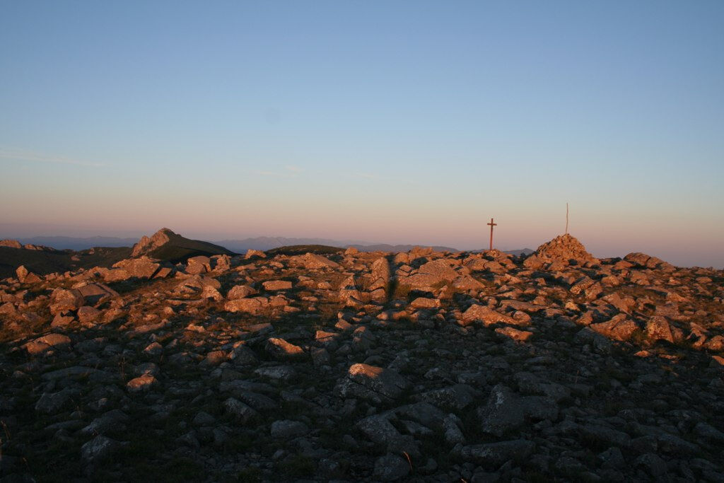
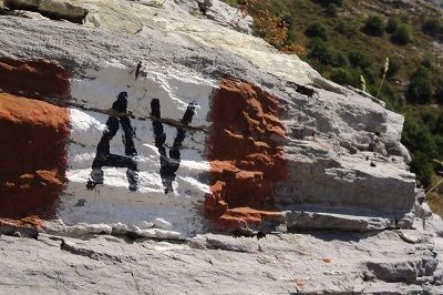
Here, you cross the broad ridge of Monte Aiona (1701 m), where the Alta Via reaches the highest altitude along the Apennine chain. There’s nothing particularly difficult in the climb or descent of Monte Aiona, but it’s necessary to remember that the mist can rise quite suddenly,out of the blue, making one lose all sense of direction. Thanks to the nature of this rock, the Aiona plateau is an area with strange magnetic forces making a compass totally useless. Should you come across mist or fog, you are therefore advised to only follow the sign–posting, which is clear and frequent for this reason. In winter, in the presence of snow and ice, it is advisable not to take this trail unless you are expert excursionists equipped with rampons and ice axes.

Mountain equipment is recommended.
In winter, with snow and ice, the route is recommended only for experienced hikers equipped with ice axe and crampons.
Significant difficulties in the winter period due to heavy snowfall: it is not recommended to undertake the route in winter on the most difficult stages, especially in the presence of snow, ice or fog.
Magnetic anomaly zone: digital devices, phones and compass may be unusable.
Walkability is not recommended in case of fog, which rises very fast here.
It is recommended to refuel with water and food before departure.
Popularne wycieczki w okolicy
-
5,0
Trail no. 34: Passo della Spingarda - Passo del Bocco
Wędrówka 12,3 km -
GE_03 Ring path of Zatta Mount
Wędrówka 14,4 km -
Trail no. 35: Passo del Bocco - Colla Craiolo
Wędrówka 7,78 km -
GE_12 Ring path Mount Ramaceto
Wędrówka 10,6 km -
Trail no. 31: Passo di Ventarola - Passo della Forcella
Wędrówka 9,06 km -
Trail no. 32: Passo della Forcella - Passo delle Lame
Wędrówka 7,01 km -
Trail no. 30: Barbagelata - Passo di Ventarola
Wędrówka 8,86 km -
GE_11 Ophiolitic path and Aiona Mount
Wędrówka 11,2 km -
Trail no. 36: Colla Craiolo - Passo di Cento Croci
ciężkiWędrówka 14,5 km -
From Il Pellegrino in Pelosa to Passo Chiappareno
średniWędrówka 6,19 km

Wędrówki i tropienie


Nie przegap ofert i inspiracji na następne wakacje
Twój adres e-mail została dodana do listy mailingowej.