


WY_N3 Vorhegg
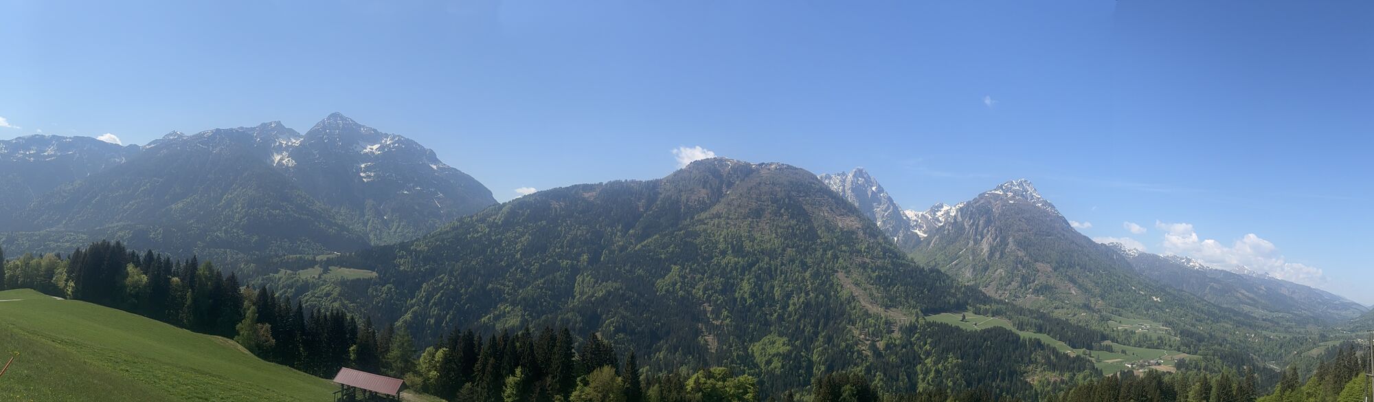
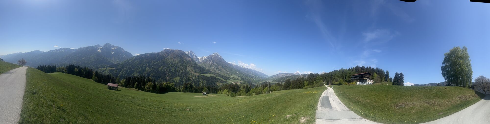
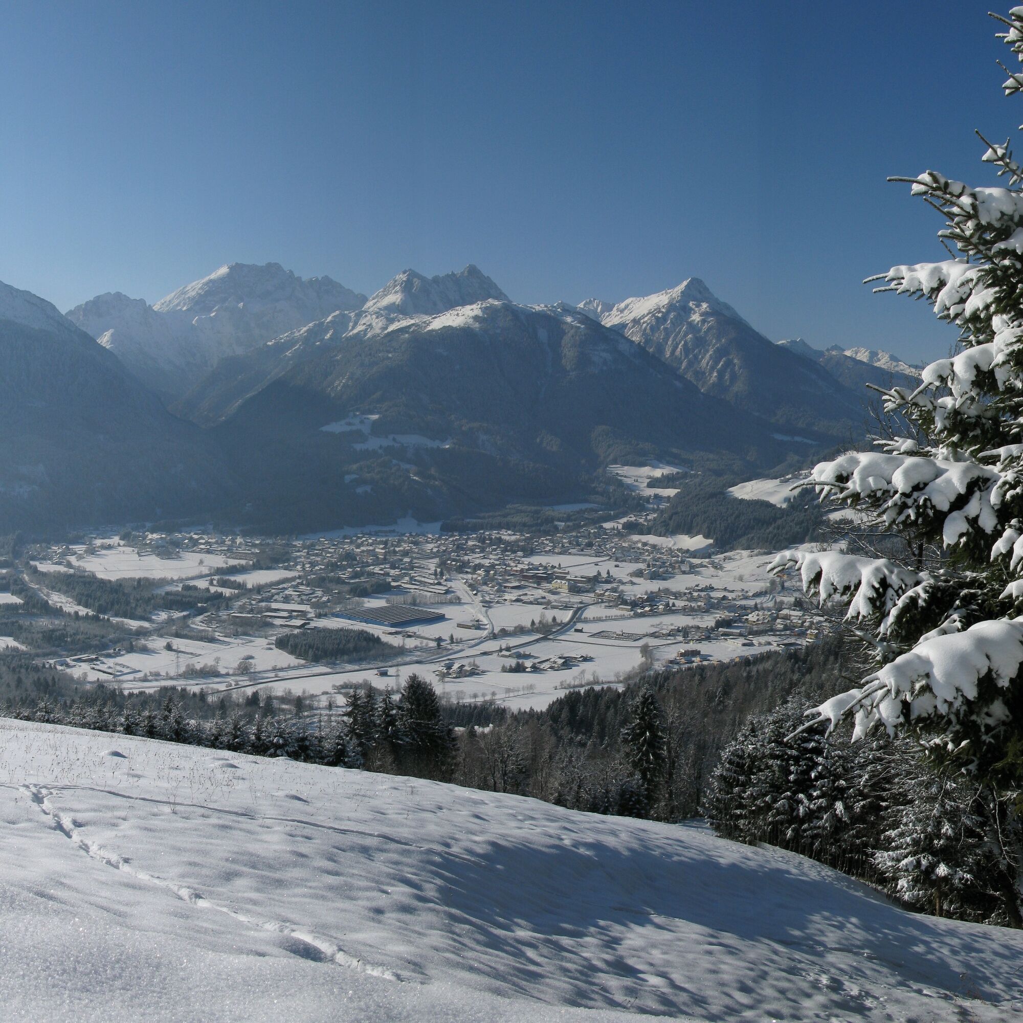
The winter hike takes you up the "Sonnenhügel" of Kötschach-Mauthen – with a panoramic view into the Gail valley, the Gailtal Alps and the Carnic Alps.

Starting point:
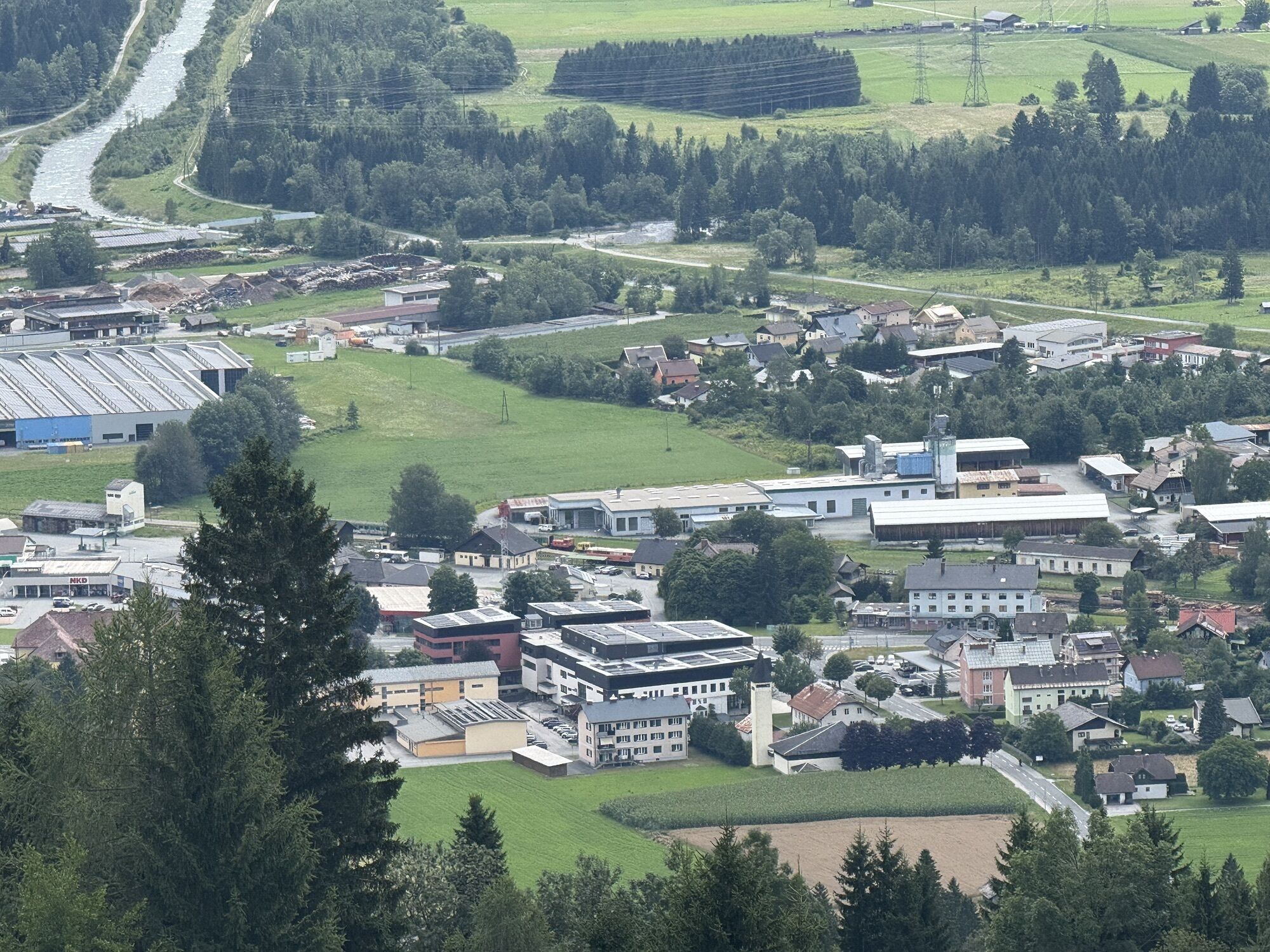
Starting from the town hall in Kötschach-Mauthen, your path initially leads you directly along the B111 towards the Lesachtal, before you turn off at the second junction onto the side road towards Vorhegg.
You reach a stream - here you continue hiking following the road to the left and cross the stream. Your route now leads you upwards over the steadily ascending paved road, the "Sonnenhügel" of Kötschach-Mauthen.
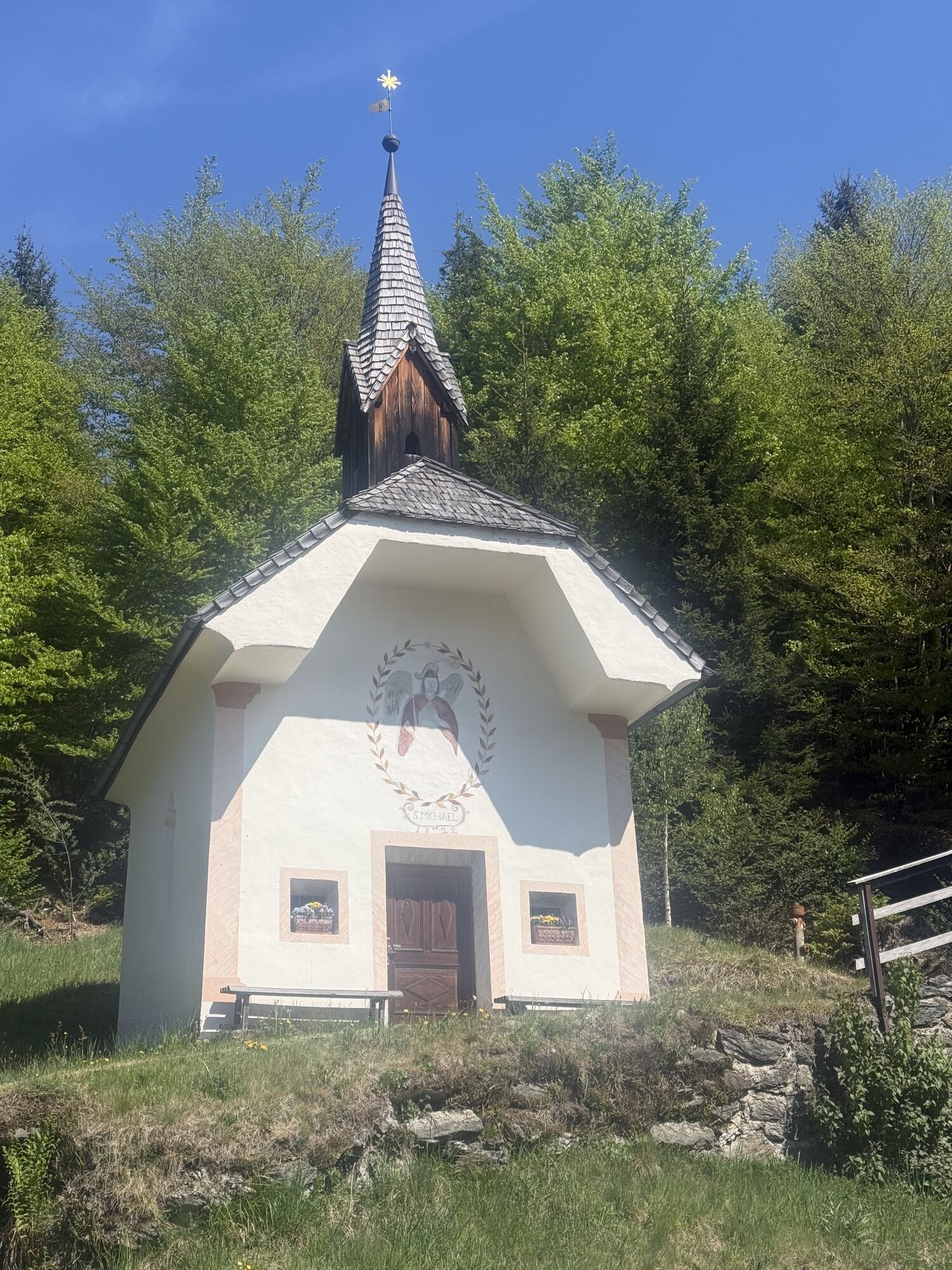
In Kreuth-Kienze you reach a fork in the road at the chapel of St. Michael - here you continue along the road (to the left).
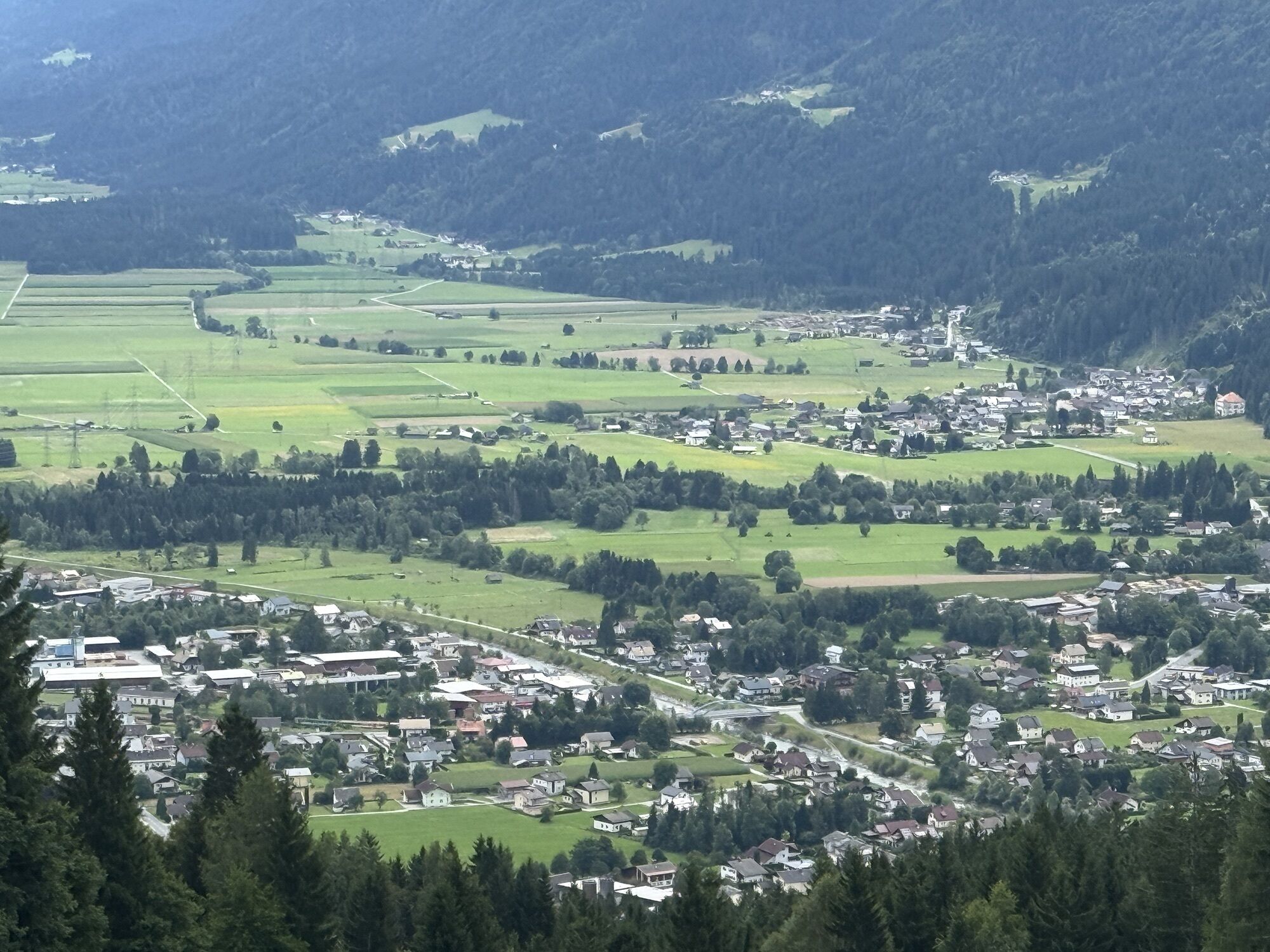
Forest stretches and sections on open areas, as well as numerous hairpin bends, accompany your ascent to Vorhegg, from where a beautiful panoramic view rewards your efforts.
The return route leads along the same side road as the outward route (the time for the return trip is not included in the indicated 1h 45min).
Tak
Tak
FAIR PLAY & RESPECT:
Mindfulness for nature – landowners – your health ... and safety in the mountains have top priority on your route and in your route planning!
Therefore, before every winter hike, inform yourself about the rules of conduct - Safety in the mountains, as well as the current snow and avalanche report Carinthia avalanche warning service and the weather situation.
Waste disposal:
Waste cannot always be avoided – but in nature it does not belong and should be disposed of properly (preferably in the valley or at home).
Emergency numbers:
European emergency number: 112 (access to all available networks)
Austrian mountain rescue: 140
Arrival by car:
From Hermagor via the B111 (Gailtal road) or from Oberdrauburg via the B110 (Plöckenpass road) to Kötschach-Mauthen.
The most sustainable way to get there is by train to Oberdrauburg (coming from Lienz or Villach) or to Hermagor (coming from Villach).
From Oberdrauburg or Hermagor you then reach the town of Kötschach-Mauthen by bus.
Details at - Nassfeld mobility info as well as Kärntner Linien route planner
Free parking is available in Kötschach-Mauthen at the town hall, as well as at the valley station of the Vorhegg cable cars.
Are you looking for more winter hiking routes in the region?
You’ll find this and many more infos at - Route tips
In the town centre of Kötschach-Mauthen there are numerous year-round open places to eat – details at Service A-Z
The route runs on a paved and cleared access road.
Popularne wycieczki w okolicy
-
4,9
Pirknerklamm (C)
średniVia ferrata 2 km -
4,6
Obergail - Obergailer Alm - Obergailer Lake - Enderberg hut - Source for Health & Peace - Madonna circular hiking route - Obergail
średniWędrówka 11,4 km -
4,9
Karnischer Hauptkamm - Hohe Warte 2.780m - Hike and Bike
ciężkiWycieczki górskie 19,5 km -
4,3
Mountainbiketour von der Hubertuskapelle zum Wolayersee
ciężkiMountainbike 9,06 km -
3,9
Summit hike to the Hochstadel
średniWędrówka 7,83 km -
3,7
Cellon-Stollen und Senza Confini auf den Cellon und Steinberger Weg zum Abstieg
średniVia ferrata 7,09 km -
3,6
RW_N61 Kleiner Pal (1,867 m)
ciężkiWędrówka 6,52 km -
4,3
WW_N18 flower paradise Mussen
średniWędrówka 6,52 km -
5,0
Valentin-Wolayersee-Runde
średniWędrówka 12,4 km -
4,5
03 Südalpenweg, 24. Etappe: Valentinalm - Wolayerseehütte
średnidługodystansowy szlak pieszy 9,63 km

Wędrówki i tropienie


Nie przegap ofert i inspiracji na następne wakacje
Twój adres e-mail została dodana do listy mailingowej.