


Rollbahn path - Großfragant - Innerfragant
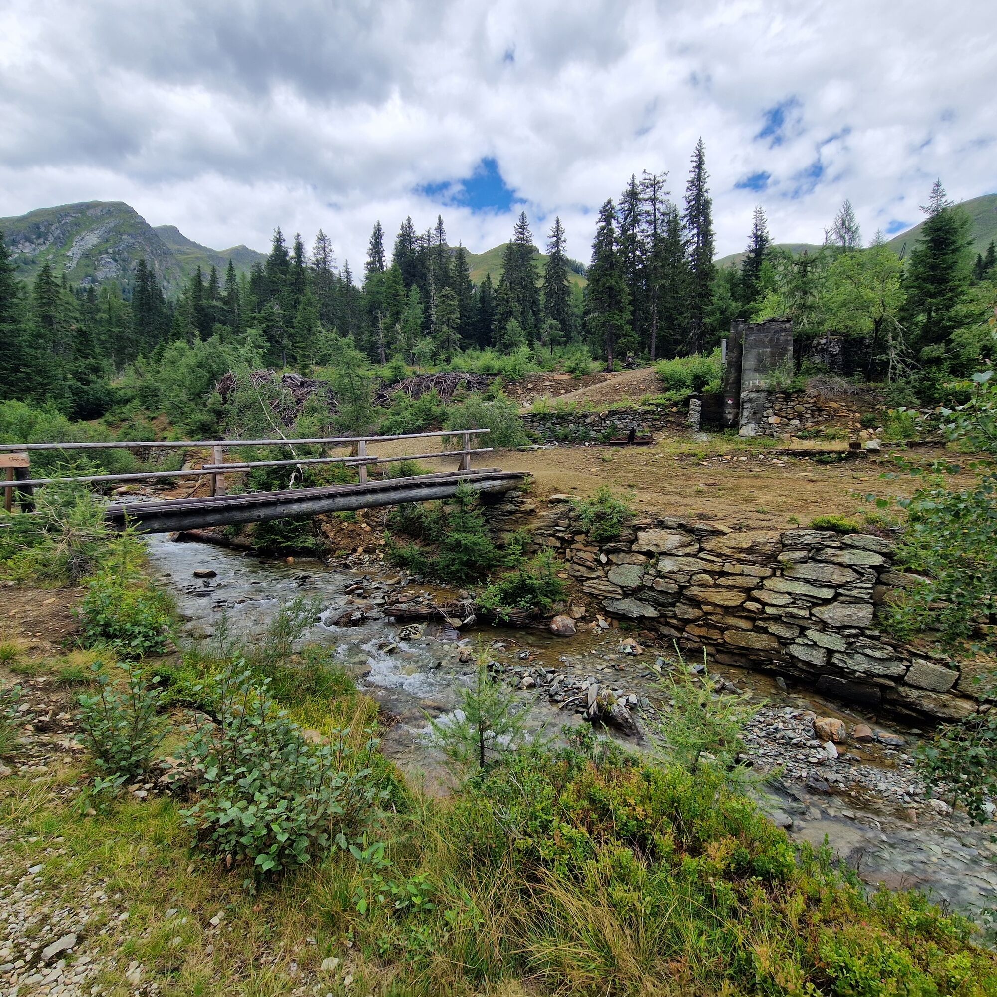
In the past, the mined copper ores were transported down exclusively in winter with sledges and sack trains. Around 1906/07, the 4,400 m long Rollbahn was built for ore transport. From then on, the loaded...
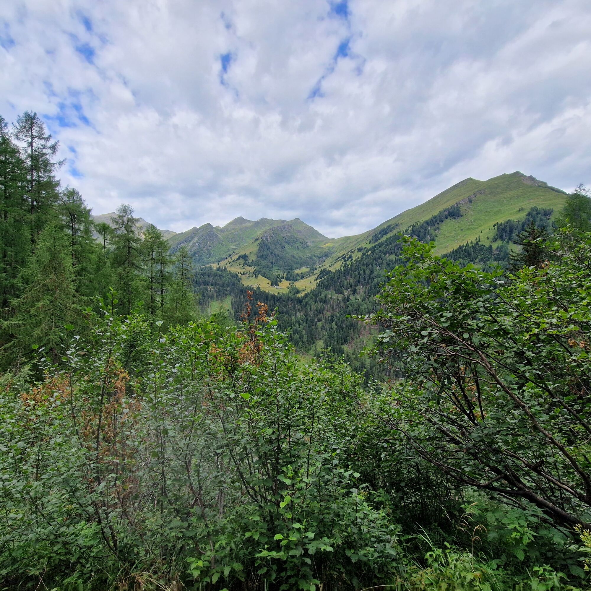
In the past, the mined copper ores were transported down exclusively in winter with sledges and sack trains. Around 1906/07, the 4,400 m long Rollbahn was built for ore transport. From then on, the loaded tubs could be pushed on rails, supported by the slight gradient, to the newly built cable car. This brought the ore down to the valley at Außfragant. Today, the Rollbahn path, designed as a beautiful, secured hiking trail, leads visitors into the Großfragant alpine pasture area. Abandoned tunnels, wall remains, debris heaps, rusty tools, and machine parts still bear witness to the once intensive mining of natural resources. The 7 km long Rollbahn path is thus the access route to the high alpine area of Großfragant. After a refreshment at the Fraganter Schutzhaus, the descent into the valley follows. The descent leads to the village of Innerfragant, resulting in a varied route.
The hike can also be done in reverse order.
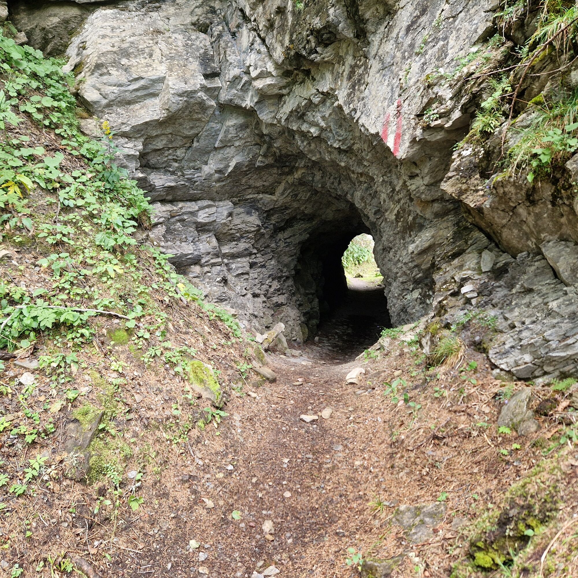
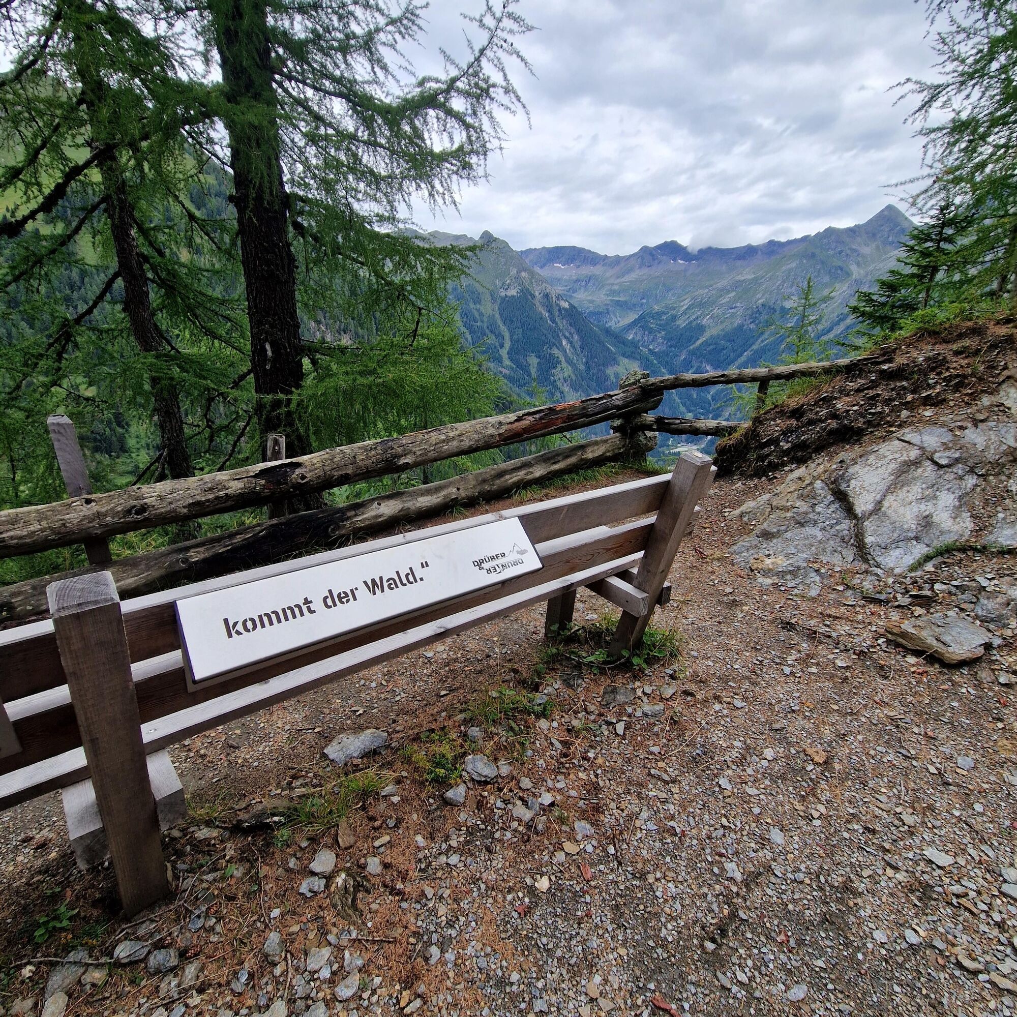
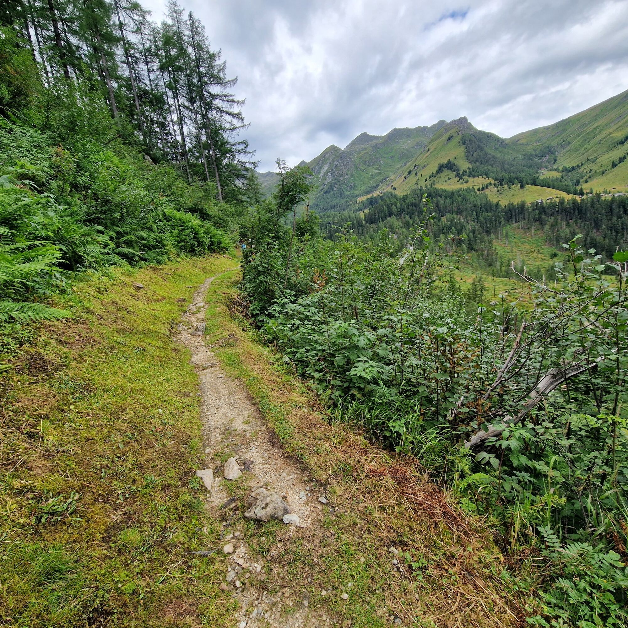
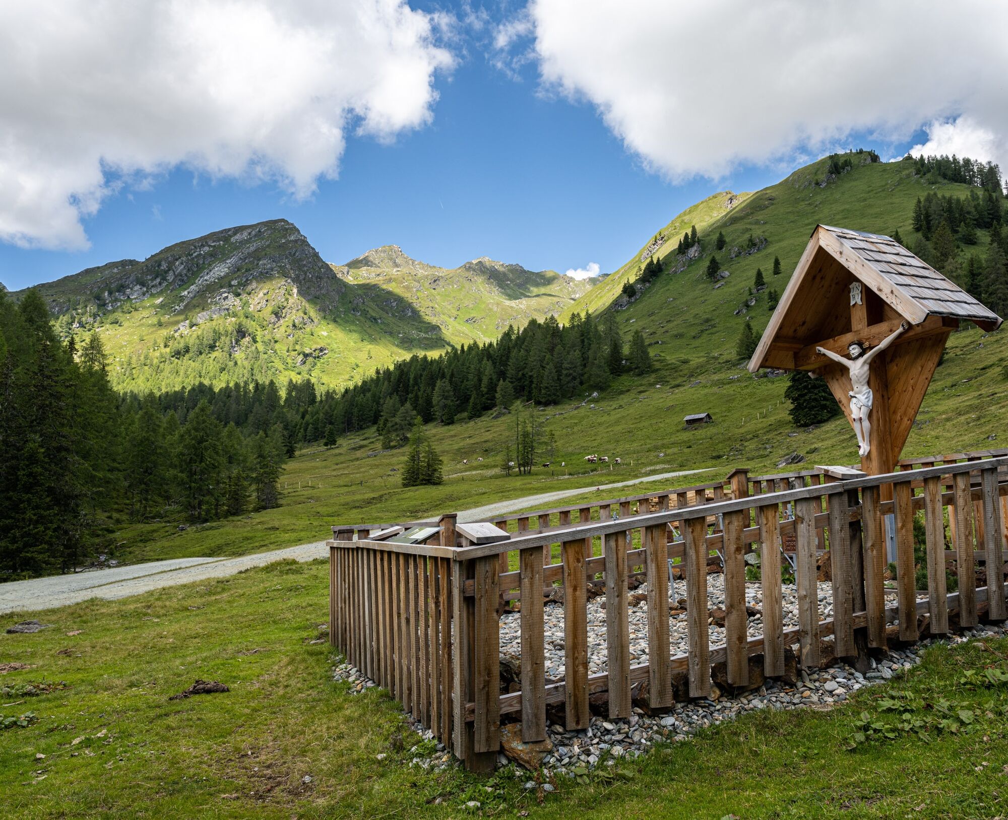
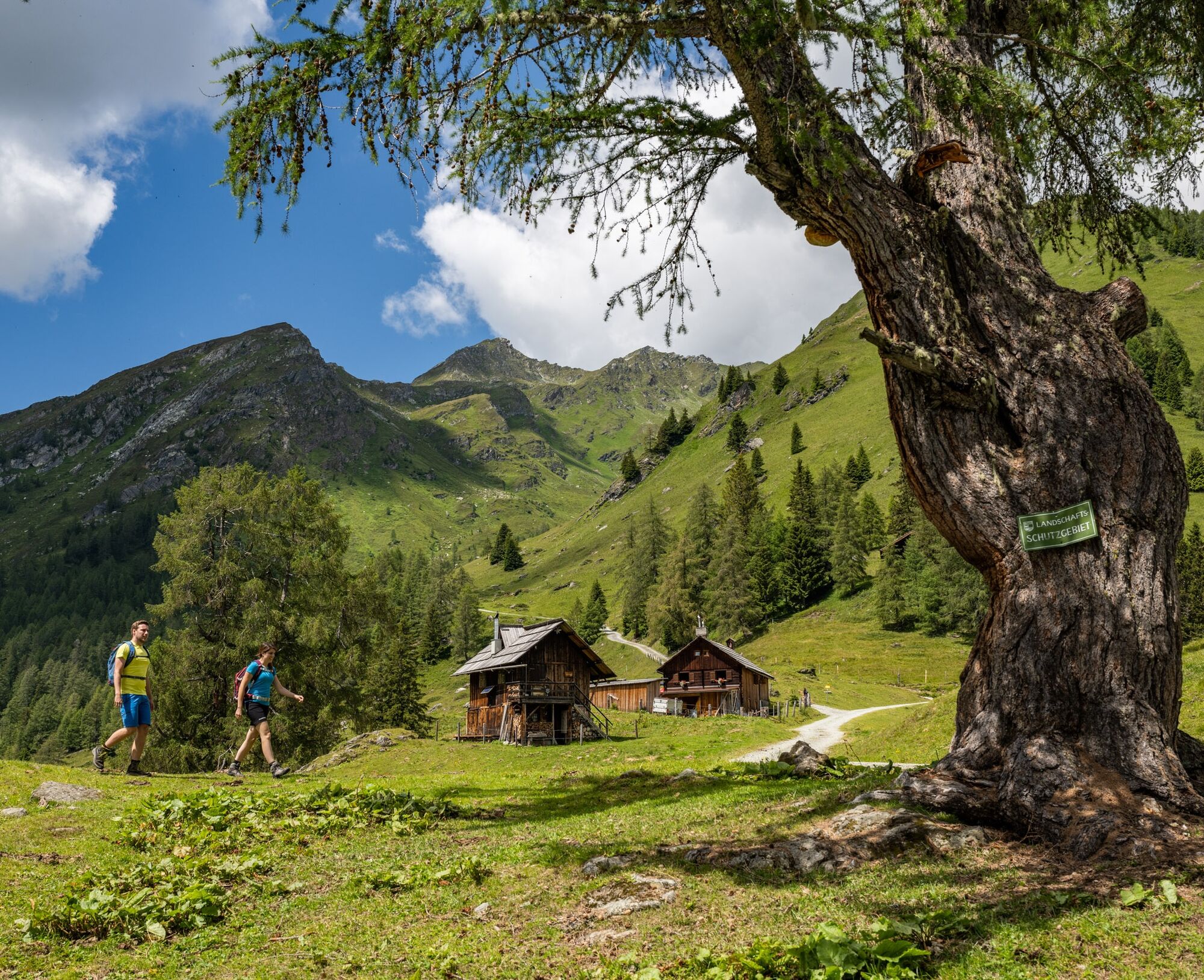
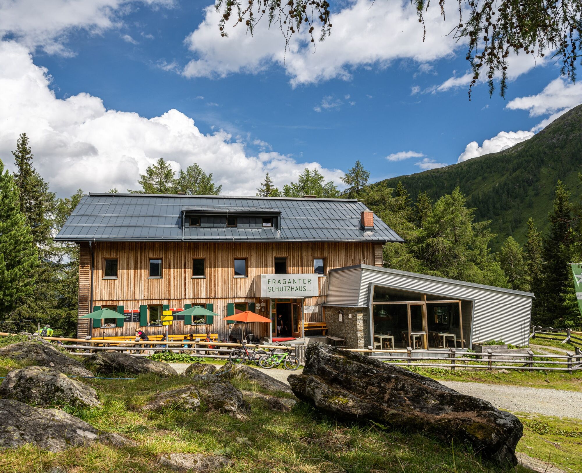
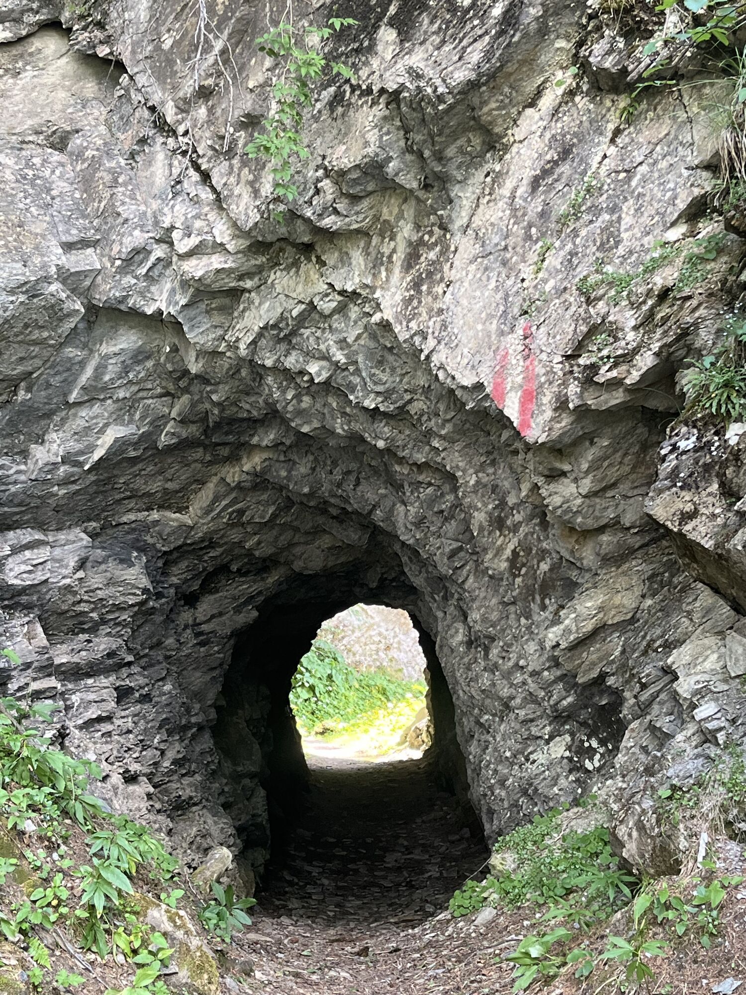
Drive up with a taxi via the toll road to the Rollbahn parking lot at 1,740 m. Directly from the Rollbahn parking lot, we first hike along the 7 km long historic Rollbahn path with a slight gradient into the alpine pasture area of Großfragant. Along the route, we pass a short tunnel and come across audio stations as well as artistically designed panels that inform us about the history of the former copper mining and alpine farming (stations 1 to 10 of the Großfragant themed trail "drunter&drüber" are located on the Rollbahn path). The fairy tale "Matryoshka in the Mountains," written by the Carinthian author, can be heard at the audio stations. Along the almost flat path, viewing benches invite you to linger. During the mining period, the Rollbahn was built for ore transport. Today, the Rollbahn, designed as a beautiful, secured hiking trail, leads us into the Großfragant alpine area. At the end of the Rollbahn path, we cross the Gundibrücke bridge. After the Gundibrücke, the path goes uphill for a short distance before we continue straight ahead at the fork towards the Alpine Club youth hostel. The restored "Russe Cross" appears in front of us, and above it the Fraganter Schutzhaus is already in sight. The last few meters... Now we have earned a break! The Eggerhütte is about 850 m past the Fraganter Schutzhaus (tip: dairy farmer and hut keeper Maridl processes the milk from her cows into products such as cheese and butter). Refreshed, we now head down to Innerfragant. From the Fraganter Schutzhaus, we first follow the forest road downhill, then after about 800 meters, we turn left. We cross the Fragantbach twice and follow the marked trail until we finally reach the village of Innerfragant. The last 200 meters lie ahead of us... on the left side, we see a beautiful waterfall from the Fragantbach.
The bus stop "Innerfragant Ort" is located directly on the Innerfragant state road L20a.
The hike can also be done in reverse order.
Tak
Good, stable footwear or hiking boots with tread sole and possibly hiking poles. Snacks and drinks, as well as warm clothing on shady days.
The section 'Descent to Innerfragant' is somewhat steep in places.
Poor or almost no mobile phone reception in Großfragant. To contact the taxi company for a possible return trip, you can possibly use the landline phone in the Fraganter Schutzhaus.
Starting points for hikes: Rollbahn parking lot or bus stop "Innerfragant Ort"
Drive up with a taxi via the toll road to the Rollbahn parking lot:
By taxi (with advance booking):- HPV Mölltal - Tel.: +434783 31399
- Taxi Angermann - Tel.: +434782 2008
Return trip from Innerfragant:
By hiking bus line 5114 from the bus stop "Innerfragant Ort" By taxi (with advance booking):- HPV Mölltal - Tel.: +434783 31399
- Taxi Angermann - Tel.: +434782 2008
Return trip from Innerfragant (bus stop Innerfragant Ort) – by hiking bus line 5114:
In the summer months, a hiking bus (line no. 5114) runs twice daily directly from and to the valley station of the Mölltal Glacier Bahn/Innerfragant. Towards Flattach Ort with bus line no. 5114 from the bus stop "Innerfragant Ort." All timetables for bus & train (ÖBB, Postbus, and Carinthian lines) can be found at the Scotty-ÖBB timetable information.
Parking at the Rollbahn parking lot. Space-saving parking.
The 5th stage of the Alpe-Adria Trail runs along this route.
Catering options:
Fraganter Schutzhaus - (Tel.: +43 4785 396) | Opening times: early June to late September/early October
Eggerhütte: currently not operated
Further information from the Hohe Tauern tourism region – the National Park region at www.nationalpark-hohetauern.at or +4348242700
On the Rollbahn path, you are traveling on the traces of "drunter & drüber" - a themed trail that immerses you into a world of contrasts from long past times.
Popularne wycieczki w okolicy
-
4,8
Wanderung zur Schwussner Hütte
światłoWędrówka 8,07 km -
4,7
Hohe Sonnblick Up
ciężkiWędrówka 9,14 km -
5,0
Silberpfennig, Salzburger Land/Österreich
średniWędrówka 13,8 km -
4,5
Niedersachsenhaus
średniWędrówka 4,84 km -
3,8
Raggaschlucht
średniWędrówka 3,44 km -
4,4
Groppenstein Gorge Obervellach
średniWędrówka 2,99 km -
5,0
Rifflscharte - Kolmkarscharte - Bockhartscharte - Sportgastein
średniWędrówka 13,5 km -
4,9
Schareck über Ostgrat
ciężkiWycieczka wysokogórska 13,3 km -
4,6
Vorderer Geißelkopf
średniWycieczka wysokogórska 19,1 km -
5,0
Hagener Hütte am Mallnitzer Tauern
światłoWędrówka 11,9 km

Wędrówki i tropienie


Nie przegap ofert i inspiracji na następne wakacje
Twój adres e-mail została dodana do listy mailingowej.