


TW_N18 Geotrail Zollnersee
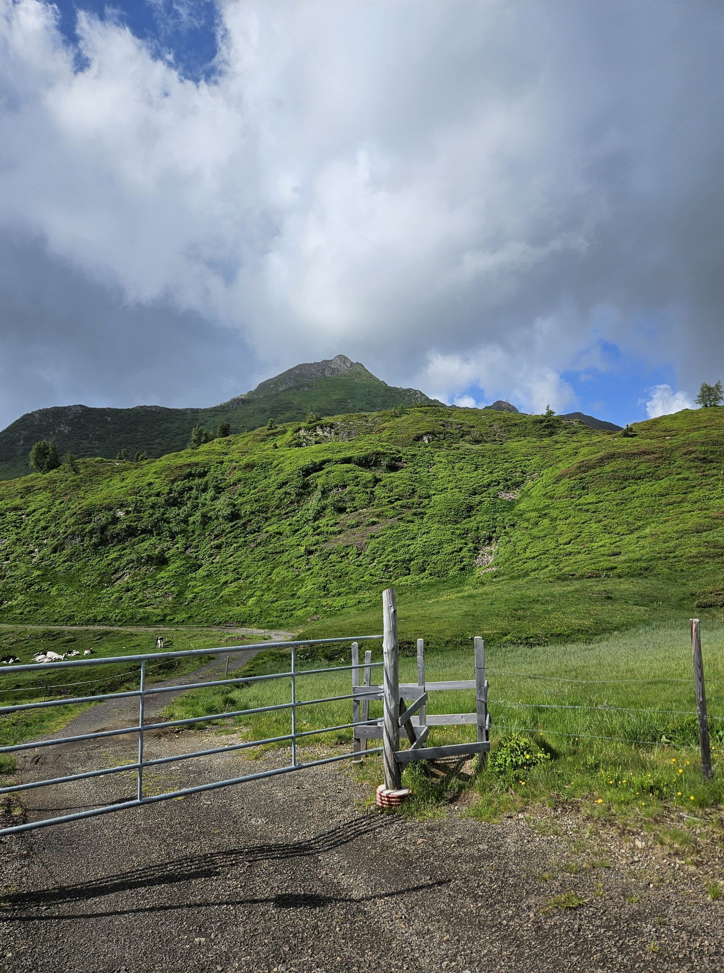
Hardly any other alpine pasture landscape in the Carnic Alps is as beautiful and diverse as the area around Zollner Höhe. The natural jewel Zollner See, wetlands, moors, debris slopes, gentle hills, and...
Hardly any other alpine pasture landscape in the Carnic Alps is as beautiful and diverse as the area around Zollner Höhe. The natural jewel Zollner See, wetlands, moors, debris slopes, gentle hills, and rugged mountains now characterize the area. They are the result of the interplay of rocks, mountain formations, glacial ice ages, climate, weathering, and human activities. Especially since the Middle Ages, the alpine pasture areas have been greatly expanded by clearing. The first documented mention of Zollner Alm also goes back to the year 1444.
At the same time, the Zollner area is one of the key points for understanding the geological structure of the Carnic Alps. Two rocks at a junction convey the entire history of the impressive mountain world along the border with Italy in a concentrated form.


STOP 1 - The Moor - a woolly cushion
At this location, you are on the edge of a moor, a common landscape feature in the Zollner area. It forms by the accumulation of peat, dead plants that are not fully decomposed due to constant waterlogging. The impermeable quartz rocks underground and the high precipitation of more than 2,000 millimeters per year cause this waterlogging. Typical moor plants are peat mosses or cotton grasses. Their decomposition products (humic substances) and the iron minerals contained in the rock also cause the brown color of the stream.
Pollen analyses have shown that there was still a lake here 3,000 years ago, from which today's moor developed through silting up. As long as the moor remains influenced by lake or groundwater, it is called a low moor. Over time, the moor grows upwards and develops into a raised bog. It only receives water from precipitation. One of its typical characteristics is a convex surface, which can already be seen here. This moor, sometimes more than two meters deep, is in a transitional stage.
STOP 2 - Geology and landscape – an ice planer
In all directions, this stop impressively shows how much rock determines the forms of a landscape.
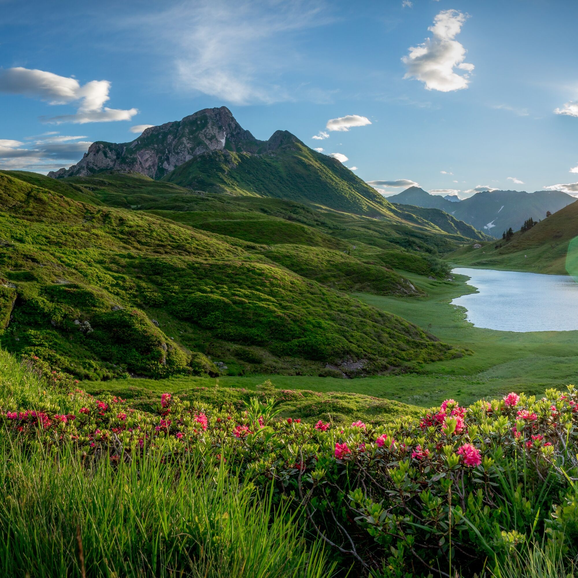
To the southwest, the rugged peak of Hoher Trieb stands out, towering over the hilly alpine pasture. It is made of limestone, while the alpine pasture areas and Zollner Höhe to the northwest consist of various schists and sandstones. The latter split more easily due to their schistose structure and are more susceptible to weathering than the compact limestones. Therefore, the limestones erode less quickly and remain as high peaks. Additionally, the glacier of the last ice age covered the alpine pasture terrain up to about 2,000 meters. Only the highest peaks, such as the Kleine and Hohe Trieb, protruded. These ice masses, which did not lie still but moved over the Zollner area, created the gentle hilly terrain about 20,000 years ago with their planing effect.
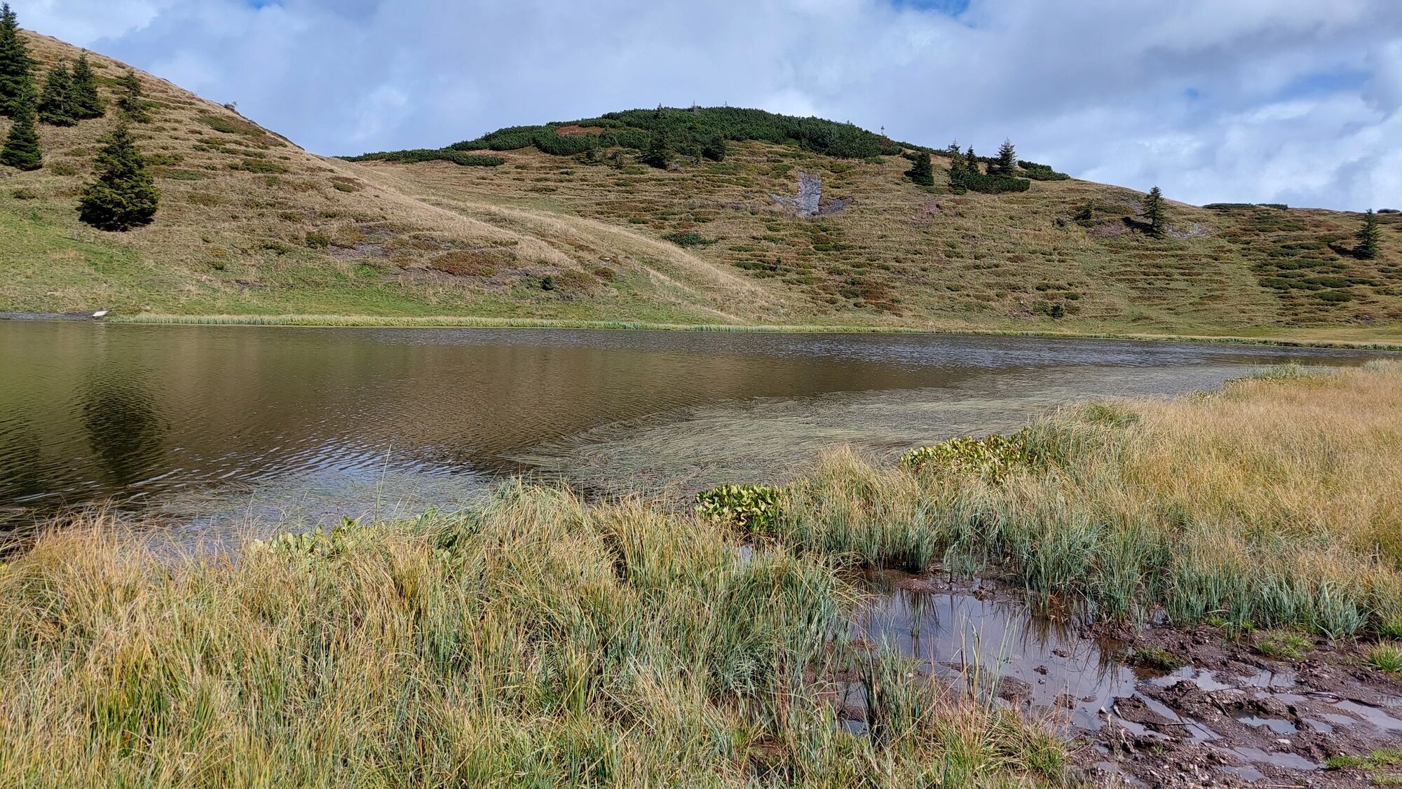
STOP 3 - Zollnersee – a landscape jewel with an uncertain future
It is difficult to speak of hard facts in such an idyllic landscape. But the Zollnersee also owes its formation to geology. The glacier of the last ice age carved a basin into the schists now beneath the lake. These impermeable, strikingly black rocks prevent water from seeping away and also form the hills surrounding the lake. They are among the older rocks in the Zollnersee area, around 410 million years old.
The Zollnersee was declared a natural monument in 1985 mainly because of its scenic beauty. However, silting up is well advanced, and the lake is slowly turning into a moor. The lake, up to three meters deep, is also the habitat of rare plants and animals. Noteworthy are the occurrences of the narrow-leaved cattail and alpine frogbit. For wildlife, it is also an important breeding spot for alpine newts.
STOP 4 - Limestone plateau – home of tiny creatures
To reach this limestone hilltop, you must first climb a gentle hill of sandstones and schists. Although completely different, all three rocks belong to one unit, the so-called Auernig formation. It formed about 300 million years ago in the Carboniferous period in a coastal area and is the youngest bedrock formation in the Zollnersee area. At that time, sands were washed from a mainland into a shallow sea. Then the sea advanced towards the land. In this sea lived corals, calcareous algae, fusulinids, and sea lilies. Their calcareous shells accumulated over the sands and gradually built the fossil-rich limestone plateau seen today.
Among the fossils, rice-grain-sized, now extinct fusulinids dominate. The same species are found, among others, in the Moscow Basin, proving that a continuous sea connection once existed between the Carnic Alps and Russia. The calcareous algae prove that the sea was not very deep because they need sunlight for their growth.
STOP 5 - Limestone plateau – home of animal "flowers"
This location, like the last stop, belongs to a once contiguous limestone plateau, which has broken into sub-plates over millions of years. Remnants of this extensive limestone platform are repeatedly found between the Zollner area and Nassfeld.
Unlike the last stop, large fossils dominate here: sea lilies or crinoids. In addition, calcareous algae, fusulinids, and fossilized snails can be found in the rock.
The sea lilies owe their name to their flower-like appearance, but they are animal organisms that still inhabit the seas today. A stalk with roots anchors them firmly to the sea floor. At the upper end of the stalk, from a kind of flower called a crown, the animal's arms extend.
The individual segments of the animal's calcareous hard parts lost their cohesion after death. Therefore, fully preserved sea lilies are rare. Usually, like here, only parts are found.
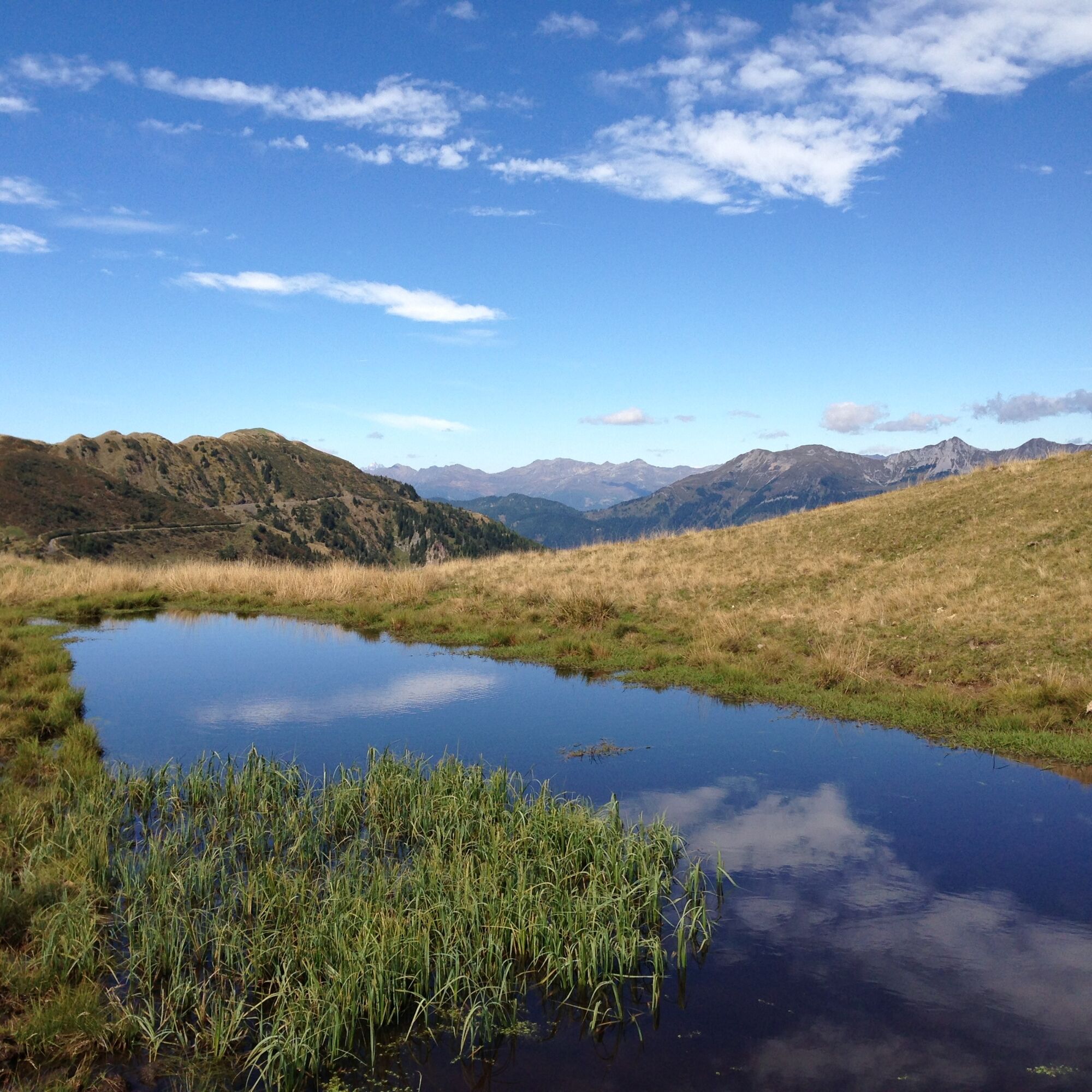
STOP 6 – The basin – a relic of the ice age
From this stop, you overlook a large kettle-shaped hollow, in which a moor has developed. The basin is almost completely closed. Only east of the Zollnersee Hut, the stream flowing from the moor has deeply incised a rock threshold of hard quartz rock. The hollow formed – like many others at Zollner – in the last ice age when the glacier carved the underlying rock into a basin. But not only bedrock confines the basin.
Exactly at the stop, the terrain flattens into a distinctive terrace that drops steeply into the basin after a few meters. This terrace also formed in the last ice age when the streams from Kleiner Trieb deposited debris at the edge of the melting glacier. After the ice melted, the terrace-like terrain step remained. These terrain forms, common in the Gail valley, are therefore called ice marginal terraces.
STOP 7 – Mining – a tough livelihood
At this location and at other points along the geotrail, one can find small "holes" in the landscape. These are old mines where iron ore was once extracted.
The iron ore deposits are linked to rocks about 360 million years old from the Devonian period, which formed at about 3,000 meters water depth. So here you stand on ancient deep-sea floor!
In this hostile sea, almost only spherical radiolarians lived. Their shells consisted of quartz and were not even a millimeter large. Nevertheless, mighty rock packages formed from them because countless radiolarians populated the sea as plankton and accumulated after dying.
The very hard rocks, made almost entirely of quartz, occur in two forms: as compact radiolarites (lydite) or as siliceous schists if they split easily.
STOP 8 – Old and new mountains – the key to the past
At this stop, you are at a key point for understanding the geological structure of the Carnic Alps because here the two units or levels that make up the Carnic Alps meet.
The rocks of the older level are about 370 million years old. They went through two mountain-building phases. The first, the Variscan, occurred in the Carnic Alps about 320 million years ago in the Carboniferous period. It tilted and folded the rocks that were originally deposited horizontally.
After this turbulent phase, which lasted about 10 million years, the rocks of the younger level were horizontally deposited again on top of the old rocks. Both levels then underwent the second mountain-building phase, the Alpine orogeny. The climax of this crumpling process was about 30 million years ago. It tilted the rocks again, uplifted today's mountains from the sea, and thus created the impressive mountain landscape of the Carnic Alps.
Tak
Tak
Mountain boots
Wind and rain protection
snack and drinks
valid passport, if it goes over the national border
FAIR PLAY & RESPECT:
Awareness of nature – landowners – your health... and safety in the mountains have highest priority for your route and associated route planning!
Therefore, inquire about the rules of conduct before every hike - Safety in the mountains - as well as the current weather conditions.
Waste disposal:
Waste is not always avoidable - but it has no place in nature and must be disposed of properly (preferably in the valley or at home).
Emergency numbers:
European emergency call: 112 (access to any available network)
Alpine emergency call Austria: 140
via the B111 Gailtal federal highway to Dellach, turn towards Weidenburg, from there ascend to Zollner on the toll-free forest road.
by train or bus to Dellach im Gailtal, by bus to Weidenburg, by taxi then to the parking lot near the Zollnersee Hut.
just before the Zollnersee Hut
Are you looking for hiking tips in the region and a state-certified guide for a guided mountain hike?
You can find this and many other infos at - Hiking tips and provider info
Places to eat:
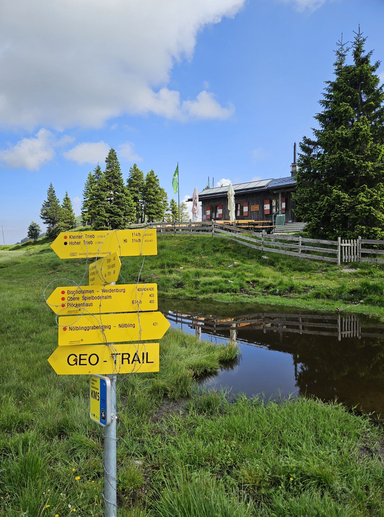
- Zollnersee Hut
Also in Dellach, St. Daniel and the surrounding places there are numerous, year-round open places to eat - details at Service A-Z.
You should not miss the detour to the Zollnertörl. Where a magnificent view of the Italian mountains opens up.
A visit to the Zollnersee Hut is worthwhile! The hut hostess serves creative, homemade delicacies such as buckwheat scrambled pancakes, lavender, or dead-nettle syrup.
The GeoPark Carnic Alps offers guided routes on the Geotrail Zollnersee and special programs for kids. Also worth seeing is the visitor center GeoPark Carnic Alps in Dellach im Gailtal.
âGeoPark Carnic Alps
Visitor Center
9635 Dellach/Gail 65
+43 (0) 4718 / 301- 17
Email: office@geopark-karnische-alpen.at
www.geopark-karnische-alpen.at
Popularne wycieczki w okolicy
-
4,9
Karnischer Hauptkamm - Hohe Warte 2.780m - Hike and Bike
ciężkiWycieczki górskie 19,5 km -
3,7
Cellon-Stollen und Senza Confini auf den Cellon und Steinberger Weg zum Abstieg
średniVia ferrata 7,09 km -
3,6
RW_N61 Kleiner Pal (1,867 m)
ciężkiWędrówka 6,52 km -
4,3
WW_N18 flower paradise Mussen
średniWędrówka 6,52 km -
5,0
Valentin-Wolayersee-Runde
średniWędrówka 12,4 km -
4,5
03 Südalpenweg, 24. Etappe: Valentinalm - Wolayerseehütte
średnidługodystansowy szlak pieszy 9,63 km -
5,0
Möselalm - Weißbriach/Gitschtal
światłoWędrówka 5,12 km -
4,5
KL_N5 Crete Rosse
średniVia ferrata 6,96 km -
5,0
Frischenkofel
średniWędrówka 5,25 km -
4,5
WW_N15 Lanz - Jukbichl
średniWędrówka 9,86 km

Wędrówki i tropienie


Nie przegap ofert i inspiracji na następne wakacje
Twój adres e-mail została dodana do listy mailingowej.