







434 Col d'Anzana

The route starts near the sports field of Campascio. From here, a narrow asphalt road leads to the village of Cavaione, which lies 800 meters higher, where it ends and becomes a well-developed gravel road...
The route starts near the sports field of Campascio. From here, a narrow asphalt road leads to the village of Cavaione, which lies 800 meters higher, where it ends and becomes a well-developed gravel road leading up to the Rifugio Anzana mountain hut.
From there, the not very steep path begins, climbing over alpine meadows up to the Col d'Anzana. The flat pass offers a fantastic panorama and at the same time forms the Switzerland-Italy border. Apart from the shepherds, one is unlikely to meet anyone up here. For the hiker, it is simply too far, and for the mountaineer unattractive. So the ideal bike area.
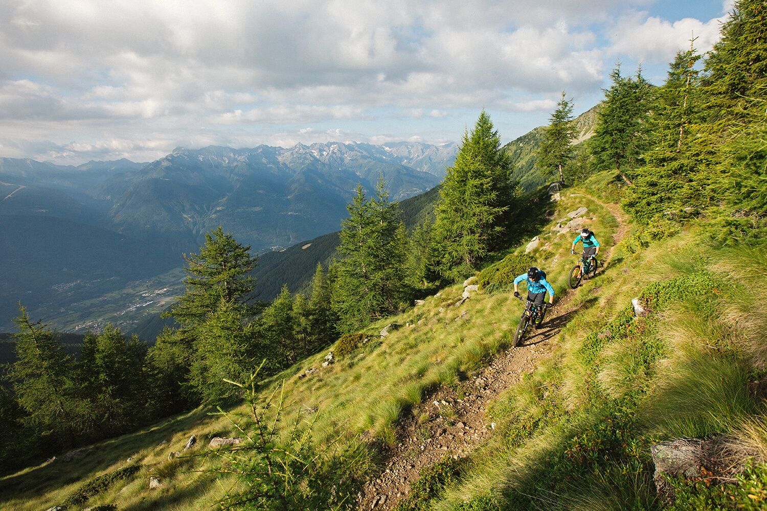
The descent begins with a beautiful panoramic trail that runs along the mountainside towards the east. The panorama ranges from the Ortler group to the Bergamo Alps and deep below the valley floor of Veltlin. Individual larches that grow here up to over 2000 m above sea level line the path, which gradually turns into an old military road. Endless switchbacks with dry stone walls lead downhill, and the builders of these paths likely never imagined that they would one day provide so much fun to others. From the village of Lughina, you can use the new, well-maintained gravel road or follow the old route with large cobblestones. The latter is a true delight for skilled riders. In the last 200-300 meters of elevation, there is a rich selection of paths and trails that lead down through orchards and vineyards to Tirano.
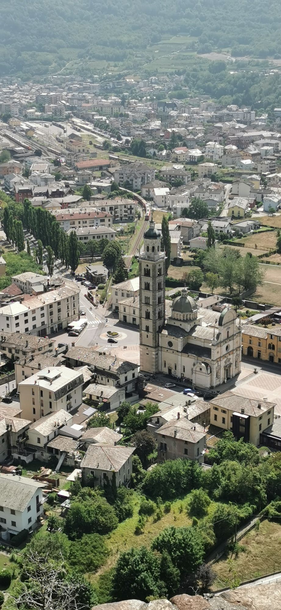
In Tirano, the visit to the Basilica della Madonna (pilgrimage church) and the old town with its historic palazzi is recommended. The return to Campascio mainly follows natural paths and side roads, ascending about 200 meters. Remarkable is the passage by the small church of Santa Perpetua from the 12th century, which is built on a natural balcony overlooking Tirano. Those who are tempted by one of the excellent Veltliner wines available here, or want to avoid the effort of the final ascent, can take the Rhaetian Railway back to Valposchiavo.





This route is signposted in only one direction: Brusio–Tirano (IT)
The route crosses a border - carry an identity card or passport.
Attention: Snowfields can be present on high sections until the summer months.
Access: The road from Cavaione to Pescia Bassa is open to car traffic but is lightly used.
Shuttle bus - PubliCar
You can shorten the route by taking the shuttle bus from Poschiavo to Cavajone. Information and reservations at the post bus: +41 81 844 10 42, autopostale.poschiavo@bluewin.ch, www.balzarolo.ch/de/personentransport
Rhaetian Railway
From Tirano, the Rhaetian Railway offers the possibility to return by train to Valposchiavo. Check the timetable; not all trains can take bicycles.
Timetable: www.sbb.ch
Cavaione
On the western side of the valley above Brusio lies the hamlet of Cavaione, nestled against the steep southern slope of the Giümelin. Cavaione is the youngest locality in Switzerland: thanks to the border change between Switzerland and Italy in 1865, Cavaione was incorporated into the municipality of Brusio, and its inhabitants received Swiss citizenship in 1873. Previously, the residents of Cavaione often avoided tax and military service by cleverly declaring themselves to belong to whichever country suited them better.
Lagh dal Mat and Lagh da la Regina
From the Capanna Anzana, after just over half an hour of walking, you reach the mountain lake Lagh dal Mat (Fool's Lake) and with a further 30-minute walk the Lagh da la Regina (Queen's Lake). These delight with the clarity and unique color spectrum of their waters. Additionally, both offer breathtaking views of the eastern valley side of Valposchiavo, the town of Tirano, and the lush Veltlin.
Please note:
The route crosses a border - carry an identity card or passport.
Popularne wycieczki w okolicy
-
Alp Grüm - Cavaglia - Poschiavo
średniWędrówka 9,41 km -
4,0
Giro del Lago - Le prese - Miralago
światłoWędrówka 7,43 km -
Val dal Saient - Short version
Wędrówka 11,4 km -
4,0
Mufule' Lake Ring
średniWędrówka 5,49 km -
5,0
32.05 Poschiavo - Tirano, Trans Altarezia Bike
ciężkiMountainbike 29,1 km -
Szlak Valtellina
średniJazda na rowerze 113,2 km -
33.10 Le Prese - Tirano, Via Albula / Bernina
średniWędrówka 14,6 km -
5,0
Runchett da Sotsassa
średniTrasa tematyczna 1,54 km -
Charcoal Burner Route San Romerio
ciężkiTrasa tematyczna 2,91 km -
30.06 Alp Grüm - S. Romerio, ViaValtellina
średniWędrówka 20,0 km
Wędrówki i tropienie


Nie przegap ofert i inspiracji na następne wakacje
Twój adres e-mail została dodana do listy mailingowej.





