


Löwenpfad "Filstalgucker" - Views from the heart of the Filstal
Poziom trudności: 2
You can follow in the footsteps of the lion in the Göppingen district: The Löwenpfade stand for quality hiking and entice with impressive views, diverse natural landscapes, and mysterious places. Sixteen...
You can follow in the footsteps of the lion in the Göppingen district: The Löwenpfade stand for quality hiking and entice with impressive views, diverse natural landscapes, and mysterious places. Sixteen circular hiking routes, between 3 and 24 kilometers long, offer hiking fun for almost every taste.
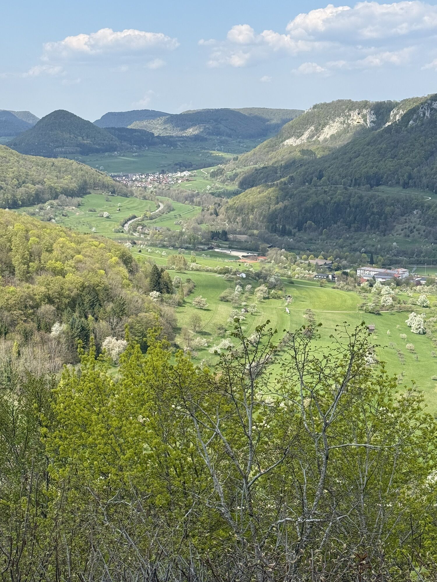
The Löwenpfad "Filstalgucker" in Geislingen an der Steige is a certified circular route by the German Hiking Association in the "dream route" category. The approximately 13.2-kilometer hike starts at the hiking car park by the village church in the district of Türkheim. After a short route through the village, it goes across meadows and fields into the beech forest towards the southeast, before reaching open fields again a few kilometers north of Wittingen.
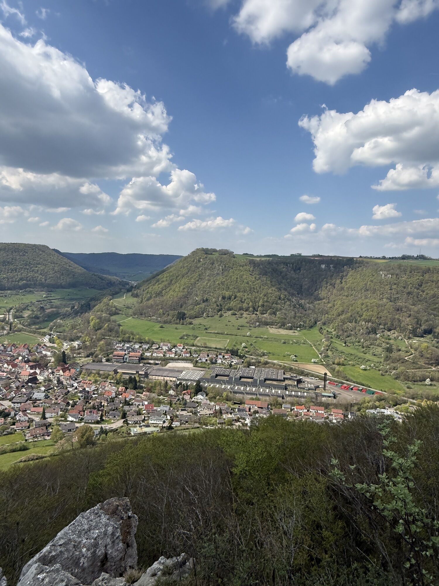
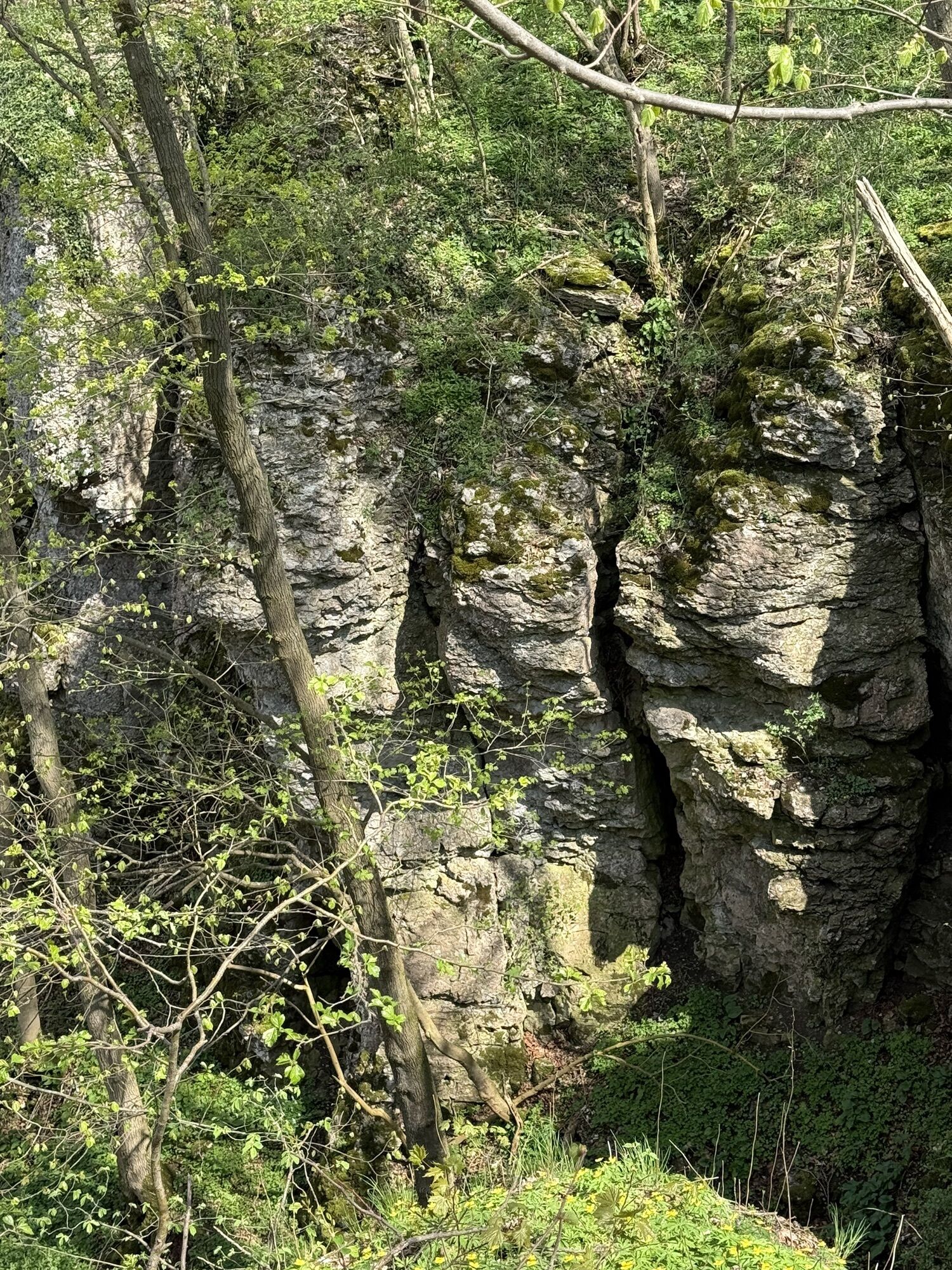
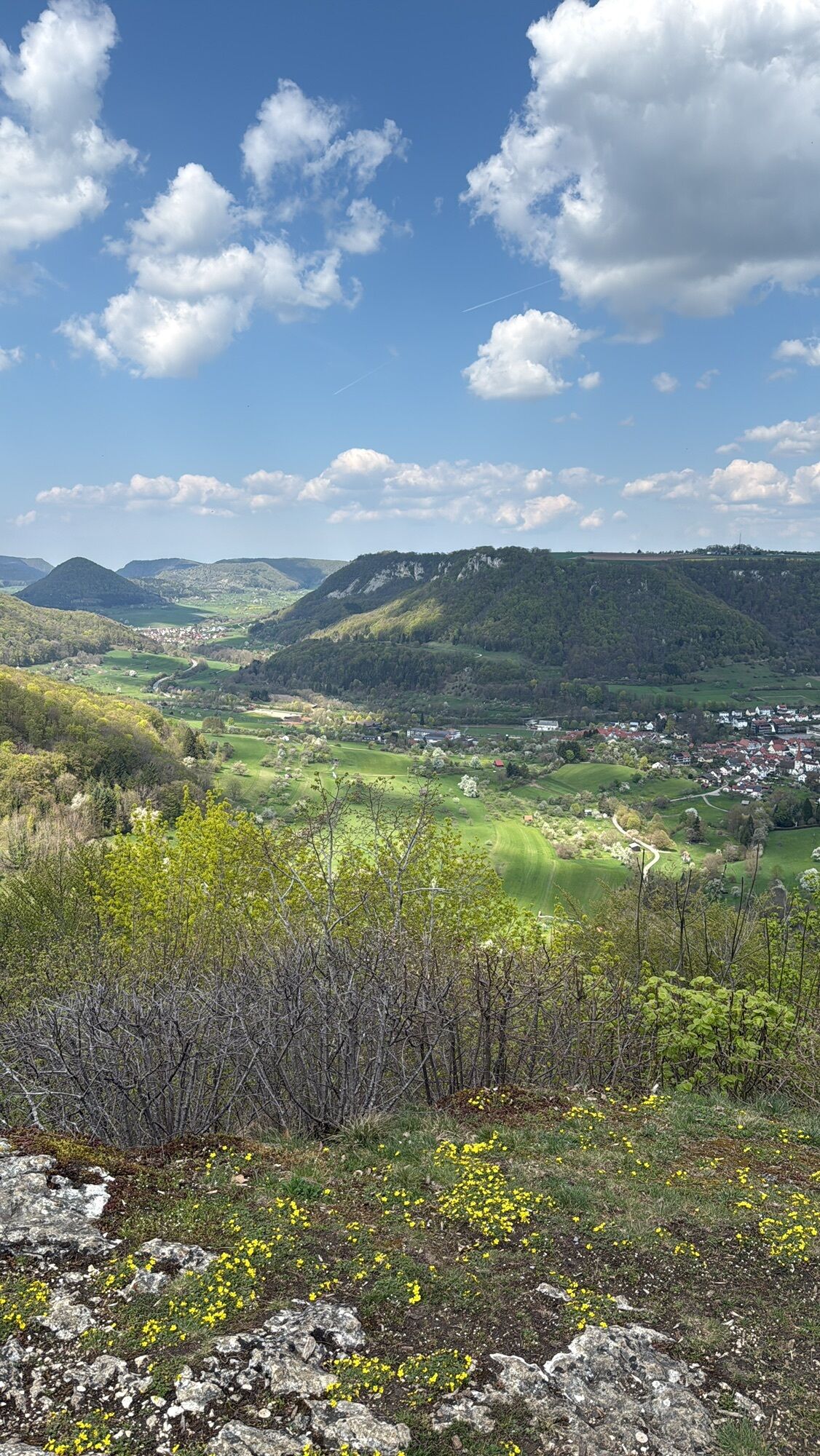
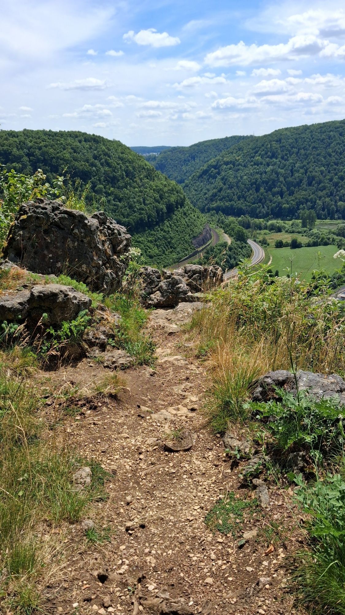
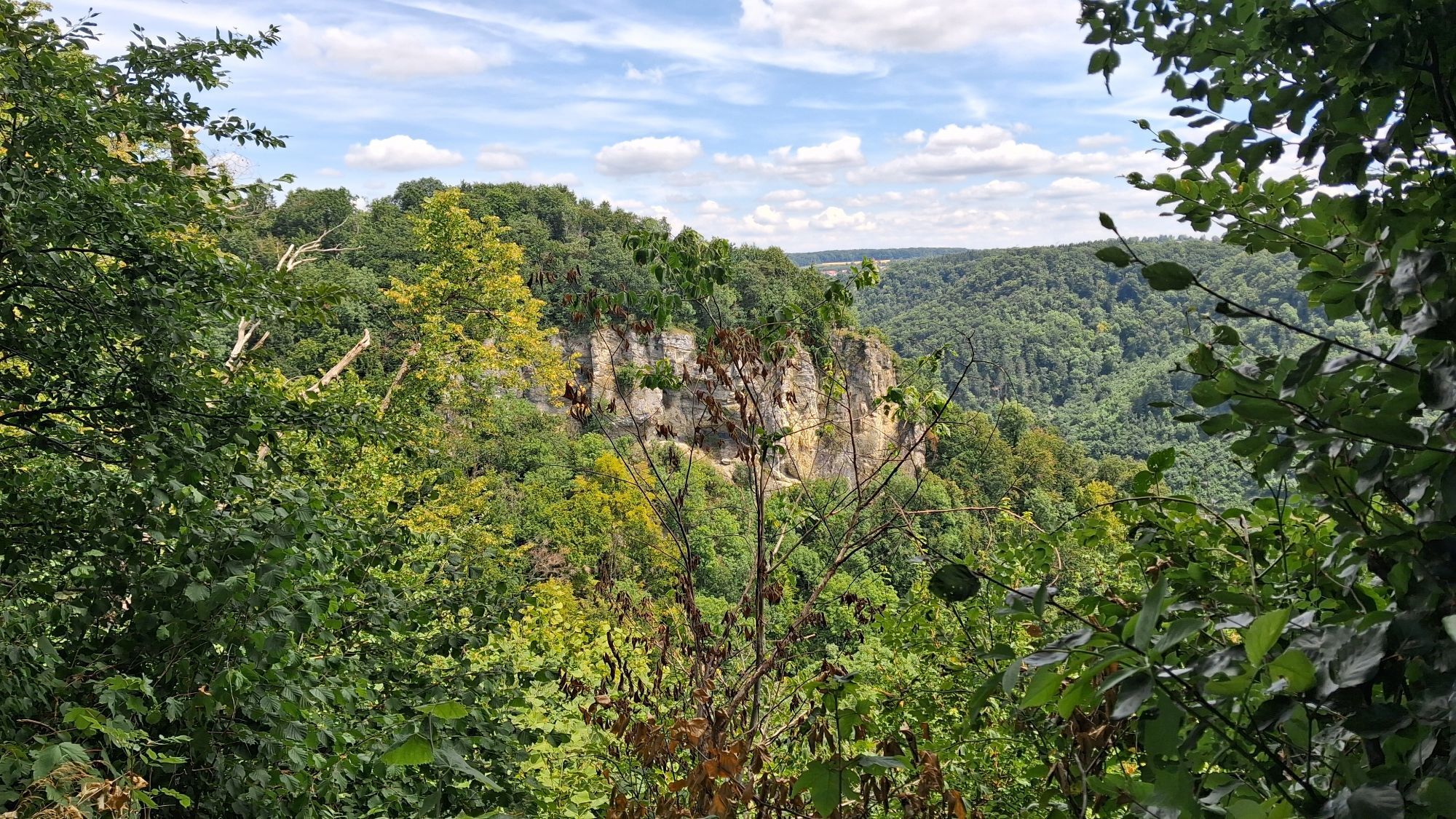
The path then follows narrow trails always along the Albtrauf and offers especially beautiful views into the Rohrachtal from the Tiroler Felsen and the Geiselstein. After some time, you reach the impressive Ostlandkreuz, which towers high above the town of Geislingen an der Steige. Passing imposing rock formations, the path continues along the Albtrauf towards Kahlenstein. The nearby Kahlenstein cave is worth a short visit.
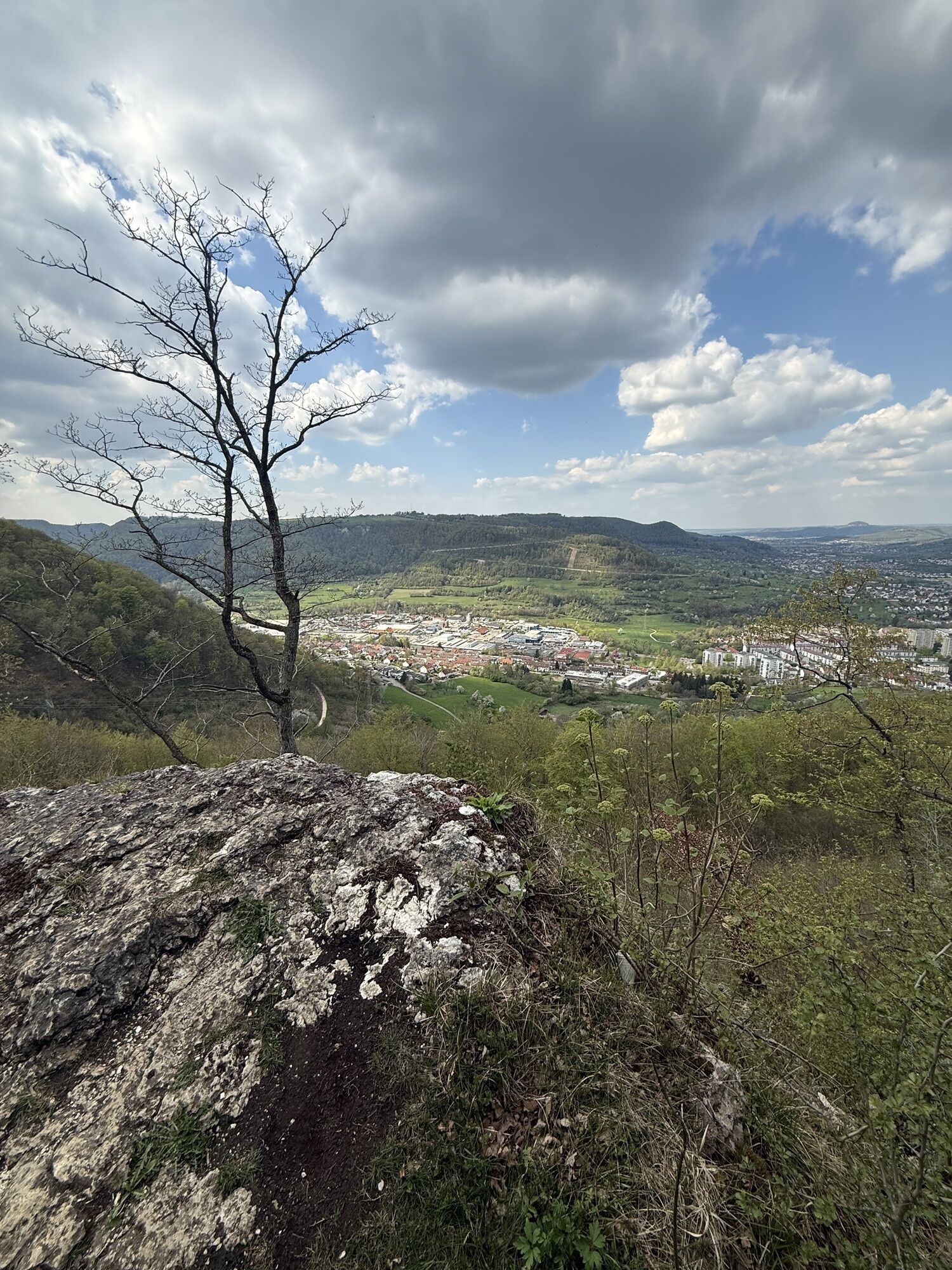
Shortly before the end of the route, before the district of Türkheim, the Burgstall - remains of an old castle - offers probably the most beautiful view of the tour over the Upper Filstal, before returning to the starting point.
More information at loewenpfade.de

The approximately 13.2-kilometer-long hike starts at the hiking car park by the village church in the district of Türkheim. After a short route through the village, it goes across meadows and fields into the beech forest towards the southeast, before reaching open fields again a few kilometers north of Wittingen.
The trail then follows narrow paths along the Albtrauf and offers especially beautiful views into the Rohrachtal from the Tiroler Felsen and the Geiselstein. After some time, you reach the impressive Ostlandkreuz, which towers high above the town of Geislingen an der Steige. Passing imposing rock formations, the path continues along the Albtrauf towards Kahlenstein. The nearby Kahlenstein cave is worth a short visit.
Shortly before the end of the route, before the district of Türkheim, the Burgstall - remains of an old castle - offers probably the most beautiful view of the tour over the Upper Filstal, before returning to the starting point.
Tak
Slip-resistant footwear is recommended.
Not a prepared trail.
You can reach the district of Türkheim in the town of Geislingen an der Steige by car via the A8, Stuttgart - Ulm, exit Mühlhausen (B 466) or exit Merklingen (L 1230) towards Geislingen an der Steige.
Alternatively, you can also approach via the B10, exit in Geislingen an der Steige towards Türkheim.
Navigation to the starting point with Google Maps
In Geislingen/Steige there is a connection to the MEX and RE trains of the Filstalbahn on the Stuttgart-Ulm route. From Geislingen central bus station (ZOB), take bus line 350 to the "Türkheim" stop. From there, it is about a 2-minute walk to the starting point, the hiking car park by the church.
The district timetable can be found at: www.vvs.de/fahrplan
Parking options at the start/end point of the route by the village church in Geislingen-Türkheim. Additional parking is available at the Geiselsteinhaus car park or the Schildwacht car park (near the Ostlandkreuz).
2
Respectful coexistence in the Göppingen district.
Code of conduct:
Respect trail closures and quiet zones developed in the leisure trail concept. Do not leave litter or animal droppings on the trail. Act considerately and thoughtfully. Please take care of your own safety. Respect other users of forest and fields. Show consideration for animals and plants. Plan forest path use in advance and use daylight. Avoid twilight in the morning and evening. Avoid using forest edges so that wildlife can better get accustomed to humans.More information at ruecksicht-macht-wege-breiter.de
The viewpoint "Burgstall" in Geislingen-Türkheim is one of the most beautiful on the Swabian Alb. Especially enjoyable during sunset.


Popularne wycieczki w okolicy
-
4,5
Löwenpfad "Orchideenpfad" - Herbs, Pasqueflower and Juniper Heathlands
średniWędrówka 9,33 km -
5,0
Löwenpfad "Heldentour" - The king stage of the Löwenpfade
ciężkiWędrówka 23,6 km -
4,4
Löwenpfad "Geislinger Felsen-Tour" - up and down through the Eybach valley
średniWędrówka 10,8 km -
4,5
Löwenpfad "Weitblick-Tour" - High up and far-reaching view
ciężkiWędrówka 12,0 km -
4,7
Löwenpfad "Filstalgucker" - views from the heart of the Filstal valley
średniWędrówka 13,0 km -
3,7
Löwenpfad "Wasserberg-Runde" - pure panorama and typical Swabian Jura landscapes
ciężkiWędrówka 12,0 km -
4,3
Lion Trail "Steigen Tour" - Along the Swabian construction of the century
ciężkiWędrówka 16,1 km -
3,5
Lion trail "Messelberg tour" - hiking with impressive views
średniWędrówka 7,72 km -
3,8
Lion trail "Ave-Weg" - A touch of pilgrimage on the Albtrauf
średniWędrówka 8,65 km -
1,0
Nordalbrunde
średniWędrówka 4,76 km
Wędrówki i tropienie


Nie przegap ofert i inspiracji na następne wakacje
Twój adres e-mail została dodana do listy mailingowej.