


Löwenpfad "Wasserberg-Runde" - pure panorama and typical Swabian Jura landscapes
Poziom trudności: T2
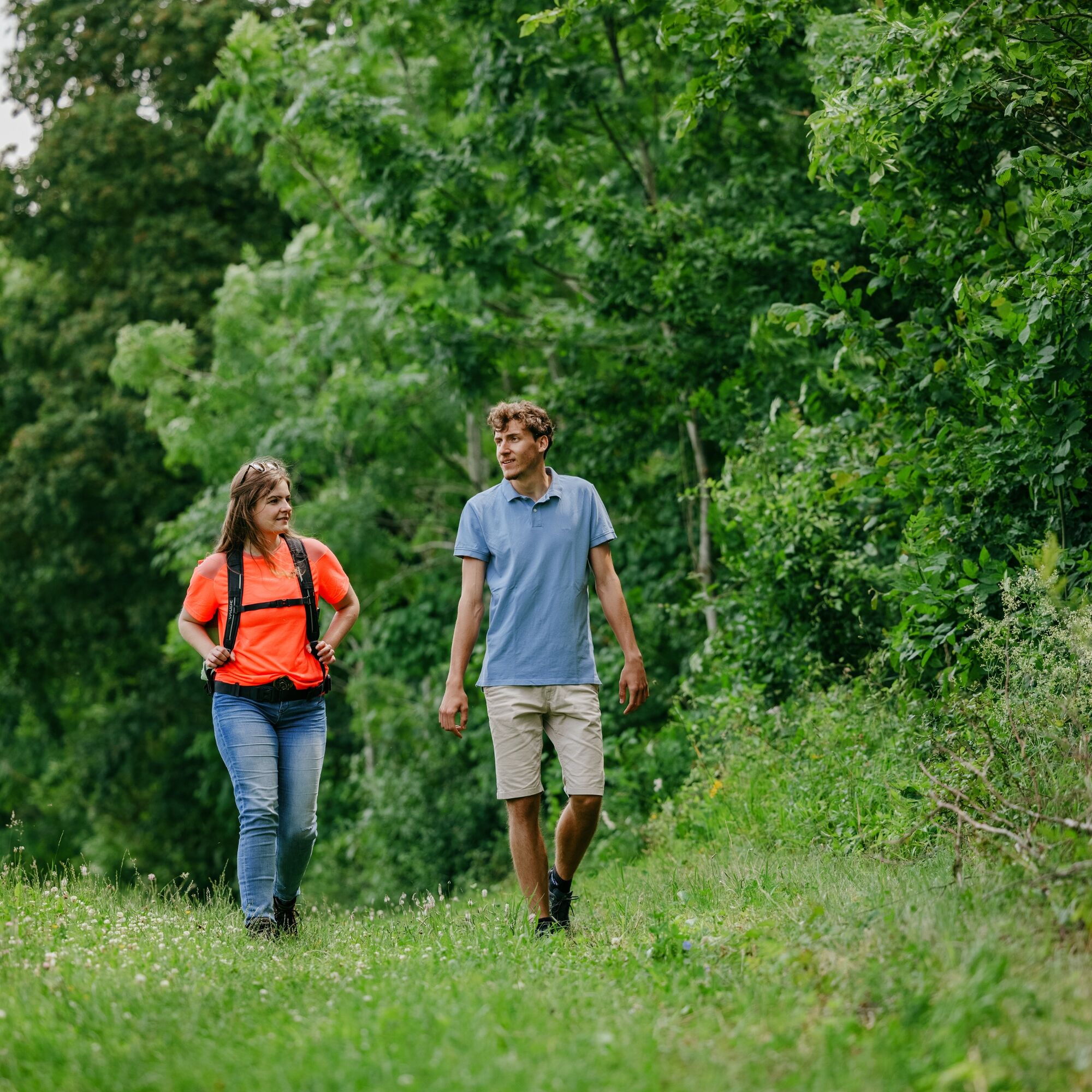
You can follow in the footsteps of the lion in the Göppingen district: The Löwenpfade are hiking routes with a quality claim, attracting with impressive views, varied natural landscapes, and mysterious...
You can follow in the footsteps of the lion in the Göppingen district: The Löwenpfade are hiking routes with a quality claim, attracting with impressive views, varied natural landscapes, and mysterious places. Sixteen circular hiking trails, between 3 and 24 kilometers long, offer hiking fun for almost every taste.
The Löwenpfad "Wasserberg-Runde" near Unterböhringen and Hausen is a circular route certified by the German Hiking Association in the "dream route" category. The approximately 12.0-kilometer long route starts at the hiking car park at Hexensattel between Reichenbach im Täle and Unterböhringen and leads directly into the Wasserberg-Haarberg nature reserve. The path runs above a large and steep juniper heath up to the summit of the Haarberg with a fantastic view. Among the many light- and warmth-loving animal and plant species that have developed here, you can find many rare orchids.
Then we hike through forests and meadows, past the "new weather oak," the emblem tree of Unterböhringen. At the mountain edge, we enjoy the impressive, beautiful views towards Unterböhringen and into the Filstal valley. The steep descent goes over heathlands down to Unterböhringen with a local stopover option. On the half-height path on the left valley slope, we continue to Hausen and then along the Weigoldsberg alternately through heaths, meadows, and forests back to Hexensattel between Reichenbach im Täle and Unterböhringen.
More information at loewenpfade.de

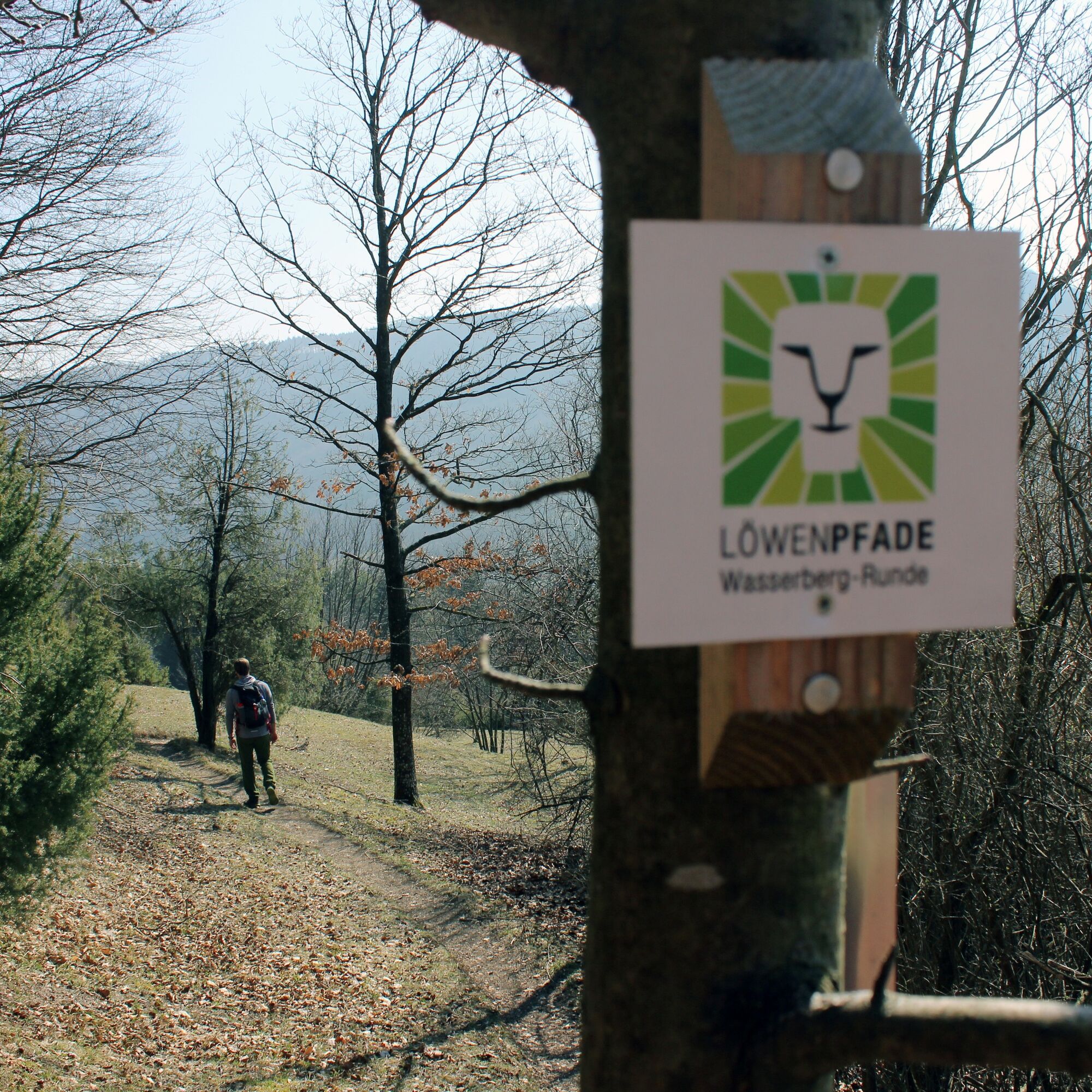
The approximately 12-kilometer route starts at the hiking car park at Hexensattel between Reichenbach im Täle and Unterböhringen and leads directly into the Wasserberg-Haarberg nature reserve. The path runs above a large and steep juniper heath up to the summit of the Haarberg with a fantastic view. Among the many light- and warmth-loving animal and plant species that have developed here, you can find many rare orchids.
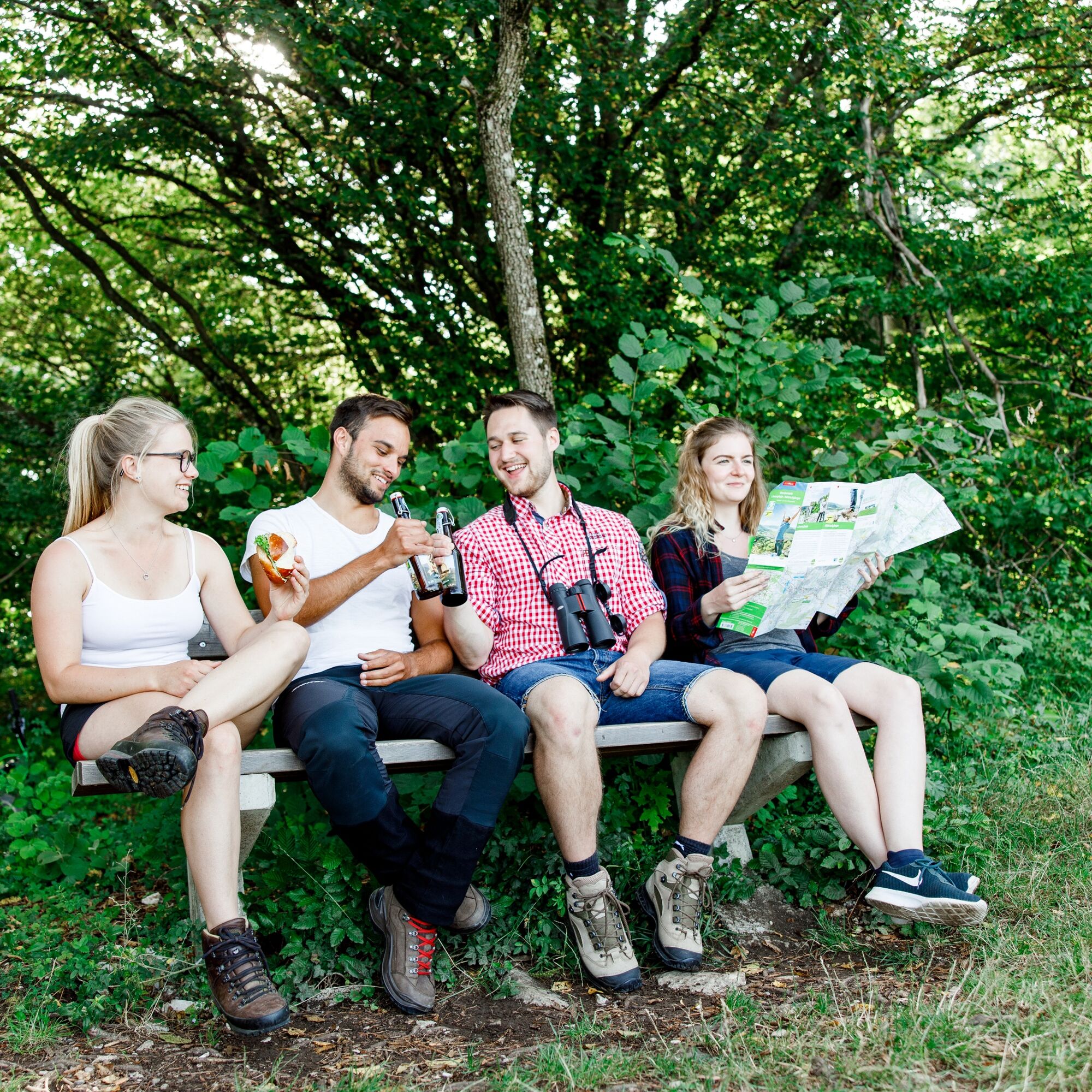
It continues to the Wasserberghaus, which can be reached via a short detour of about one kilometer. Here, a rustic stopover with good traditional Swabian cuisine is offered. Additionally, there is a wonderful view over the Alb foothills - from the "Three Emperor Mountains" to the Staufer town of Göppingen.
Then you hike through forests and meadows, past the "new weather oak," the emblem tree of Unterböhringen. At the mountain edge, enjoy the impressive, beautiful views towards Unterböhringen and into the Filstal valley. The steep descent goes over heathlands down to Unterböhringen with a local stopover option. On the half-height path on the left valley slope, continue hiking to Hausen and then along the Weigoldsberg alternately through heaths, meadows, and forests back to Hexensattel between Reichenbach im Täle and Unterböhringen.
Slip-resistant footwear is recommended.
Some paths can be slippery and dangerous when wet. Watch your steps and use hiking poles for stability if necessary.
You can reach Reichenbach im Täle (a district of Deggingen) by car via the A8, Stuttgart - Ulm, Mühlhausen exit towards Geislingen an der Steige (B 466), or via the B10, exit in Geislingen an der Steige towards Deggingen / Reichenbach im Täle.
Navigation to the starting point with Google Maps
In Geislingen/Steige, connections to the MEX and RE trains of the Filstalbahn on the Stuttgart-Ulm route are available. From the station, bus line 966 from Geislingen central bus station towards Wiesensteig can be used up to the "Rathaus" stop in Reichenbach im Täle.
You can find the district timetable at: www.vvs.de/fahrplan
There are sufficient parking spaces at the Hexensattel hiking car park between Reichenbach im Täle and Unterböhringen.
Tak
T2
Respectful coexistence in the Göppingen district.
Code of conduct:
Respect path closures and the quiet zones developed in the leisure path concept. Leave no traces such as trash or animal droppings, treat your path with care. Act prudently and considerately. Adjust your behavior to the respective situation. Safety comes first. Respect other users of the forest and fields. Be considerate of animals and plants. Plan in advance and use daylight. Try to avoid dawn and dusk. Observe the prohibition to enter agriculturally used areas during the growing season. Stay on designated paths and avoid forest edges so that wild animals can better get used to humans.More information at ruecksicht-macht-wege-breiter.de
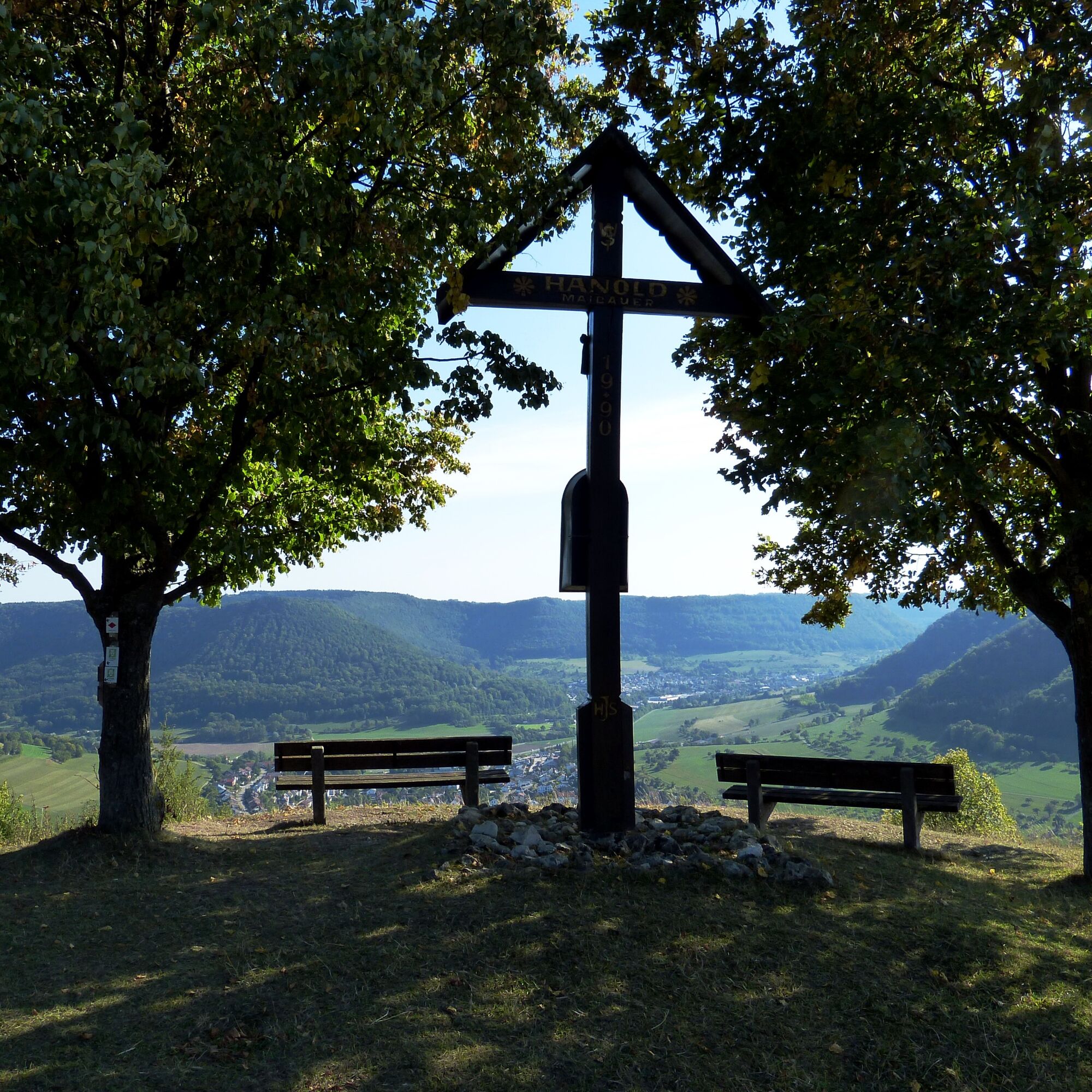
At the summit of the Haarberg, the crucifix opens up an impressive view, offering a breathtaking look over the surrounding landscape.
Those who don’t mind a small detour can enjoy a cozy break at the Wasserberghaus, known for its Swabian cuisine and inviting atmosphere.
Nature lovers will be in their element in the nature reserve around the Haarberg. Rare plants thrive in the juniper heaths, and various animals can also be observed here, making this area a true natural paradise.
The descent from the weather oak to Unterböhringen not only offers a grand view but is also an unforgettable experience for hiking enthusiasts. The path leads through impressive landscapes and rewards with a unique view of the valley and the surrounding nature.

Popularne wycieczki w okolicy
- 4,5
Löwenpfad "Orchideenpfad" - Herbs, Pasqueflower and Juniper Heathlands
średniWędrówka 9,33 km - 4,8
Löwenpfad "Filsursprung-Runde" - pure nature around the Reußenstein
średniWędrówka 14,1 km - 4,9
Löwenpfad "Staufer-Runde" - Barbarossa's traces before a dreamlike backdrop
średniWędrówka 11,3 km - 5,0
Lion trail "Berta-Hörnle-Tour" - castle stories in a dreamlike setting
ciężkiWędrówka 14,7 km - 5,0
Löwenpfad "Heldentour" - The king stage of the Löwenpfade
ciężkiWędrówka 23,6 km - 4,4
Löwenpfad "Geislinger Felsen-Tour" - up and down through the Eybach valley
średniWędrówka 10,8 km - 4,5
Löwenpfad "Weitblick-Tour" - High up and far-reaching view
ciężkiWędrówka 12,0 km - 4,7
Löwenpfad "Filstalgucker" - views from the heart of the Filstal valley
średniWędrówka 13,0 km - 5,0
Boßler circuit
średniWędrówka 8,59 km - 4,3
Lion Trail "Steigen Tour" - Along the Swabian construction of the century
ciężkiWędrówka 16,1 km
Wędrówki i tropienie


Nie przegap ofert i inspiracji na następne wakacje
Twój adres e-mail została dodana do listy mailingowej.