







Through the wild romantic Schweinbachtal to the Bruderhöhle cave

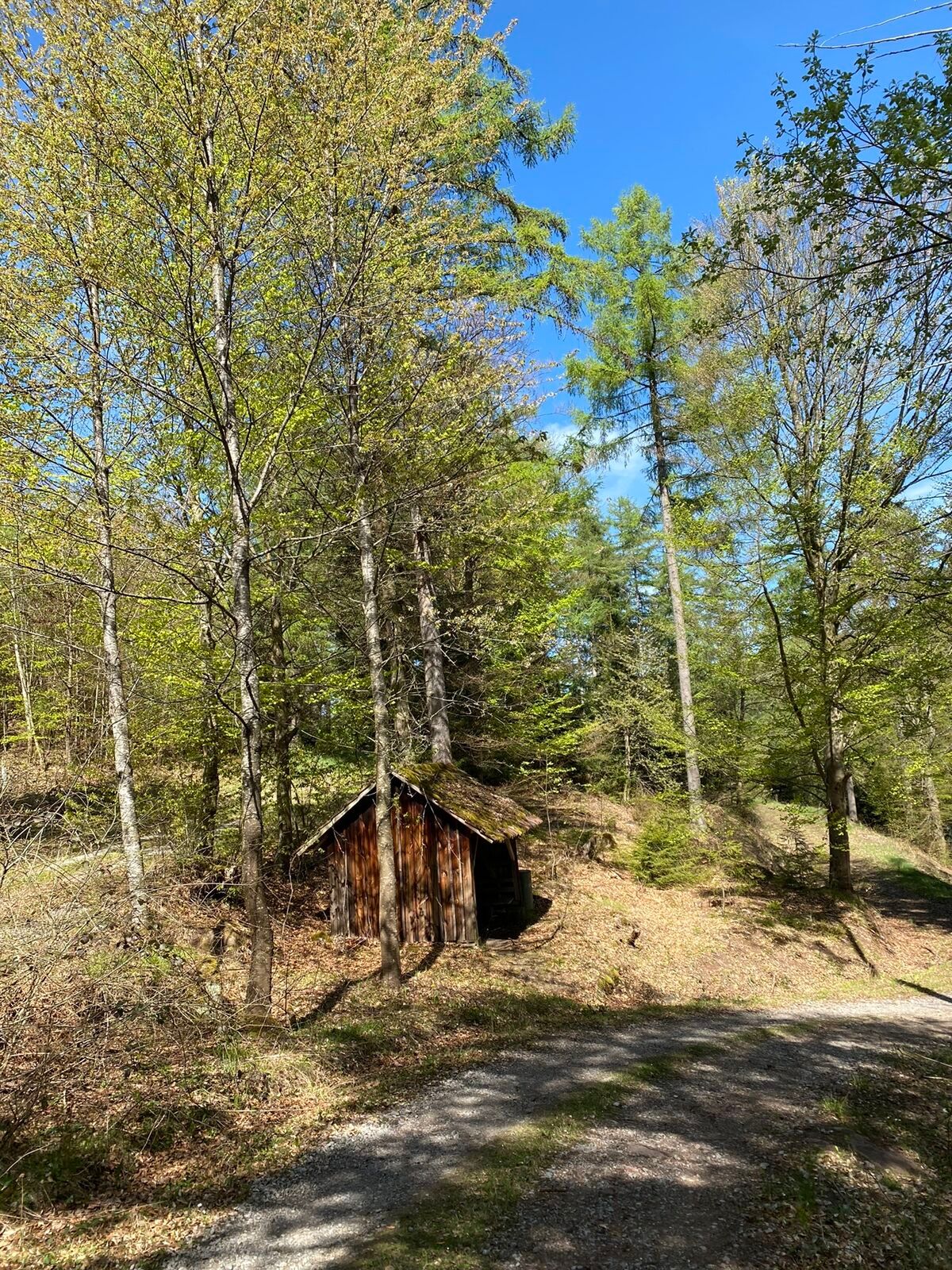
From the monastery complex of St. Peter and Paul we pass the deer enclosure and then dive into the wild romantic Schweinbachtal. Stepping stones lead us through the brook with its many rapids. Past the...
From the monastery complex of St. Peter and Paul we pass the deer enclosure and then dive into the wild romantic Schweinbachtal. Stepping stones lead us through the brook with its many rapids. Past the sea of rocks we reach Oberkollbach, where we can pause comfortably. Our path finally leads past impressive giant sequoias to the bizarre rock formation of the Bruderhöhle cave and back to Hirsau.

Follow the signposts and the lozenges of the Black Forest Association: Hirsau Monastery, Wildbader Straße, Schweinbachtal, Steinernes Brückle, sea of rocks, Adler, Tiroler Weg, Tiroler Wald, Lärchengarten, Lützenhardt, Conventrain, Brudersteige, Hirsau Monastery parking lot
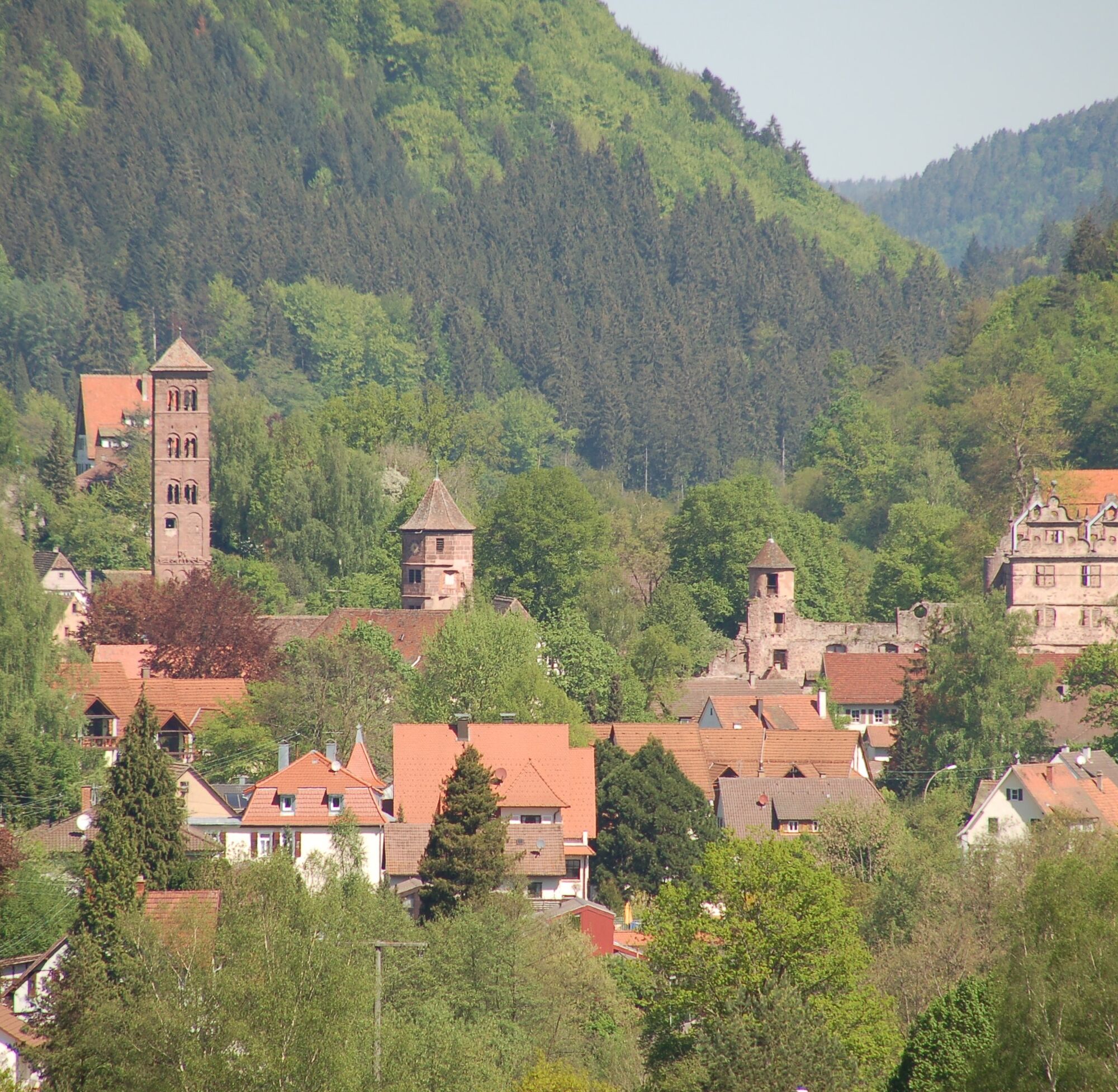
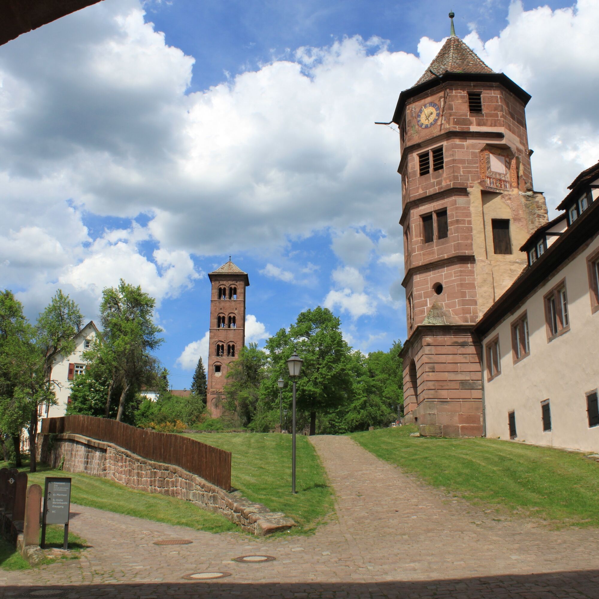
We start our hike at the monastery complex St. Peter and Paul in Hirsau. Those who like can visit the complex at the beginning, but those who are eager to answer the call of nature should visit the impressive site after the route. The former Benedictine monastery was the most important German reform monastery north of the Alps in the 11th and 12th centuries, but was partially severely damaged in 1692 during heavy fights against the French troops. Architecturally significant ruins with relics from various styles are recognizable: the Romanesque column basilica, once the largest Romanesque church in southwest Germany, and the ruins of a Renaissance castle, where the elm tree sung about by Ludwig Uhland until 1989 stood. The late Gothic Marian chapel, which has remained intact, towers above the Gothic cloister. Since 2007, the monastery area has been the backdrop for the “Calwer Klostersommer in Hirsau,” which features big names and demanding productions.
We should not miss the monastery museum in Hirsau either (opening hours: April-October: Tuesday-Friday from 1 pm to 4 pm, Saturday-Sunday from 12 pm to 5 pm). Here we can immerse ourselves in the medieval art history of Hirsau and experience the monastery as a former center of Benedictine reforms in Germany.
We finally leave the monastery complex through the upper gate, cross the road and, if we now follow the blue lozenge, we pass through the Bärental district to the deer enclosure, where we can watch red deer grazing. Past a company, we reach a fork where we can choose to turn right and now follow the yellow lozenge for guidance. The path goes gently uphill and narrows after passing the last house, leading us into the gentle silence of the forest.
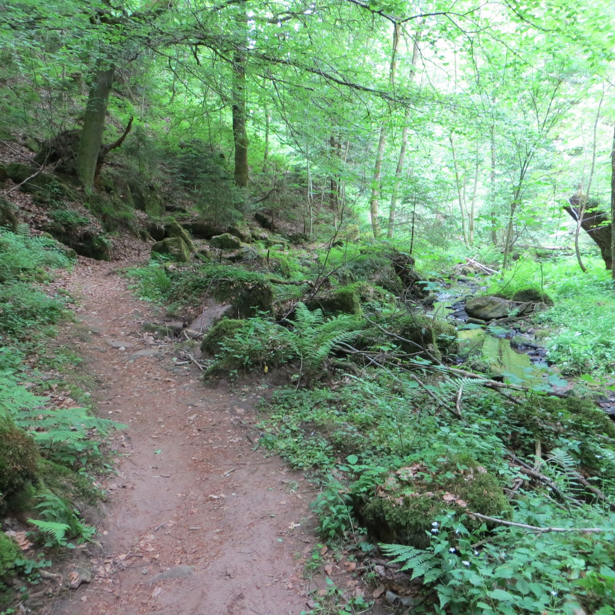
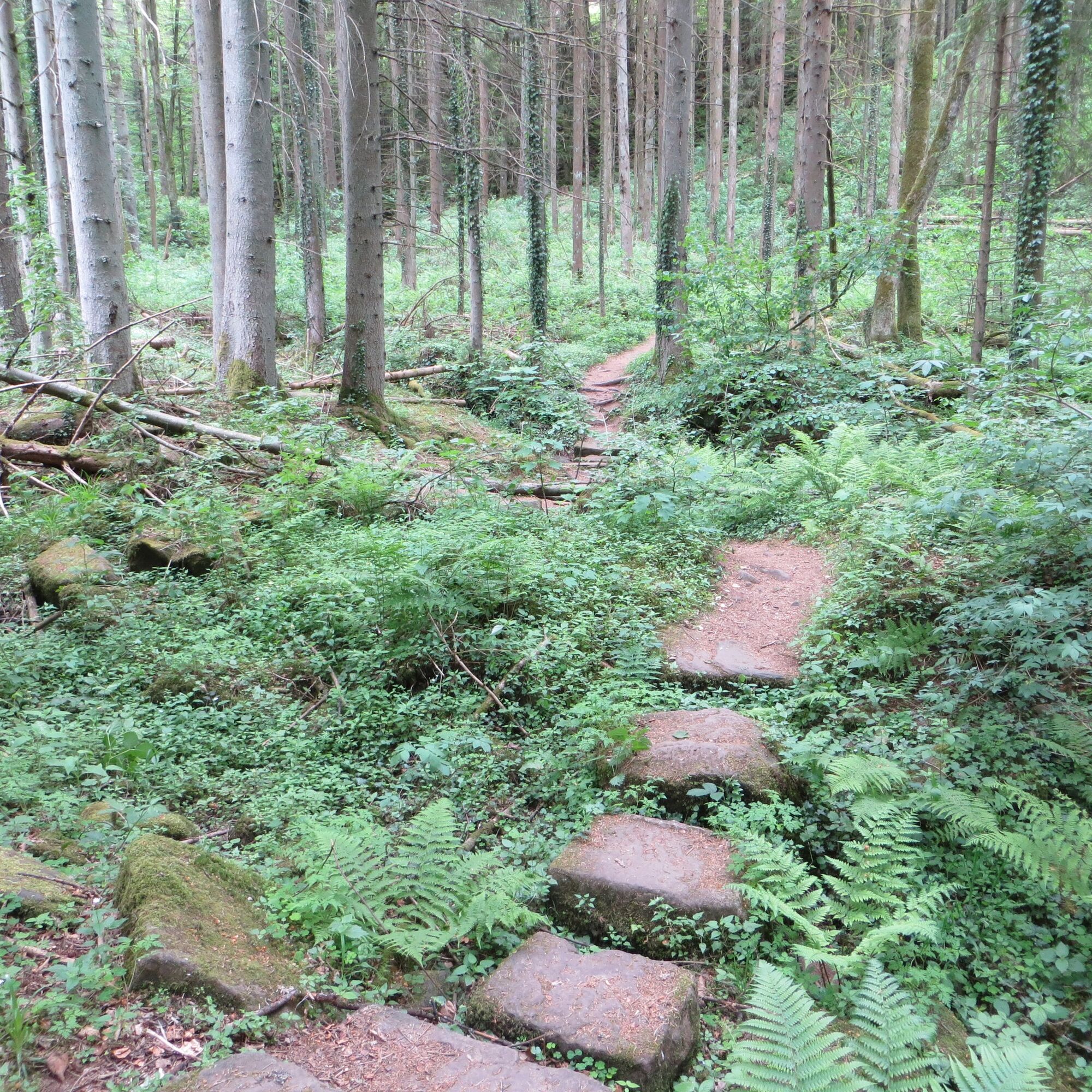
We can rest briefly at the Schäufelbach spring before continuing into the wild romantic Schweinbachtal. For a short section, the hike still runs on a wide path, but then, after crossing a bridge, a adventurous, almost inconspicuous path opens up. Already in the first meters, it is not easy for our eyes to concentrate on the path, so interesting and inviting to explore is the nature around us. We pass gnarled, old trees of a mixed forest that provide pleasant shade along the dreamily babbling brook and walk over roots and moss-covered stones. A somehow mystical, primeval forest-like atmosphere. Fantastic! Over stepping stones, we repeatedly change sides of the brook. Enthralled by the magnificent natural landscape, we barely notice that we gradually gain height and soon leave the valley again.
We then reach a wider path again and turn right at the signpost “Steinernes Brückle.” Unfortunately, due to the danger of collapse, we cannot use the stone bridge; therefore, we cross the brook via some large sandstone blocks and climb up to the road. We cross this and continue uphill past the so-called sea of rocks. Leaving the forest opens up wide fields and meadows through which we stroll comfortably to Oberkollbach.
We pass through the village and turn right at the Adler inn onto Alte Badstraße. At the edge of the village, we turn left towards the Bruderhöhle cave, follow the blue lozenge for 200 m and then turn right into the shade of the forest. We come to a forest track and follow it to the right, now again following the yellow lozenge.
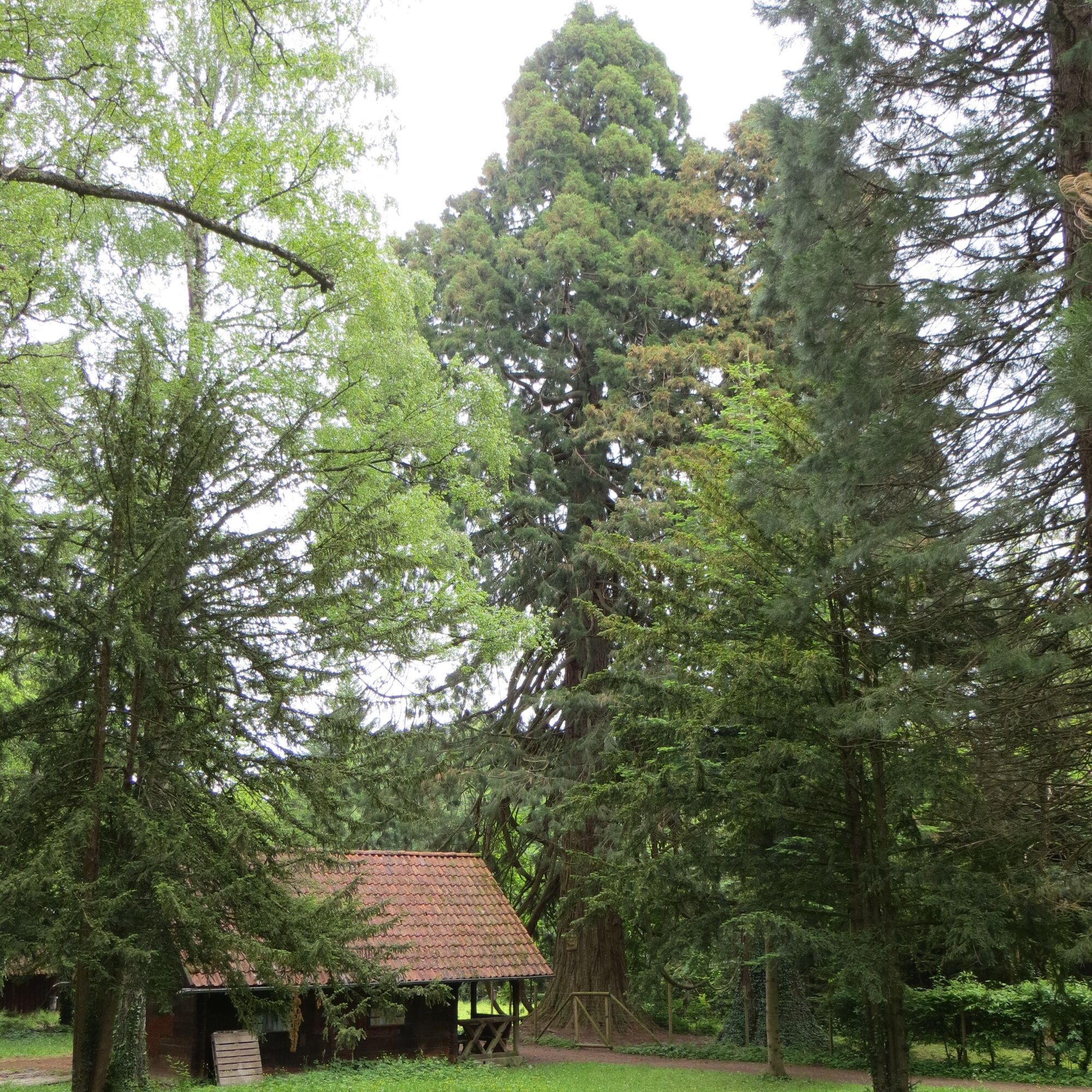
We reach a road and turn left onto a path that we leave after 100 m to the left again and continue straight ahead on the wide path. This leads us directly to the next highlight of our route, which rather reminds us of the western slopes of the Sierra Nevada: some giant sequoias up to 35 m high tower into the sky. In 1865, King Karl had the sequoias planted, grown from Californian seeds. A wonderful spot that practically invites us to rest briefly under the imposing appearance of the so-called Wellingtonias.
Finally, we continue to the left (following the yellow lozenge) and turn left 1 km later. Then the path leads right onto the Kohlsteigle, which we descend to the Annahütte. There we turn right and enjoy the path along the mountainside, from which we can catch views of the opposing forest slope again and again.
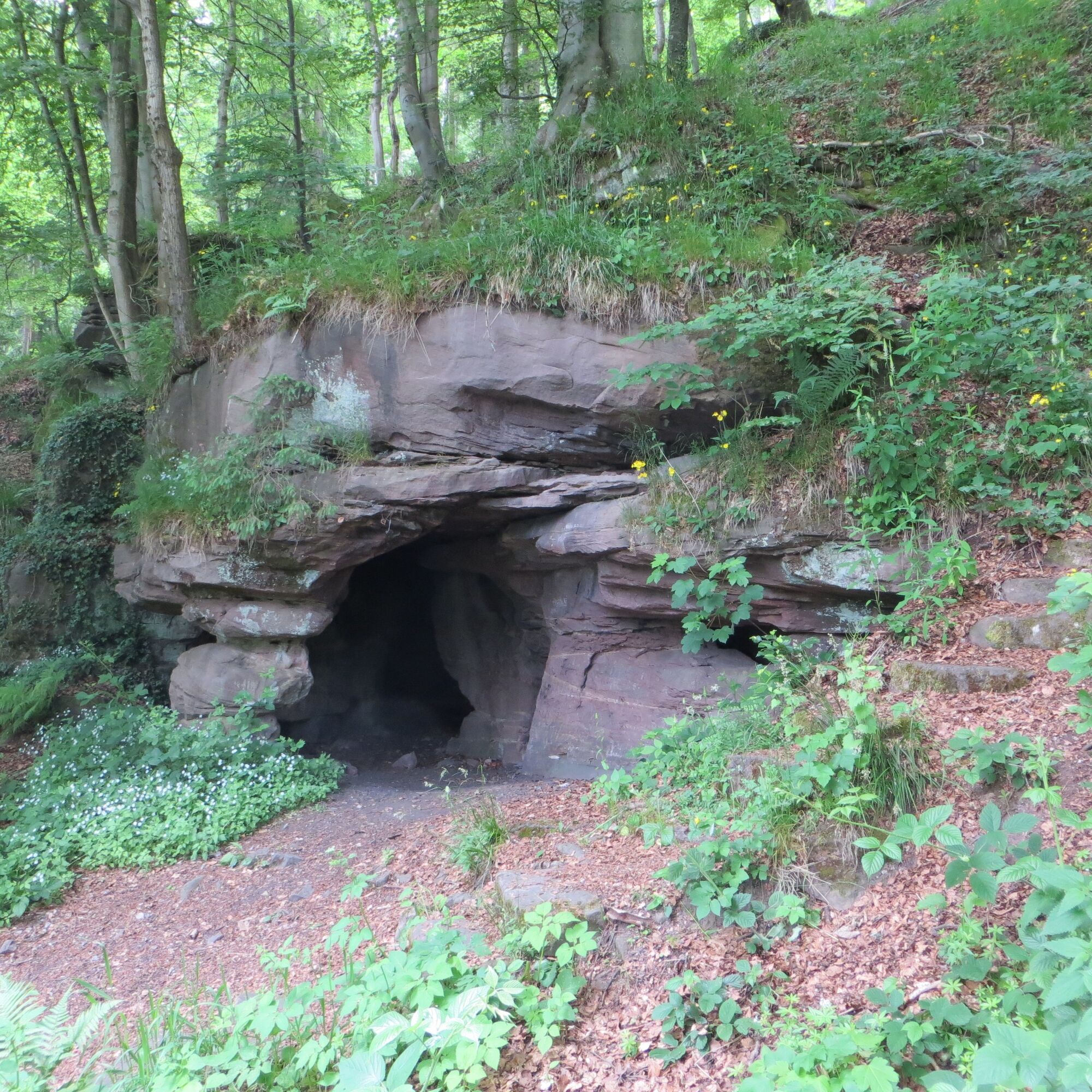
Then it goes uphill briefly again, before reaching the Bruderhöhle cave by a wide right bend. Some narrow stair steps lead us through the colored sandstone formations to the entrance of the approximately 12 m long cave. It is said that monks of Hirsau Monastery sought refuge in the cave in times of war – hence the name of the cave.
After our exploration tour through the rock formation, we walk downhill, leave the forest and reach the first houses of Hirsau. Now it is not far to our starting point.
Tak
Arrival by car:
Motorway A8 from Karlsruhe: exit Pforzheim-West (approx. 30 km); continue via federal highway 463 towards Calw-Hirsau. Motorway A8 from Ulm/Stuttgart: exit Leonberg (approx. 25 km), continue via federal highway 295 towards Weil der Stadt to Calw-Hirsau. Motorway A81 from the south/Lake Constance: exit Gärtringen-Stadtmitte (approx. 20 km), continue via K 1075; near Deckenpfronn at the roundabout take the first exit and continue on B 296 towards Calw. Then continue via federal highway 463 to reach Calw-Hirsau.Plan your arrival by car at www.map24.de
More information is available at www.calw.de/Anreise.
Arrival by train:
Route Pforzheim - Calw - Horb - Tübingen (Kulturbahn). Long-distance train connections (EC, IC, ICE) are best reached in Karlsruhe with connecting trains via Pforzheim (Kulturbahn). If arriving via Stuttgart, we recommend further travel with the S-Bahn S6 Stuttgart - Weil der Stadt, changing to bus line 670 to Calw. From ZOB Calw (central bus station) take the Kulturbahn to Calw-Hirsau, stop HirsauPlan your arrival at http://reiseauskunft.bahn.de/bin/query.exe/d
Arrival by bus:
Greater Stuttgart area bus line 670 DB Bahn Regiobus / Volz; (Calw-Weil der Stadt) connection to S6 Area Böblingen / Sindelfingen:Bus line 763 DB Bahn Regiobus; Calw-Böblingen (connection to S1) From the central bus station Calw (ZOB) you can reach Hirsau with bus lines 670, 680 or 820, stops St. Aurelius or Kloster. You can also reach Hirsau with the Kulturbahn from ZOB Calw, exit: Hirsau stop.
Plan your arrival at www.efa-bw.de
Other parking options:
Parking lot at Hirsau gym, Alte Kuranlagen Parking lot at Hirsau train stationIn Hirsau, be sure to visit the monasteries St. Peter and Paul (freely accessible) and St. Aurelius as well as the monastery museum (Calwer Straße 6, phone: 07051 59015, opening hours: April to October: Tuesday to Friday 1:00 pm to 4:00 pm, Saturday and Sunday 12:00 pm to 5:00 pm).


Kamery internetowe z trasy

Popularne wycieczki w okolicy
-
5,0
Wild romantic Monbach Valley
światłoWędrówka 6,25 km -
4,9
Der Teinacher (Premiumweg & Genießerpfad)
średniWędrówka 12,0 km -
4,0
Wolfsschlucht and Fox Gorge
średniWędrówka 9,74 km -
5,0
Water, Woods and Meadowtrail / Zavelstein > Calw (Premium trail & Genussweg)
ciężkiWędrówka 14,4 km -
5,0
AugenBlick route Bad Teinach-Zavelstein Zettelberg
ciężkiWędrówka 15,5 km -
5,0
GeoTour Wildberg through the picturesque Lützenschlucht
ciężkiWędrówka 2,80 km -
4,0
Circular route Hirsau - Oberreichenbach - Schweinbachtal - Hirsau
średniWędrówka 10,2 km -
4,5
Waldeck ruins and the largest water wheel in Europe
średniWędrówka 15,4 km -
4,0
Through the Lengenbach valley to the historic Burg Liebenzell
średniWędrówka 10,9 km -
5,0
From Altburg over scenic heights to Zavelstein
średniWędrówka 10,6 km

Wędrówki i tropienie


Nie przegap ofert i inspiracji na następne wakacje
Twój adres e-mail została dodana do listy mailingowej.





