


Ravenstein-Round
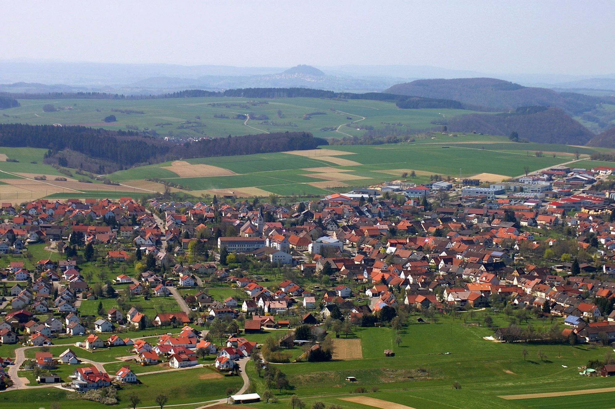
Böhmenkirch, with its villages Treffelhausen, Steinenkirch & Schnittlingen, offers leisure activities and much more.
Relax and unwind in unspoiled nature and forget about everyday life - this is possible...
Relax and unwind in unspoiled nature and forget about everyday life - this is possible in Böhmenkirch. Here you will find a landscape of forests, open heights, wild and romantic valleys, nature and landscape conservation areas, which you can explore on foot or by bike on numerous marked trails.
In winter, well-groomed and marked cross-country ski trails criss-cross the densely wooded landscape. Skiers and snowboarders will find the best conditions at our ski lifts in Treffelhausen and Schnittlingen. Our cozy inns, cafés and well-run restaurants provide for your physical well-being after the sport.
The Ravenstein circuit is a varied hike with impressive views and exciting natural and cultural highlights. The starting point is Steinenkirch, from where the tour first leads across the Alb plateau. A particular highlight is the wild and romantic Magental valley with its steep slopes, dense forests and natural paths.
Böhmenkirch town hall
Hauptstraße 100 | 89558 Böhmenkirch
07332 9600-0 | gemeinde@boehmenkirch.de | www.boehmenkirch.de

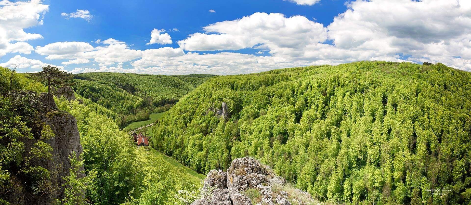
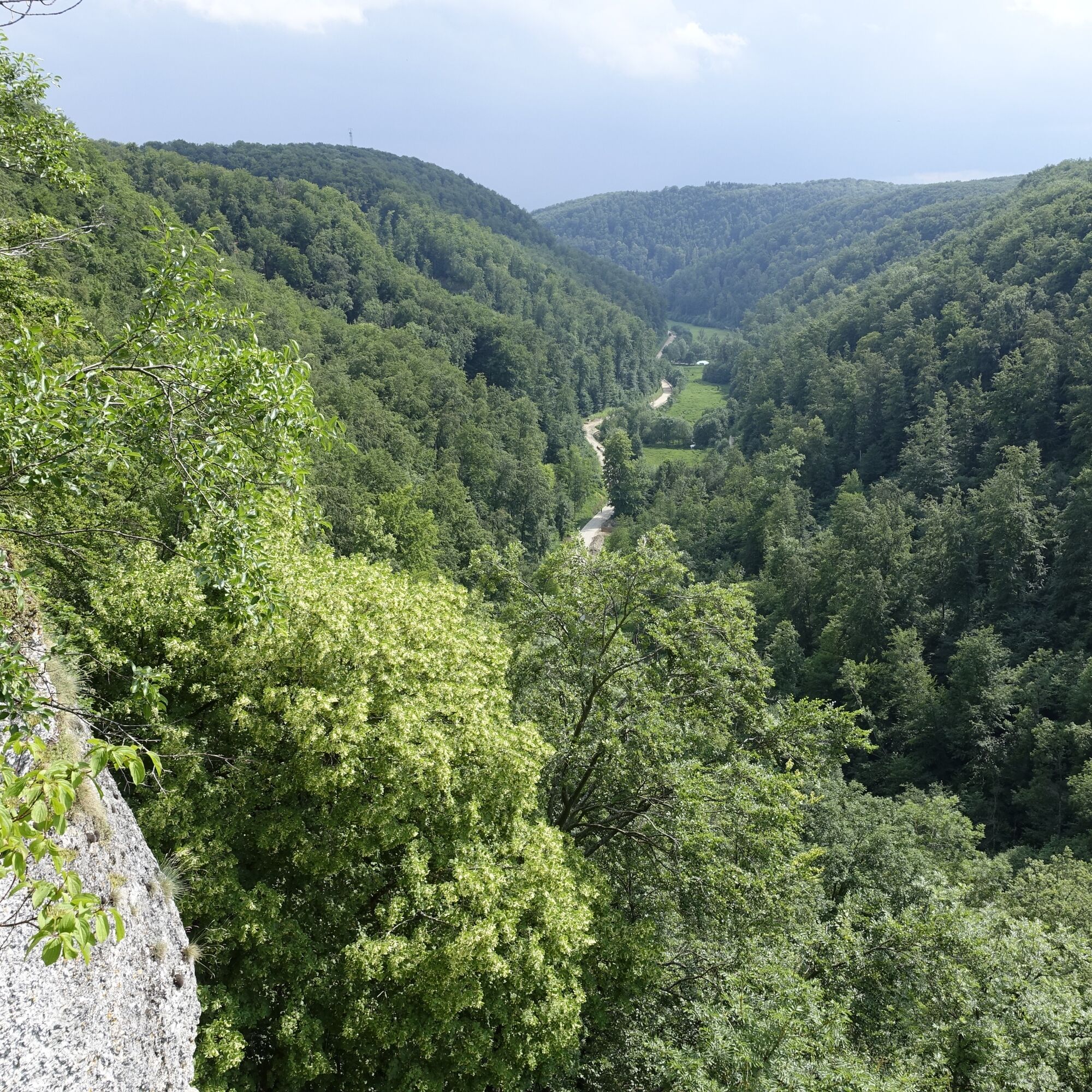
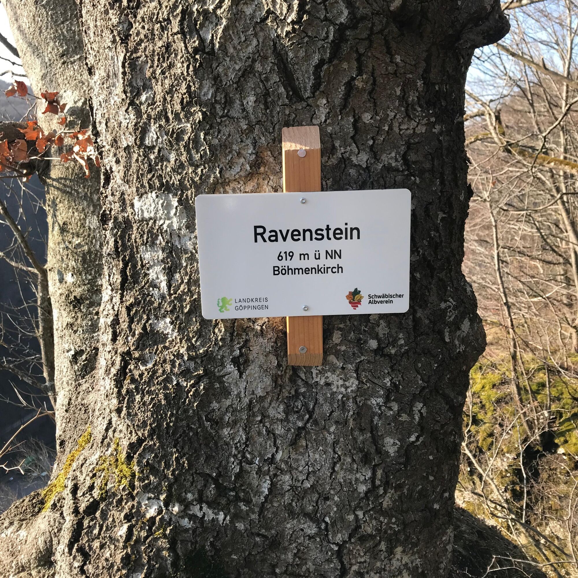
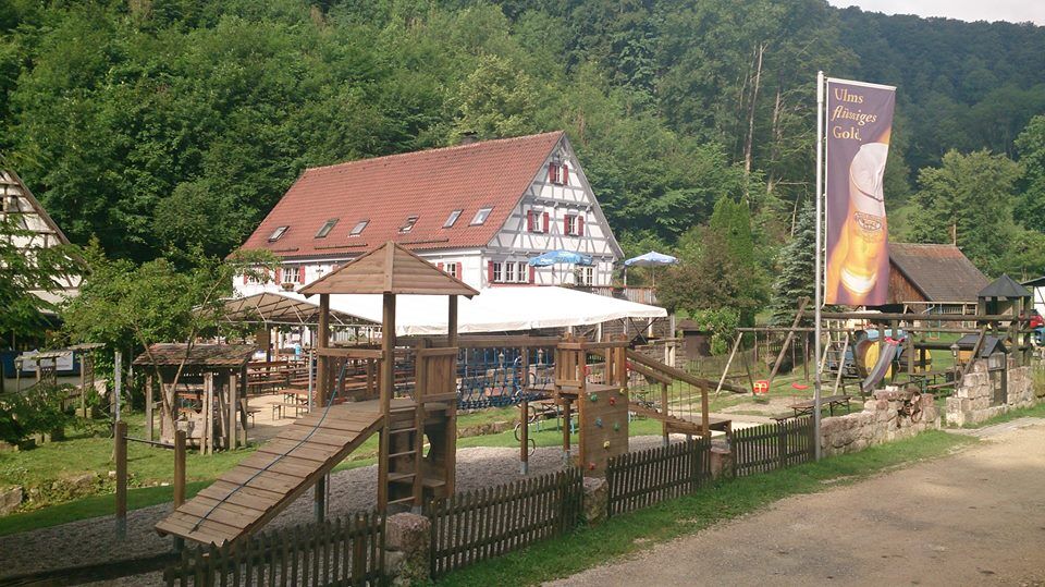
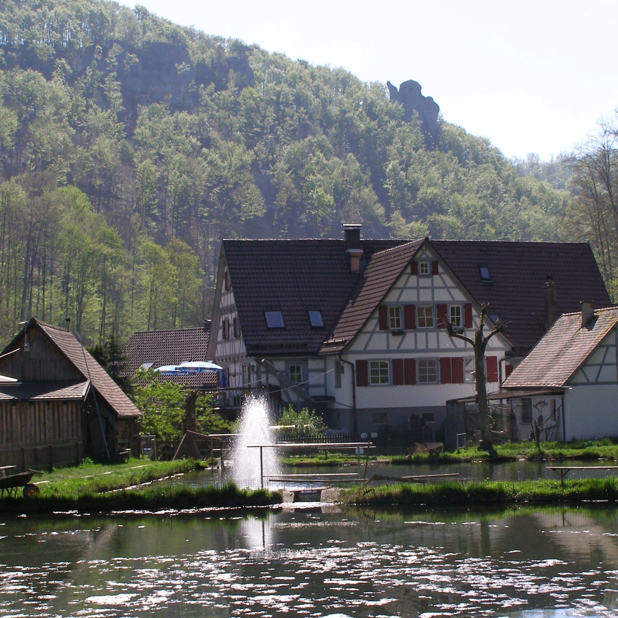
After our start in Steinenkirch, we soon reach the small hamlet of Ravenstein. From there, it is worth making a detour to the former Ravenstein Castle with a fantastic view over the Roggental valley. Ravenstein Castle was first mentioned in documents in 1191. Today, only moss-covered ramparts are still visible, which were probably once high defensive walls. The descent into the Roggen valley is short and crisp. We soon pass the legendary Mordloch, the entrance to the fourth longest cave in Baden-Württemberg at 4.3 kilometers. We also recommend a stop at the Obere Roggenmühle with its fish farm and traditional restaurant. The route then continues through the wild and romantic Magental valley back up the Alb to Steinenkirch. Here, too, you can enjoy a delicious meal at the Landgasthof Rössle.
Tak
Sturdy hiking boots recommended, optional hiking poles. Bring weather-appropriate clothing and sufficient water and food.
Sure-footedness required, especially in wet conditions. Watch out for falling branches in the Magental valley. Take care on rocky and steeper passages.
You can find the district timetable at: www.vvs.de/fahrplan
Parking lot at Landgasthof Rössle
Parking lot at the Steinenkirch cemetery
Parking lot near the Roggenmühle
Code of conduct:
Respect trail closures and the quiet zones developed in the leisure trail concept. Leave no traces such as garbage and animal droppings, treat your path with care. Act with foresight and consideration. Adapt your behavior to the situation at hand. Safety first. Respect other users of the forest and meadows. Be considerate of animals and plants. Plan ahead and make the most of daylight. Try to avoid dusk in the morning and evening. Observe the ban on entering agricultural land during the growing season. Stay on the designated paths and avoid the edges of the forest so that wild animals can get used to people better.More information at ruecksicht-macht-wege-breiter.de
The fourth longest cave in Baden-Württemberg, the Mordloch, is located in the upper Roggen valley. The Mordloch carries water and can only be fully explored by experienced scuba divers and explorers. The Obere Roggenmühle can be reached directly after the Mordloch. The water flowing out of the murder hole was used in the mill to grind grain. The mill ceased operation in 1917. Today, the fresh spring water is used for trout fish farming.

Popularne wycieczki w okolicy
- 4,5
Löwenpfad "Orchideenpfad" - Herbs, Pasqueflower and Juniper Heathlands
średniWędrówka 9,33 km - 5,0
Löwenpfad "Heldentour" - The king stage of the Löwenpfade
ciężkiWędrówka 23,6 km - 4,4
Löwenpfad "Geislinger Felsen-Tour" - up and down through the Eybach valley
średniWędrówka 10,8 km - 4,5
Löwenpfad "Weitblick-Tour" - High up and far-reaching view
ciężkiWędrówka 12,0 km - 4,7
Löwenpfad "Filstalgucker" - views from the heart of the Filstal valley
średniWędrówka 13,0 km - 3,7
Löwenpfad "Wasserberg-Runde" - pure panorama and typical Swabian Jura landscapes
ciężkiWędrówka 12,0 km - 3,5
Lion trail "Messelberg tour" - hiking with impressive views
średniWędrówka 7,72 km - 4,3
Lion Trail "Steigen Tour" - Along the Swabian construction of the century
ciężkiWędrówka 16,1 km - 3,8
Lion trail "Ave-Weg" - A touch of pilgrimage on the Albtrauf
średniWędrówka 8,65 km - 1,0
Nordalbrunde
średniWędrówka 4,76 km
Wędrówki i tropienie


Nie przegap ofert i inspiracji na następne wakacje
Twój adres e-mail została dodana do listy mailingowej.