Mont CHEVRIER circuit
ciężki
Pobierz tę trasę na swój telefon komórkowy
Mont CHEVRIER circuit
ciężki
Wędrówka
11,55
km
Zeskanuj kod QR i rozpocznij nawigację w aplikacji bergfex.

Wędrówki i tropienie


Mont CHEVRIER circuit
ciężki
Odległość
11,55
km
Czas trwania
03:00
h
Ascent
360
hm
Poziom morza
403 -
742
m
Ścieżka do pobrania
Mont CHEVRIER circuit
ciężki
Wędrówka
11,55
km
Depart from the Château church parking lot in Tarare.
Follow rue des Ayets, then the cemetery, towards Fomblaise. At the crossroads, continue straight ahead. Turn right onto chemin des Voûtes and follow...
Opis
Depart from the Château church parking lot in Tarare.
Follow rue des Ayets, then the cemetery, towards Fomblaise. At the crossroads, continue straight ahead. Turn right onto chemin des Voûtes and follow it to Charpenay. Reach Notre Dame de la Roche either by road or through the woods. Leave the Marian site via the E.S.A.T. workshops towards Beaumangu. Do not take the descent to the farm, but continue along the dirt track on the left.
At Mouillatoux, at the crossroads, turn left through the Bois de la Grande Combe, then down to the Chapelle de Bel-Air.
Return to Tarare on the old, sloping Chemin des Croix (unmarked), which takes you back to your starting point in Rue des Ayets.
Trasa
Église Saint-André
(404 m)
Miejsce kultu
0,0 km
Le Cantubas
(426 m)
Rozliczenie
1,2 km
Chapelle Notre-Dame de la Roche
(754 m)
Miejsce kultu
5,8 km
La Roche
(750 m)
Rozliczenie
6,0 km
Chapelle Notre-Dame-de-Bel-Air
(571 m)
Miejsce kultu
10,7 km
Église Saint-André
(404 m)
Miejsce kultu
11,5 km
Trasa
Mont CHEVRIER circuit
ciężki
Wędrówka
11,55
km
Tarare
(383 m)
Miasto
0,0 km
Église Saint-André
(404 m)
Miejsce kultu
0,0 km
Le Cantubas
(426 m)
Rozliczenie
1,2 km
Fomblaise
(532 m)
Rozliczenie
2,6 km
Le Charpenay
(711 m)
Rozliczenie
5,5 km
Chapelle Notre-Dame de la Roche
(754 m)
Miejsce kultu
5,8 km
La Roche
(750 m)
Rozliczenie
6,0 km
Beaumangu
(634 m)
Rozliczenie
7,1 km
Chapelle Notre-Dame-de-Bel-Air
(571 m)
Miejsce kultu
10,7 km
Tarare
(383 m)
Miasto
11,5 km
Église Saint-André
(404 m)
Miejsce kultu
11,5 km
Udostępnij trasę
Mont CHEVRIER circuit
ciężki
Wędrówka
11,55
km
Błąd
Wystąpił błąd. Spróbuj ponownie.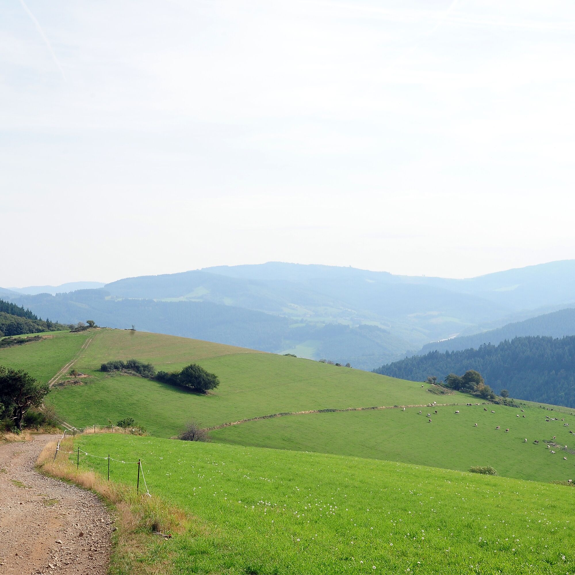
Nie ma jeszcze recenzji
Popularne wycieczki w okolicy
The forest of Flachère - Beaujolais - Légny
światłoWędrówka 6,68 kmCircuit de découverte du patrimoine
światłoWędrówka 2,19 kmFrom Oingt to Col du Châtoux - Beaujolais - Oingt - Val d'Oingt
ciężkiWędrówka 15,1 kmDes dégringoules* au vert - Beaujolais - Amplepuis
światłoWędrówka 5,13 kmMała wycieczka po crêt d'Arjoux - Monts du Lyonnais - Saint-Julien-sur-Bibost
światłoWędrówka 4,93 kmThe forest of Brou - Beaujolais - Dième
światłoNordic Walking 10,5 kmMa première nuit étoilée - Beaujolais - Tarare
ciężkiWędrówka 36,5 kmCircuit VTT n°113 rouge : En lisière des communes
ciężkiMountainbike 16,8 kmAround the Lac des Sapins - Beaujolais Vert - Cublize
światłoWędrówka 4,76 kmThe chapel of La Salette - Beaujolais Vert - Joux
ciężkiWędrówka 19,9 km
Wędrówki i tropienie

Ponad 550.000 propozycji wycieczek, szczegółowe mapy i intuicyjny planer tras sprawiają, że aplikacja jest niezbędna dla wszystkich entuzjastów przyrody.

Nie przegap ofert i inspiracji na następne wakacje
Zapisz się do newslettera
Błąd
Wystąpił błąd. Spróbuj ponownie.Dziękujemy za rejestrację
Twój adres e-mail została dodana do listy mailingowej.
Wycieczki po całej Europie
Austria Szwajcaria Niemcy Włochy Słowenię Francja Holandia Belgia Polska Liechtenstein Czechy Słowacja Hiszpania Chorwacja Bośnia i Hercegowina Luksemburg Andorra Portugalia Islandia Wielka Brytania Irlandia Grecja Albania Macedonia Północna Malta Norwegia Czarnogóra Mołdawia Kosowo Węgry San Marino Rumunia Estonia Łotwa Białoruś Cypr Litwa Serbia Bułgaria Monako Dania Szwecja Finlandia