The chapel of La Salette - Beaujolais Vert - Joux
ciężki
Nawigacja
Nawigacja
Pobierz tę trasę na swój telefon komórkowy
The chapel of La Salette - Beaujolais Vert - Joux
ciężki
Wędrówka
19,90
km
Zeskanuj kod QR i rozpocznij nawigację w aplikacji bergfex.

Wędrówki i tropienie


The chapel of La Salette - Beaujolais Vert - Joux
ciężki
Odległość
19,90
km
Czas trwania
07:00
h
Ascent
692
hm
Poziom morza
472 -
890
m
Ścieżka do pobrania
The chapel of La Salette - Beaujolais Vert - Joux
ciężki
Wędrówka
19,90
km
You'll love:
• A complete, athletic trail, lightly paved with some elevation gain. Before setting off, prepare for a 1.5-2 hour gradual climb to the GR®7. At Moulin Lafay, redouble your efforts to tackle...
Opis
You'll love:
• A complete, athletic trail, lightly paved with some elevation gain. Before setting off, prepare for a 1.5-2 hour gradual climb to the GR®7. At Moulin Lafay, redouble your efforts to tackle the last, steepest kilometers.
• The beauty of the landscapes and the wild nature. Around Joux, the Tarare mountains are steep, the mountain uninhabited. Here, the forest, the sound of rivers, and birdsong reign.
• The Saint-Cyr-de-Valorges pond, nestled on the edge of the woods.
• Two great panoramas: around Croix Armide, where the landscape runs from east to west, with the Alps on one side and the Forez on the other. Further on, from the chapel, admire the plunging view of Joux.
You'll enjoy it best:
• In any season. The mountain views are most admirable in winter, when the mountains emerge from the sea of clouds under pure blue skies. Bring binoculars!
• Outside of the warmer months, the GR®7 is windy. Wear suitable clothing and footwear for trekking on stony and muddy paths in places.
• Sit down at a picnic table by the Saint-Cyr pond or in the picnic area for a midday snack. Save dessert for a relaxing break on the way back to the chapel.
• While strolling through Joux, discovering its unusual heritage.
A bit of culture:
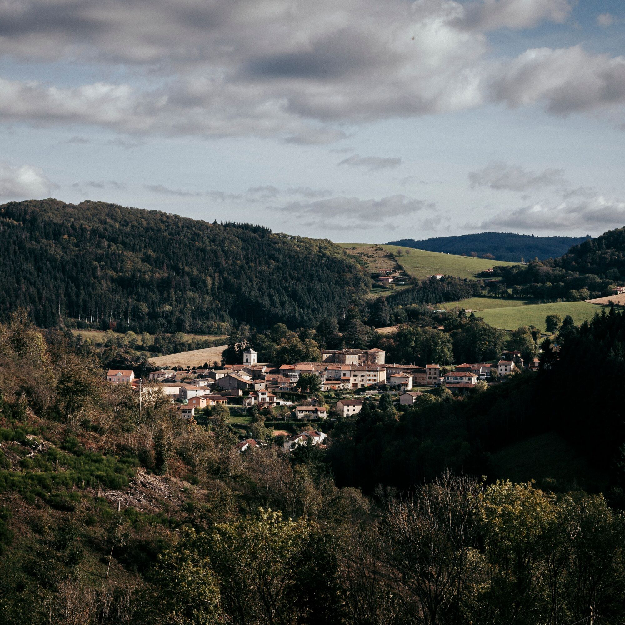
Joux seen from the Notre-Dame-de-la-Salette chapel
The building has watched over the village for nearly 150 years. Research conducted by the conservation association created for its preservation reveals that it was built to protect soldiers engaged in the Franco-German conflict of 1870.
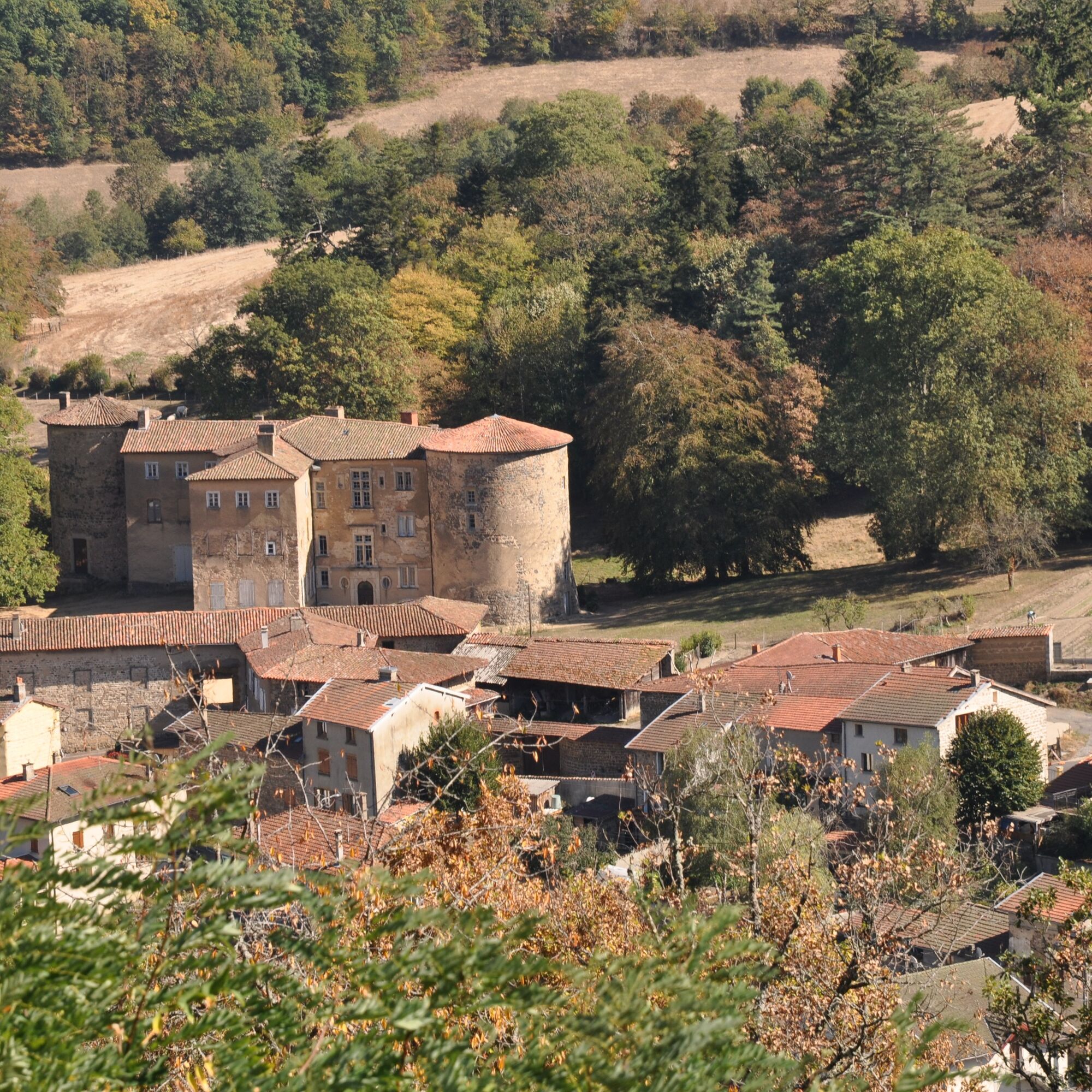
From the chapel, the view sweeps over the village and is drawn towards the dam and the castle. One can also see the unique layout of Joux, which was surrounded by a rampart walk in the Middle Ages.
The castle is best admired from the exterior as it is privately owned. The first mention of its existence dates back to the 11th century. Since its origins, it has belonged to two families and has always been inhabited. Located off-center from the village, the dam is a reminder of the once-prosperous textile industry in theTurdine Valley. It supplied the factories with water. With very little limestone, this water is now used, in particular, for brewing beers.
• A complete, athletic trail, lightly paved with some elevation gain. Before setting off, prepare for a 1.5-2 hour gradual climb to the GR®7. At Moulin Lafay, redouble your efforts to tackle the last, steepest kilometers.
• The beauty of the landscapes and the wild nature. Around Joux, the Tarare mountains are steep, the mountain uninhabited. Here, the forest, the sound of rivers, and birdsong reign.
• The Saint-Cyr-de-Valorges pond, nestled on the edge of the woods.
• Two great panoramas: around Croix Armide, where the landscape runs from east to west, with the Alps on one side and the Forez on the other. Further on, from the chapel, admire the plunging view of Joux.
You'll enjoy it best:
• In any season. The mountain views are most admirable in winter, when the mountains emerge from the sea of clouds under pure blue skies. Bring binoculars!
• Outside of the warmer months, the GR®7 is windy. Wear suitable clothing and footwear for trekking on stony and muddy paths in places.
• Sit down at a picnic table by the Saint-Cyr pond or in the picnic area for a midday snack. Save dessert for a relaxing break on the way back to the chapel.
• While strolling through Joux, discovering its unusual heritage.
A bit of culture:
Joux seen from the Notre-Dame-de-la-Salette chapel
The building has watched over the village for nearly 150 years. Research conducted by the conservation association created for its preservation reveals that it was built to protect soldiers engaged in the Franco-German conflict of 1870.
From the chapel, the view sweeps over the village and is drawn towards the dam and the castle. One can also see the unique layout of Joux, which was surrounded by a rampart walk in the Middle Ages.
The castle is best admired from the exterior as it is privately owned. The first mention of its existence dates back to the 11th century. Since its origins, it has belonged to two families and has always been inhabited. Located off-center from the village, the dam is a reminder of the once-prosperous textile industry in theTurdine Valley. It supplied the factories with water. With very little limestone, this water is now used, in particular, for brewing beers.
Trasa
Le Tilia
(519 m)
Restauracja
0,4 km
Église de l'Assomption
(520 m)
Miejsce kultu
0,4 km
Joux
(510 m)
Wioska
0,6 km
La Salette
(606 m)
Korytarz/teren
18,2 km
Chapelle Notre-Dame de la Salette
(605 m)
Miejsce kultu
18,3 km
Joux
(510 m)
Wioska
19,2 km
Église de l'Assomption
(520 m)
Miejsce kultu
19,5 km
Trasa
The chapel of La Salette - Beaujolais Vert - Joux
ciężki
Wędrówka
19,90
km
Le Tilia
(519 m)
Restauracja
0,4 km
Église de l'Assomption
(520 m)
Miejsce kultu
0,4 km
Joux
(510 m)
Wioska
0,6 km
La Voisinée Marsande
(563 m)
Rozliczenie
1,3 km
La Salette
(606 m)
Korytarz/teren
18,2 km
Chapelle Notre-Dame de la Salette
(605 m)
Miejsce kultu
18,3 km
Joux
(510 m)
Wioska
19,2 km
Église de l'Assomption
(520 m)
Miejsce kultu
19,5 km
Le Tilia
(519 m)
Restauracja
19,5 km
Autor
Dostarczone przez Rhône Tourisme
Wycieczkę The chapel of La Salette - Beaujolais Vert - Joux zapewnia outdooractive.com.

Nie ma jeszcze recenzji
Popularne wycieczki w okolicy
Circuit de découverte du patrimoine
światłoWędrówka 2,19 kmDes dégringoules* au vert - Beaujolais - Amplepuis
światłoWędrówka 5,13 kmMała wycieczka po crêt d'Arjoux - Monts du Lyonnais - Saint-Julien-sur-Bibost
światłoWędrówka 4,93 kmThe forest of Brou - Beaujolais - Dième
światłoNordic Walking 10,5 kmMa première nuit étoilée - Beaujolais - Tarare
ciężkiWędrówka 36,5 kmCircuit VTT n°113 rouge : En lisière des communes
ciężkiMountainbike 16,8 kmAround the Lac des Sapins - Beaujolais Vert - Cublize
światłoWędrówka 4,76 kmMonts du Lyonnais - The Chamousset country loop - 2.3
światłoDroga rowerowa 34,9 kmTrail around Lac des Sapins - Beaujolais Vert - Cublize
ciężkiTrailrunning 15,0 kmCircuit VTT n°107 rouge : Les 3 rivières
ciężkiMountainbike 19,1 km
Wędrówki i tropienie

Ponad 550.000 propozycji wycieczek, szczegółowe mapy i intuicyjny planer tras sprawiają, że aplikacja jest niezbędna dla wszystkich entuzjastów przyrody.

Nie przegap ofert i inspiracji na następne wakacje
Zapisz się do newslettera
Błąd
Wystąpił błąd. Spróbuj ponownie.Dziękujemy za rejestrację
Twój adres e-mail została dodana do listy mailingowej.
Wycieczki po całej Europie
Austria Szwajcaria Niemcy Włochy Słowenię Francja Holandia Belgia Polska Liechtenstein Czechy Słowacja Hiszpania Chorwacja Bośnia i Hercegowina Luksemburg Andorra Portugalia Islandia Wielka Brytania Irlandia Grecja Albania Macedonia Północna Malta Norwegia Czarnogóra Mołdawia Kosowo Węgry San Marino Rumunia Estonia Łotwa Białoruś Cypr Litwa Serbia Bułgaria Monako Dania Szwecja Finlandia