
MTB Route 213 - The Roman Aqueduct of the Gier
ciężki
Pobierz tę trasę na swój telefon komórkowy
MTB Route 213 - The Roman Aqueduct of the Gier
ciężki
Mountainbike
23,08
km
Zeskanuj kod QR i rozpocznij nawigację w aplikacji bergfex.


Wędrówki i tropienie





MTB Route 213 - The Roman Aqueduct of the Gier
ciężki
Odległość
23,1
km
Czas trwania
02:18
h
Ascent
361
hm
Poziom morza
214 -
330
m
Ścieżka do pobrania
MTB Route 213 - The Roman Aqueduct of the Gier
ciężki
Mountainbike
23,08
km
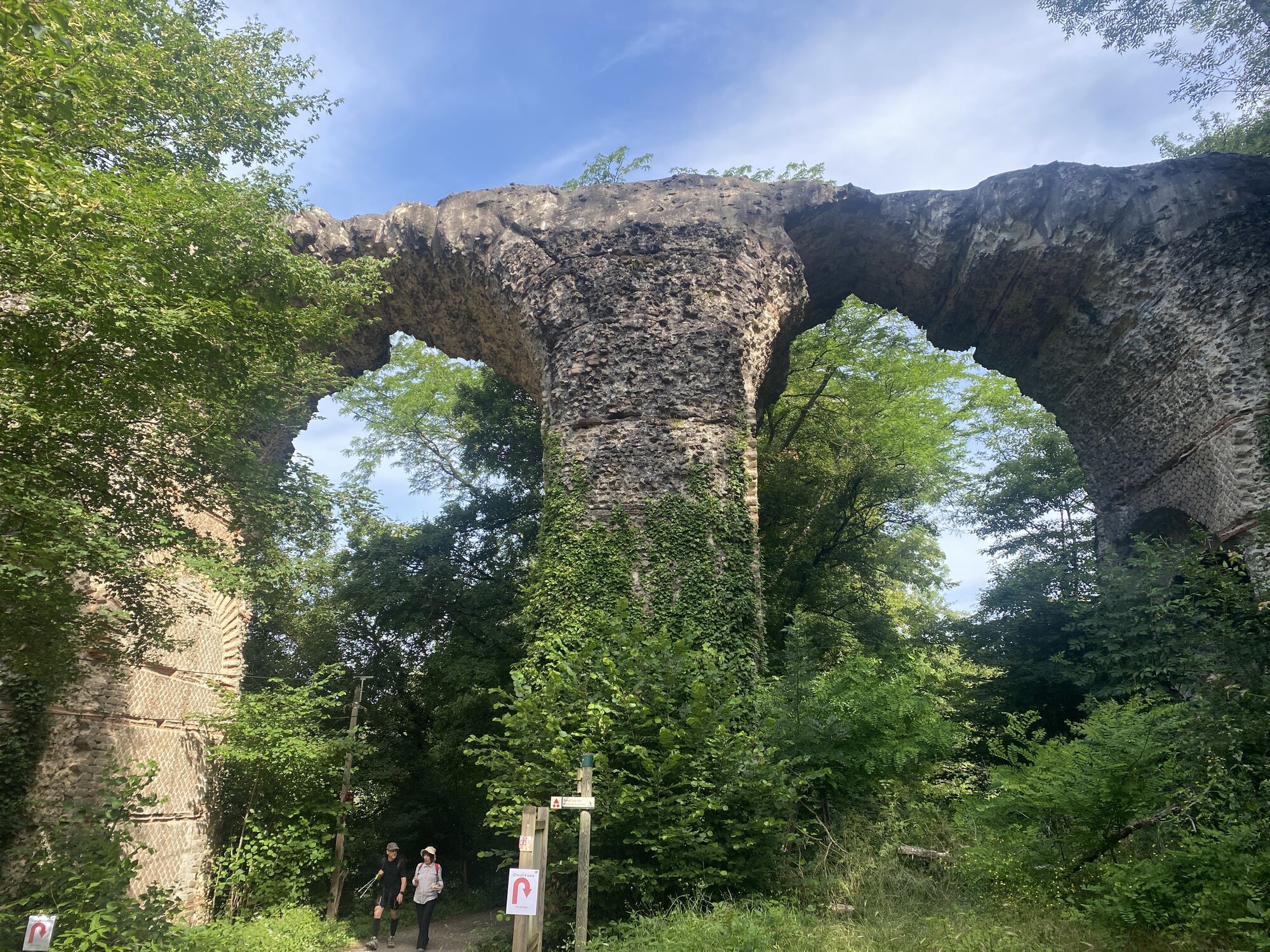
The Aqueduct of the Gier is one of the four aqueducts that supplied water to Lugdunum. Drawing water from the Gier at Saint-Chamond, it transported it for 86 km to Fourvière. On your return to Chaponost,...
Opis
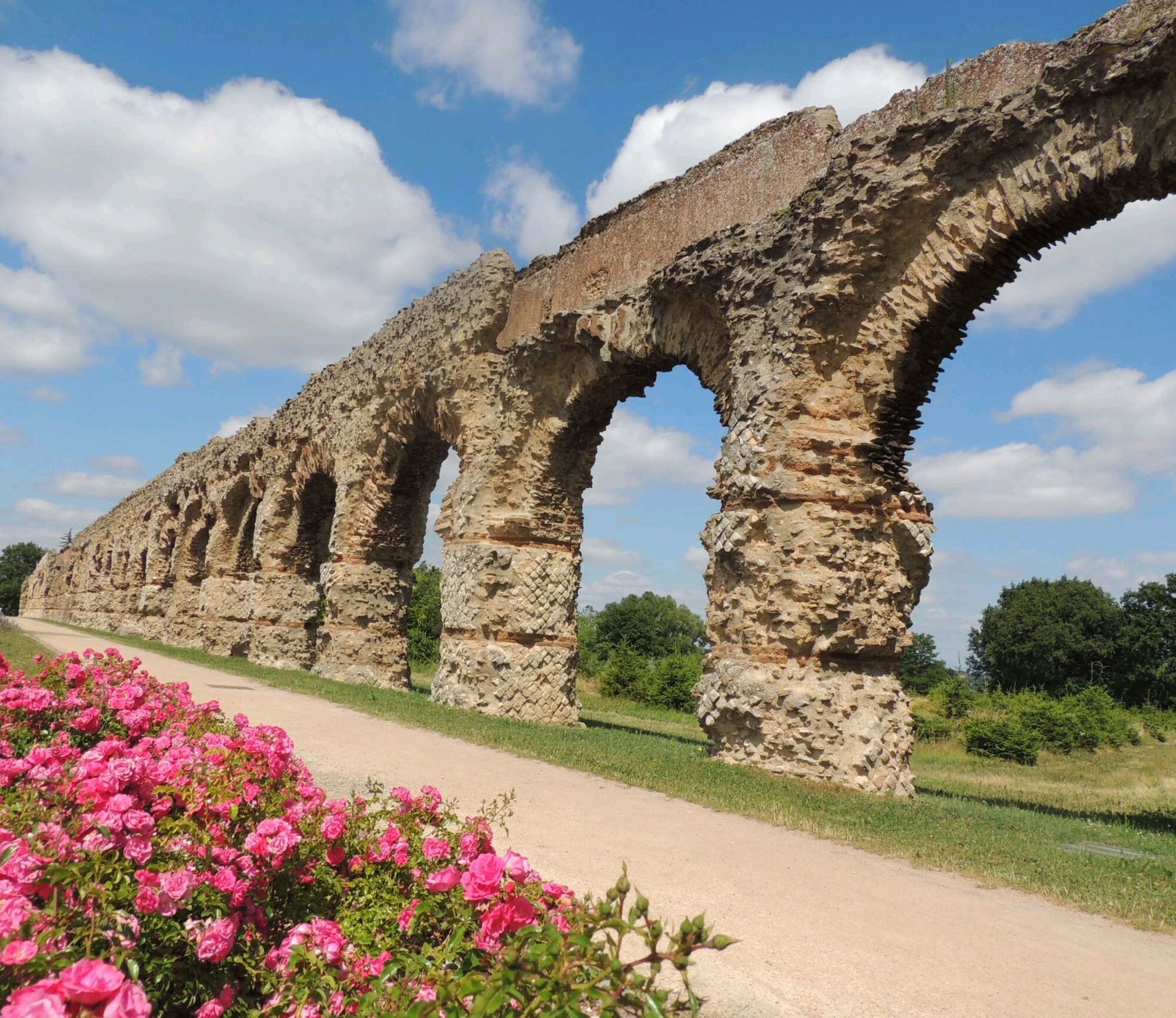
The Aqueduct of the Gier is one of the four aqueducts that supplied water to Lugdunum. Drawing water from the Gier at Saint-Chamond, it transported it for 86 km to Fourvière. On your return to Chaponost, after crossing the Boulard Park and passing along its pond, you will enjoy a very nice view of the village and the Monts du Lyonnais.
Trasa
Chaponost
(289 m)
Wioska
0,2 km
Oullins
(189 m)
Miasto
3,4 km
Chaponost
(289 m)
Wioska
6,6 km
Le Milon
(309 m)
Rozliczenie
10,3 km
L'Archet
(312 m)
Korytarz/teren
16,5 km
Brignais
(206 m)
Miasto
17,5 km
Chaponost
(289 m)
Wioska
23,0 km
Trasa
MTB Route 213 - The Roman Aqueduct of the Gier
ciężki
Mountainbike
23,08
km
Chaponost
(289 m)
Wioska
0,2 km
Le Boulard
(289 m)
Korytarz/teren
0,4 km
Oullins
(189 m)
Miasto
3,4 km
Francheville
(245 m)
Miasto
5,1 km
Auberge des Aqueducs
(309 m)
Restauracja
5,4 km
Chaponost
(289 m)
Wioska
6,6 km
Le Milon
(309 m)
Rozliczenie
10,3 km
L'Archet
(312 m)
Korytarz/teren
16,5 km
Brignais
(206 m)
Miasto
17,5 km
Chaponost
(289 m)
Wioska
23,0 km
Autor
Dostarczone przez Monts du Lyonnais
Wycieczkę MTB Route 213 - The Roman Aqueduct of the Gier zapewnia outdooractive.com.

Dodatkowe informacje i wskazówki
Dodatkowe informacje
Adapt your equipment and the choice of the route according to your level and the weather. Do not leave the paths.
Pump to inflate your bike tires available for self-service, at the 8 May 1945 square (below the media library, at the corner of Etienne Gros street and Maréchal Joffre avenue).
Pump to inflate your bike tires available for self-service, at the 8 May 1945 square (below the media library, at the corner of Etienne Gros street and Maréchal Joffre avenue).
Nie ma jeszcze recenzji
Popularne wycieczki w okolicy
-
5,0
Walk to the Garon siphon bridge of the Roman Aqueduct of Gier
światłoWędrówka 6,08 km -
The Signal - Monts du Lyonnais - Saint-André-la Côte
światłoWędrówka 14,5 km -
Roman Gier Aqueduct path
ciężkiWędrówka 44,4 km -
Wine trails at the heart of the vineyards
światłoWędrówka 4,92 km -
The Tacot, ephemeral journey
światłoTrasa tematyczna 1,91 km -
Health-sport hike: the Croix Forest bridge
światłoWędrówka 9,78 km -
Walking towards the Aqueduct of Gier - Monts du Lyonnais - Chaponost
światłoWędrówka 8,25 km -
Let's walk in the woods - Monts du Lyonnais - Pollionnay
światłoWędrówka 12,6 km -
Family hike "In the heart of the orchards"
światłoWędrówka 4,04 km -
Route around the Tourette
światłoWędrówka 10,6 km
Wędrówki i tropienie

Ponad 550.000 propozycji wycieczek, szczegółowe mapy i intuicyjny planer tras sprawiają, że aplikacja jest niezbędna dla wszystkich entuzjastów przyrody.

Nie przegap ofert i inspiracji na następne wakacje
Zapisz się do newslettera
Błąd
Wystąpił błąd. Spróbuj ponownie.
Dziękujemy za rejestrację
Twój adres e-mail została dodana do listy mailingowej.
Wycieczki po całej Europie
Austria
Szwajcaria
Niemcy
Włochy
Słowenię
Francja
Holandia
Belgia
Polska
Liechtenstein
Czechy
Słowacja
Hiszpania
Chorwacja
Bośnia i Hercegowina
Luksemburg
Andorra
Portugalia
Islandia
Wielka Brytania
Irlandia
Grecja
Albania
Macedonia Północna
Malta
Norwegia
Czarnogóra
Mołdawia
Kosowo
Węgry
San Marino
Rumunia
Estonia
Łotwa
Białoruś
Cypr
Litwa
Serbia
Bułgaria
Monako
Dania
Szwecja
Finlandia





