


From Saillon to Ovronnaz
Poziom trudności: T2
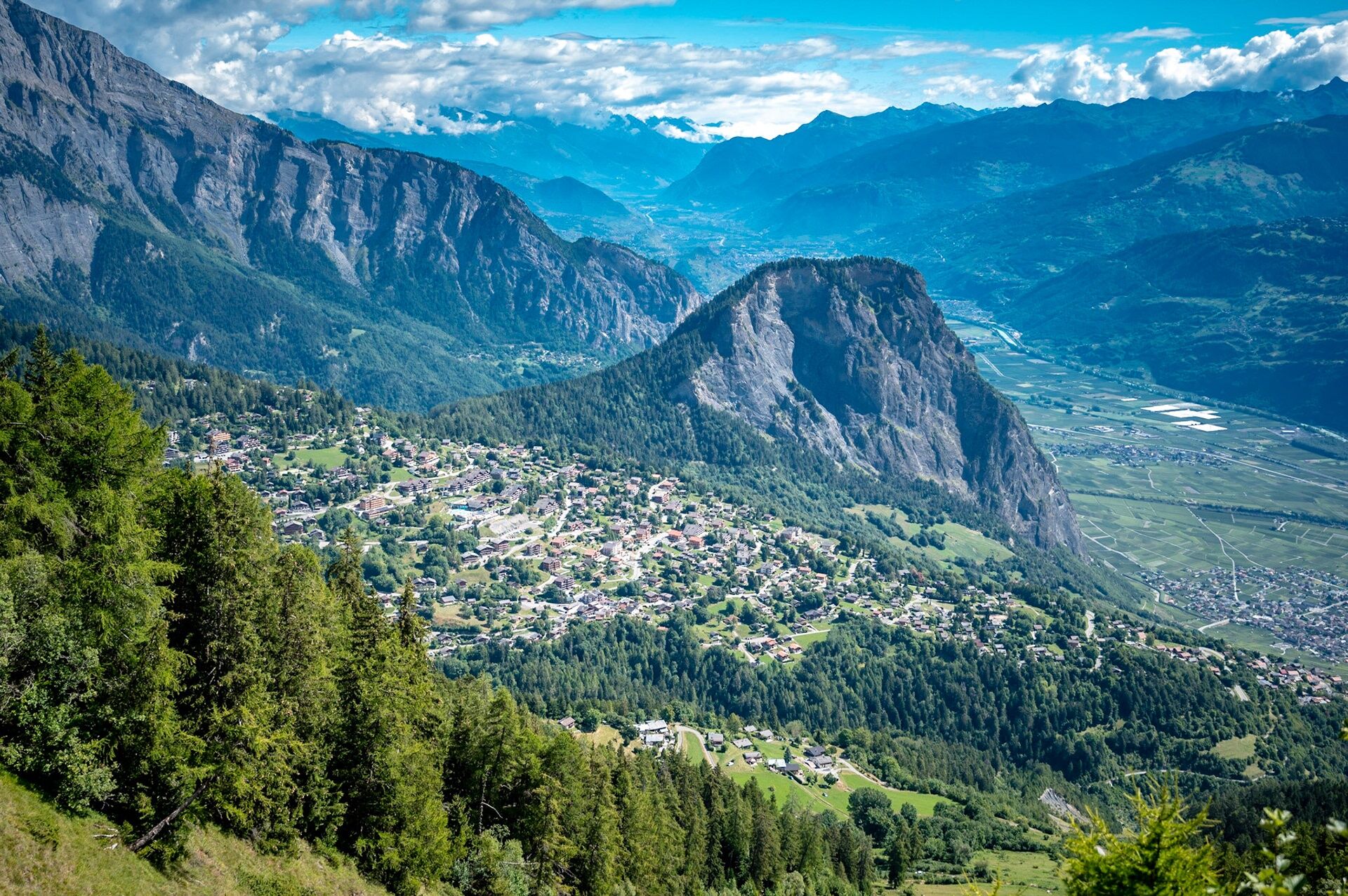
Ovronnaz is the closest mountain resort to Saillon. This resort is located in the municipality of Leytron, with which we share the famous Passerelle at Farinet.
From Saillon, you cross the medieval town,...
Ovronnaz is the closest mountain resort to Saillon. This resort is located in the municipality of Leytron, with which we share the famous Passerelle at Farinet.
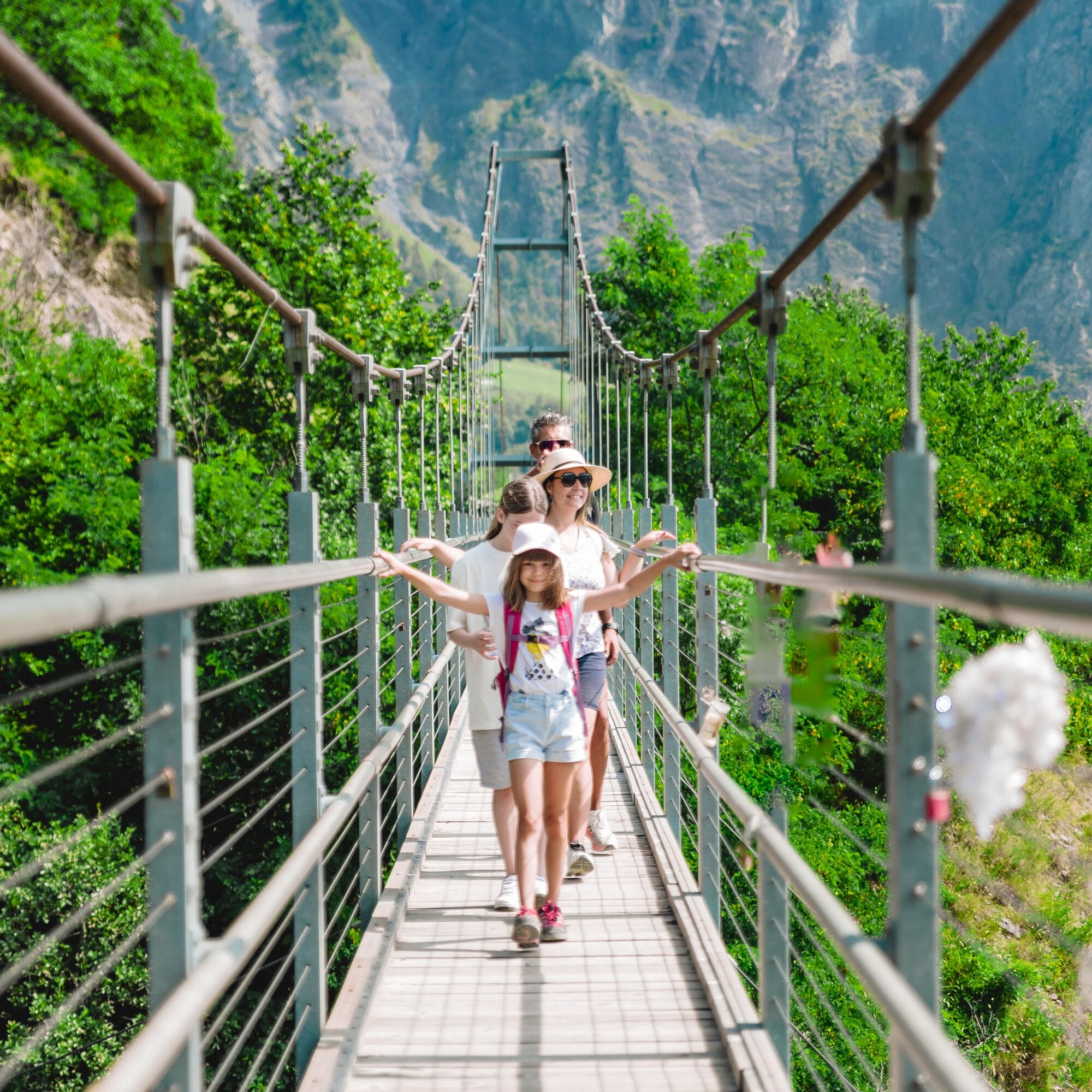
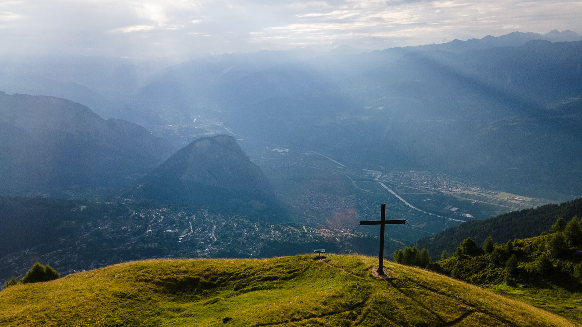
From Saillon, you cross the medieval town, elected the most beautiful town in Switzerland in 2023, then you follow a path through the vineyard leading you to the Passerelle at Farinet (more details here). This footbridge, suspended 136m high, offers an impressive view of the Salentze gorges and the Rhône plain. Picnic spots are available next to the Passerelle.
For the second part of the ascent, you pass through the hamlet "Les Places" and the village of Dugny until you find a peaceful path in the forest along the Salentze to the Ovronnaz resort. You can then descend back by post bus to Saillon.

Follow the route from Saillon to the Passerelle at Farinet (route here).
After the footbridge, continue on the flat path to the hamlet "Les Places." Where there are some parking spots, turn left and follow the road towards Dugny. Follow the Ovronnaz road, then take the left onto the Scie road and just after the bridge, take the trail that enters the forest which you follow to the Chou road leading you into the resort.
When you arrive at the resort, join the Bains road to take the post bus at the stop "Ovronnaz, Centre thermal Melley" (bus 312). You will need to change buses at the stop "Leytron ancienne poste" (bus 311 towards Martigny).
We recommend:
Good shoes Weather-appropriate clothing: always have a waterproof jacket Hat or cap Sunscreen Bottle of water Picnic Camera Walking sticks (optional) Binoculars (optional) Printed version of the route (click "print" to download)Prepare your hike: https://www.valais.ch/fr/activites/randonnee/preparer-sa-randonnee
Using the routes and information on this website is the responsibility of each hiker. On-site conditions may cause route changes. Valais/Wallis Promotion declines all responsibility for the accuracy and completeness of the website's information.
For all hikes:
Carry a map. Download the full route description with a large-scale map by clicking the "print" icon at the top right of the page. Only use marked trails and observe all signposts – for your safety, to protect livestock, and not to disturb wildlife. Close gates after passing through. Be respectful of other users, as well as plants and animals.For mountain hikes
Be especially careful to protect yourself from the sun at altitude. UV rays can be very strong, even when cloudy. Plan your hike carefully: consider each participant’s physical level, weather forecasts, and the season. Weather can change quickly and unexpectedly in the mountains. It is essential to have appropriate clothing and sufficient food and water supplies. In uncertain weather, turn back in time.Prepare your hike https://www.valais.ch/fr/activites/randonnee/preparer-sa-randonnee
Follow the A9 motorway and take exit 23 (Saxon) from Martigny, or 24 (Riddes) from Brigue, then drive towards Saillon.
Take bus 311 from Sion CFF or Martigny CFF or Riddes CFF to the Saillon Collombeyres stop. Place Farinet is 2 minutes on foot from the stop.
Park your vehicle in the free parking at Place Farinet located at the foot of the town, or in the Parking des Remparts located in the town.
T2
Learn more about the destination: Saillon (website)
Enjoy discovering the Ovronnaz resort upon your arrival. More information: link to their website.
Kamery internetowe z trasy

Popularne wycieczki w okolicy
-
5,0
From Saillon to the Farinet suspension bridge
średniWędrówka 7,86 km -
From Savoleyres to the mountain lake Lac des Vaux
średniWędrówka 14,0 km -
4,5
Cleuson Dam
średniWędrówka 11,5 km -
4,0
Tripon - Brac – Ancien Bisse du Torrent Neuf – St. Marguerite – Torrent Neuf – Prafirmin - St. Germain
światłoWędrówka 12,9 km -
Tour du Grand Chavalard
średniWędrówka 14,9 km -
4,5
The Larches of Balavaux
światłoWędrówka 11,0 km -
5,0
Tour de La Seya hike
średniWędrówka 8,09 km -
Via Farinetta
ciężkiVia ferrata 6,41 km -
3,5
The Ahornweg « La Voie des Erables »
ciężkiWędrówka 9,66 km -
4,5
Vineyard terrace hike in Martigny
światłoWędrówka 6,36 km
Wędrówki i tropienie


Nie przegap ofert i inspiracji na następne wakacje
Twój adres e-mail została dodana do listy mailingowej.