


Alte Suon hike Bürchen – Brandalp

The path leads through a larch forest along the Alte Suon. This is a natural water channel originating in Ginals and running through the communities of Unterbäch, Bürchen, and Zeneggen, among others. In...
The path leads through a larch forest along the Alte Suon. This is a natural water channel originating in Ginals and running through the communities of Unterbäch, Bürchen, and Zeneggen, among others. In autumn, the needles of the larch trees change from a rich green to a mixture of yellow, orange, and brown before they eventually fall. This annual golden transformation of the larch forests is a fascinating event.

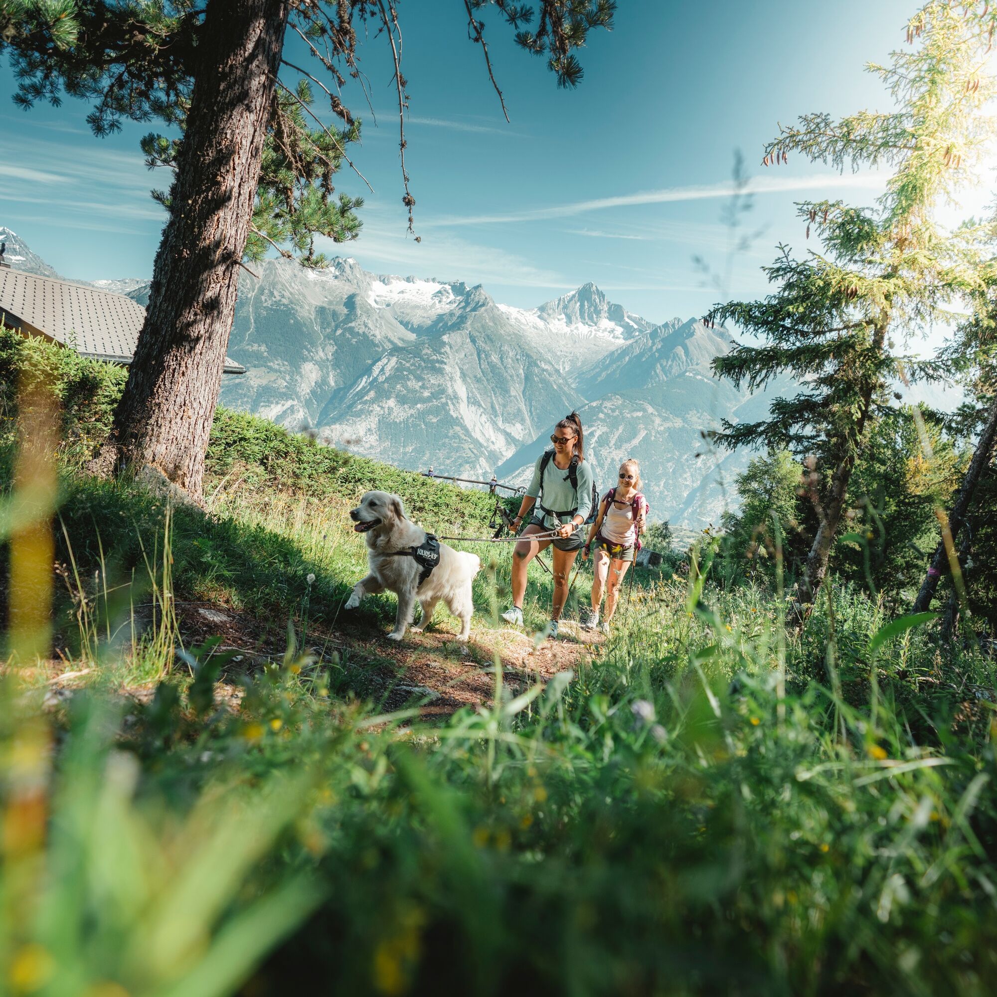
The path connects the two neighboring villages Bürchen and Unterbäch and is accompanied by the Alte Suon. This is an old water channel built centuries ago to irrigate the meadows. The impressive hike begins in Bürchen-Gärlich near the bus stop. You first walk south, then west along a relatively flat path through a larch forest and beside the Alte Suon. The trees present a wonderful sight with their lush green in spring and summer and a mixed colour palette of yellow, orange, and brown in autumn. You pass the Ronalpe, the Waldstafel, and the Gärwerwald, then head north to the mountain station at Brandalp above Unterbäch.
Sturdy footwear, provisions, and water
Coming from Brig, take the A9 towards Lausanne / Sion / Lötschberg. After 3 km, follow Route 9 (signs to Lausanne / Sion). After crossing the river, turn left into Bürchnerstrasse and follow the winding road for about 8.5 km. Then turn left into Lerchboden and follow the road. After about 2.5 km, you reach the destination.
Postbus Visp - Bürchen - Station
There is a parking lot at the bus stop.
Moosalp Tourism
www.moosalpregion.ch
Tel. +41 27 934 17 16 | info@moosalpregion.ch
Unterbäch Tourism
www.unterbaech.ch
Tel. +41 27 934 56 56 | info@unterbaech.ch
The chairlift also brings you easily and conveniently from Brandalp to Unterbäch or vice versa in summer. Please note the corresponding operating times.
Kamery internetowe z trasy
-
Brandalp - Skilift Seefeld
-
Eischoll - Stryggen
-
Moosalp - Bergrestaurant Dorbia
-
Air Zermatt - Station Raron
-
Air Zermatt - Station Raron
-
Brandalp - Skilift Seefeld
-
Brandalp - Skilift Seefeld
-
Brandalp - Skilift Seefeld
-
Brandalp - Skilift Seefeld
-
Air Zermatt - Station Raron
-
Eischoll Dorf
-
Brandalp - Skilift Seefeld
-
Brandalp - Skilift Seefeld
-
Brandalp - Skilift Seefeld
-
Brandalp - Skilift Seefeld
-
Törbel - Chalet Dolores
Popularne wycieczki w okolicy
-
5,0
Moosalp Panoramaweg
światłoWędrówka 6,36 km -
3,8
Höhenweg Saas-Fee - Grächen
Wędrówka 12,0 km -
5,0
Bella-Tola
średniWycieczka wysokogórska 6,72 km -
4,6
Gspon high-altitude route
średniWędrówka 13,9 km -
5,0
Grächen high path
ciężkiWędrówka 17,0 km -
5,0
Panoramaweg Visperterminen
światłoWędrówka 9,72 km -
SUONEN CIRCULAR HIKE GREDETSCHTAL
średniWędrówka 7,45 km -
4,0
NATICHERBERG CIRCULAR TRAIL
średniWędrówka 12,1 km -
Ferden-Niwen-Lauchernalp
ciężkiTrailrunning 19,0 km -
Kinderwanderweg MoosAlbi uns seine Waldtiere
światłoWędrówka 3,50 km
Wędrówki i tropienie


Nie przegap ofert i inspiracji na następne wakacje
Twój adres e-mail została dodana do listy mailingowej.