


Col de Portes de Culet – Mythical Alpine passes
Poziom trudności: 3
The descent of the Portes de Culet pass from Monthey follows the right bank of the "Val d'Illiez" up to Troistorrents. At the height of this village, you gain elevation with several hairpin bends and can...
The descent of the Portes de Culet pass from Monthey follows the right bank of the "Val d'Illiez" up to Troistorrents. At the height of this village, you gain elevation with several hairpin bends and can admire the beautiful church of this small village in the Val d’Illiez. The road then branches right and becomes narrower. It leads you up to the pass summit of Portes de Culet, surrounded by the region's typical alpine meadows. The relaxing atmosphere of this place is simply magical!

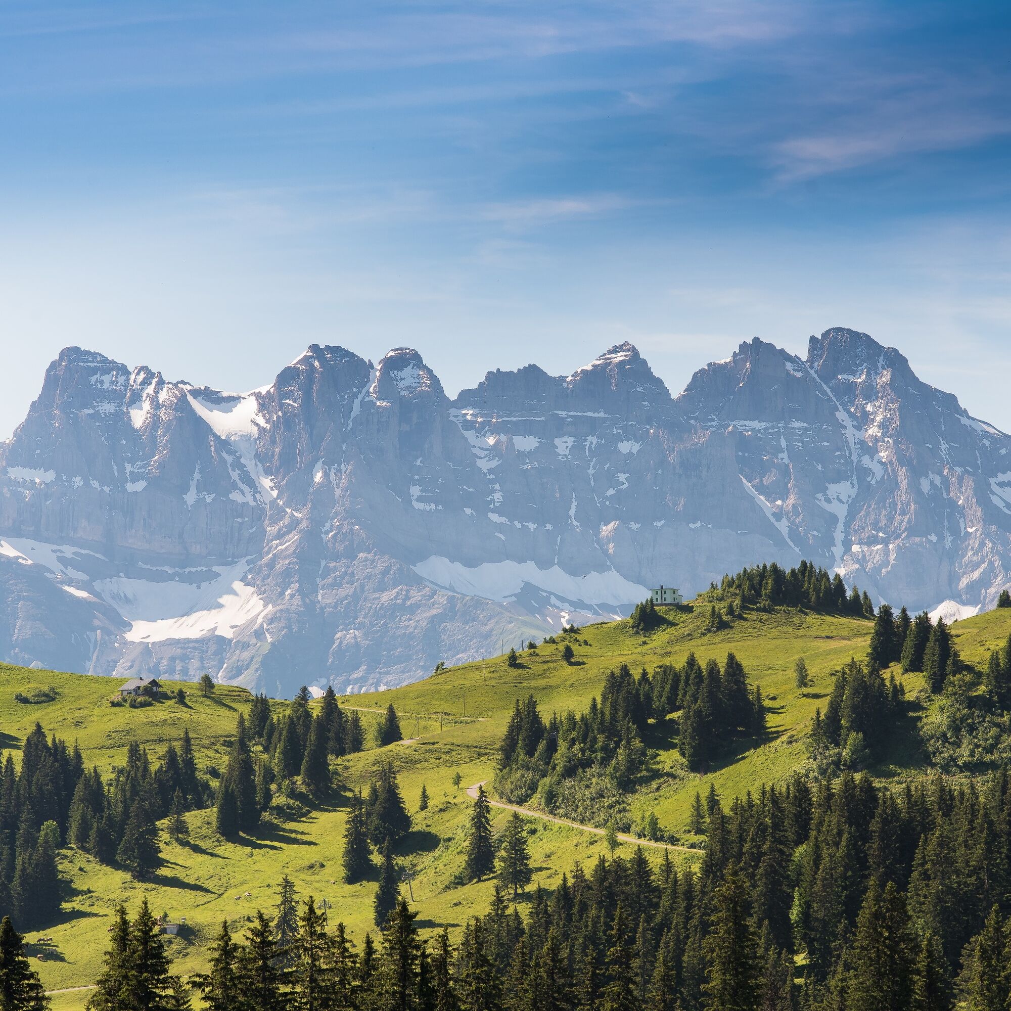
The Col des Portes de Culet is a often underestimated ascent in Lower Valais, but it is definitely worth a detour! The climb to Troistorrents, where you cross the valley's cog railway, is quite easy. As you ride up towards Morgins, you gradually see the Dents du Midi in all their glory. The range consists of seven peaks, with Haute Cime being the highest. The emblematic mountain of the region with its rugged face is incredibly impressive. After leaving the main road, the route takes you through a protected natural landscape up to the pass summit. A gem you should not miss!
Our recommendation: Technically flawless bike, helmet, gloves and bell, weather-appropriate clothing (always carry rain protection), drink and provisions.
Respect the rules of Swiss road traffic. Riding this route is at your own risk; any liability is excluded. Respect the flora and fauna in your surroundings. For your safety, we recommend wearing a bicycle helmet. Emergency numbers: 144 Ambulance / 117 Police / 1414 Rega.
Assess your own skills and fitness well. Riding these routes is fundamentally at your own responsibility.
Motorway A9 to exit 19 (Bex), then take the second exit towards Monthey at the roundabout. Coming from Lausanne, take exit 18 (St-Triphon) and do not drive through the tunnel into the Collombey valley, but continue towards Monthey city center.
You can reach Monthey with regular regional train connections on the Simplon line Brig - St. Gingolph.
Various parking options, follow the local parking guidance system in Monthey:
Place Cardinale (Route du Simplon)
Parking AOMC (Avenue de France 6)
Municipal Parking (Place de l'Hôtel de Ville)
3
More information:
MontheyPopularne wycieczki w okolicy
- 4,0
Chemin du Lac de Taney
średniWędrówka 8,60 km - 5,0
Sentier de Salanfe
średniWędrówka 12,8 km - 5,0
Circular hike Roc Coupé – Bonavau – Champéry
średniWędrówka 12,1 km - 5,0
Morgins - Col des Portes du Soleil
światłoWycieczka narciarska 15,2 km - 4,7
Le Grammont
światłoWędrówka 13,8 km - 4,5
Galerie Défago
światłoWędrówka 8,81 km - 5,0
Champéry - Sous Scex
Wędrówka 2,41 km Champéry - Seen von Antème
Wędrówka 14,8 km- 4,0
Circular hike to the Lacs d’Antème
ciężkiWędrówka 16,3 km - 3,0
Sentier des alpages de Vionnaz
światłoWędrówka 13,6 km
Wędrówki i tropienie


Nie przegap ofert i inspiracji na następne wakacje
Twój adres e-mail została dodana do listy mailingowej.