


Circular hike to the Lacs d’Antème
Zdjęcia naszych użytkowników
-
 © Jordi Duran BatidorUtworzono dnia 24.08.2024
 -
 © Jordi Duran BatidorUtworzono dnia 24.08.2024
 -
 © Jordi Duran BatidorUtworzono dnia 24.08.2024
 -
 © Ben MöhlmannUtworzono dnia 12.03.2026
 -
 © Ben MöhlmannUtworzono dnia 12.03.2026
 -
 © Ben MöhlmannUtworzono dnia 12.03.2026
 -
 © Ben MöhlmannUtworzono dnia 12.03.2026


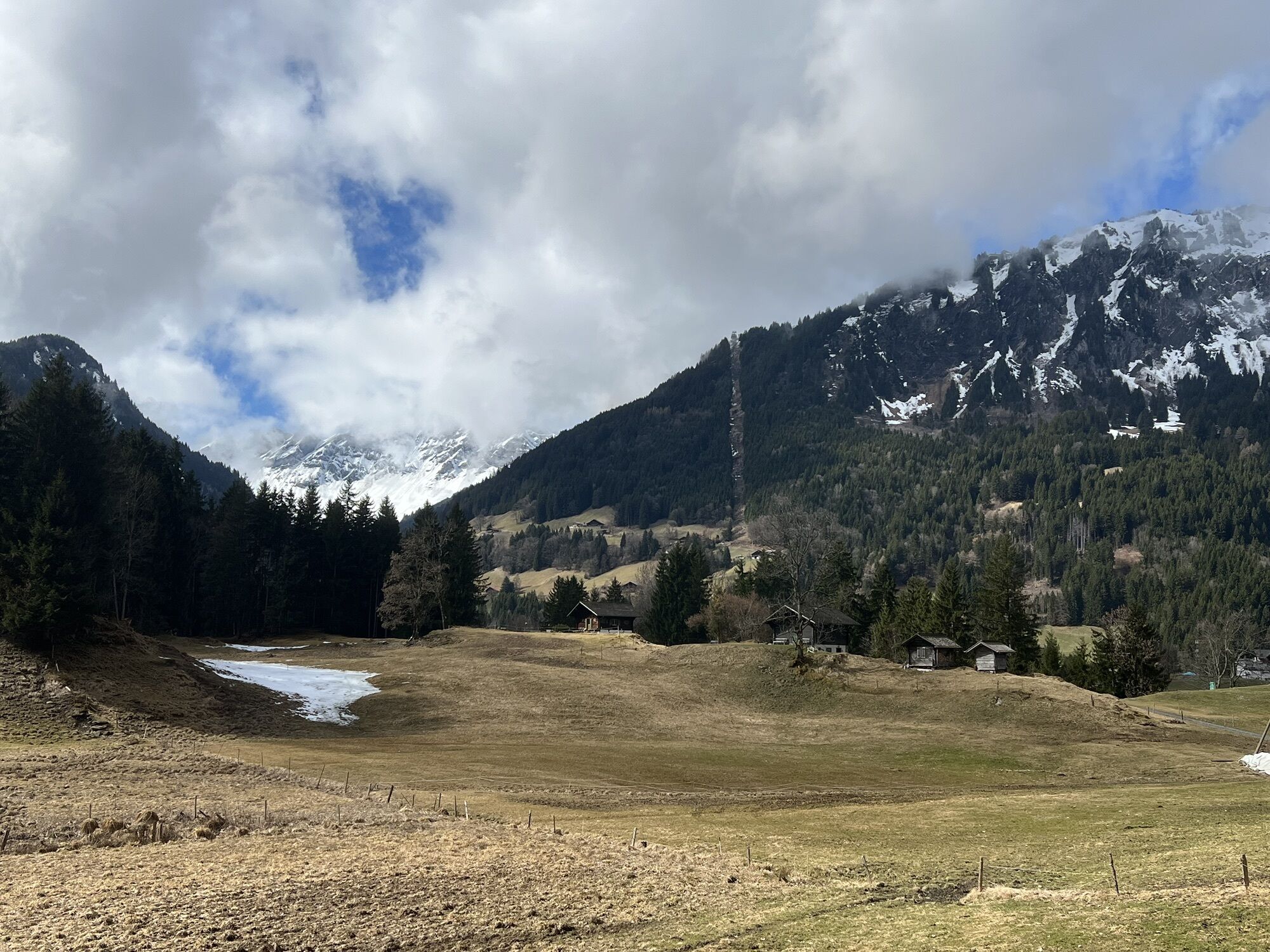
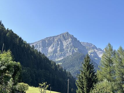
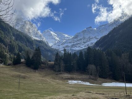
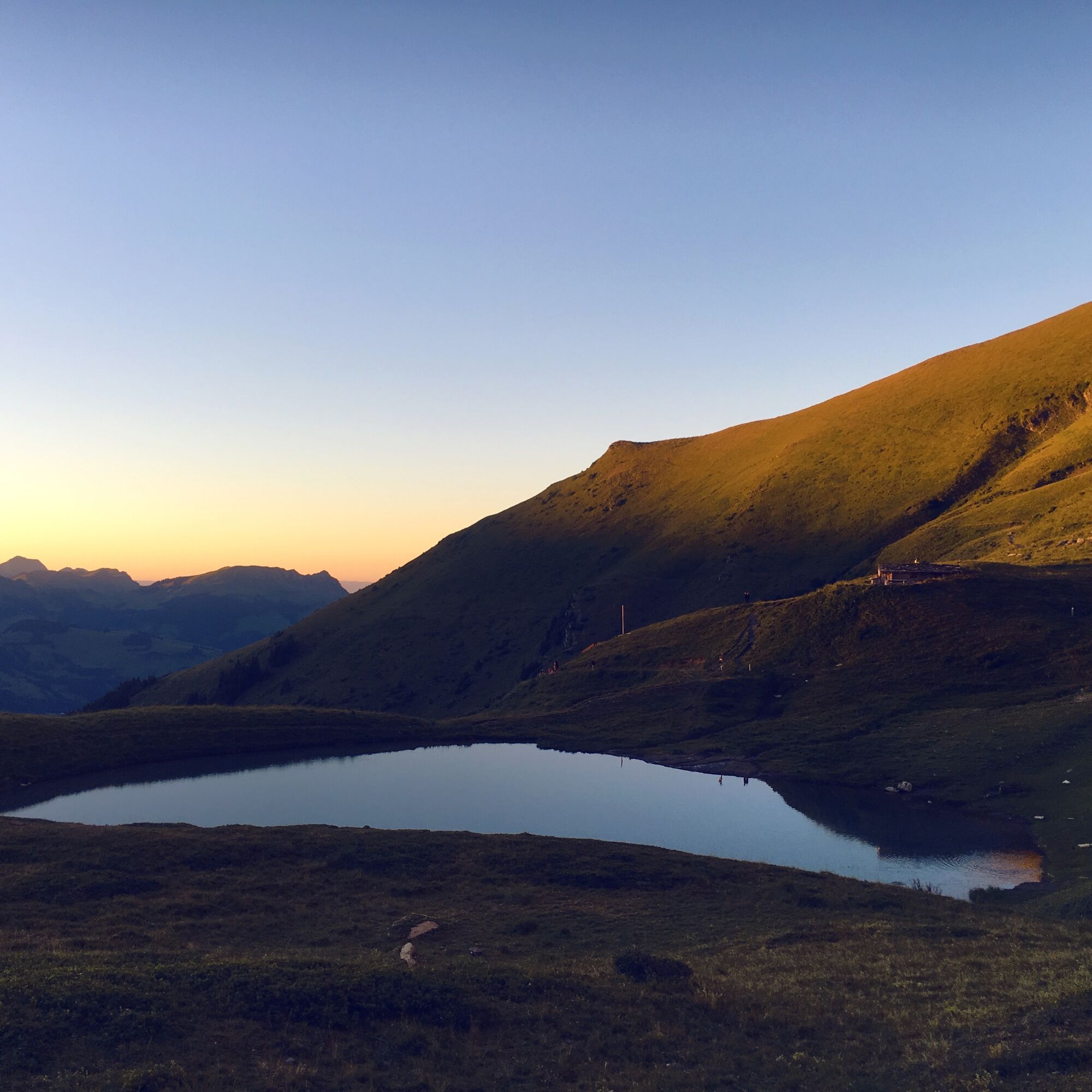
The Lacs d’Anthème are a group of several small mountain lakes below the jagged peaks of the Dents du Midi - one of the best-known mountains of Switzerland. The highest peak of this mountain formation,...
The Lacs d’Anthème are a group of several small mountain lakes below the jagged peaks of the Dents du Midi - one of the best-known mountains of Switzerland. The highest peak of this mountain formation, the Haute Cime (3,257 m), towers over the lakes. They are surrounded by blooming meadows and offer a charming view.
The hike starts at the Champéry train station. The village was among the first tourism destinations in Switzerland: the first hotel was opened here already in 1857. The path quickly leads to one of the first tourist attractions of Valais: a dizzying path along steep rock walls. A local entrepreneur named Emmanuel Défago opened the «Galerie Défago» in 1864: a path mostly running over a natural rock ledge. In places, the path had to be arduously chiselled into the rock. A century later, the rock path was extended to a total of 600 m. The view over Champéry and the whole valley becomes more spectacular with every step.
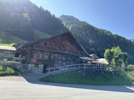
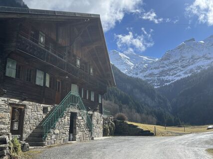
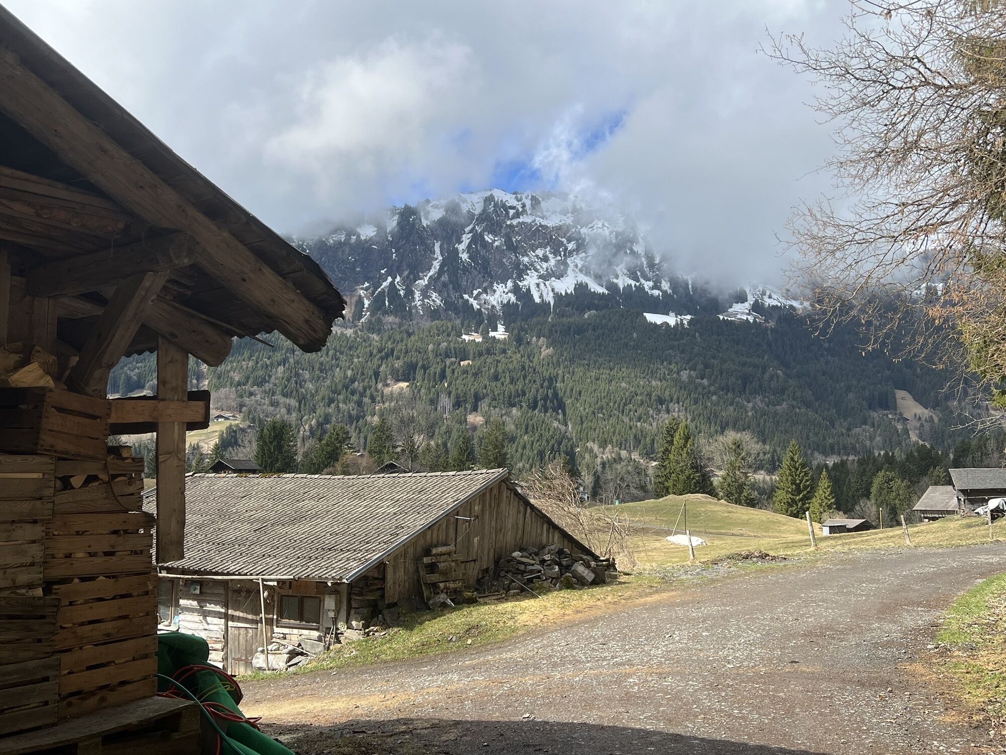
After this eventful passage, the path continues over the mountain slope to the Tière river, which is fed by the Lacs d’Anthème further up. It now goes in zigzags up the steep slopes to the first lake at 2,032 m above sea level. Very close by is a cozy mountain hut: the Cabane d’Anthème.
At the hut you get information about a separate nature trail leading from the hut to the other small lakes. The lakes are connected by small, delicate streams. An audio guide reveals the secrets of the many alpine plants flourishing in these peacefully hanging gardens. The audio guide is also available at the mountain hut. The nature trail is less than 2 km long and takes about 45 minutes.
Our hike, however, leaves the lakes and turns west. It then goes steeply down through the forest in zigzags to reach the first section of our hike above the Vièze again.
Highlights of the hike:
Exciting path along the cliffs of the Défago Gallery. Idyllic mountain lake framed by alpine flowers with a wonderful view. Inviting mountain hut and nature trail at the lake.
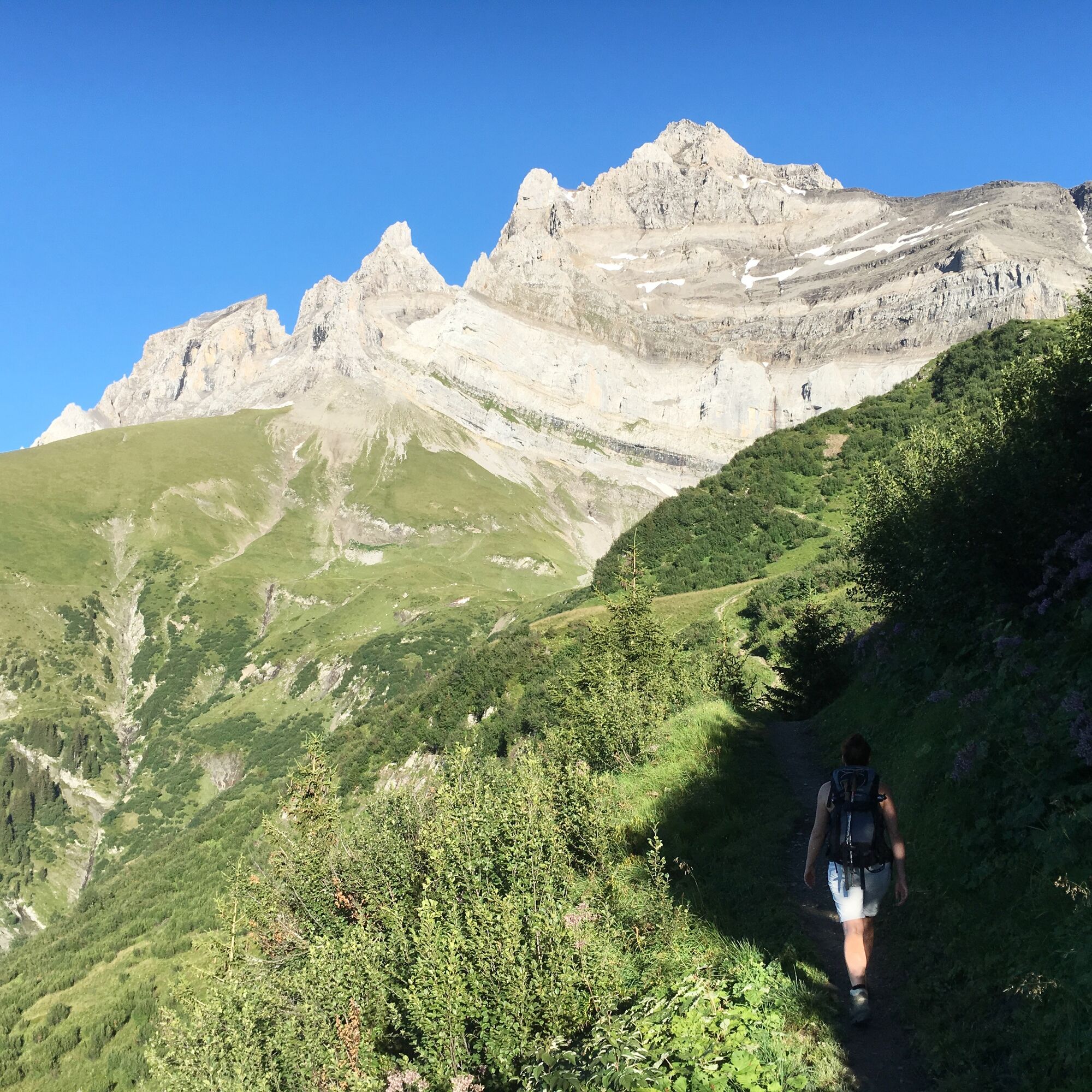

From the train station, the path leads south through Champéry and crosses the river. The path passes a small café and the entrance to the «Accrobranche du Dahu» - an adventure rope park. Among the various routes is the «Tyro» course with 8 zip lines, up to 180 m long. After a short climb, you reach the Défago Gallery.
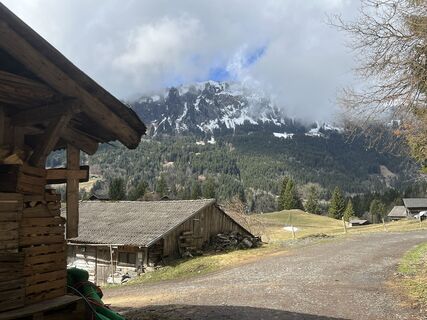
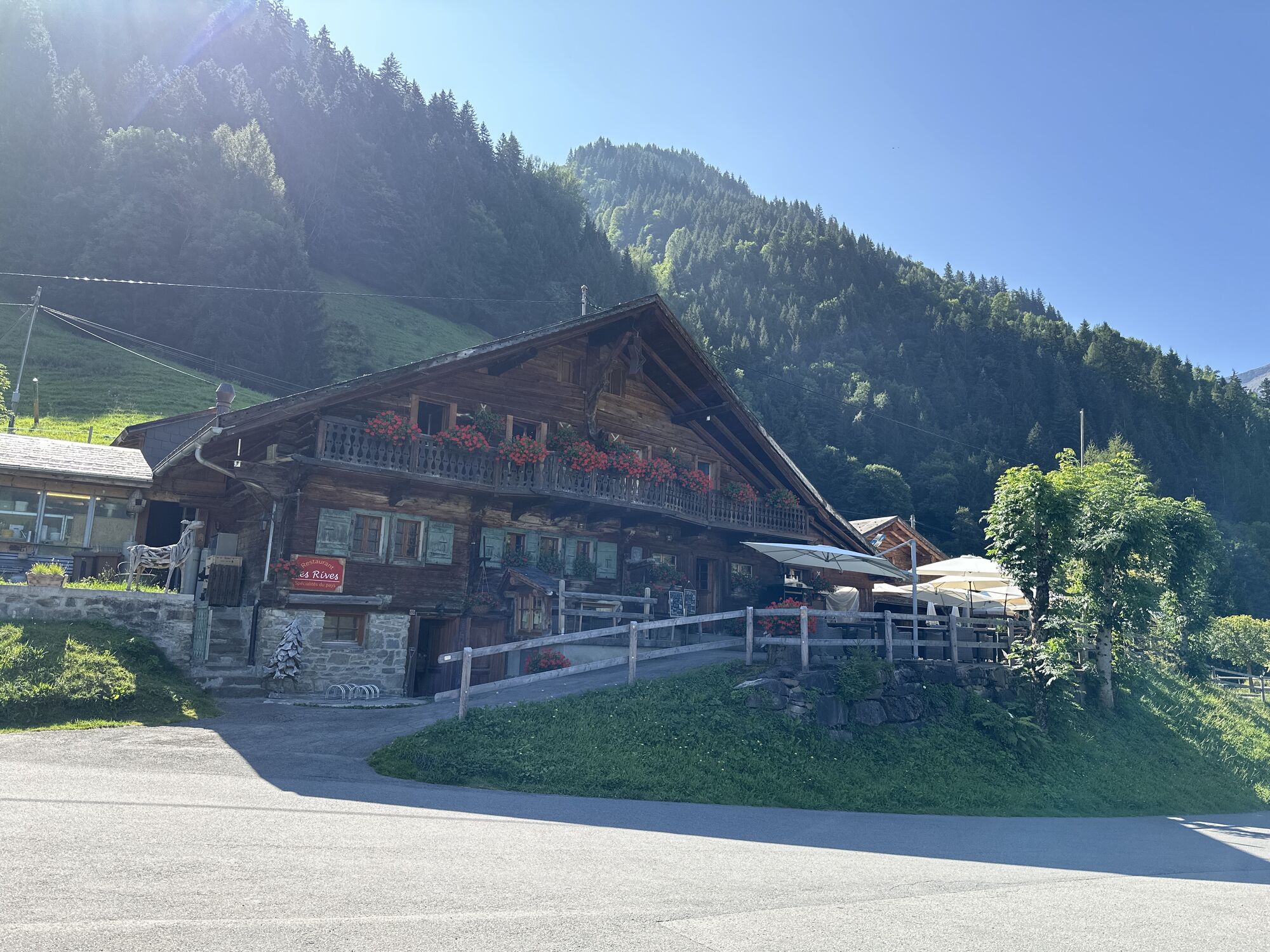
At the end of the Défago Gallery, you have the opportunity to take a short break at the Cantine des Rives restaurant and enjoy the wonderful view over Champéry. The restaurant offers, among other things, raclette melted over an open wood fire.
Our path continues to the Tière river. Nearby is the end point of an impressive via ferrata. Then it continues again towards the lakes, down the slopes through the forest, and finally the path merges again into the outlet below the entrance to the Défago Gallery.
Tak
We recommend:
Good footwear Weather-dependent clothing: always carry a waterproof vest Headwear Sunscreen Water bottle Picnic Camera Binoculars (optional) Hiking poles (optional) Printout of the hiking trail (click "Print" to download)For certain hikes:
SwimsuitUse of the hiking trails and information on this website is at your own risk. Local conditions may cause changes to the route. Valais/Wallis Promotion takes no responsibility for the accuracy and completeness of the information on this website. Assess your own abilities and fitness well. Use of the various routes is fundamentally at your own responsibility.
For all hikes:
Carry a map with you. Download the complete description of the hiking trail with a large-scale map by clicking "Print" at the top right of the page. Use only marked hiking trails and observe all signposts and instructions - for your own safety, to protect grazing animals, and out of respect for wildlife. Close gates after passing through. Behave considerately towards other trail users, plants, and animals.For mountain hikes:
Carry additional sun protection. UV rays at high altitudes can be very strong, even in cloudy weather. Plan your hike carefully: consider the required fitness level of all participants, weather forecasts, and seasonal dependencies. Weather conditions in the mountains can change very quickly and without warning. Appropriate clothing and enough provisions (food and drink) are very important. In unstable weather, better return early.For high alpine hikes:
Inform your family about your hiking route. If possible, avoid going alone. Do not venture onto glaciers without a mountain guide. Observe warning signs indicating dangers along riverbanks, watercourses below dams and reservoirs: water levels can rise quickly and without warning.Exit the A9 at St-Triphon, then head towards Portes du Soleil via Collombey, Troistorrents, Val-d'Illiez, and finally Champéry
Coming from Brig or Geneva, take the Simplon line to Aigle and change there to the regional train towards Champéry (AOMC). Detailed timetables for trains and post buses can be found at sbb.ch.
Large parking lot at the train station in Champéry.
More information about the destination:
ChampéryWith the «Multi Pass» you have many interesting advantages and can use numerous leisure activities in the Portes du Soleil region for free.
Kamery internetowe z trasy
Popularne wycieczki w okolicy
-
5,0
Sentier de Salanfe
średniWędrówka 12,8 km -
5,0
Circular hike Roc Coupé – Bonavau – Champéry
średniWędrówka 12,1 km -
3,5
Lac d'Emosson - Gorge de la Veudale - Col de la Terrasse - Lac du Vieux Emosson zurück nach Lac d'Emosson
średniWędrówka 14,3 km -
5,0
Morgins - Col des Portes du Soleil
światłoWycieczka narciarska 15,2 km -
4,5
Galerie Défago
światłoWędrówka 8,81 km -
5,0
Champéry - Sous Scex
Wędrówka 2,41 km -
Champéry - Seen von Antème
Wędrówka 14,8 km -
Hike to Lac Vert (Chésery)
ciężkiWędrówka 17,3 km -
3,0
Hiking trail along the Vièze gorges
światłoWędrówka 6,18 km -
Mont-Blanc Balcony Trail
średniWędrówka 8,36 km

Wędrówki i tropienie


Nie przegap ofert i inspiracji na następne wakacje
Twój adres e-mail została dodana do listy mailingowej.