


Törbel Loop
Poziom trudności: S0
Places to eat: Restaurant Dorbia, Restaurant Moosalp, Hotel Weisshorn in Törbel, and the Bistrotto in Törbel

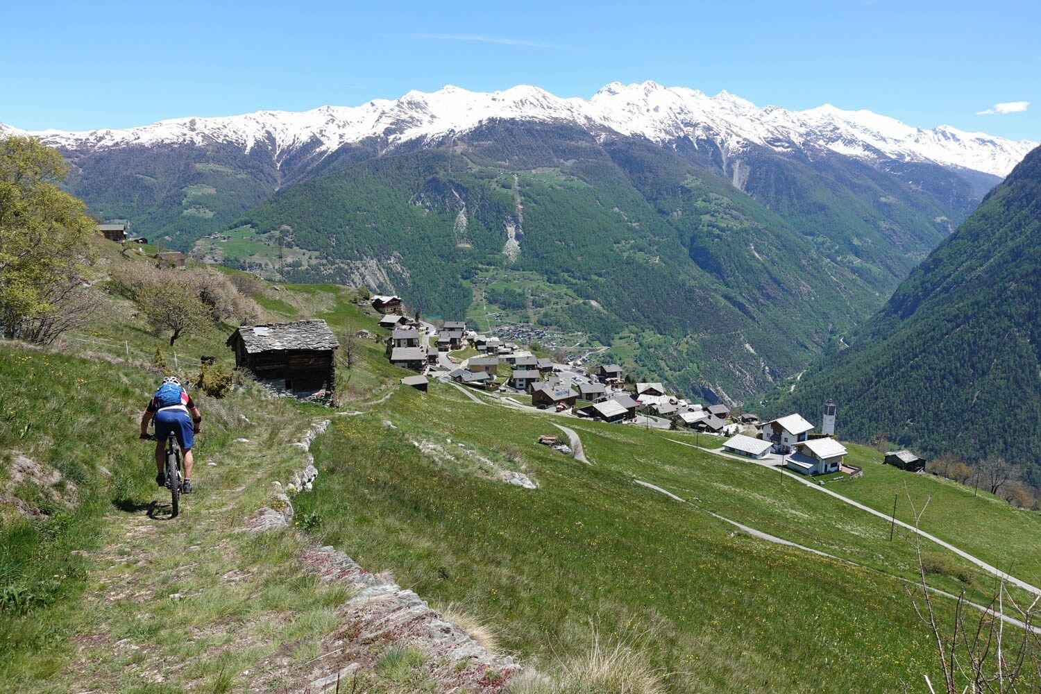
Törbel is accessible by public transport from Visp in about 30 minutes. The Törbel Loop leads from the typical Valais mountain village of Törbel at 1,500 meters above sea level along the road to the Moosalp (approx. 2,000 meters above sea level). Törbel offers beautiful views of the impressive mountain landscape, valleys, and villages in all directions. On the Moosalp, there are two mountain restaurants with culinary delicacies. The Törbel Loop ends with the descent to the Alp "Pletsche" and along the road back to Törbel.
Well-maintained road up to Törbel.
Parking is available at the village square, on the Fura, and at the Wegsol.
S0
The typical Valais village of Törbel with the open-air museum Urchigs Terbil
Kamery internetowe z trasy
Seetal - Grächen
Brandalp - Skilift Seefeld
Moosalp - Restaurant Moosalp - Törbel
Hannigalp
Grächen - Dorf
Moosalp - Bergrestaurant Dorbia
Brandalp - Skilift Seefeld
Brandalp - Skilift Seefeld
Brandalp - Skilift Seefeld
Brandalp - Skilift Seefeld
Rothorli
Grächen
Stalden
Gspon
Furggen Berg
Brandalp - Skilift Seefeld
Brandalp - Skilift Seefeld
Brandalp - Skilift Seefeld
Brandalp - Skilift Seefeld
Törbel - Chalet Dolores
Yakfarm - Embd
Heidabahn Talstation
Popularne wycieczki w okolicy
- 3,3
Europaweg Grächen - Europahütte - Zermatt
ciężkiWędrówka 39,9 km - 5,0
Moosalp Panoramaweg
światłoWędrówka 6,36 km - 3,8
Höhenweg Saas-Fee - Grächen
Wędrówka 12,0 km - 5,0
Via ferrata Jägihorn
ciężkiVia ferrata 6,14 km - 5,0
Ibex path
średniWędrówka 9,02 km - 5,0
Grächen high path
ciężkiWędrówka 17,0 km SUONEN CIRCULAR HIKE GREDETSCHTAL
średniWędrówka 7,45 km- 5,0
Panoramaweg Visperterminen
światłoWędrówka 9,72 km - 4,0
NATICHERBERG CIRCULAR TRAIL
średniWędrówka 12,1 km Kinderwanderweg MoosAlbi uns seine Waldtiere
światłoWędrówka 3,50 km
Wędrówki i tropienie


Nie przegap ofert i inspiracji na następne wakacje
Twój adres e-mail została dodana do listy mailingowej.