Spitzkofel - via hut Kerschbaumeralm
ciężki
Nawigacja
Nawigacja
Pobierz tę trasę na swój telefon komórkowy
Spitzkofel - via hut Kerschbaumeralm
ciężki
Wędrówka
18,03
km
Zeskanuj kod QR i rozpocznij nawigację w aplikacji bergfex.

Wędrówki i tropienie


Spitzkofel - via hut Kerschbaumeralm
ciężki
Odległość
18,03
km
Czas trwania
09:00
h
Ascent
1 623
hm
Poziom morza
1 090 -
2 681
m
Ścieżka do pobrania
Spitzkofel - via hut Kerschbaumeralm
ciężki
Wędrówka
18,03
km
Zdjęcia naszych użytkowników

 © Florian DürneggerUtworzono dnia 04.09.2025
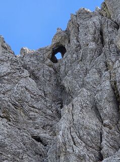 © Florian DürneggerUtworzono dnia 04.09.2025
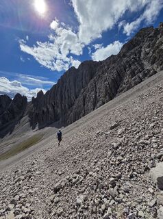 © Florian DürneggerUtworzono dnia 04.09.2025
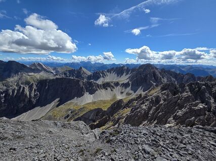 © Florian DürneggerUtworzono dnia 04.09.2025
 © Florian DürneggerUtworzono dnia 04.09.2025
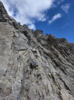 © Florian DürneggerUtworzono dnia 04.09.2025
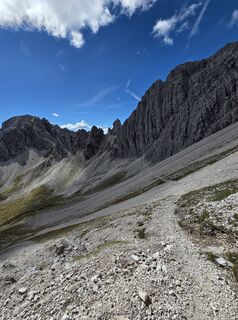 © Florian DürneggerUtworzono dnia 04.09.2025
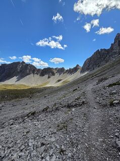 © Florian DürneggerUtworzono dnia 04.09.2025
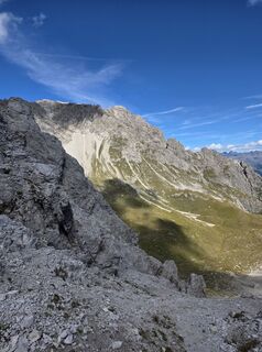 © Florian DürneggerUtworzono dnia 04.09.2025
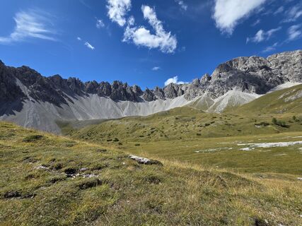 © Florian DürneggerUtworzono dnia 04.09.2025
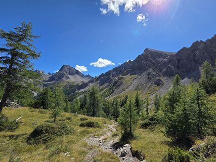 © Florian DürneggerUtworzono dnia 04.09.2025
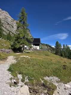 © Florian DürneggerUtworzono dnia 04.09.2025
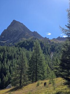 © Florian DürneggerUtworzono dnia 04.09.2025
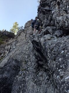 © Florian DürneggerUtworzono dnia 04.09.2025
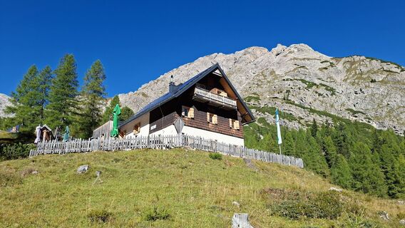
 © franz faschingUtworzono dnia 20.09.2025
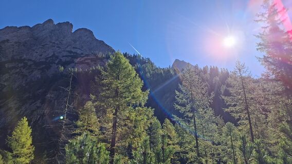 © franz faschingUtworzono dnia 20.09.2025
 © franz faschingUtworzono dnia 20.09.2025
 © franz faschingUtworzono dnia 20.09.2025

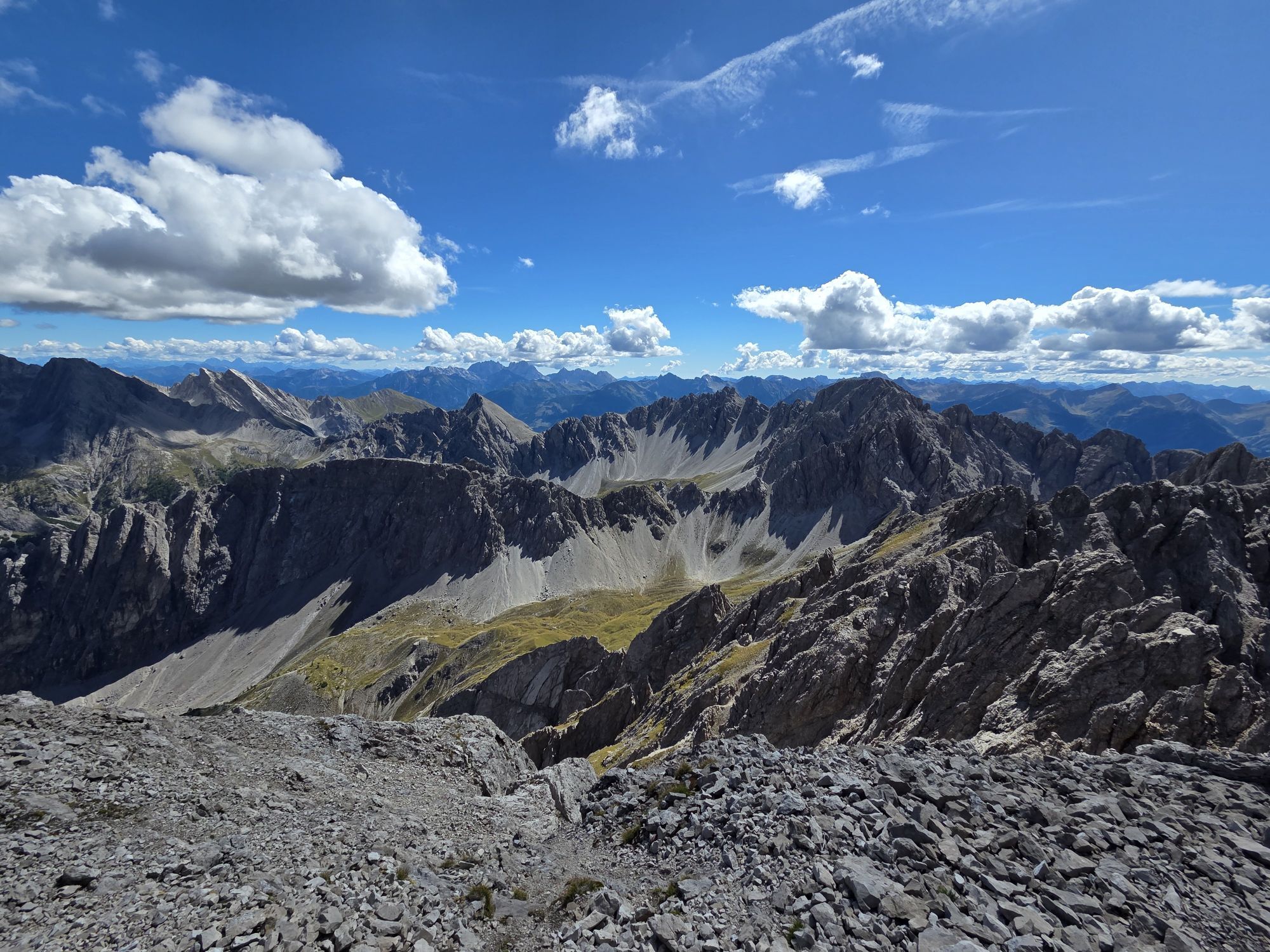
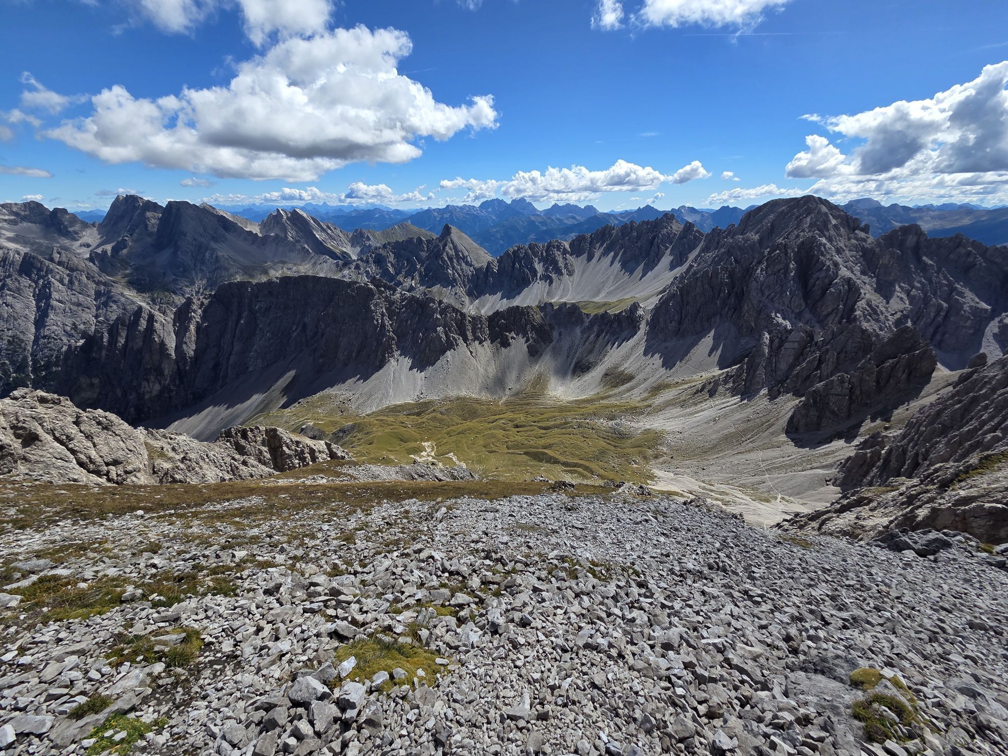

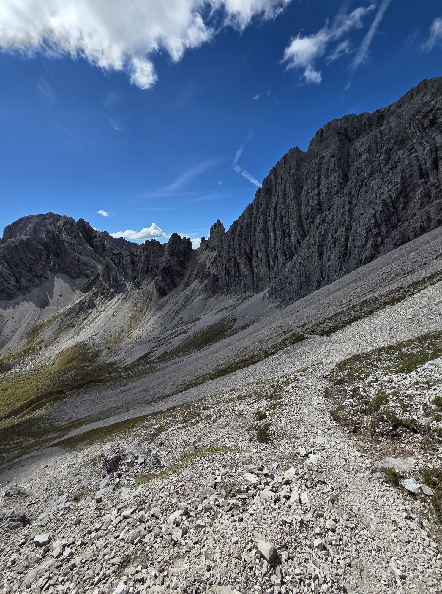
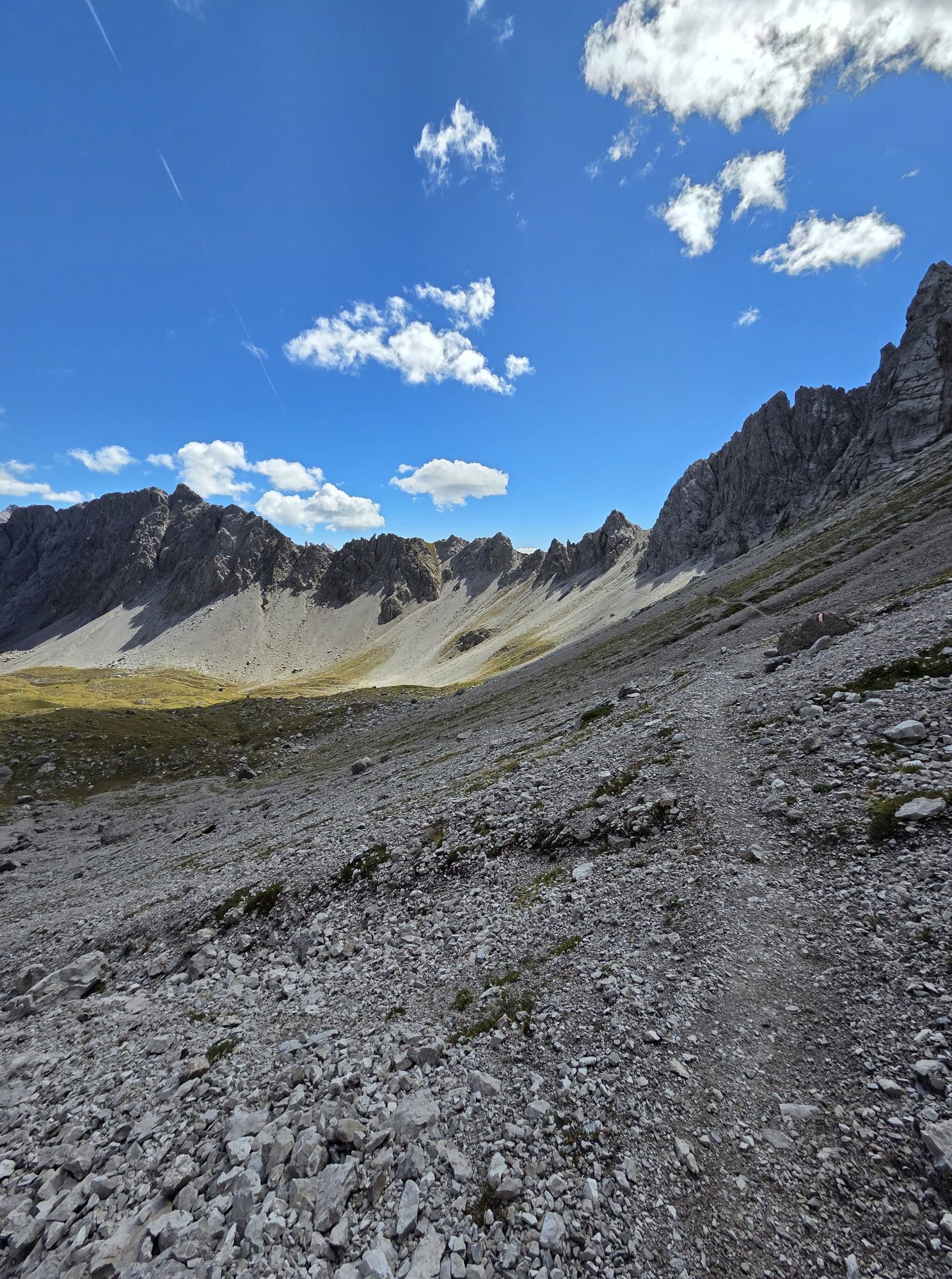


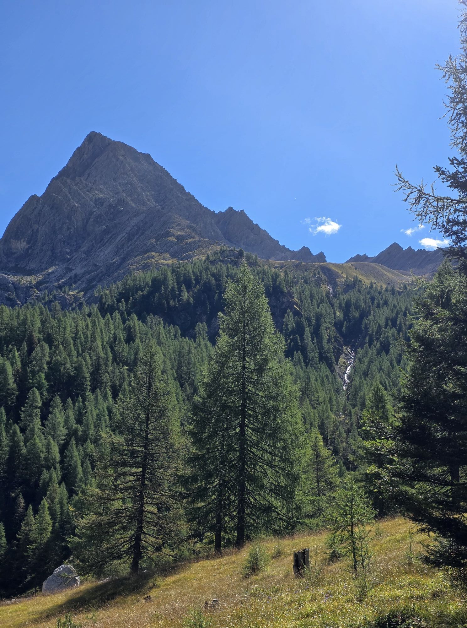

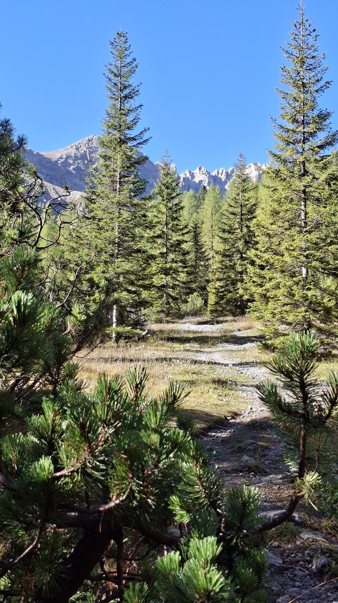
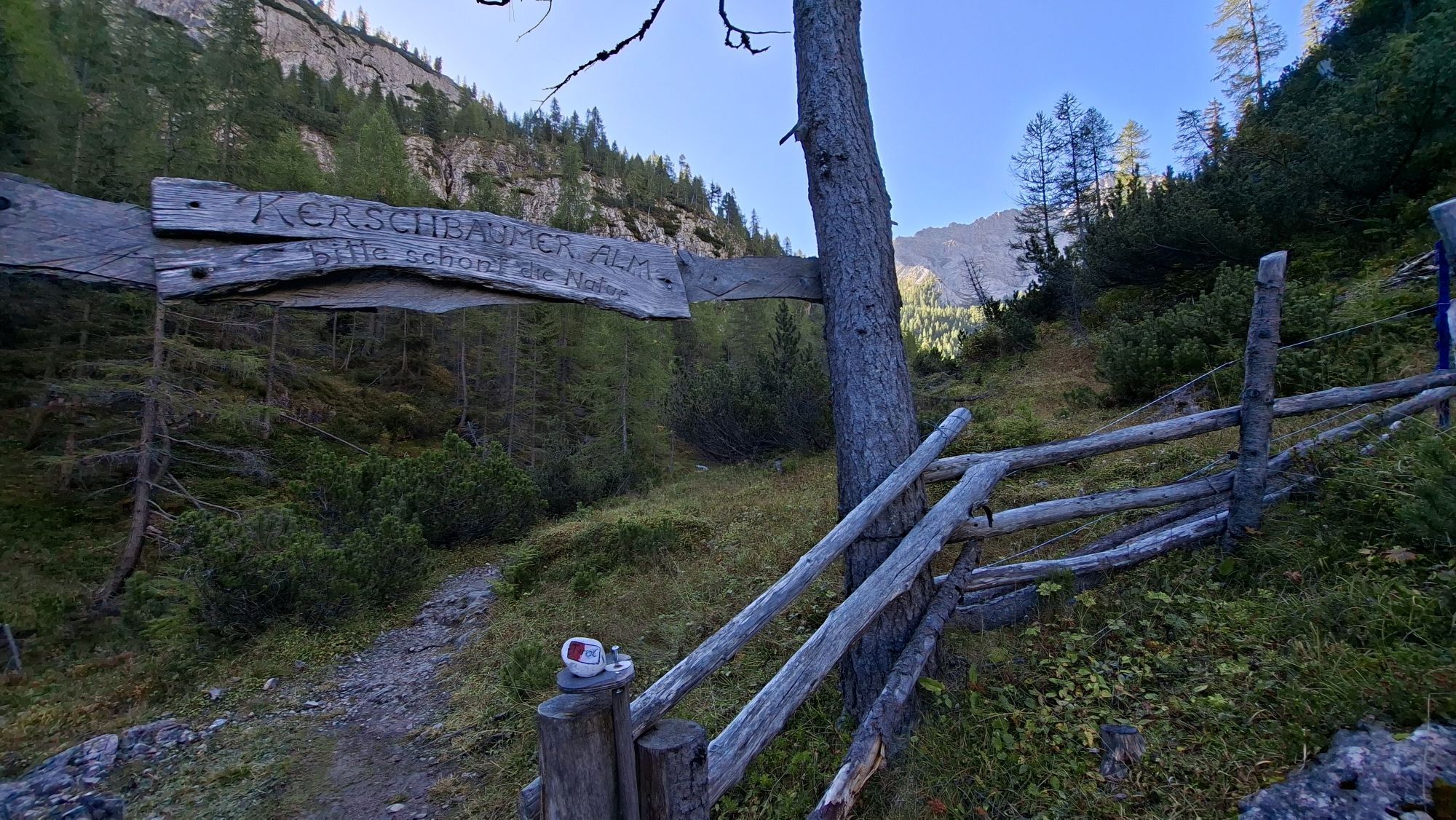
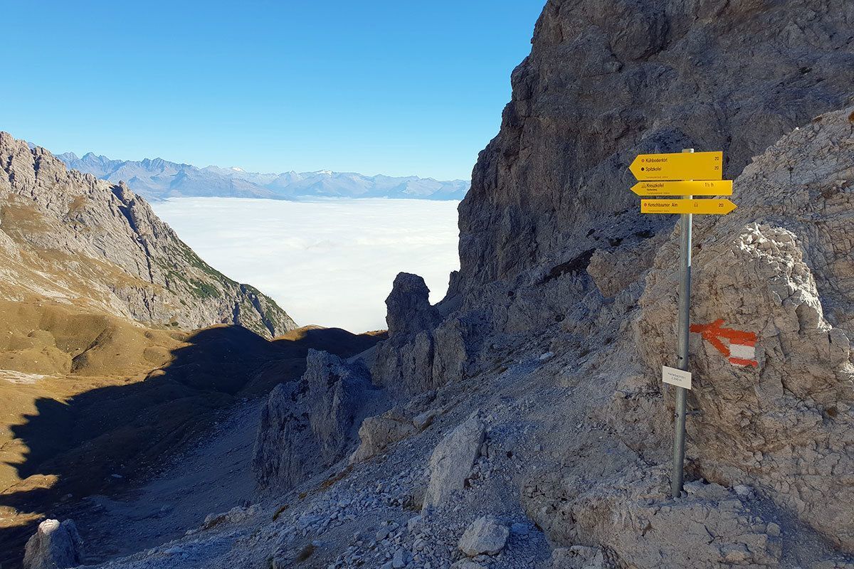
From Klammbrückl car park (natural landmark) up the well signposted path to Kerschbaumeralm, Hallebachtörl and Kuhbodentörl. Continue on the steep path in a northerly direction up to around 2500m. The...
Opis
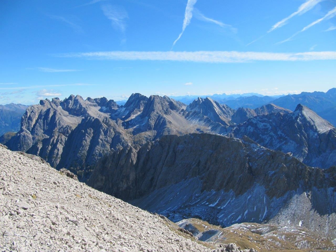
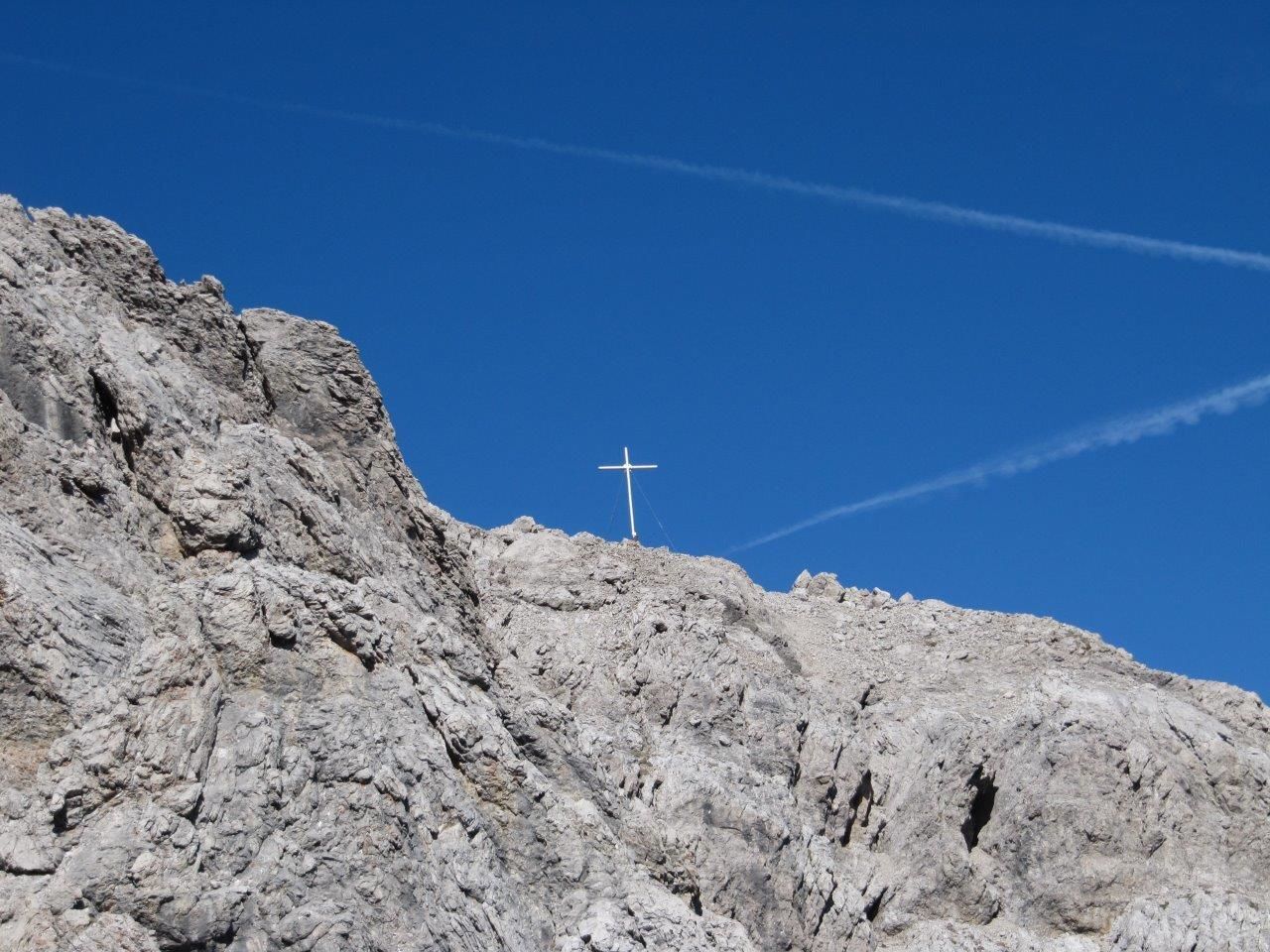
From Klammbrückl car park (natural landmark) up the well signposted path to Kerschbaumeralm, Hallebachtörl and Kuhbodentörl. Continue on the steep path in a northerly direction up to around 2500m. The via ferrata route begins at Linderhütte. Via the descent, secured with steel cable, about 50 m down into the Spitzkofelscharte and after this about 100 m - also steel cable secured - up to the summit at 2717m.
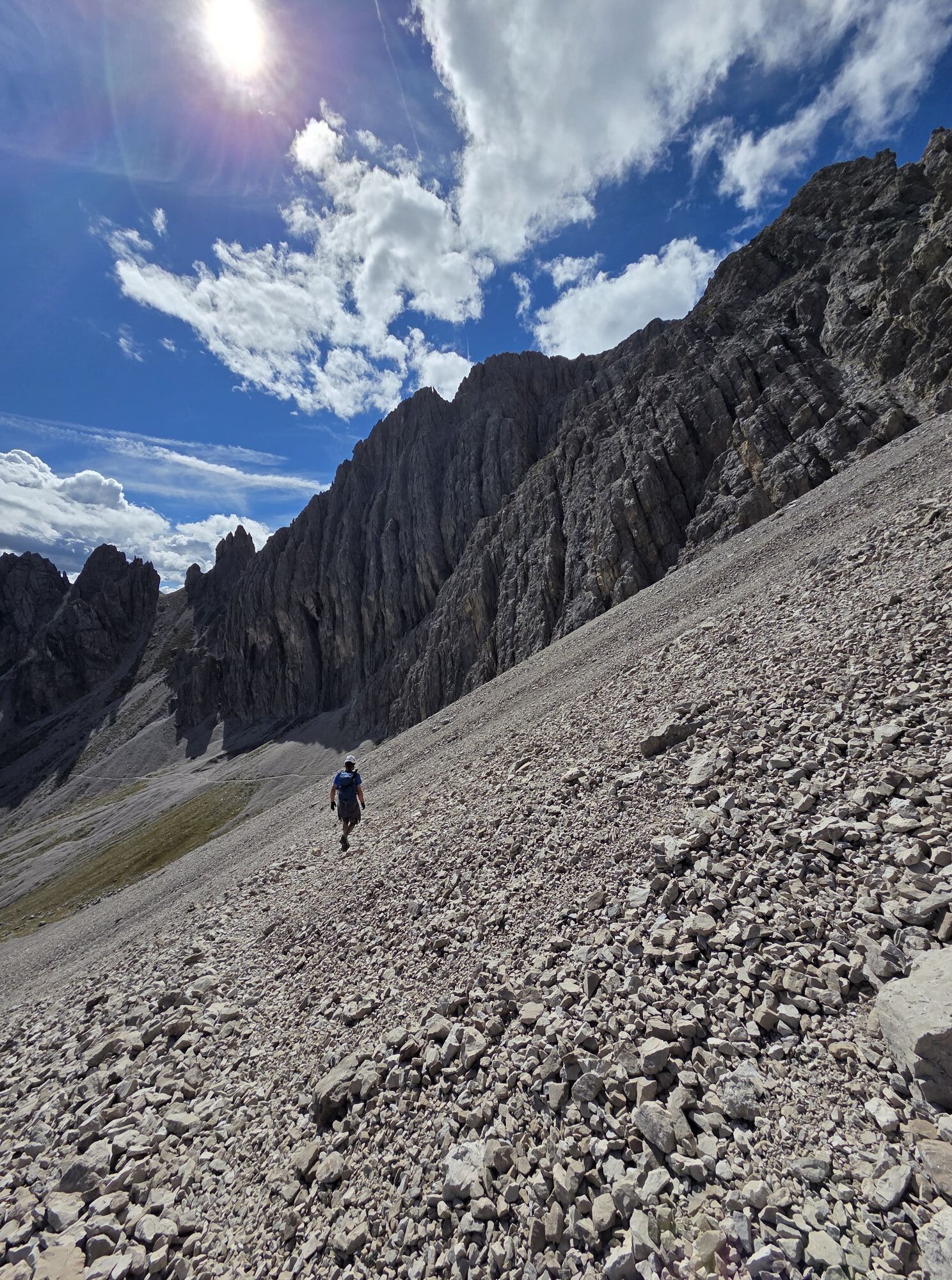
Difficult sections: B. The path is not secured with steel cables throughout (only at the steepest cliff sections), in the easier terrain sure-footedness is required in parts.
Difficult sections: B. The path is not secured with steel cables throughout (only at the steepest cliff sections), in the easier terrain sure-footedness is required in parts.
Trasa
Klapffall
(1 716 m)
Wodospad
3,5 km
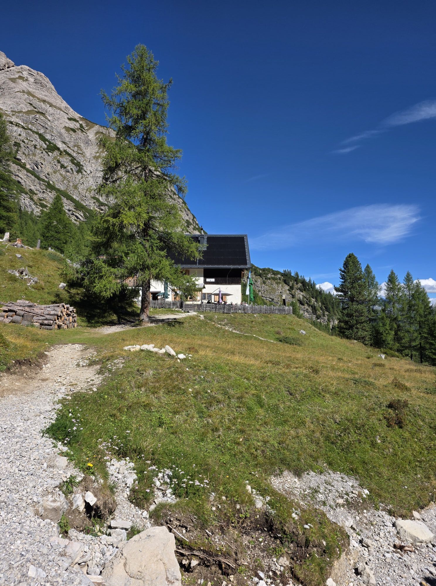
Kerschbaumeralm Schutzhaus
(1 902 m)
Schronienie
4,6 km
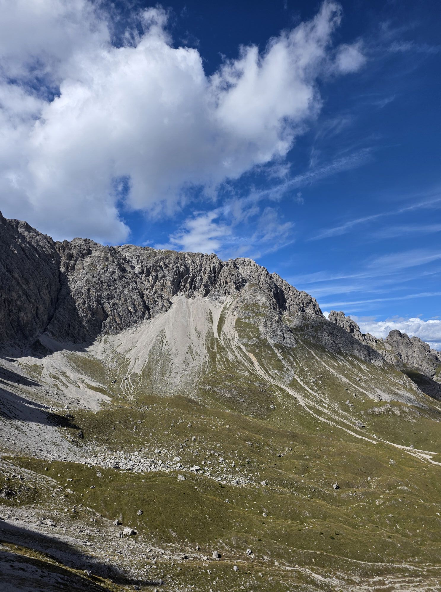
Hallebachtörl
(2 399 m)
Siodełko górskie
6,9 km
Spitzkofel
(2 717 m)
Szczyt
8,9 km
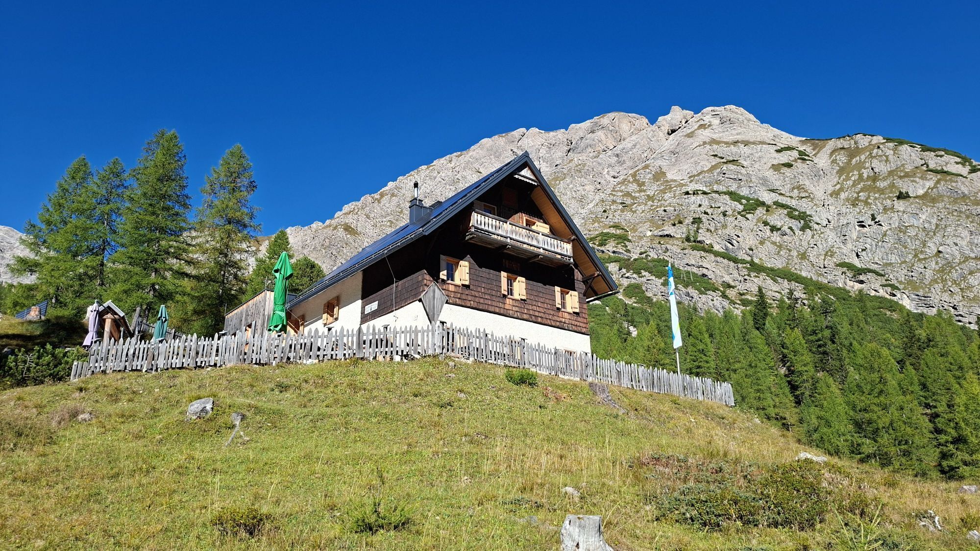
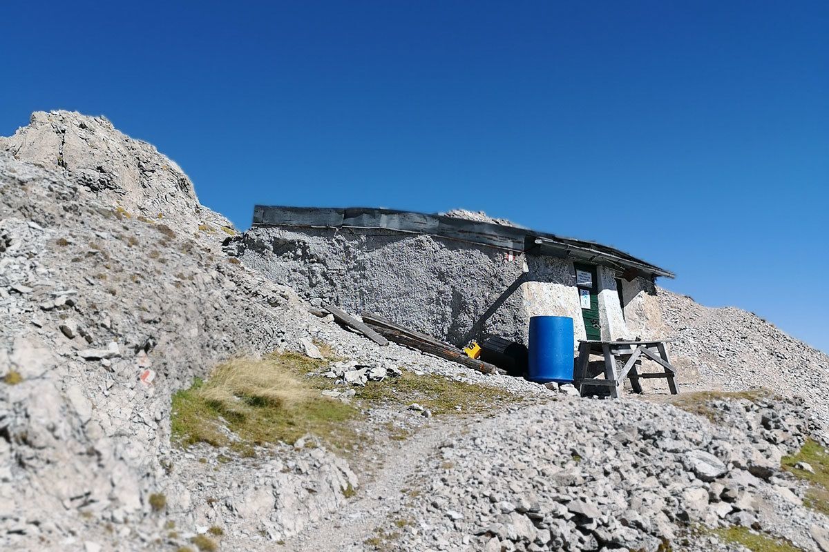
Linderhütte
(2 681 m)
Schronienie
9,3 km
Hallebachtörl
(2 399 m)
Siodełko górskie
11,0 km
Kerschbaumeralm Schutzhaus
(1 902 m)
Schronienie
13,3 km
Trasa
Spitzkofel - via hut Kerschbaumeralm
ciężki
Wędrówka
18,03
km
Klapffall
(1 716 m)
Wodospad
3,5 km
Kerschbaumeralm Schutzhaus
(1 902 m)
Schronienie
4,6 km
Hallebachtörl
(2 399 m)
Siodełko górskie
6,9 km
Spitzkofel
(2 717 m)
Szczyt
8,9 km
Linderhütte
(2 681 m)
Schronienie
9,3 km
Hallebachtörl
(2 399 m)
Siodełko górskie
11,0 km
Kerschbaumeralm Schutzhaus
(1 902 m)
Schronienie
13,3 km
Klapffall
(1 716 m)
Wodospad
14,4 km
Nie ma jeszcze recenzji
Kamery internetowe z trasy

Popularne wycieczki w okolicy
- 4,8
Lienzer Dolomiten-Lasertörl
średniWędrówka 13,2 km - 5,0
Ederplan round from the parking lot Stronach
średniWędrówka 7,19 km - 3,9
Karlsbader Hütte - Lienzer Dolomiten
Wędrówka 8 km - 4,7
Karlsbader Hütte über Rudl-Eller-Weg
ciężkiWędrówka 5,10 km - 4,1
Straßkopf
średniWędrówka 4,06 km - 3,2
Straßkopf
średniWycieczka narciarska 10,6 km - 3,9
Summit hike to the Hochstadel
średniWędrówka 7,83 km - 4,8
Böses Weibele - Pustertaler Höhenweg
średniWędrówka 13,2 km - 4,8
#33: Schleinitz Klettersteig, 3 Gipfel Runde (B)
średniVia ferrata 10,6 km - 5,0
Dolomitenhütte, Rudl-Eller-Weg / Steig, Piccola Ferrata, Laserzsee, Karlsbaderhütte, Dolomitenhütte, Tristach, Österreich
średniWycieczki górskie 11,1 km

Wędrówki i tropienie

Ponad 550.000 propozycji wycieczek, szczegółowe mapy i intuicyjny planer tras sprawiają, że aplikacja jest niezbędna dla wszystkich entuzjastów przyrody.

Nie przegap ofert i inspiracji na następne wakacje
Zapisz się do newslettera
Błąd
Wystąpił błąd. Spróbuj ponownie.Dziękujemy za rejestrację
Twój adres e-mail została dodana do listy mailingowej.
Wycieczki po całej Europie
Austria Szwajcaria Niemcy Włochy Słowenię Francja Holandia Belgia Polska Liechtenstein Czechy Słowacja Hiszpania Chorwacja Bośnia i Hercegowina Luksemburg Andorra Portugalia Islandia Wielka Brytania Irlandia Grecja Albania Macedonia Północna Malta Norwegia Czarnogóra Mołdawia Kosowo Węgry San Marino Rumunia Estonia Łotwa Białoruś Cypr Litwa Serbia Bułgaria Monako Dania Szwecja Finlandia