Hoher Bösring
średni
Nawigacja
Nawigacja
Pobierz tę trasę na swój telefon komórkowy
Hoher Bösring
średni
Wycieczka narciarska
4,76
km
Zeskanuj kod QR i rozpocznij nawigację w aplikacji bergfex.

Wędrówki i tropienie


Hoher Bösring
średni
Odległość
4,76
km
Czas trwania
03:00
h
Ascent
896
hm
Poziom morza
1 380 -
2 291
m
Ścieżka do pobrania
Hoher Bösring
średni
Wycieczka narciarska
4,76
km
Zdjęcia naszych użytkowników
-

 © meteomodelUtworzono dnia 08.02.2026
 -
 © meteomodelUtworzono dnia 08.02.2026
 -
 © meteomodelUtworzono dnia 08.02.2026
 -
 © meteomodelUtworzono dnia 08.02.2026
 -
 © meteomodelUtworzono dnia 08.02.2026
 -
 © Franz DvoranUtworzono dnia 22.01.2026
 -
 © Franz DvoranUtworzono dnia 22.01.2026
 -
 © Franz DvoranUtworzono dnia 22.01.2026
 -
 © Franz DvoranUtworzono dnia 22.01.2026
 -
 © Franz DvoranUtworzono dnia 22.01.2026
 -
 © Franz DvoranUtworzono dnia 22.01.2026
 -
 © Arnold MoserUtworzono dnia 01.01.2024
 -
 © Arnold MoserUtworzono dnia 01.01.2024
 -

 © Wolfgang Reicher 2Utworzono dnia 15.09.2025
 -
 © Wolfgang Reicher 2Utworzono dnia 15.09.2025
 -
 © Wolfgang Reicher 2Utworzono dnia 15.09.2025
 -
 © Wolfgang Reicher 2Utworzono dnia 15.09.2025
 -
 © Wolfgang Reicher 2Utworzono dnia 15.09.2025
 -
 © Sebastian FichtlUtworzono dnia 25.10.2023
 -
 © Sebastian FichtlUtworzono dnia 25.10.2023

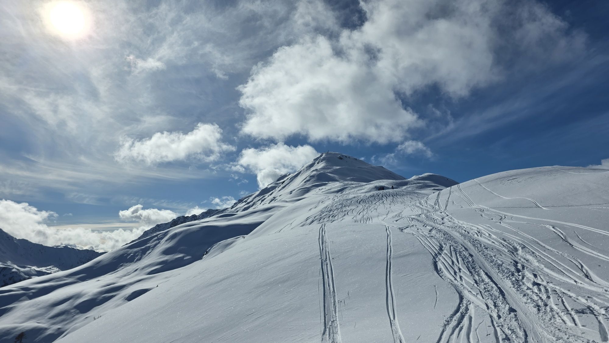
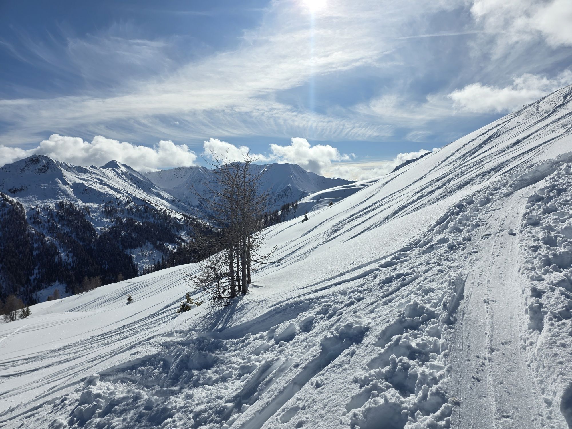
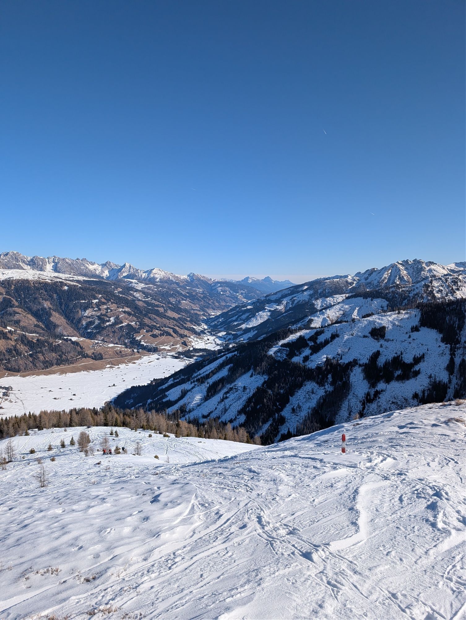


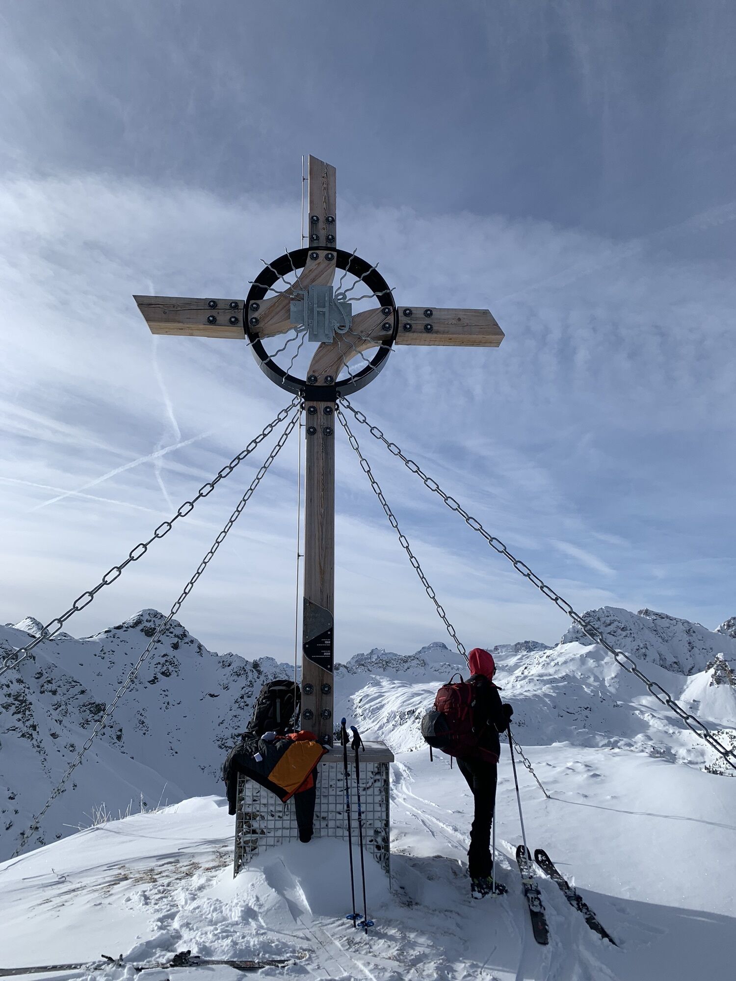
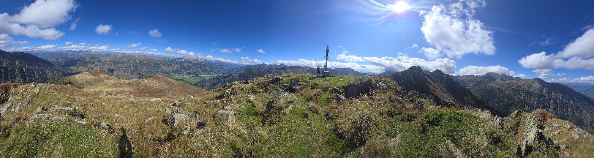
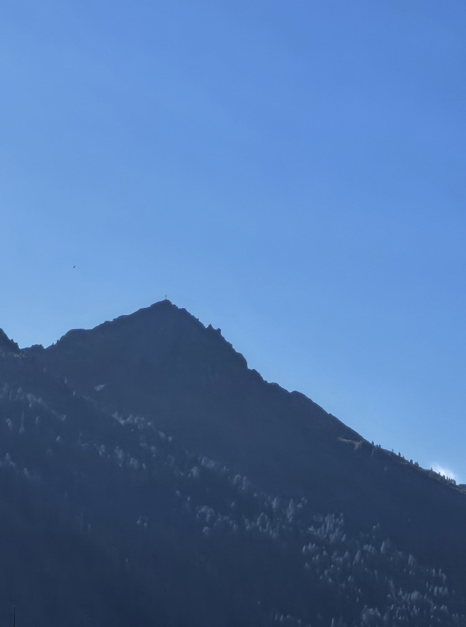

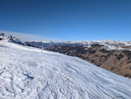
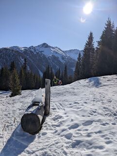
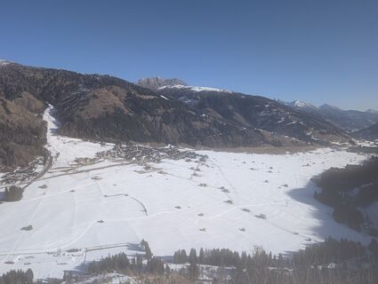
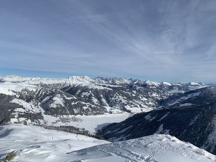
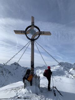
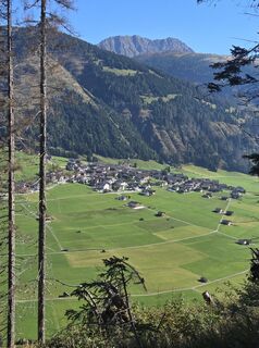
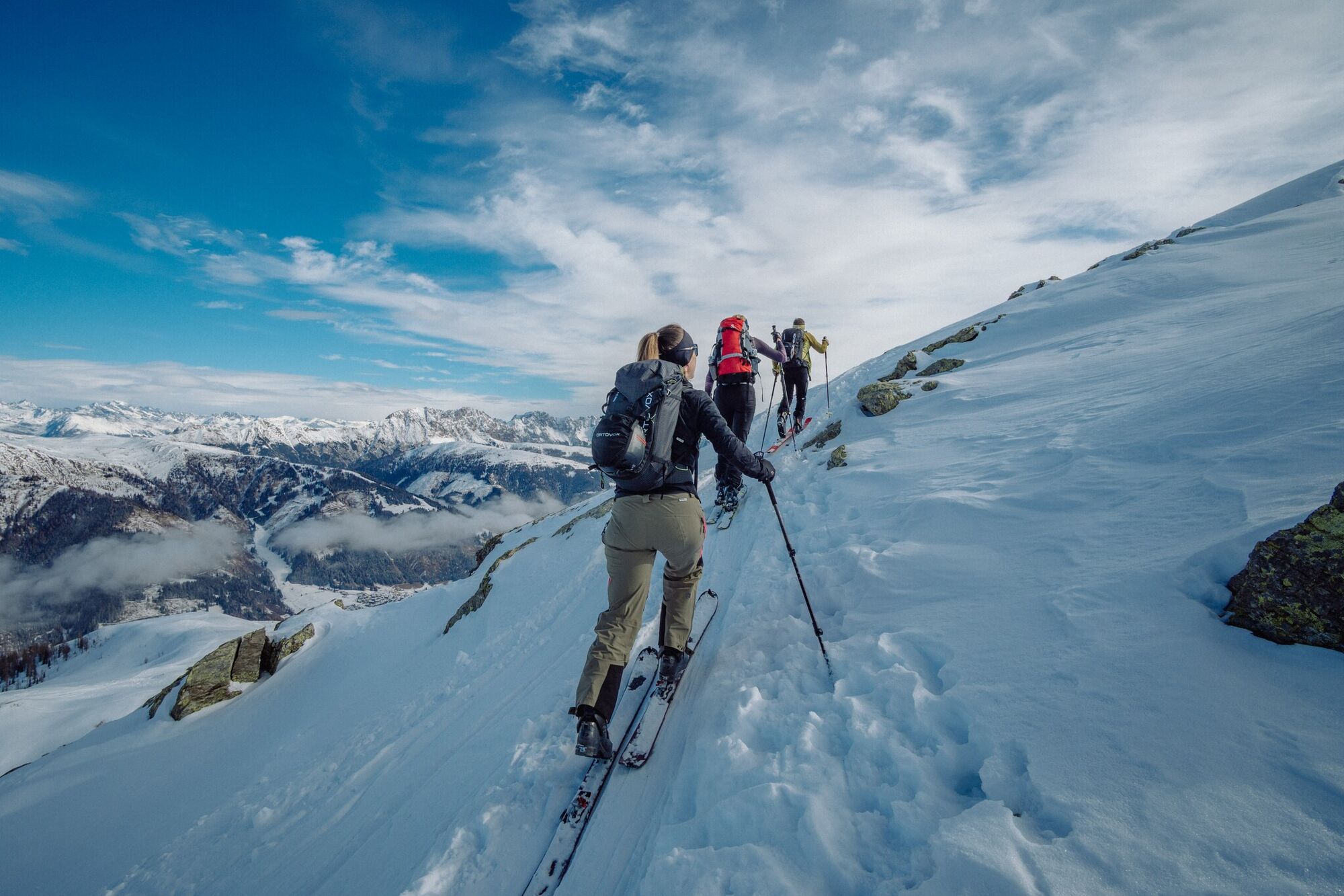
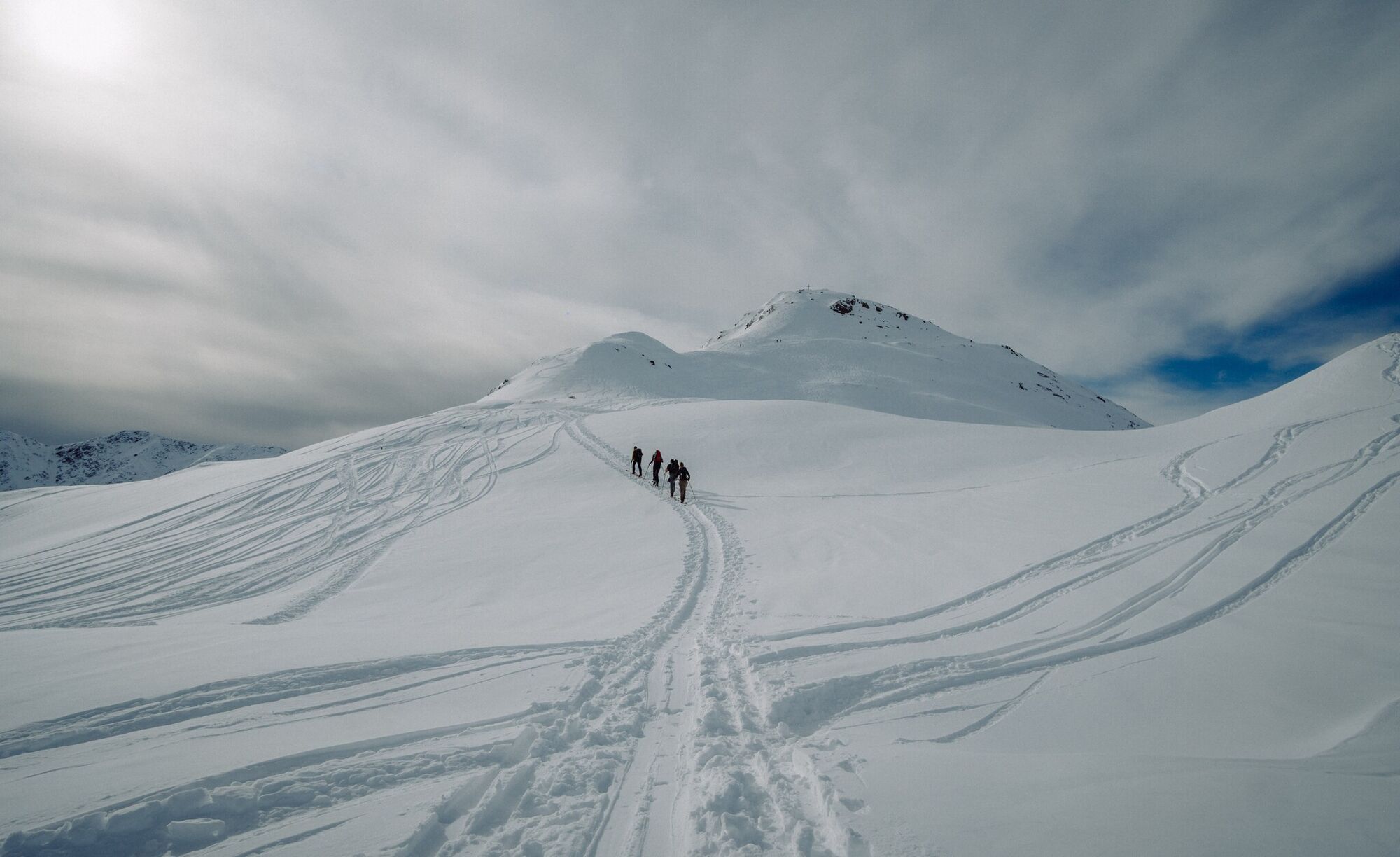
The ridge of the Hoher Bösring is in the shaded side of Obertilliach and separates Obertilliacher Tal from Leitental. The domed peak rises gently from the steep protected forest and is great for a trip...
Opis
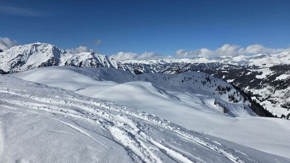
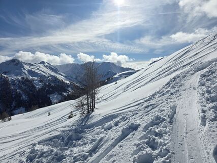
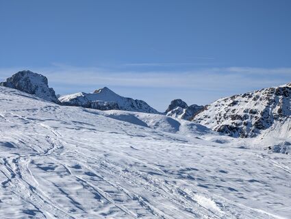
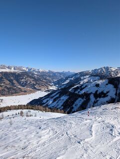
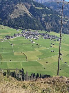
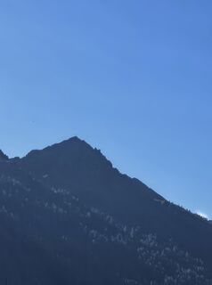
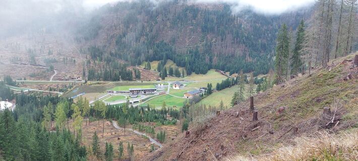
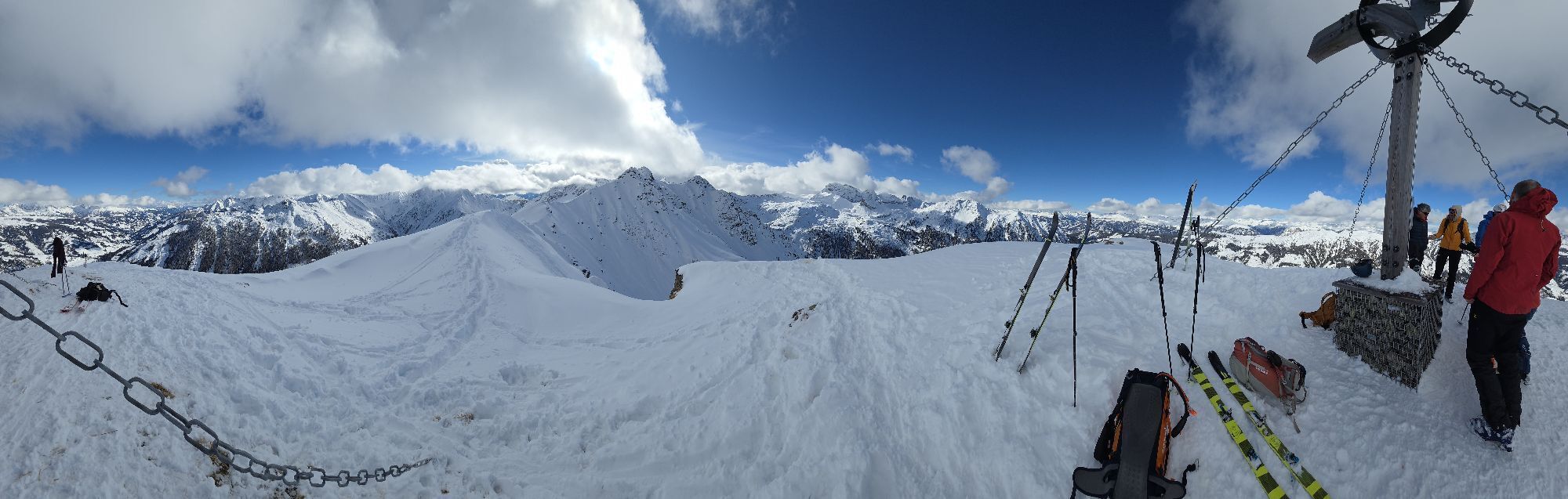
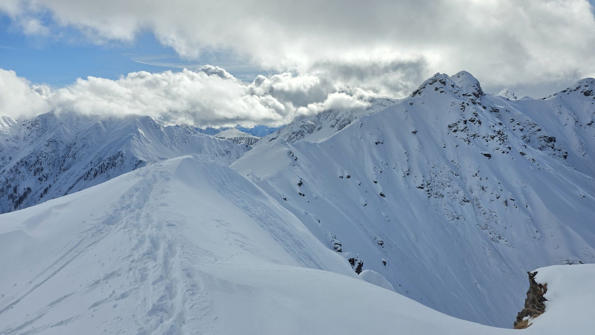
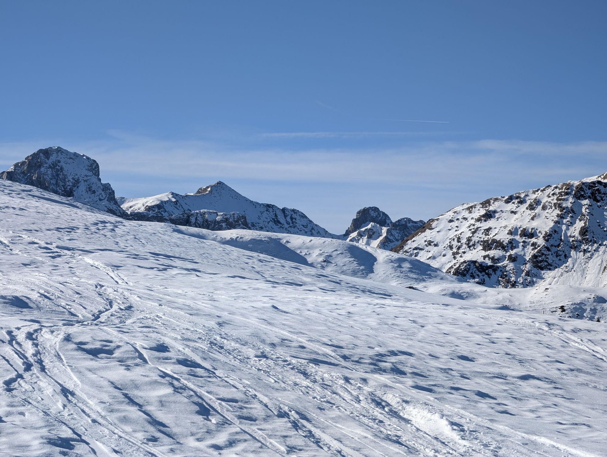
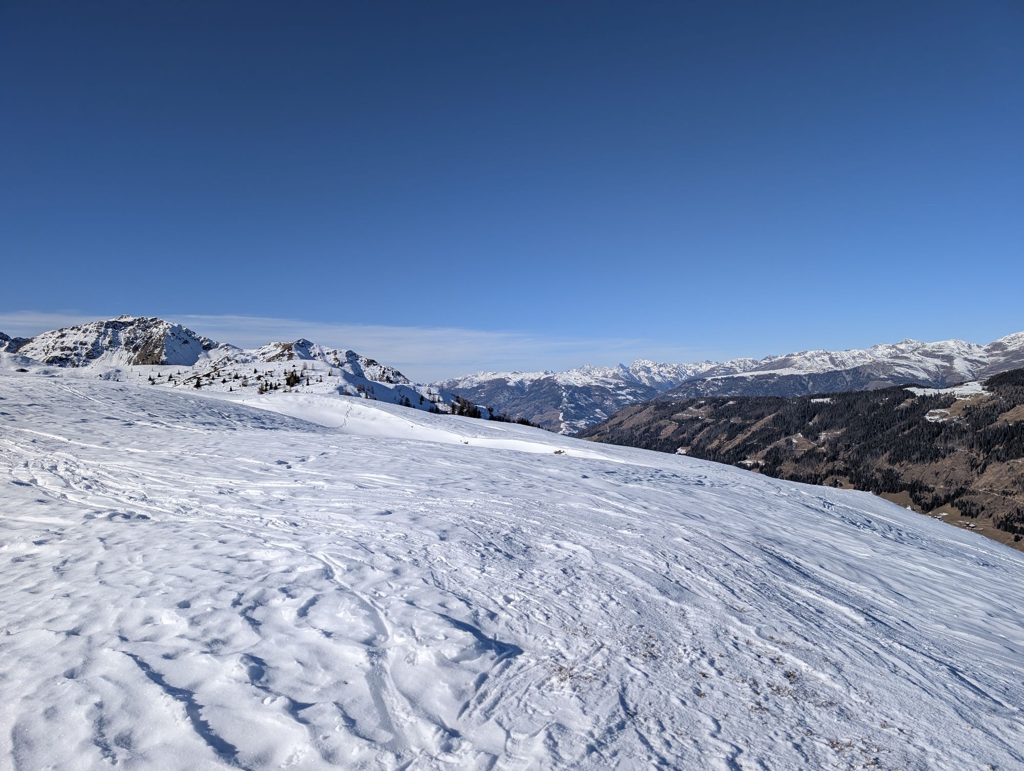
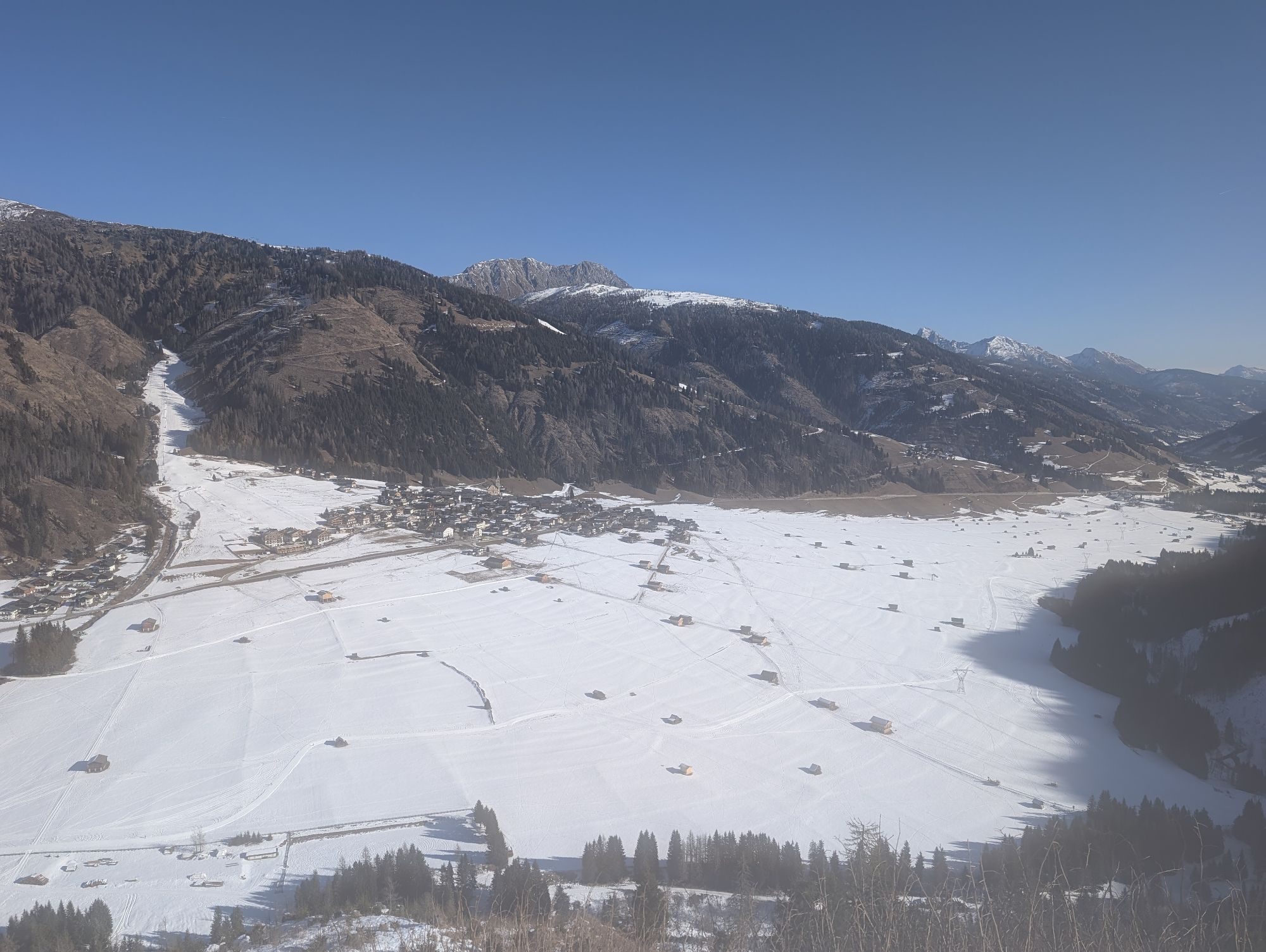
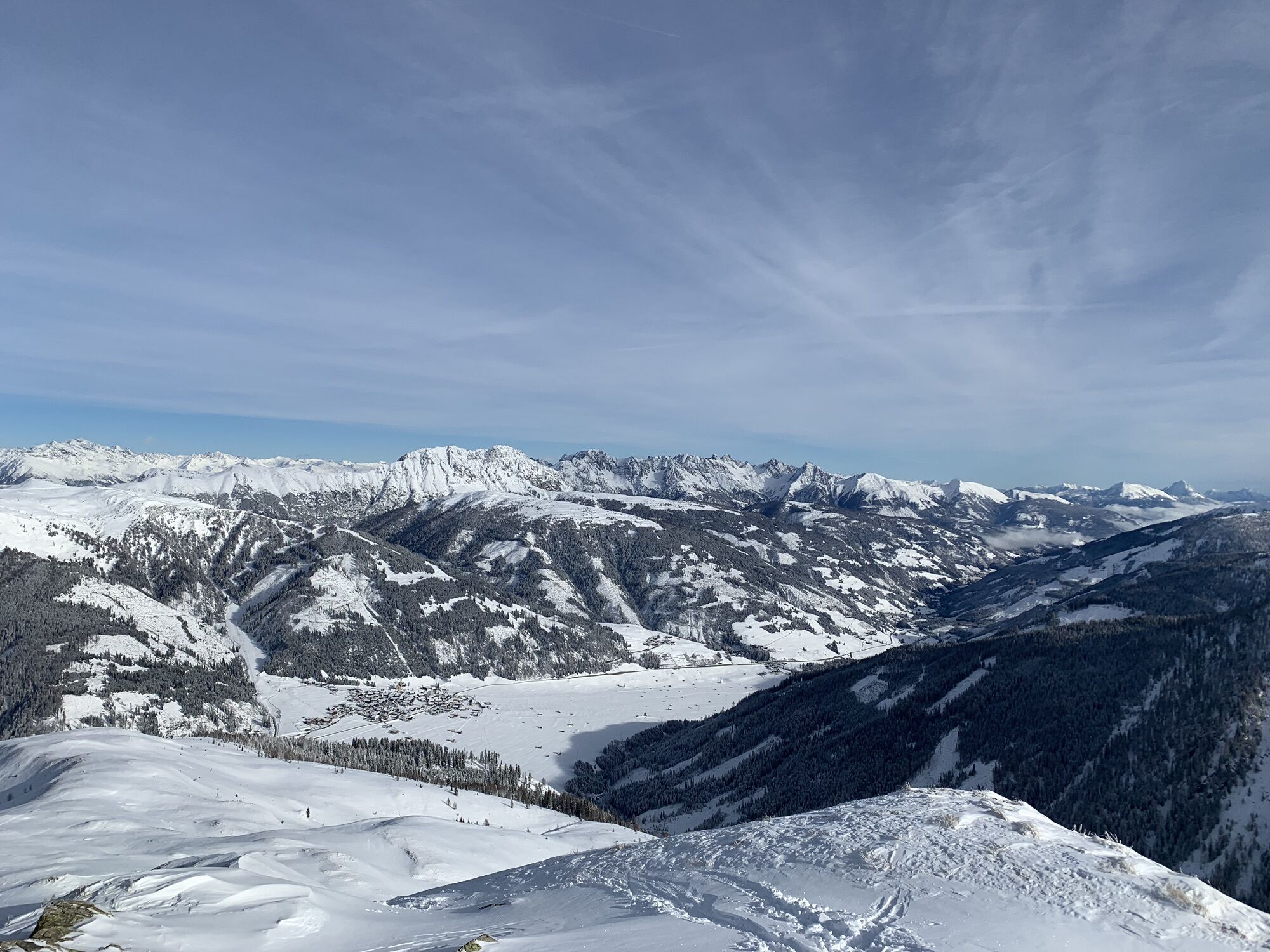
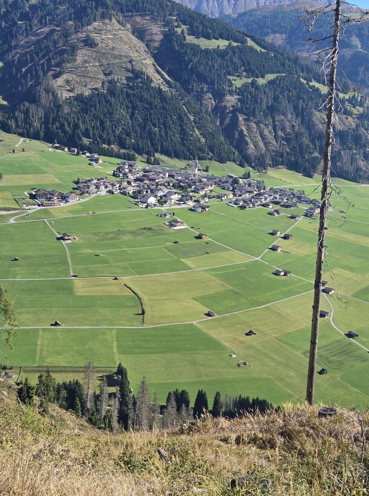
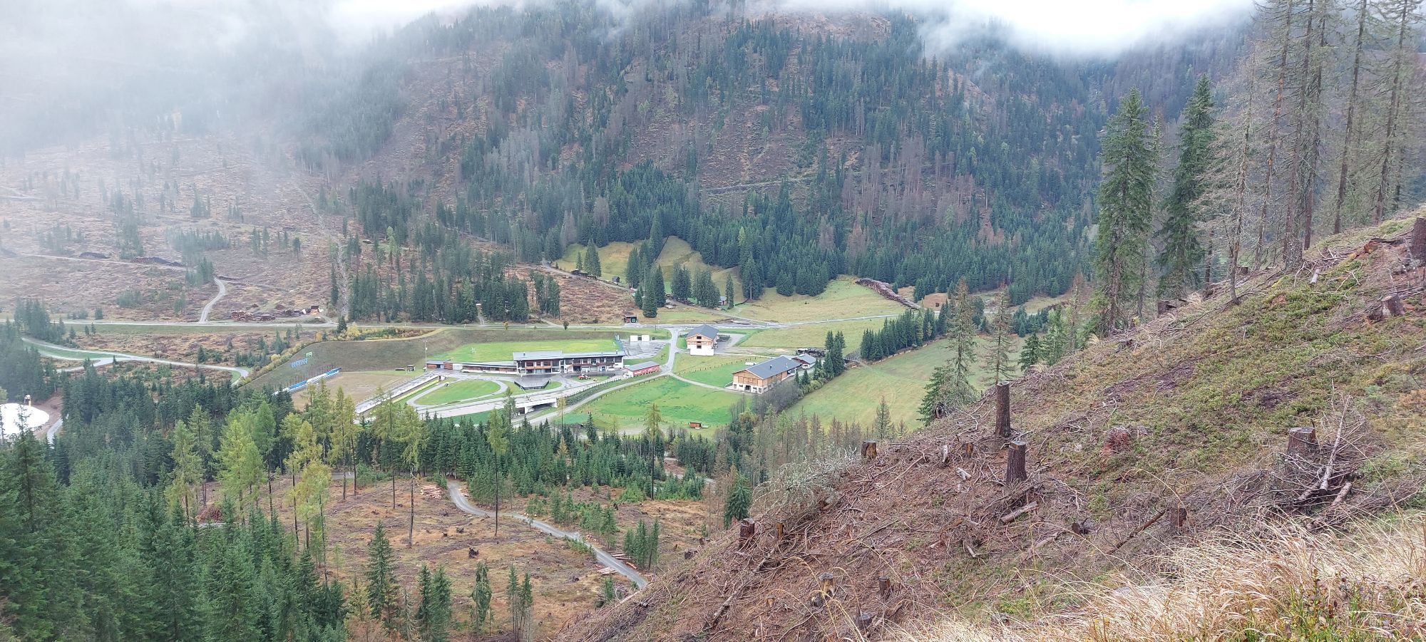
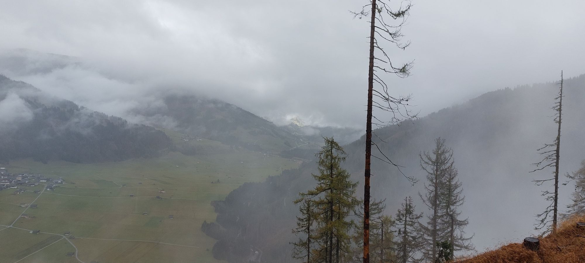
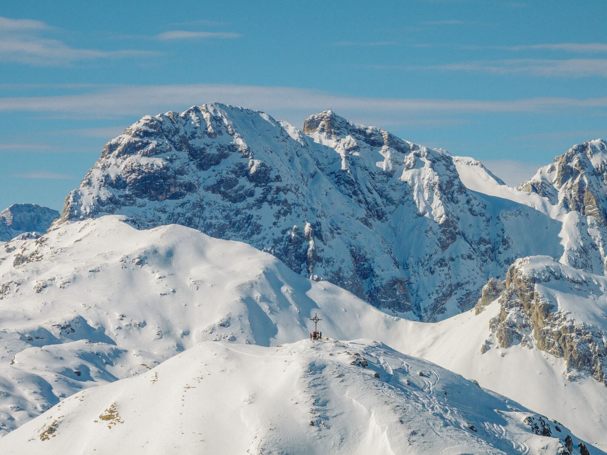
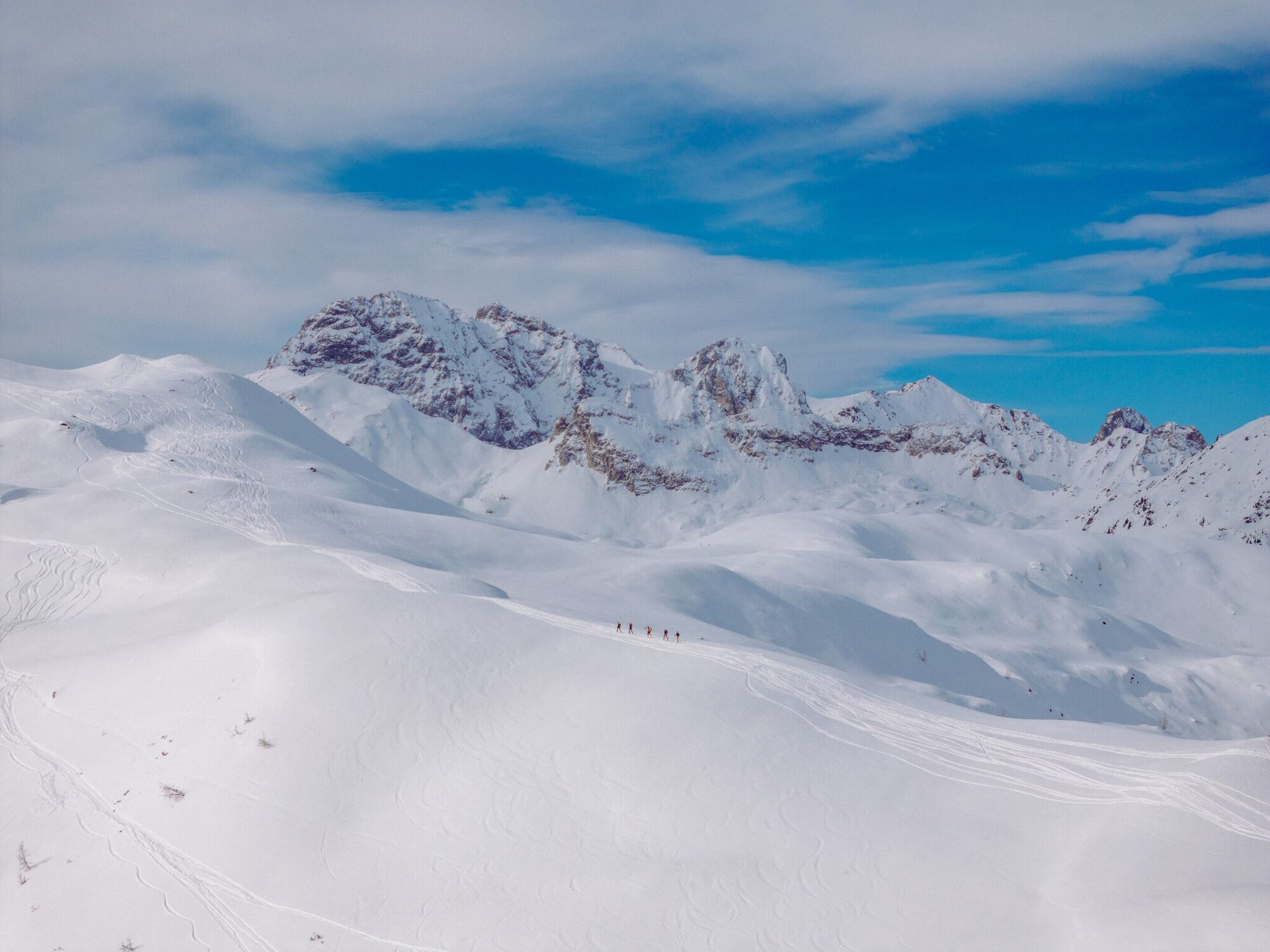
The ridge of the Hoher Bösring is in the shaded side of Obertilliach and separates Obertilliacher Tal from Leitental. The domed peak rises gently from the steep protected forest and is great for a trip in the depths of winter due to the low risk of avalanche. A forest road proceeds to the forest limit, which, depending on the snow, can be used for the descent and also makes it possible for less proficient skiers or those new to ski touring to get down safely. Starting point is the biathlon centre, around 1 kilometre to the west of Obertilliach (large car parking area). Where the slope climbs from its lowest point out of the bottom of the river and into the shaded forest, is where our tour begins (yellow signposts). Follow the slope briefly before heading into the dark forest and cutting the forest trail short by taking the mostly powder snow covered track. We get to a Jagdhüttl, which is in a romantic glade, before the track takes us back without any difficulties into open terrain. While we cross the little rise of the Zwieselegg (2169 m) the summit of the Hoher Bösring is already well visible. The short north-facing slope which follows can be tackled in just a few hairpin bends and is a key section in terms of avalanche technique (2 ½ - 3 hours from the car park). Descent along the ascent track and depending on the conditions, via the forest trail back into the valley.
Additional ski tour tips can be obtained in the ski tour guides by Thomas Mariacher. These are available here: http://www.grafikzloebl.at/verlag/buecher/
Additional ski tour tips can be obtained in the ski tour guides by Thomas Mariacher. These are available here: http://www.grafikzloebl.at/verlag/buecher/
Trasa
Trasa
Hoher Bösring
średni
Wycieczka narciarska
4,76
km
Ostatnio śledzony
tydzień temu
Informacje o przyjeździe
Przybycie
Mit dem Auto bis zum Biathlonzentrum Obertilliach
Transport publiczny
Mit dem Bus bis zur Haltestelle "Obertilliach Biathlonzentrum"
Parking
Parkplatz Obertilliach
Wyceny
1 Komentarz
sepp ranner
18. mar. 2025
Weryfikacja zakończona
Schön
Kamery internetowe z trasy
Aktywności na trasie

Popularne wycieczki w okolicy
-
4,5
Kartitsch-Obstansersee Hütte
średniWędrówka 13,1 km -
5,0
Porzehütte (1.942 m)
światłoWędrówka 9,01 km -
4,8
Sillianer Hütte 2.447 m
średniWędrówka 16,8 km -
4,2
Connyalm (2.070 m)
Wędrówka 6,36 km -
5,0
Tuffbad - Guggenberger Sattel - Samalm - Tuffbad
średniWędrówka 12,2 km -
5,0
Carnic altitude trail. Stage 4: Porzehütte – Hochweißsteinhaus
ciężkiWędrówka 17,5 km -
3,8
Karnischer Höhenweg KHW 403 - "Weg des Friedens"
średniWędrówka 46,7 km -
2,0
Porzehütte/Tilliacher Joch am Karnischen Kamm
średniMountainbike 8,99 km -
5,0
Karnischer Höhenweg – Etappe 2: Obstansersee Hütte – Porzehütte
ciężkidługodystansowy szlak pieszy 12,0 km -
4,5
Klammbrückl - Kerschbaumeralm - Spitzkofel
ciężkiWędrówka 8,71 km

Wędrówki i tropienie

Ponad 550.000 propozycji wycieczek, szczegółowe mapy i intuicyjny planer tras sprawiają, że aplikacja jest niezbędna dla wszystkich entuzjastów przyrody.

Nie przegap ofert i inspiracji na następne wakacje
Zapisz się do newslettera
Błąd
Wystąpił błąd. Spróbuj ponownie.
Dziękujemy za rejestrację
Twój adres e-mail została dodana do listy mailingowej.
Wycieczki po całej Europie
Austria
Szwajcaria
Niemcy
Włochy
Słowenię
Francja
Holandia
Belgia
Polska
Liechtenstein
Czechy
Słowacja
Hiszpania
Chorwacja
Bośnia i Hercegowina
Luksemburg
Andorra
Portugalia
Islandia
Wielka Brytania
Irlandia
Grecja
Albania
Macedonia Północna
Malta
Norwegia
Czarnogóra
Mołdawia
Kosowo
Węgry
San Marino
Rumunia
Estonia
Łotwa
Białoruś
Cypr
Litwa
Serbia
Bułgaria
Monako
Dania
Szwecja
Finlandia