


3-day mountain hut walk
Zdjęcia naszych użytkowników
-

 © AlexanderUtworzono dnia 20.12.2020
 -
 © AlexanderUtworzono dnia 20.12.2020
 -
 © Anne 1980Utworzono dnia 21.03.2026
 -
 © En RicoUtworzono dnia 12.02.2026
 -
 © En RicoUtworzono dnia 12.02.2026
 -
 © Péter SzelencsikUtworzono dnia 11.01.2026
 -
 © Sonja BoscarolliUtworzono dnia 20.12.2025
 -

 © MarianneUtworzono dnia 04.11.2025
 -
 © Rico NoackUtworzono dnia 15.10.2025
 -
 © Kirsten BrendelUtworzono dnia 09.10.2025
 -
 © Kirsten BrendelUtworzono dnia 09.10.2025
 -
 © Kirsten BrendelUtworzono dnia 09.10.2025
 -
 © Sabrina ArtmannUtworzono dnia 21.09.2025
 -
 © Sabrina ArtmannUtworzono dnia 21.09.2025
 -
 © Sabrina ArtmannUtworzono dnia 21.09.2025
 -
 © Philipp RößlerUtworzono dnia 19.09.2025
 -
 © Philipp RößlerUtworzono dnia 19.09.2025
 -
 © Philipp RößlerUtworzono dnia 19.09.2025
 -
 © Philipp RößlerUtworzono dnia 19.09.2025
 -
 © Philipp RößlerUtworzono dnia 19.09.2025
 -
 © Philipp RößlerUtworzono dnia 19.09.2025
 -
 © Philipp RößlerUtworzono dnia 19.09.2025
 -
 © Philipp RößlerUtworzono dnia 19.09.2025
 -
 © Philipp RößlerUtworzono dnia 19.09.2025
 -
 © SKrebsUtworzono dnia 15.09.2025
 -
 © HustmeissnerUtworzono dnia 04.09.2025
 -
 © Sandra WinkelmannUtworzono dnia 23.08.2025
 -
 © Sandra WinkelmannUtworzono dnia 23.08.2025
 -
 © Sandra WinkelmannUtworzono dnia 23.08.2025
 -
 © Sandra WinkelmannUtworzono dnia 23.08.2025
 -
 © Sandra WinkelmannUtworzono dnia 23.08.2025
 -
 © Sandra WinkelmannUtworzono dnia 23.08.2025
 -
 © Sandra WinkelmannUtworzono dnia 23.08.2025
 -
 © Sandra WinkelmannUtworzono dnia 23.08.2025
 -
 © Sandra WinkelmannUtworzono dnia 23.08.2025
 -
 © Péter OroszUtworzono dnia 18.08.2025
 -
 © Willy 11Utworzono dnia 15.08.2025
 -
 © Willy 11Utworzono dnia 13.08.2025
 -
 © Willy 11Utworzono dnia 13.08.2025
 -
 © Michael SomerwilUtworzono dnia 06.08.2025
 -
 © Michael SomerwilUtworzono dnia 06.08.2025
 -
 © Michael SomerwilUtworzono dnia 06.08.2025
 -

 © Stefan AustUtworzono dnia 18.07.2025
 -
 © Stefan AustUtworzono dnia 18.07.2025
 -
 © Stefan AustUtworzono dnia 18.07.2025
 -
 © Stefan AustUtworzono dnia 18.07.2025
 -
 © Stefan AustUtworzono dnia 18.07.2025
 -
 © Stefan AustUtworzono dnia 18.07.2025


Stage 1:
Start in Going, Hüttling (820 m). Forest road 817 leads you via the Graspoint-Niederalm (981 m) up to the Obere Regalm with homemade regional delicacies (1,313 m; only open in summer on Fridays,...
Stage 1:
Start in Going, Hüttling (820 m). Forest road 817 leads you via the Graspoint-Niederalm (981 m) up to the Obere Regalm with homemade regional delicacies (1,313 m; only open in summer on Fridays, Saturdays, Sundays, from middle September until middle October only Saturdays & Sundays).
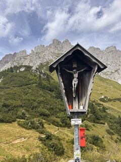
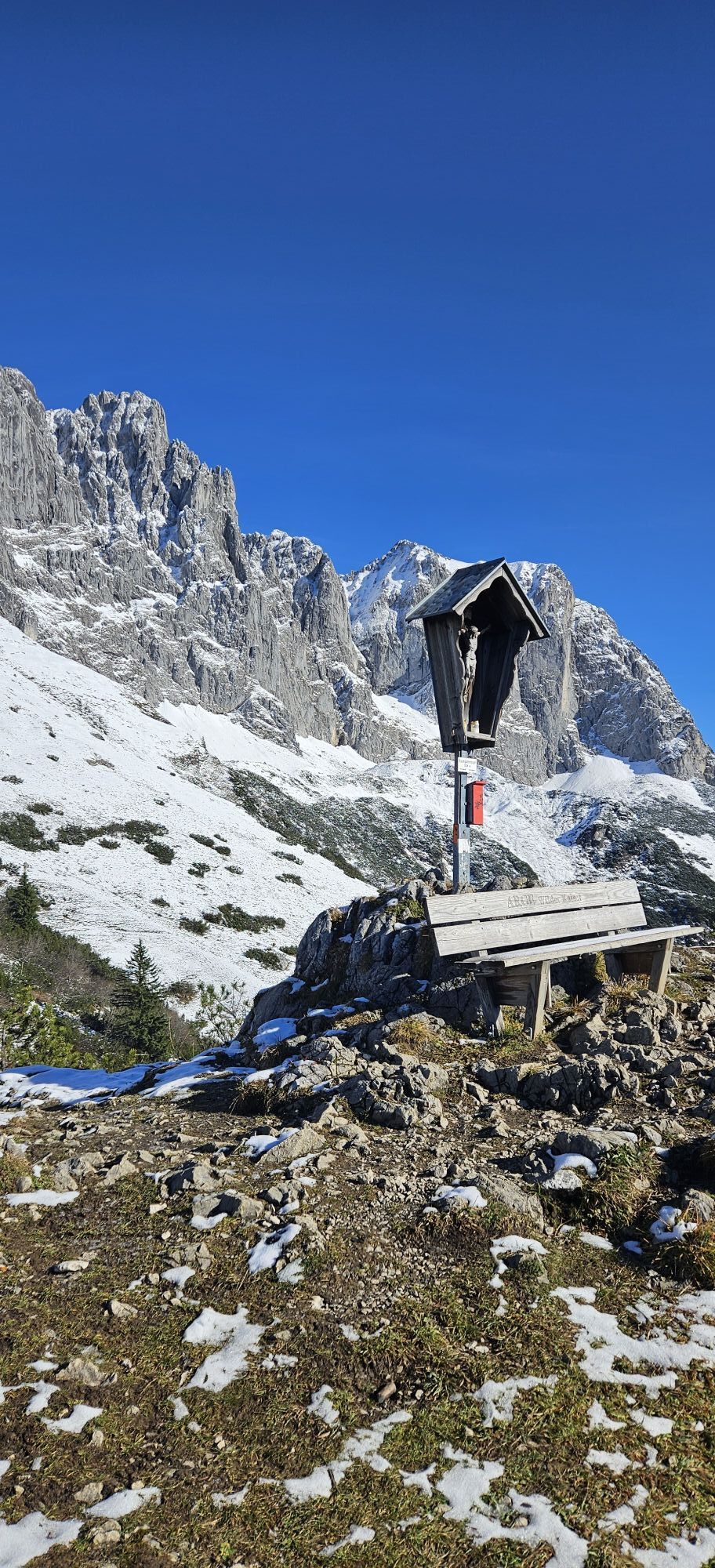
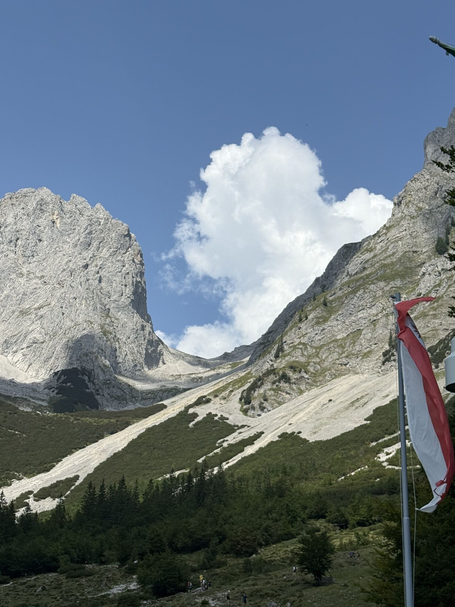
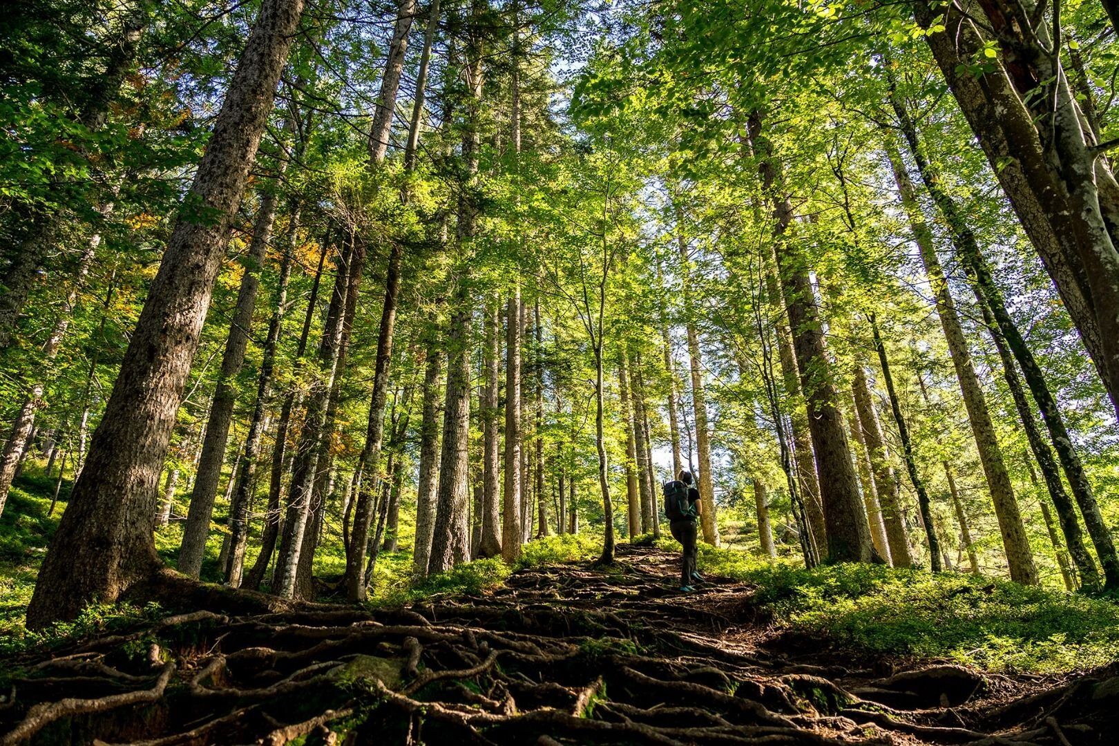
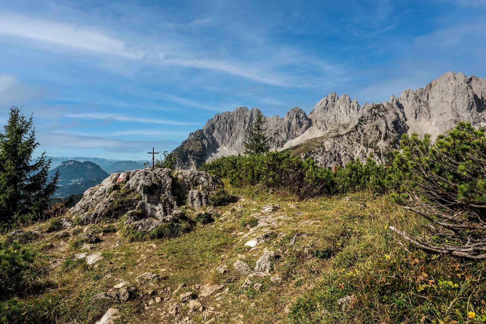
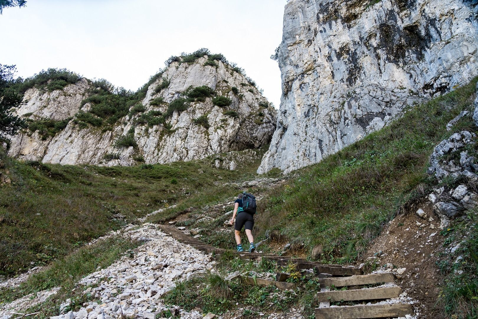
Suitably fortified, you should head uphill through the Alpine meadows on the picturesque trail 827 until you reach the Brennender Palven mountain (also known as the Baumgartenköpfl, 1,572 m). You are rewarded for having made the ascent with fantastic panoramas over the rock massif of the Wilder Kaiser in the north and over the Kitzbühel Alps and Hohe Tauern mountain range in the south. This is also the site of the famous Bergsteigergrab, which is the final resting place of the “Koasamuch”. This famous climber from the “Edelweissgilde” organisation, born Much Wieser in Scheffau in 1888, was dedicated to having summit books on all summits in the Wilder Kaiser region.
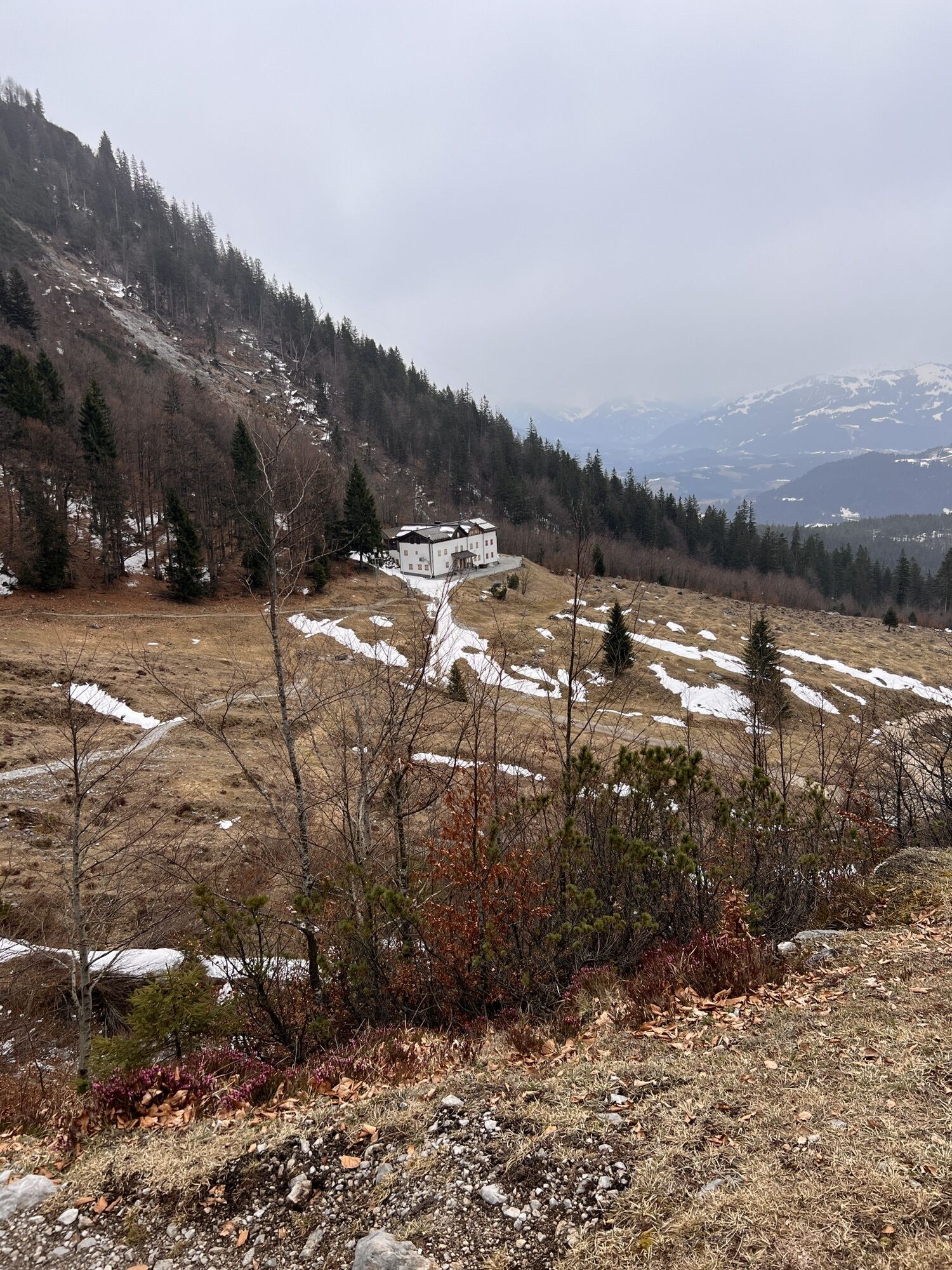
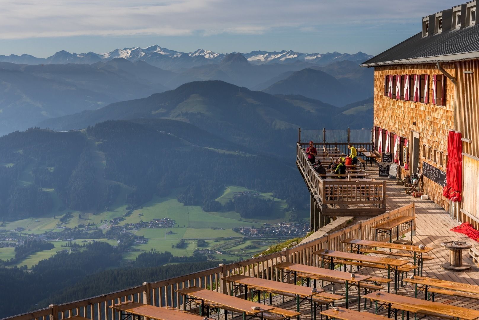
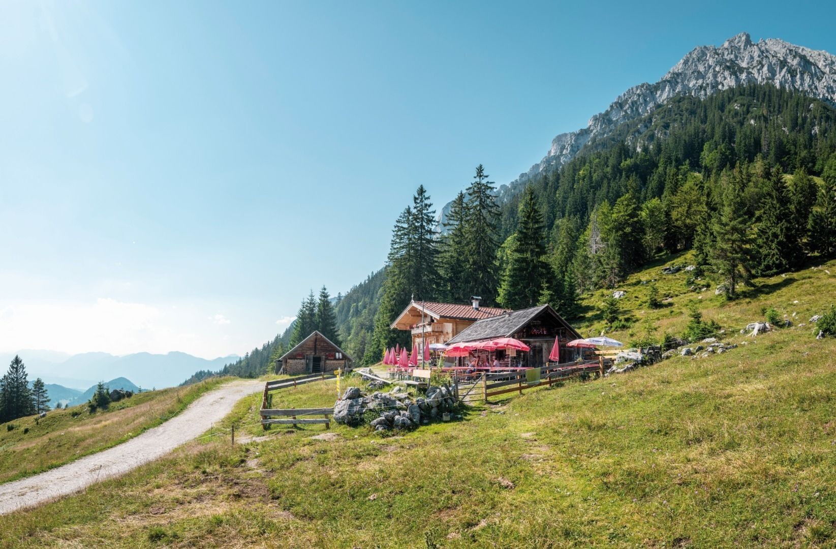
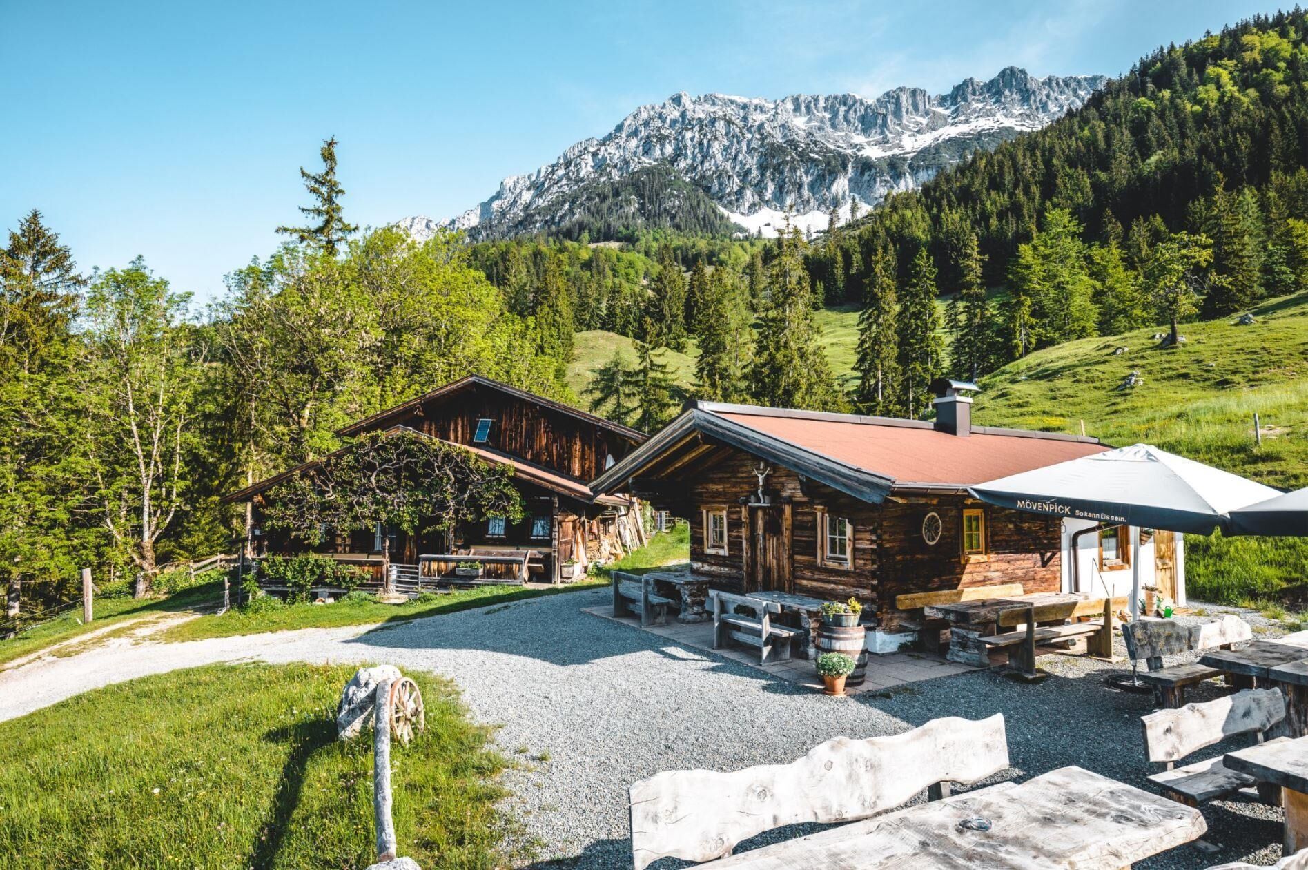
Path 824 heads west, leading down towards the Gaudeamushütte (1,263 m). This cosy mountain hut is an inviting option for a refreshment stop or even your first overnight stay. Enjoy the fascinating view into Ellmauer Tor!
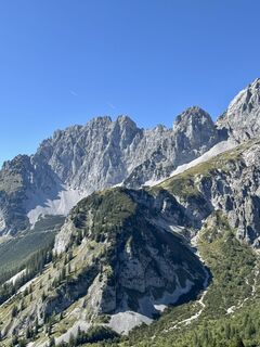
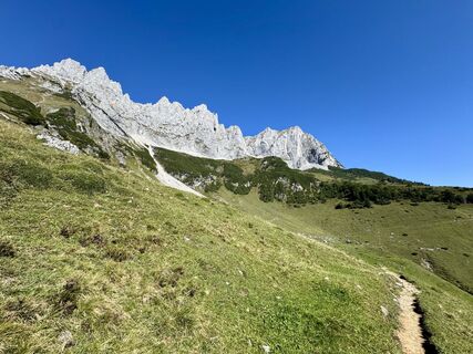
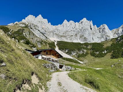
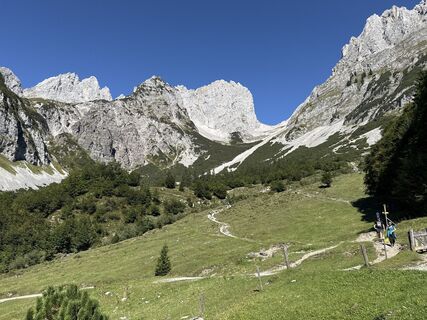
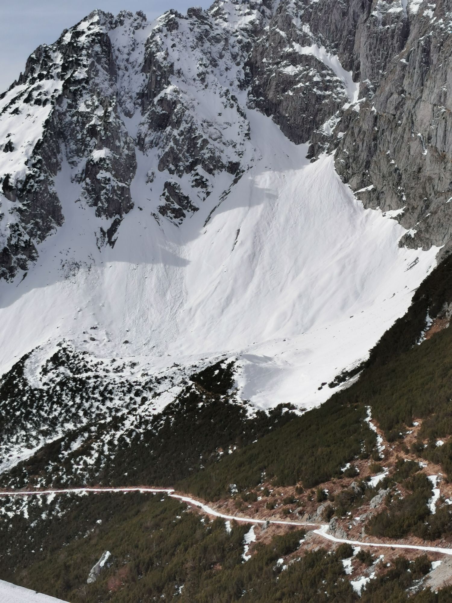
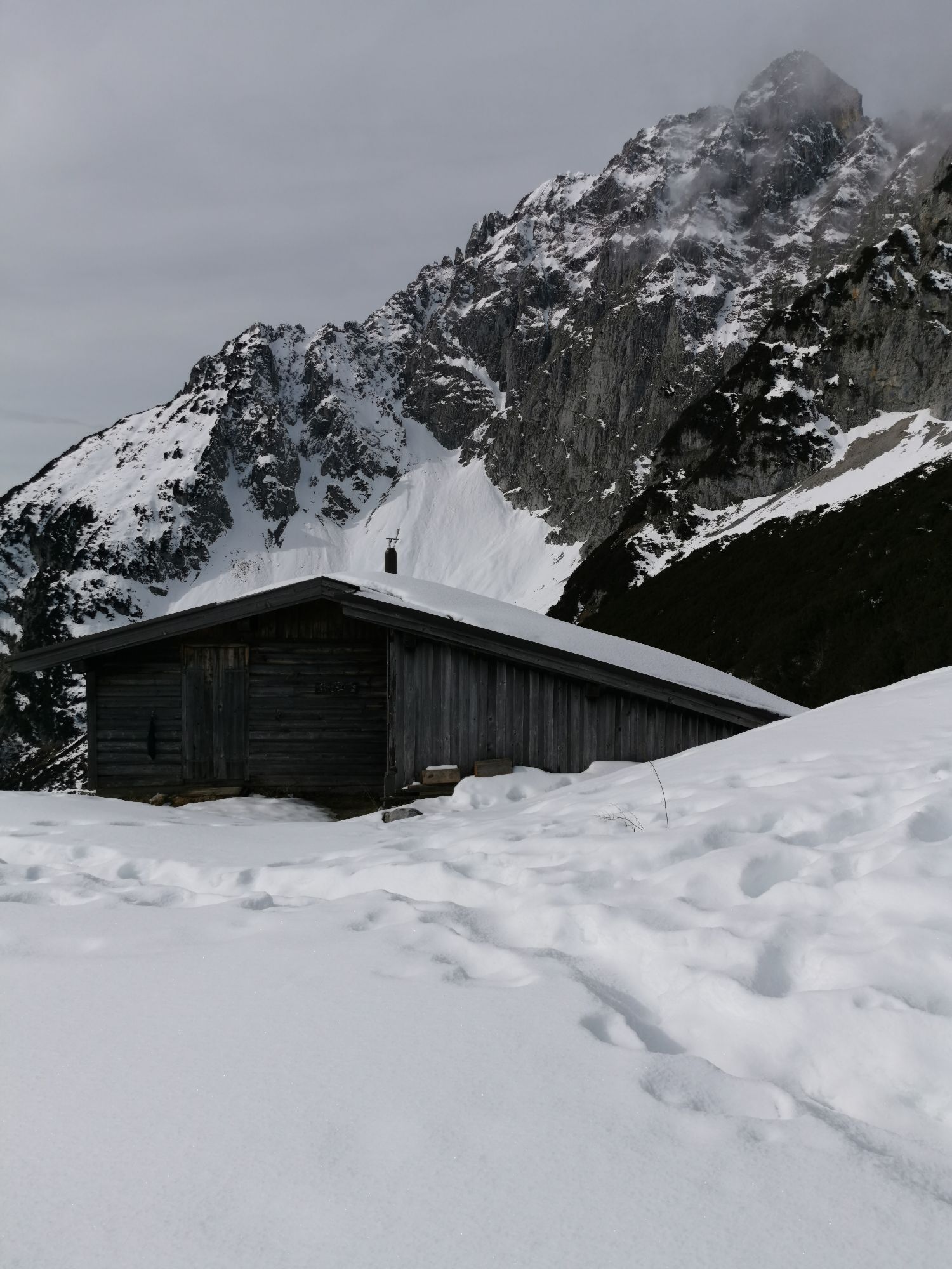
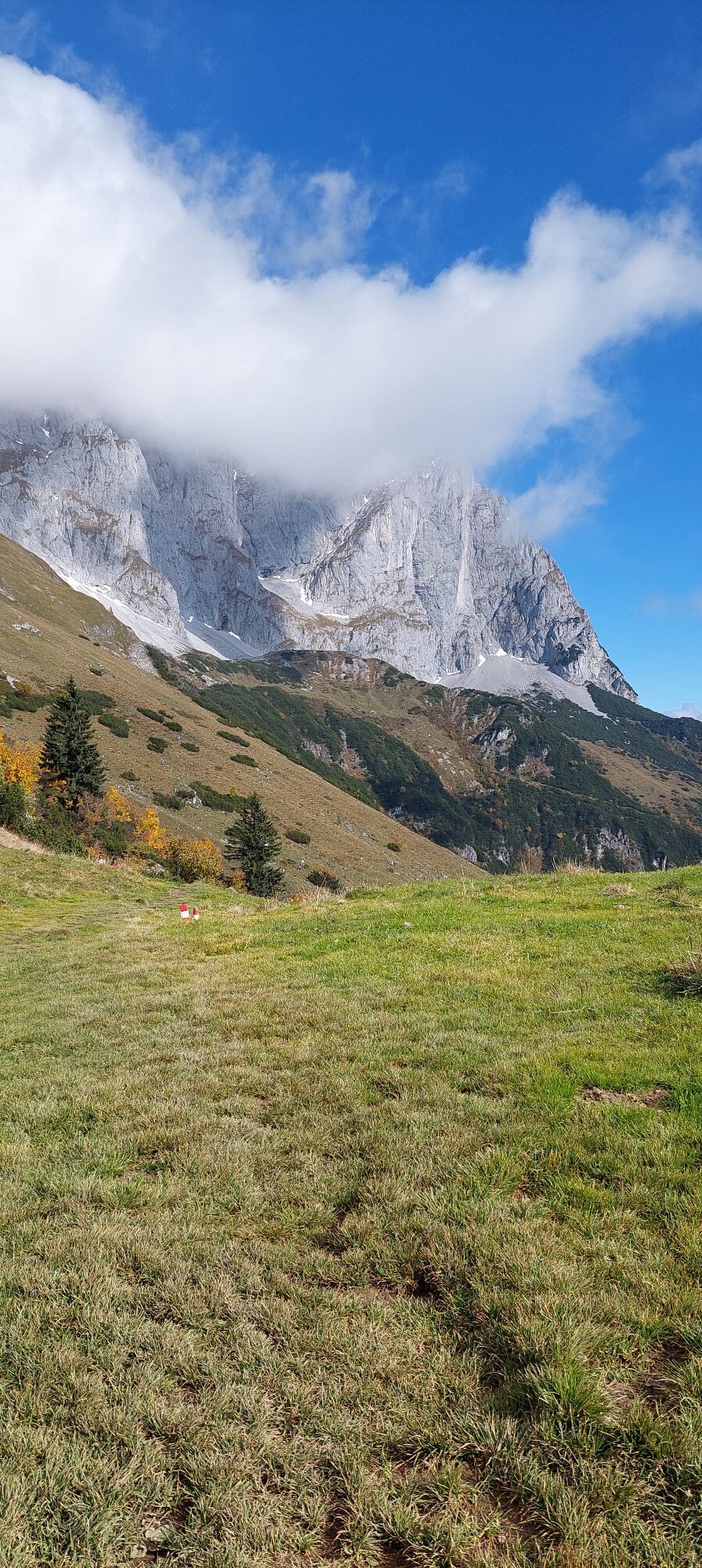
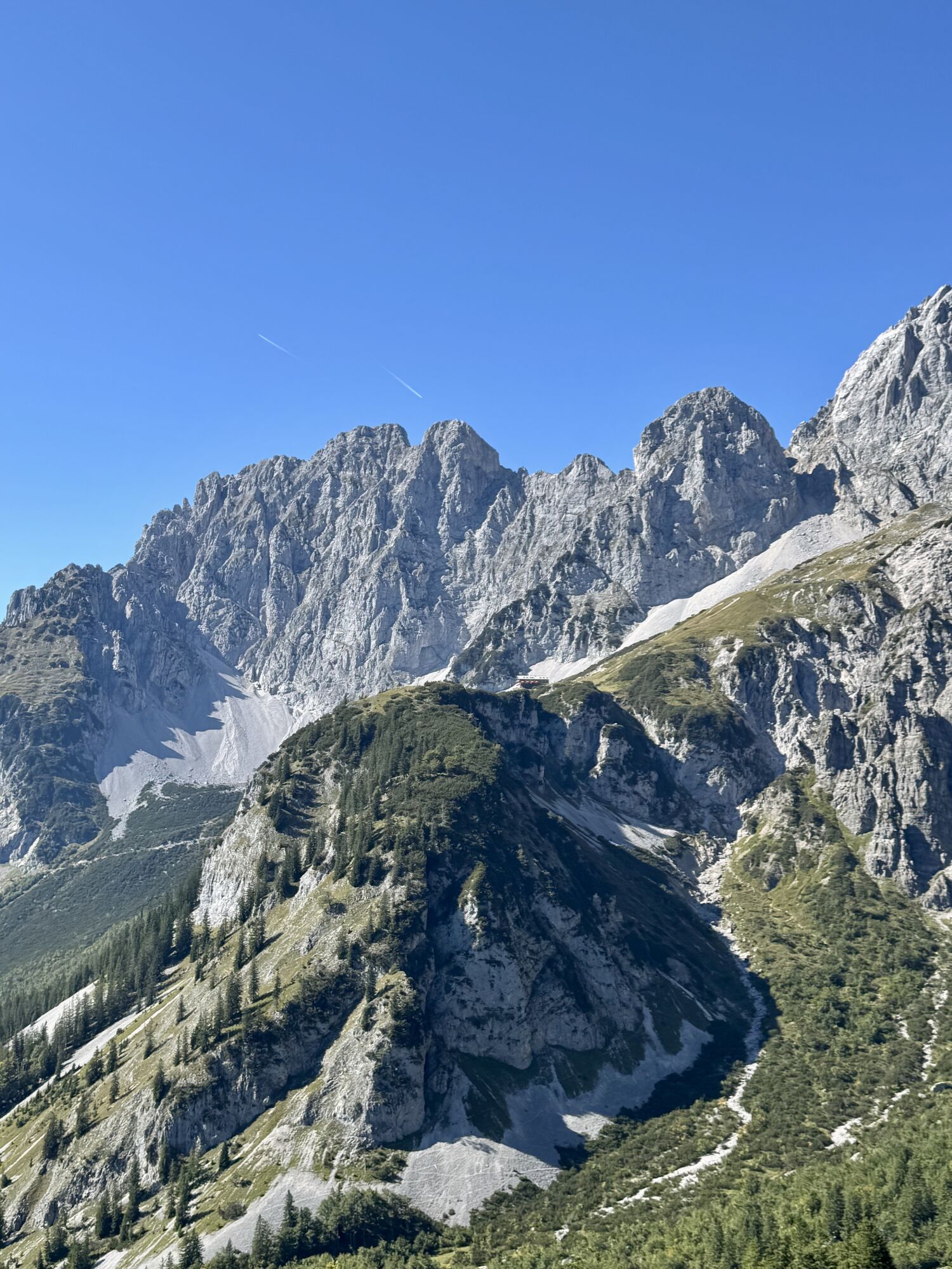
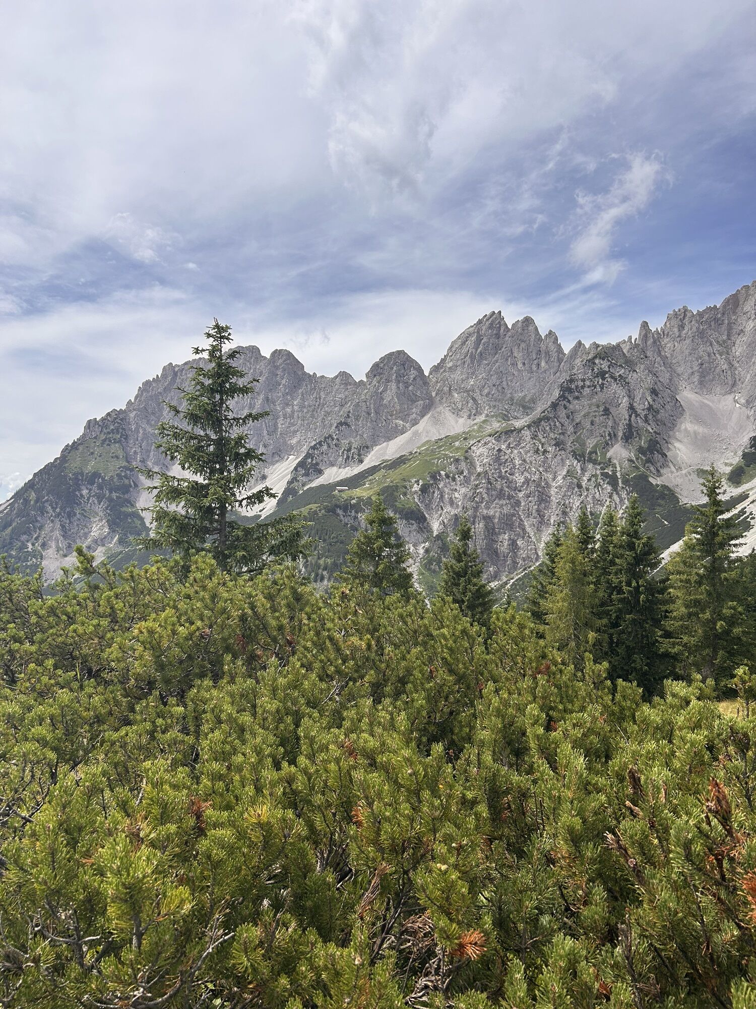
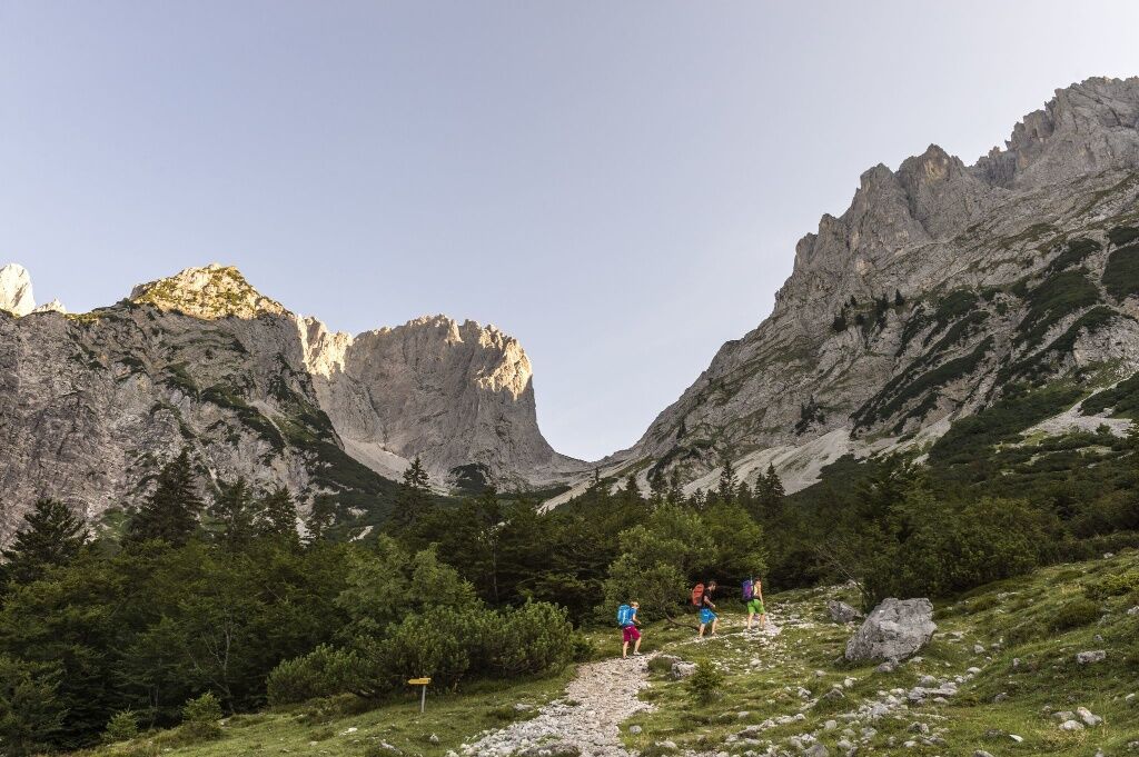
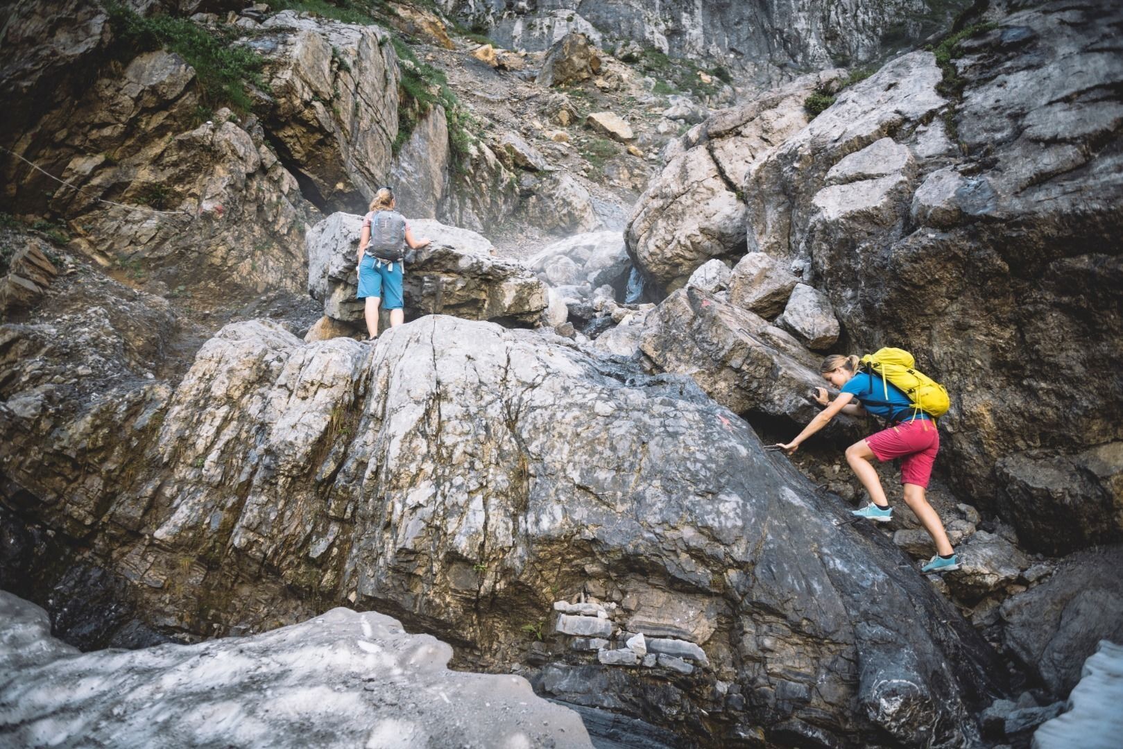
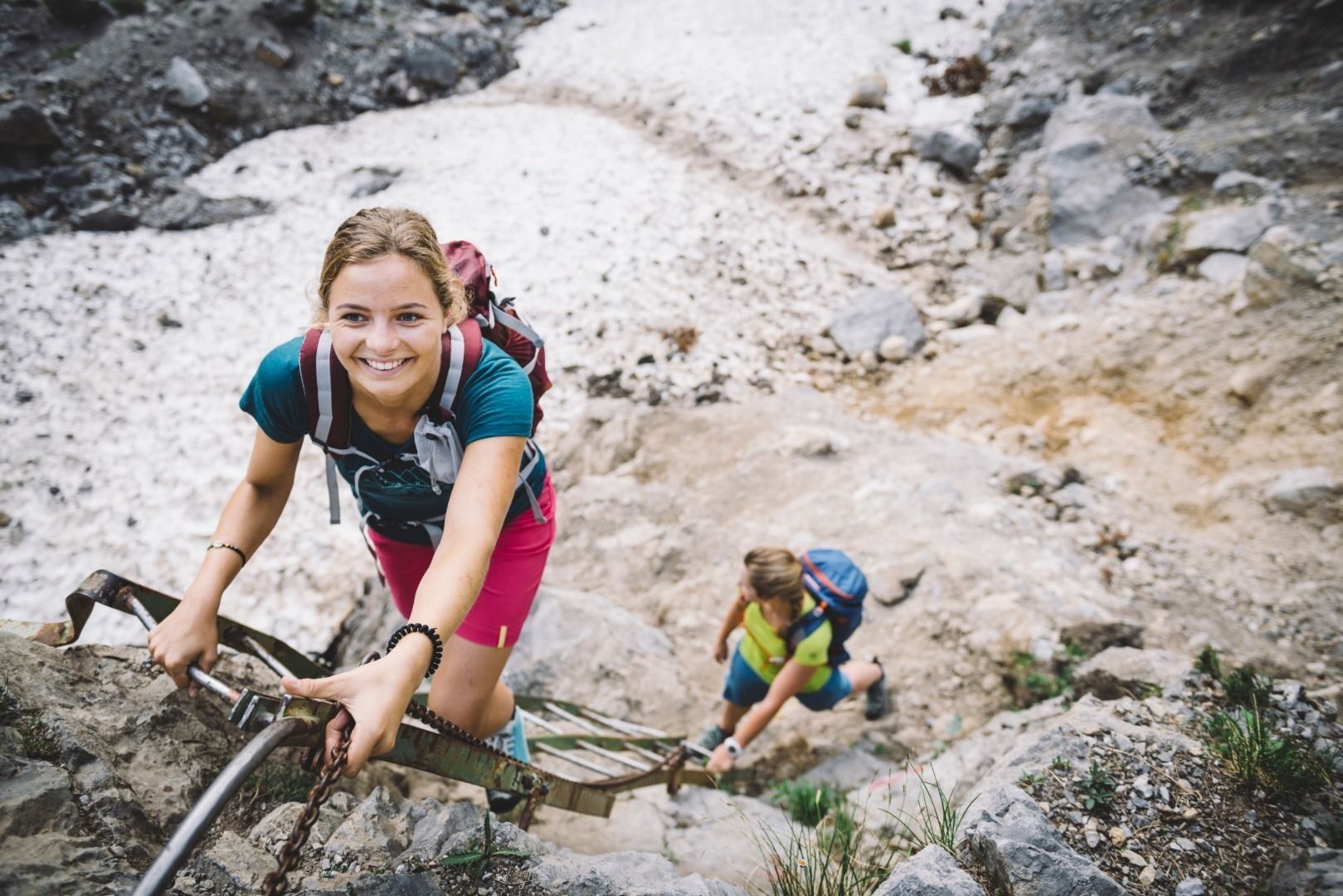
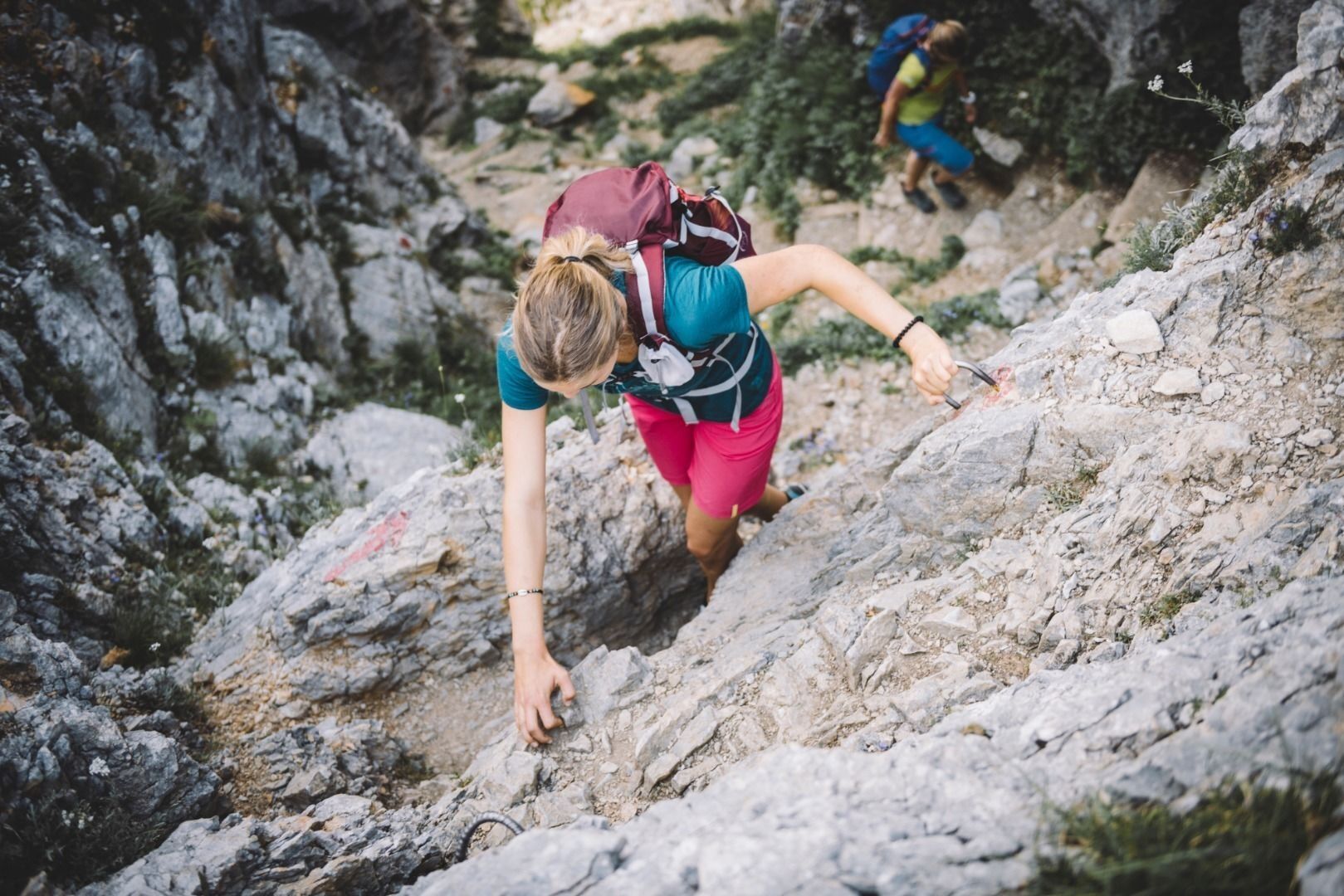
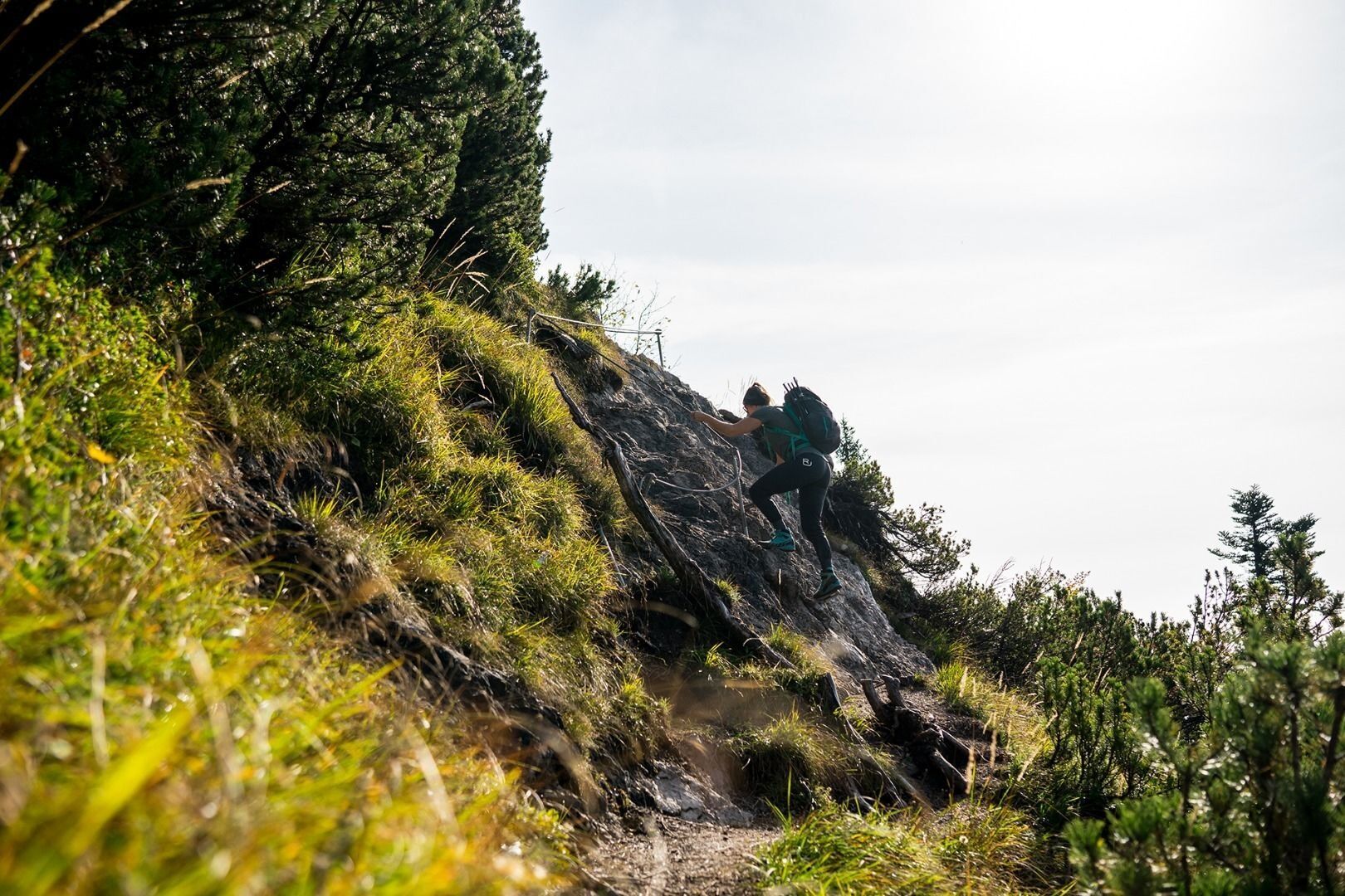
If you continue walking to the Gruttenhütte mountain hut, you will need to stay on path 824/813 towards Klamml as of this point. The narrow path, which leads through the steep Klamml, is secured with a ladder and several iron clamps (surefootedness and a good head for heights are essential – caution due to danger of rock falls from the via ferrata!). After following a number of bends, the Gruttenhütte (1,620 m) will come into view. This hut was built in 1899 and is the highest in the Wilder Kaiser. It is exposed on a rocky crest, features a beautiful sun terrace and is located directly at the foot of the Ellmauer Halt. This is the highest summit in the Wilder Kaiser region at 2,344 metres and an important starting point for mountaineers and climbers. On a clear day, you can savour wonderful views as far as the Grossvenediger mountain.
Stage 2:
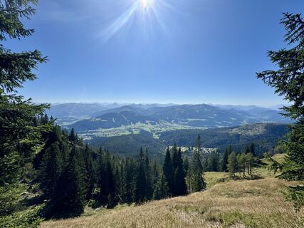
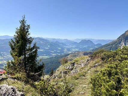
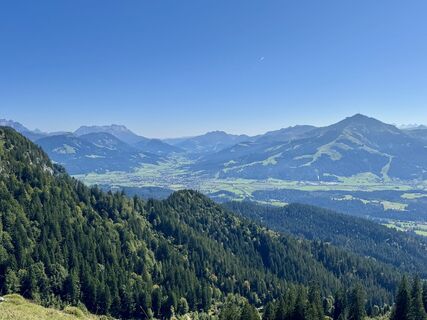
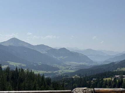
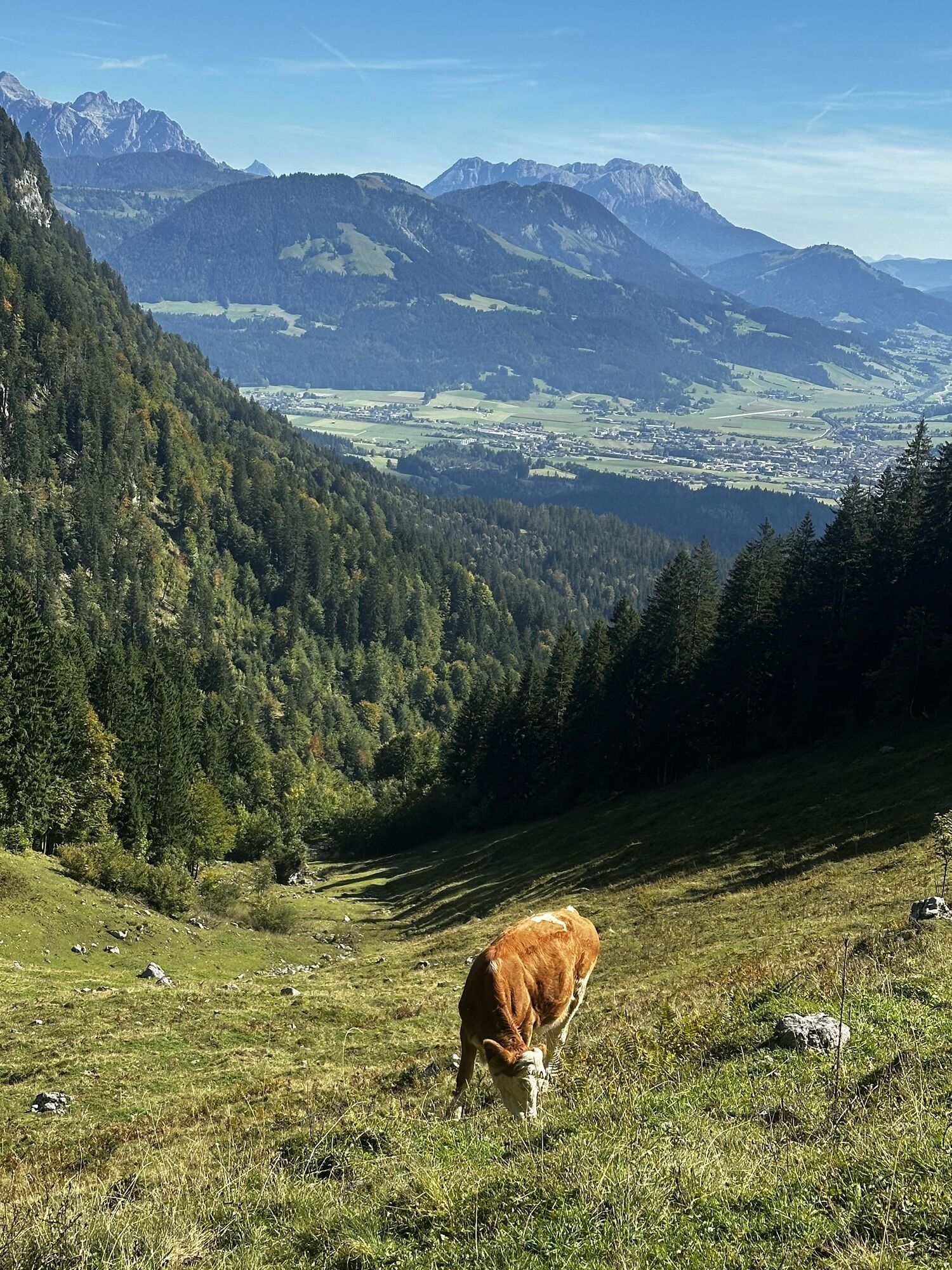
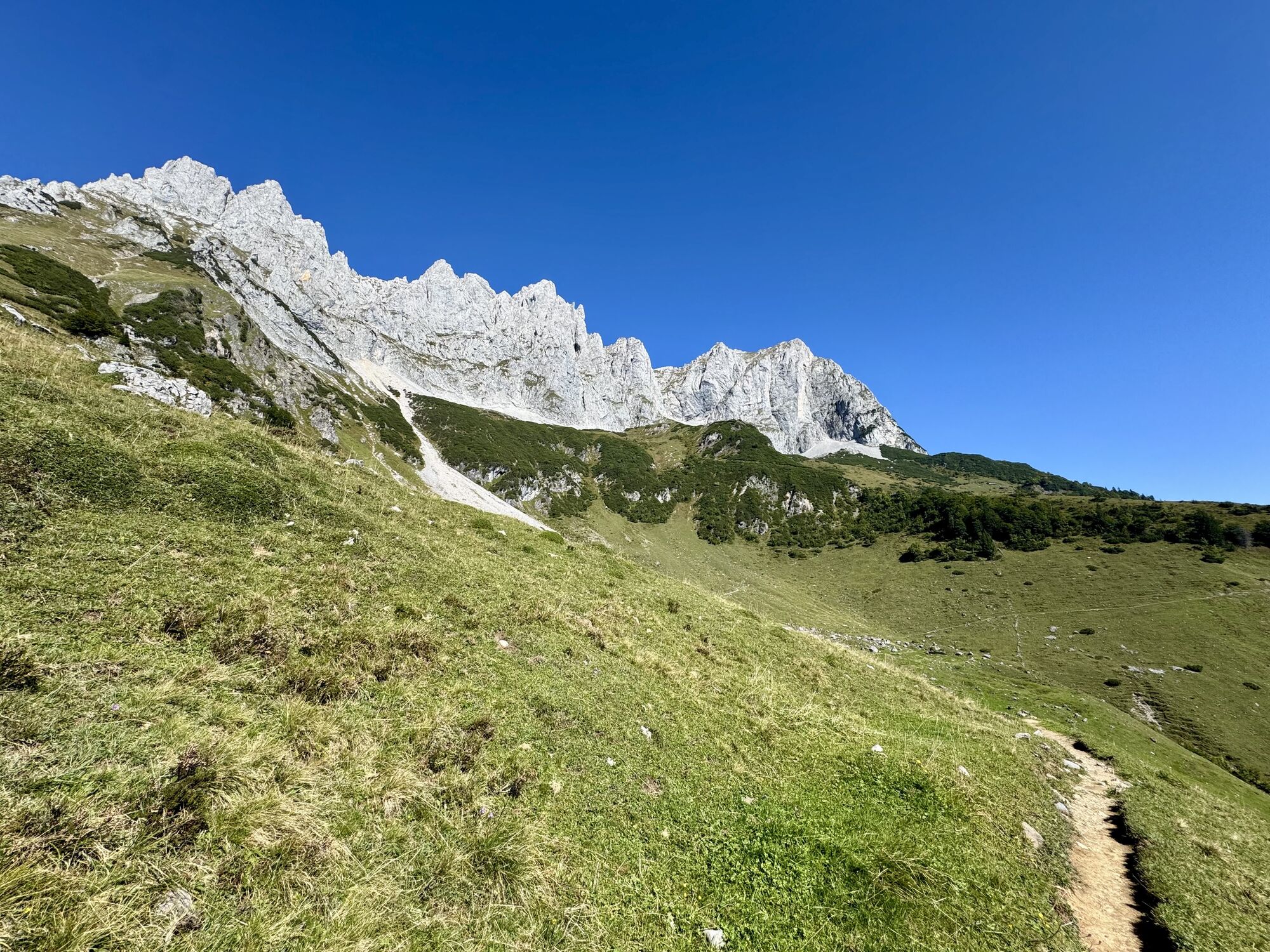
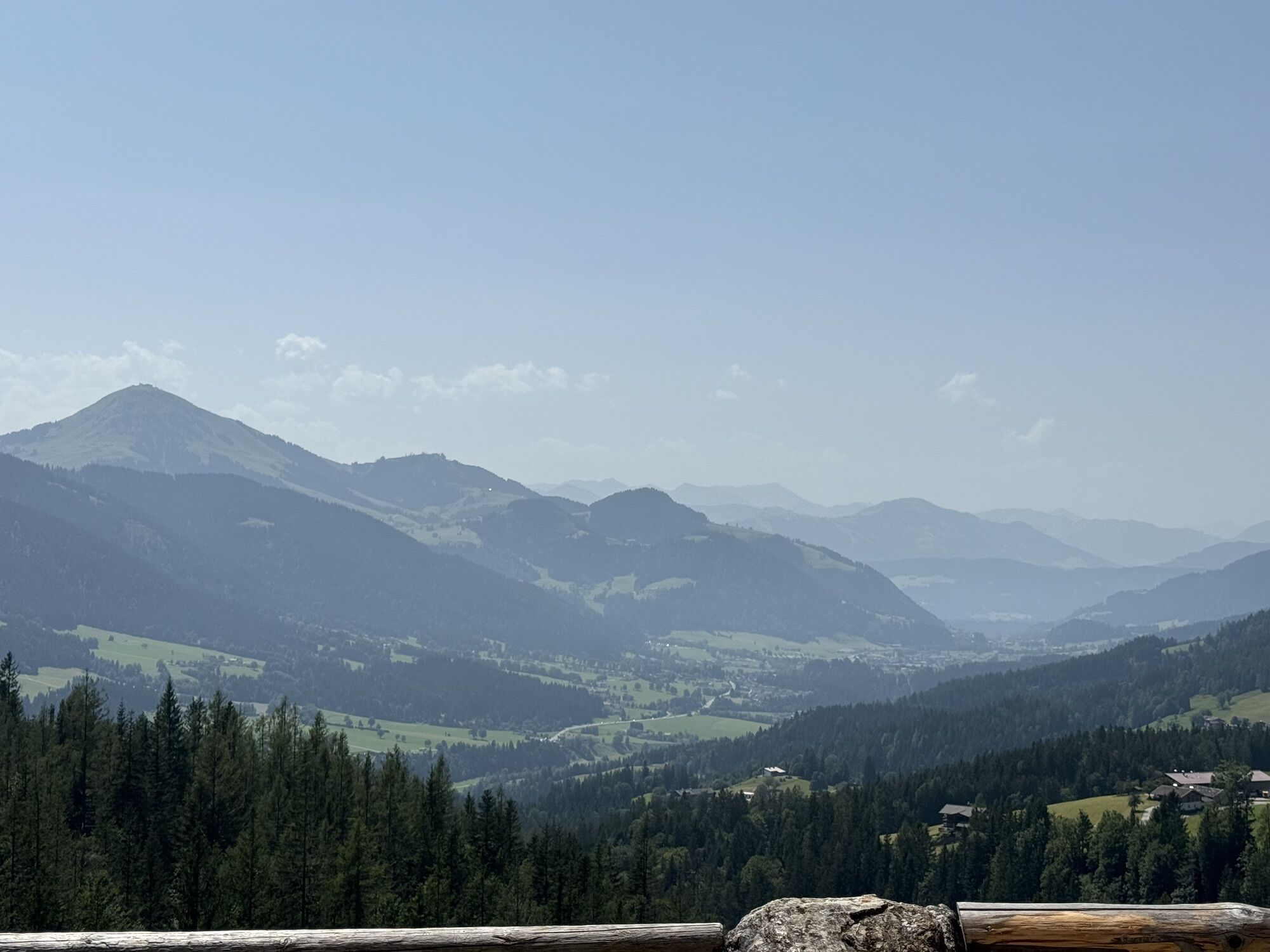
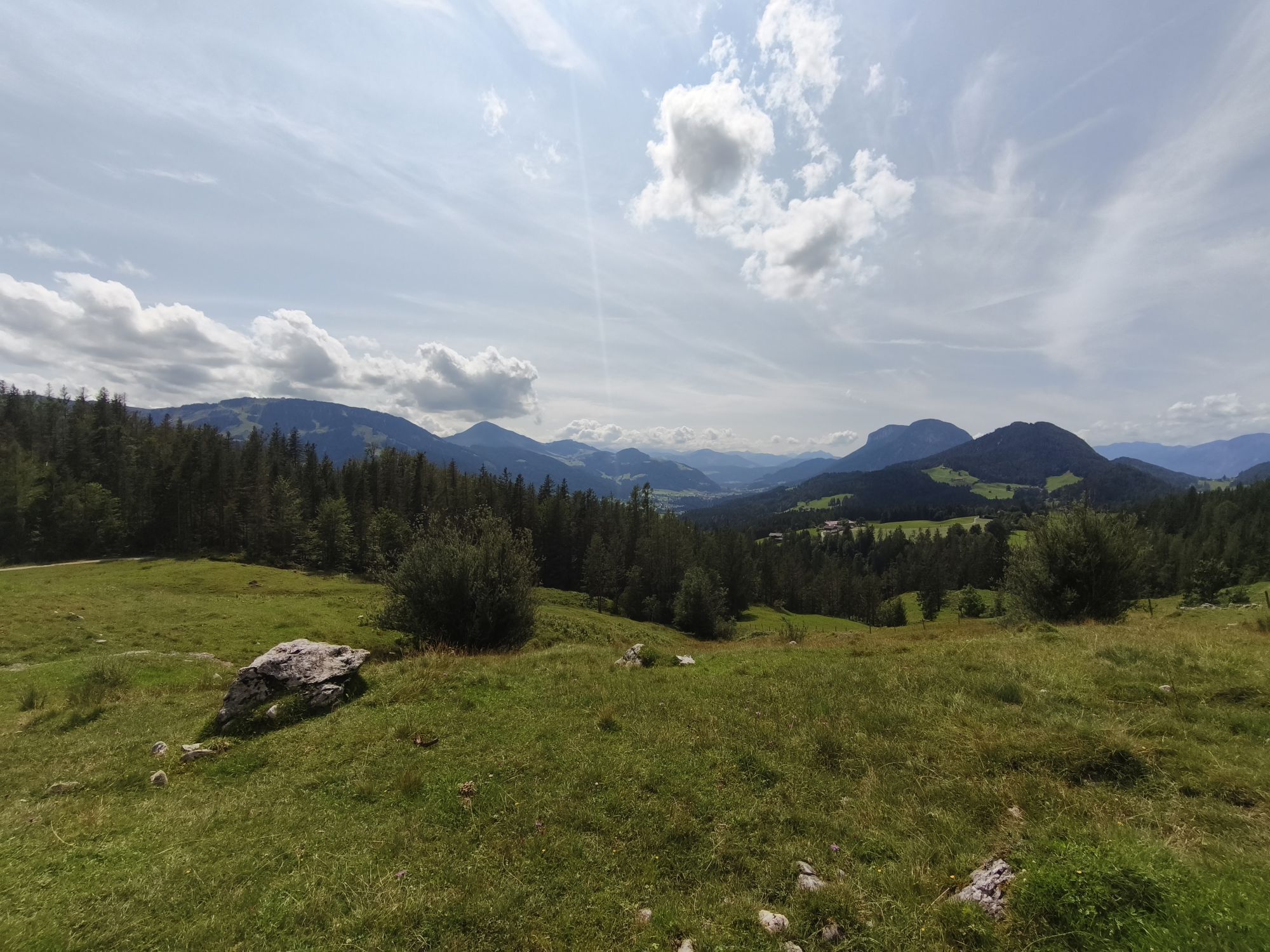
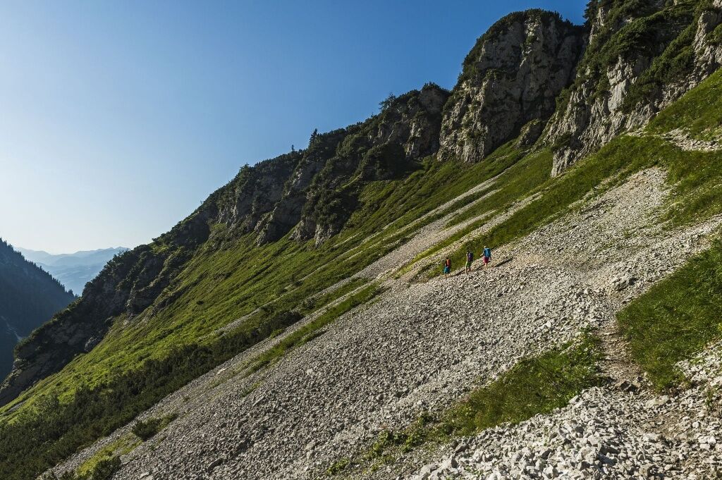
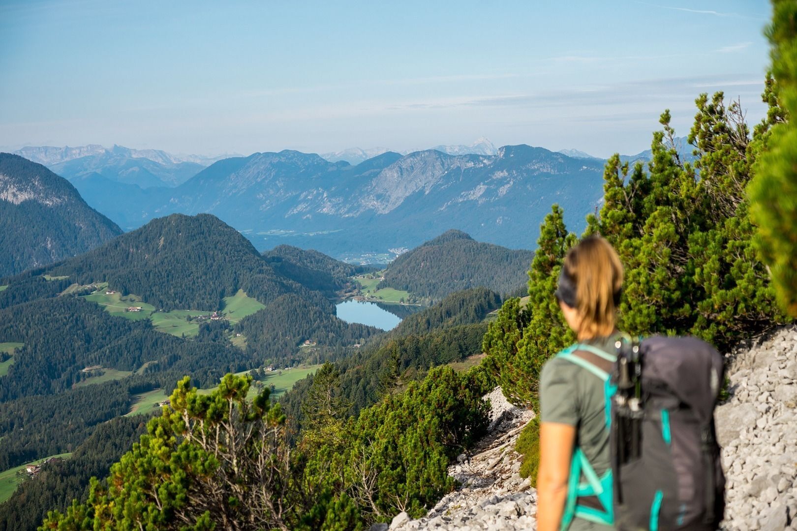
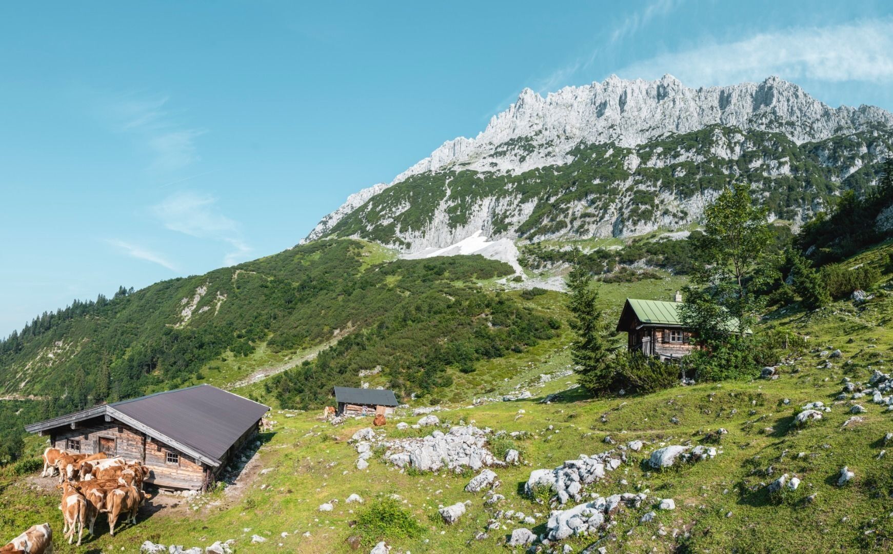
Starting from the Gruttenhütte mountain hut, hike west on road 14a for the first 15 minutes. At the next singpost you turn over a few steps onto the Wilder-Kaiser-Steig trail (WKS) 823. You hike in southwesterly direction, beneath the Treffauer and Tuxeck summits via the Lenggries (one of the largest gravel cirques in the Wilder Kaiser region), you pass by mountain pines and through mountain forests. The Kitzbühel Alps and the glaciers of the Hohe Tauern mountain range are always in view. The wild and romantic Kaiser-Hochalm Alpine pasture, which is located below the Sonnenstein mountain, does not feature any establishments that serve food but is still a wonderful photo opportunity.
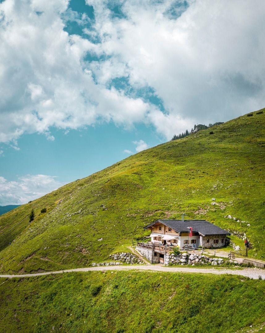
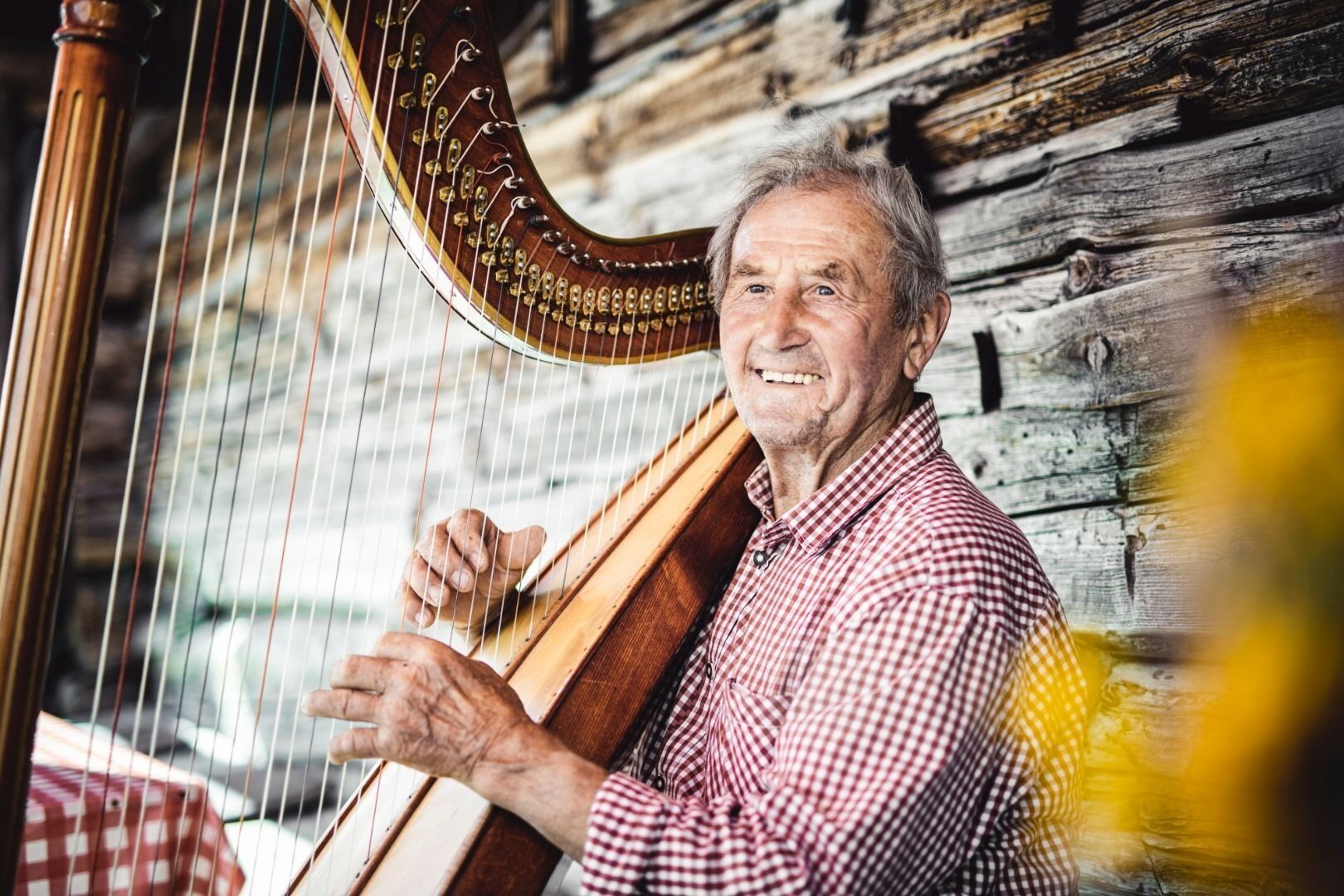
Continue on the Wilder-Kaiser-Steig trail 821/823 to Steiner-Hochalm mountain hut (1,257 m; only serves drinks). Enjoy a pleasant rest, with innkeepers Maridi and Peter often also serving up spontaneous harp music and song.
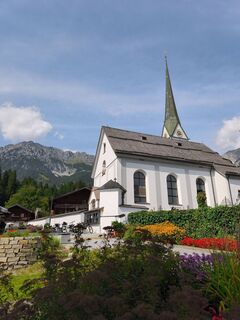
Once this has put a spring in your step, you should start walking along the road and subsequently on the Höhenweg trail 821. Head downhill in the direction of Bärnstatt/Hintersteiner See until you come to the St. Leonhard Kapelle chapel. Slightly further south, the Gasthof Bärnstatt inn offers a place to stay for those looking to enjoy a gentle hike. Alternatively, you can follow the road to the Seestüberl restaurant on the eastern bank of Hintersteiner See lake.
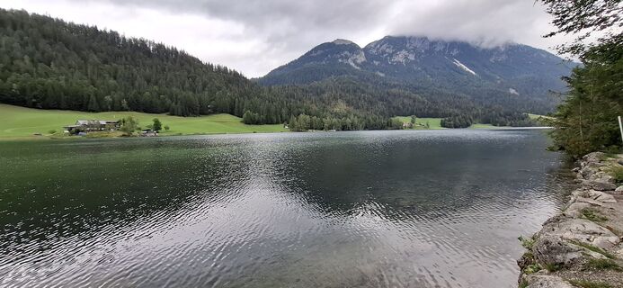
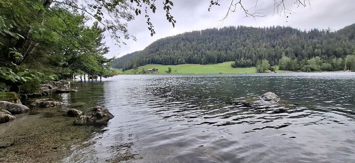
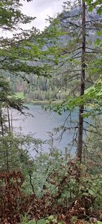
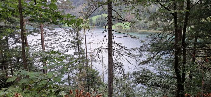
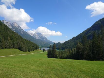
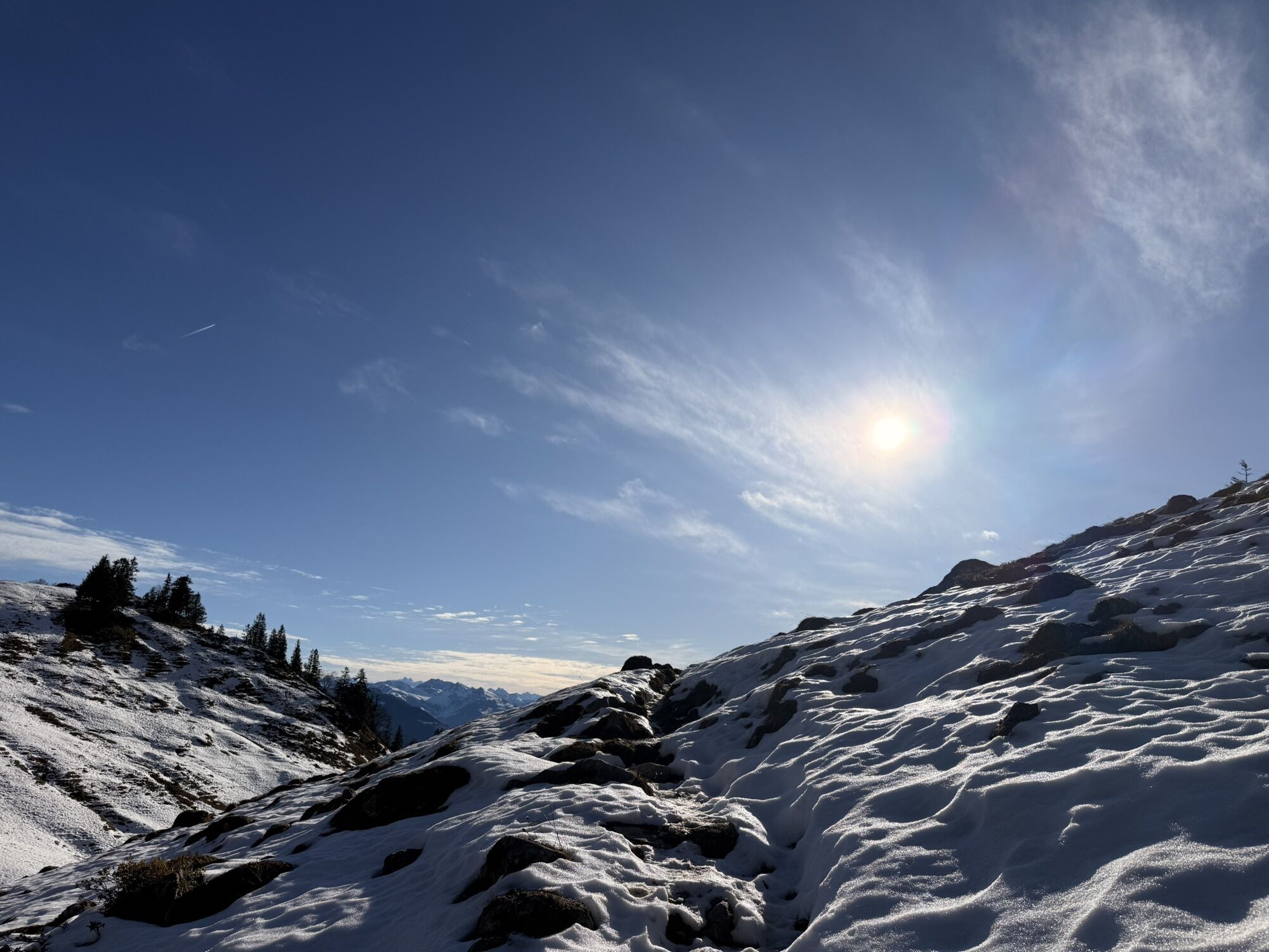
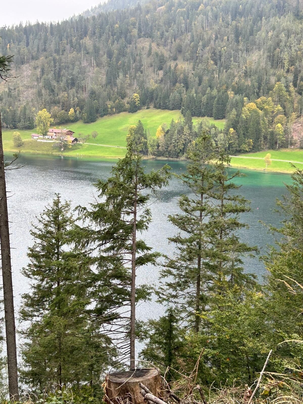
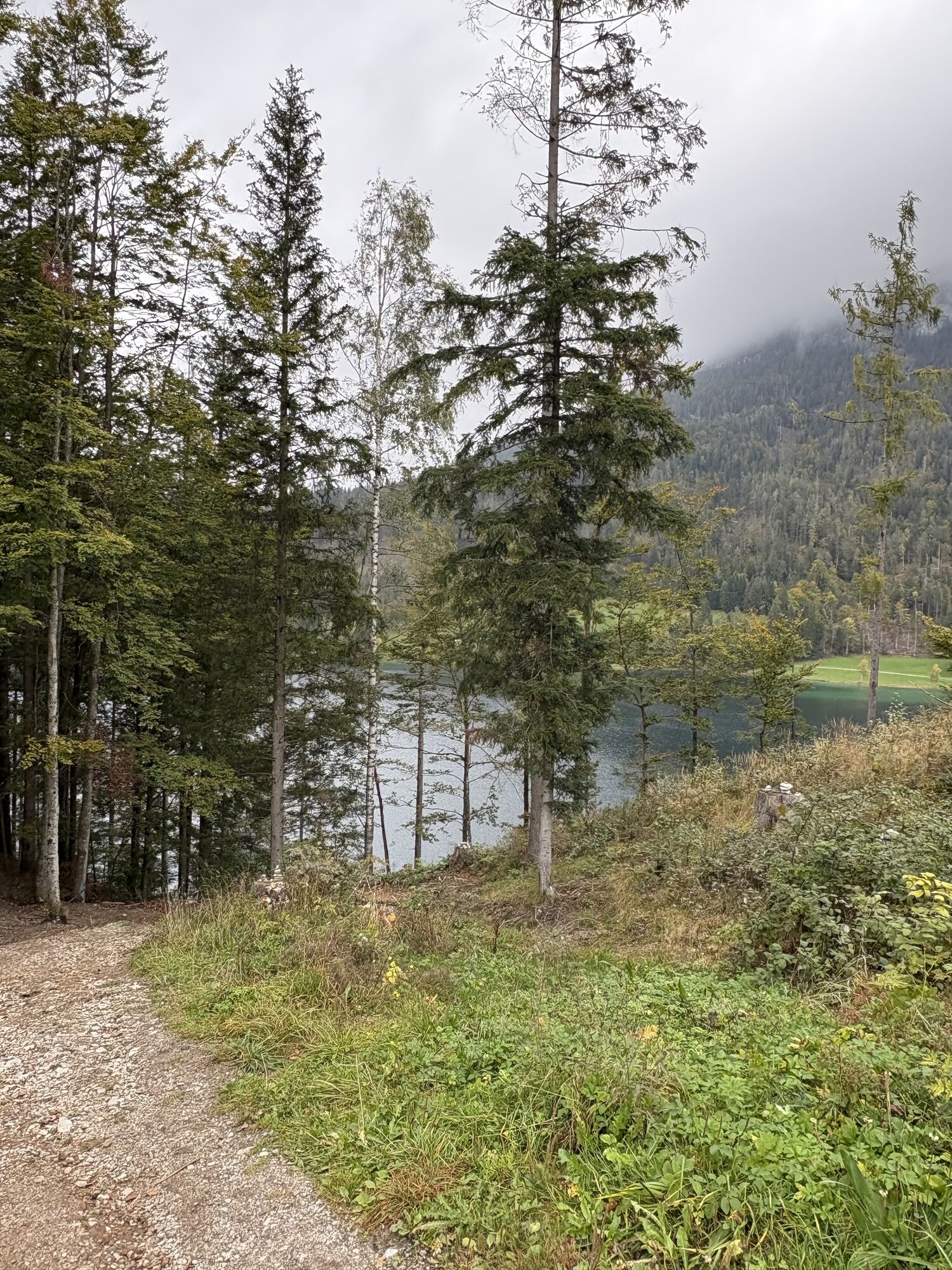
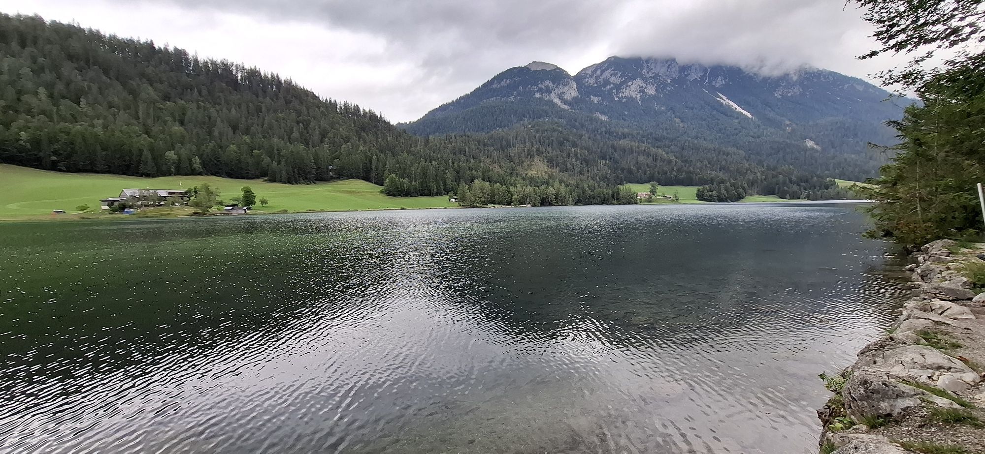
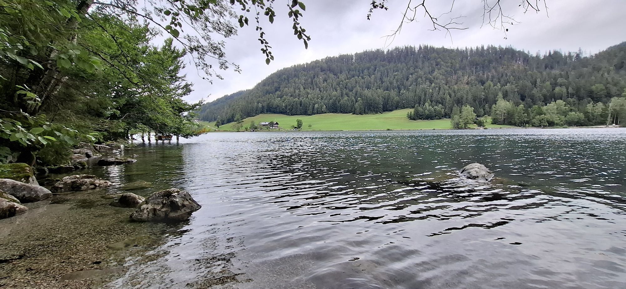
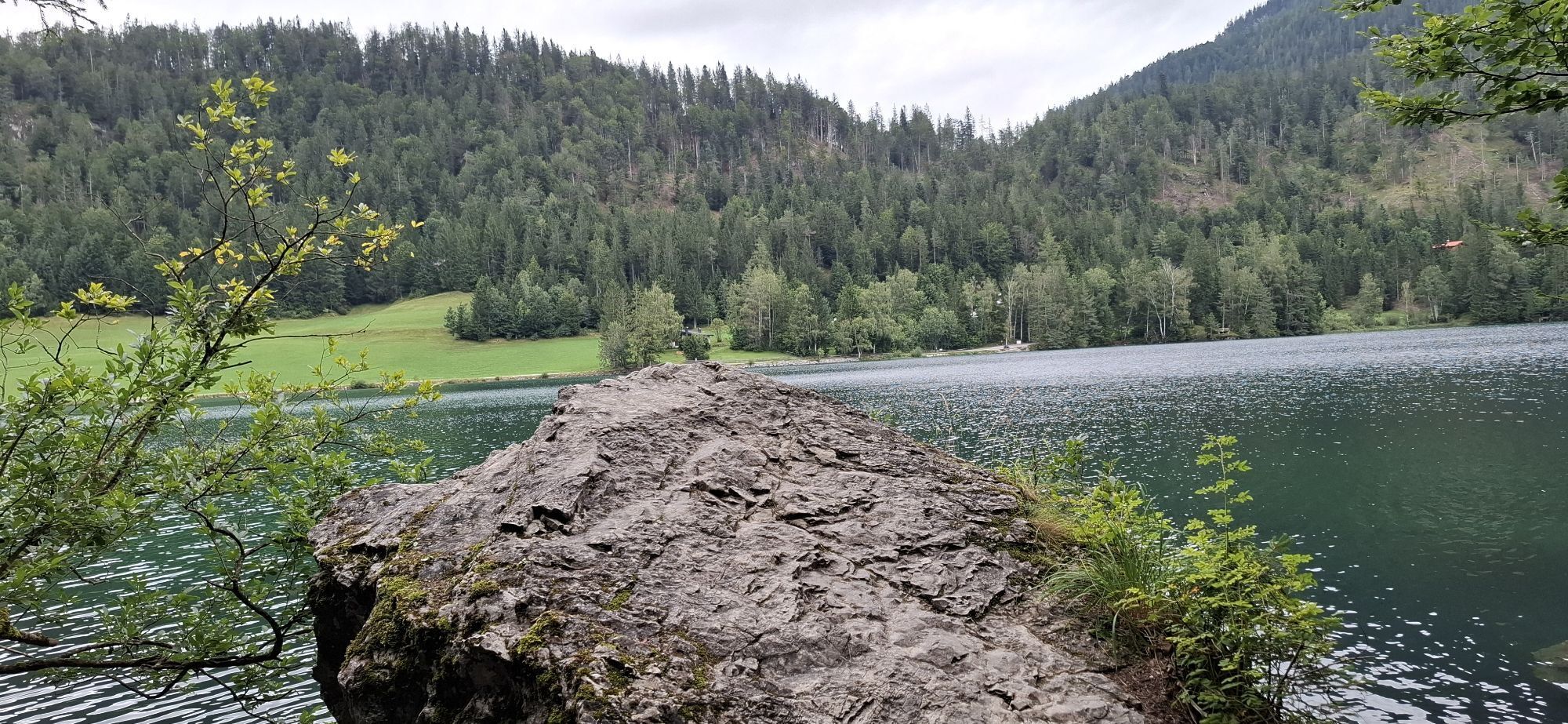
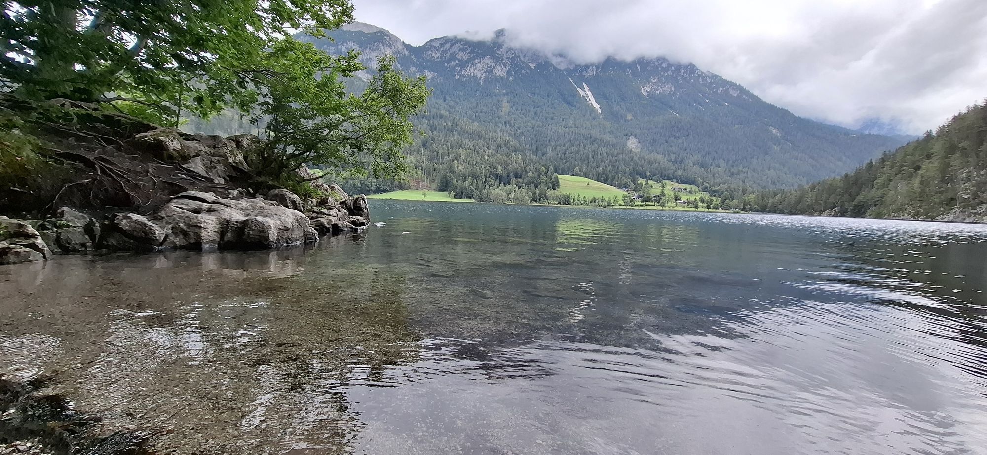
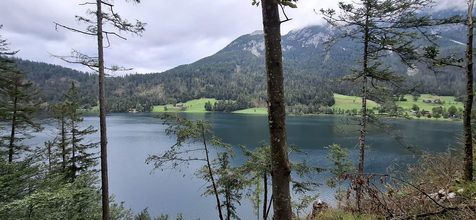
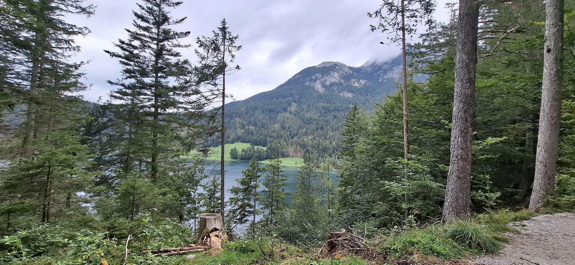
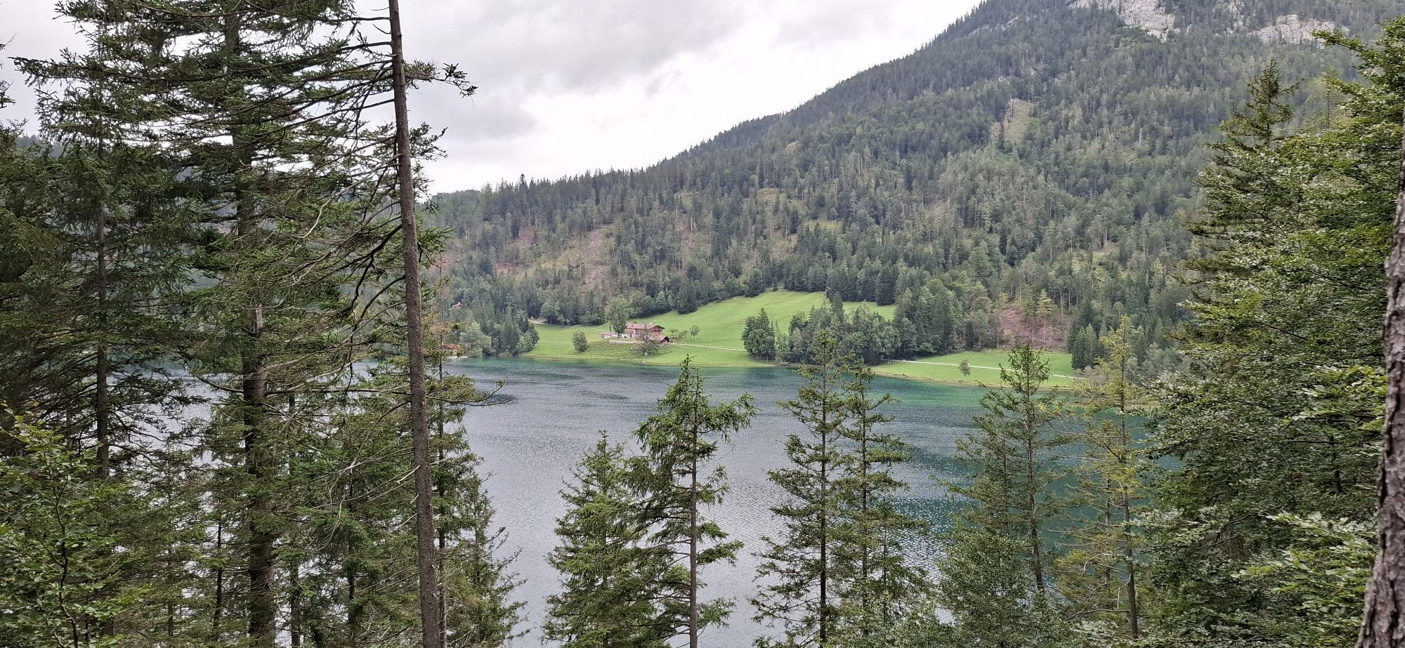
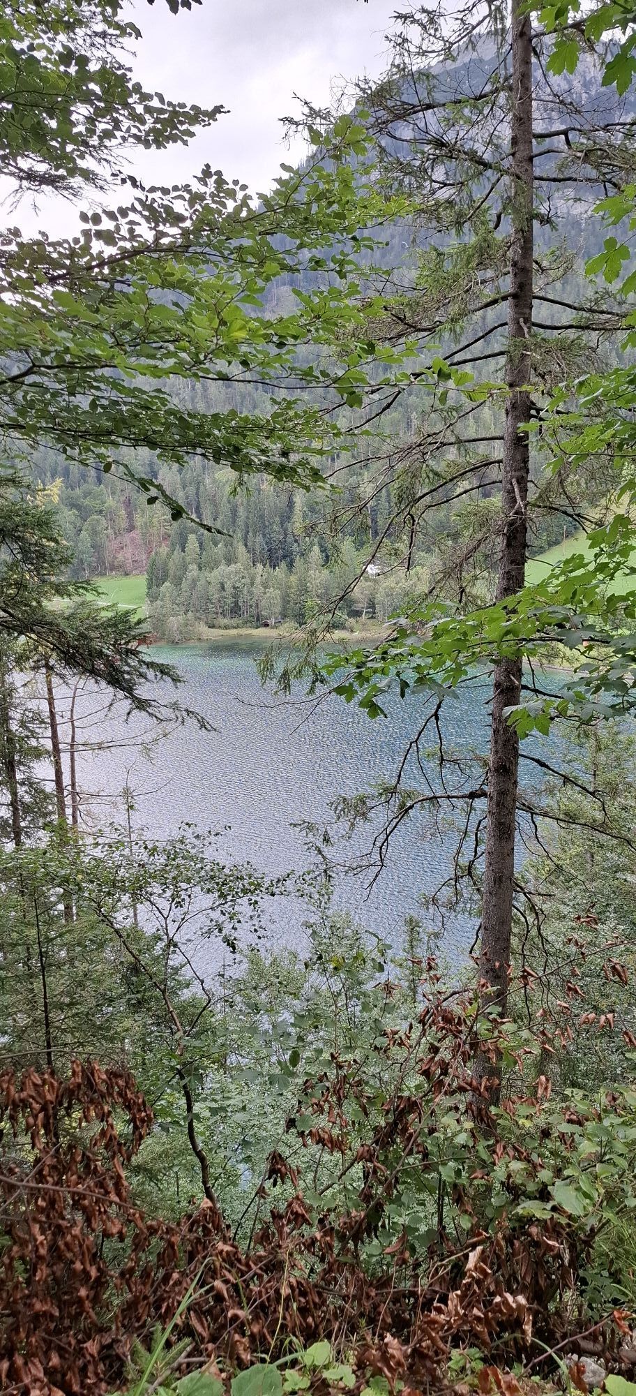
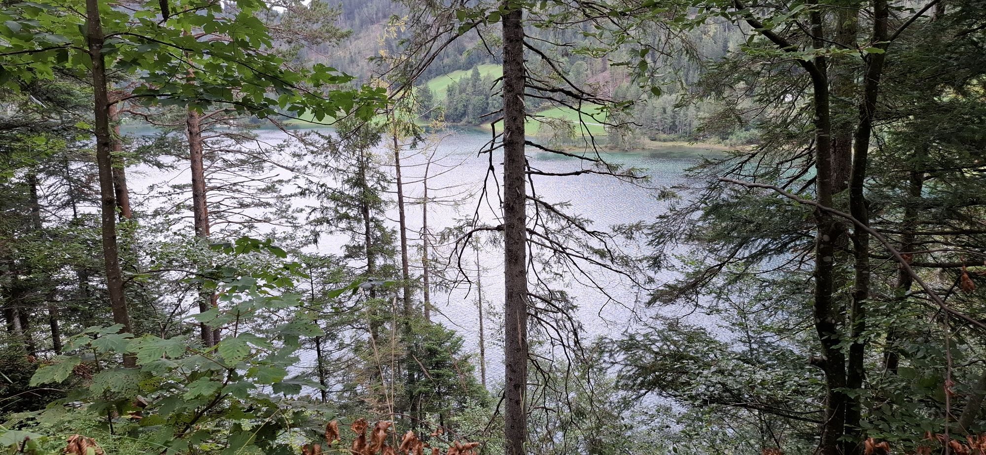
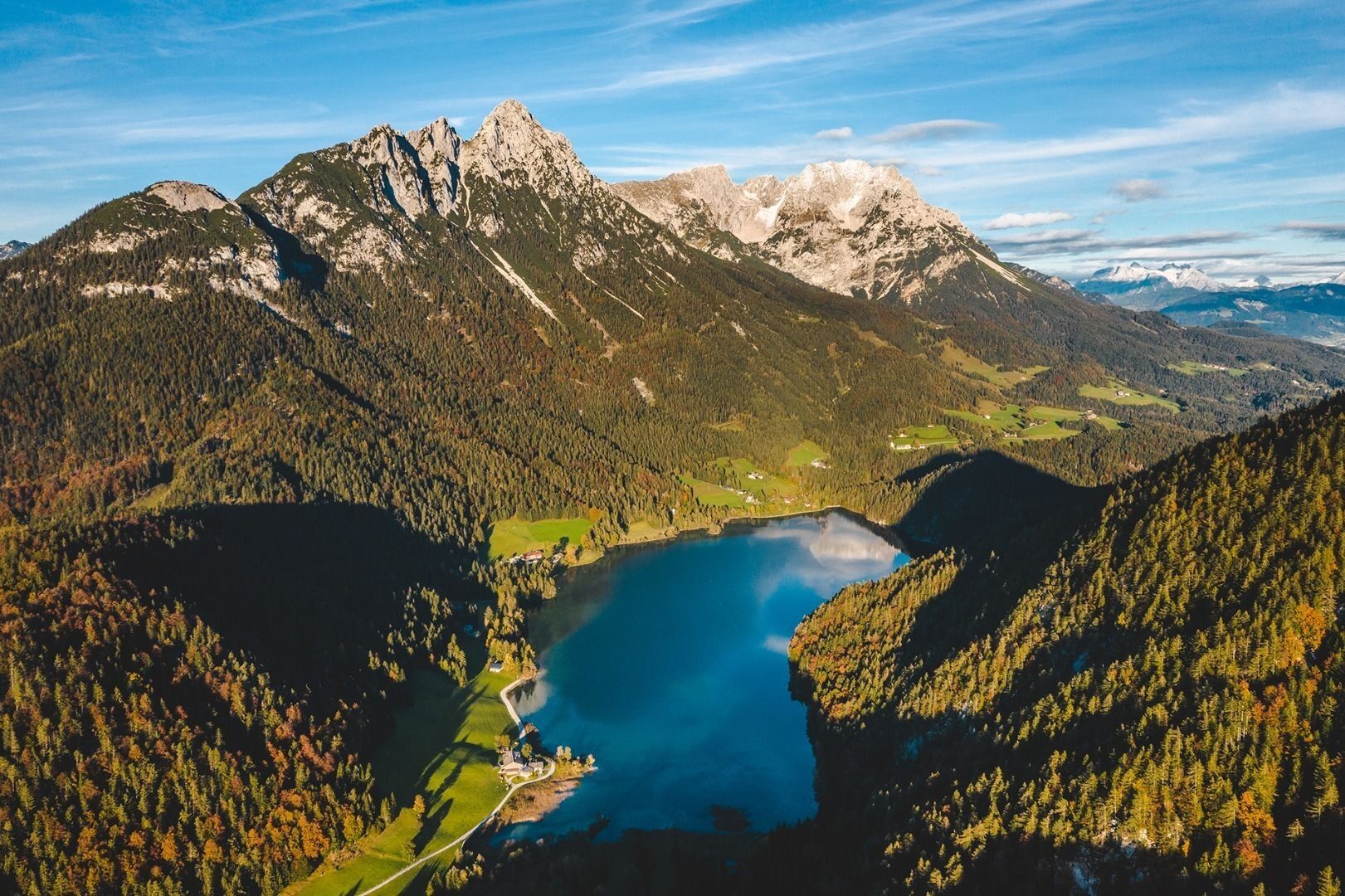
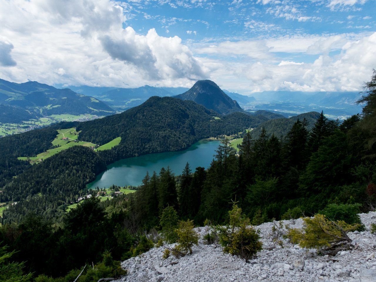
Hintersteiner See
The crystal clear mountain lake has a beautiful turquoise hue and provides a welcome cool-down for tired feet. The water is fed from underground sources and the visibility of up to 10 metres below the surface is testament to its superlative quality. The lido on the eastern bank of the lake is an ideal place to catch your breath after completing another demanding stage for the day.
From the car park at the Hintersteiner See lake/Seestüberl restaurant, head south into the forest. Here, footpath 822 provides an idyllic walk to the western bank of the crystal clear mountain lake. When this merges into the road, hike north to the Pension Maier, which is also a good inn for a refreshment stop. Further options for overnight stays on the western banks include the Pension Hagenhof and Goingstätt farm.
Stage 3:
Behind Pension Maier, forest road no. 45 leads up a moderate incline to the Walleralm Alpine pasture at the foot of the Zettenkaiserkopf mountain. Savour the wonderful panorama over the Hohe Salve mountain and down into the Inntal valley as you enjoy a pleasant break at the Stöfflhütte mountain hut, Kafma Alm mountain hut or the Walleralm mountain inn. If you make the short ascent to the Kreuzbichl summit, you will be rewarded with a fantastic all-round view.
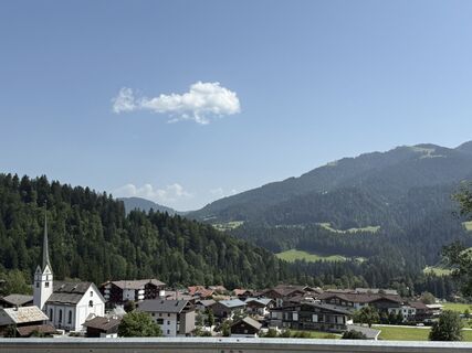
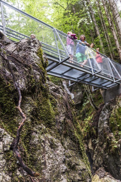
From the Walleralm, the route leads east along the Jagersteig trail (Wilder-Kaiser-Steig trail 823) to the Steiner-Hochalm (1,257 m). It then heads south to the Hinterschiessling Alm mountain hut (1,020 m), which offers specialities featuring the farm’s own Angus beef. Hike through the wonderful Rehbachklamm gorge to reach Scheffau village centre. The free “KaiserJet” bus for hikers will bring you back to the starting point in Going.
Caution:
Obere Regalm – in summer, food is served only on Fridays, Saturdays and Sundays, from middle of September until middle of October only Saturdays & Sundays - when the weather is good.
The Steiner-Hochalm only serves drinks!
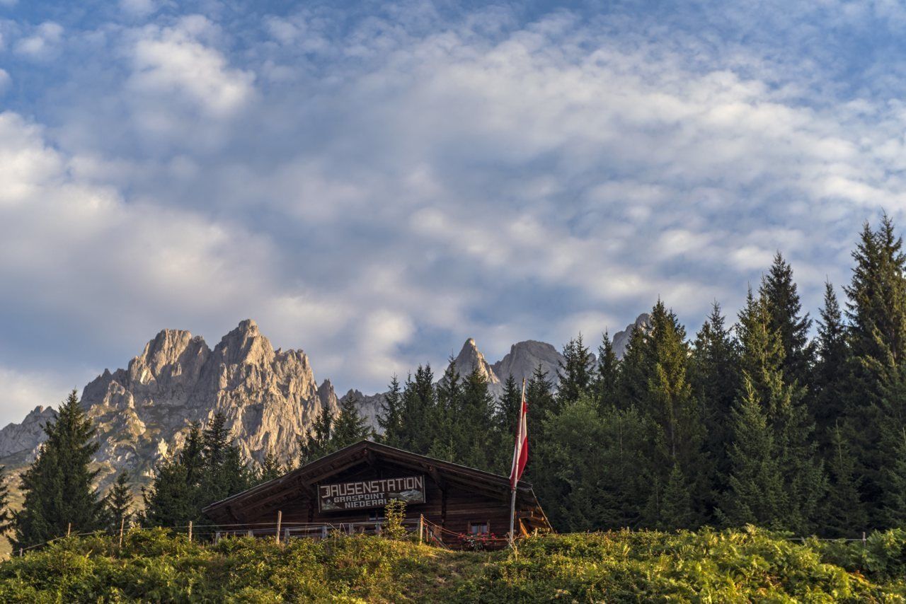
start in Going, Hüttling (820 m). Forest road 817 leads you via the Graspoint-Niederalm (981 m) up to the Obere Regalm (1,313 m; only open on Wednesdays, Saturdays, Sundays and bank holidays). In the cosy mountain hut below the south faces of the Regalmspitze summit, there is a special organic buffet offering breakfast on the mountain every “dry” Wednesday. This includes fresh homemade farmhouse bread along with sausage from the farm’s own cows.
Suitably fortified, you should head uphill through the Alpine meadows on the picturesque Wilder-Kaiser-Steig trail 827 until you reach the Brennender Palven mountain (also known as the Baumgartenköpfl, 1,572 m). You are rewarded for having made the ascent with fantastic panoramas over the rock massif of the Wilder Kaiser in the north and over the Kitzbühel Alps and Hohe Tauern mountain range in the south. This is also the site of the famous Bergsteigergrab, which is the final resting place of the “Koasamuch”. This famous climber from the “Edelweissgilde” organisation, born Much Wieser in Scheffau in 1888, was dedicated to having summit books on all summits in the Wilder Kaiser region.
Path 824 heads west, leading down towards the Gaudeamushütte (1,263 m). This cosy mountain hut is an inviting option for a refreshment stop or even your first overnight stay. Make sure you try the delicious homemade pastries from the Leichtfried family!
If you continue walking to the Gruttenhütte mountain hut, you will need to stay on path 824/813 towards Klamml as of this point. The narrow path, which leads through the steep Klamml, is secured with a ladder and several iron clamps (surefootedness and a good head for heights are essential – caution due to danger of rock falls from the via ferrata!). After following a number of bends, the Gruttenhütte (1,620 m) will come into view. This hut was built in 1899 and is the highest in the Wilder Kaiser. It is exposed on a rocky crest, features a beautiful sun terrace and is located directly at the foot of the Ellmauer Halt. This is the highest summit in the Wilder Kaiser region at 2,344 metres and an important starting point for mountaineers and climbers. On a clear day, you can savour wonderful views as far as the Grossvenediger mountain. The fresh roast pork prepared in the wood-fired oven is a particular favourite!
The cosy Riedlhütte mountain hut (1,224 m) is another option for an overnight stay.
CAUTION: due to renovation work, the Gruttenhütte in Ellmau will only be open to a limited number of guests in summer 2017. With regard to the availability of places for overnight stays, at least on particular weekends, this information will only be announced at short notice.
Alternative options for overnight stays are provided by the Gaudeamushütte and the Riedlhütte. Please make sure to reserve your places at these mountain huts in good time!
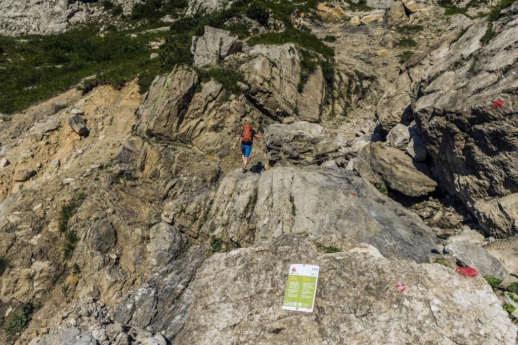
NEW: Klamml via ferrata
Only for experienced via ferrata climbers. Difficulty level B/C in the lower section and D in the upper section. The two sections are connected by a two-rope bridge (to be used exclusively with a helmet, climbing harness and via ferrata set).
Stage 2:
starting from the Gruttenhütte mountain hut, hike west on road 14a of the Wilder-Kaiser-Steig trail (WKS) 823 for the first 15 minutes as you head beneath the Kaiserkopf (2,171 m, summit between Ellmauer Halt and Treffauer). Stay on the Wilder-Kaiser-Steig trail heading in a northwesterly direction, walking beneath the Treffauer and Tuxeck summits via the Lenggries (one of the largest gravel cirques in the Wilder Kaiser region). As you pass by mountain pines and through mountain forests, the Kitzbühel Alps and the glaciers of the Hohe Tauern mountain range are always in view. The wild and romantic Kaiser-Hochalm Alpine pasture, which is located below the Sonnenstein mountain, does not feature any establishments that serve food but is still a wonderful photo opportunity.
Continue on the Wilder-Kaiser-Steig trail 821/823 to Steiner-Hochalm mountain hut (1,257 m; only serves drinks). Enjoy a pleasant rest, with innkeepers Maridi and Peter often also serving up spontaneous harp music and song.
Once this has put a spring in your step, you should start walking along the road and subsequently on the Höhenweg trail 821. Head downhill in the direction of Bärnstatt/Hintersteiner See until you come to the St. Leonhard Kapelle chapel. Slightly further south, the Gasthof Bärnstatt inn offers a place to stay for those looking to enjoy a gentle hike. Alternatively, you can follow the road to the Seestüberl restaurant on the eastern bank of Hintersteiner See lake.
Hintersteiner See
The crystal clear mountain lake has a beautiful turquoise hue and provides a welcome cool-down for tired feet. The water is fed from underground sources and the visibility of up to 10 metres below the surface is testament to its superlative quality. The lido on the eastern bank of the lake is an ideal place to catch your breath after completing another demanding stage for the day.
From the car park at the Hintersteiner See lake/Seestüberl restaurant, head south into the forest. Here, footpath 822 provides an idyllic walk to the western bank of the crystal clear mountain lake. When this merges into the road, hike north to the Pension Maier, which is also a good inn for a refreshment stop. Further options for overnight stays on the western banks include the Pension Hagenhof and Goingstätt farm.
Stage 3:
behind Pension Maier, forest road no. 45 leads up a moderate incline to the Walleralm Alpine pasture at the foot of the Zettenkaiserkopf mountain. Savour the wonderful panorama over the Hohe Salve mountain and down into the Inntal valley as you enjoy a pleasant break at the Stöfflhütte mountain hut or the Walleralm mountain inn. If you make the short ascent to the Kreuzbichl summit, you will be rewarded with a fantastic all-round view.
From the Walleralm, the route leads east along the Jagersteig trail (Wilder-Kaiser-Steig trail 823) to the Steiner-Hochalm (1,257 m). It then heads south to the Hinterschiesslingalm mountain hut (1,020 m), which offers specialities featuring the farm’s own Angus beef. Hike through the wonderful Rehbachklamm gorge to reach Scheffau village centre. The free “KaiserJet” bus for hikers will bring you back to the starting point in Going.
Caution:
Obere Regalm – in summer, food is served only on Wednesdays, Saturdays and Sundays when the weather is good.
The Steiner-Hochalm only serves drinks!
Wilder Kaiser hiking map (1:25.000) is available in the tourist information centres Ellmau, Going, Scheffau and Söll for € 6,90 or with Wilder Kaiser GuestCard for € 6,-.
Additions for overnight stay at mountain hut:
Mountain hut sleeping bag, indoor shoes, toiletries and towel, personal medication, headlamp, Alpine Club ID Card, cash, charger for mobile phone
The hiking routes between the huts are often rather long, we recommend taking plenty of food and drink and booking your overnight stays well in advance.
Heading from St. Johann on the B178 road, take the first exit to Going and drive through the village. Before the bridge turn diagonally left. Pass the supermarket "M-Preis" and turn left after the "Schedererhaus" and immediately right again in front of the ski school.
Public bus stops: Going Dorf or Going Stanglwirt
From the Schedererfeld car park or the "Going Dorf" bus stop, continue with the "Hüttling Hiking Bus" free of charge to the starting point of the Kaiserkrone to Going Hüttling.
From Scheffau take the free "KaiserJet" hiking and bathing bus back to Going.
Bus stop Scheffau Dorf
More information at www.wilderkaiser.info/mobility
From the car park directly with the Hüttling hiking bus free of charge to the starting point of the Kaiserkrone to Going Hüttling.
The car park at the hiking starting point in Hüttling is a day car park, which means that no ticket can be purchased for several days. The parking ticket is therefore only valid on the day of issue! It is a public car park from May to October. During the winter months from November to April the car park is not attended. During this time the use is at your own risk!
Camping and permanent parking is prohibited on this car park. (Vehicles that are parked illegally will be reported to the police and towed.)
Kamery internetowe z trasy
Popularne wycieczki w okolicy
-
4,5
Über Hintersteinersee und Walleralm aufs Hochegg
światłoWędrówka 12,2 km -
4,7
Kirchdorf: Zur geheimnisvollen Teufelsgasse
średniWędrówka 7,90 km -
4,7
Musikantensteig zur Naunspitze
średniWędrówka 8,96 km -
4,2
Bergdoktor Wohnhaus "Gruberhof" (Köpfing Hof) Rundeweg-Söll
światłoWędrówka 8,70 km -
4,5
Wanderung um den Hintersteinersee
światłoWędrówka 5,29 km -
3,3
Kaisertal Rund-Wanderung
średniWędrówka 13,9 km -
4,7
Hintersteinersee
średniWędrówka 9,87 km -
4,9
Ellmauer Tor (22.07.2020)
średniWędrówka 9,32 km -
4,9
Streif Wanderweg
średniWędrówka 5,73 km -
4,9
Route 209: Brechhornhaus-Choralpe
ciężkiMountainbike 24,4 km
Wędrówki i tropienie


Nie przegap ofert i inspiracji na następne wakacje
Twój adres e-mail została dodana do listy mailingowej.