


Circular hiking trail - Children's adventure trail - Starting point Lichtenhain
The path leaves the small village of Lichtenhain beneath the cable car mountain station. After passing under the steep section of the cable car, there is the opportunity to experience the ups and downs...
The path leaves the small village of Lichtenhain beneath the cable car mountain station. After passing under the steep section of the cable car, there is the opportunity to experience the ups and downs of the different cable car carriages. This is especially attractive when, in the summer months with good weather, the goods platform with the open-topped carriage, called Cabrio, is in use.
Passing Sandmann's Fairy Tale Hut, the path first leads through a varied high forest, then along the forest edge and pastures to the dog training area.
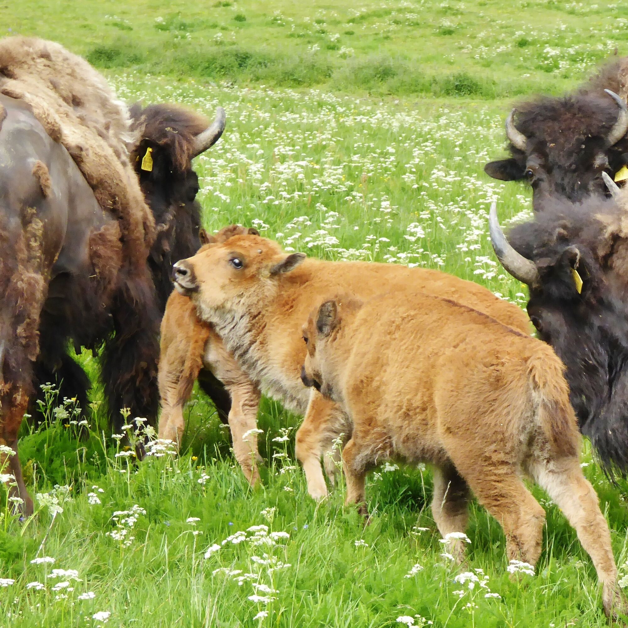
On a short, steeply downhill forest path, you reach the pasture area where the meadow path again goes uphill through the pastures of the bison. Protected by wire fences, you can admire these huge animals here, which were still found as wild animals in our forests 500 years ago. They were saved from extinction through breeding, and nowadays efforts are again underway to release them into the wild in Europe. This also took place in Germany in 2013 in the Rothaar Mountains with a small group of these largest herbivorous land animals on our continent.
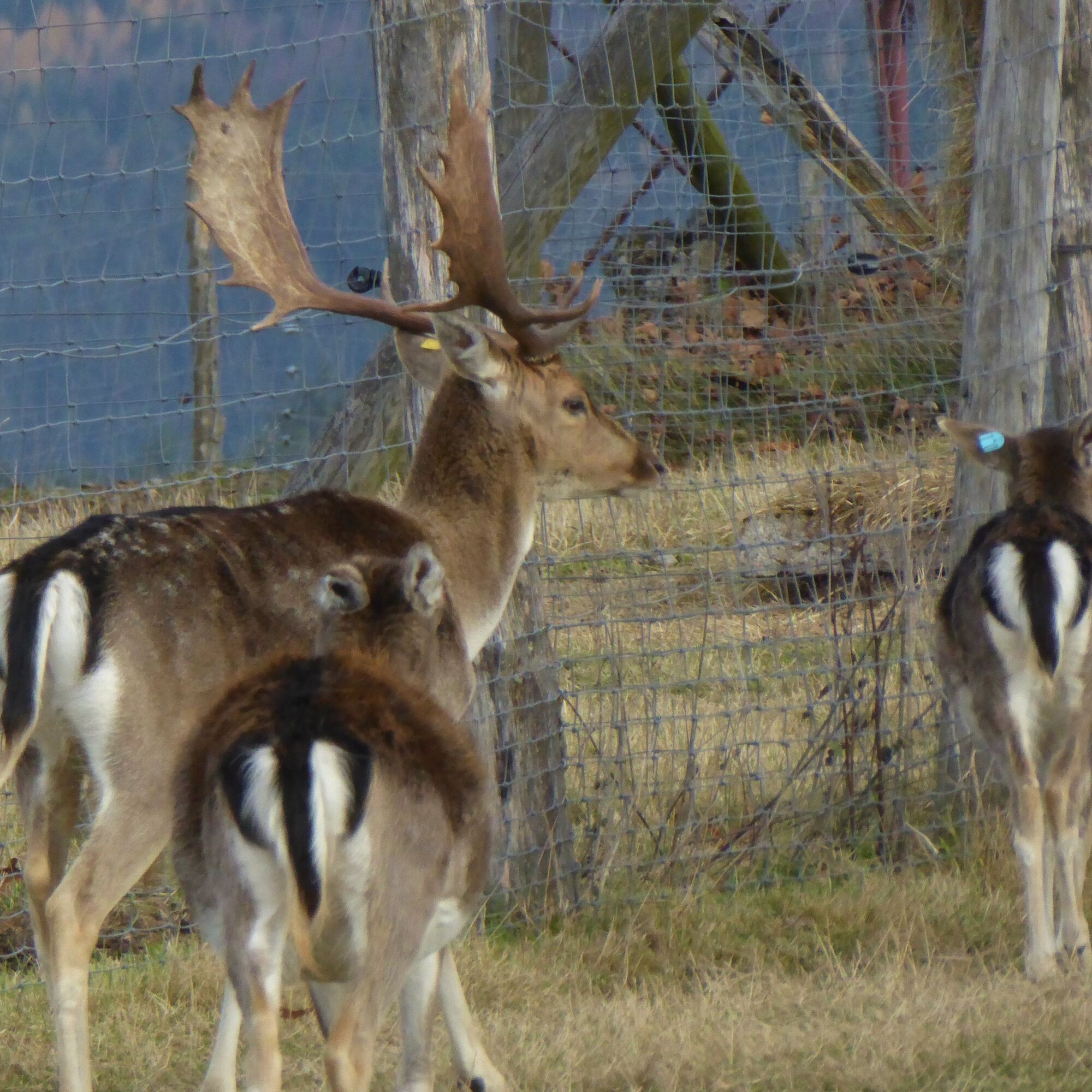
From the pasture area, a signpost points to the fallow deer enclosure – it is always interesting to look at the fallow deer and does bred here, as well as the plentiful young animals.
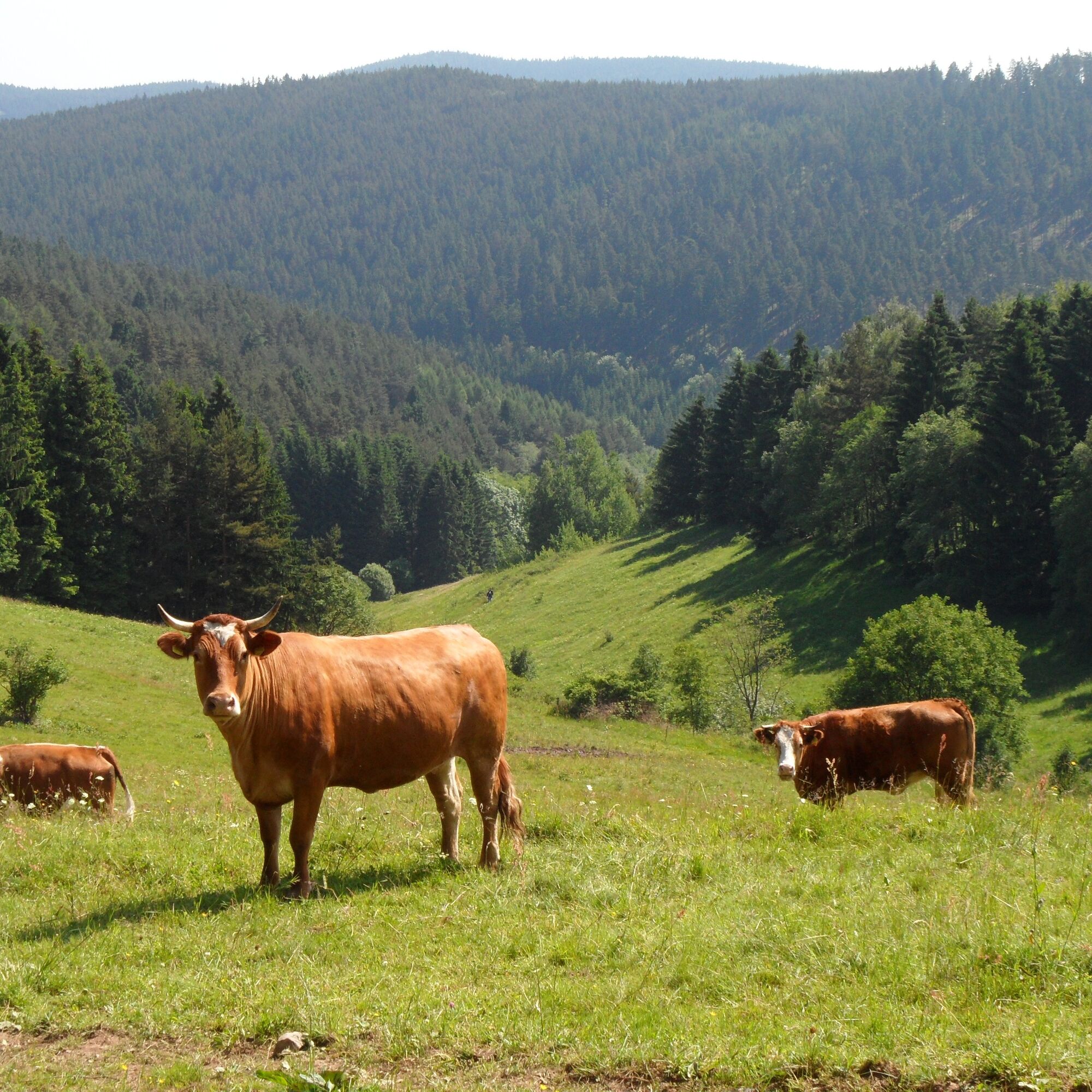
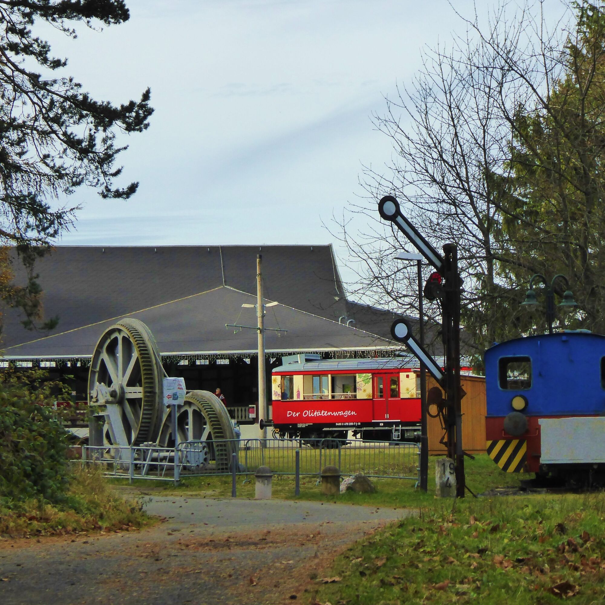
Continuing through the pasture area, which provides the cattle herds of Natur-Fleisch GmbH “Rennsteig” Oberweißbach with ideal conditions for healthy and natural rearing, the path leads back to Lichtenhain. Here, in the immediate vicinity of the forest inn Falkenblick, you will find the facilities of the Lichtenhain forest railway—a narrow-gauge railway with a 600-millimeter gauge. On Saturdays and public holidays, it’s often possible to enjoy a short ride on this railway.
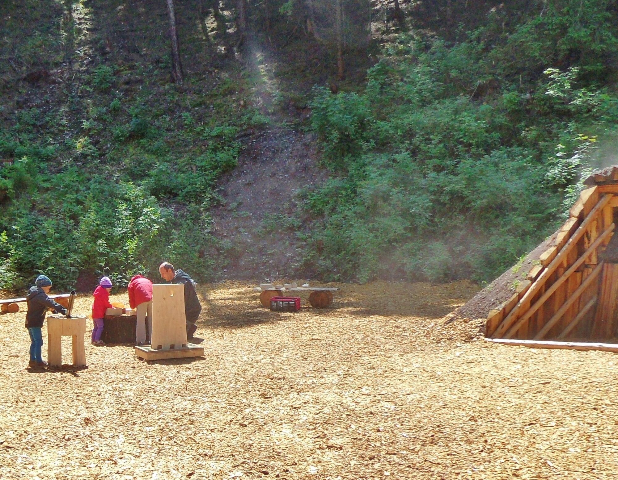
Besides that, there is also the transfer point from the cable car’s steep section to the flat section, which offers much of interest to technically interested visitors and users of the cable car. From here the path leads into Fröbel Forest. In this forest area on Falken Hill, since 2013 a forest experience trail with several interesting stations has been developed. Friedrich Fröbel, who was born in Oberweißbach, founded the first kindergarten in 1840. He believed that children should acquire their natural environment through play. The stations already created and those still to come in Fröbel Forest adopt these ideas and thus offer plenty of space for the development of children's activity and play drive.
After Fröbel Forest it is not far back to the starting point of the hike.
Hiking stamps – On these circular trails you can collect digital hiking stamps for your personal hiking certificate. At the marked stamp points, scan the respective QR code with your smartphone and add the location to your stamp account via the generated link. You can also collect the hiking stamps without a smartphone. Notes can be found on-site on the QR code signs. All stamp points are located directly on the path!
And the special feature:
The KomBus hiking buses quickly and comfortably bring you back to the starting point of your hike!


Starting point – Passing under the cable car – Sandman's Fairy Tale Hut – Marion’s Idyll shelter – Dog training area – Fork to pasture ascent – Rolling path – Falkenblick inn – Fröbel Forest – Starting point.
Tak
Sturdy footwear
Rainwear
First aid kit
GPS device or smartphone
Drinks
Always stay on the marked hiking trails and pay attention to forest-specific hazards.
Coming from the A71, take exit 15 Ilmenau - East and then continue on B88 to Pennewitz. Turn right onto Herschdorfer Straße L1144. Follow the road through Mellenbach to Lichtenhain to the mountain station of the Oberweißbach cable car.
Coming from the A73, take exit 5 (Eisfeld-Nord) and continue on B281 towards Neuhaus am Rennweg. After passing through Neuhaus am Rennweg, take the third exit at the roundabout to the left towards Oberweißbach / Lichtenhain.
You can travel to Lichtenhain by train on the Oberweissbach Mountain and Schwarzatal Railway. From Obstfelderschmiede (Schwarzatal), it first goes by funicular to Lichtenhain.
You can also conveniently use the German Rail travel information service. Enter Lichtenhain as your destination.
Alternatively, Lichtenhain is also accessible by bus. The KomBus GmbH serves the town with line 313. These connections are also included in the results search of the German Rail.
Parking lot at the Lichtenhain cable car station Google NAV point
Local contact
Tourist Information / Memorial Museum
Markt 10 / 98744 Oberweißbach
Tel.: 036705 - 62123
Central contact
Tourist and Service Center
(Main entrance town hall)
Bahnhofstr. 23 | 07422 Bad Blankenburg
Tel. 03 67 41 - 26 67
You should allow enough time for the route, as there is not only a lot to see, but in the Fröbel Forest, children can actively engage with nature and of course play as well.
The ride with the Oberweißbach Mountain and Schwarzatal Railway is an experience for the whole family.
Popularne wycieczki w okolicy
- 3,0
Circular hike - "4 ponds hike" Neustadt am Rennsteig - Thuringian Forest
ciężkiWędrówka 12,6 km - 4,8
Circular hiking trail - "To the most beautiful viewpoints" - Thuringian Forest
średniWędrówka 12,8 km - 4,5
Circular route - “To the Strudel pots of the Schwarza” - Starting point at the Chrysopras weir - Bad Blankenburg
średniWędrówka 9,01 km Circular hiking trail - "Sculpture Trail" - Hiking start Unterweißbach - Thuringian Forest
średniWędrówka 24,4 kmCircular route - "When Rennsteig meets the Schwarzatal panorama path" - Limbach
średniWędrówka 9,68 km- 5,0
Circular route 5 - Neustadt am Rennsteig - Thuringian Forest
średniWędrówka 8,50 km Circular hike - "Friedrich Fröbel" - Bad Blankenburg
ciężkiWędrówka 14,4 kmCircular trail - Saugartenpfad - Hiking start at Chrysopraswehr - Bad Blankenburg
średniWędrówka 8,39 kmCircular hike - Around the pumped-storage power plant - Goldisthal
średniWędrówka 19,5 kmPanoramaweg Schwarzatal - Stage 1 Schwarza to Schwarzburg - Thuringian Forest
ciężkiWędrówka 15,4 km
Wędrówki i tropienie


Nie przegap ofert i inspiracji na następne wakacje
Twój adres e-mail została dodana do listy mailingowej.