


Tibetan Bridge route (SwitzerlandMobile 628)
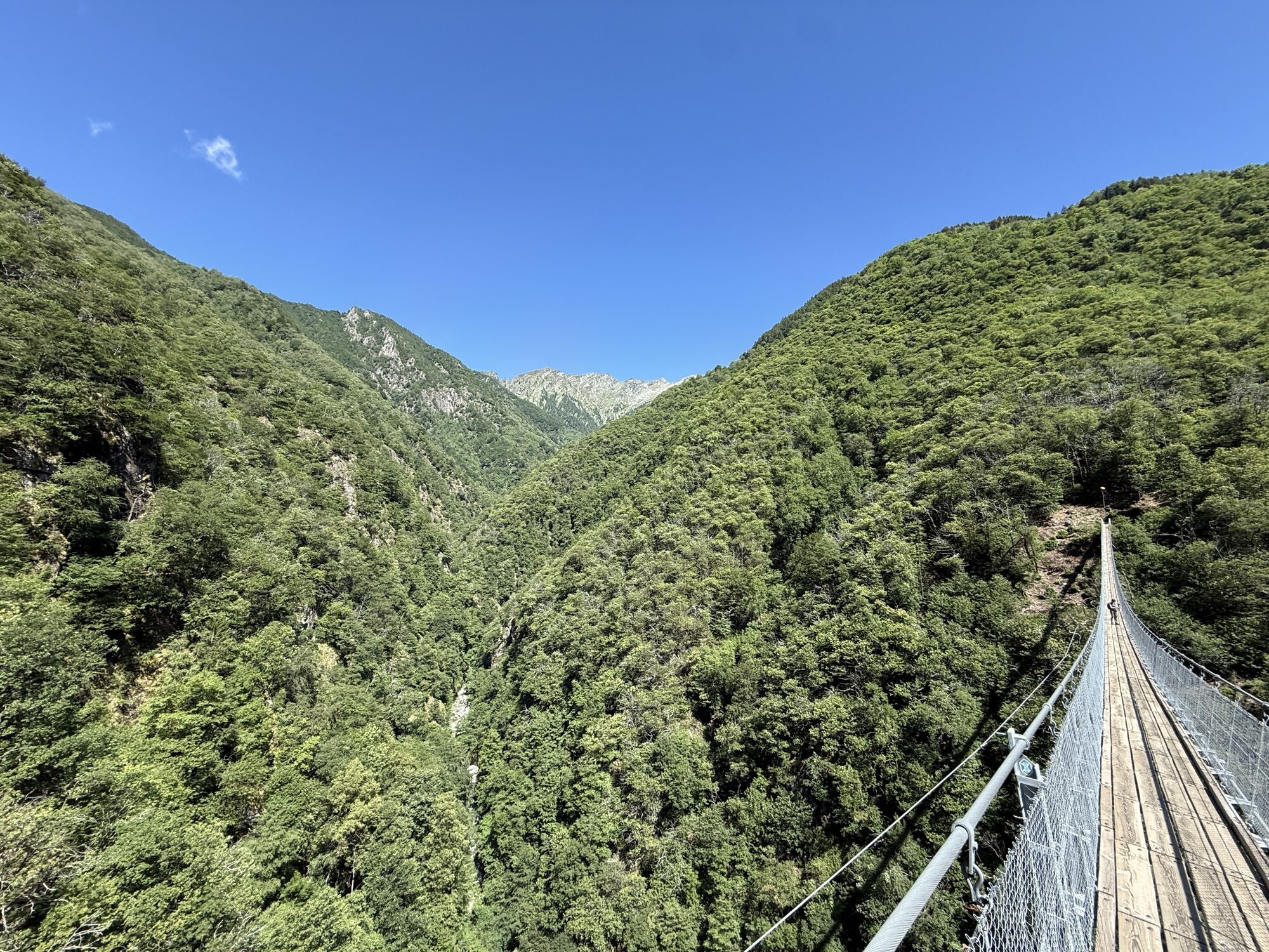
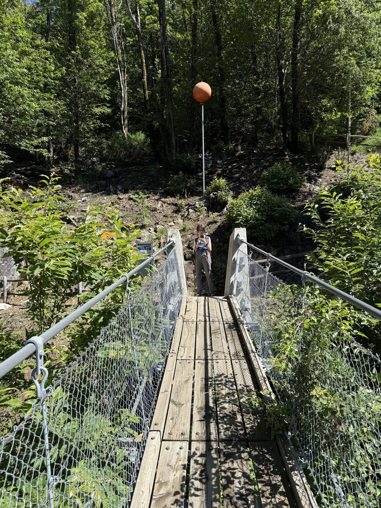
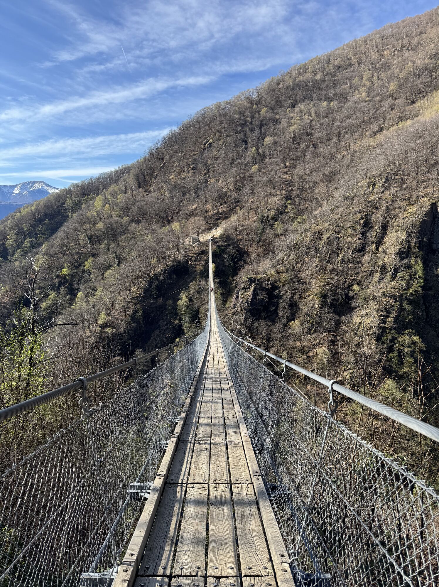
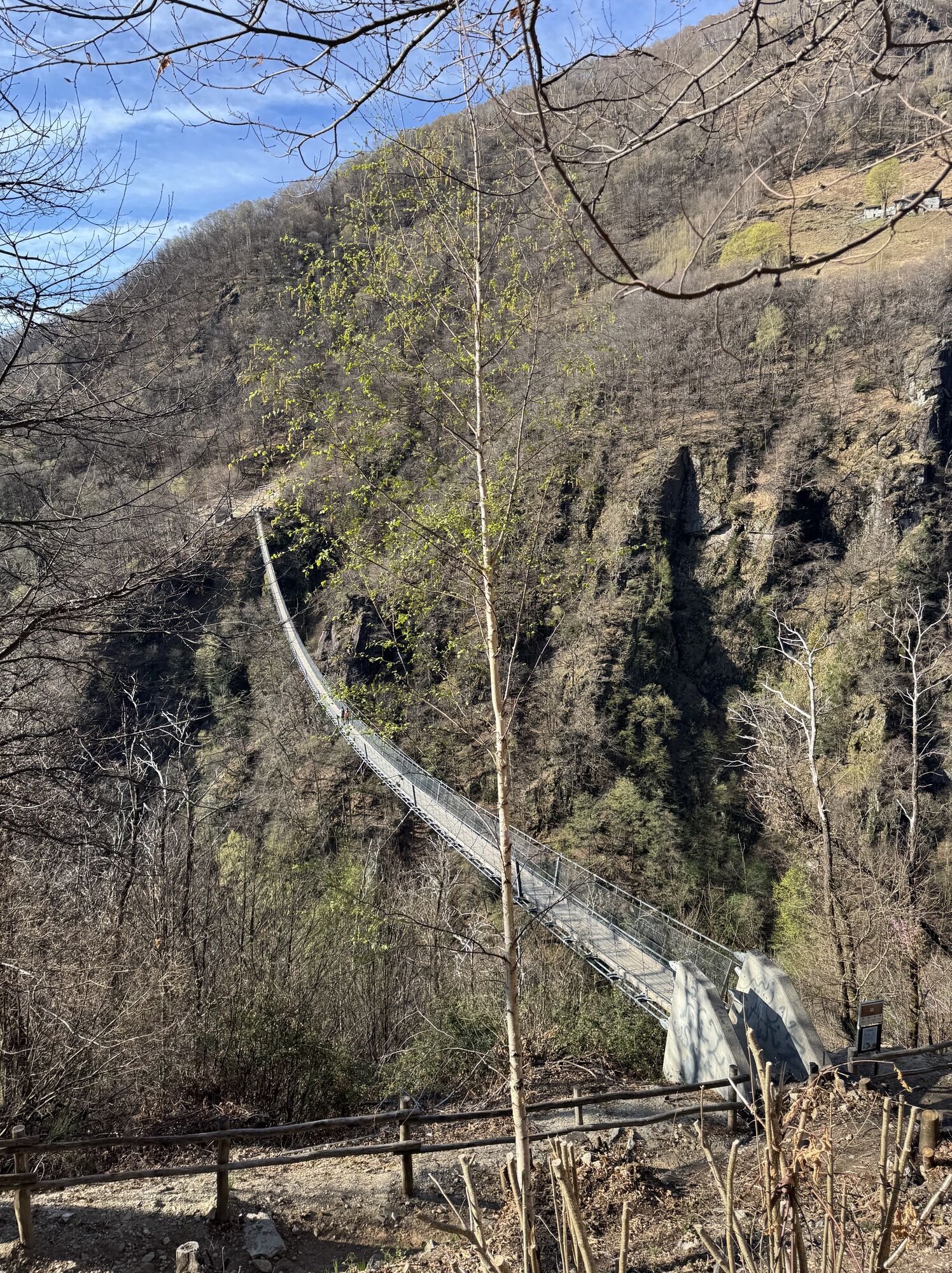
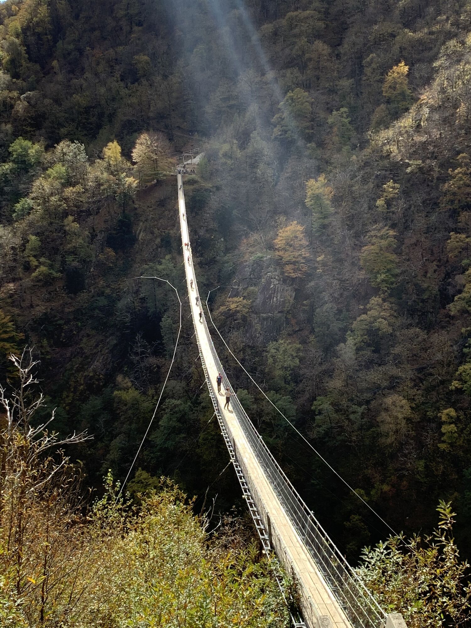
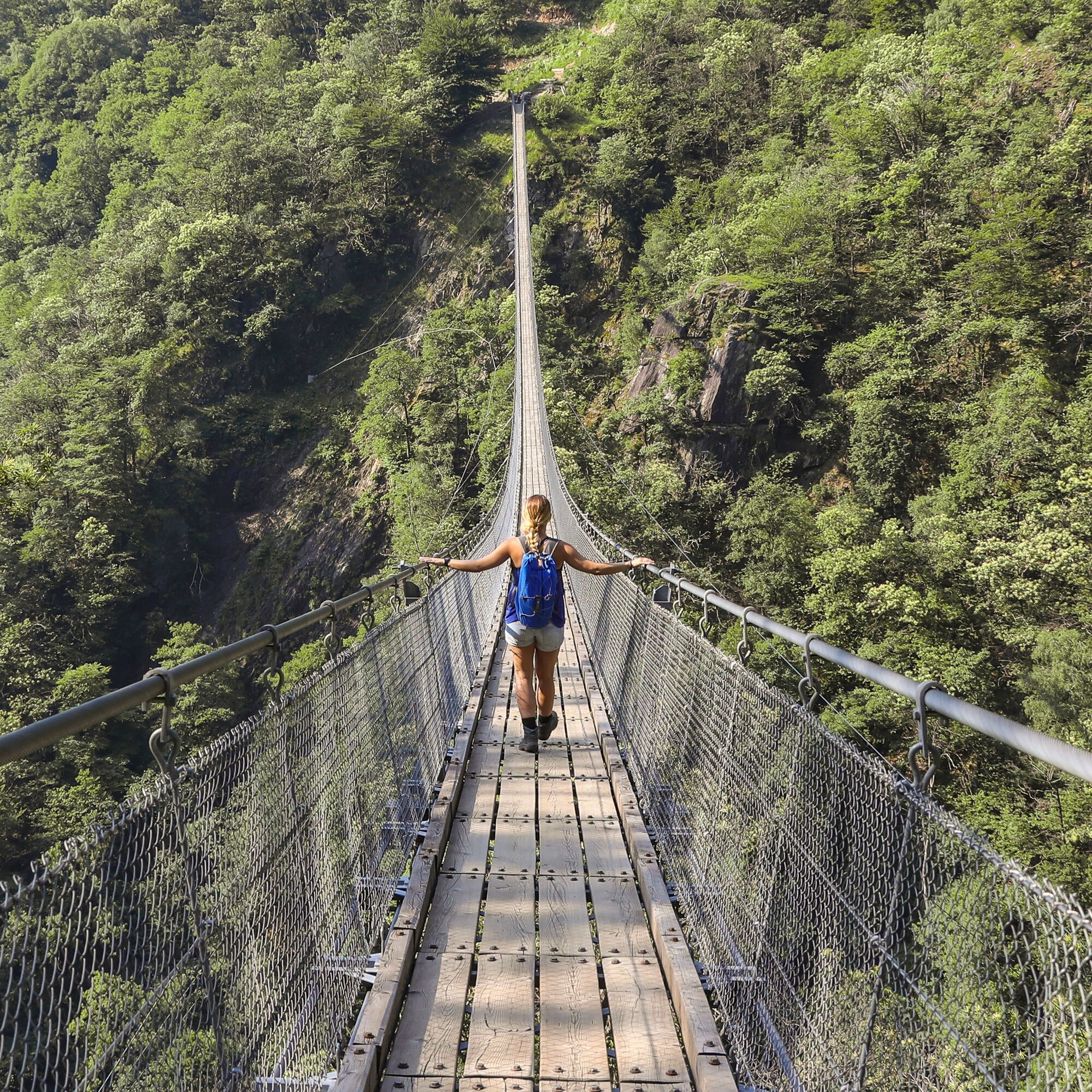
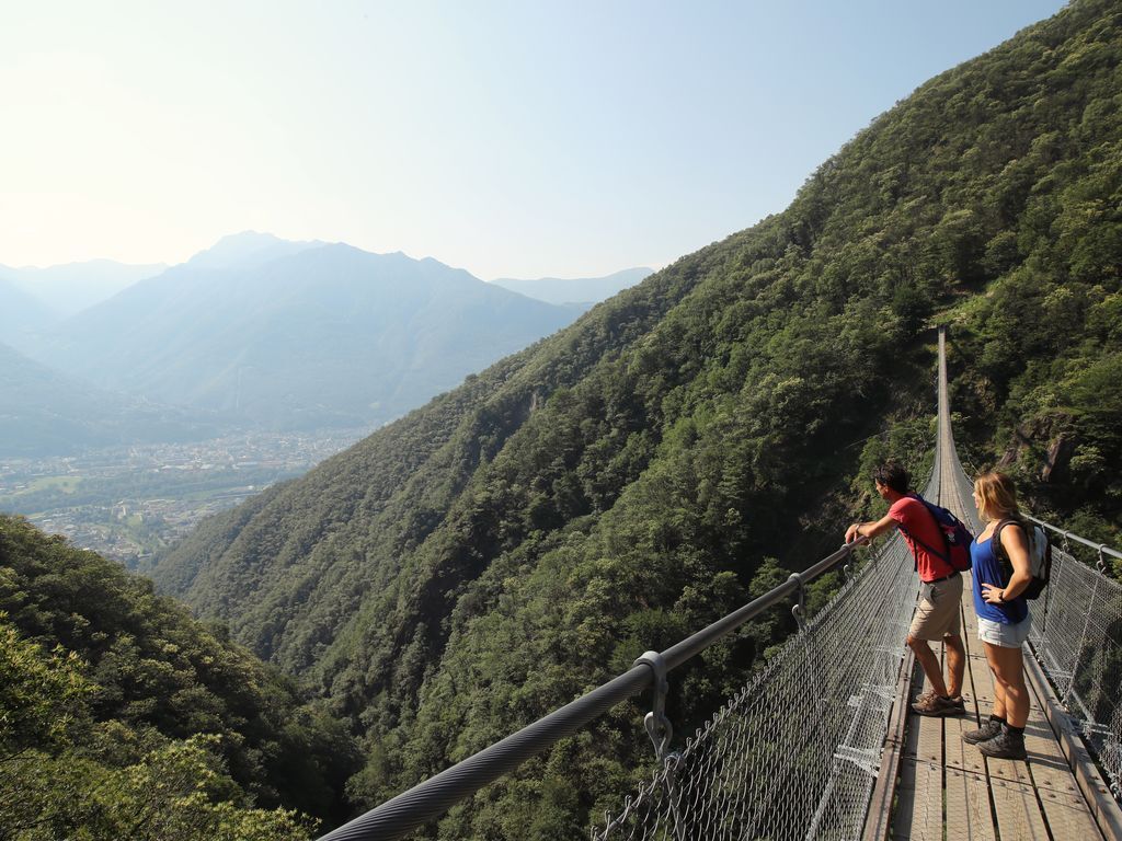
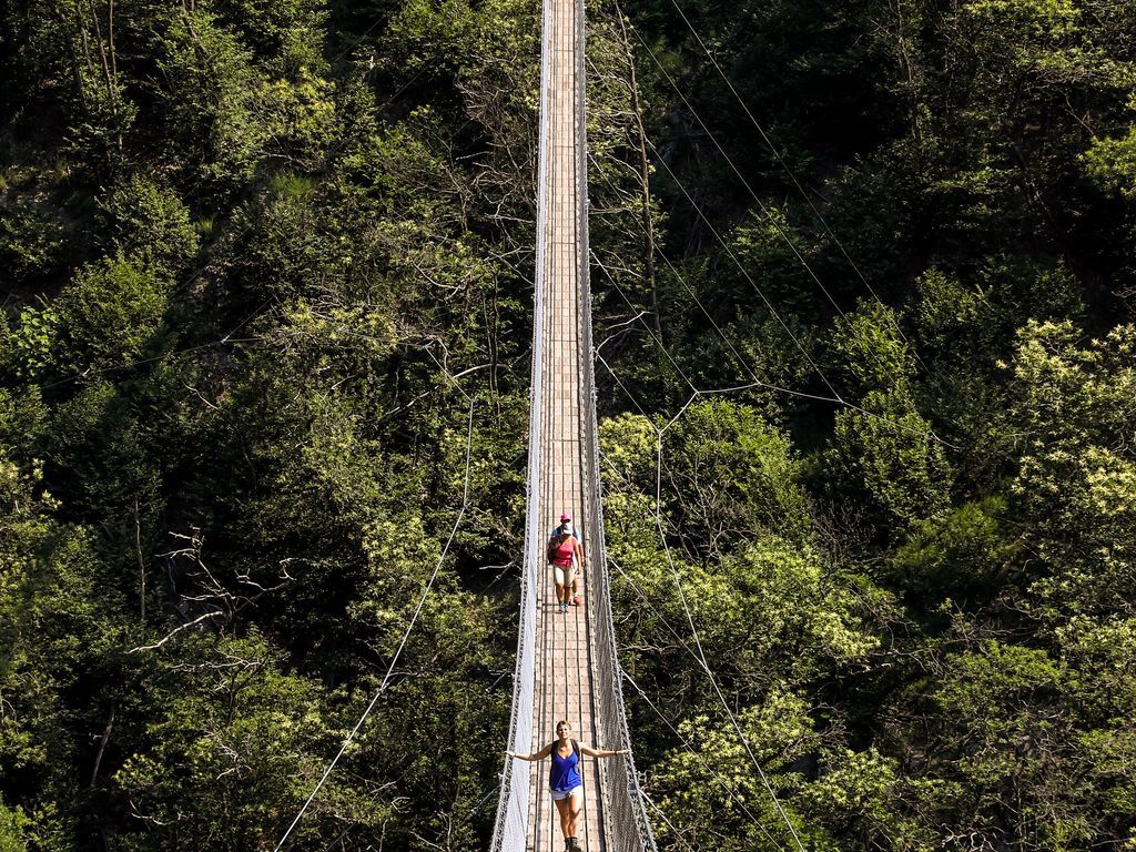
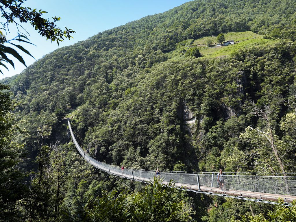
A particular point of interest is the Carasc Tibetan Bridge, which connects the hills of Monte Carasso and Sementina. This bridge, of considerable scenic impact, is 270 meters long and suspended 130 meters...
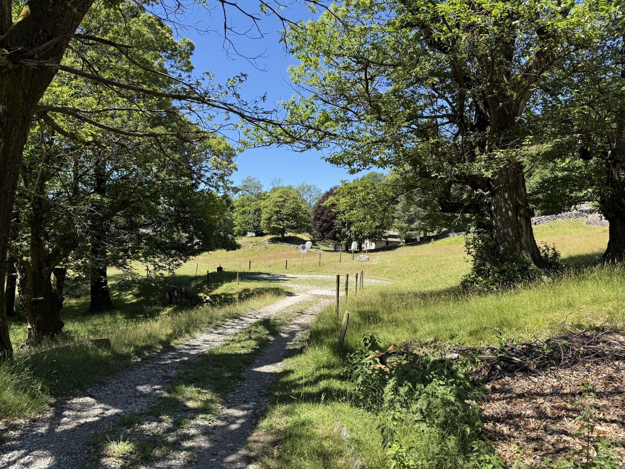
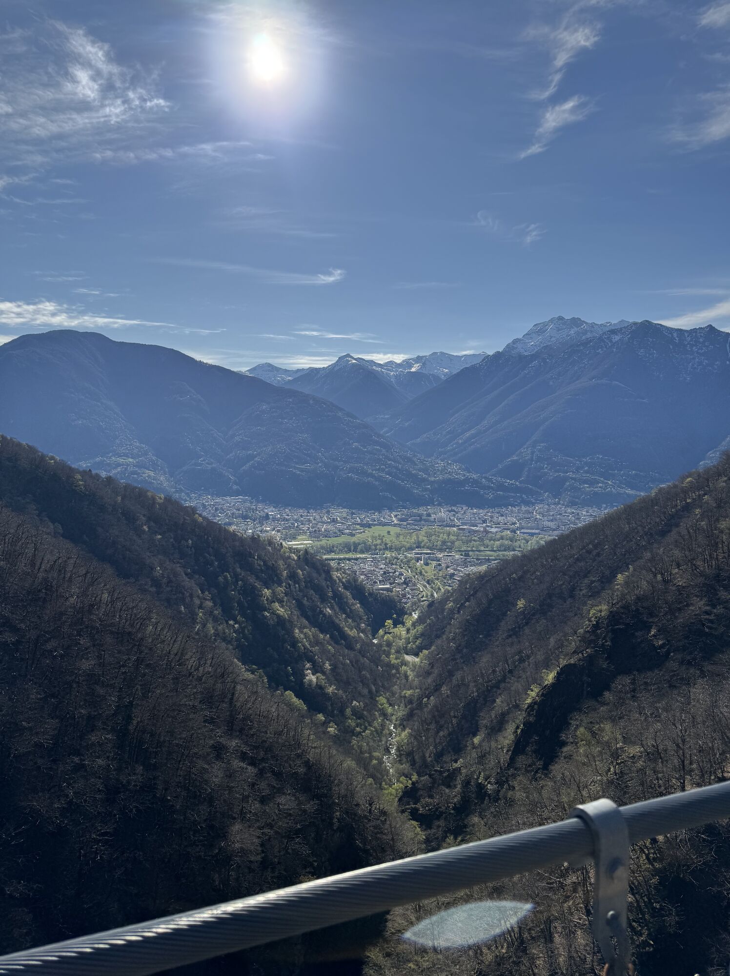
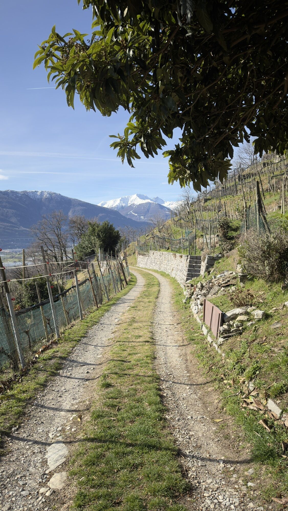
The route starts at the Monte Carasso – Mornera cable car station. After about 5-10 minutes walking along the cantonal road, you cross the river that separates Monte Carasso from Sementina and turn right onto Via alla Serta, then take the path toward San Defendente (about one hour and fifteen minutes of walking). From San Defendente, the path continues for about 40 minutes before reaching the Tibetan Bridge.
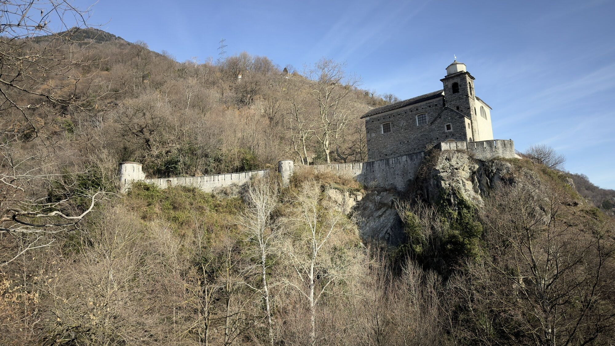
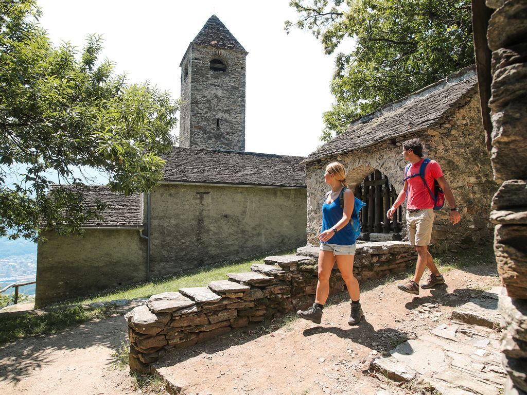
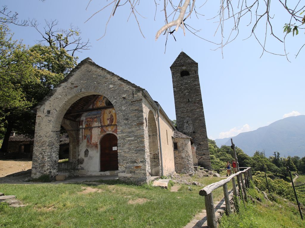
After crossing the majestic Tibetan Bridge, you reach the San Bernardo chapel in 35 minutes, of Romanesque origin and rich in frescoes. Its origins date back to the end of the 11th century and the interior is architecturally simple but full of frescoes from the 14th and 15th centuries, which cover practically all the walls. Particularly curious is the painting of the Last Supper, where the artist depicts local products on the table such as river crabs and cherries.
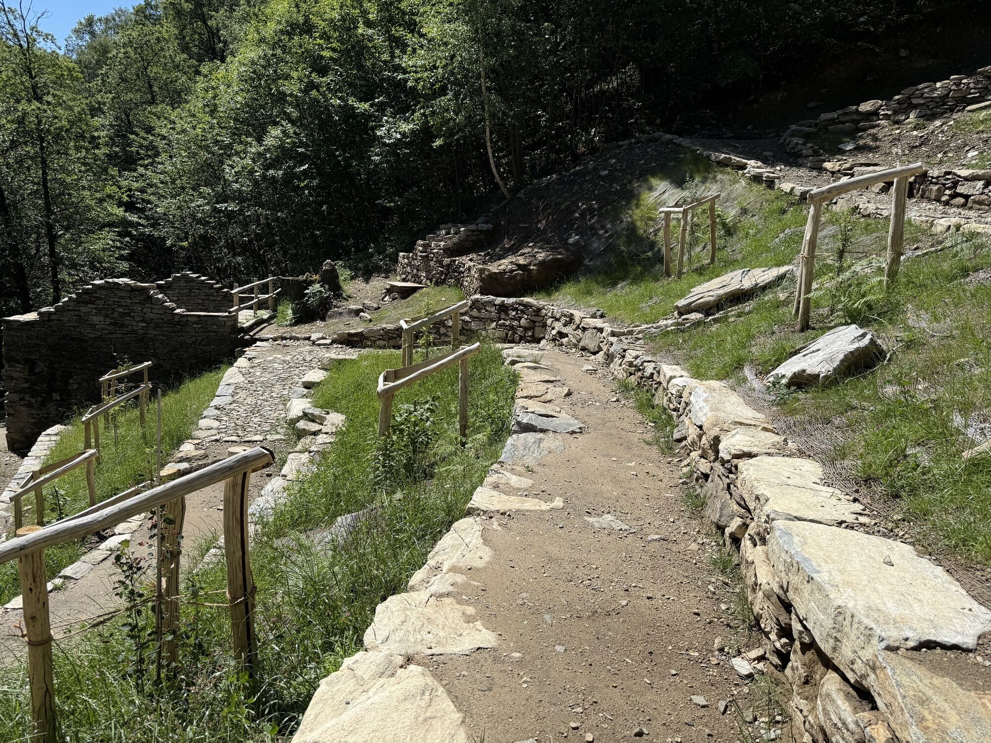
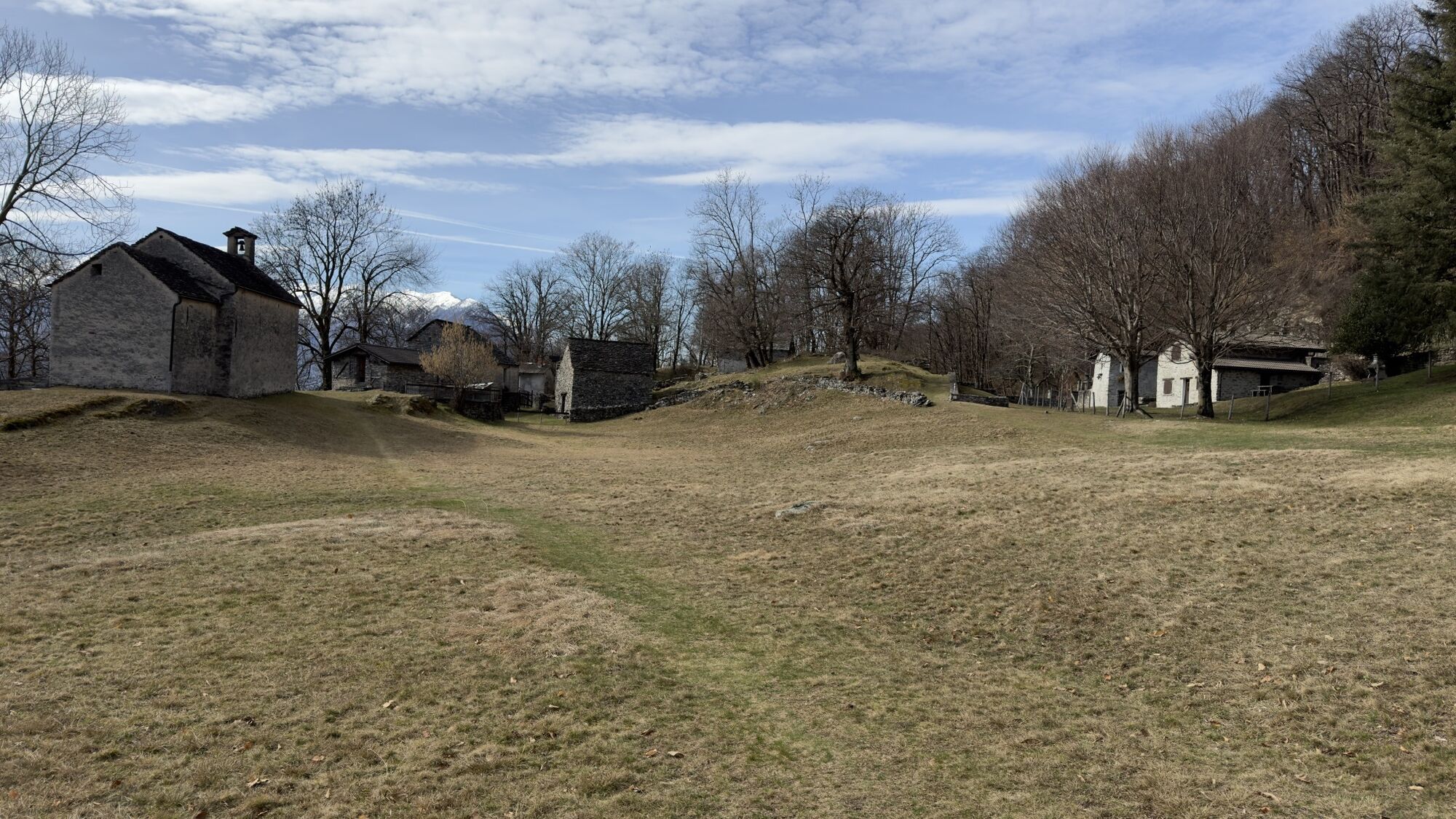
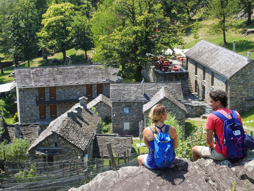
Within a few minutes' walk, you discover the splendid Curzútt hamlet, with its dry stone buildings, gardens, and terraced vineyards, which has been magnificently restored in recent years by the Curzútt - San Barnárd Foundation. The project did not aim to create an open-air museum but a living center that today also hosts a hostel and a restaurant of excellent quality. Several buildings, dry stone walls, and the ancient mule track have been restored, as well as a charming playground for the little ones.
The walk down from Curzútt takes about 35 minutes to return to the starting point. Alternatively, it is possible to descend by cable car. During the high season, it is recommended to book tickets via the website www.mornera.ch.

Tak
Tak
Hiking boots
Cap
Water bottle
Sunglasses
Sunscreen
Hiking map
Camera
Food
For winter walks, follow the logo indicated on the green signposts: Giro del ponte tibetano / 628
To explore the route, we recommend buying the official maps of the Federal Office of Topography Swisstopo. In addition, the following website map.geo.admin.ch offers constantly updated data.
To enjoy the route, we recommend purchasing the official maps from the Federal Office of Topography Swisstopo. Additionally, the site map.geo.admin.ch offers constantly updated data.
This project was created to promote the effective and sustainable management of Alpine huts in the Ticino area, particularly waste management. Responsible waste management in the mountains is a matter of common sense. We can all contribute: https://www.montagnepulite.ch/it/regole-d-oro
We recommend leaving your car at the public parking lot on Via Tatti in Bellinzona and taking Bus Line 2 or walking about 15 minutes to the start of the trolleybus. For those arriving by train, it is possible to take the same bus directly from the Bellinzona FFS station. For more details, please consult the parking map. A shuttle bus service is also available.
We recommend booking the cable car: www.mornera.ch
Follow the logo for the winter routes shown on the green signs: Tibetan bridge route / 628

Popularne wycieczki w okolicy
- 4,9
Verzasca Dam-Mergoscia-Corippo-Lavertezzo
średniWędrówka 13,0 km - 4,5
Revöira Ethnographic Trail (SwitzerlandMobile 629)
średniWędrówka 7,97 km - 4,0
Cardada Bike (SwitzerlandMobility 397)
ciężkiMountainbike 30,6 km - 5,0
Verzasca Dam-Monti di Motti-Verzasca Dam
średniWędrówka 9,31 km - 4,8
Von Isone über den Camoghè 2.227m nach Colla
ciężkiWędrówka 20,2 km - 4,0
Vogorno-Alpe Bardughè-Vogorno
średniWędrówka 12,2 km - 4,5
Klettersteig dei tre signori, Monte Carasso
ciężkiVia ferrata 4,85 km Sentiero Verzasca (SvizzeraMobile 74)
średnidługodystansowy szlak pieszy 34,4 km- 4,3
The Bellinzona Fortress and its castles
światłoWędrówka 5,41 km - 5,0
Monti di Motti-Sassariente-Gana-Monti di Motti
ciężkiWędrówka 12,9 km
Wędrówki i tropienie


Nie przegap ofert i inspiracji na następne wakacje
Twój adres e-mail została dodana do listy mailingowej.