


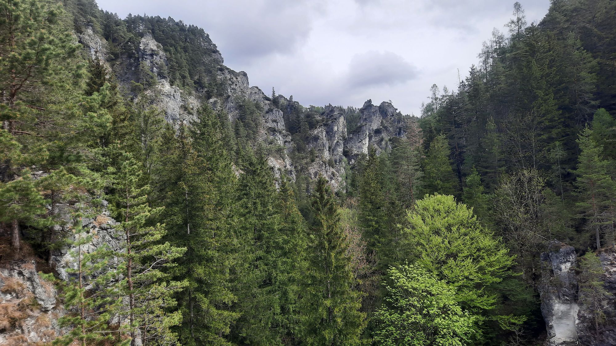
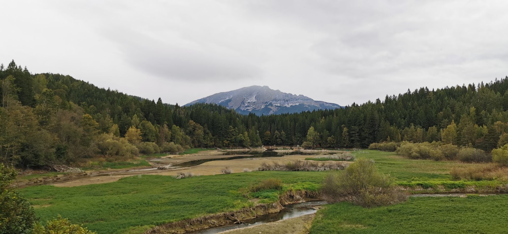
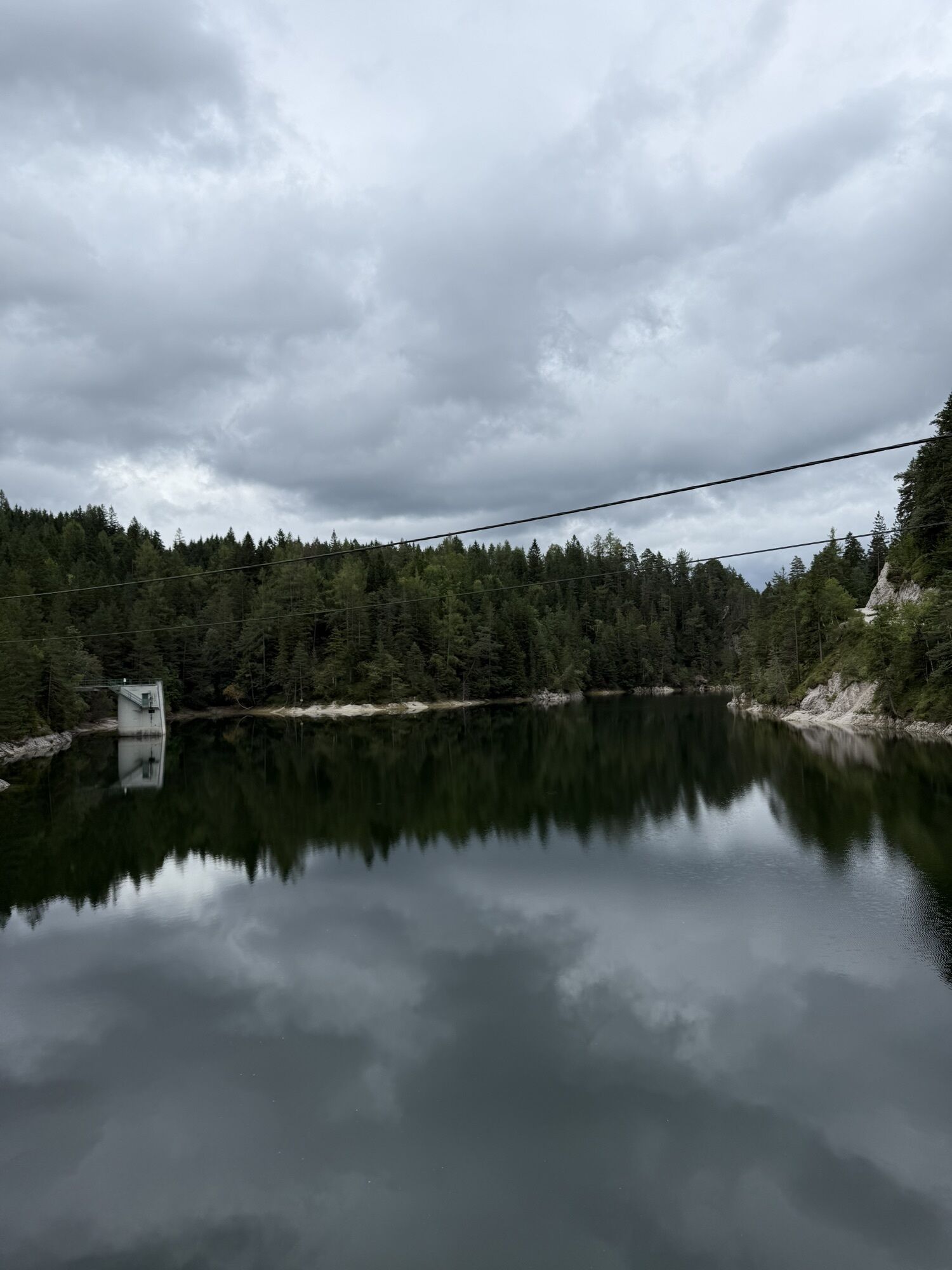
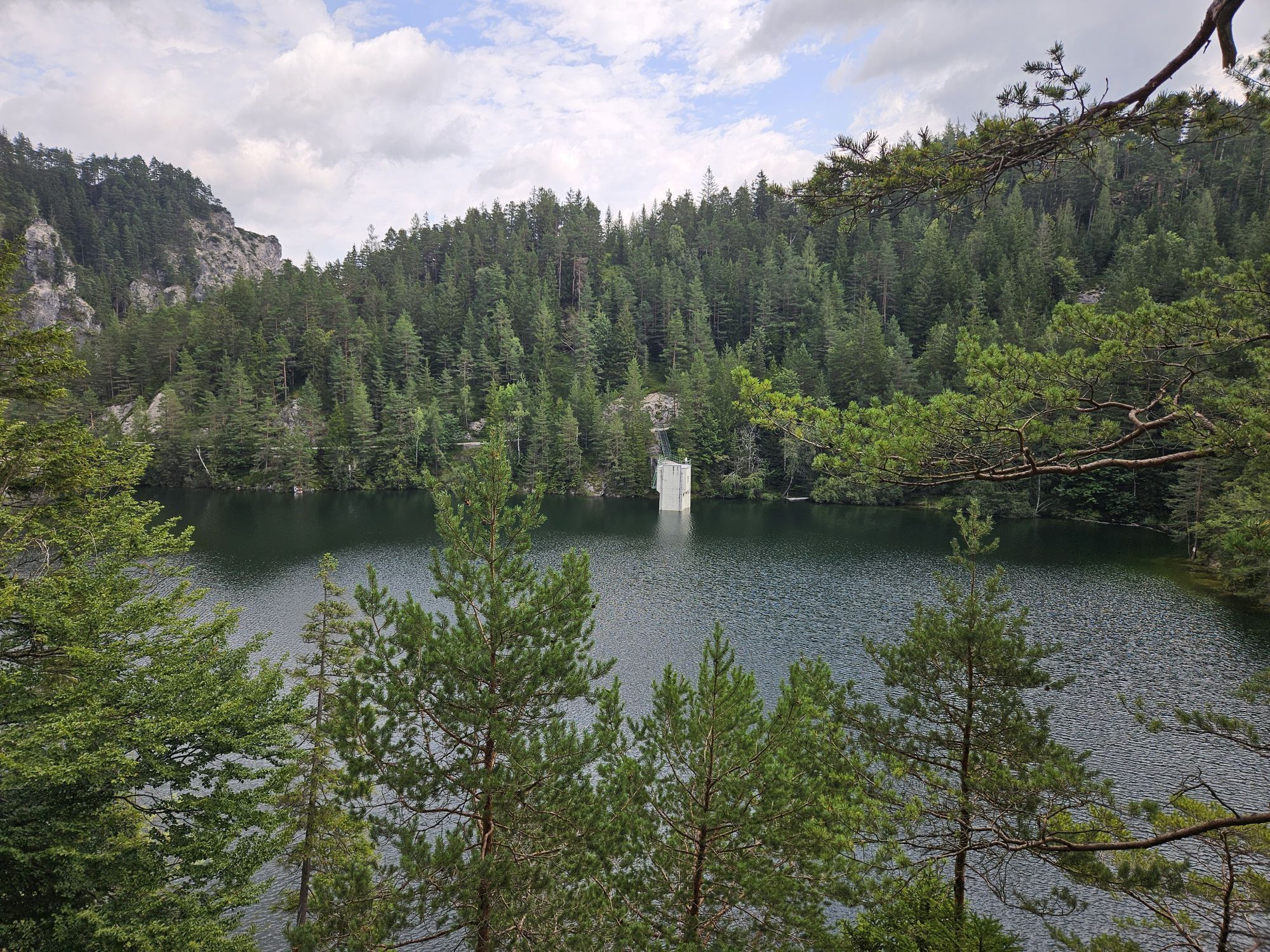
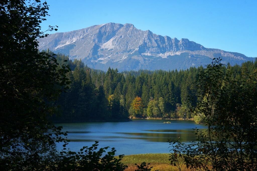
Erlauf reservoir Mitterbach - Erlaufklause
The starting point of the route is the station in Mitterbach, so a comfortable journey with the Mariazellerbahn is recommended. The hike first leads along the federal road to the Mitterbach nature park...
The starting point of the route is the station in Mitterbach, so a comfortable journey with the Mariazellerbahn is recommended. The hike first leads along the federal road to the Mitterbach nature park entrance; at the Erlaufstauseeschänke you can not only take a short break but also pay the nature park entrance fee.
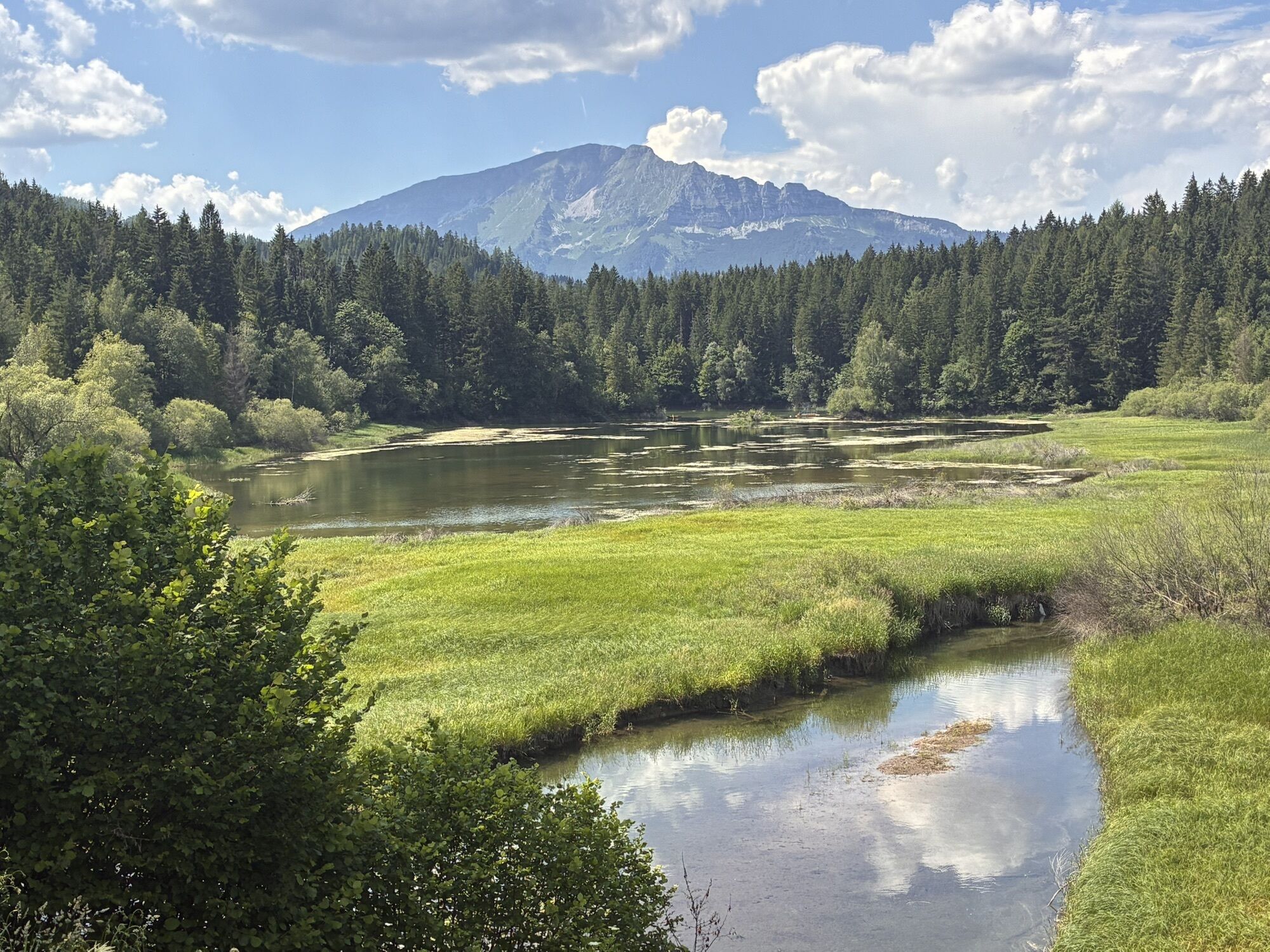
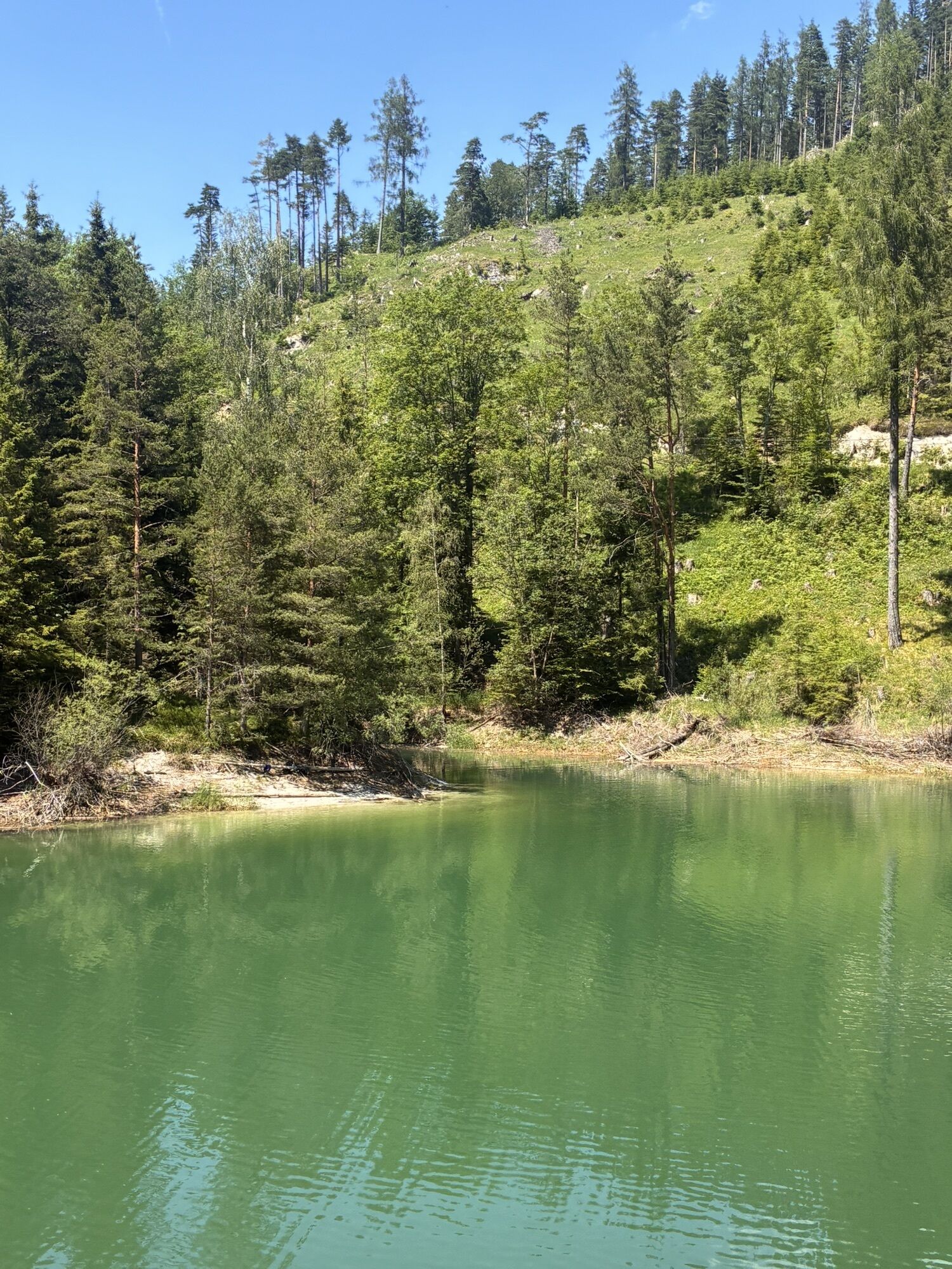
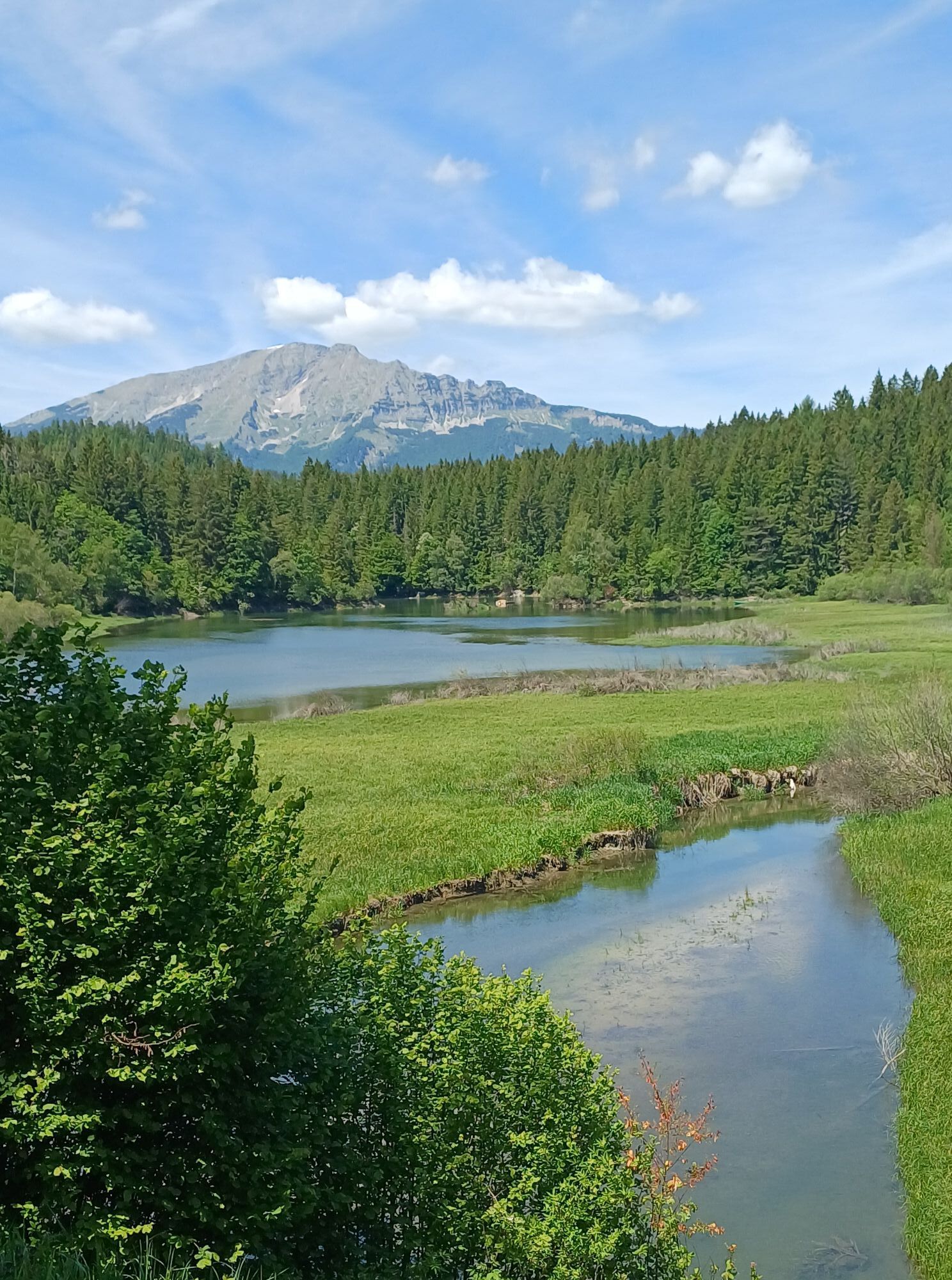
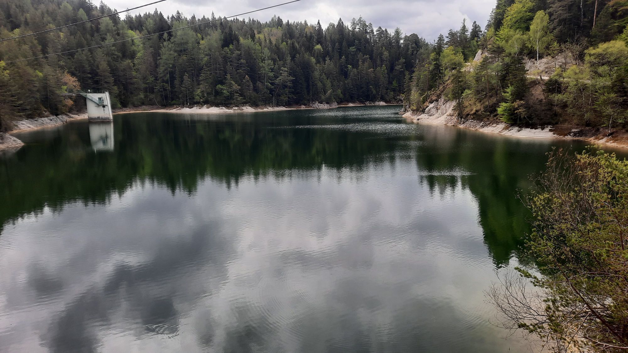
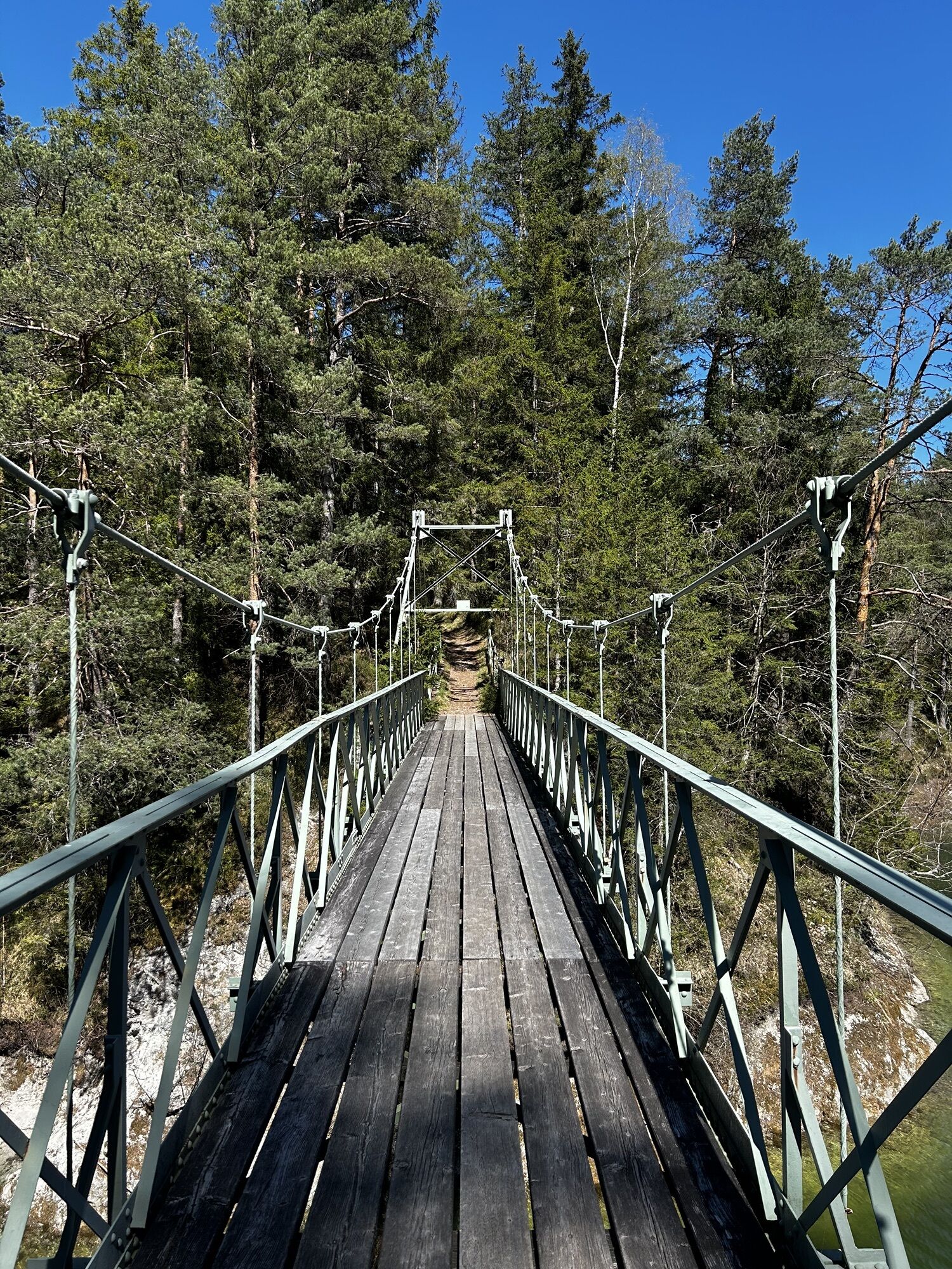
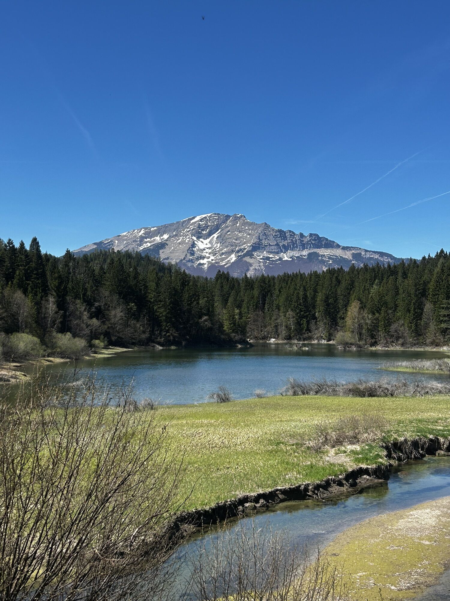
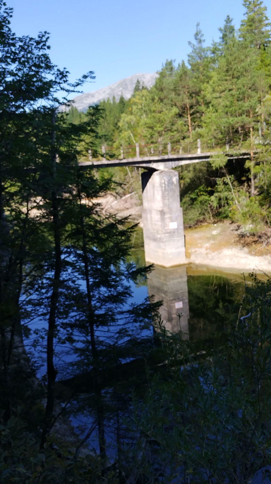
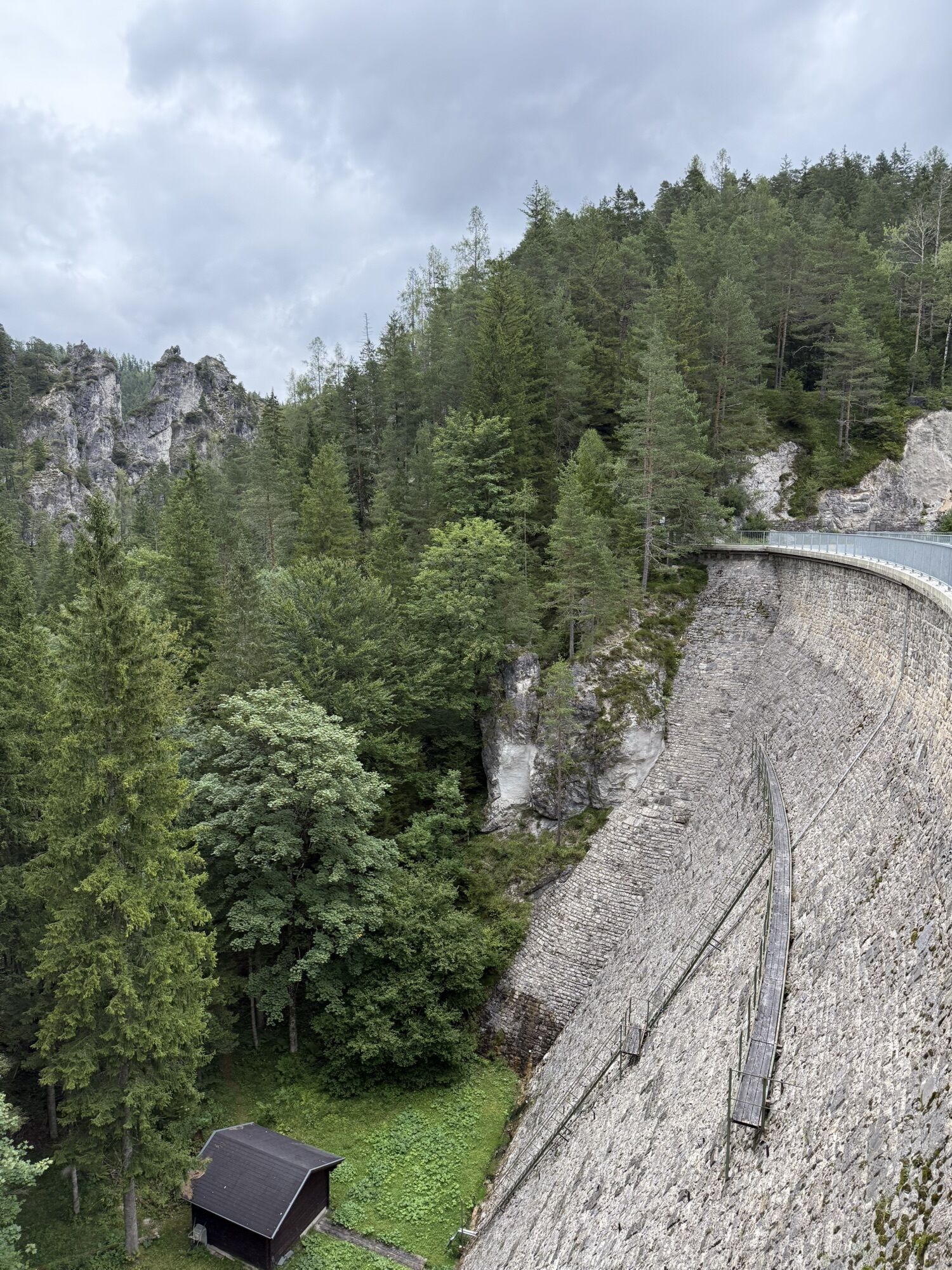
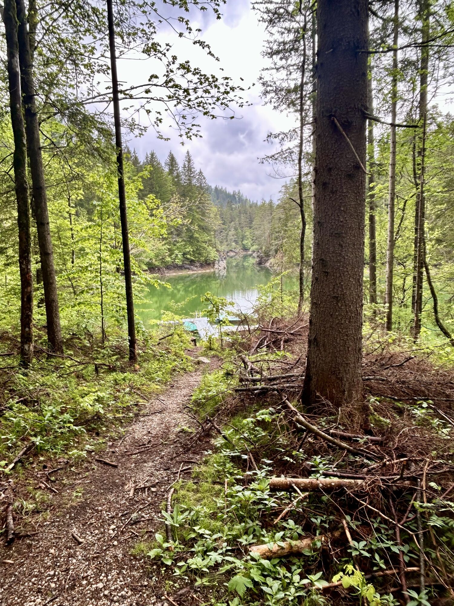
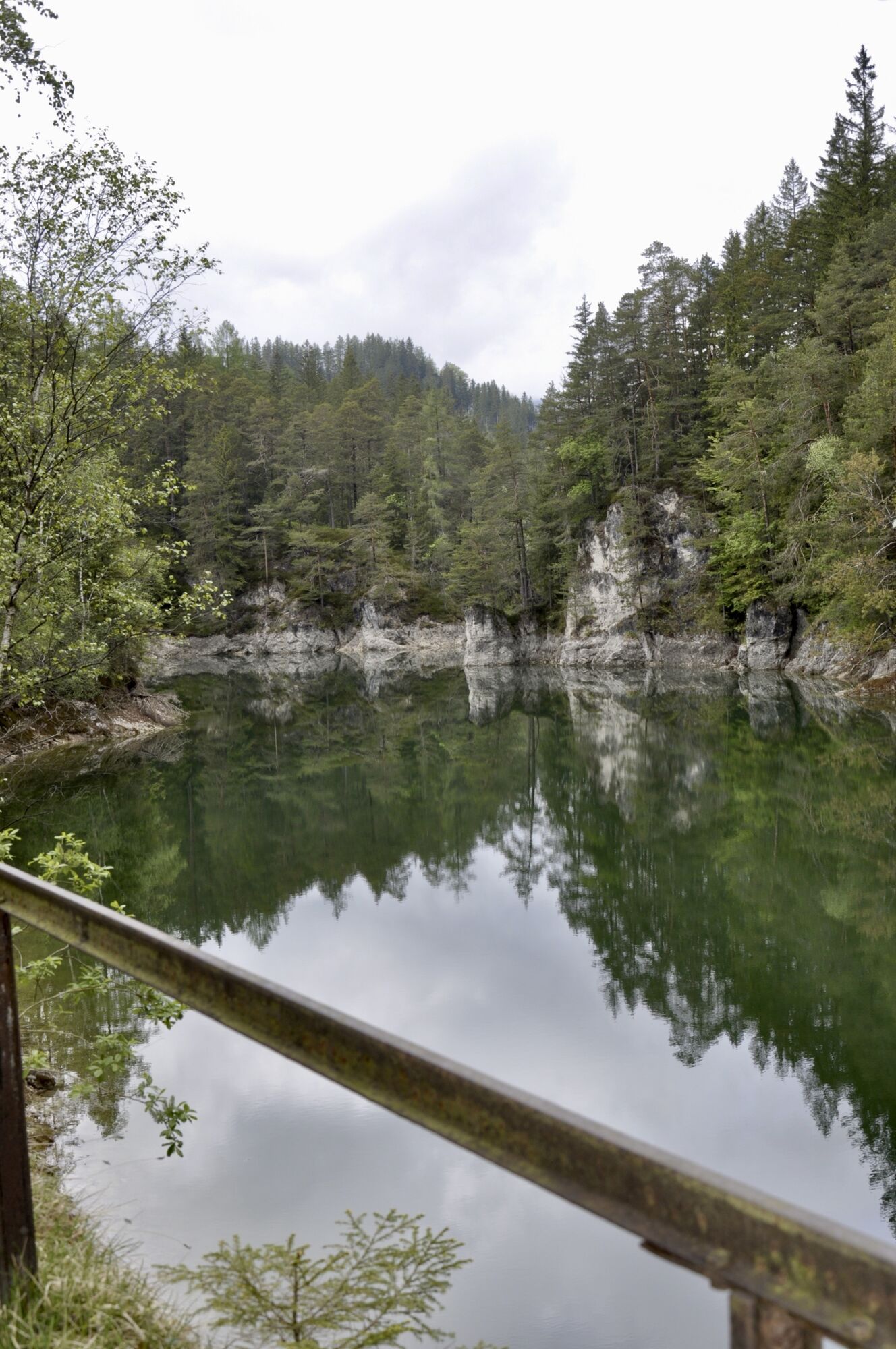
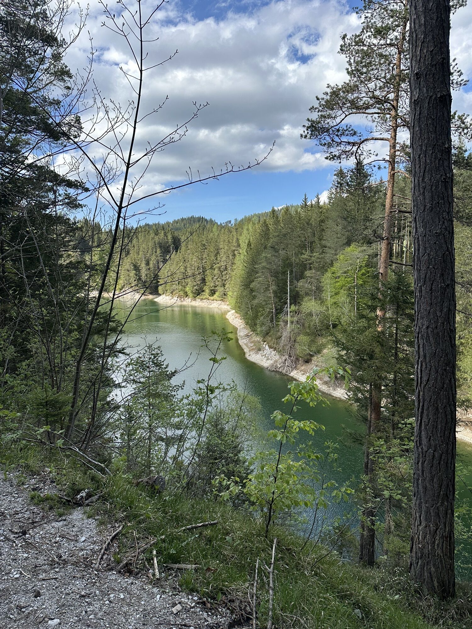
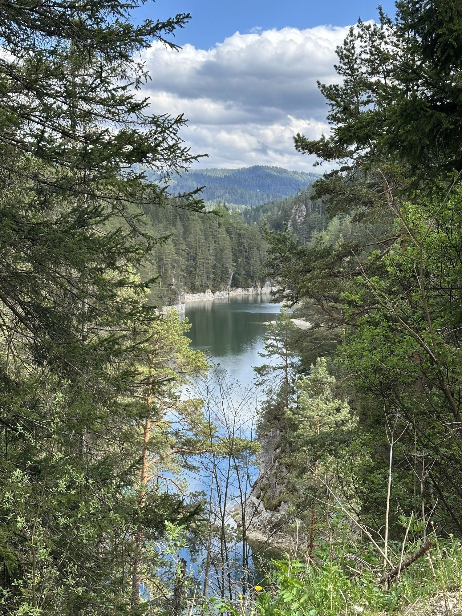
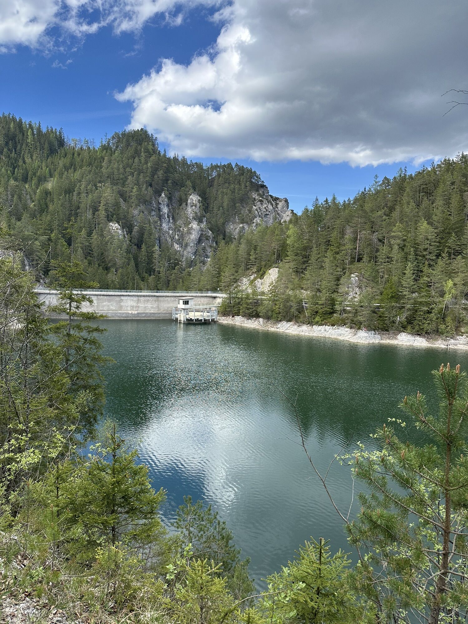
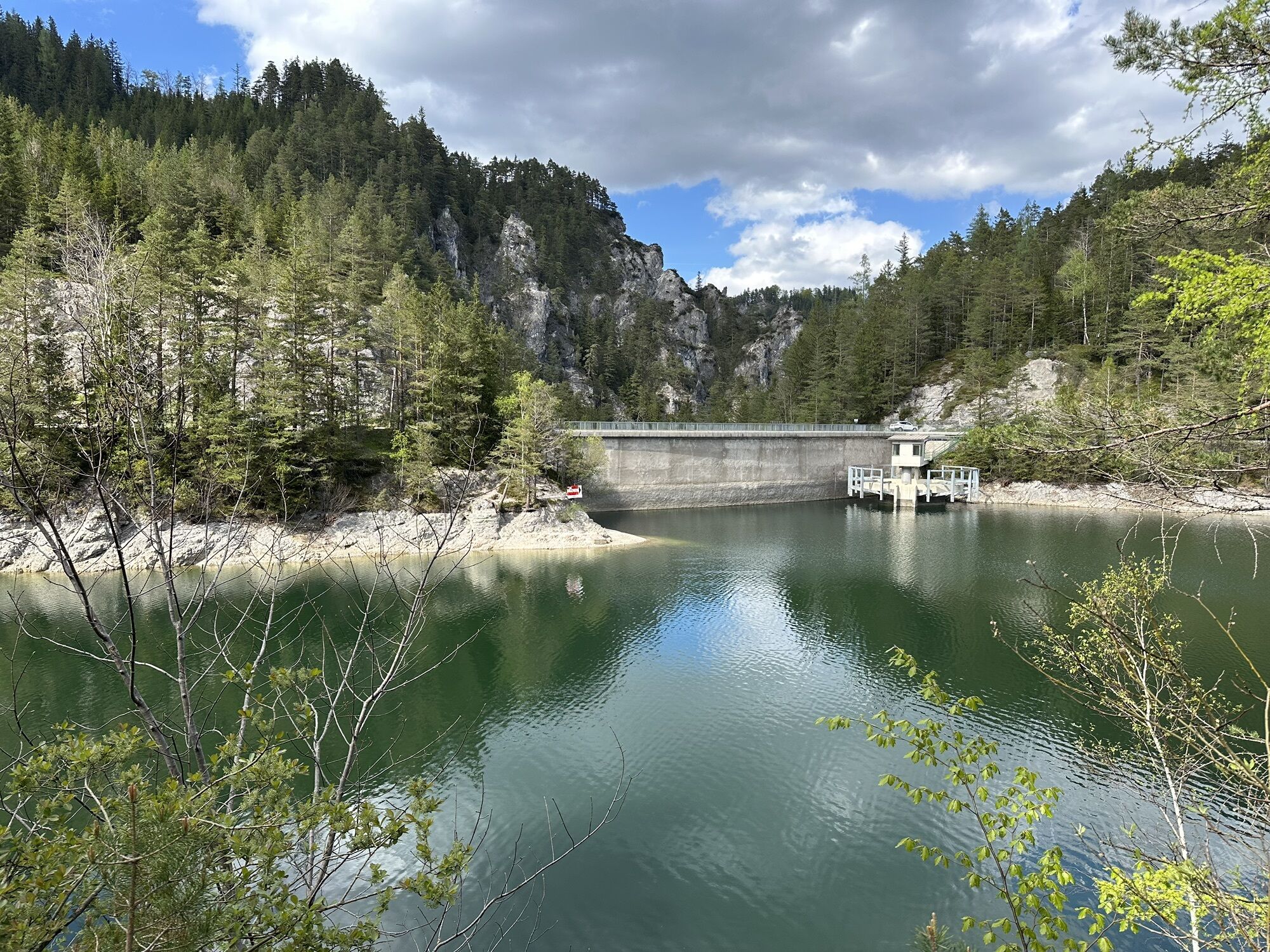
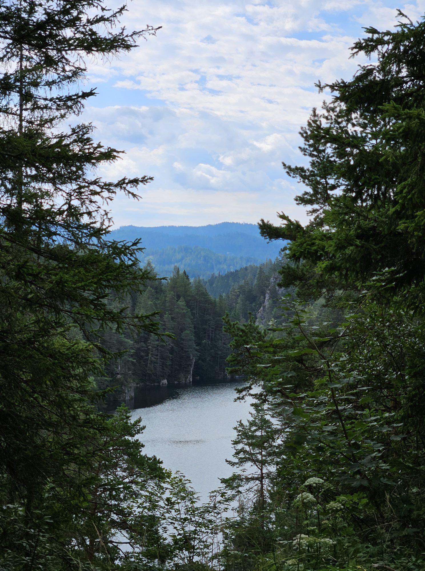
The path then follows the entire south shore along the fjord-like Erlauf reservoir with crystal-clear water to the impressive dam. From there it is just a stone's throw to the Erlaufklause station. The return to Mitterbach is then again by Mariazellerbahn.

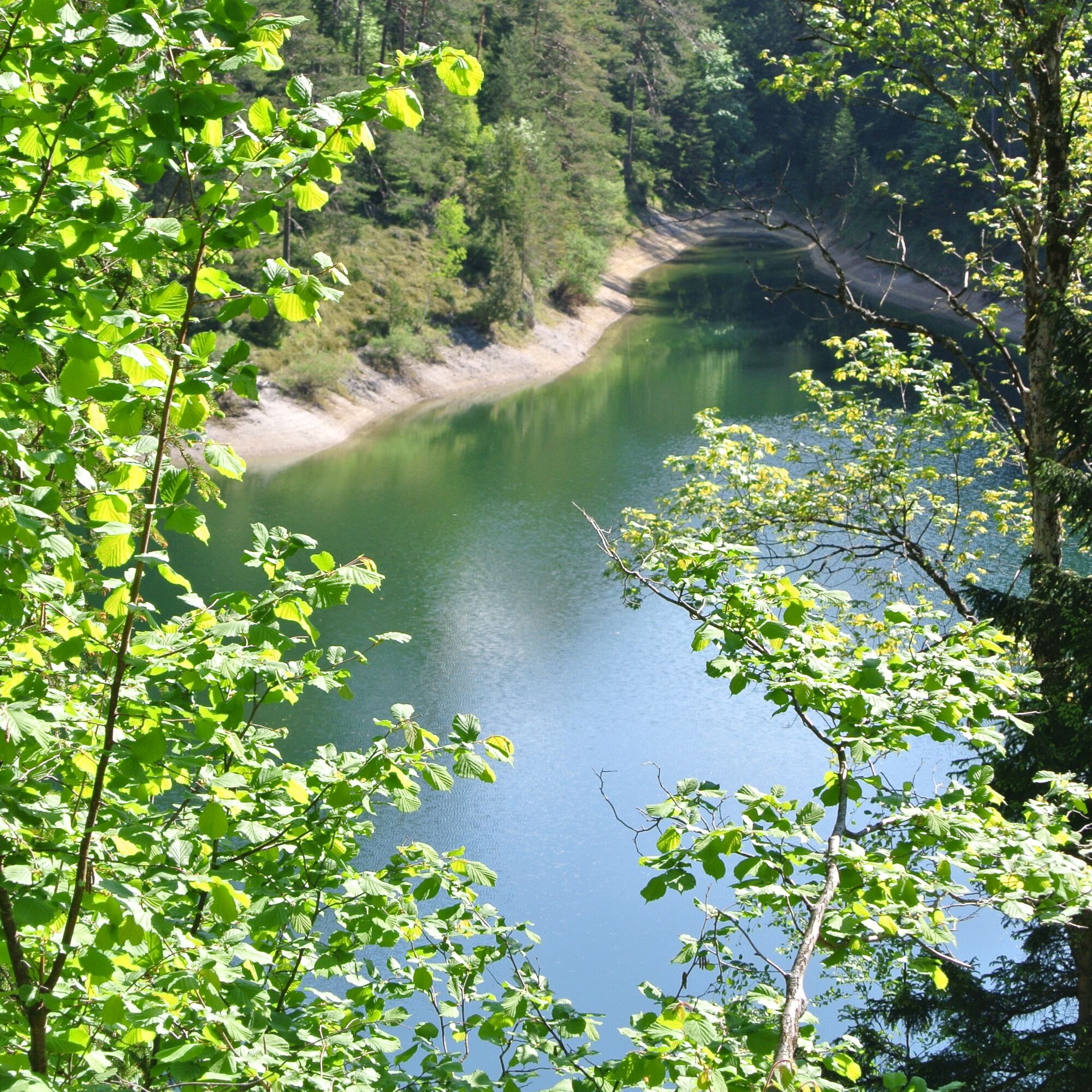
In the town of Mitterbach, start heading north toward the entrance of the Ötscher-Tormäuer Nature Park (opposite the sawmill). The path runs along the south shore of the Erlauf reservoir toward Hagenstraße and then to the dam. After crossing the dam, you reach Erlaufklause station in about 10 minutes via the paved road.
Tak
Tak
Tak
Hiking clothing, sturdy footwear, drink
The route is mostly barrier-free but not fully accessible!
Please check in advance for any path and road closures in the Ötscher-Tormäuer Nature Park. You can find this information at https://www.naturpark-oetscher.at/aktuelles-top-informiert-im-naturpark
From Linz: A1 motorway; exit Ybbs; direction Wieselburg and Scheibbs (approx. 1.5 h from Linz)
From Vienna: A1 motorway; exit St. Pölten via the Pielach valley (approx. 1.5 h from Vienna)
From Styria (Graz): S35 toward Leoben to the Bruck/Mur junction, B116 to Kapfenberg, B20 toward Mariazell
Mariazellerbahn from St. Pölten or Mariazell to Mitterbach.
Paid parking is available at both the Mitterbach and Erlaufklause nature park entrances - 5€/day. The revenue from parking management benefits the maintenance of the nature park. (coin payment only at parking meter)
Ötscher-Tormäuer Nature Park
Tel.: 02728/21 100 or info@naturpark-oetscher.at
Erlaufstauseeschänke
Tel.: 0664 / 932 22 67 or franz.wiedner@ready2web.net
https://erlaufstauseeschaenke.jimdofree.com/
Seegasthaus Ötscher-Basis
Tel.: (0)664 75 04 82 77 or gastroteam@seegasthaus-oetscherbasis.at
www.seegasthaus-oetscherbasis.at
Mariazellerbahn: www.mariazellerbahn.at
The Water Experience Trail, only a short detour of the route, offers insights into springs, biotopes, and fish species of the reservoir!
Kamery internetowe z trasy
Mariazeller Bürgeralpe - Berggasthof
Zuckerwiese
Gemeindealpe Mittelstation
Sternwarte
Mariazell
Gipfelbahn Bergstation
Gemeindealpe Mittelstation
Mittelstation Gemeindealpe
Gemeindealpe Talstation
Terzerhaus
Flugplatz St. Sebastian
Snowpark Gemeindealpe
Birkihang
Terzerhaus
Bürgeralpe - Kristallsee
Mariazeller Bürgeralpe - Berggasthof
Mariazell
Feldbauer Mariazell
Terzerhaus
Mittelstation
Gemeindealpe Mittelstation
Mitterbach
Stapelhaus
Terzerhaus
Mariazell - Chalets Monte Styria
Hauptplatz
Basilika Mariazell
Flugplatz St. Sebastian
Zellerhüte - Mariazell
Talstation

Popularne wycieczki w okolicy
- 4,8
Gemeindealpe
średniWędrówka 13,5 km - 5,0
Von Lackenhof auf den Ötscher
światłoWędrówka 5,29 km - 4,9
Lassingfall->Ötscherhias->Erlaufklause
średniWędrówka 8,72 km - 4,9
Lackenhof ÖTSCHER Rauer Kamm 19.10.2014
ciężkiWędrówka 14,1 km - 4,8
Naturpark Ötscher-Tormäuer Wienerbruck
światłoWędrówka 6,06 km - 4,7
Trefflingfall über Hochbärneckhütte
średniWędrówka 12,2 km - 4,7
Erlaufsee-Rundweg
światłoWędrówka 5,37 km - 4,6
Tour auf den Göller
światłoWycieczki górskie 9,32 km - 4,6
Ötschergräben Runde über Wienerbruck, Josefsberg und Erlaufsee
światłoWędrówka 16,8 km - 4,2
Ybbstaler Alpen: Hintere Tormäuer und Ötschergräben
światłoWędrówka 13,1 km
Wędrówki i tropienie


Nie przegap ofert i inspiracji na następne wakacje
Twój adres e-mail została dodana do listy mailingowej.