


Follow the water - Easy paths to the Golling Waterfall !
Poziom trudności: T1
Zdjęcia naszych użytkowników

 © David BrunoUtworzono dnia 05.10.2022
 © David BrunoUtworzono dnia 05.10.2022
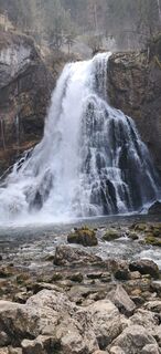
 © Buchegger BarbaraUtworzono dnia 06.04.2026
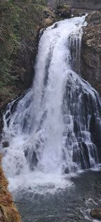 © Buchegger BarbaraUtworzono dnia 06.04.2026
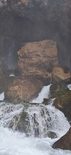 © Buchegger BarbaraUtworzono dnia 06.04.2026
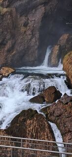 © Buchegger BarbaraUtworzono dnia 06.04.2026
 © EDITHUtworzono dnia 01.11.2025
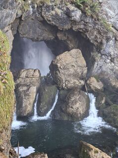 © EDITHUtworzono dnia 01.11.2025
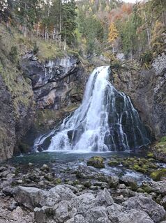 © EDITHUtworzono dnia 01.11.2025
 © ElkeAUtworzono dnia 31.10.2025
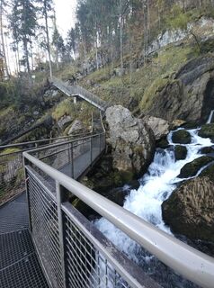 © ElkeAUtworzono dnia 31.10.2025
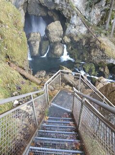 © ElkeAUtworzono dnia 31.10.2025
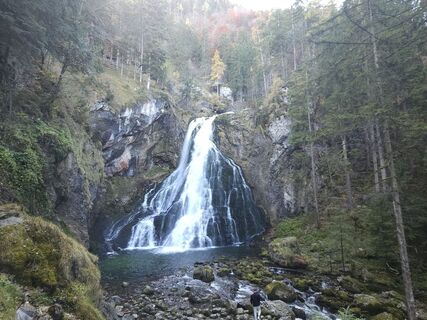 © ElkeAUtworzono dnia 31.10.2025
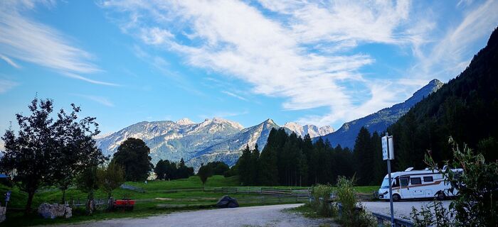
 © ReginaStUtworzono dnia 04.09.2025
 © ReginaStUtworzono dnia 04.09.2025
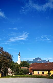 © ReginaStUtworzono dnia 04.09.2025
 © ReginaStUtworzono dnia 04.09.2025
 © ReginaStUtworzono dnia 04.09.2025
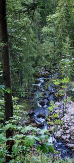 © ReginaStUtworzono dnia 04.09.2025
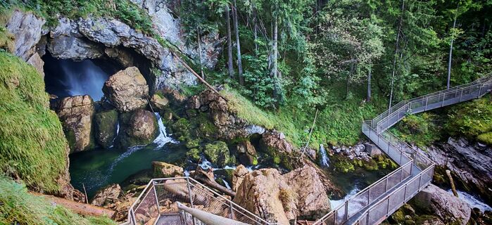 © ReginaStUtworzono dnia 04.09.2025
 © ReginaStUtworzono dnia 04.09.2025
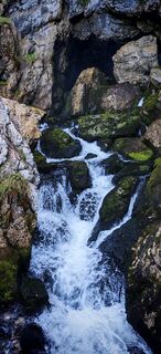 © ReginaStUtworzono dnia 04.09.2025
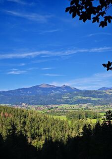 © ReginaStUtworzono dnia 04.09.2025
 © ReginaStUtworzono dnia 04.09.2025
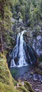 © ReginaStUtworzono dnia 04.09.2025
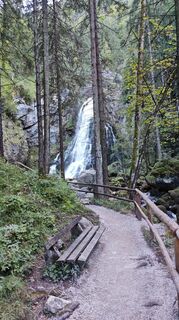 © ReginaStUtworzono dnia 04.09.2025
 © Bernhard Astner (Benton18)Utworzono dnia 19.06.2025
 © David BrunoUtworzono dnia 05.10.2022
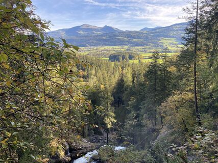 © David BrunoUtworzono dnia 05.10.2022
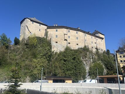 © Maria GrafUtworzono dnia 08.04.2026
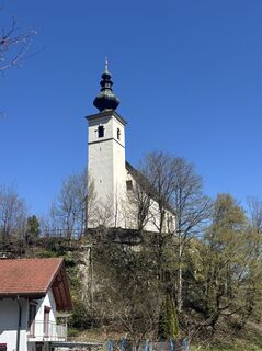 © Maria GrafUtworzono dnia 08.04.2026


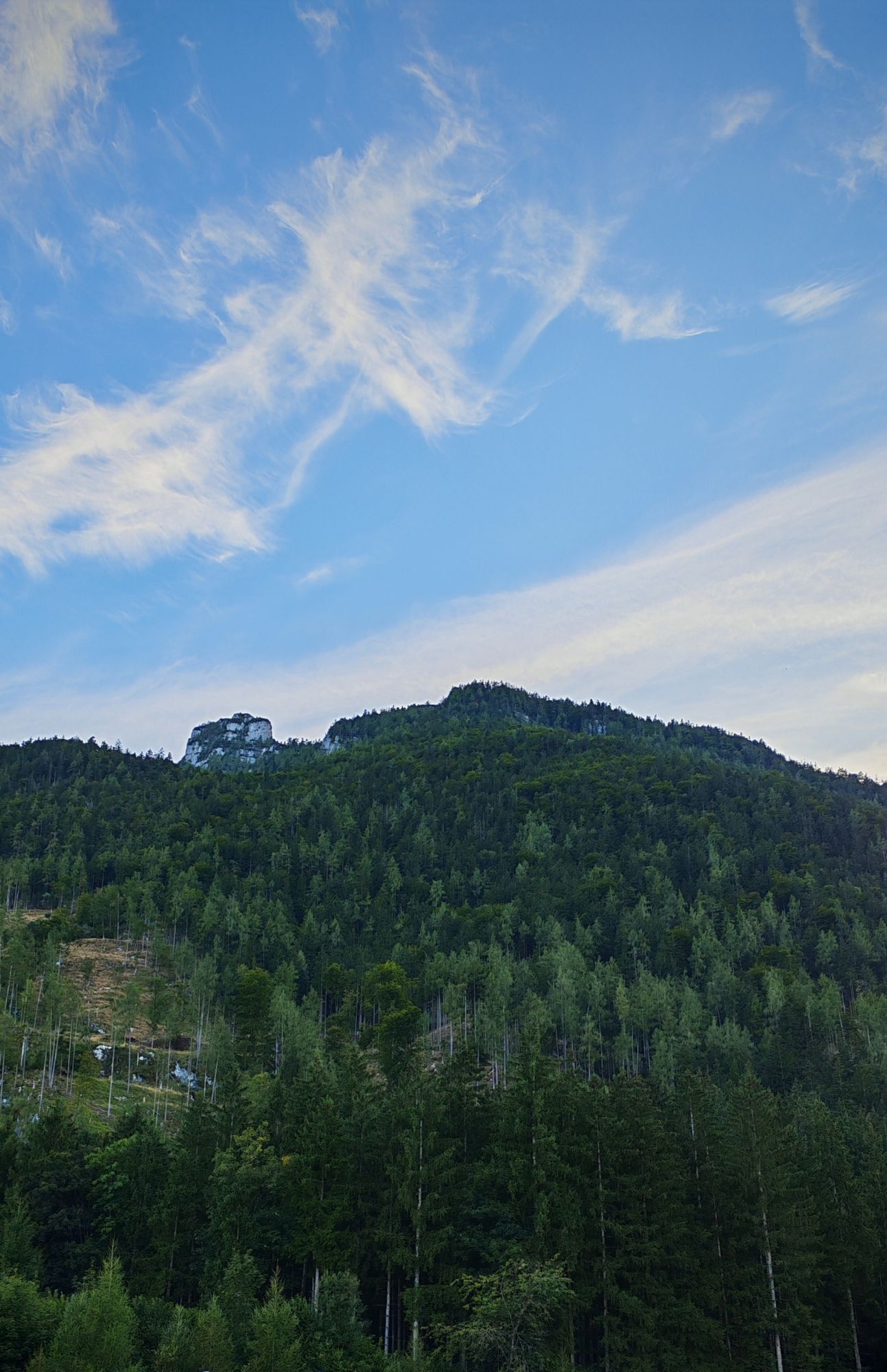


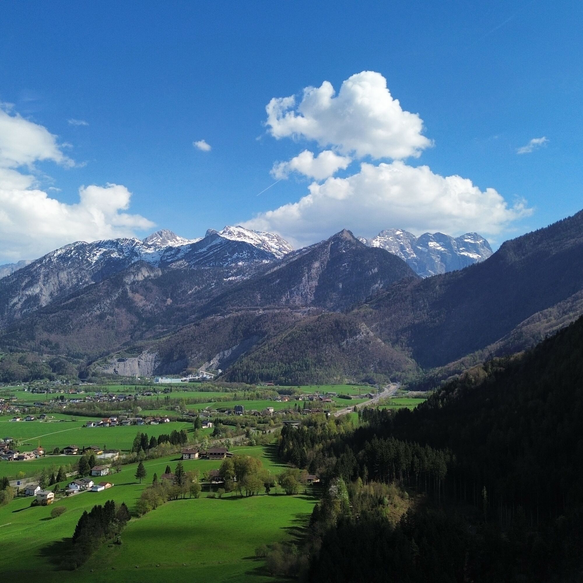
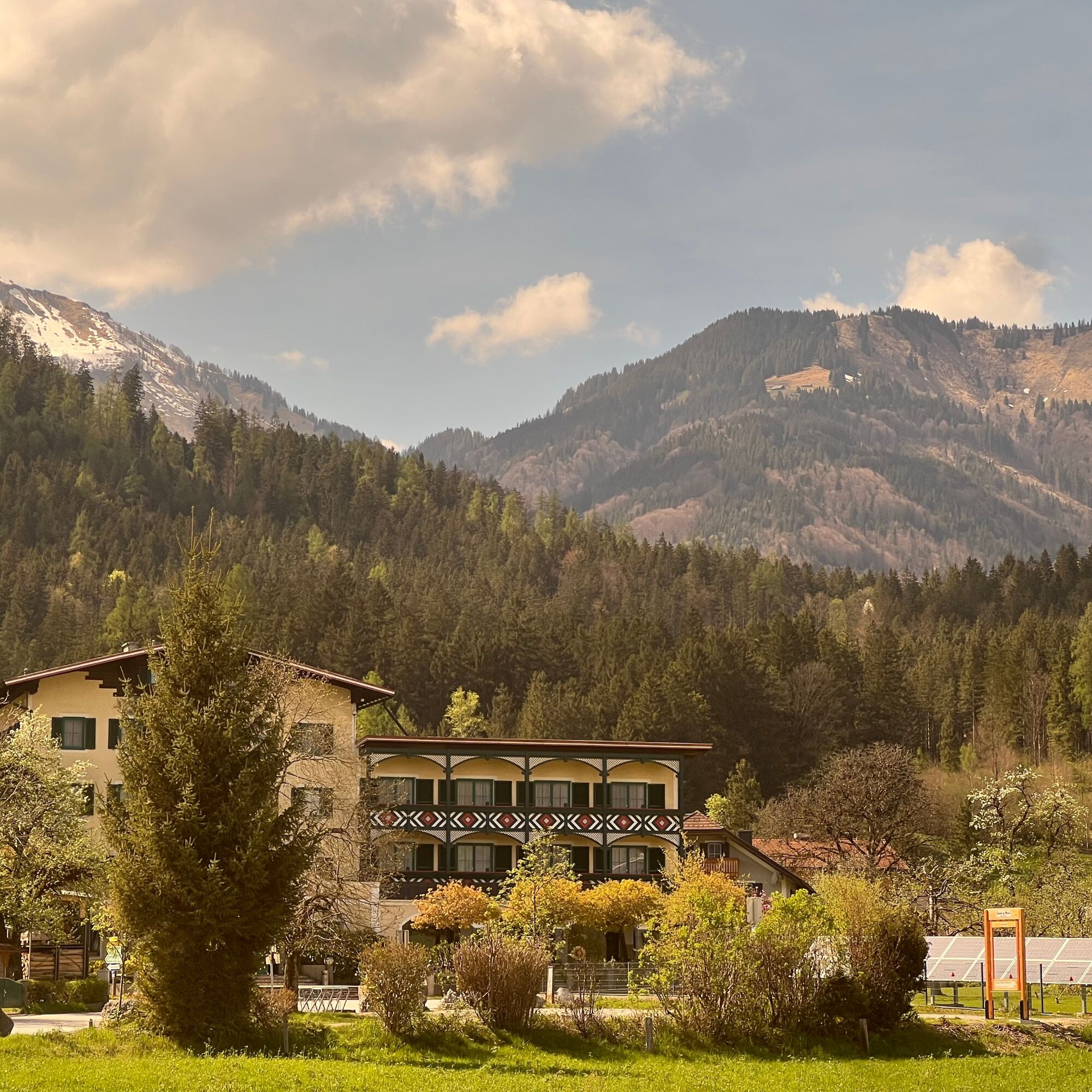
Just a quarter of an hour from Salzburg on the Railjet lies the market town of Golling an der Salzach. "Golling" comes from the Slovenian "golica," meaning "grass-covered mountain." Shortly after stepping...
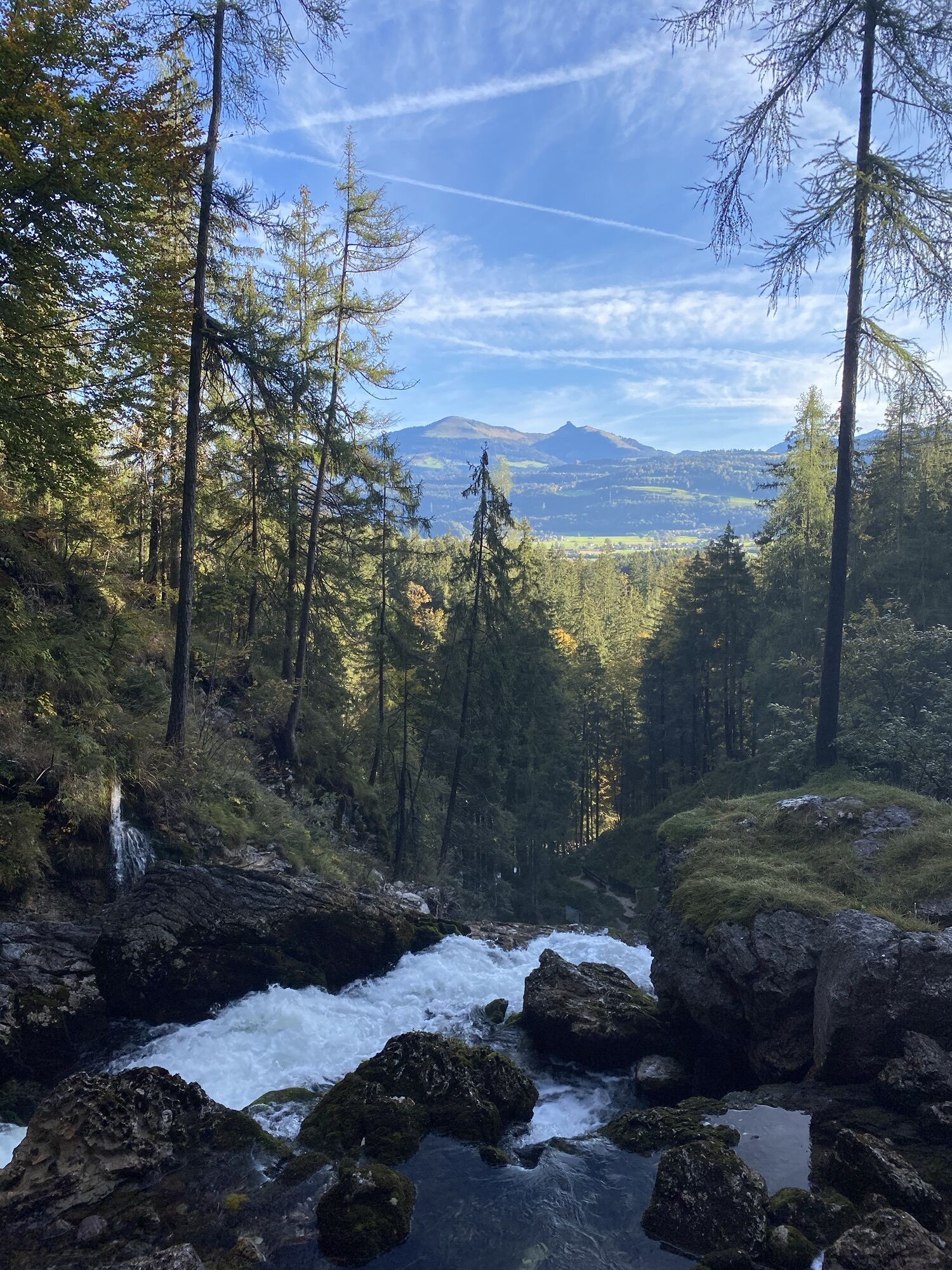
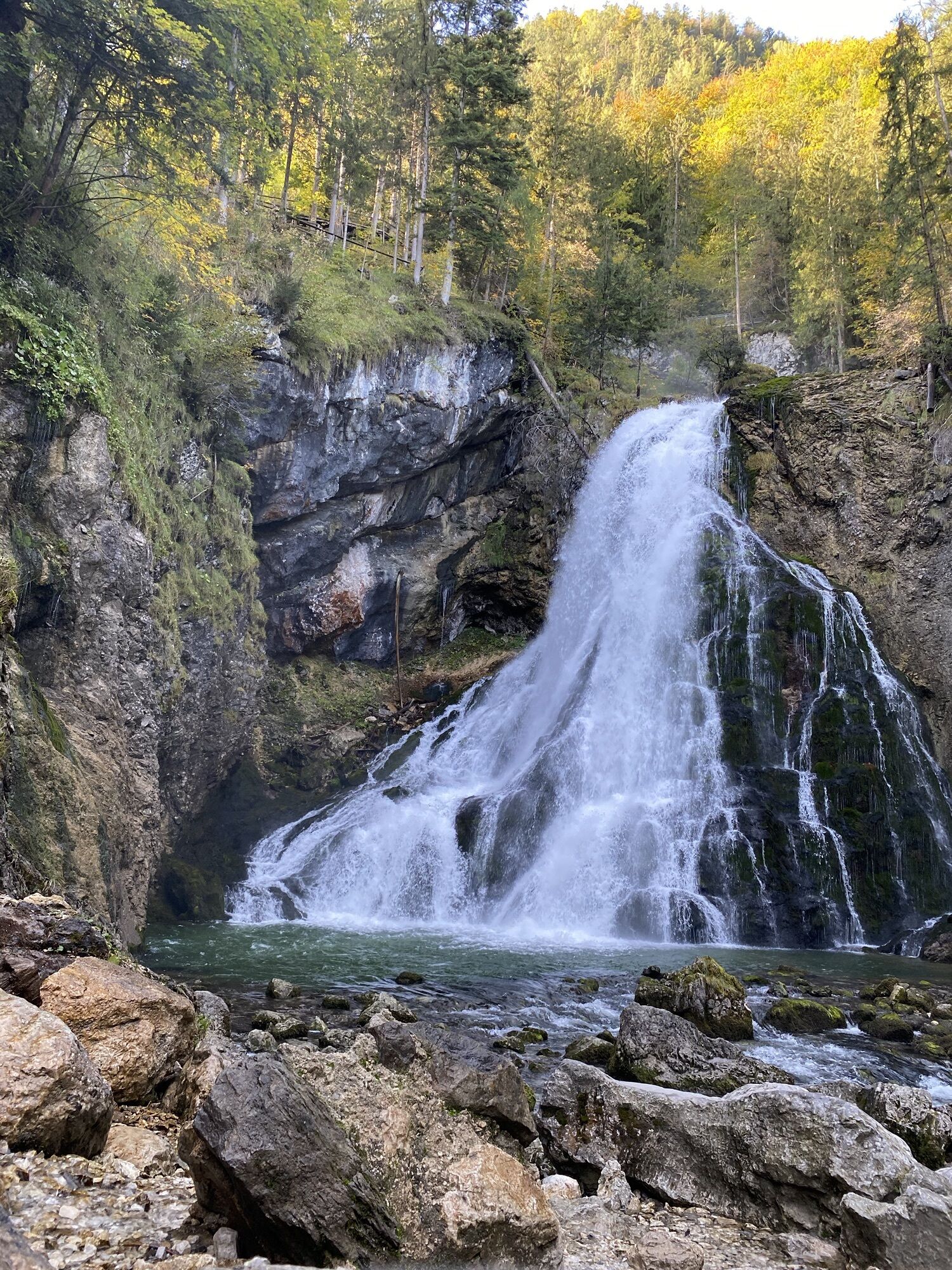
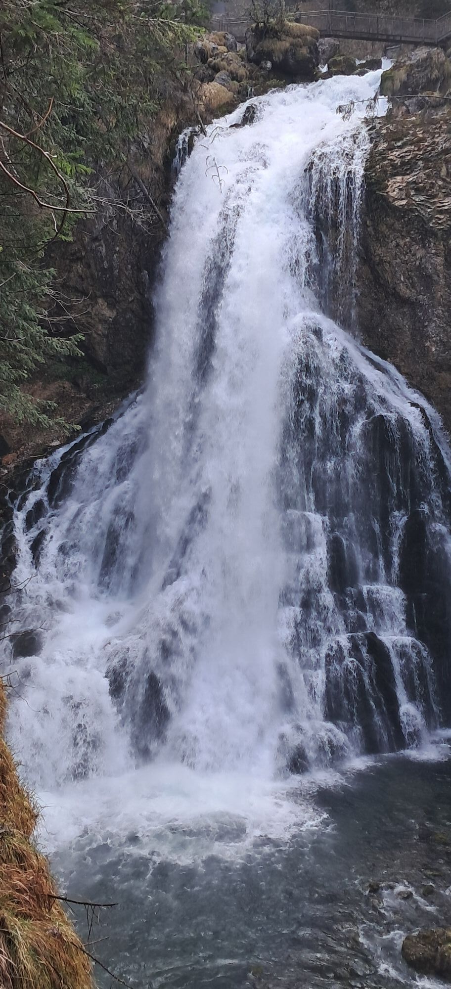
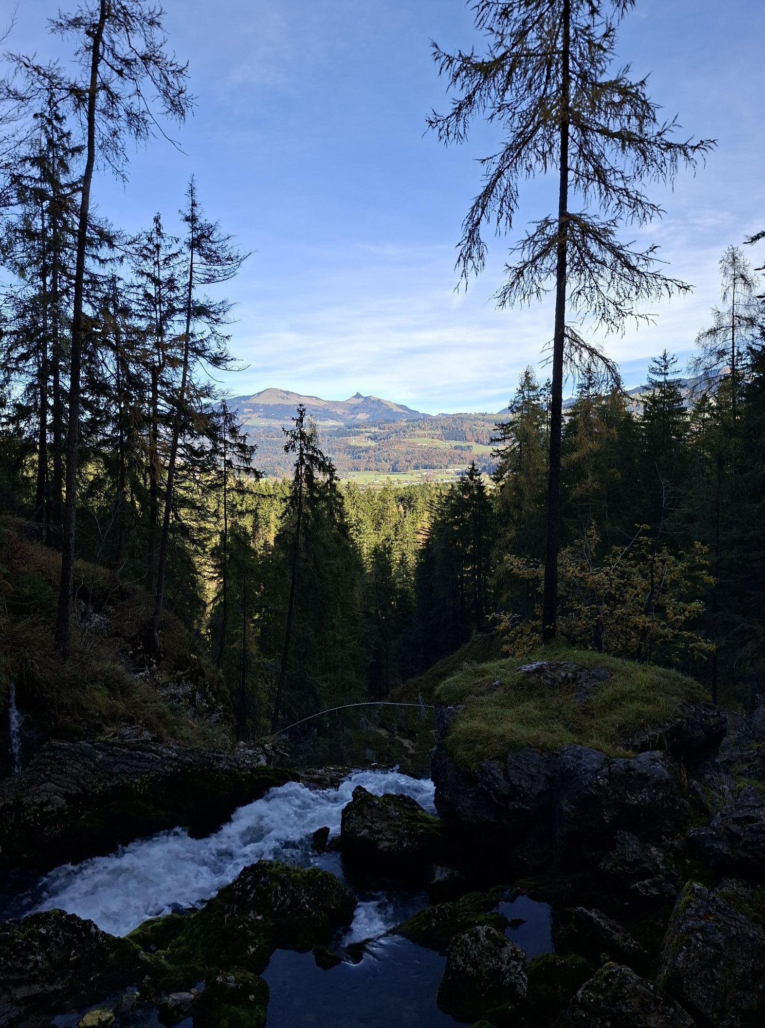
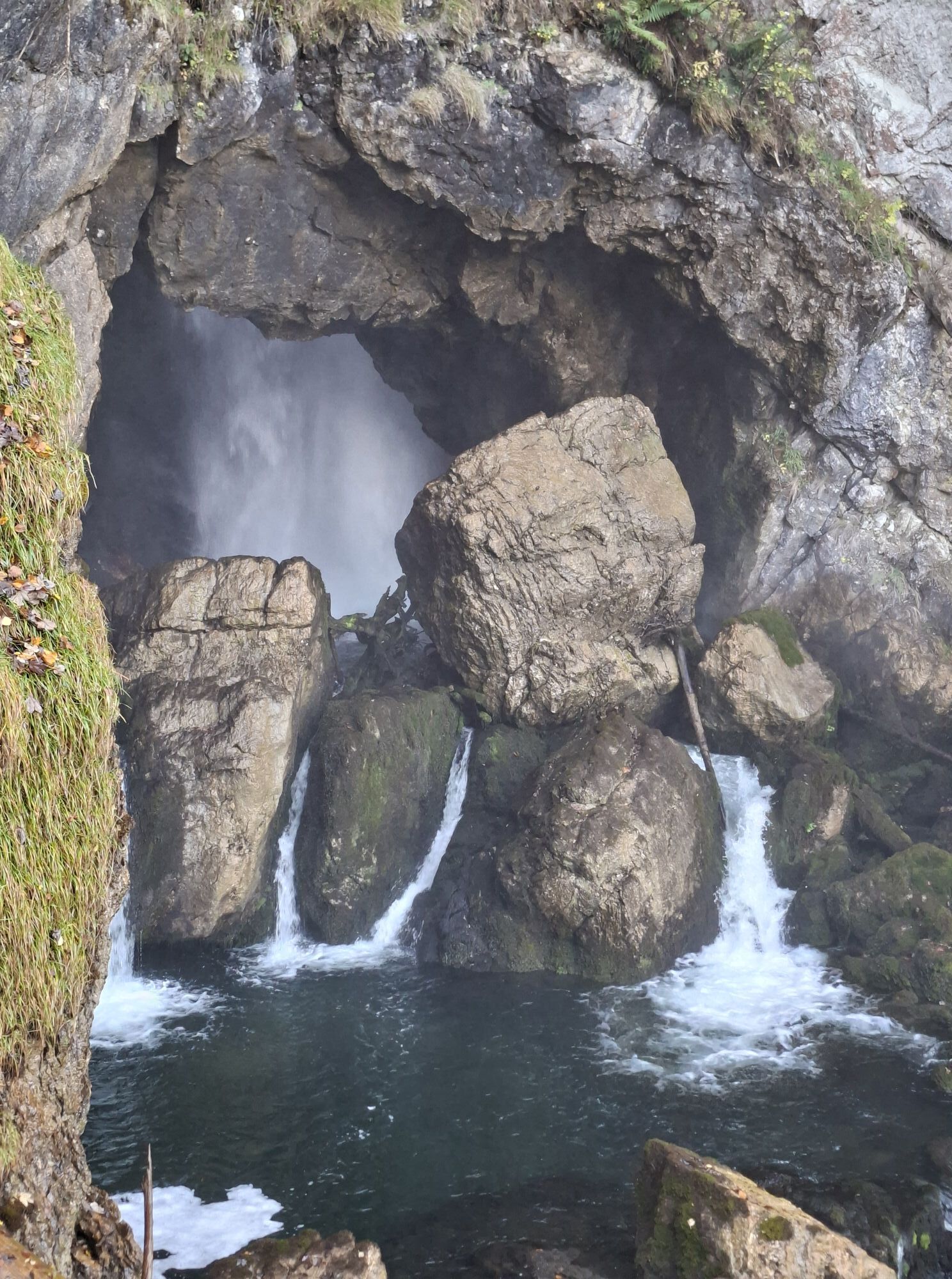
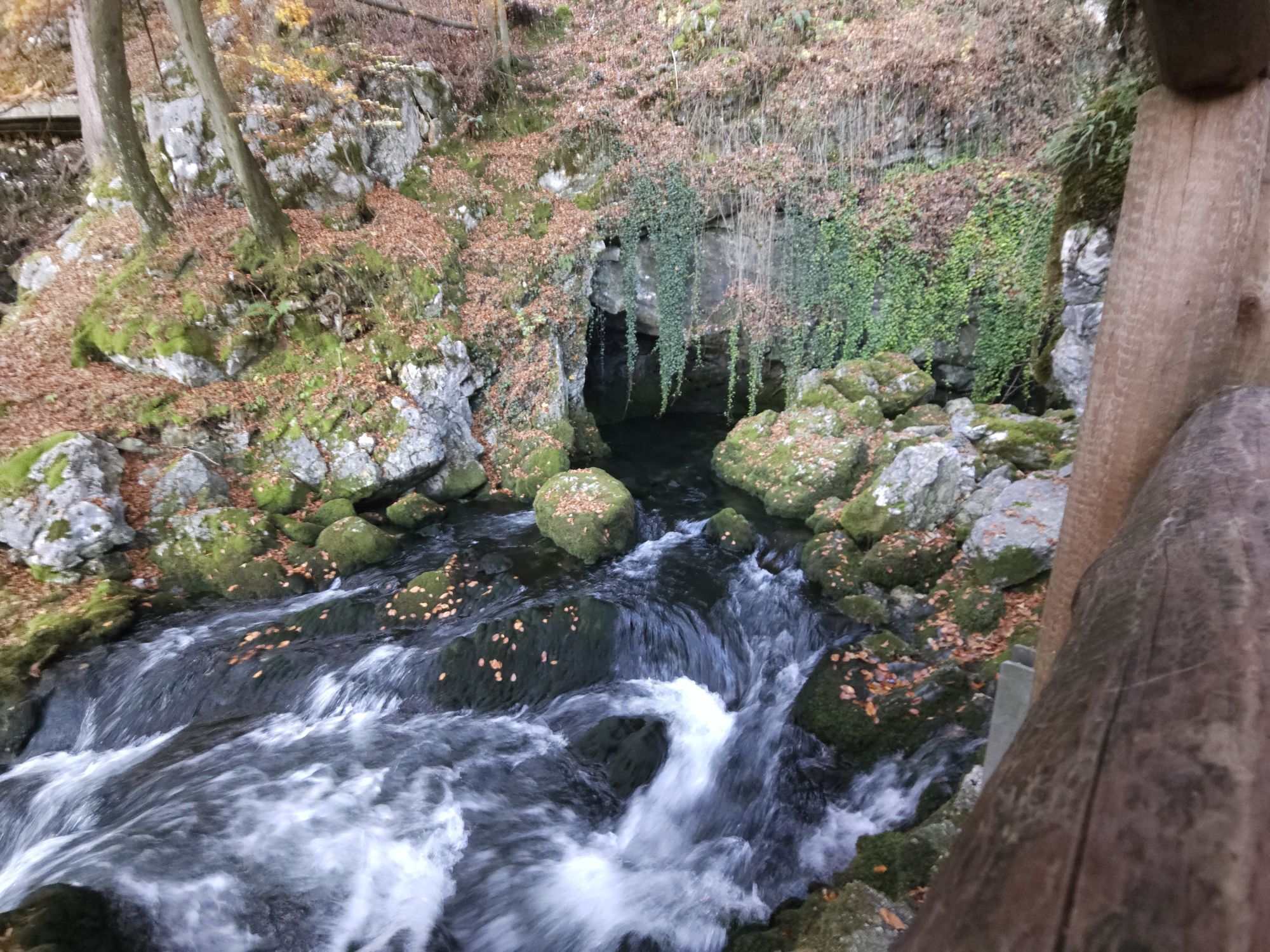
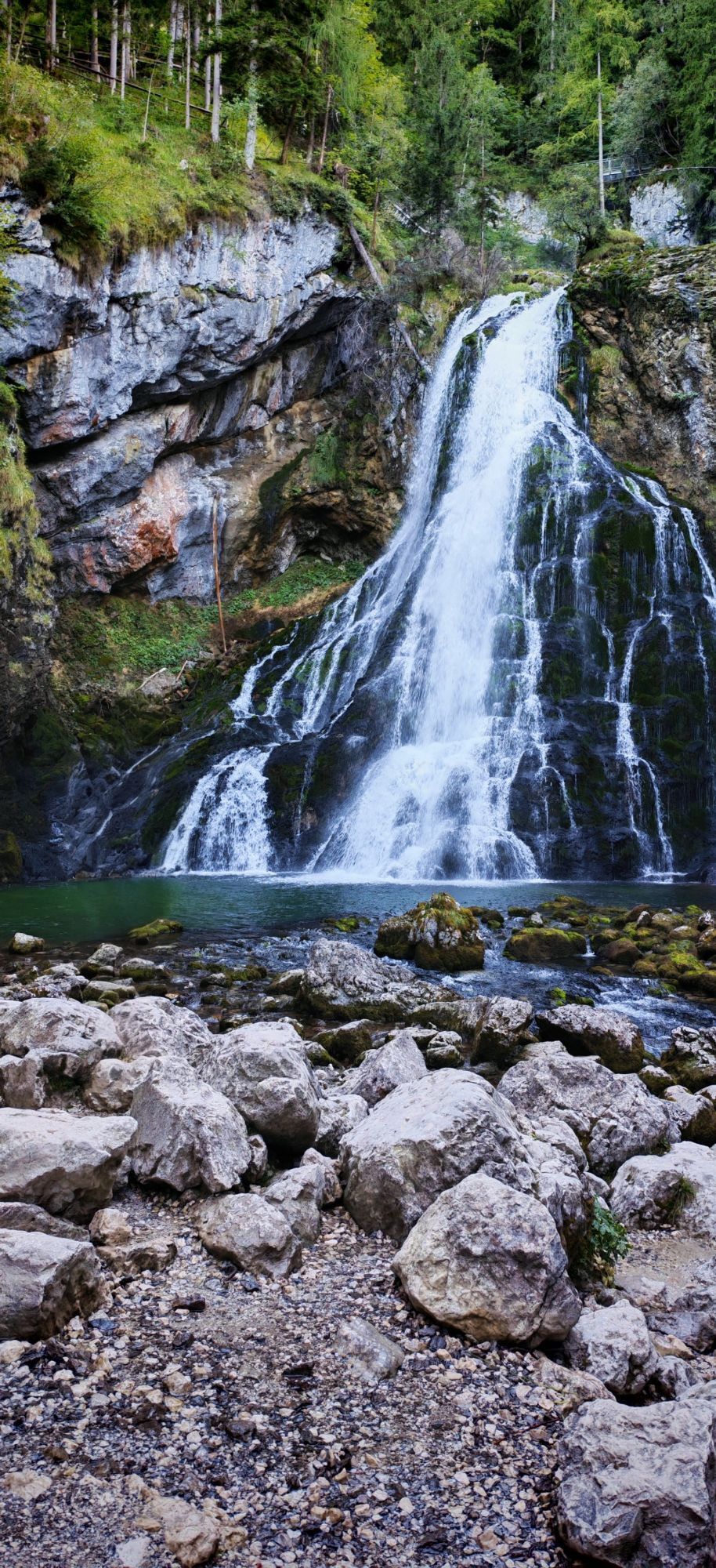
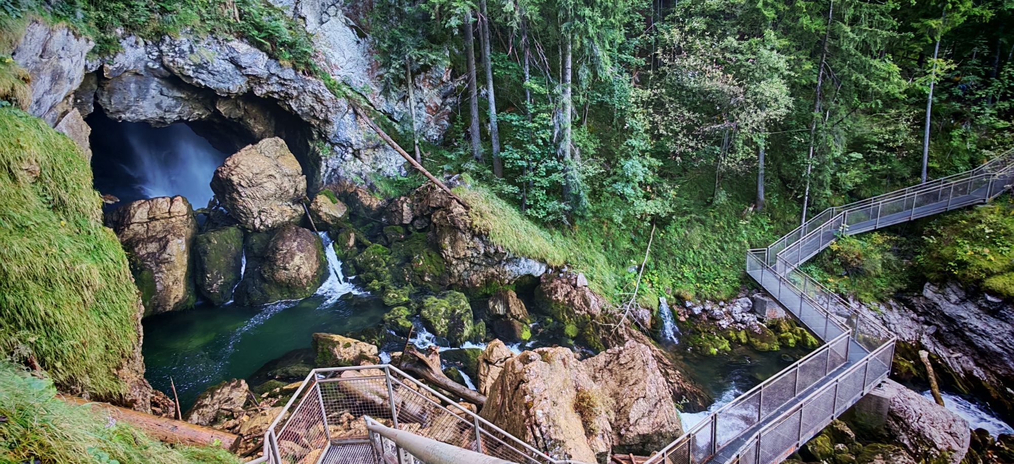
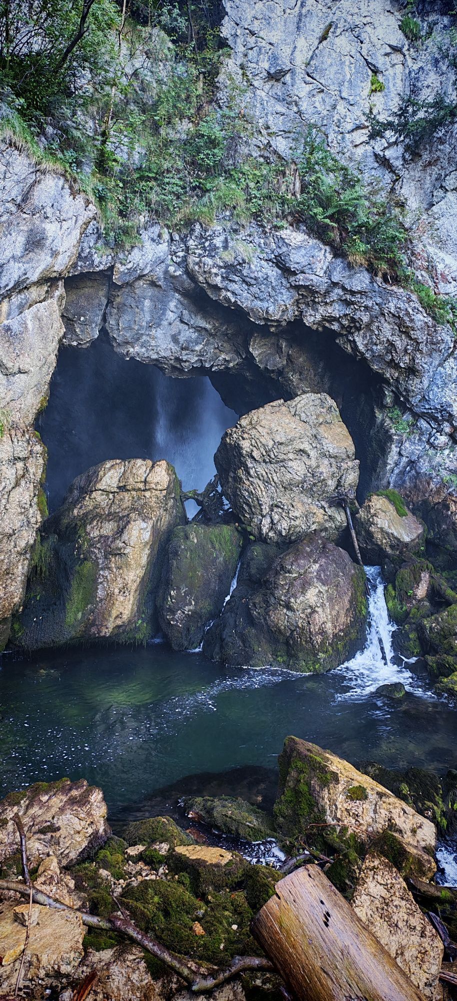
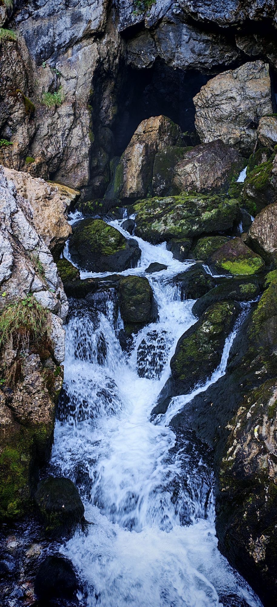
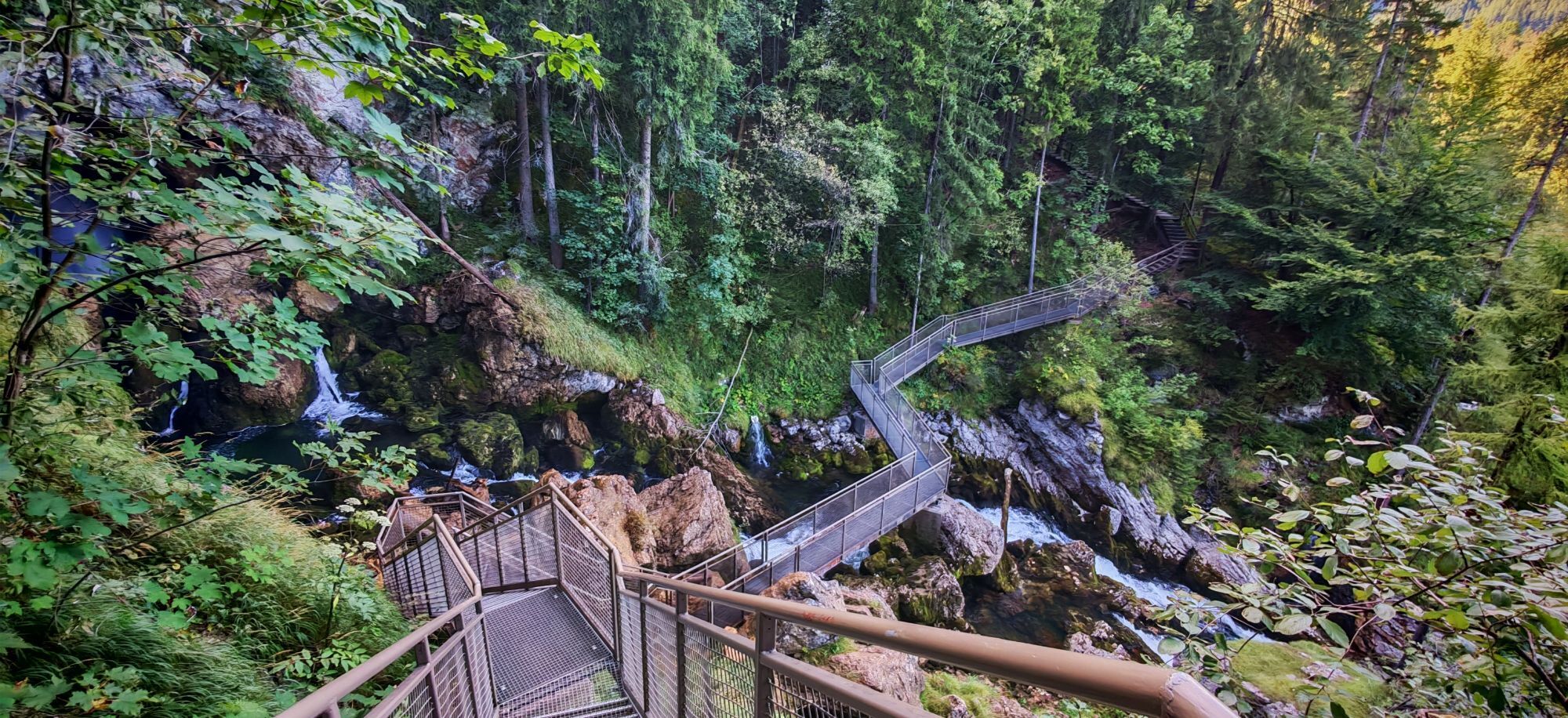
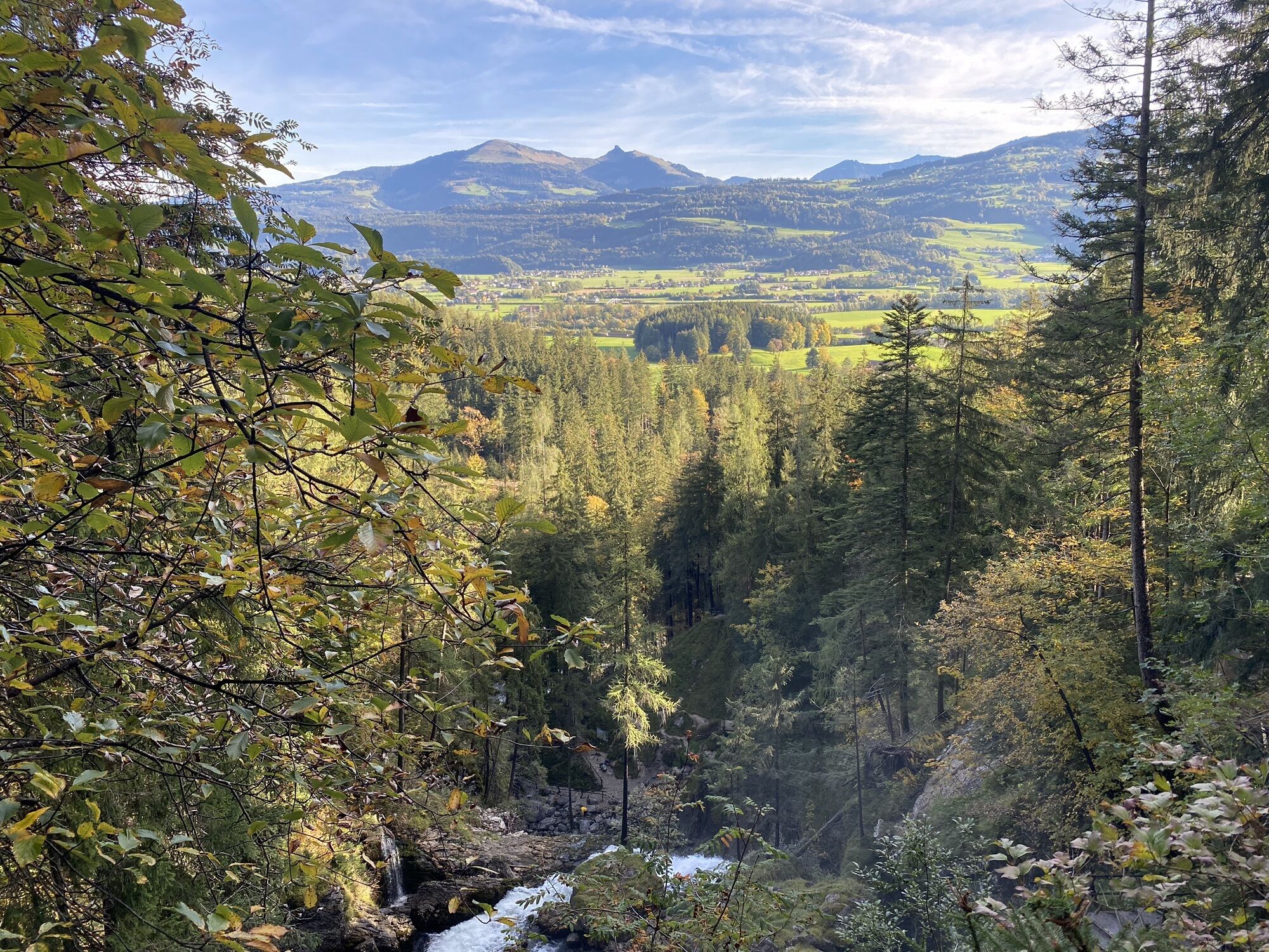
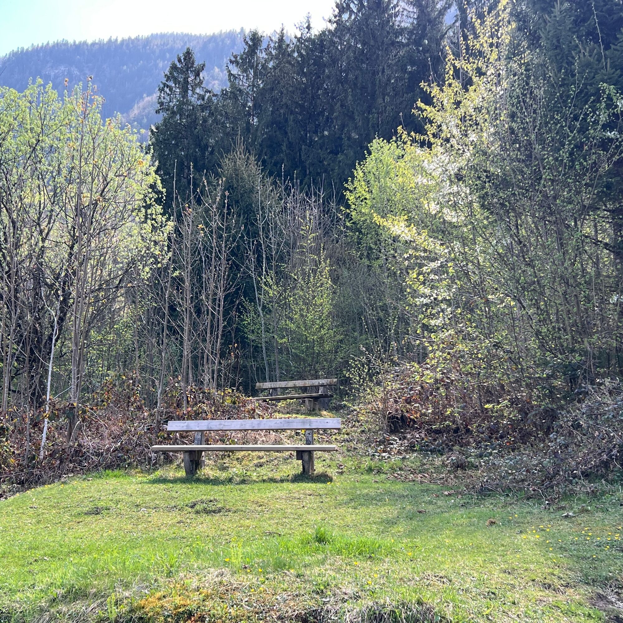
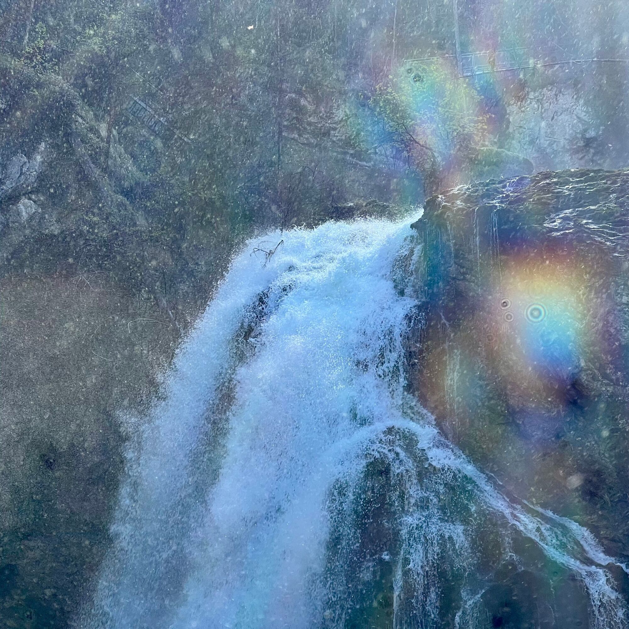
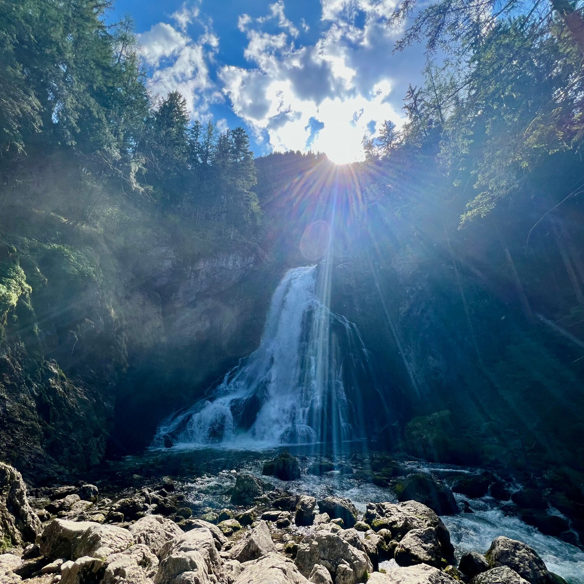
What you definitely won't find here, however, is a national park atmosphere à la Yosemite! The destination of this circular hike is the Golling Waterfall, consisting of two impressive cascades. Within a large rocky gorge, surrounded by coniferous trees, you can relax and immerse yourself in a completely different world.
Between 30,000 and 42,000 liters of water per second plunge 100 meters into the depths below. Especially on warm days, it's great fun to cool off and refresh yourself in the spray of the cold water.
However, the waterfall isn't the only highlight along this route. Fans of the musical "The Sound of Music" can pause at the photo point by St. Nicholas Church and capture the moment.
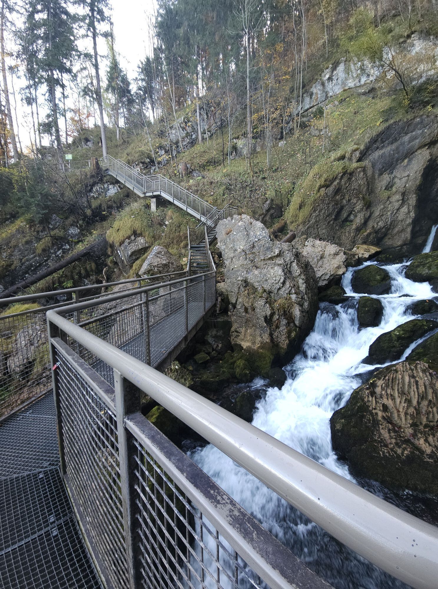
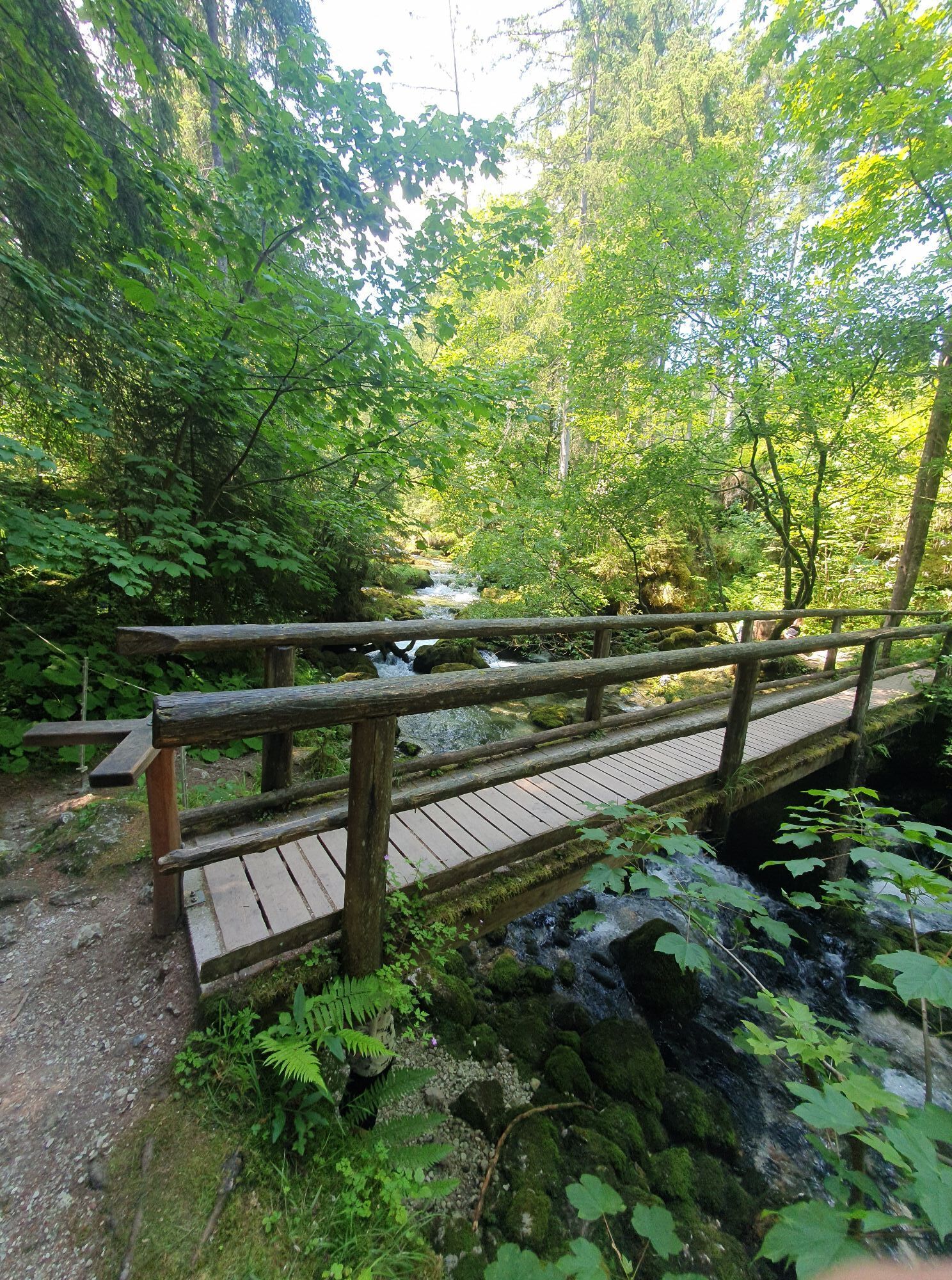
Except for the stairs and the section of terrain at the waterfall, the tour is relatively flat and easy to walk. Including travel time and breaks, you should allow about four hours. Information on opening hours and any admission prices can be found on the Golling Waterfall website.
Direct directions and details at: www.salzburg-erfahren.at

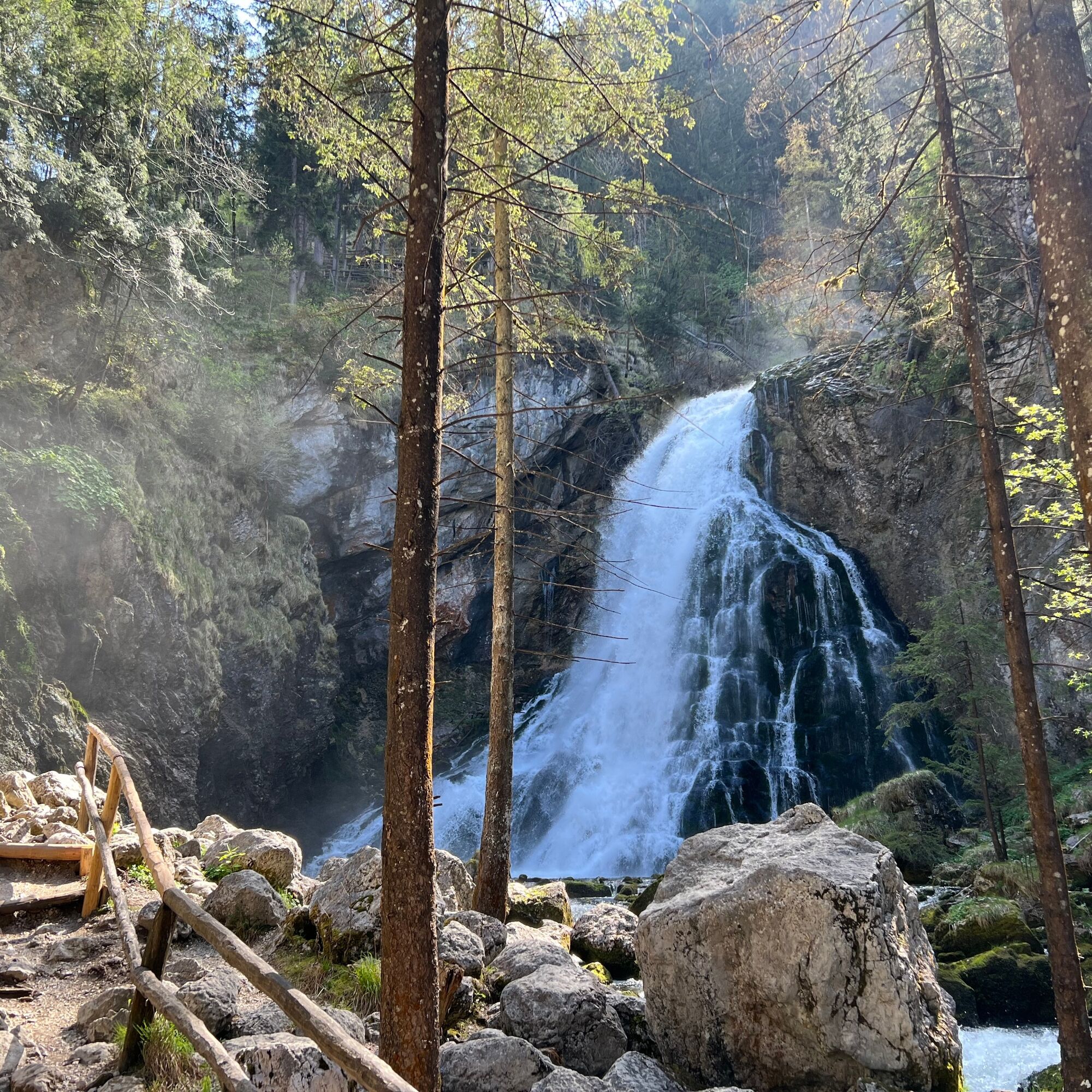
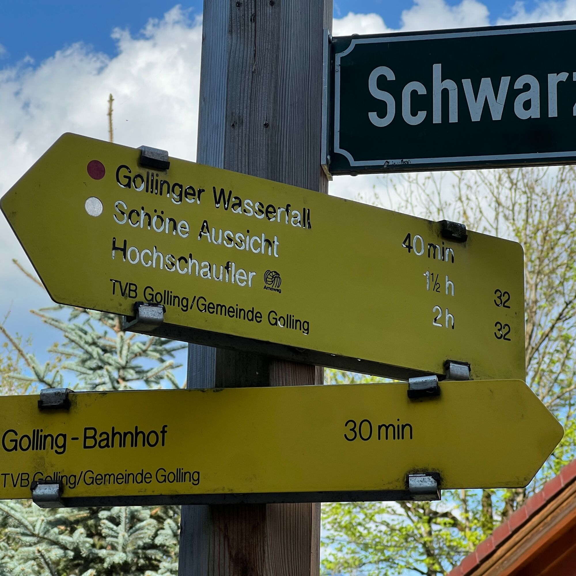
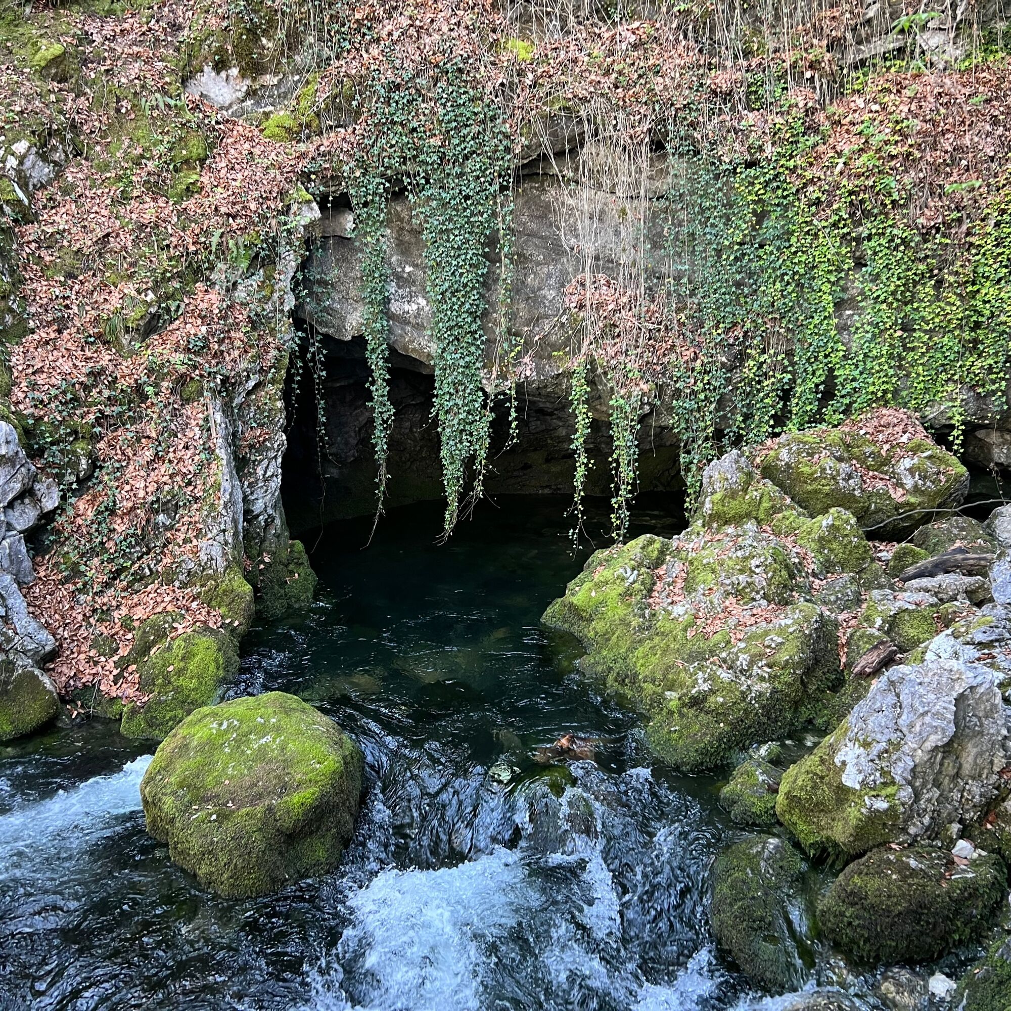
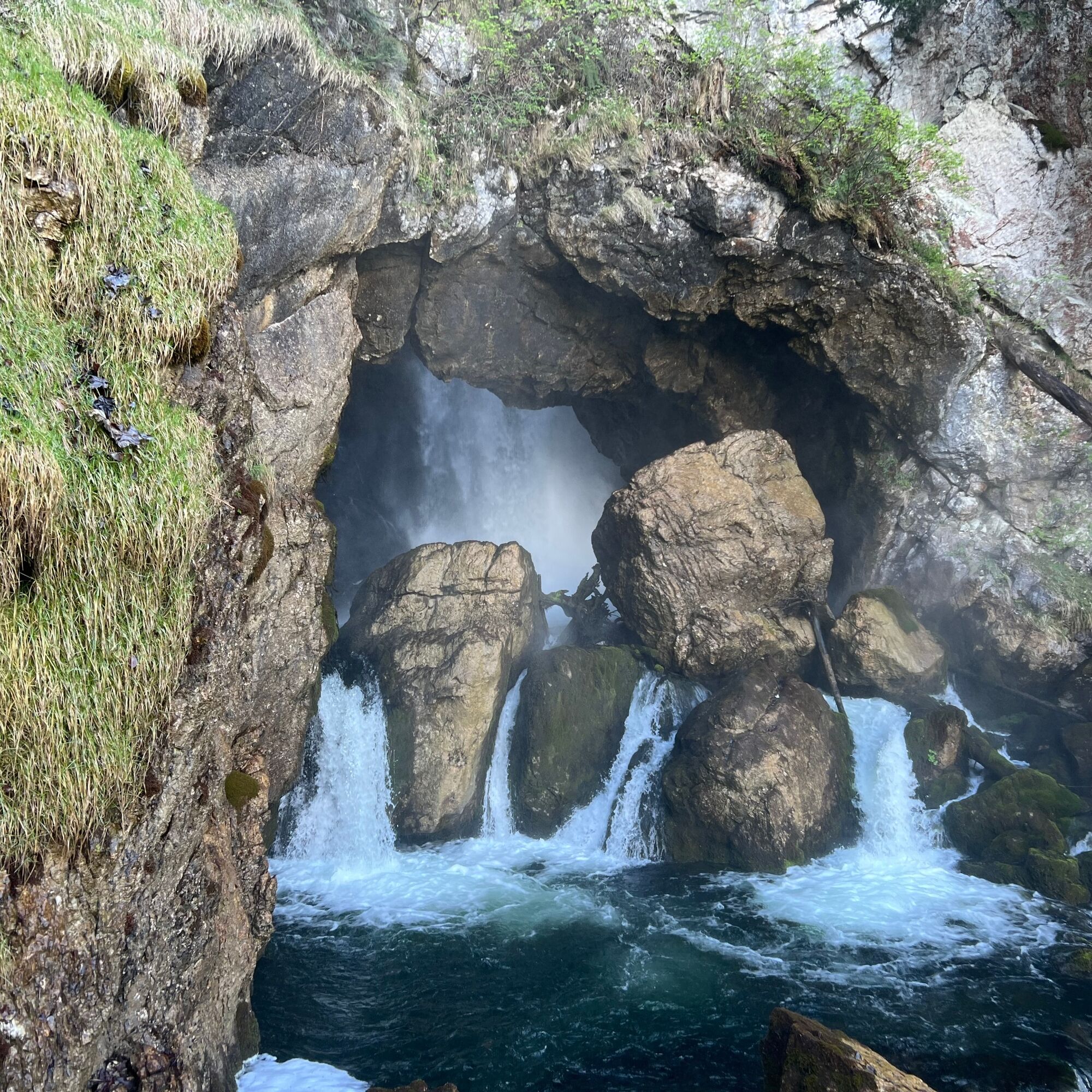
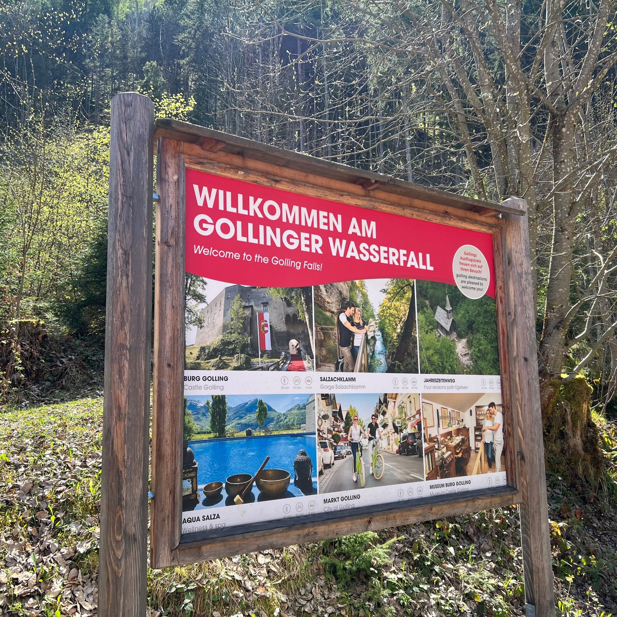
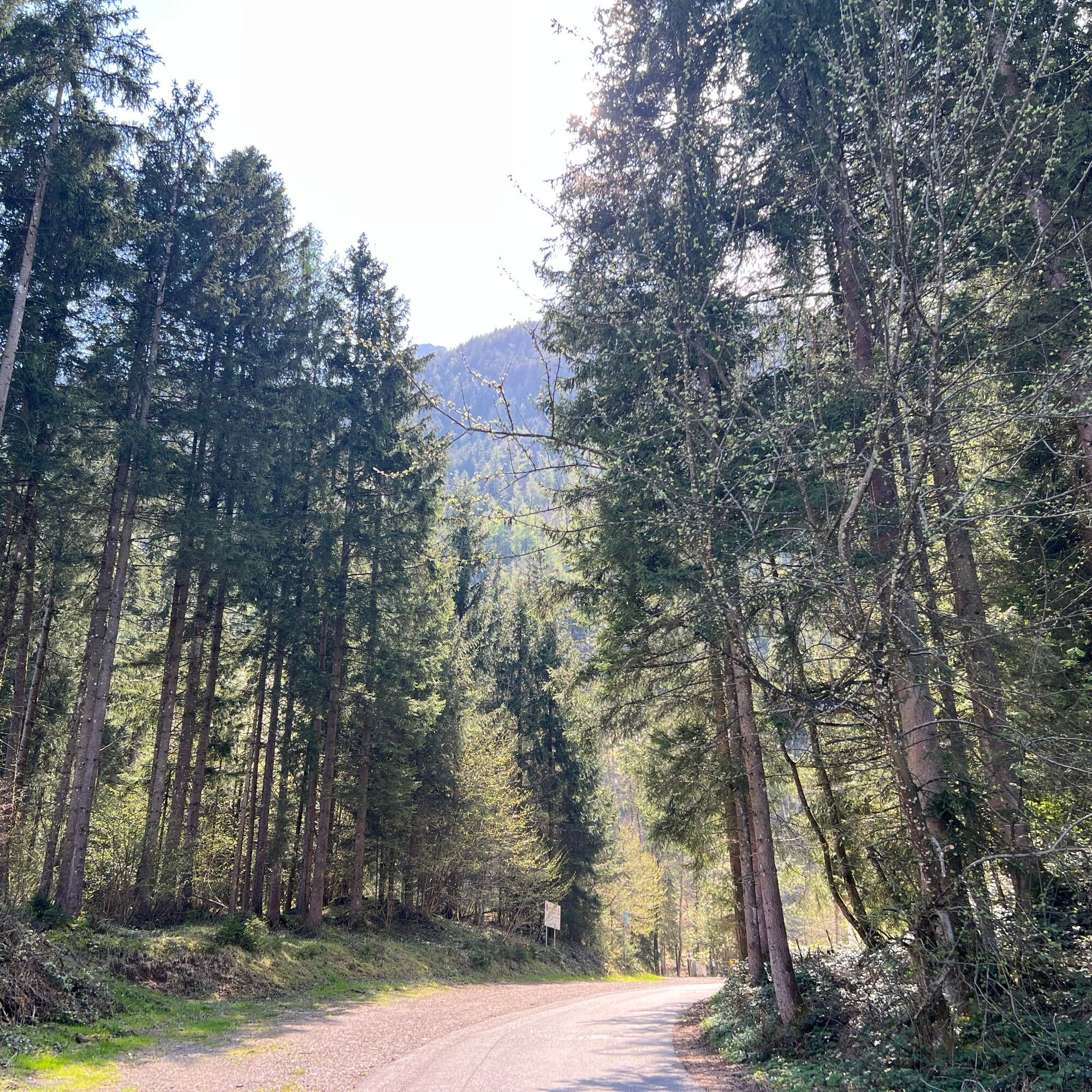
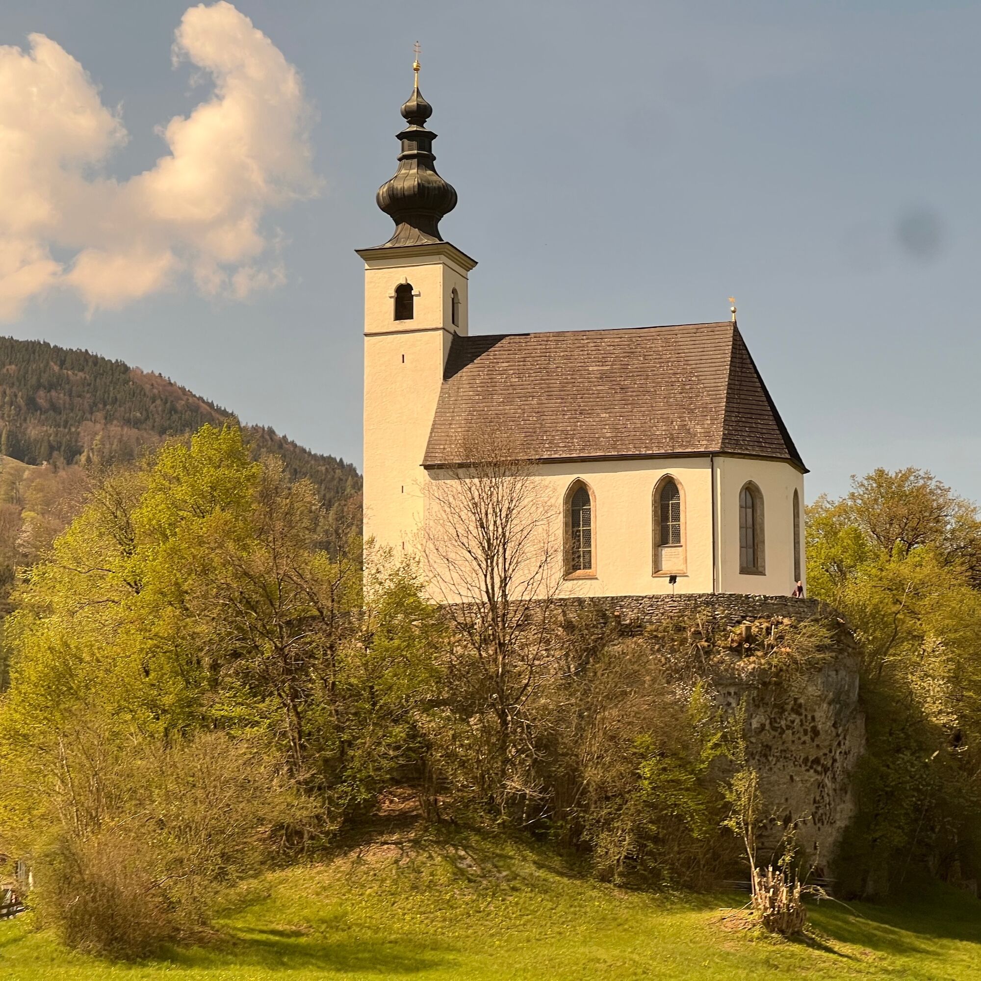
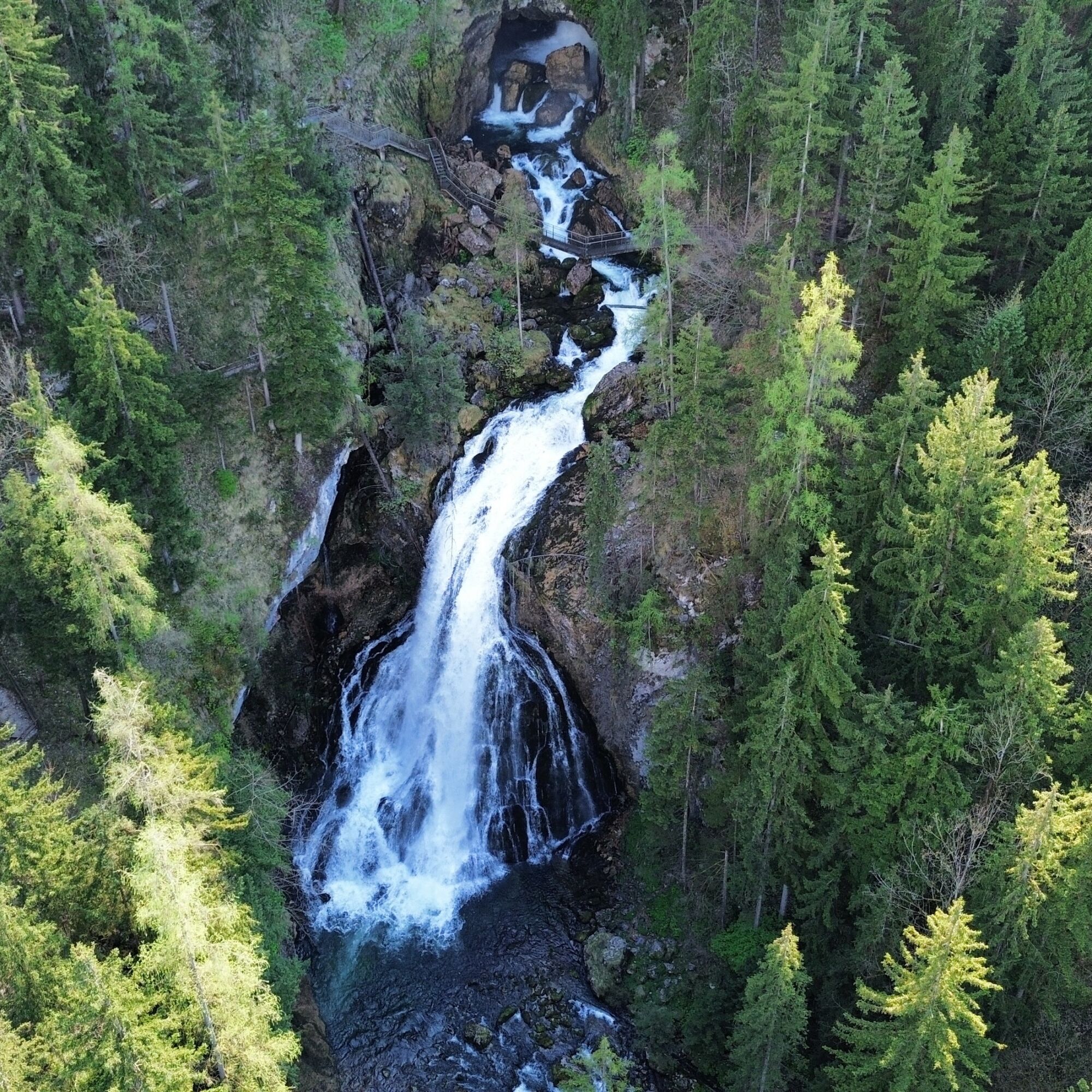
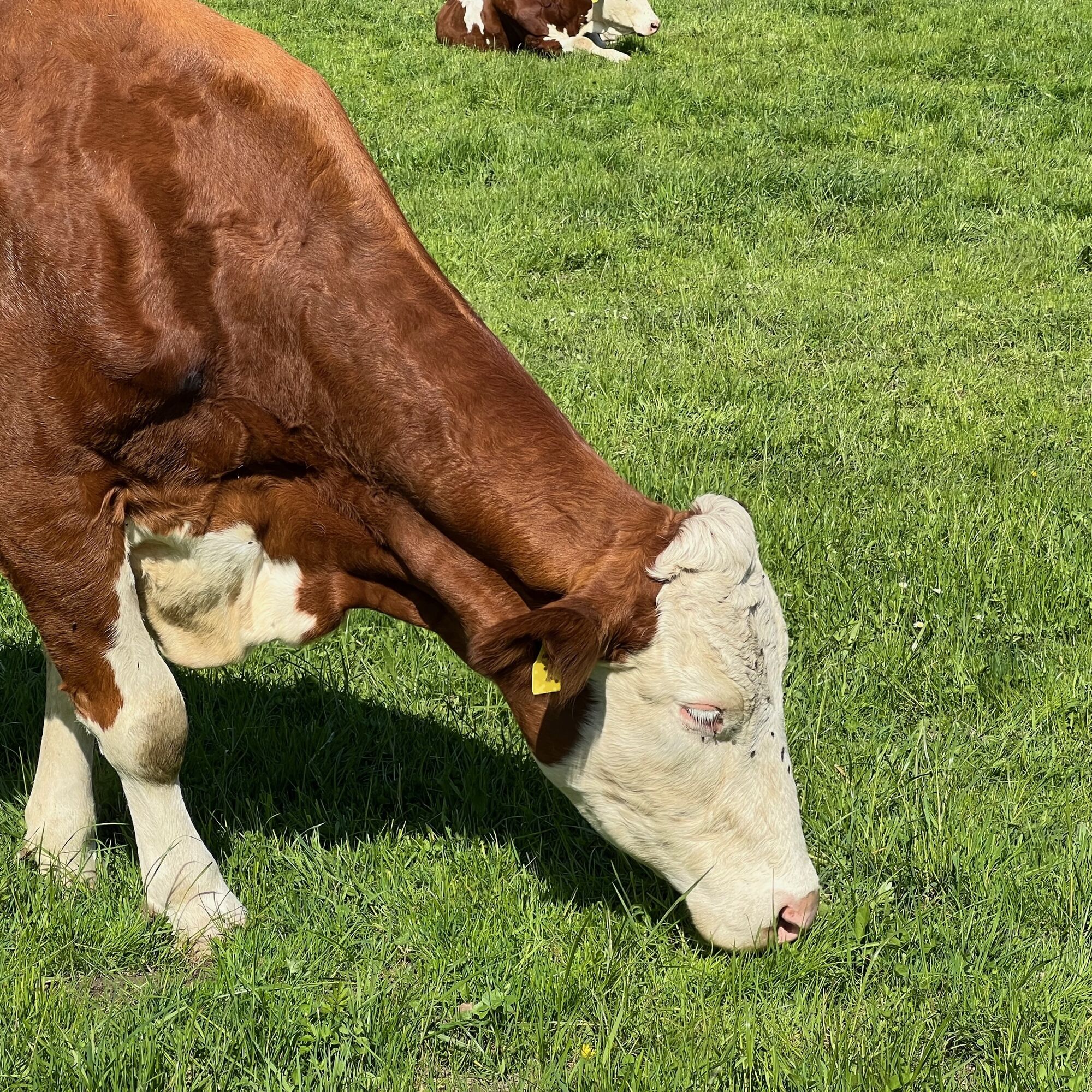
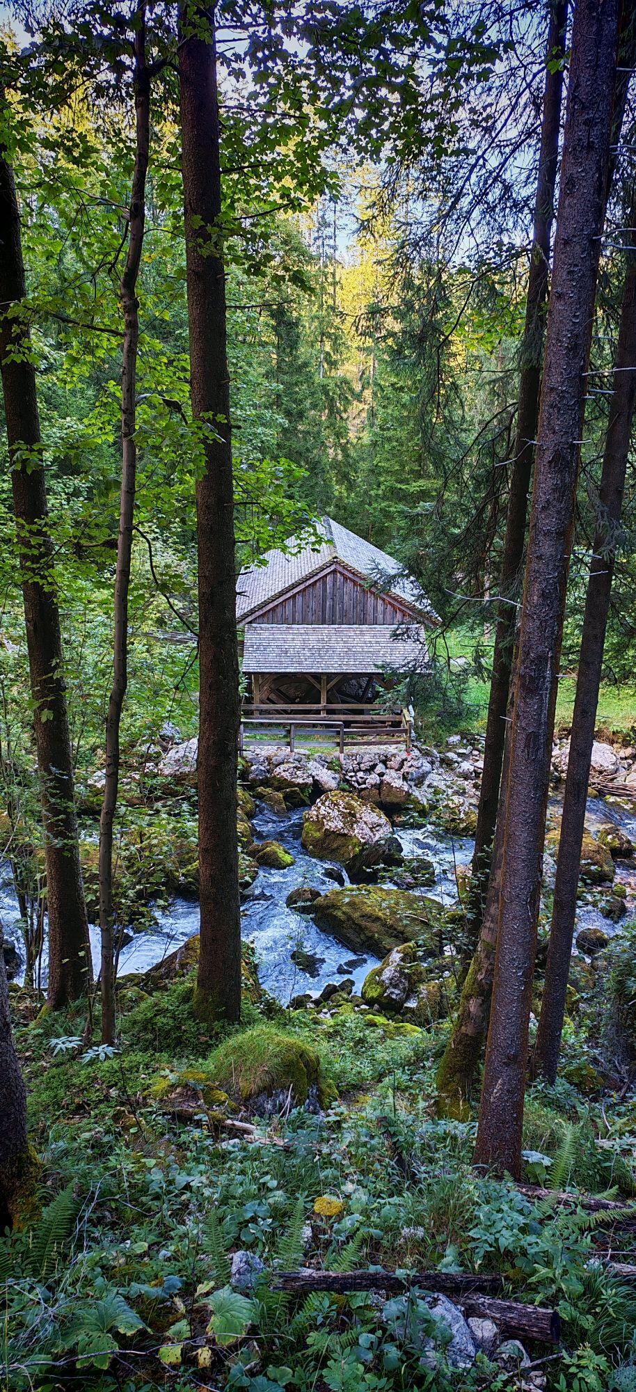
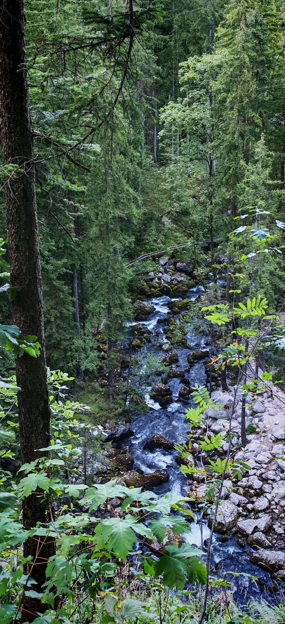
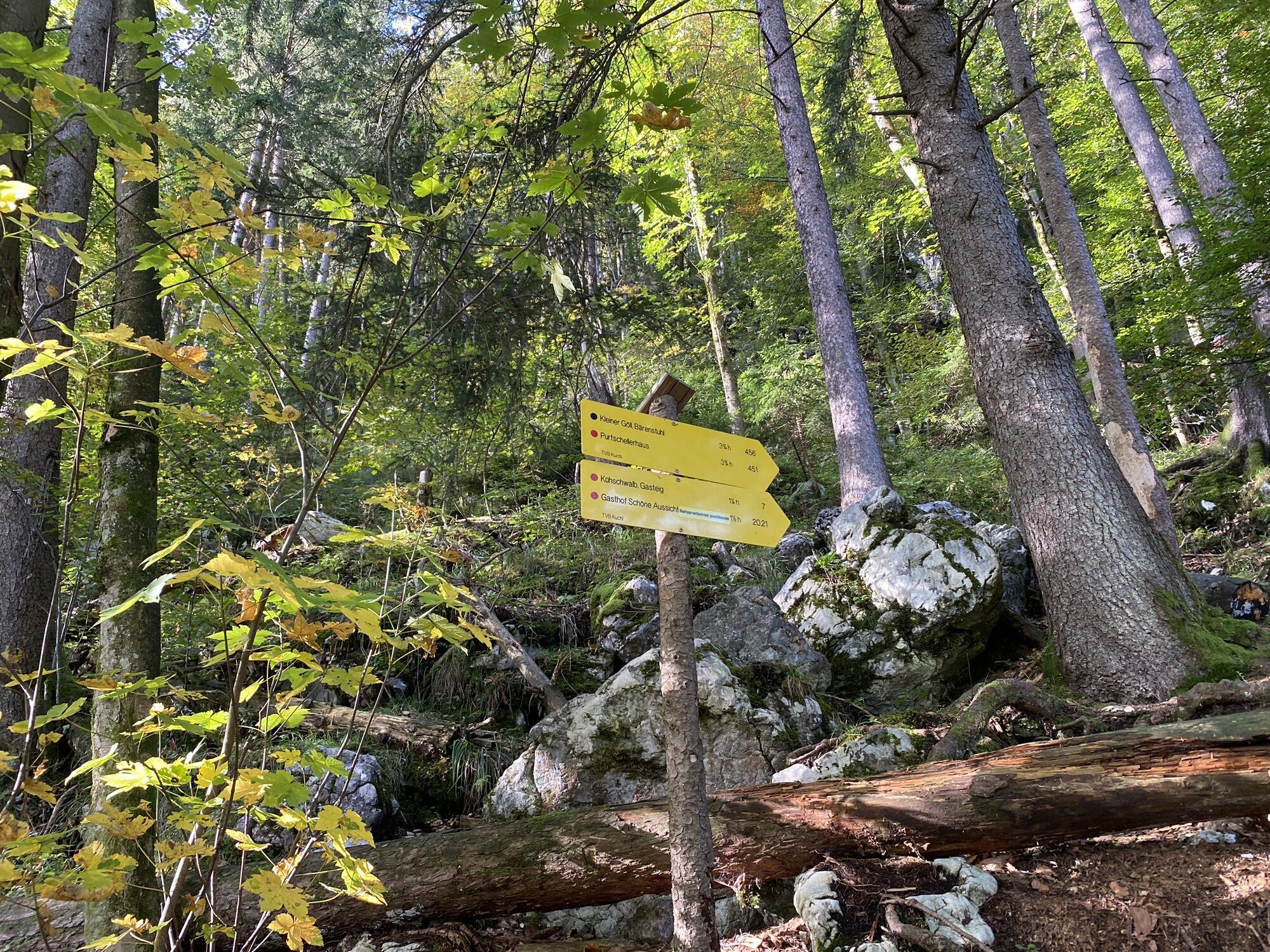
The paths become narrower, and we are surrounded by cows, donkeys, and horses. At the fork after the A10 underpass, we turn right. The St. Nicholas Church, visible from afar, can serve as a landmark. It stands on a hill in the Lacher settlement; we walk past it on the left, and at the end of the road, conifers transform the path into a forest track. A few meters further on is the entrance to the waterfall. In the waterfall's nature reserve, you can explore to your heart's content and enjoy the cascades via the permanently installed walkways and stairs. Those who want to reach the source at the very top can expect an elevation gain of approximately 130 meters.
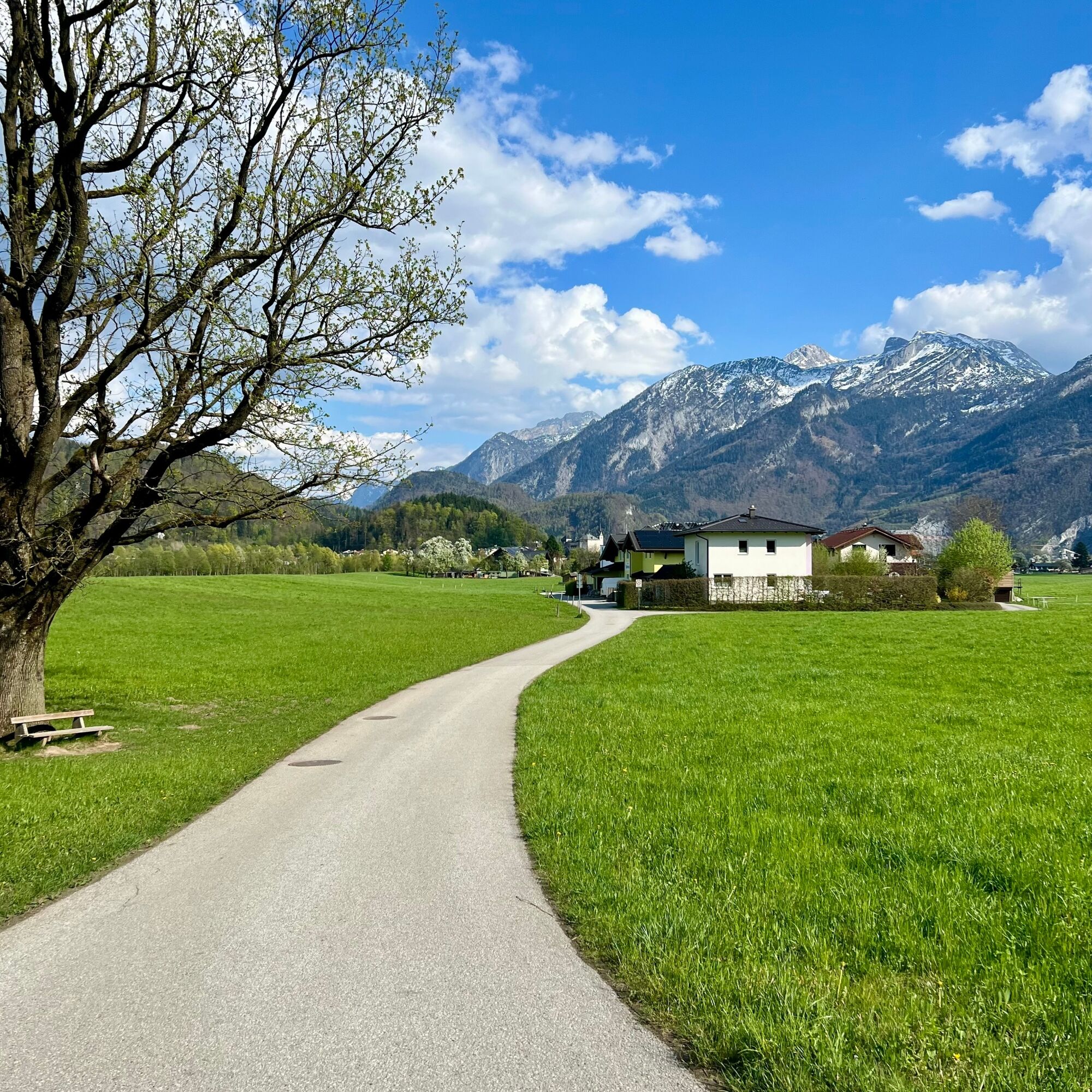
It's a good idea to take a break and then make the return journey a loop. To do this, simply turn left after the church and follow the Schwarzenbach path before turning right onto the meadow path. From here, the way to the train station is signposted.
Tak
Sturdy footwear and water-resistant clothing are recommended.
The following rules apply in the immediate vicinity of the waterfall:
Nature reserve
Do not leave the stairs and paths
Difficult trail conditions
Parents are responsible for their children
The return trip to Salzburg is just as straightforward. Long-distance trains are the easiest option, requiring only one stop.
Timetable information and downloads: Online at www.salzburg-verkehr.at or on your smartphone via the free Salzburg Verkehr app for Android and iOS.
Direct travel information and details at: salzburg-erfahren.at
T1
Salzburg Transport
Image credit:Simon Klein
The waterfall changes depending on the position of the sun and the time of year - this trip is more than worthwhile!
Popularne wycieczki w okolicy
- 4,7
Schwarzer Berg / Golling
średniWędrówka 2,54 km - 4,6
Kneifelspitze
Wędrówka 2,53 km - 4,6
Grünstein
światłoWędrówka 2,57 km - 3,9
Malerwinkel Rundwanderweg
światłoWędrówka 3,60 km - 3,8
Durch die Almbachklamm nach Ettenberg
Wędrówka 7,54 km - 3,6
Wanderung zur Ostpreußenhütte in Werfen (1.630 m)
średniWędrówka 11,2 km - 4,9
Hoher Göll über Mannlsteig
średniWędrówka 16 km - 4,8
Almbachklamm zum Gasthof Dürrlehen
średniWędrówka 8,94 km - 4,8
Schlenken and Schmittenstein hike
ciężkiWędrówka 10,9 km - 4,7
Mühlenweg und Winnerfall Scheffau am Tennengebirge
średniWędrówka 4,79 km
Wędrówki i tropienie


Nie przegap ofert i inspiracji na następne wakacje
Twój adres e-mail została dodana do listy mailingowej.