


Gerzkopf
Zdjęcia naszych użytkowników
-

 © Maximilian StögerUtworzono dnia 22.05.2023
 -
 © Roland SteinfadtUtworzono dnia 06.10.2022
 -
 © Roland SteinfadtUtworzono dnia 06.10.2022
 -
 © HaraldUtworzono dnia 13.11.2025
 -
 © Eveline ZechaUtworzono dnia 16.08.2024
 -
 © Eveline ZechaUtworzono dnia 16.08.2024
 -
 © Eveline ZechaUtworzono dnia 16.08.2024
 -
 © Eveline ZechaUtworzono dnia 16.08.2024
 -
 © Maximilian StögerUtworzono dnia 22.05.2023
 -
 © Maximilian StögerUtworzono dnia 22.05.2023
 -
 © Maximilian StögerUtworzono dnia 22.05.2023
 -
 © Maximilian StögerUtworzono dnia 22.05.2023
 -
 © Maximilian StögerUtworzono dnia 22.05.2023
 -
 © Maximilian StögerUtworzono dnia 22.05.2023
 -
 © Maximilian StögerUtworzono dnia 22.05.2023
 -
 © Maximilian StögerUtworzono dnia 22.05.2023
 -
 © Maximilian StögerUtworzono dnia 22.05.2023
 -
 © Maximilian StögerUtworzono dnia 22.05.2023
 -
 © Maximilian StögerUtworzono dnia 22.05.2023


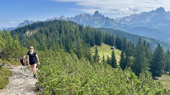
With the Fidibus summer (hiking bus) from Filzmoos, you quickly reach the starting point in Neuberg. The path to Gerzkopf leads through a quiet, untouched, and primeval landscape. Through the fairy-tale...
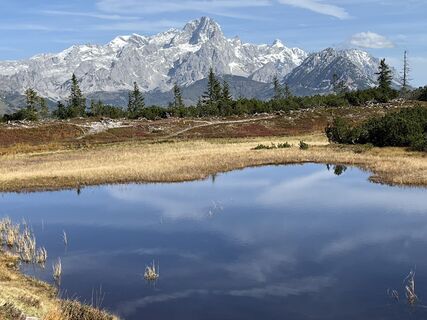
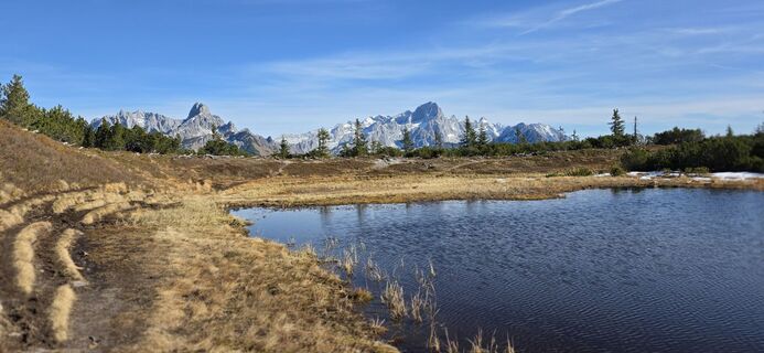
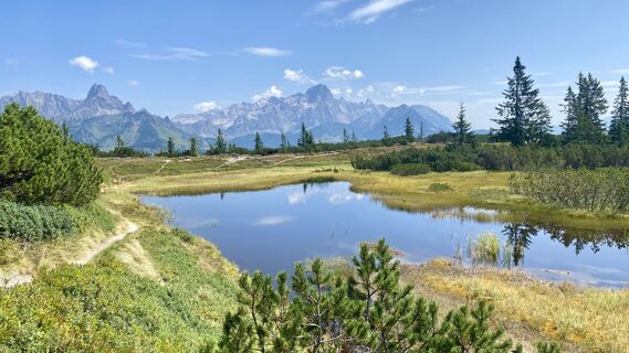
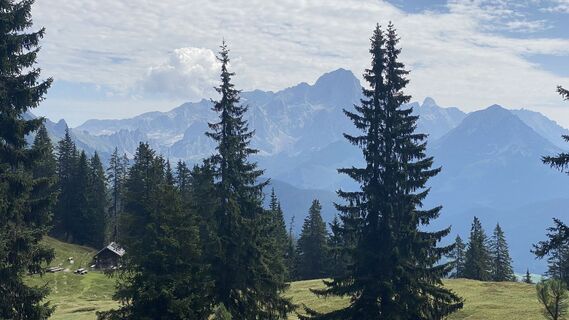
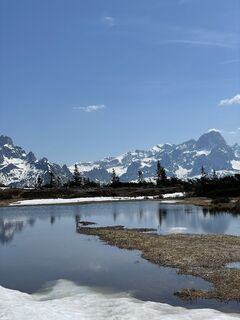
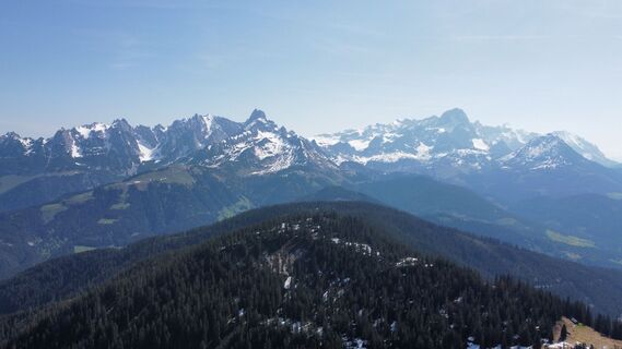
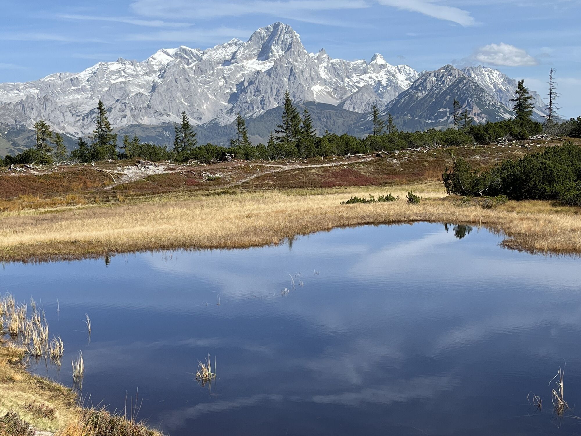
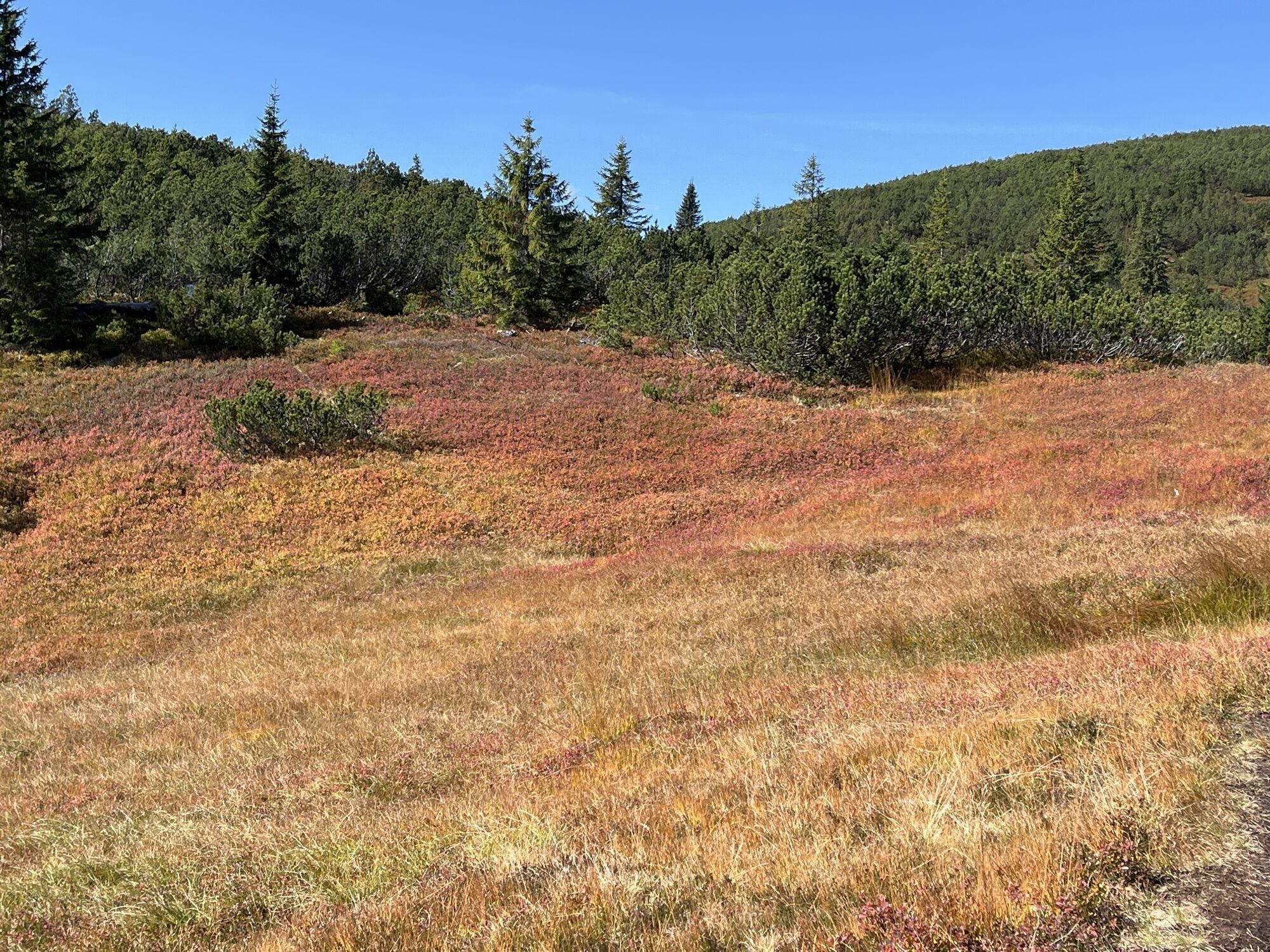
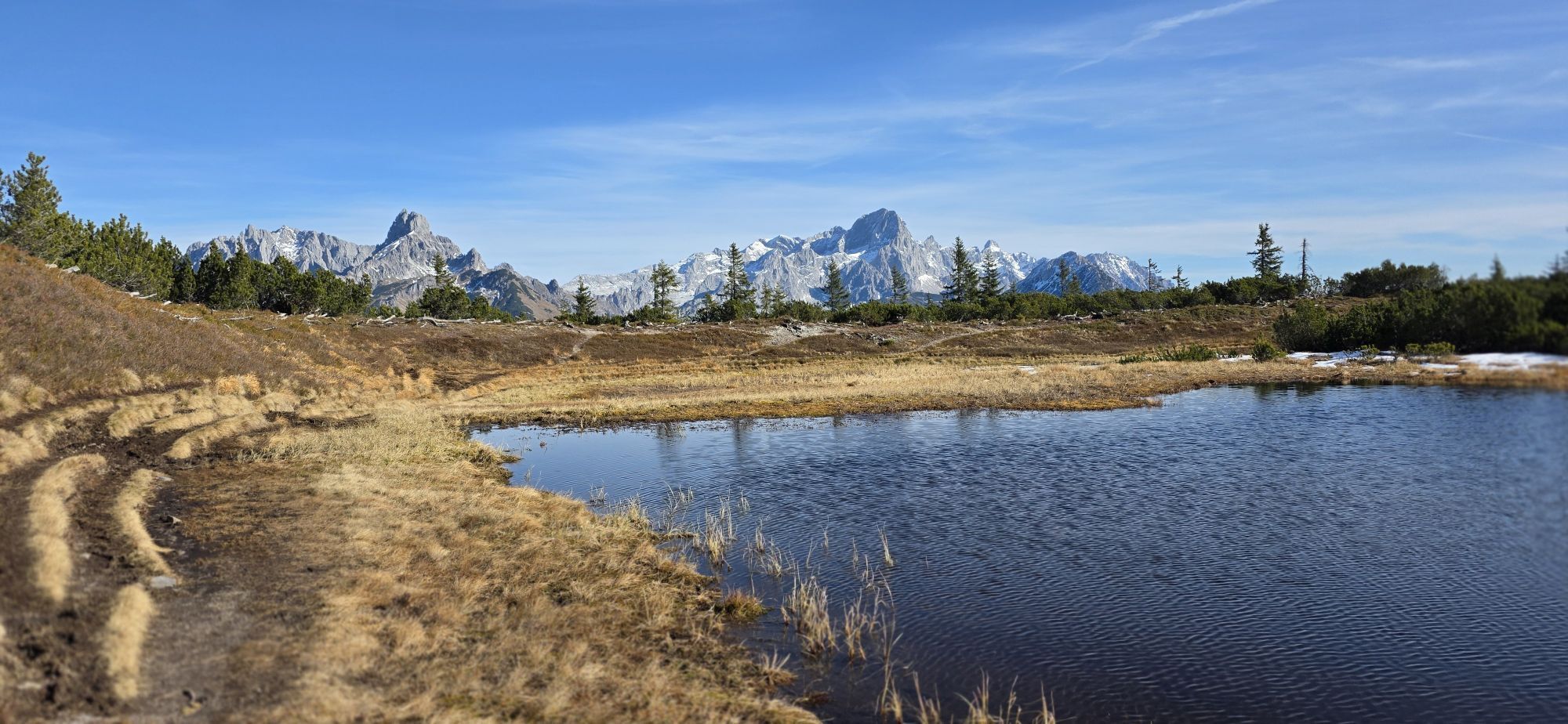
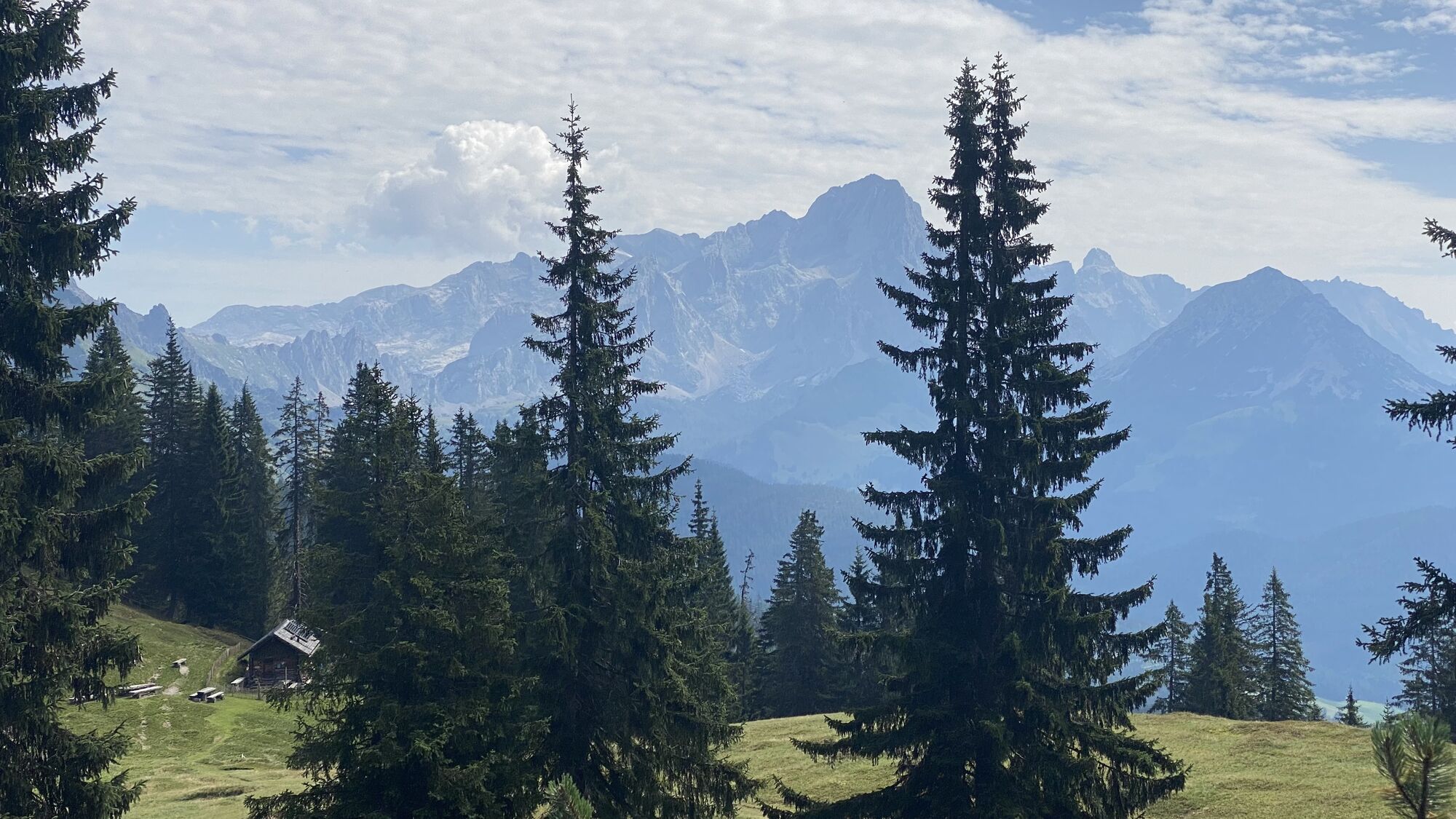
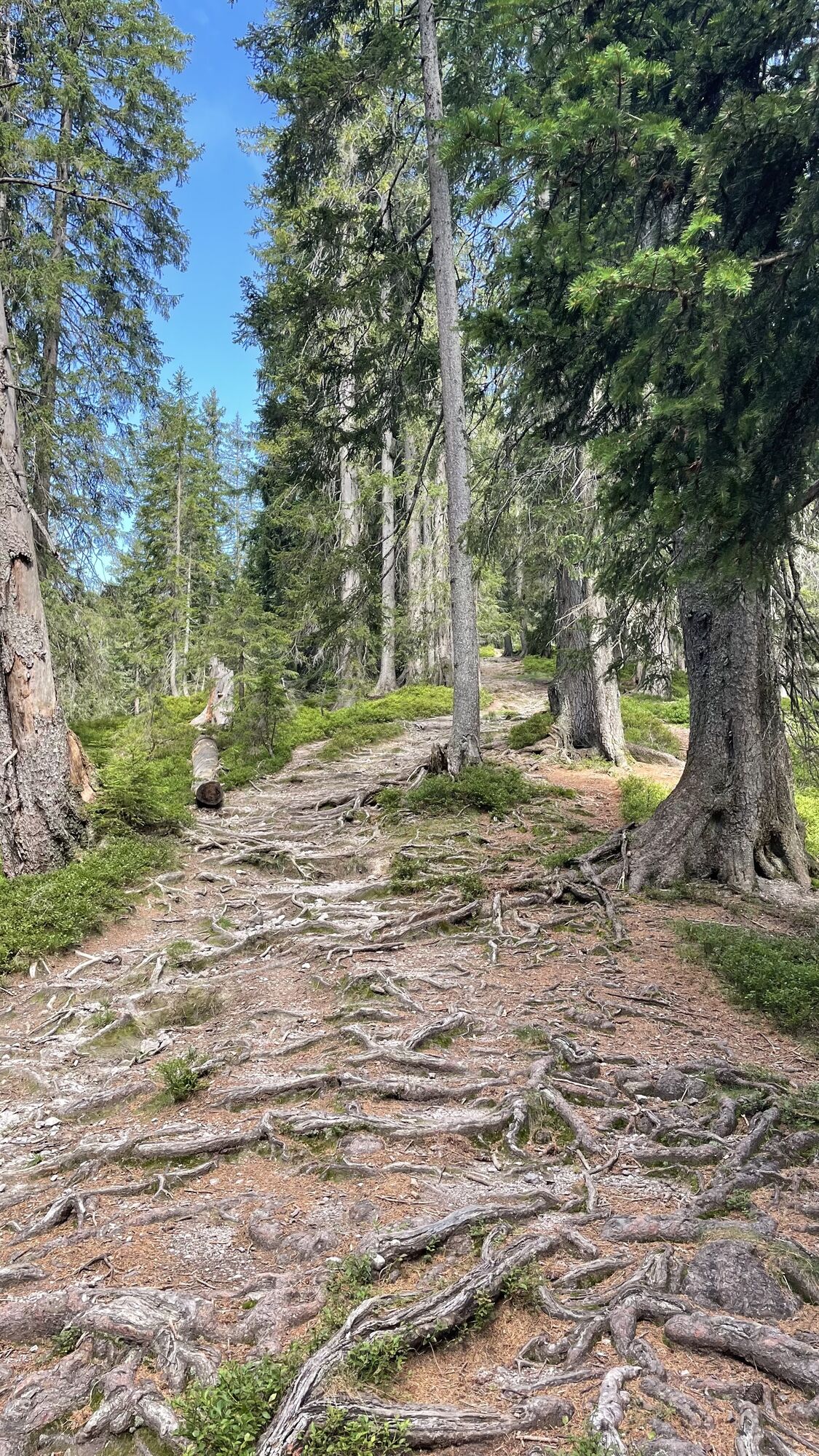
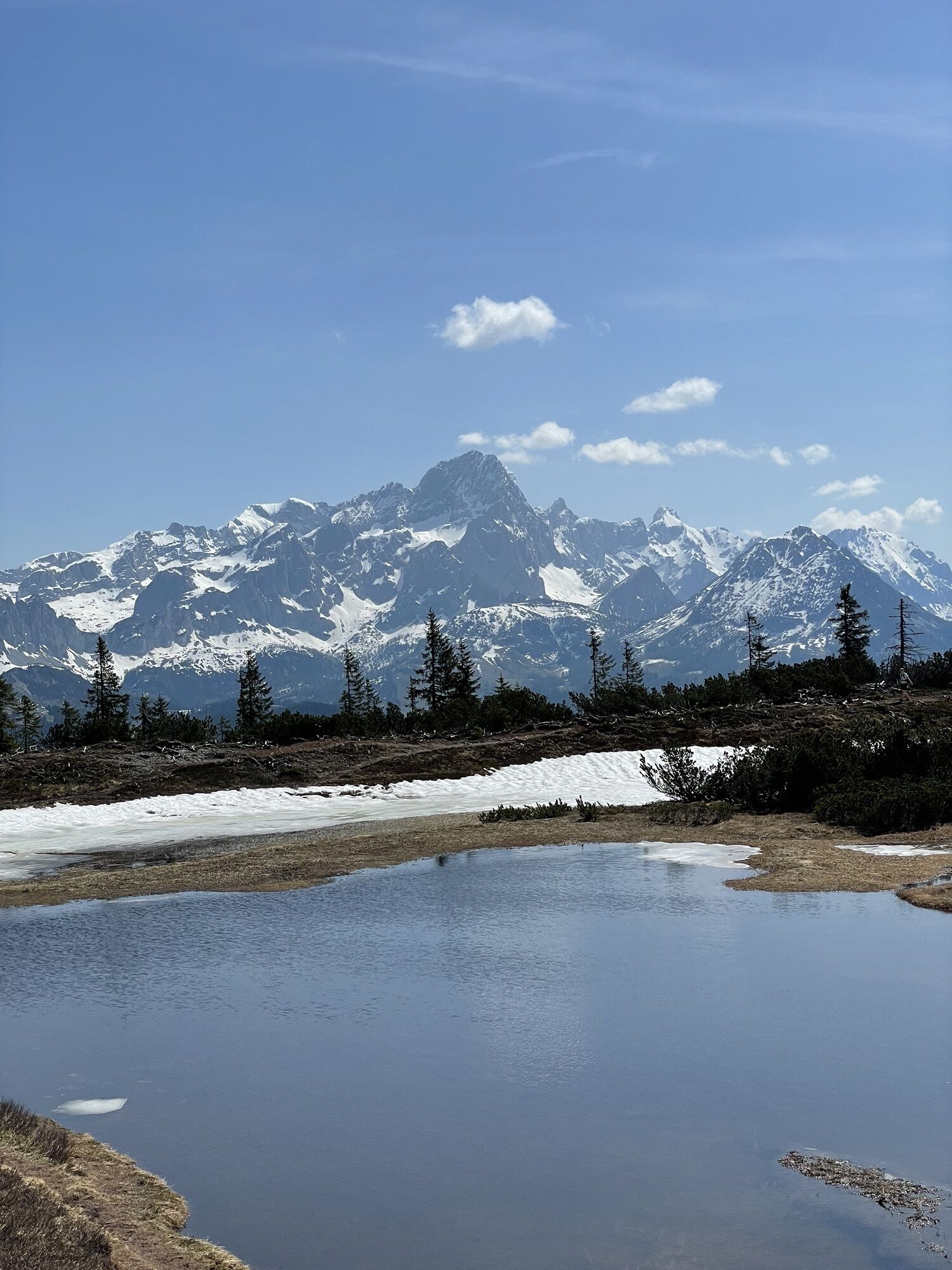
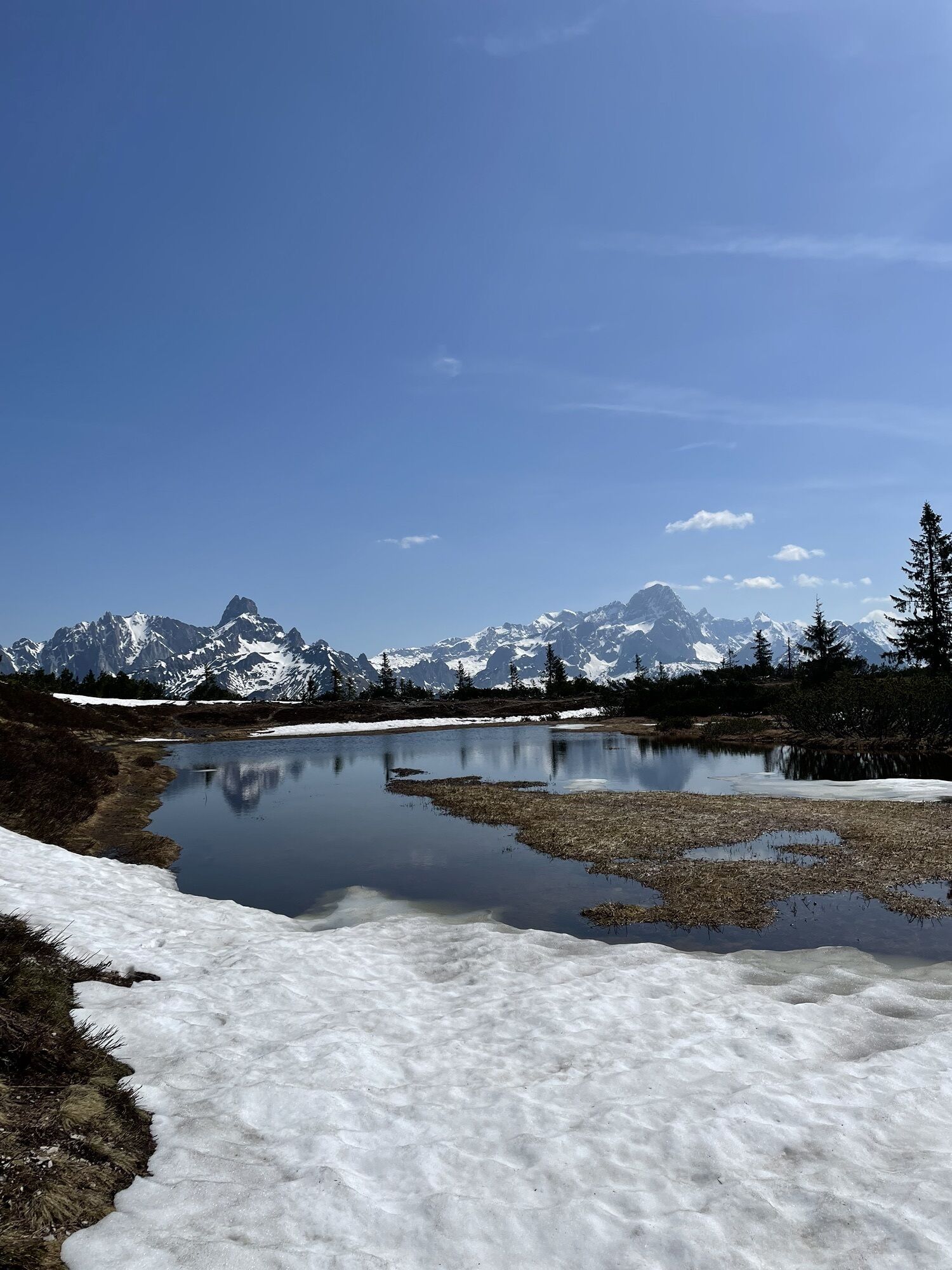
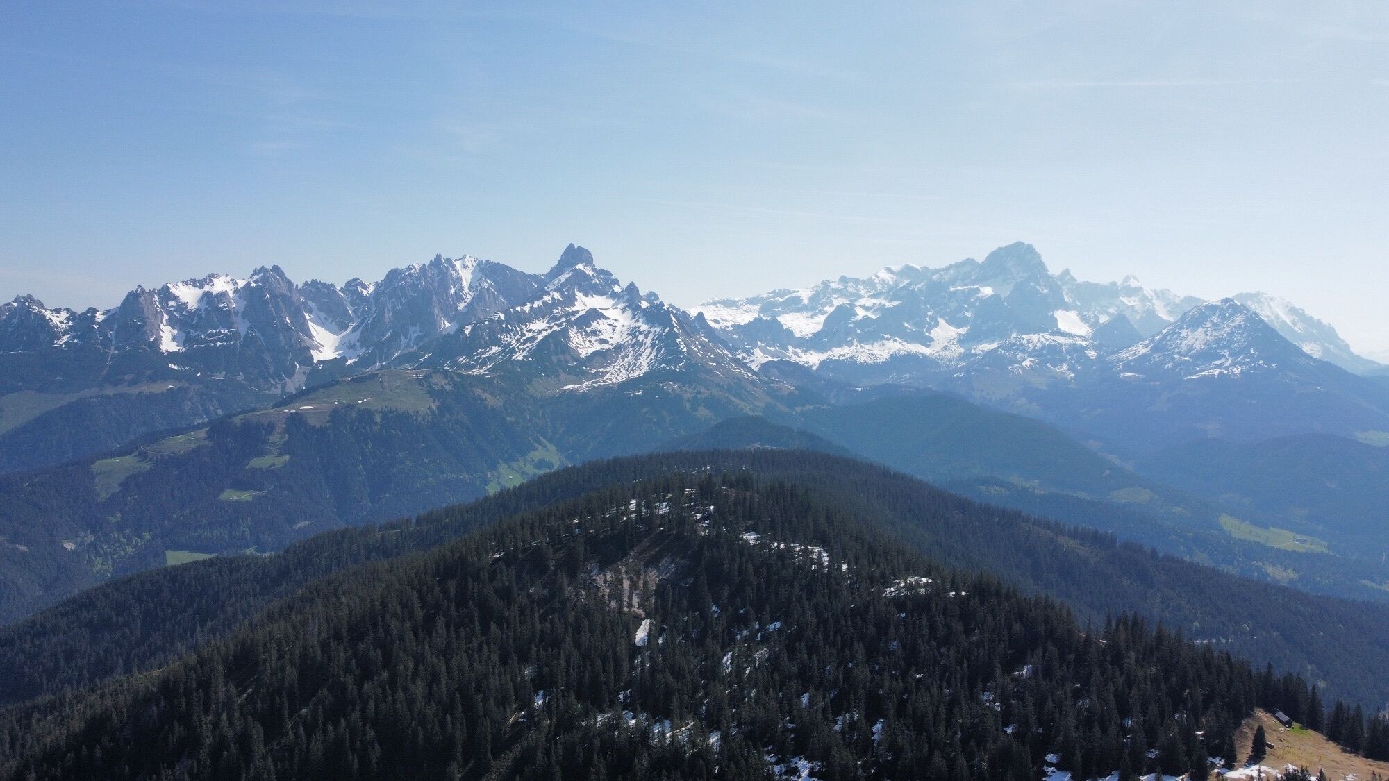
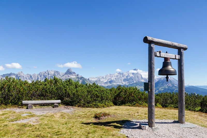
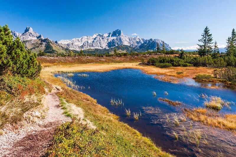
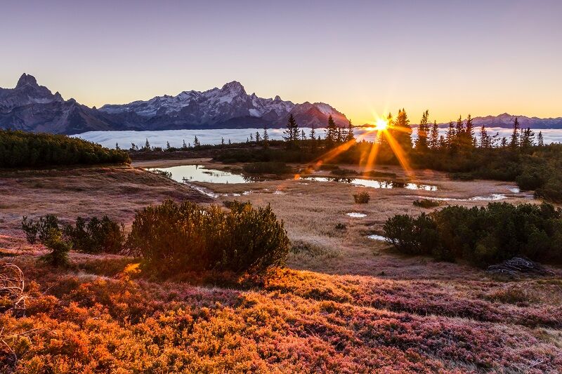
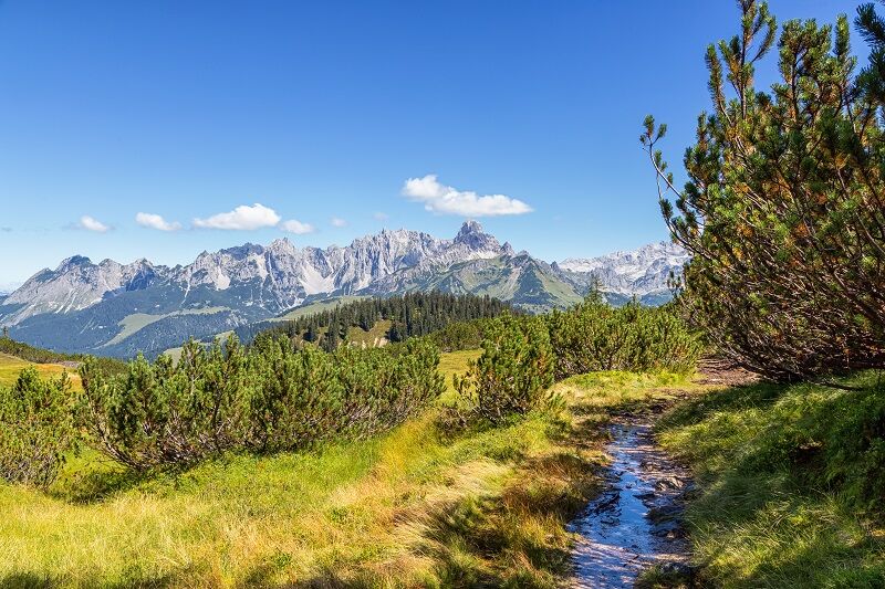
With the Fidibus summer (hiking bus) from Filzmoos, you quickly reach the starting point in Neuberg. The path to Gerzkopf leads through a quiet, untouched, and primeval landscape. Through the fairy-tale spruce forest, you reach a dense dwarf pine belt, in which the Gerzkopf bogs are embedded as small natural jewels. These are unique in the federal state of Salzburg and of special ecological value. The hiker enjoys a magnificent view from the summit over the Gosaukamm, the Dachstein massif, the Tennengebirge, and the Niedere Tauern. The distinctive Bischofsmütze dominates the view to the east, and in the distance rise the peaks of the High Tauern. Directly in front of the Neubergerhof is a Fidibus stop to return to Filzmoos. From early June to early September, the shepherd's hut is open (only in good weather).

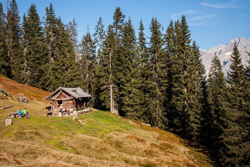
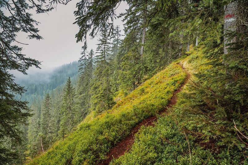
Just before the old sawmill in Neuberg, turn left towards Nestlerhof. You walk directly past Nestlerhof. Shortly before Perlmaishaus, a forest path leads uphill on the right. You cross several forest roads until you reach the tree line at the ridge. On the right of the path is the shepherd's hut. You walk up to the left, initially through somewhat rocky terrain, past the "Black Tarn" until you reach the summit of Gerzkopf, partly through dwarf pines.
Tak
Weather changes, rapid temperature drop, thunderstorms, wind, fog, and snowfields are objective dangers and require the right behavior on the way. Hut keepers are experienced mountain experts; they can give good tips about the weather and the route. Lack of equipment, overestimation, carelessness, poor condition, and wrong assessment can lead to critical situations. In thunderstorms: absolutely avoid summits, ridge areas, and secured rope sections.
A good backpack is helpful, and for routes in alpine terrain, a hat, gloves, a good jacket, and trousers belong to the basic equipment. Good waterproof shoes, sunglasses, sun protection, and sufficient drinks are essential. Flashlight, map material, knife, and a small first aid kit also belong.
GPS data and orientation aids
Available GPS data, like hiking maps, are only an orientation aid because they can never represent an exact image or the detail richness of a path in reality. Especially at danger spots, the final decision must always be made on site based on the actual conditions.
In an emergency, please call the following emergency numbers:
140 - for alpine emergencies - Austria-wide 112 - Euro emergency GSM emergency serviceTauern motorway A10 - exit Eben - turn left towards Filzmoos - after about 8 km turn left to Neuberg, after about 1.1 km turn left again - from here there are 2 designated parking spaces for Gerzkopf (follow the signs).
Coming from Filzmoos:
Roundabout - take exit towards Neuberg - turn right in Neuberg - after about 1.1 km turn left - from here there are 2 designated parking spaces for Gerzkopf (follow the signs).
With the FIDIBUS (Filzmoos hiking bus), you quickly reach the starting point in Neuberg. Stop "Abzweigung Gseng" - return is the stop directly at Hotel Neubergerhof.
Designated parking spaces for "Natura 2000 Gerzkopf".
At the Filzmoos tourist information, you can get a hiking map (Euro 5.50) or a hiking sketch (Euro 2.00) with information about this route.
KOMPASS hiking map 031 “The Dachstein, Ramsau, Filzmoos” – 1:25,000 (very detailed, weatherproof paper. Ideal for planning and on the go.)
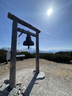
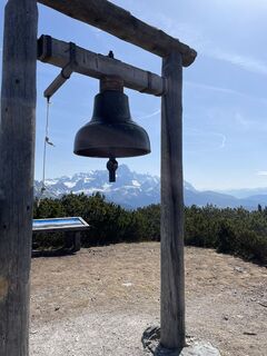
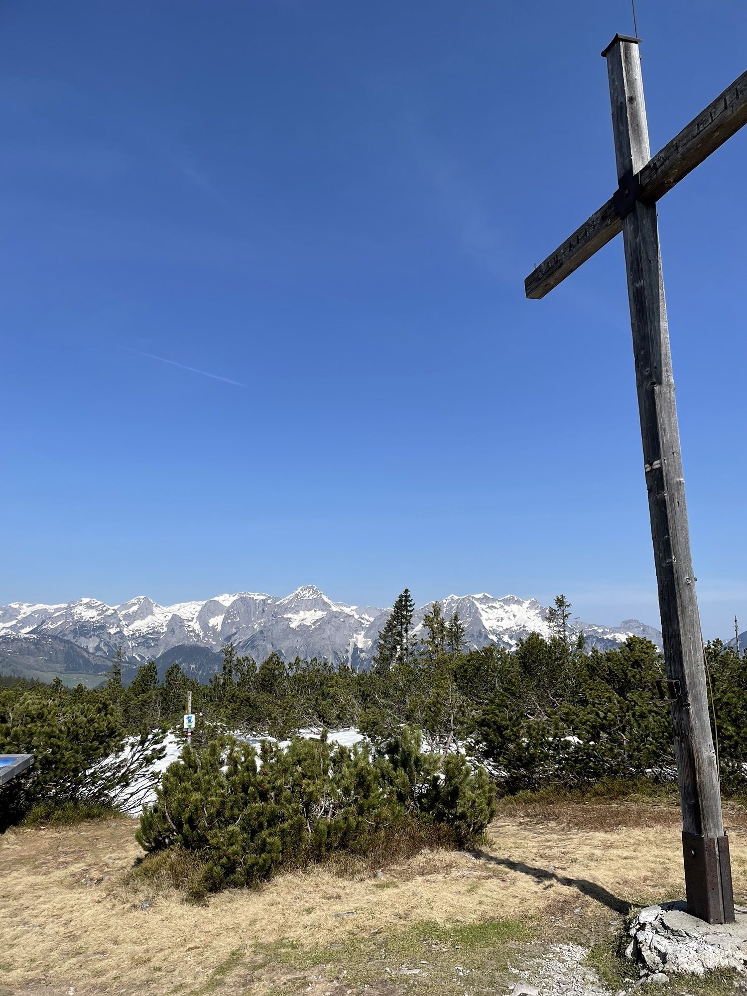
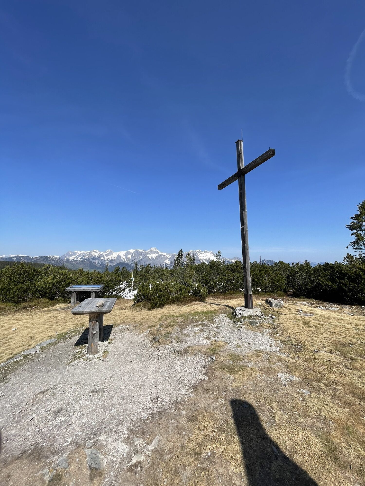
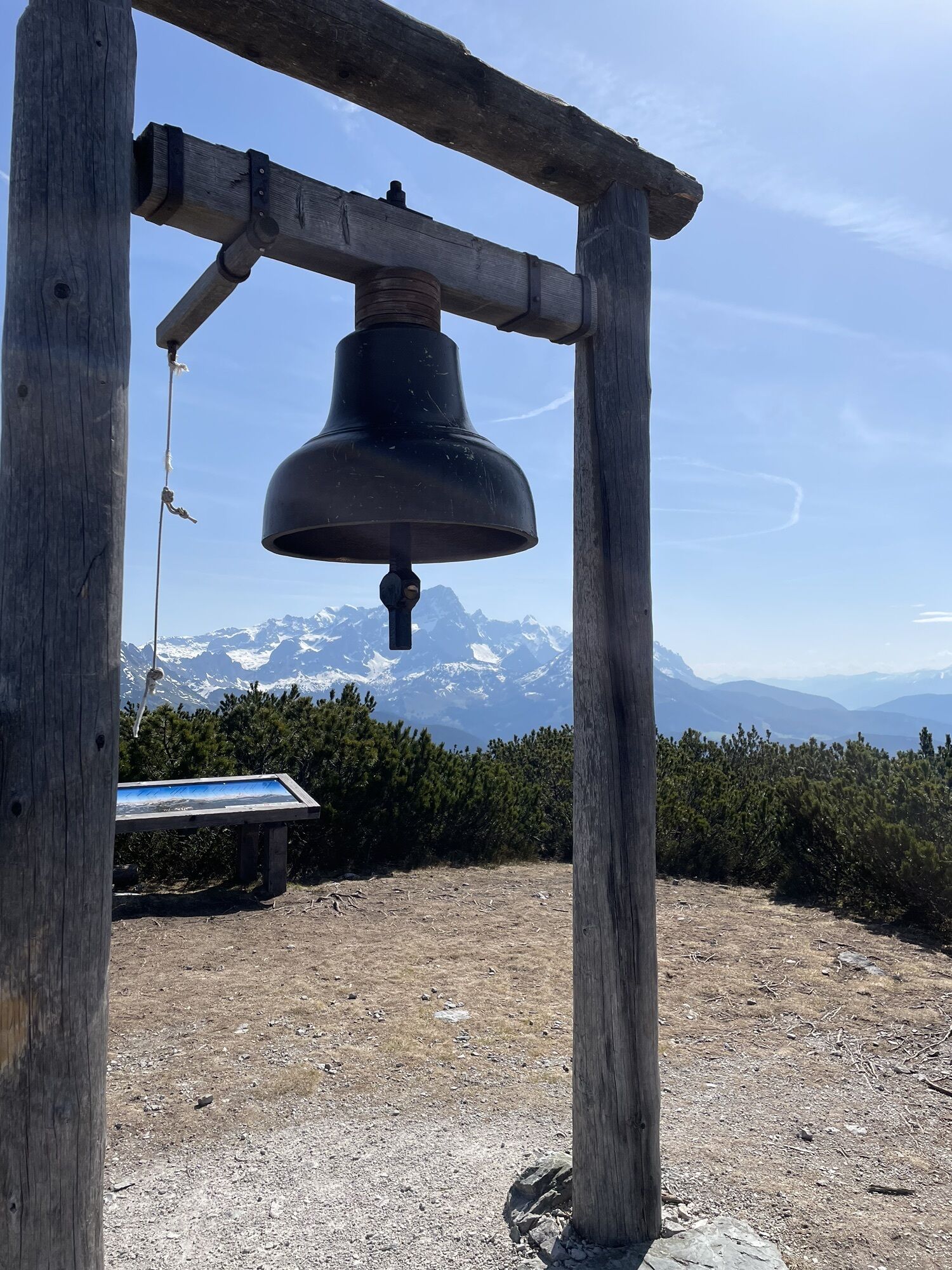
Beautiful view, magnificent raised bog landscape with small moor lake, summit cross with bell.
Kamery internetowe z trasy
-
Rossbrand
-
Aparthotel Jagdhof Filzmoos
-
Aparthotel Jagdhof Filzmoos
-
Sankt Martin - Hotel Martinerhof
-
Lungötz
-
Papageno Bergstation
-
Papageno Bergstation
-
Papageno Bergstation
-
Papageno Bergstation
-
Papageno Bergstation
-
Papageno Bergstation
-
Papageno Bergstation
-
Papageno Bergstation
-
Radstadt - Rossbrand
-
Ferienanlage Reithof
Popularne wycieczki w okolicy
-
4,3
Filzmoos: Rötelstein (Rettenstein)
Wędrówka 9,50 km -
4,7
Tour around the Gosaukamm
średniWędrówka 20,9 km -
4,7
Tour around the Lake Gosau
światłoWędrówka 4,43 km -
4,7
Tor-Wanderung
ciężkiWędrówka 14,2 km -
4,6
Ski route Lackenkogel
średniWycieczka narciarska 7,82 km -
4,4
Ramsau am Dachstein: Steinerne Jungfrauen
Wędrówka 8,11 km -
4,9
Werfenweng Mountainbikerunde Söldenhütte
średniMountainbike 18,8 km -
4,7
Vorderer u. hinterer Gosausee
średniWędrówka 15,0 km -
4,6
Donnerkogel vom Gosausee mit Intersport Klettersteig C/D und Himmelsleiter
ciężkiVia ferrata 7,70 km -
4,6
Bachlalm-Murmeltiere Rundwanderweg
światłoWędrówka 10,2 km

Wędrówki i tropienie


Nie przegap ofert i inspiracji na następne wakacje
Twój adres e-mail została dodana do listy mailingowej.