


Steinwand circular snowshoe hiking route (73/79)
The Steinwand circular route, located southeast at mid-mountain level, runs over a forest ridge. It fascinates with a magnificent panoramic view of the town Altenmarkt, the Tennengebirge, the High Dachstein,...
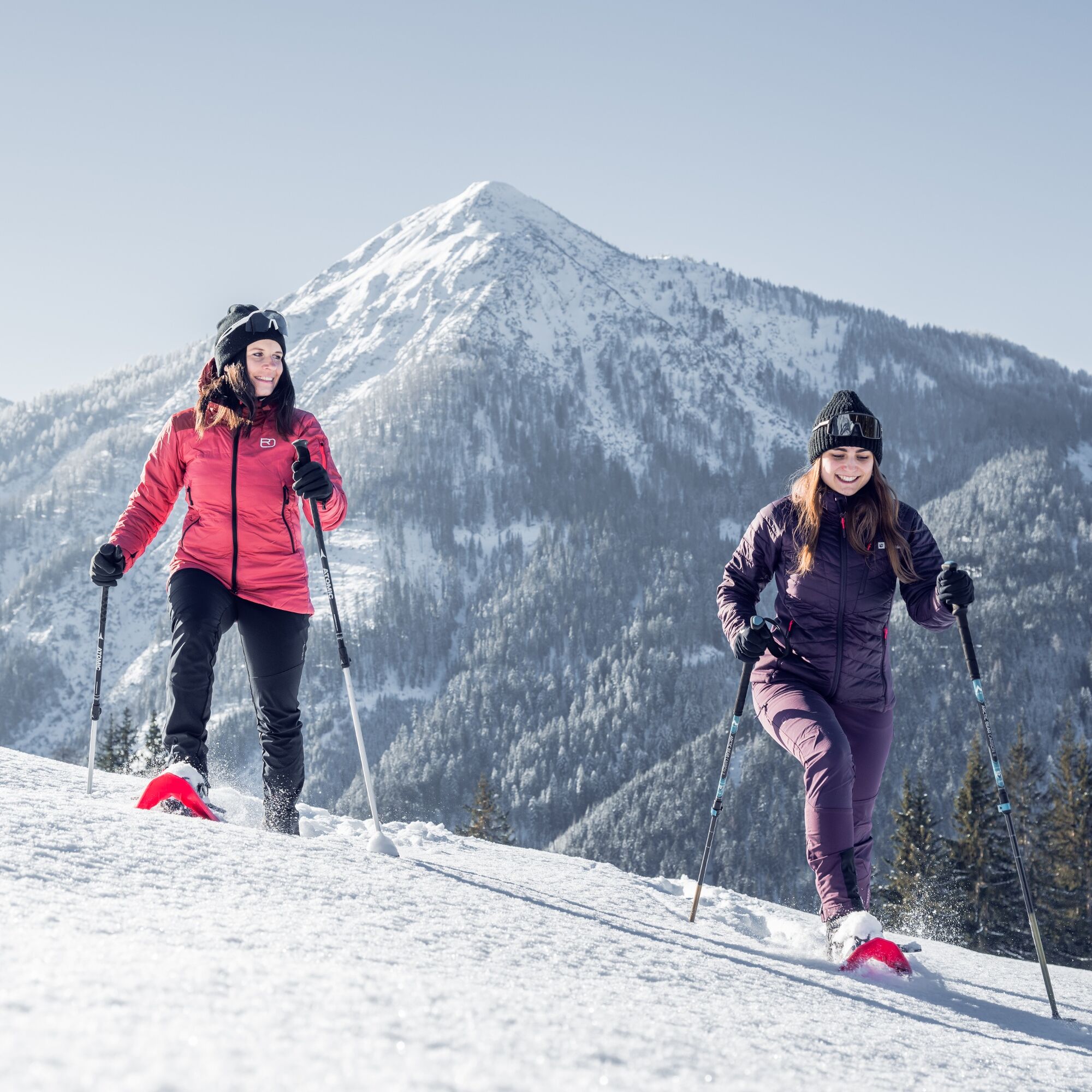
The Steinwand circular route, located southeast at mid-mountain level, runs over a forest ridge. It fascinates with a magnificent panoramic view of the town Altenmarkt, the Tennengebirge, the High Dachstein, and Altenmarkt’s "local mountain" Lackenkogel. The circular route leads from the starting point Ameisenberg at a medium altitude to the highest point, Wolfsgrube, then an easy descent into the Zauch valley, along the Zauchbach back to the starting point.

Cleared path from the starting point to Hochnössler (45 min).
Snowshoes, poles, good non-slip footwear
Observe the information boards! Check the current avalanche situation with the avalanche warning service!
Tauern Motorway A 10, Altenmarkt exit (EXIT 63), Altenmarkt West exit, from the church 2.2 km towards Zauchensee to the Hochbifangbahn parking lot
Hochbifangbahn parking lot
Altenmarkt-Zauchensee Tourist Association
Sportplatzstraße 6
A-5541 Altenmarkt-Zauchensee
Tel: +43 6452 5511
Email: info@altenmarkt-zauchensee.at
www.altenmarkt-zauchensee.at
www.facebook.com/altenmarkt-zauchensee
Kamery internetowe z trasy
Gamskogelhütte
Radstadt - Simonyhof
Altenmarkt - Sinnhubbauer
Altenmarkt - Schartner
Kemahdhöhe
Zauchensee Weltcuparena
Reitlehenalm
Zauchensee
Kemahdhöhe
Kemahdhöhe
Kemahdhöhe
Kemahdhöhe
Zauchensee Weltcuparena
Zauchensee Weltcuparena
Zauchensee Weltcuparena
Zauchensee Weltcuparena
Zauchensee Weltcuparena
Radstadt - Wasserwerk
Zauchensee - Rosskopf
Popularne wycieczki w okolicy
- 4,3
Filzmoos: Rötelstein (Rettenstein)
Wędrówka 9,50 km - 4,8
4-Jahreszeiten Wanderweg
średniWędrówka zimą 5,94 km - 4,6
Ski route Lackenkogel
średniWycieczka narciarska 7,82 km - 4,8
Obertauern to the Johannes Waterfall
średniWędrówka 9,39 km - 4,8
Reiteralmrunde
światłoWędrówka 5,71 km - 5,0
Rundwanderweg von der Fallhausalm und Vögeialm übers Klamml zur Oberhütte am See
średniWędrówka 10 km - 4,5
Ursprungalm - Hochwurzen
średniWędrówka 9,37 km - 4,6
Rittispanoramaweg
światłoWędrówka 5,30 km - 4,3
Ski tour Red 8er Wagrain
średniWycieczka narciarska 4,12 km - 5,0
Strimskogel-Runde
Wędrówka 13 km
Wędrówki i tropienie


Nie przegap ofert i inspiracji na następne wakacje
Twój adres e-mail została dodana do listy mailingowej.