


At the Eibenstock reservoir / Marienweg
Poziom trudności: T1
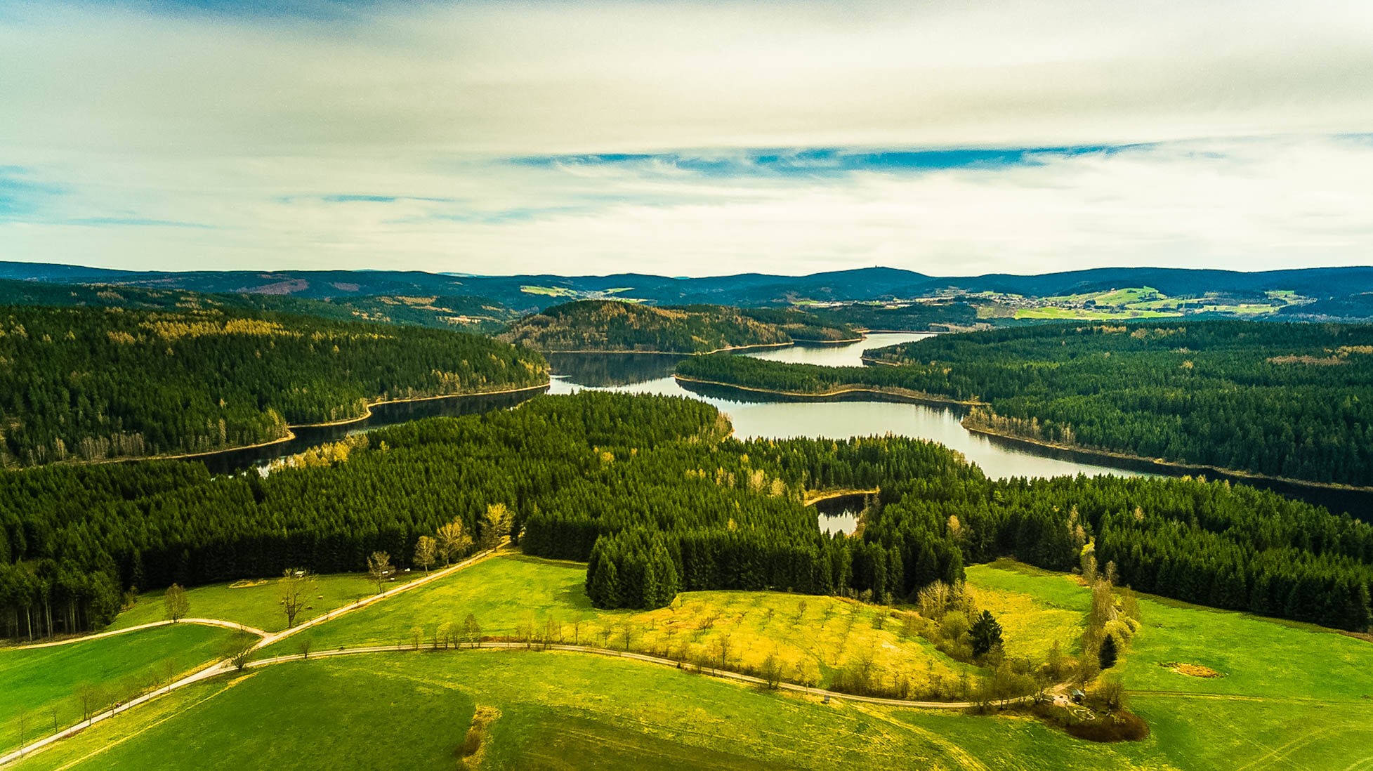
Great view of the reservoir ... information boards about the history of the region ... walking on the dam ... Kneipp facility... walking through the forest on the forest path ...
In the village of Hundshübel,...
Great view of the reservoir ... information boards about the history of the region ... walking on the dam ... Kneipp facility... walking through the forest on the forest path ...
In the village of Hundshübel, there is a restaurant "Goldener Hirsch" next to the church.
Goldener Hirsch closed Mon-Tue / Wed-Sun 11am-8pm Tel.: 037462/639975
At the Torfstich parking lot directly next to the B169, there is also a restaurant "Zum Torfstich".
Zum Torfstich closed Mon-Tue / Wed-Sun 11am-9pm Tel.: 037462/5151

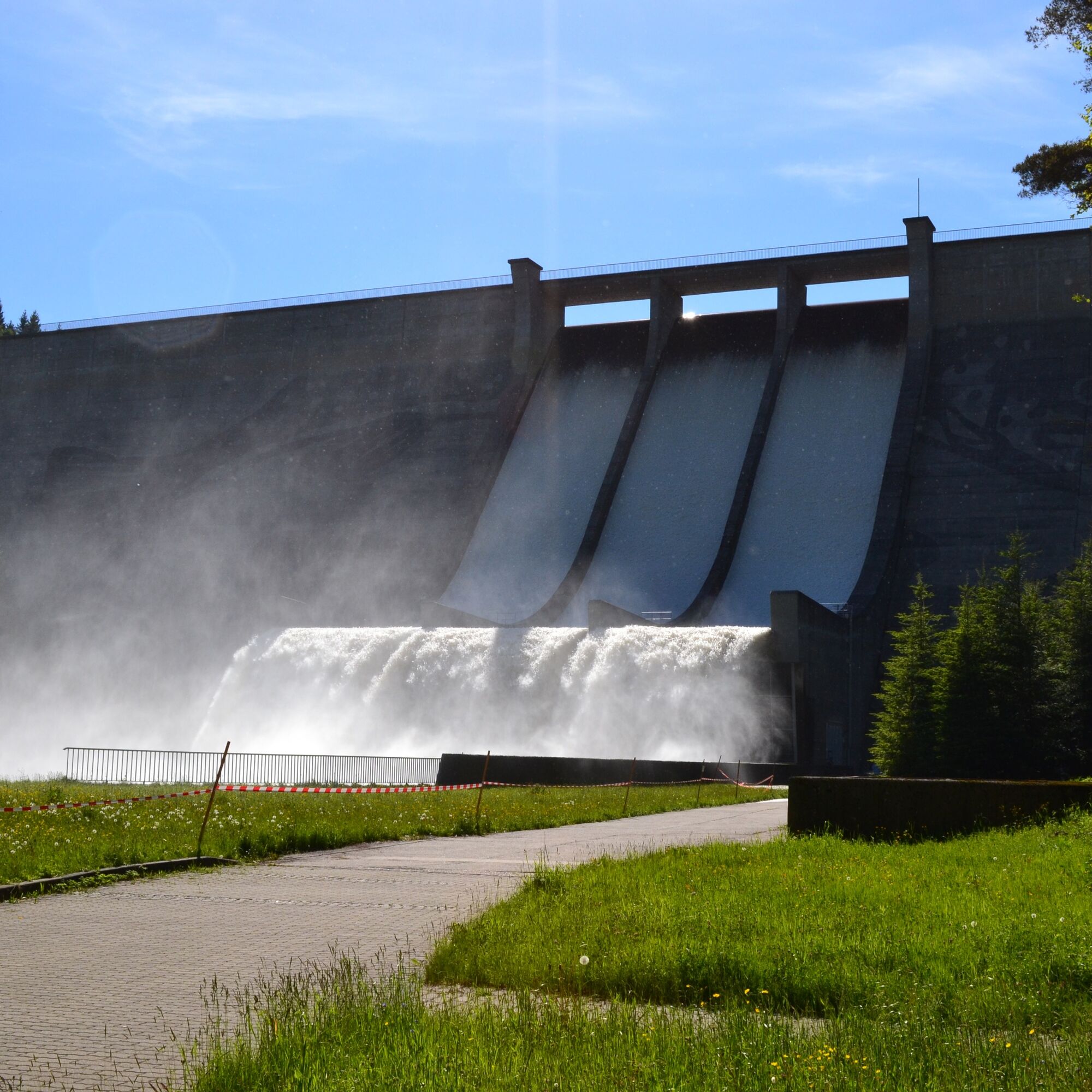
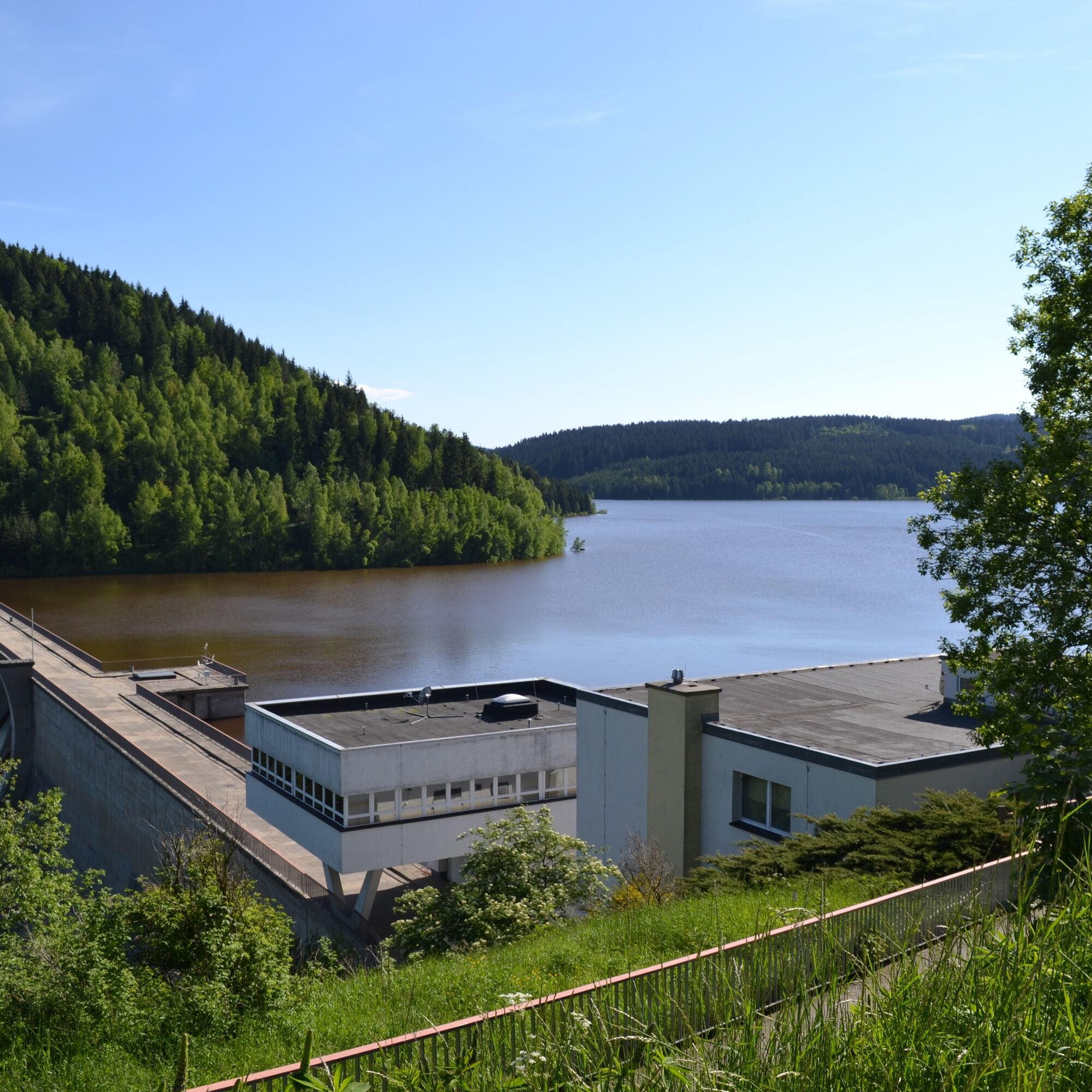
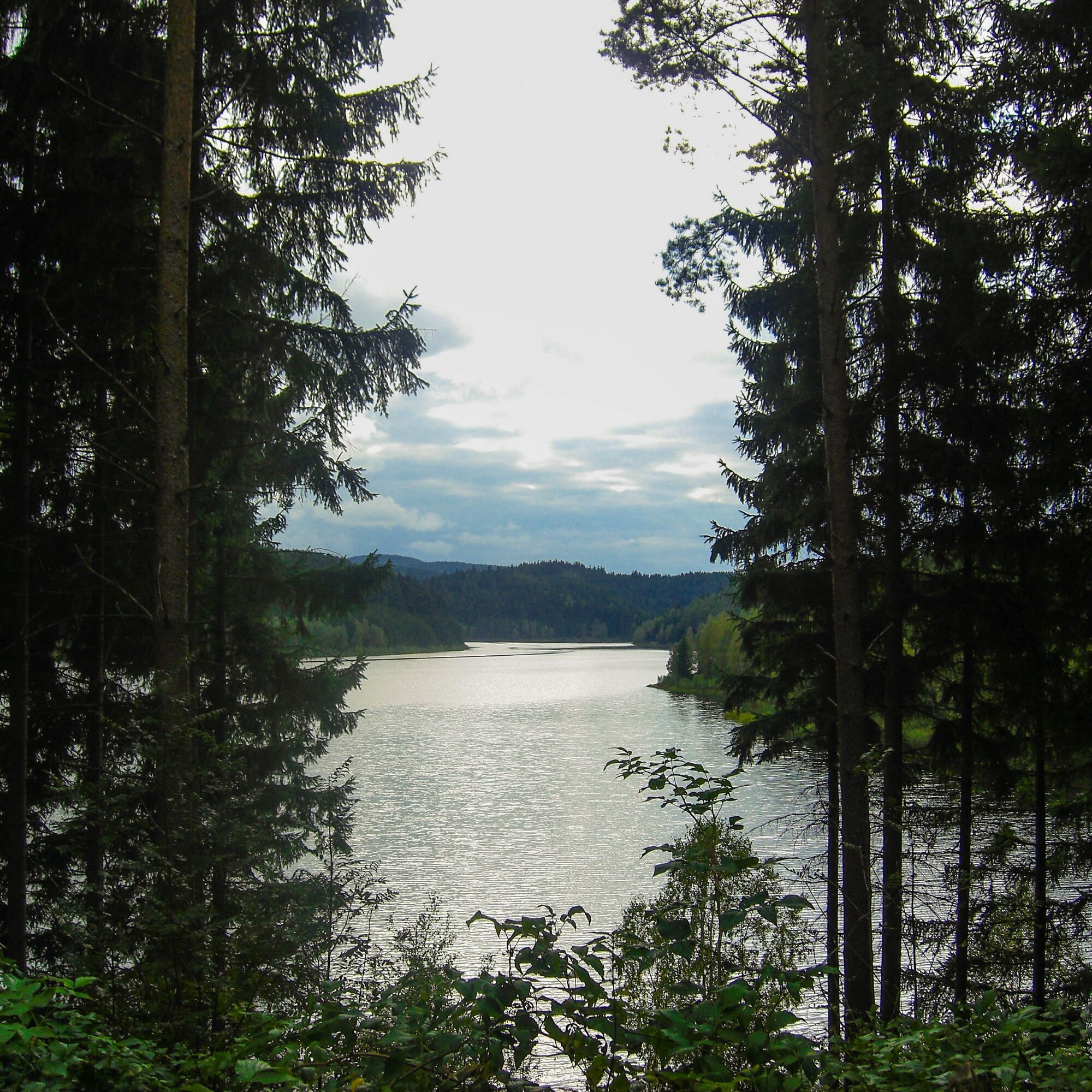
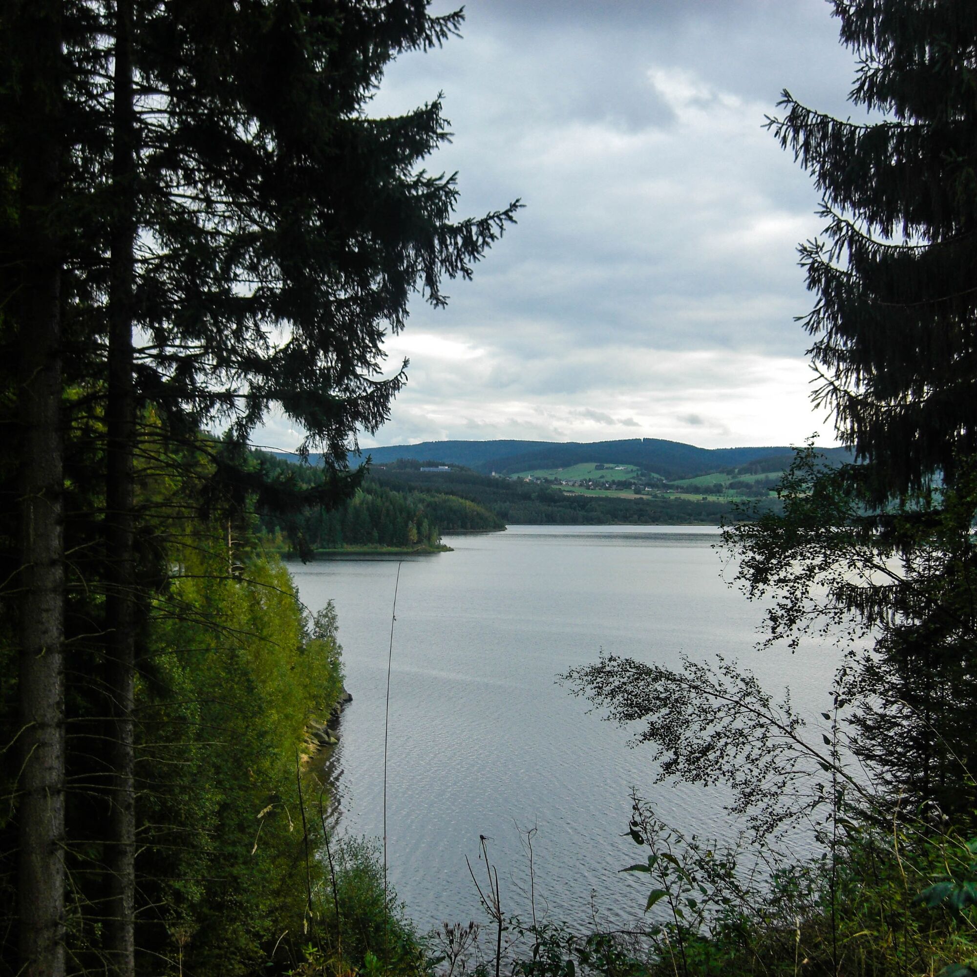
Our hike starts from the parking lot at the forebay at the Ganzmeilensäule and two hiking boards at the beginning of the Marienweg. It immediately leads into the forest on a forest path. After about 150 m, we turn right, where the third hiking board is already standing. Now it goes steadily uphill until we reach a shelter and the next hiking boards. We keep right and then pass a pile of wood and another hiking board on a short left-right-left, until we finally reach the Kneipp basin. Here you can take a short break or cool your feet a bit. Then the path continues towards the reservoir dam. Along the way, there are still some hiking boards. There are several resting benches en route. Until we reach the next intersection, where we again turn right towards the dam. After a short up and down, we slowly approach the dam. However, it can only be viewed from a distance initially. Only after passing some garages and then turning right on a short narrow path through the forest and a staircase do we reach a paved road. On the paved road, we then turn right again and reach the dam after about 300-500 meters. The dam is walkable and you can enjoy the view here. From here, it goes back the same way to the beginning. So those who have not read all the hiking boards yet, can catch up now.
I wish you a lot of fun hiking. :-)
Tak
Tak
Tak
Tak
Normal footwear is sufficient
From Schneeberg direction B169 turnoff Eibenstock
From Rodewisch direction B169 turnoff Eibenstock
There is a bus connection from Eibenstock or Schneeberg. Please check the timetable.
http://www.rve.de/fahrplan/regional/
Bus line 370 from the direction of Schneeberg or Schönheide
Bus line 372 from the direction of Eibenstock
Parking available at the Hundshübel forebay
T1
Popularne wycieczki w okolicy
-
Rundwanderung Talsperre Sosa
światłoWędrówka 7,95 km -
4,0
Panorama trail Schwarzenberg
średniWędrówka 13,8 km -
5,0
At the Eibenstock dam / Hundshübler circular hiking trail
światłoWędrówka 4,61 km -
2,0
Sosa Talsperre - Blauenthaler Wasserfall
ciężkiWędrówka 9,03 km -
Segwayfahrt bei Eibenstock
światłoMountainbike 15,2 km -
4,0
Burg Stein- Alexanderstein -Prinzenhöhle - Burg Stein ,Hartenstein, Deutschland Hartenstein, Deutschland
światłoWędrówka 9,51 km -
Burg Stein - Prinzenhöhle - Bastei (Mehltheuer) - Burg Stein ,Hartenstein, Deutschland Hartenstein, Deutschland
średniWędrówka 13,9 km -
30 km - Loop of the Three-Reservoir Marathon Eibenstock
średniMountainbike 33,4 km -
Langenweißbach, Talsperre Amselbach und Weißbach , z. T. urig ,querfeldein Langenweißbach, Deutschland
średniWędrówka 8,93 km -
50 km - loop of the Drei-Talsperren-Marathon Eibenstock
ciężkiMountainbike 50,3 km

Wędrówki i tropienie


Nie przegap ofert i inspiracji na następne wakacje
Twój adres e-mail została dodana do listy mailingowej.