






On forest paths and observation towers in Bad Neuenahr

The hike runs through open mixed forest on varied paths over the heights in the south of the spa town. The observation towers on the way at Steckenberg (371 m) and Neuenahrer Berg (340 m) offer a beautiful...
The hike runs through open mixed forest on varied paths over the heights in the south of the spa town. The observation towers on the way at Steckenberg (371 m) and Neuenahrer Berg (340 m) offer a beautiful panoramic view of the Ahr valley, the Grafschaft, and the Rhine heights.
The hike includes some moderate climbs and descents (see elevation profile).


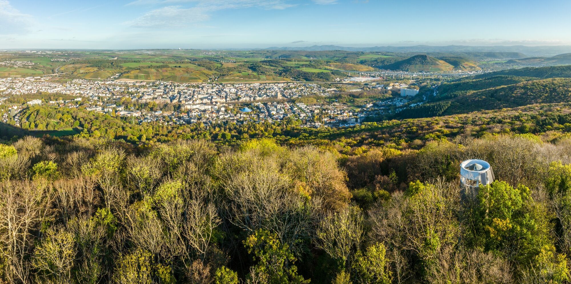


From Willibrordusstraße, walk right opposite the church on a narrow bitumen path („Bischofsweg“) along the cemetery uphill to the L83 main road. Opposite, turn right next to the bench and continue uphill on the Bischofsweg towards Steckenberg. Past the parking area, follow the sign Kletterpark slightly uphill to the shelter at the Paradieswiese and the entrance to the forest climbing park  (220 m, 1.2 km). Here you meet the AhrSteig, which you follow straight ahead for a short distance: first along the meadow, then right uphill on the bitumen path. Where the AhrSteig branches left uphill, the hiking trail continues straight and after a short distance reaches the Osteifelweg of the Eifelverein (290 m, 1.9 km), which you now follow right to Steckenberg (371 m, 3.5 km). The short climb to the observation tower is rewarded with a beautiful view of Bad Neuenahr, the Grafschaft, and the Rhine Heights.
From the tower, continue straight on the Osteifelweg. After 200 m, a path leads left to the Klimastation, the former open-air sanatorium of the spa. (Possibility to stop for refreshments on weekends).
On the further path, you soon reach a wide crossing (opposite the Bloser Hütte), where you continue half-left and after 1 km reach the Landstraße L83 (4.9 km). Follow this road to the right and after 100 m turn right onto the forest path. At the next fork, leave the Osteifelweg and continue on the narrow left path parallel to the road. This path, bordered by holly bushes, leads into the Ahr-Venn-Weg (
Tak
Sturdy footwear and weatherproof clothing are required. Light backpack provisions (drinks) are recommended.
For the sake of the natural landscape and your own safety, please observe the following instructions:
To protect the animal and plant life of the Ahr valley, it is important that you do not leave the designated paths, keep dogs on a leash, and keep the landscape clean. Because of the risk of forest fires, open flames are to be avoided.
Coming from A61 on B283 to the L83 junction towards Königsfeld. At the Bachem exit, immediately left onto Dahlienweg, Hochstraße. At the end, turn right into Willibrordusstraße up to the church.
DB-Ahrtalbahn station Bad Neuenahr. Via access path AhrSteig to the replacement bridge at the spa garden, cross it and continue via the spa garden street to Willibrordusstraße (1.4 km).
Free parking at Willibrordusstraße near the church and on adjacent streets.
If open (see signs), a stop for a hearty "hut meal" is recommended at the "Klimastation".
In spring, the ground in the Idienbachtal is covered with flowers of wood anemones, periwinkle, and lesser celandine.


Popularne wycieczki w okolicy
-
4,4
Andernach - Trasshöhle - Teufelsknochen - Siebengebirgsblick
średniWędrówka 12,6 km -
4,7
Steinerberg - Altenahr über Teufelsley und Teufelsloch
średniWędrówka 9,30 km -
4,0
Teufelsloch-Höhenwanderung
średniWędrówka 7,44 km -
4,8
Rieden - Gänsehals - Maifeldblick
średniWędrówka 14,2 km -
4,7
Round route Bad Neuenahr No. 5 - Through the Ramersbach Forest
średniWędrówka 9,31 km -
Weinwanderung Dernau nach Ahrweiler
Wędrówka 23,4 km -
4,5
Kasbachtal
światłoWędrówka 10,2 km -
4,7
Rundwanderung Rech / Steinerberg
średniWędrówka 14,2 km -
Burg Are - Engelsley Nord - Süd und im Tal zurück
ciężkiWycieczki górskie 3,63 km -
5,0
Leichte Rund-Wanderung Dernau / Mayschoß
światłoWędrówka 5,46 km
Wędrówki i tropienie


Nie przegap ofert i inspiracji na następne wakacje
Twój adres e-mail została dodana do listy mailingowej.





