


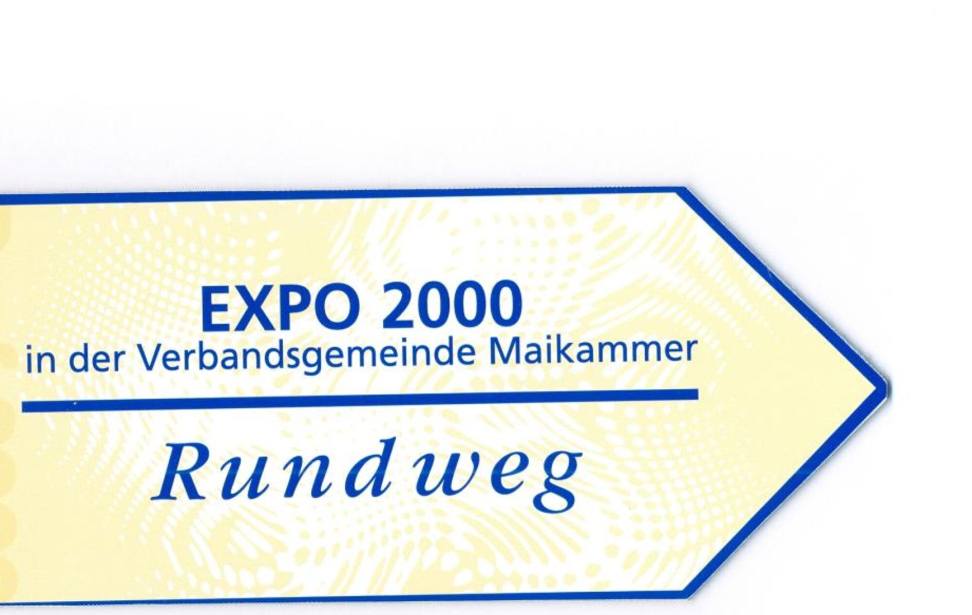
Maikammer - EXPO circular route
The EXPO circular route is situated at an altitude between 130 and max. 320 m above sea level. In the Kirrweiler area, the path has an almost flat course. In the Maikammer section, flat and gently ascending...
The EXPO circular route is situated at an altitude between 130 and max. 320 m above sea level. In the Kirrweiler area, the path has an almost flat course. In the Maikammer section, flat and gently ascending stretches alternate. In the St. Martin area, due to its location on the eastern slope of the Haardtrand, some more challenging climbs arise, e.g., ascent to the sports field and "Haus am Weinberg" from about 240 to about 320 m above sea level.
The circular course runs partly on paved paths, and partly a former historic pavement has been restored, as for example on the path from Maikammer to St. Martin in the Berggasse area, and it is marked with arrow signs and the label "EXPO circular route."

The start and finish of the EXPO circular route Maikammer is at the parking deck, Johannes-Damm-Str.
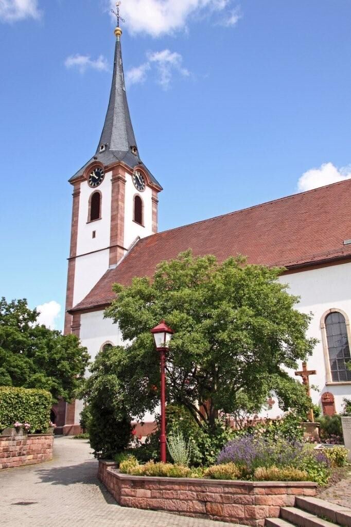
From here, the path leads northwards via Frantzplatz, Marktstraße, and Kirchgasse to Weinstraße Nord. A highlight along the way is the Catholic Church "St. Cosmas and Damian." It is a spacious baroque hall structure from the years 1756/57 and is located at a site where already in late Roman times a notable building stood.
After crossing Weinstraße Nord, the circular route continues through Rebengasse, at the end of which it turns right into the street "Im Kirchenstück," here at the end turn left and then continue straight on along Diedesfelder Straße. This leads out of Maikammer to the roundabout.
Here, the path continues along the L 512 (German Wine Route) towards Diedesfeld. After about 200 m, it turns left onto a field path. Here there is again a beautiful view of the Palatinate Forest and Hambach Castle.
It continues about 1 km straight ahead almost to the edge of the forest, at a small pond the path then turns left and follows the German Wine Route hiking trail southwards to the L 515 (Kalmithöhenstraße).
After crossing the street, the path continues a good 100 m further south before turning left and continuing via Kapellenweg and the wine educational trail. Shortly before the first houses of Maikammer appear, the circular route turns right. At the end, it goes a short distance left again and then immediately right into Mühlstraße. After about 500 m, the path reaches St. Martiner Straße (K 32) and then continues through Mühlweg to Kropsbach. On the left lies BG RCI. This is circled, and the path continues left along the brook to the southern bypass. From here, it goes through Gartenstraße, Weinstraße Süd, and Immengartenstraße back to the starting point at the parking deck.
Tak
This path requires no special equipment.
This path requires no special safety precautions.
Take the BAB 65 exit Edenkoben-Maikammer; continue on L 516 towards Maikammer. Then follow the signs towards the center and there follow the signs to "Rathaus" (town hall). The starting point at the parking deck on Johannes-Damm-Straße is located directly next to the town hall.
By Palatina bus, lines 500 or 501, from Landau or Neustadt to Maikammer, stops: Catholic Church or Frantzplatz.
By regional train from Landau or Neustadt to Maikammer-Kirrweiler stop. From there about 20 minutes walk to the starting point or by Palatina bus, line 504.
Timetables for bus and train are available at www.vrn.de.
Parking deck, Johannes-Damm-Straße
ATTENTION! – Campaign for considerate coexistence in nature
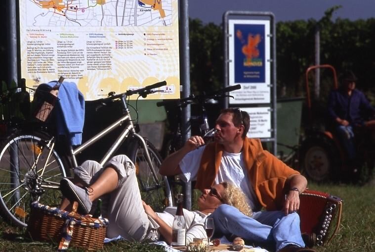
Always behave predictably, friendly, and considerately towards everyone you meet on the way. Respect nature, do not destroy plants, and always stay on the paths. Try to avoid excessive noise and leave the forest before dusk. Remember a rubbish bag for on the go and take your litter back home with you. Please keep your dog on a leash at all times. Other visitors and animals will thank you. For your own safety, observe all path closures, even on weekends. Park only in designated parking spaces. Leave room for emergency vehicles and agricultural machinery. Give priority to agricultural and forestry traffic, please.Plan a picnic for a break at one of the numerous picnic spots.
You can also find numerous interesting tips and information about the EXPO circular route at www.maikammer.de
Kamery internetowe z trasy
Popularne wycieczki w okolicy
Wachenheim - Eckkopf - Heidenlöcher - Wachenheim
średniWędrówka 12,8 km- 4,5
From Deidesheim over the Heidenlöcher to Eckkopf
średniWędrówka 14,6 km - 5,0
Wachenheimer Valleys Route to Oppauer Haus
średniWędrówka 11,7 km - 4,0
Thomas‘ Waldweinstube über die Wachtenburg
światłoWędrówka 4,81 km - 5,0
Palatinate Weinsteig Stage 08 Dernbach - Annweiler am Trifels
ciężkidługodystansowy szlak pieszy 14,4 km - 5,0
Vom Hambacher Schloss auf die Kalmit
średniWędrówka 11,3 km - 5,0
Rundtour Roth unter Riethburg
średniWędrówka 14,5 km Neustadt, Kaltenbrunner Tal, Totenkopfhütte, Hellerhütte, Königsberg, Neustadt Neustadt an der Weinstraße, Rheinland-Pfalz
światłoWędrówka 18,1 km- 3,0
Maikammer - Palatinate Almond Trail (Circular Route)
światłoTrasa tematyczna 14,6 km Palatinate Wine Route stage 05 Neustadt a. d. Weinstraße - St. Martin
ciężkidługodystansowy szlak pieszy 19,8 km

Wędrówki i tropienie


Nie przegap ofert i inspiracji na następne wakacje
Twój adres e-mail została dodana do listy mailingowej.