


18th Ahrtal Summit Festival: Hemmessener Hut - Large Summit Round
Zdjęcia naszych użytkowników
 © Albert KlapperichUtworzono dnia 08.04.2026
 © Albert KlapperichUtworzono dnia 08.04.2026
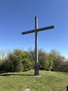 © Albert KlapperichUtworzono dnia 08.04.2026
 © Edit SzoboszlayUtworzono dnia 24.05.2021
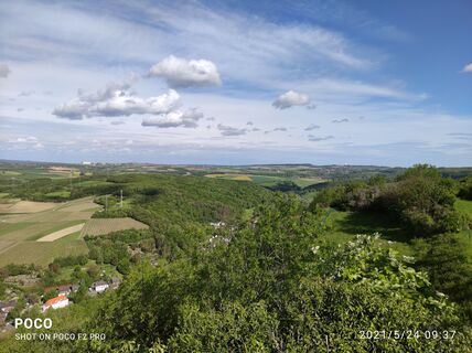 © Edit SzoboszlayUtworzono dnia 24.05.2021
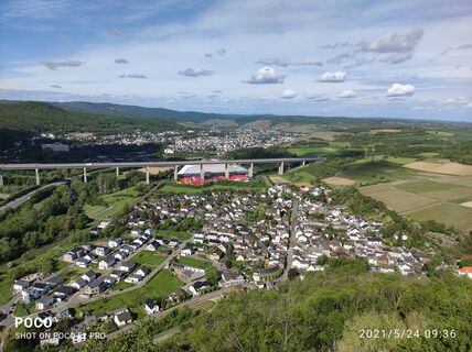 © Edit SzoboszlayUtworzono dnia 24.05.2021
 © Edit SzoboszlayUtworzono dnia 24.05.2021


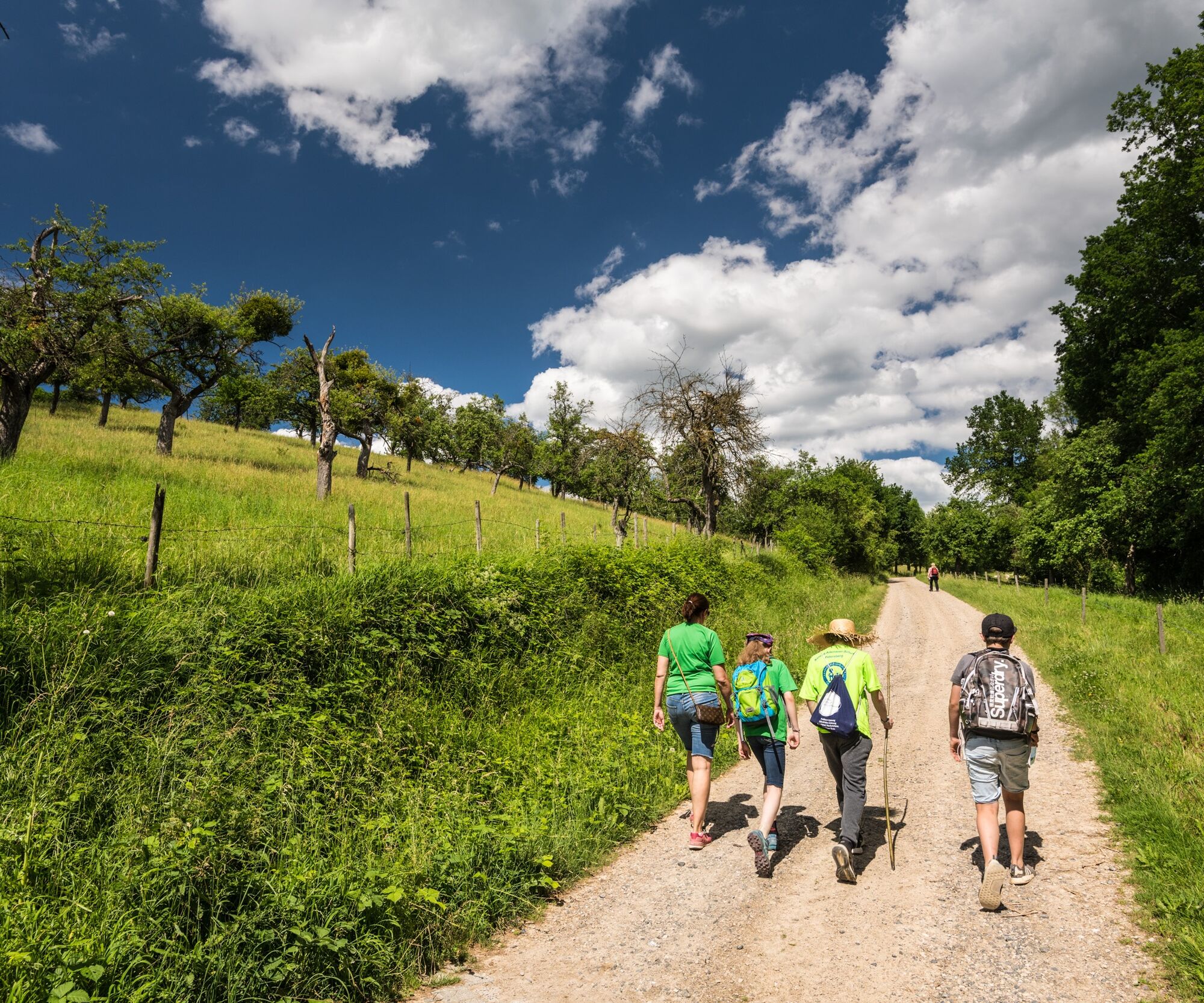
Our large summit round takes us from the Kurpark in Bad Neuenahr over the Landskrone to our day's summit at the Hemmessener Hut. The return goes through the vineyards and the city center of Bad Neuenahr...
Our large summit round takes us from the Kurpark in Bad Neuenahr over the Landskrone to our day's summit at the Hemmessener Hut. The return goes through the vineyards and the city center of Bad Neuenahr to our destination: the Kurpark in Bad Neuenahr-Ahrweiler.
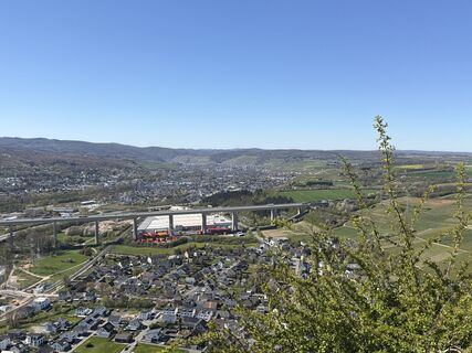
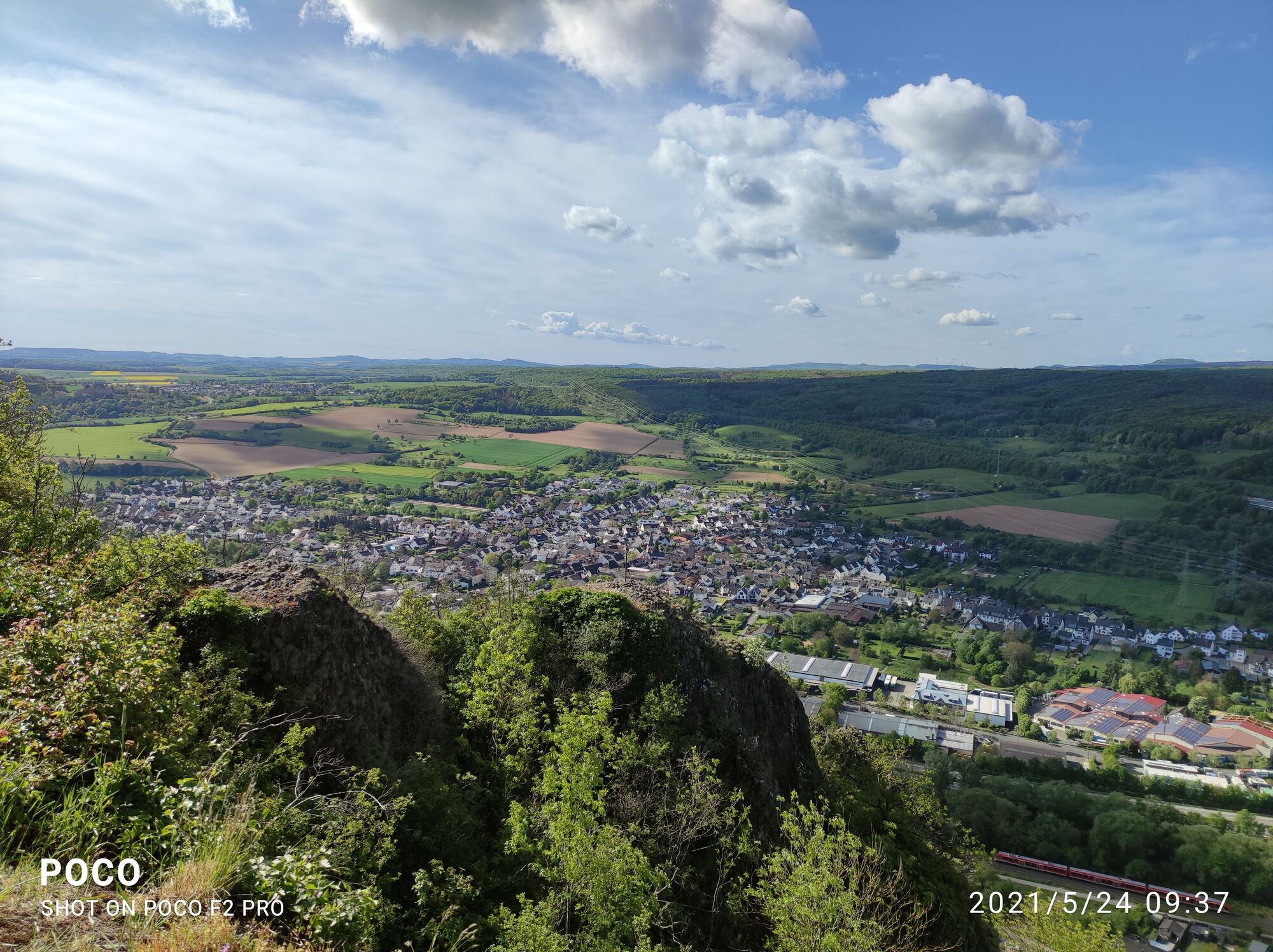
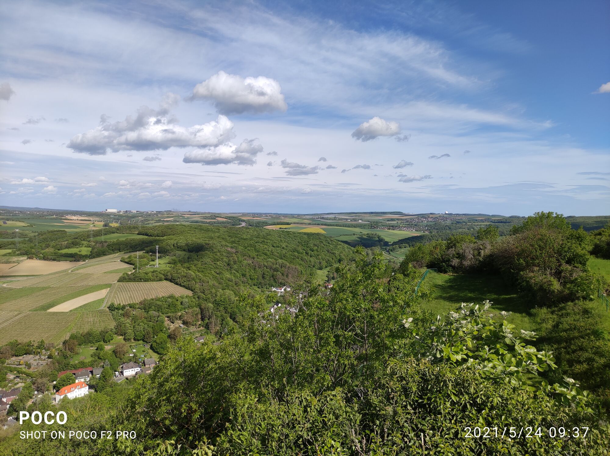
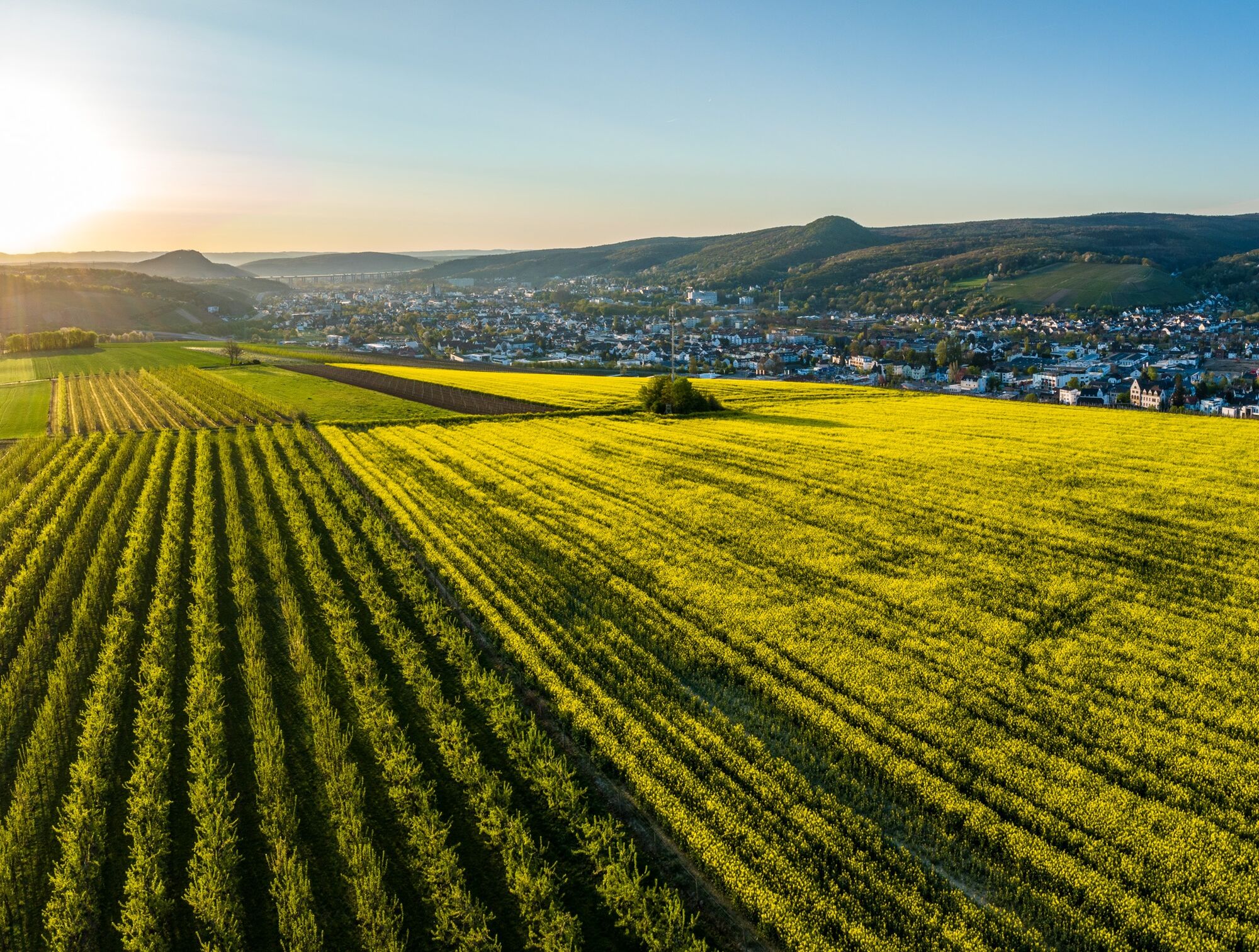
The Hemmessener Hut is nestled in the vineyards above Bad Neuenahr-Ahrweiler directly on the Rotweinwanderweg and offers a wonderful opportunity to rest. On the “Lichter Berg” at 190 meters height, you have a fantastic panoramic view from Heimersheim over Bad Neuenahr to Walporzheim and the heights of the Ahr mountains.
Starting point of the guided hike: Tourist Information Kurpark Bad Neuenahr-Ahrweiler
When: May 30, 2024, 10 a.m.
Hiking guide: Michel Maher
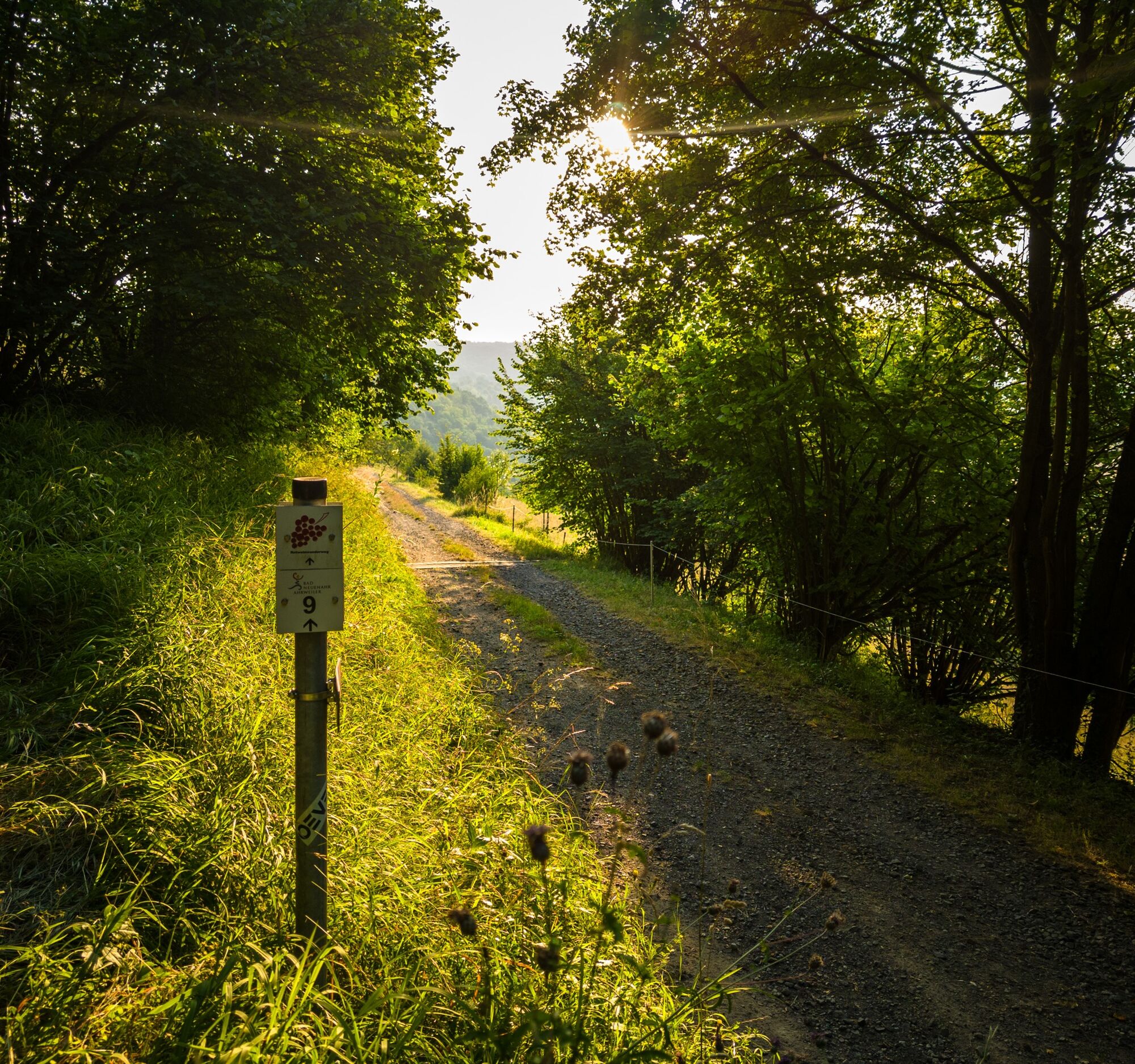
We start at the Kurpark, cross the emergency bridge over the Ahr and walk through Telegrafenstraße to the main street. Here we continue to the right, then turn left into Bergstraße, cross Rathaus- and Heerstraße and follow Bergstraße uphill. At the end of the hollow way, turn right on the Rotweinwanderweg (RWW) towards Bad Bodendorf.
After a short distance, we turn left off the RWW and soon enjoy first views of the district town, the Neuenahrer Berg (330m) and ahead above the fields the view of our first stage destination: the Landskrone with the white Maria-Hilf Chapel. At the end of the downhill meadow path, we reach the RWW again, turn left, continue straight ahead and, after a large right curve, head towards the Ahr valley bridge of the A61, which we shortly afterwards pass under.
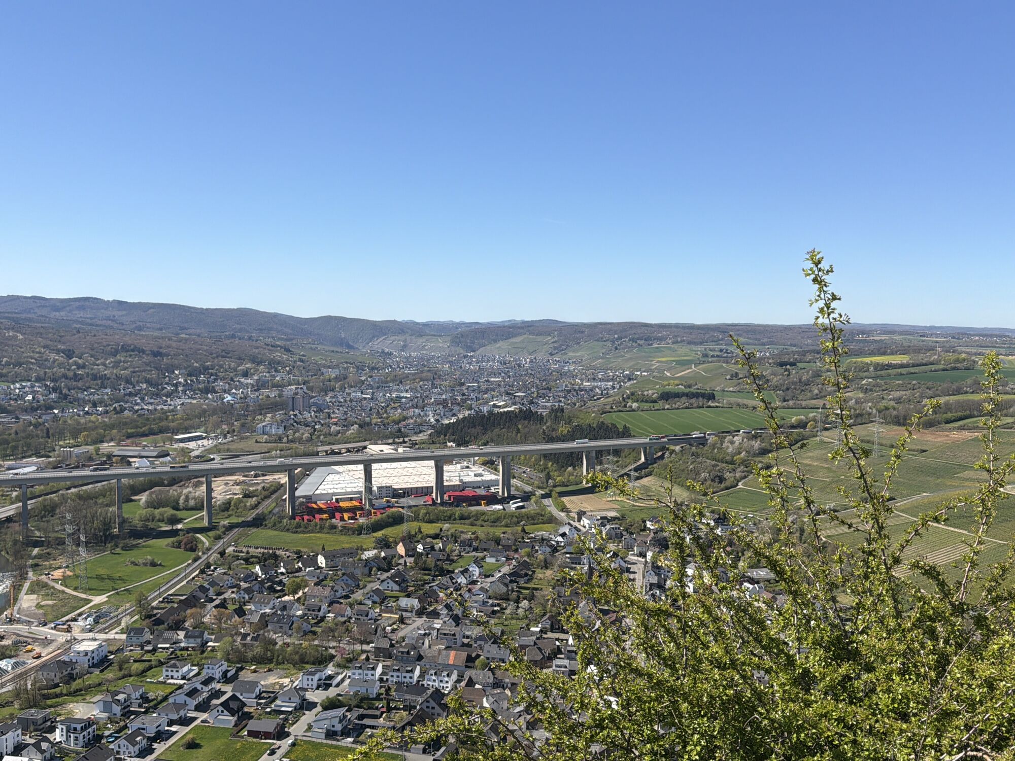
To the right in the valley lies the production site of Coca-Cola Germany, which also includes the Apollinaris spring. Slightly to the right ahead is the district of Heppingen with its Martinus Church, beyond the Ahr is the district of Heimersheim with the distinctive Laurentius Church and in front of us is the Landskrone. We continue to follow the RWW and cross Bonner Straße behind the Heppinger cemetery, turn briefly to the left and after a resting place, go right up 138 steps on a staircase. (Those who do not want to climb up to the Landskrone, turn left at the top and after 300 m meet another path coming from the summit).
To the summit we turn briefly left and then follow the signposted Osteifelweg of the Eifel Association, which leads up to the volcanic cone of the Landskrone (254 m) in several hairpin bends. Information boards provide a historical overview here and the magnificent panoramic views from the castle ruins invite you to rest. For the further route, go briefly back and down in a curve to the street Im Seifelsgraben. Here we stay briefly to the right, follow An der Burgpforte to the left downhill to Bonner Straße and walk right further and turn right into Kapellenstraße. At the end, we cross the Leimersdorfer Bach and follow the path upstream along the creek.
After 500 m, follow the forest edge on the forest path leading left uphill to the summit. Then continue right along the forest edge until after 350 m you turn right and walk parallel to the motorway to the Bengener valley bridge. We pass under the motorway bridge and walk left uphill parallel to the A61 to soon turn right onto Bengener Heide. We pass the eastern edge of the airfield and turn right, walk a bit along the fence and come to the Heidestube for refreshments.
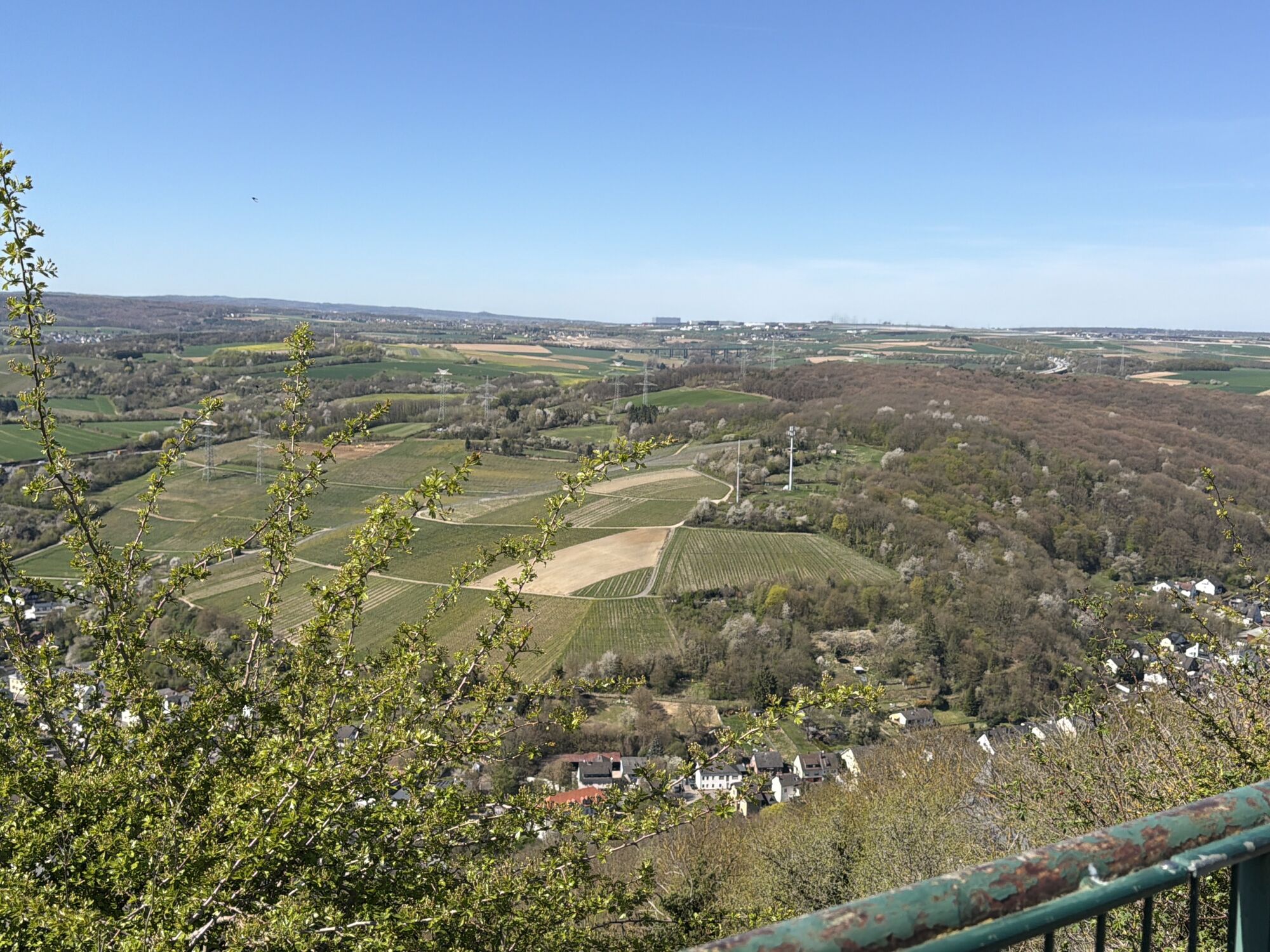
Then continue briefly on the downhill road, then turn right onto the field path and reach the first vineyards through the open fields and enjoy the wide views of the district town, the Ahrberge with the Neuenahrer Berg and half left in front of us the Dernauer Krausberg with the distinctive tower. Shortly afterwards, we follow the path leading left downhill and see (600 m) ahead the hiking destination: the Hemmessener Hut. With a hearty rest and wonderful views into the Ahr valley, we enjoy the well-deserved break.
For the return to Bad Neuenahr, follow the downhill road, walk briefly downhill on the street Im Delmich and follow the left downhill farm road. At the end, go right to the houses in Im Muckental, then left parallel to the bypass road to Nordstraße and through Telegrafenstraße back to the Kurpark.
Hiking guide: Michel Maher
Sturdy footwear, provisions and water for the way.
There are no specific safety instructions.
In the interest of the natural landscape and your own safety, please observe the following instructions:
To protect the animal and plant life of the Ahr valley, it is important that you do not leave the signposted paths, keep your dogs on a leash and keep the landscape clean. Due to the risk of forest fires, open fires are to be avoided. Participation in the Ahrtal summit festival is at your own risk. We ask parents and escorts of children to be especially attentive, as the steep slopes and rock outcrops can be dangerous for children. Therefore, we ask that children be supervised at all times. The instructions of the organizer and persons commissioned by them must be followed. The Ahrtal-Tourismus Bad Neuenahr-Ahrweiler e.V. assumes no liability for property or personal injury.
Thank you for your understanding!
By car coming from the north via the A61 to the Bad Neuenahr-Ahrweiler motorway junction. The short feeder motorway A 573 leads to Bad Neuenahr, Ahrweiler and the other districts.
Coming from the south, leave the motorway at the exit Sinzig / Bad Neuenahr and then follow the feeder motorway A 571 as well as the bypass road B 266 towards Bad Neuenahr-Ahrweiler.
Arrival and departure are possible by public transport. For everyone who wants a short trip in the Ahr valley, there are numerous accommodation options in the area. Please note that the infrastructure in and around Ahrweiler is still affected by flooding. Also, the usual parking spaces are therefore partly not available. Therefore, we recommend you to come by public transport (bus / train).
Take the regional train to Bad Neuenahr station. From there various bus lines run to the Kurpark Bad Neuenahr. Optionally, the route can also be taken on foot back (approx. 15 minutes walking time).
Parking options in the city
TIP: If you want to end the day with a glass of Ahr wine in the green, you can do so in the WeinLounge in the Kurpark.
Popularne wycieczki w okolicy
- 4,6
Drachenfängerrunde
średniWędrówka 11,8 km - 5,0
Rundweg Breiberge, Logebachtal, Tretschbachtal
Wędrówka 19,8 km - 4,0
Siebengebirge über 7 Berge
średniTrailrunning 24,2 km Wolkenburg und Nonnenstromberg
Wędrówka 13,0 km- 4,0
Teufelsloch-Höhenwanderung
średniWędrówka 7,44 km 13-Gipfel-Tour im Siebengebirge
średniWędrówka 19,4 km- 4,9
Sieben auf einen Streich (Skiclub Bad Honnef, GeneralAnzeiger Bonn)
średniWędrówka 24,5 km - 5,0
Round route Bad Neuenahr No. 5 - Through the Ramersbach Forest
średniWędrówka 9,31 km Weinwanderung Dernau nach Ahrweiler
Wędrówka 23,4 km- 4,7
Rundwanderung Rech / Steinerberg
średniWędrówka 14,2 km

Wędrówki i tropienie


Nie przegap ofert i inspiracji na następne wakacje
Twój adres e-mail została dodana do listy mailingowej.