


Pfälzerwald route
Poziom trudności: 4
Requirement: medium-difficulty route with several small and two steep climbs (Gelterswoog - Queidersbach with 80 m ascent over 1.5 km and Gräfenstein loop with 95 m ascent over 1.3 km, the latter can be...
Requirement: medium-difficulty route with several small and two steep climbs (Gelterswoog - Queidersbach with 80 m ascent over 1.5 km and Gräfenstein loop with 95 m ascent over 1.3 km, the latter can be "bypassed" by riding directly between Münchweiler and Hinterweidenthal through the Waschtal on the Pirminius cycle path).
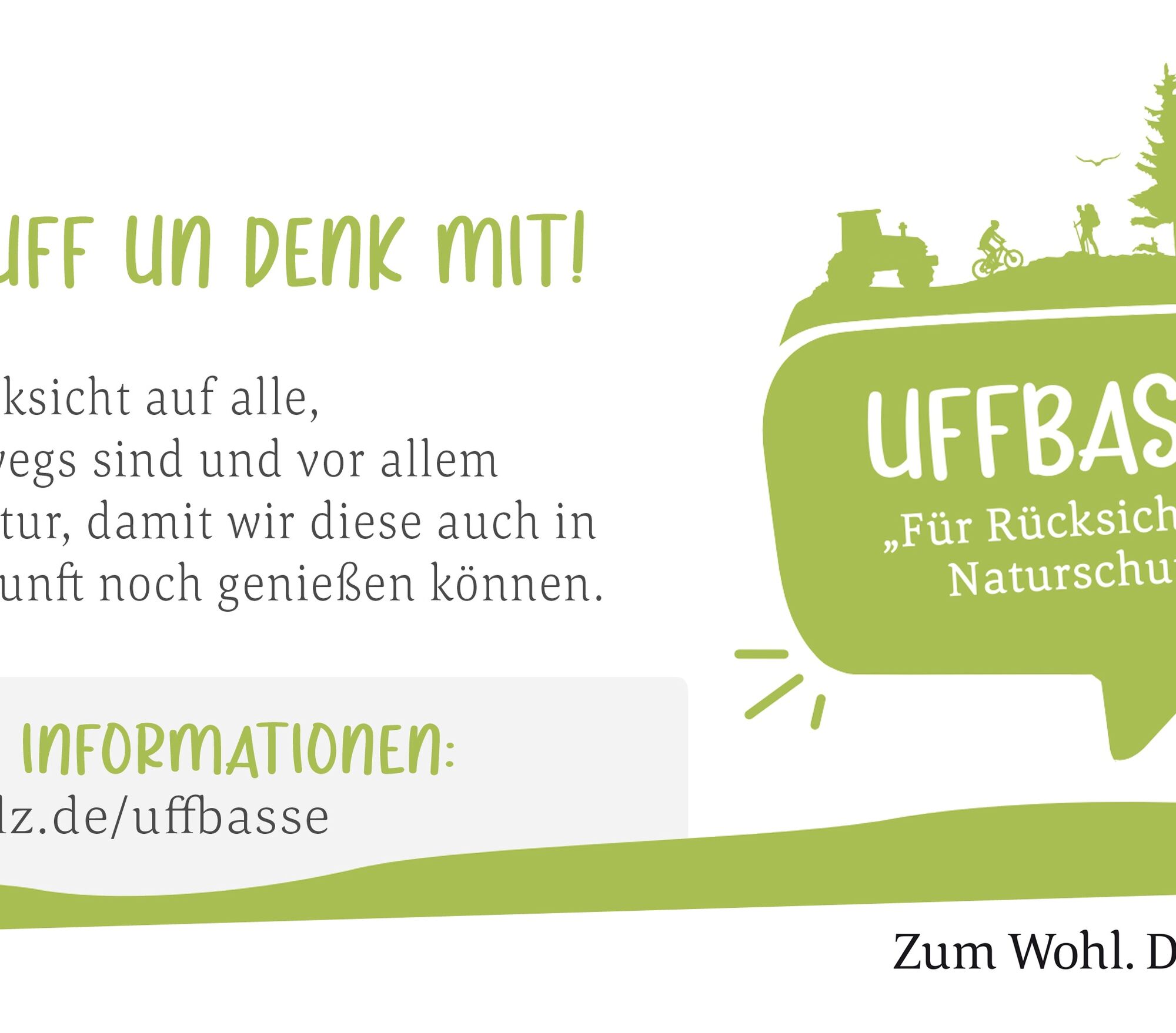
ATTENTION! - Campaign for respectful coexistence in nature
Fire & Smoking - Making fire, smoking and grilling are strictly prohibited in the forest and must absolutely be avoided! Fires and thus major damage to nature and wildlife can only be prevented this way.
Be considerate while on the move - Always behave in a foresighted, friendly and considerate manner towards everyone you meet on the way.
Nature protection - Stay on designated paths and avoid unnecessary noise when you are in nature. Leave the forest no later than dusk to not disturb the rhythm of nocturnal animals.
Picnic & rubbish - Remember a rubbish bag for the way and take your waste back home. Use only furnished rest areas for breaks and picnics.
Leash your dogs - Please always keep your dog on a leash. Other visitors and animals will thank you.
More info at: www.pfalz.de/uffbasse

Starting at the main station in Kaiserslautern, the Pfälzerwald route runs straight ahead along "Richard-Wagner-Straße" to the second traffic light at the corner of "Richard-Wagner-Straße" / "Pirmasenser Straße". Turn left and continue for about 1.2 kilometers along "Pirmasenser Straße" to its end at "Königstraße" (there is a tobacco shop at the corner). There the cycle path turns left onto "Königstraße". At the traffic light, move left in the direction of Hohenecken and at the second traffic light turn left again onto "Hohenecker Straße". The cycle path continues along "Hohenecker Straße" to the traffic light at state road L 502. At the traffic light, go straight ahead. Shortly after the traffic light, the Pfälzerwald route changes to a farm road running parallel to the street and follows it to the entrance of Hohenecken.
Along "Burgherrenstraße" the cycle path runs to the end of Hohenecken. Shortly before the B 270, the cycle route turns left onto a path running parallel to the B 270 up to the Gelterswoog. There, the cycle path crosses the B 270 at a traffic light and runs along the road-side cycle path to the junction of state road L 472. The Pfälzerwald route crosses the state road and continues on a roadside cycle path until shortly before the entrance to Queidersbach. At the village sign, the route crosses the state road and leads via a short path into "Kiefernstraße". At the next intersection, turn left into the street "Zum Winterberg". At the end of the street the Pfälzerwald route changes to a combined pedestrian and cycle path and follows it for about 3 kilometers through the idyllic valley of the Queidersbach to the entrance of Linden. Along the main street, the route leads through the village. At the exit, it changes to the roadside cycle path and follows it to the entrance of Horbach.
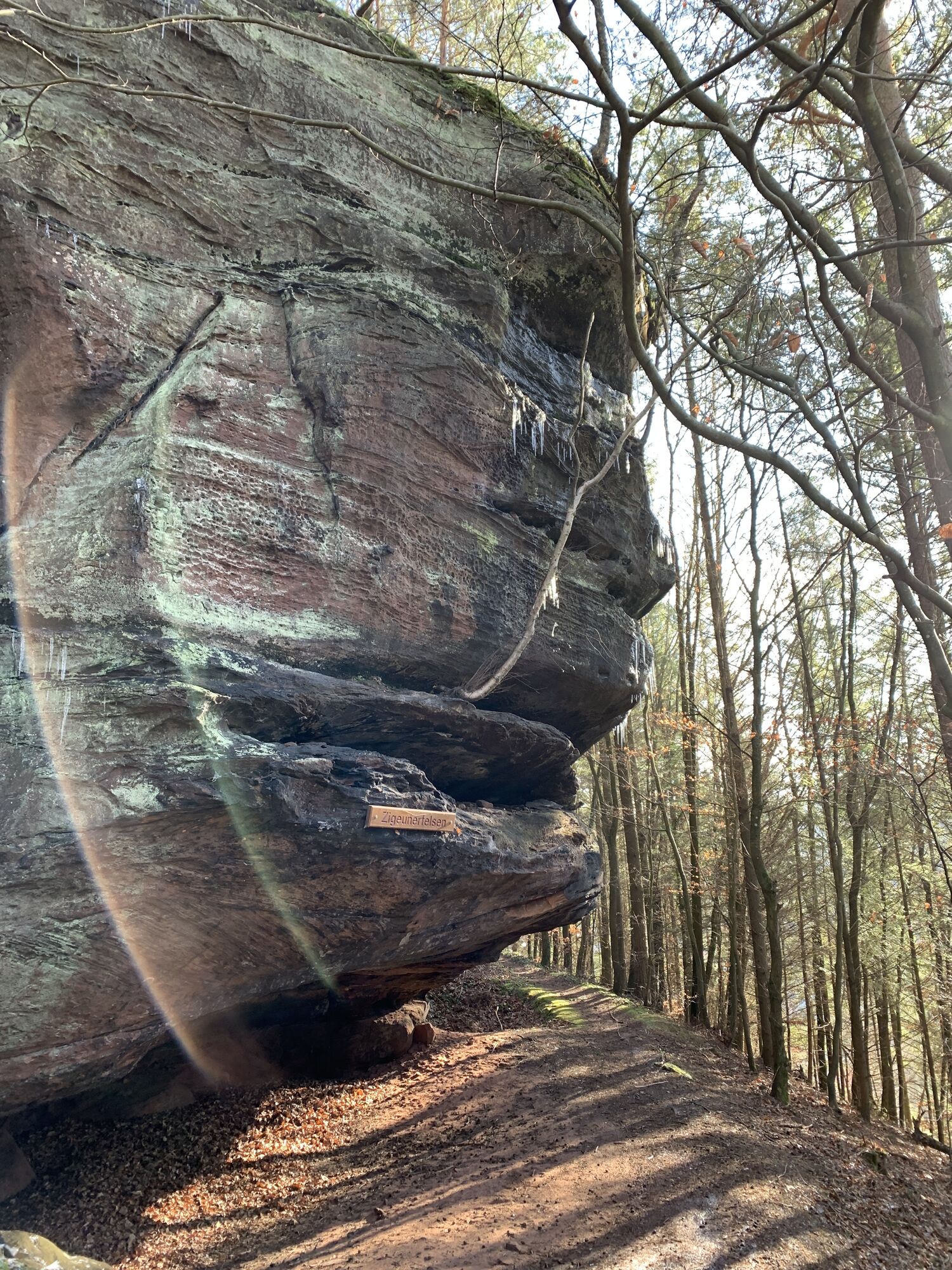
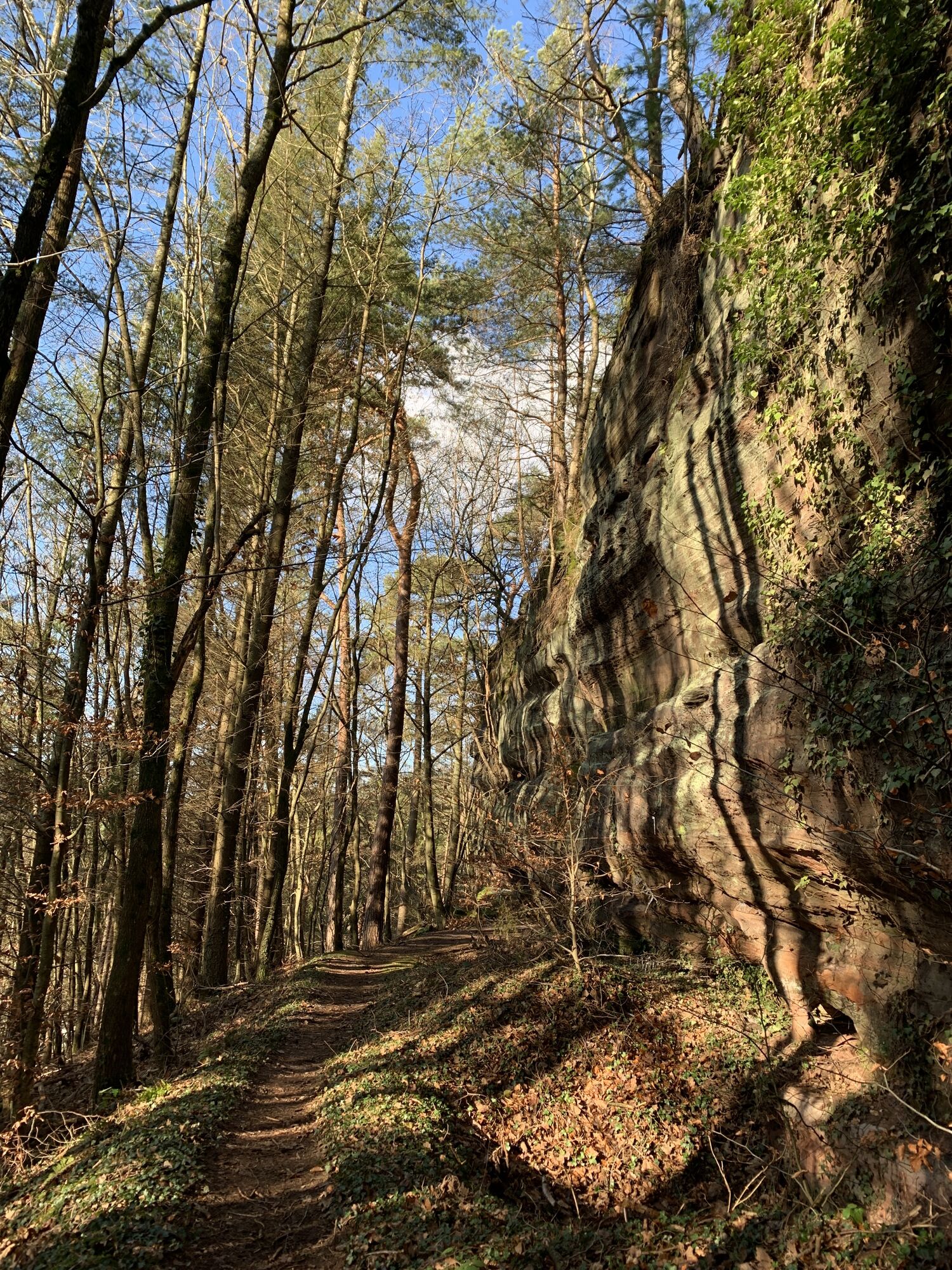
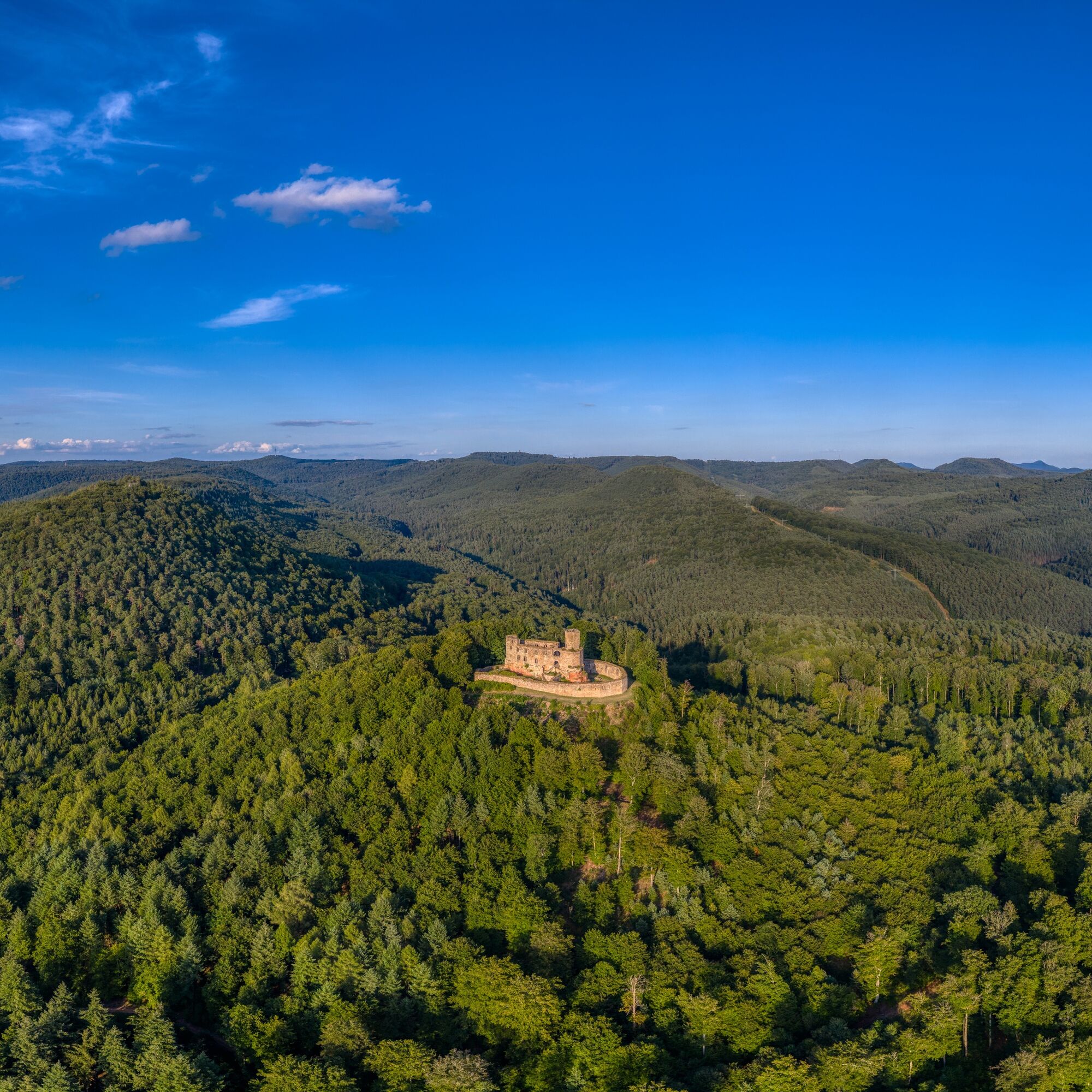
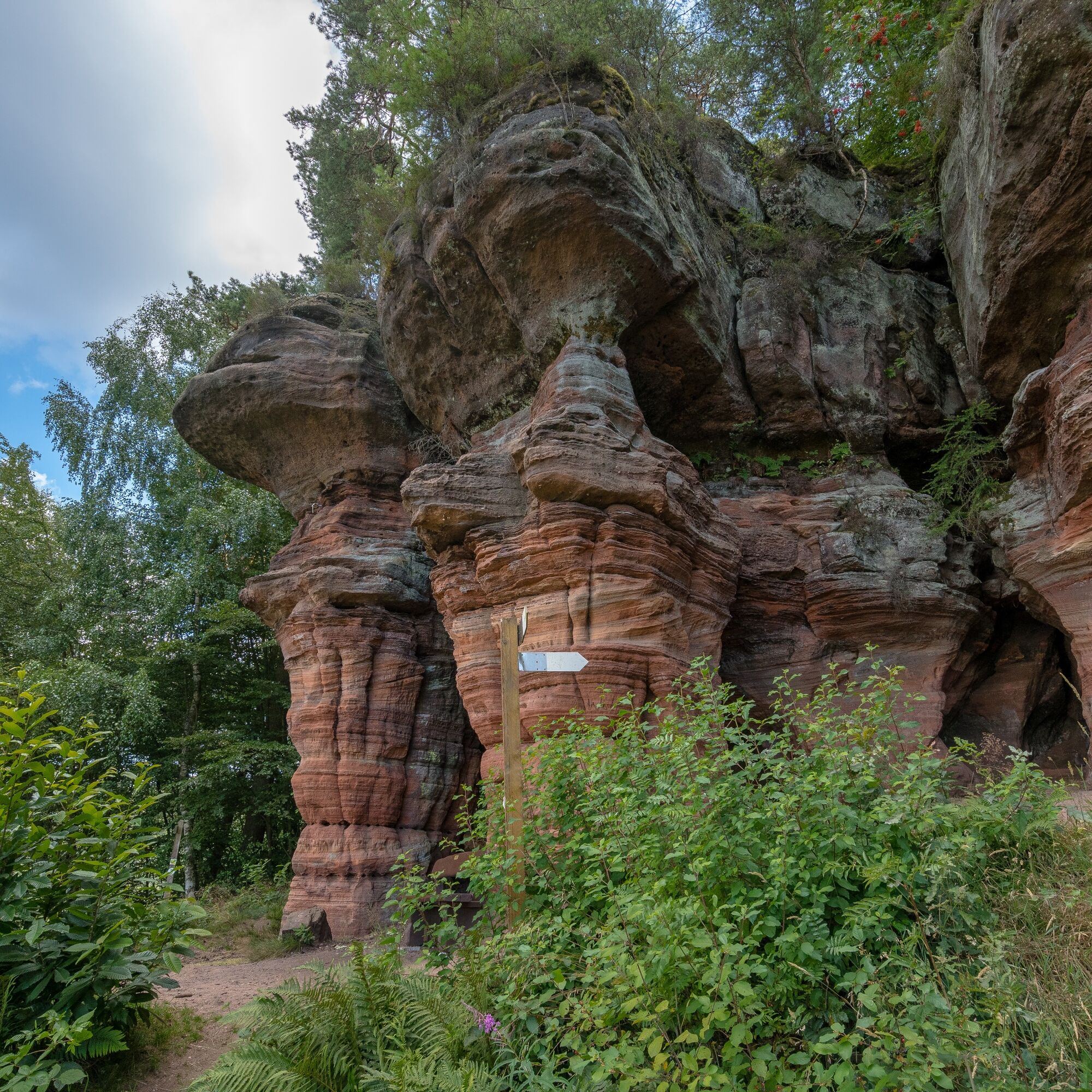
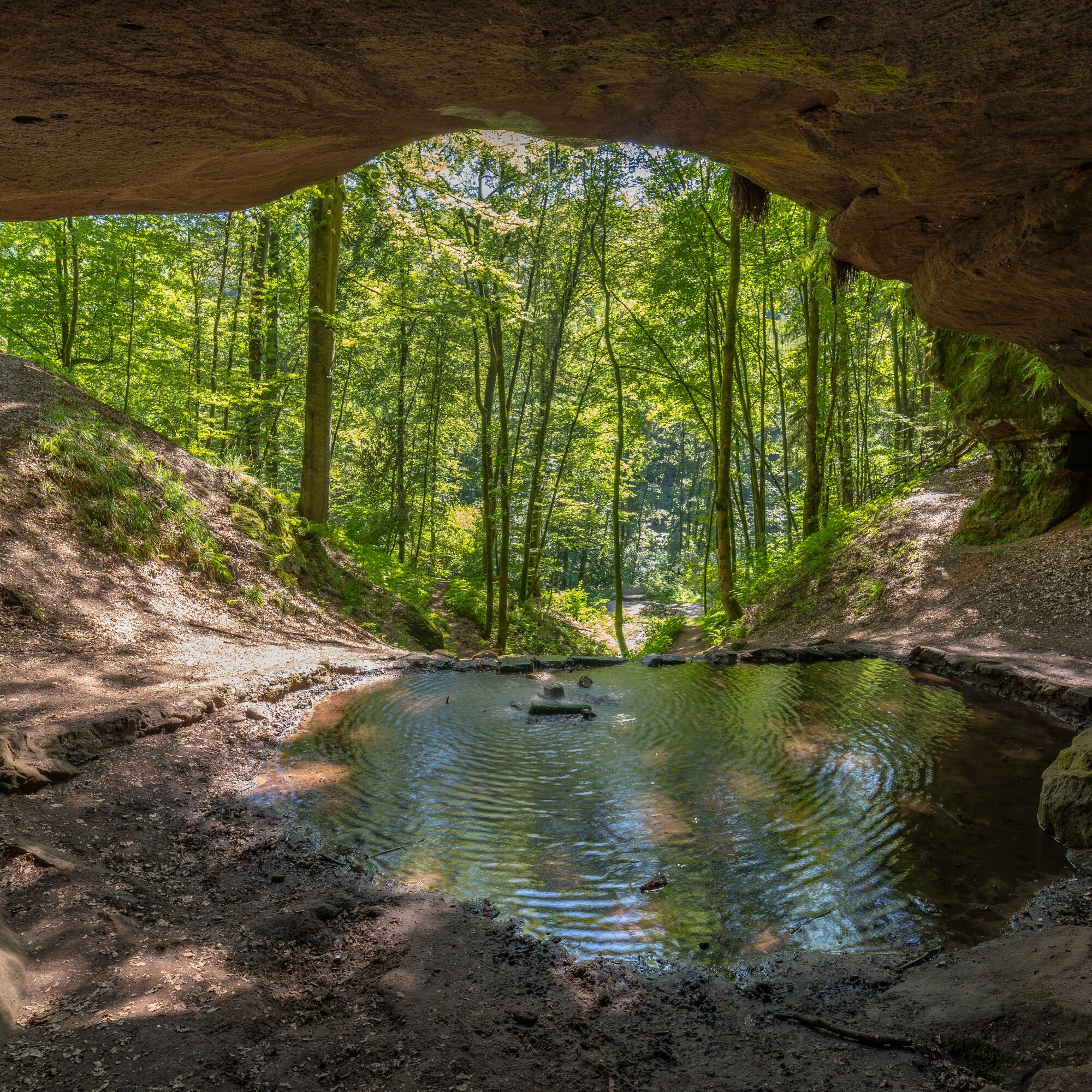
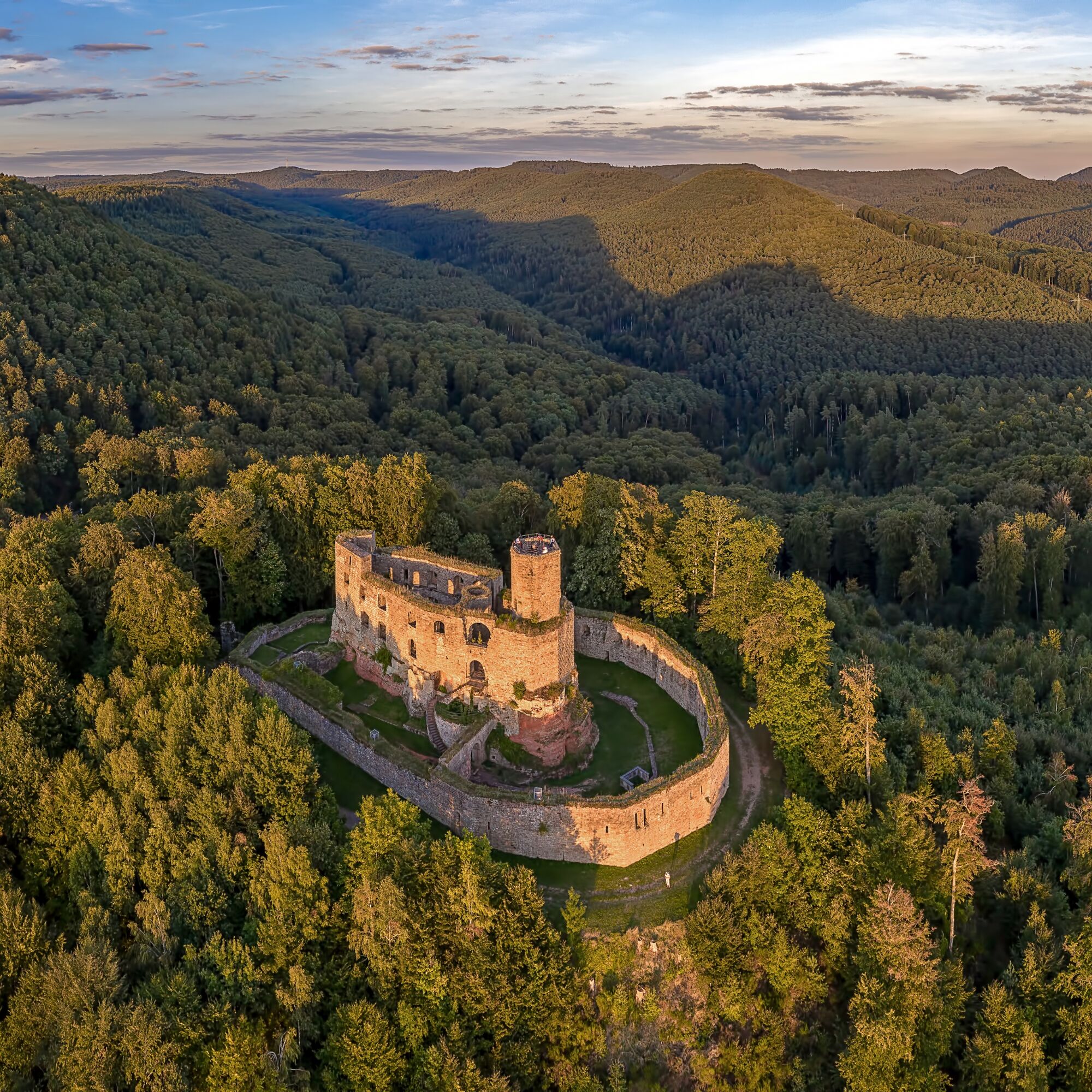
In Waldfischbach-Burgalben, a visit to the monastery complex "Maria Rosenberg" is worthwhile before continuing along the Rodalb past the natural monument Bruderfelsen, the landmark of the town of Rodalben. Here, you should also plan a detour to the Bear Cave, the largest natural rock cave in the Palatinate. This "two-storey" natural monument with a spring and a small waterfall is an oasis of calm. After passing through the community of Münchweiler an der Rodalb with its lovely public park, the route continues through the tranquil Merzalben, climbing up to the Schäferei hiking car park below Gräfenstein Castle. This jewel from the Staufer period, at the same time the namesake of the holiday region Gräfensteiner Land, impresses with its unique, seven-sided bergfried from which you have a breathtaking view of the seemingly endless forests of the UNESCO Biosphere Reserve Palatinate Forest-North Vosges. The route then finally descends into the romantic Zieglertal and along the Wieslauter to Hinterweidenthal with its distinctive rock formation "Devil's Table" and the adventure playground located there, where the route ends.
Route overview:
- Kaiserslautern - Queidersbach 9 km (165 m ascent, 90 m descent): from the northern edge of the Palatinate Forest southwestwards and over the first landscape threshold up to the Sickinger Höhe.
- Queidersbach - Biebermühle 24 km (70 m ascent, 150 m descent): through the valleys of the Queidersbach and Moosalb on cycle paths southwards.
- Biebermühle - Münchweiler/Rodalb 10.0 km (65 m ascent, 40 m descent): eastwards in the valley of the Rodalb.
- Münchweiler - Hinterweidenthal 17.5 km (170 m ascent, 220 m descent): Gräfenstein high loop through dense forest.
The route in the cycle path network: The route is important as a connection between Kaiserslautern and the central Palatinate Forest.
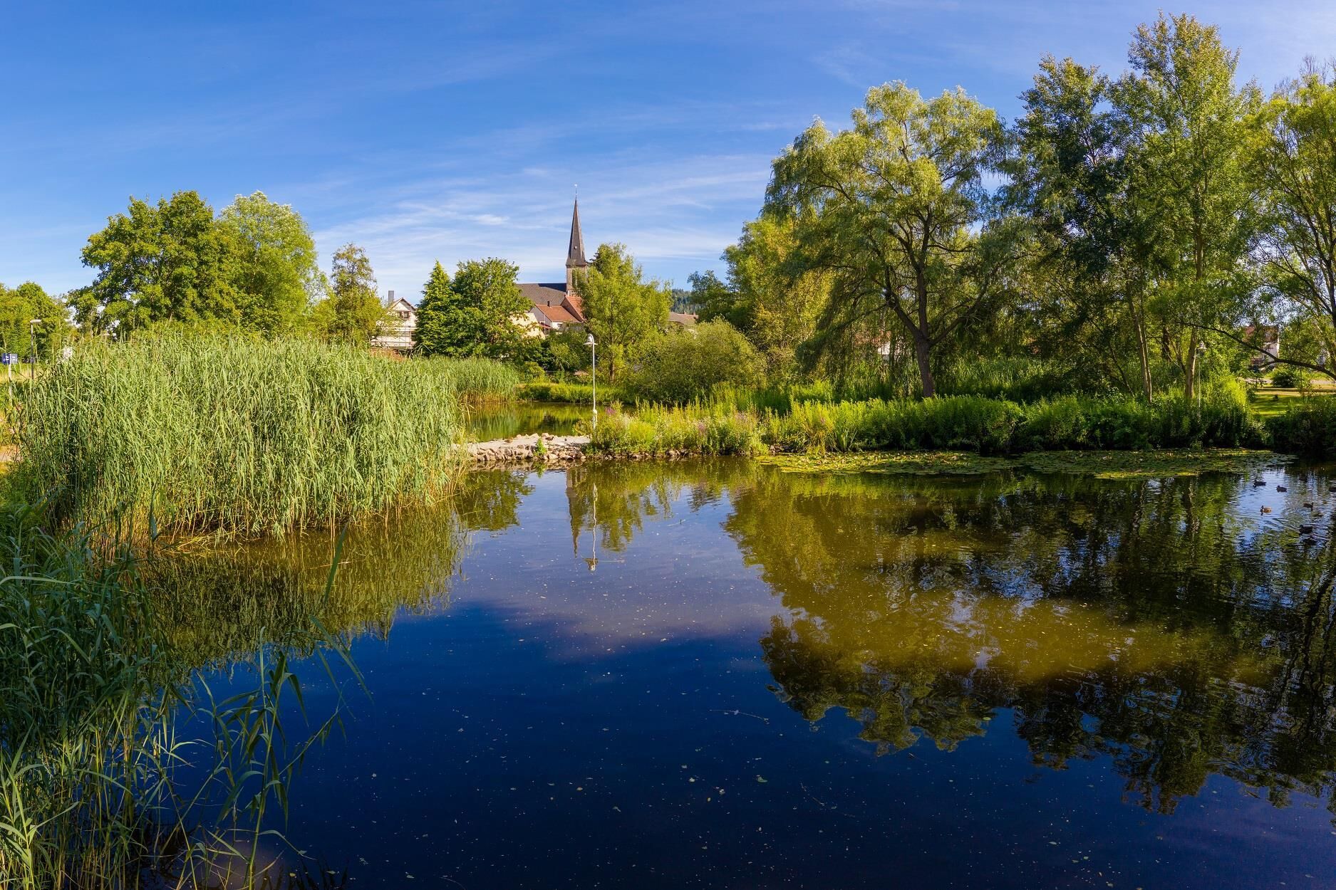
From the Barbarossa town of Kaiserslautern, with the Japanese Garden and the horticultural show, the Pfälzerwald route continues to Hohenecken. There you have the option to visit the Hohenecken castle ruins or enjoy a refreshing dip at the Gelterswoog lido. The cycle route continues along the state road to Queidersbach. The Sickinger Höhe Museum, housed in the old school building, can be visited on the first Sunday of every month. Along the edge of town, it continues on a combined cycle and pedestrian path to the neighboring municipality of Linden.
Source and more information: http://www.radwanderland.de/
Drink sufficiently and wearing a helmet is recommended
Please observe the road traffic regulations, intersections with road traffic!
By car, any town can be chosen as a starting point for the Pfälzerwald route.
You can reach the starting point in Kaiserslautern at the main station via the A 6 (exit Kaiserslautern West or city center), the A 63 (exit Kaiserslautern city center), the B 270 or the B 37.
There is a rail connection directly on the Pfälzerwald route at:
- Kaiserslautern: railway line Mannheim - Kaiserslautern - Saarbrücken
- Kaiserslautern, Schopp, Steinalben, Waldfischbach-Burgalben and Pirmasens-Nord: railway line Kaiserslautern - Pirmasens
- Pirmasens Nord, Rodalben, Münchweiler, Hinterweidenthal: Queichtalbahn Zweibrücken - Landau
The (South) Western Palatinate is well connected by the rail links Saarbrücken - Kaiserslautern, Kaiserslautern - Pirmasens and Zweibrücken - Landau. Trains run every hour (or more frequently) in all directions every day, including Saturdays, Sundays and public holidays, with exact connections to long-distance routes. All trains have special compartments for bicycles and multipurpose compartments.
Transport of bicycles is free from Monday to Friday from 9:00 a.m., as well as on weekends and public holidays. Ideal ticket offers such as the Rhineland-Palatinate ticket from DB or the Group ticket 24+ from the Rhine-Neckar Transport Association (VRN) also make rail travel an affordable pleasure.
Schedule information for arrival and departure: www.bahn.de or www.vrn.de
Parking is available especially at the train stops, the Gelterswoog and in all towns.
4
Tourist Information Verbandsgemeinde Landstuhl
Tel. +49 6371 1300012
Südwestpfalz Touristik e.V.
Tel. +49 6331 809-126
www.suedwestpfalz-touristik.de
Radwanderland
Radroutenplaner
Suggestions, notices or defects? Contact us by email: radwege@lbm.rlp.de
In years with an odd number, the "Cycling Fun in Sickinger Land" event takes place in spring from Landstuhl via Queidersbach to Waldfischbach-Burgalben. On this day, it means "free ride for cyclists and skaters." The route is closed to motorized traffic on this day and becomes a colorful recreational route for the whole family.
Popularne wycieczki w okolicy
- 4,5
Forsthaus Beckenhof - Pirmasens - Waldhaus Starkenbrunnen - Lemberg
średniWędrówka 13,6 km - 5,0
Karlstal Gorge Circular Hiking Route
średniWędrówka 10,1 km - 4,8
Lemberg - Salzwoog - Schwamborn-Quelle - Teufelstisch
średniWędrówka 11,9 km - 3,7
Eiderbachtal - Hofstätten - 7 Buchen - Annweiler Forsthaus - Eiderbachtal-Parkplatz
średniWędrówka 11,3 km Münchweiler Höhenwanderweg - complete route
ciężkiWędrówka 16,6 kmPfälzer Waldpfad full route
ciężkidługodystansowy szlak pieszy 129,3 km- 5,0
Tour to the Geißenschlupf rocks and the "Schöner Aussicht" near Leimen/Pfalz
średniWędrówka 4,33 km Rodalber rock hiking trail
ciężkiWędrówka 44,3 km- 5,0
Palatinate Forest Trail Stage 05 Rodalben - Merzalben
średnidługodystansowy szlak pieszy 10,4 km Wasserschaupfad walk
światłoWędrówka 5,80 km
Wędrówki i tropienie


Nie przegap ofert i inspiracji na następne wakacje
Twój adres e-mail została dodana do listy mailingowej.