







A short walk: La Gaude circuit

Points of interest
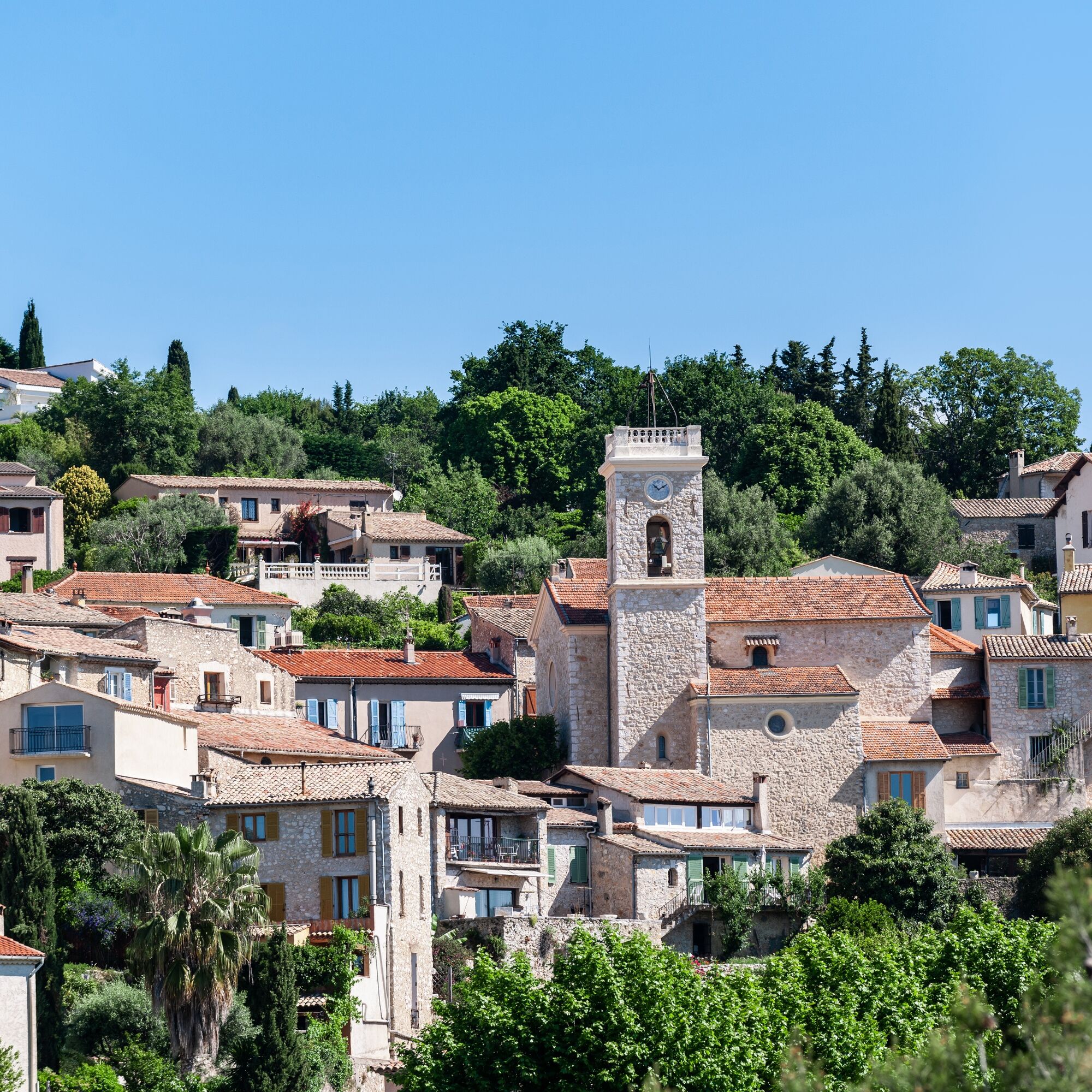
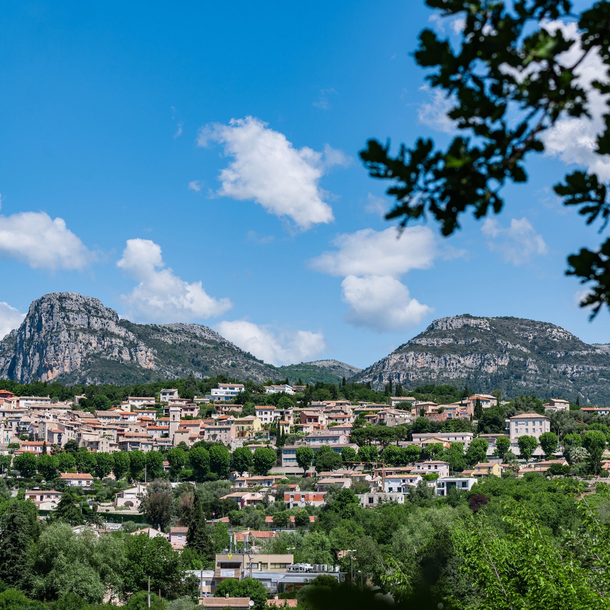
The village of La GaudeThe village nestled at the foot of the Baous mountain range, from Roman to medieval times to the present day.
The Roman sarcophagusThe sarcophagus with compartments...
Points of interest
The village of La GaudeThe village nestled at the foot of the Baous mountain range, from Roman to medieval times to the present day.
The Roman sarcophagusThe sarcophagus with compartments for collecting funerary urns, dating from Roman antiquity.
The Via Aurelia and the Roman bridgeThe authentic Roman road and bridge, classified as a historical monument.
Mediterranean forests and their biodiversityThe specific biodiversity of Mediterranean forests: a mix of coniferous and deciduous trees, the rustling of small forest animals, the forest cycle...
The former IBM research center Rural roadsThe importance of rural roads in the past, and the indispensable communication between villages.


From the parking lot, visit the village via Rue Louis Michel Feraud and then Rue Centrale.
At the intersection with rue du Four, turn left for 20 metres
then right, down the montée Saint-Apolline stairs.
Cross the Route de Cagnes and reach a mission cross. Turn left and follow the Voie Aurélia (ancient Roman road), passing the Roman sarcophagus.
Continue straight ahead on the Voie Aurélia and descend to a hairpin bend.
Leave the road and follow the path to the left. This leads to a Roman bridge and then to the "Var" side of the commune via the Chemin des Ambonnets, which joins the Route de Saint-Laurent.
Follow this road northwards for around 200m, then turn left onto the Chemin du Mont Gros. This takes you across the RM via a protected passageway in front of the stadium.
Go around the stadium and the waste disposal site on your right, and along the former IBM research center (rue André Merle).
Leave the center on your left all the time, then abandon it to go straight ahead into the forest on a narrow track. This joins the Font de Ribes et Vallon path, which you follow due south (red and white GR markings).
The path is segmented, but a continuous path leads to the second section of the path, then to the junction with the route de Saint-Jeannet at a traffic circle.
From this traffic circle, take "CR 21 de Cagnes à Gréolières". At a right angle to the left, leave the asphalt road and continue straight ahead along the valley to reach the traffic circle at the entrance to the village.
From here, you can easily reach the parking lot.
Tak
- Walking shoes are recommended
- Bring a backpack with water, a cap, a picnic or a few provisions, and warm, waterproof clothing.
- Flashlight or headlamp if you're going through a tunnel, or to avoid being caught out by nightfall
- First-aid kit
- Find out about local weather conditions before you leave
- Don't overestimate your abilities
- Inform someone close to you of your destination and departure time.
- Follow the yellow signposted paths and respect the direction of travel.
- Trails are shared: mountain bikers, horse riders and hunters may also use your route.
- Be an eco-citizen: take back your garbage, be discreet so as not to frighten off wild animals, and don't pick wild flowers or plants - a photo is enough of a souvenir.
- Respect private property, cultivated areas and natural spaces, and close gates after you've passed through.
- In summer, when the weather is hot, vegetation is very sensitive to the risk of fire, so don't light any fires - you're jeopardizing your own safety and that of others.
The Lignes d'azur network offers a single fare system throughout the Nice Côte d'Azur metropolitan area. Validation is compulsory each time you board the bus, regardless of the ticket used. To consult all fares, click here: www.lignesdazur.com
Line 55 stop "La Gaude" Village" departing from Cap 3000 in St Laurent du Var.
Possibility of modifying the departure of the circuit: line 54 departing from Grand Arénas in Nice, stop "La Gaude Stade".
Parking in front of the town hall
Or start at the La Gaude stadium, next to the waste disposal center (rue André Merle)
All outdoor activities in the Nice Côte d&039;Azur region can be found at
Popularne wycieczki w okolicy
-
4,8
Tour du Cap-Ferrat
średniWędrówka 8,99 km -
Little hike in Nice: the Mont Boron route
światłoWędrówka 5,13 km -
Grande Randonnée® de Pays: Lou Camin Nissart
ciężkidługodystansowy szlak pieszy 44,7 km -
Nice - Aspremont / Pagarine Route (stage 1)
średniWędrówka 15,8 km -
4,0
Little hike in Aspremont: Mont Chauve circuit
światłoWędrówka 6,49 km -
FFC bike circuit no. 8: the 70.3 circuit (Half IRONMAN)
średniDroga rowerowa 92,8 km -
FFC bike circuit no. 5: on the Tour De France routes (big loop)
średniDroga rowerowa 74,2 km -
5,0
Goldtoni - Alpenbogen A082 Drap-Nizza
światłodługodystansowy szlak pieszy 26,4 km -
FFC cycle route no. 1: Tour of Cap Ferrat
światłoDroga rowerowa 20,4 km -
A short walk in Saint-Jeannet : Les Baous de la Gaude and St-Jeannet
średniWędrówka 12,2 km

Wędrówki i tropienie


Nie przegap ofert i inspiracji na następne wakacje
Twój adres e-mail została dodana do listy mailingowej.





