FFC cycle route no. 1: Tour of Cap Ferrat
światło
Droga rowerowa
Nawigacja
Nawigacja
Pobierz tę trasę na swój telefon komórkowy
Mapa
FFC cycle route no. 1: Tour of Cap Ferrat
światło
Droga rowerowa
20,41 km
Zeskanuj kod QR i rozpocznij nawigację w aplikacji bergfex.
QR Code
Wędrówki i tropienie
Pobierz dla iOS
Pobierz dla systemu Android

FFC cycle route no. 1: Tour of Cap Ferrat

światło
Droga rowerowa
Odległość
20,41 km
Czas trwania
01:30 h
Ascent
183 hm
Poziom morza
2 - 77 m

Poziom trudności: 2

Ścieżka do pobrania
Mapa
FFC cycle route no. 1: Tour of Cap Ferrat
światło
Droga rowerowa
20,41 km

Zdjęcia naszych użytkowników

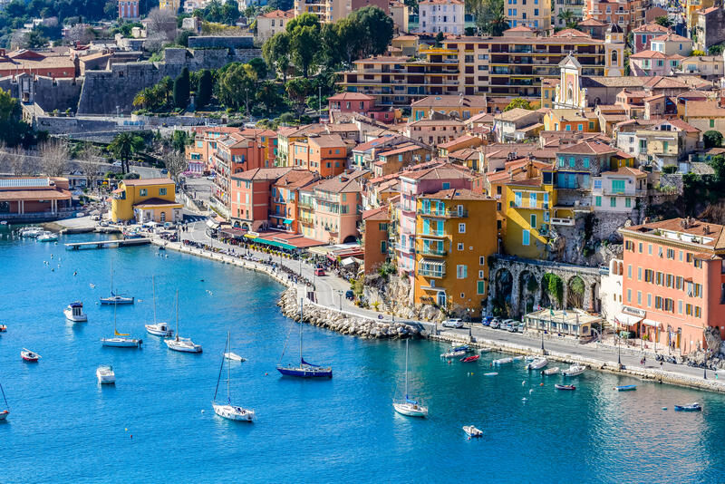
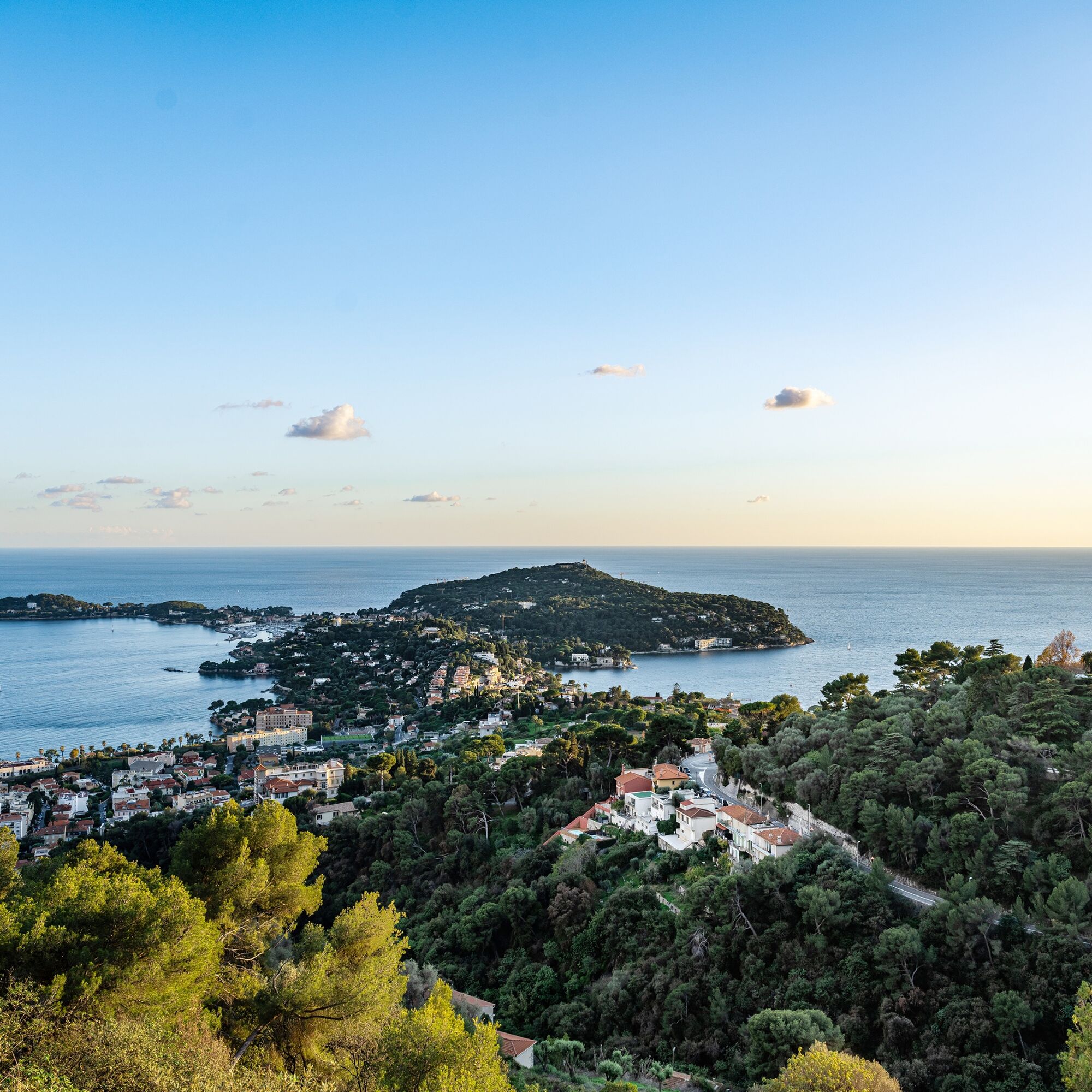
A short detour to the Lighthouse located at the southern tip of the peninsula signals the entrance to the harbor of Villefranche. Also worth seeing is the maritime center of Saint-Jean-Cap-Ferrat which...


Opis

A short detour to the Lighthouse located at the southern tip of the peninsula signals the entrance to the harbor of Villefranche. Also worth seeing is the maritime center of Saint-Jean-Cap-Ferrat which can offer an unforgettable stop.

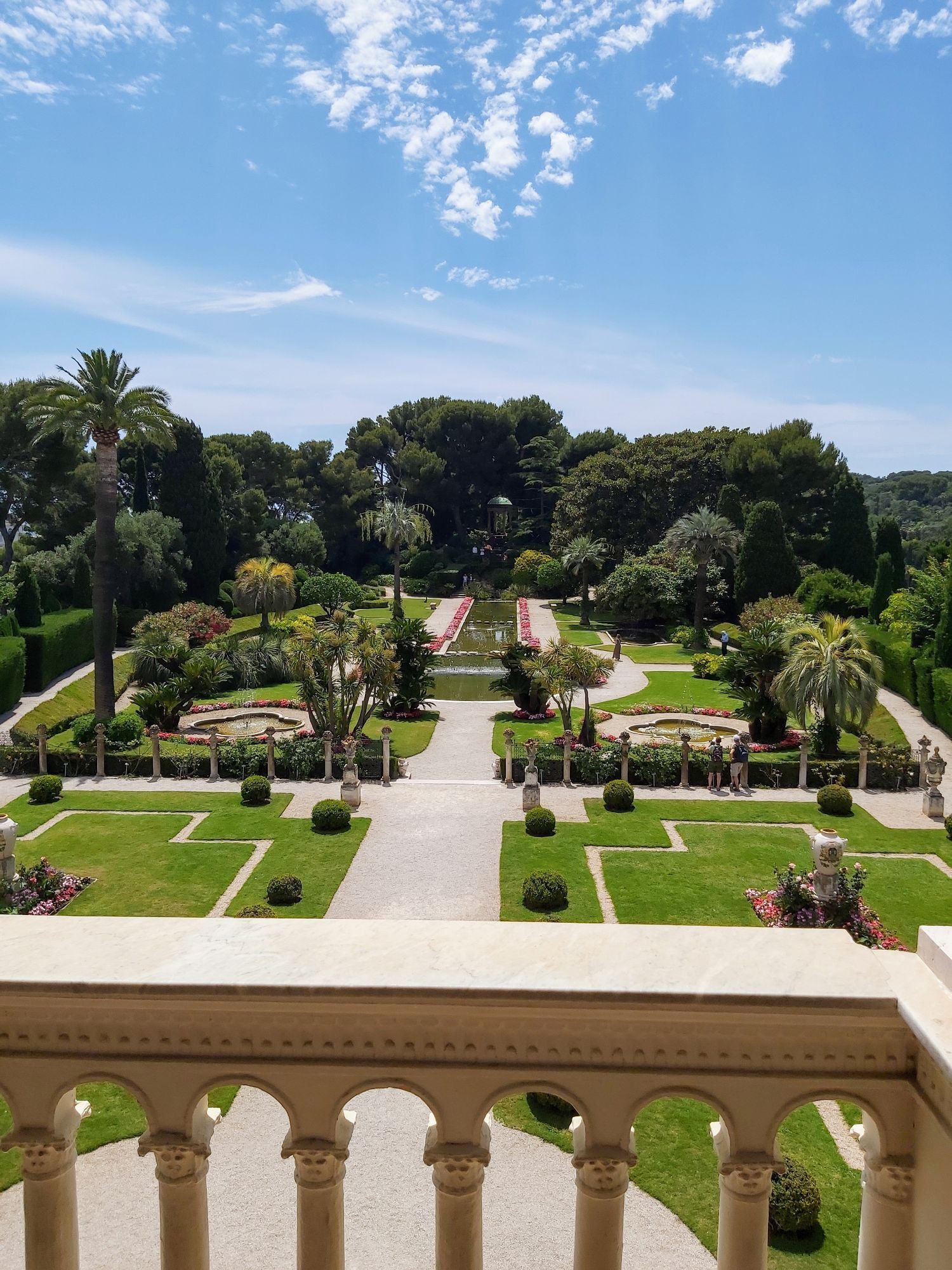
Also to discover on the way back, the villa Ephrussi de Rothschild is one of the most beautiful Renaissance-style palaces on the Côte d’Azur, built on a peninsula summit between 1905 and 1912 by Baroness Béatrice Ephrussi de Rothschild. The museum gives a particularly vivid idea of what the residence of a great art lover of the Belle Époque who had a special interest in the 18th century was like. The museum, open to the public daily, is one of the most visited sites between Nice and Menton.

All outdoor activities of the Nice Côte d'Azur Metropolis are available at https://outdoor.nicecotedazur.org 

Trasa
Église Notre-Dame du Port
(7 m)
Miejsce kultu
0,1 km
Villefranche-sur-Mer
(33 m)
Wioska
5,1 km
Remelin
(56 m)
Sąsiedztwo
5,2 km
La Ville
(41 m)
Sąsiedztwo
5,5 km
Chapelle Saint-François de Sales
(56 m)
Miejsce kultu
8,5 km
Villefranche-sur-Mer
(33 m)
Wioska
15,5 km
Église Notre-Dame du Port
(7 m)
Miejsce kultu
20,3 km
Trasa
Mapa
FFC cycle route no. 1: Tour of Cap Ferrat
światło
Droga rowerowa
20,41 km
Nice
(6 m)
Miasto
0,0 km
Église Notre-Dame du Port
(7 m)
Miejsce kultu
0,1 km
Séminaire Saint Paul
(18 m)
Miejsce kultu
1,3 km
Pizza du Mont Boron
(67 m)
Restauracja
2,3 km
Chapelle de la Pointe de la Rascasse
(60 m)
Miejsce kultu
3,2 km
bd Princesse Grace de Monaco-Rochambeau
(54 m)
Punkt widzenia
4,0 km
Saint-Estève
(110 m)
Sąsiedztwo
4,7 km
L'Octroi
(21 m)
Sąsiedztwo
4,8 km
Safranet
(94 m)
Sąsiedztwo
5,0 km
La Citadelle
(33 m)
Sąsiedztwo
5,1 km
Villefranche-sur-Mer
(33 m)
Wioska
5,1 km
La Gravette
(32 m)
Sąsiedztwo
5,1 km
Remelin
(56 m)
Sąsiedztwo
5,2 km
Corne d'Or Sud
(138 m)
Sąsiedztwo
5,4 km
La Ville
(41 m)
Sąsiedztwo
5,5 km
La Barmassa
(144 m)
Sąsiedztwo
5,7 km
Darie La Madone
(112 m)
Sąsiedztwo
5,8 km
Malariba
(120 m)
Sąsiedztwo
6,1 km
Povette
(78 m)
Sąsiedztwo
6,6 km
Les Deux Rups
(15 m)
Sąsiedztwo
6,8 km
Grasseuil
(23 m)
Sąsiedztwo
7,0 km
Pont Saint-Jean
(23 m)
Korytarz/teren
7,1 km
Chapelle Saint-François de Sales
(56 m)
Miejsce kultu
8,5 km
Chapelle Saint-François de Sales
(56 m)
Miejsce kultu
11,5 km
Saint-Jean-Cap-Ferrat
(14 m)
Wioska
12,0 km
Pont Saint-Jean
(23 m)
Korytarz/teren
13,5 km
Grasseuil
(23 m)
Sąsiedztwo
13,8 km
Les Deux Rups
(15 m)
Sąsiedztwo
14,0 km
Povette
(78 m)
Sąsiedztwo
14,1 km
Malariba
(120 m)
Sąsiedztwo
14,6 km
Darie La Madone
(112 m)
Sąsiedztwo
14,9 km
La Barmassa
(144 m)
Sąsiedztwo
15,1 km
La Ville
(41 m)
Sąsiedztwo
15,2 km
Corne d'Or Sud
(138 m)
Sąsiedztwo
15,4 km
Villefranche-sur-Mer
(33 m)
Wioska
15,5 km
Remelin
(56 m)
Sąsiedztwo
15,6 km
La Citadelle
(33 m)
Sąsiedztwo
15,7 km
La Gravette
(32 m)
Sąsiedztwo
15,7 km
Safranet
(94 m)
Sąsiedztwo
15,8 km
L'Octroi
(21 m)
Sąsiedztwo
15,9 km
Saint-Estève
(110 m)
Sąsiedztwo
16,1 km
bd Princesse Grace de Monaco-Rochambeau
(54 m)
Punkt widzenia
16,9 km
Chapelle de la Pointe de la Rascasse
(60 m)
Miejsce kultu
17,4 km
Pizza du Mont Boron
(67 m)
Restauracja
18,5 km
Grotte préhistorique du Lazaret
(29 m)
Wejście do jaskini
18,7 km
Belvédère du Mont Boron
(72 m)
Punkt widzenia
18,8 km
Église Notre-Dame du Port
(7 m)
Miejsce kultu
20,3 km
Informacje o wycieczce

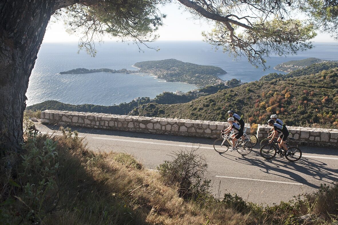
Discover Cap-Ferrat on a quiet route amidst the most beautiful residences of the Côte d’Azur and the magnificent setting of the Cap-Ferrat peninsula.

Technologia
2 / 6
Stan
2 / 6
Krajobraz
6 / 6
Doświadczenie
2 / 6
Dostępny przez cały rok
Sty
Lut
Mar
Kwi
Maj
Cze
Lip
Sie
Wrz
Paź
Lis
Gru
Udostępnij trasę
Mapa
FFC cycle route no. 1: Tour of Cap Ferrat
światło
Droga rowerowa
20,41 km
Błąd
Wystąpił błąd. Spróbuj ponownie.
Informacje o trasie
Trasa
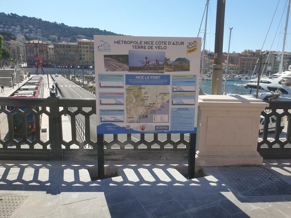
 From the viewpoint installed on the west side of Place de l’Ile de beauté, descend to the port via Quai des 2 Emmanuel, on the left is the Café du cycliste, a meeting place for cycling enthusiasts. Leave the quay, turning left onto rue du Lazaret, then turn right following signs: Lazaret Caves. After leaving Bd Stalingrad, the route takes the Bd Franck Pilatte which overlooks the port near the ferry departures to Corsica. Past the square Théodore de Banville, a steep climb begins (rue Jean Lorrain) to reach the top, the Basse corniche road (RM 6098). From this point, turn right towards Villefranche/Mer. Don’t miss a break at the cliff viewpoint Princess Grace of Monaco to admire the harbor of Villefranche and the peninsula of Saint-Jean-Cap-Ferrat. At the exit of the center of Villefranche-sur-Mer, a steep climb awaits cyclists. Once this difficulty is overcome, the descent leads to the town of Beaulieu. Turn right towards Saint-Jean-Cap-Ferrat via RM 25. Access the Cap tour via another steep climb marked to the right by a sign: Town Hall – Hôtel du Cap Ave Albert 1st. Arrived on the plateau, in front of the stadium entrance, take Bd du Général de Gaulle in the direction of the Semaphore to do the 3.3 km loop of the Cap. To return to the starting point, simply take the same route with a variant at the entrance to Nice via Bd Carnot.
Sprzęt

 -Wear an approved helmet

 -Check the condition of your tires

 -Bring a repair kit in case of a flat tire

 -Prefer at least a flashing LED light to attach to the seat post to be seen by motorists

Instrukcje bezpieczeństwa

Emergency number: 112

BASIC RULES

 -Choose a route suited to your physical condition, do not overestimate your abilities

 -Make sure to carry an ID and an emergency contact number

 -Respect traffic lights

 -Preferably use bike lanes when available, otherwise, a sign may require you:
If the "bike lane" sign is square: you decide.
If it is round, you must use this lane obligatorily.

 -Respect the environment and other road users

GOOD PRACTICES FOR GROUP RIDING

 -Riding two abreast is allowed, but single file is required:

- at dusk or in poor visibility

- when a vehicle wanting to overtake signals its approach

- In case of a breakdown, move to the low side of the road and not on the road - At 'Stop', yellow light, solid or flashing red light, stop completely for the entire group.

- Communicate within the group and use verbal and gestural language to signal obstacles or vehicles. A simple gesture or word can prevent a fall or accident.

Informacje o przyjeździe
Przybycie

Head towards PORT DE NICE

Transport publiczny

Find bus routes at: https://www.lignesdazur.com

Parking

Paid underground parking at PORT LYMPIA 100 m from the starting point - Access via Quai de la Douane

Paid surface parking at PHARE DU PORT DE NICE 400 m from the starting point - Access via place Guynemer

Dodatkowe informacje i wskazówki
Poziom trudności

2

Wskazówki

Route intended for recreational use - FFC color: green -

Nie ma jeszcze recenzji
Napisz recenzję

Recenzje pomagają innym użytkownikom wybrać kolejną przygodę. Oceniaj tylko trasę, a nie pogodę lub przekąskę.

Wybierz jedną z gwiazdek, aby ocenić wycieczkę
Zła trasa
Słaba trasa
Przeciętna wycieczka
Dobra wycieczka
Doskonała wycieczka
bergfex logoUzyskaj wgląd Zawsze na żywo z ponad 9 500 kamer internetowych. bergfex Jako użytkownik Pro, możesz teraz zobaczyć odpowiednie kamery internetowe dla wielu wycieczek w aplikacji wycieczki od. Pozwala to na bezpośredni podgląd aktualnych warunków.
Wędrówki i tropienie

Wędrówki i tropienie

Pobierz dla iOSPobierz dla systemu Android
Wędrówki i tropienie
Ponad 550.000 propozycji wycieczek, szczegółowe mapy i intuicyjny planer tras sprawiają, że aplikacja jest niezbędna dla wszystkich entuzjastów przyrody.
Wędrówki i tropienie
bergfex bergfex