





Yhdysreitti, Liperin Kinttupolut
The Yhdysreitti of Liperin Kinttupolut connects the Kinttupolut and Lykynpolut trail networks as well as other Joensuu region trails into one comprehensive network. The route starts from the Pärnävaara...
The Yhdysreitti of Liperin Kinttupolut connects the Kinttupolut and Lykynpolut trail networks as well as other Joensuu region trails into one comprehensive network. The route starts from the Pärnävaara direction near the Pieni Heinälampi lean-to, where Surmilampi Trail, Heinälampi Trail, and Yhdysreitti meet. The Yhdysreitti mainly follows sandy roads and sandy terrain tracks.
Along the way, there are several signboards where you can check your location and direction towards Lykynpolut or Jaama Trail. The route’s waymark color is purple. Along the route, the same path is also shared in the beginning by Surmilampi Trail (turquoise waymark color), in the middle by Mertalampi Trail (yellow waymark color), and at the end by Jaama Trail (orange waymark color). You can therefore also choose alternative routes towards Lykynlampi via Kinttupolut and Lykynpolut.
You can also access other Joensuu region trails from Yhdysreitti via Jaama Trail. This uniformly marked and easy-to-navigate network is nearly 200 km long.
Joensuu region trails (map)
Liperin Kinttupolut (map)
Lykynpolut (map)

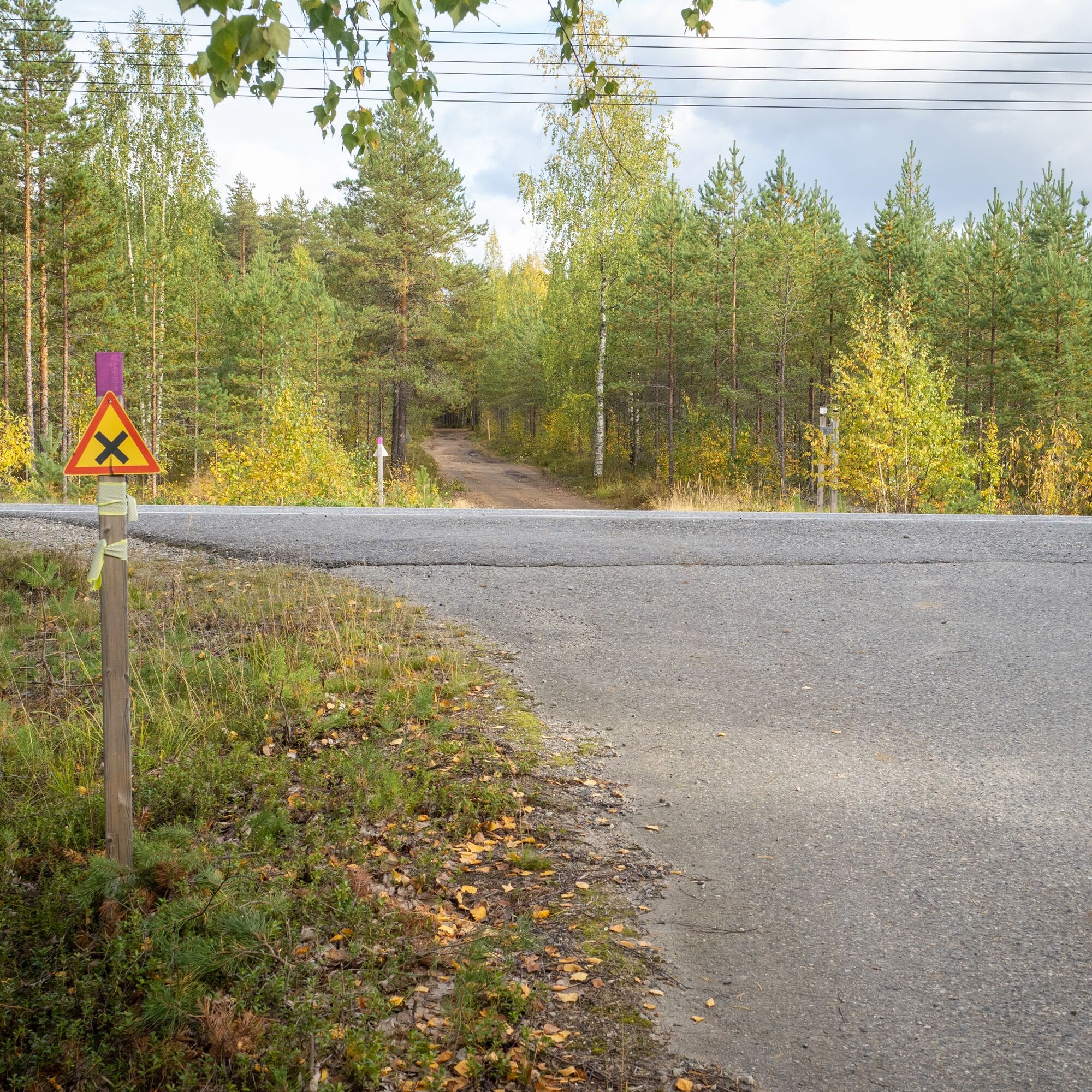
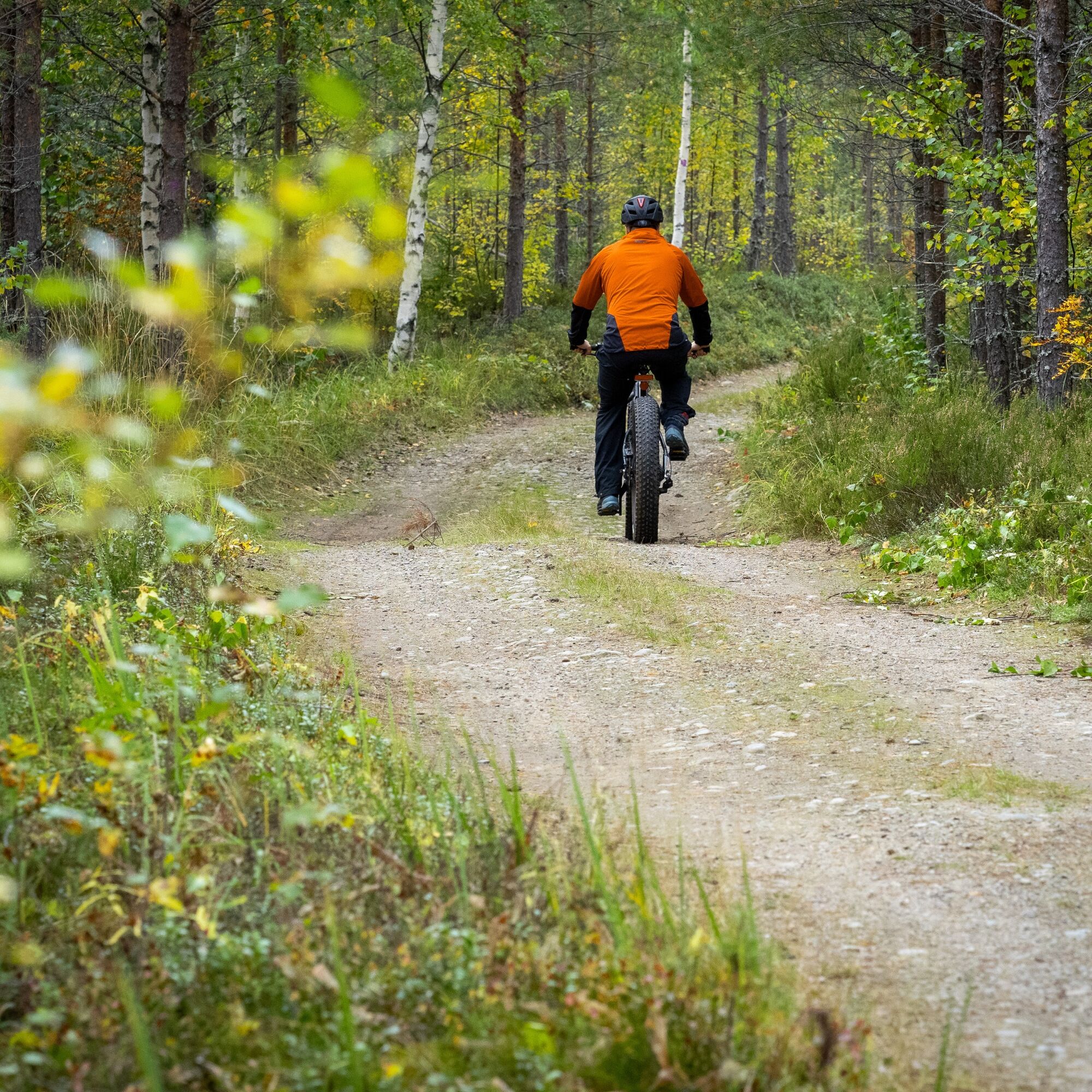

The route starts near the Pieni Heinälampi lean-to from the point where Surmilampi Trail, Heinälampi Trail, and Yhdysreitti meet. Follow the route marked with purple waymarks towards Lykynlampi. The route goes along forest sandy roads and terrain tracks. Just before the halfway point, there is an asphalt road crossing, where caution is advised. After this, the path becomes narrower and the route passes for a while along the Joensuu airport area. Another road crossing and along ski tracks to Lykynlampi.
Weather-appropriate clothing and gear
Enough drinks and snacks
Watch out for road crossings
Small first-aid kit
112 app installed on your phone
West end of Yhdysreitti: Drive from Joensuu along highway 9 towards Kuopio about 10 km, exit at junction no. 21 and then follow signs to Pärnävaara sports center. You can reach the start of Yhdysreitti via the Liperin Kinttupolut trails.
East end of Yhdysreitti: Drive from Joensuu along highway 9 towards Kuopio about 4 km, exit at junction no. 23 and follow signs for Lykynlampi at the Lykynlampi outdoor area.
The easiest access to Yhdysreitti is from its eastern end, located in front of Lykynlampi outdoor lodge. There is regular bus service to Lykynlampi.
If starting from the west end, the best starting point is Pärnävaara sports center (Urheilutie 5A, Ylämylly), from where you can reach the starting point of Yhdysreitti via other Kinttupolut routes (about 3-4 km).
The nearest bus stop from Pärnävaara sports center is Jyrinlenkki 1, from which it's about 900 meters to Pärnävaara sports center along the road.
Check schedules at https://jojo.joensuu.fi/.
Free parking spaces.
Lykynlampi has a beautiful Lykynpolut trail network.
Take a detour along Yhdysreitti to Lykynlampi, which has the magnificent Lykynpolut trail network. Especially the Lykynvaara Trail is worth seeing.
There is a swimming spot at Lykynlampi
Popularne wycieczki w okolicy
-
Liperin Kinttupolut (the easiest trails accessed from Kaprakka)
światłoMountainbike 28,2 km -
Lykynlampi (Winter) Trail, Lykynpolut
światłoMountainbike 5,20 km -
Jaama Trail, easy circular route around Joensuu
światłoMountainbike 59,4 km -
Surmilampi Trail, Liperin Kinttupolut
średniTrailrunning 6,55 km -
Joy of riding, the best parts of Joensuu region routes 184 km
średniMountainbike 184,3 km -
Jyri Trail, Liperi Kinttupolut
średniTrailrunning 16,0 km -
The best parts of Kontionpolku
średniMountainbike 40,8 km -
Kuhasalo accessible route
światłoWędrówka 3,36 km -
Pahakala Trail, Liperin Kinttupolut
światłoWędrówka 12,3 km -
Kontioniemi Trail
średniWędrówka 8,98 km
Wędrówki i tropienie


Nie przegap ofert i inspiracji na następne wakacje
Twój adres e-mail została dodana do listy mailingowej.





