


On the Romanesque roads: Chivasso - Casalborgone - Vezzolano
A connecting itinerary that starts from the Duomo of Chivasso (15th century cathedral) and, after crossing the Po at the Nature Reserve of the confluence with the Orco and Malone streams, goes up the hillside...
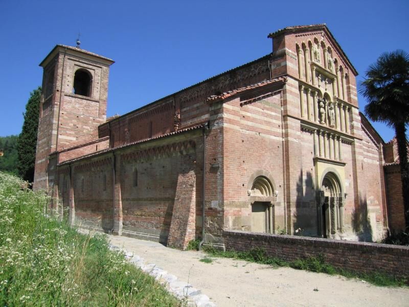
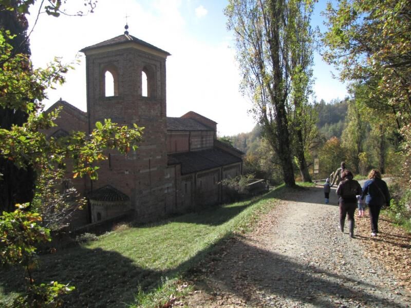
A connecting itinerary that starts from the Duomo of Chivasso (15th century cathedral) and, after crossing the Po at the Nature Reserve of the confluence with the Orco and Malone streams, goes up the hillside near Castagneto Po with suggestive views over the plain, the Bosco del Vaj wood, and the scenic hamlet of Villa di San Sebastiano da Po. You then descend to Casalborgone, passing through the characteristic "Leu" (which means "place") whose oldest buildings date back to the 11th century. The huge castle situated on a high hillside crag and supported by walls, was built on the remains of the Tower of the Radicati family, who dominated the area from the 13th to the mid-16th century. You then climb up towards Berzano San Pietro and, having passed the centre of the village, continue along the wooded slope of Cascina Vasco, shortly reaching the Abbey of S. Maria di Vezzolano and the interconnection with the Superga - Vezzolano -Crea ridge itinerary.

Tak
Popularne wycieczki w okolicy
-
UNESCO Grand Cycling Tour
ciężkiKolarstwo długodystansowe 659,6 km -
ANDEZENO - Panoramic loop towards Pino Torinese
średniJazda na rowerze 35,0 km -
CHIERI - Among vineyards, hills and history toward the Abbey of Vezzolano.
średniDroga rowerowa 58,6 km -
CHIERI - Ring toward Pavarolo, Montaldo T.se and Andezeno
średniJazda na rowerze 32,9 km -
CASALBORGONE - Bosc Grand and Bosco del Vaj by MTB
średniMountainbike 22,6 km -
Avanti Savoia!
średniMountainbike 25,0 km -
TURIN - Double loop with 3 adrenaline-pumping MTB descents
ciężkiMountainbike 25,9 km -
Cycling between Arignano, Moriondo and Mombello
średniKolarstwo długodystansowe 28,1 km -
Cycle hiking ride between Montaldo, Andezeno and Pavarolo
średniMountainbike 21,2 km -
RING_CYCLOTURIST_TORINO_SOUTH - Day 5 - from Chieri to Casalborgone
średniKolarstwo długodystansowe 29,7 km
Wędrówki i tropienie


Nie przegap ofert i inspiracji na następne wakacje
Twój adres e-mail została dodana do listy mailingowej.