


Varaita Valley Trekking: Stage 3 Frassino - Becetto
Zdjęcia naszych użytkowników
From the square in Frassino we follow the paved carriage road in the direction of Chiaronto and turn left to Borgata Peyracchia. The mule track leads us to Borgata Serre Superiore. Passing under the porch...
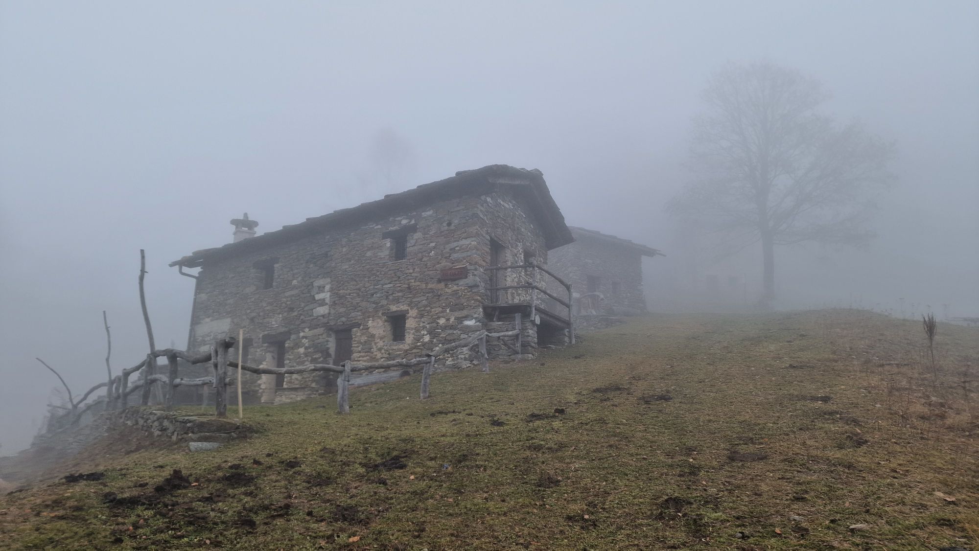
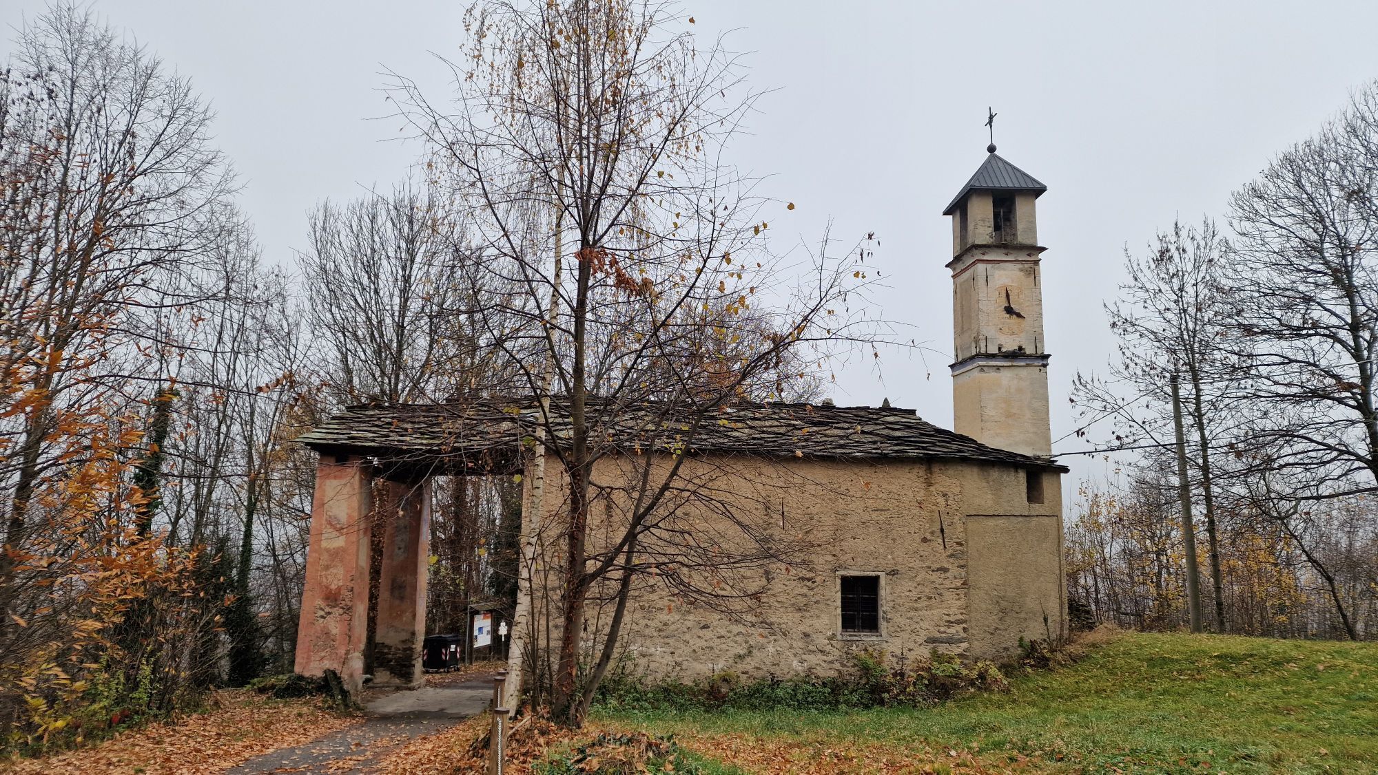
From the square in Frassino we follow the paved carriage road in the direction of Chiaronto and turn left to Borgata Peyracchia. The mule track leads us to Borgata Serre Superiore. Passing under the porch of the chapel of San Sebastiano.We cross the different hamlets always keeping to the right and reach the shrine of Madonna degli Angeli. Just before the building, on the right, the mule track starts that in a short time takes us to the hamlet of Chiaronto, passing through the hamlet of Borgione. Past the chapel of St. Anthony we cross the hamlet of Chiaronto. Leaving the votive pillar and stone fountain on the right, we follow the mule track uphill to the hamlet Ruera. Still following the path with the ruins of the Ruera hamlet behind us, after a few meters, we take the path on the right that climbs in the direction of the Colletto di Rore meires. Past the pylon and before the fountain we take the path on the left downhill and follow it until the Meira Paula sign with a fork on the right. This is followed by a flat section to the meire where the refuge of the same name stands, which can be used as an inter-tap post, and ends the forest track coming from the Rore valley. Following the same for about 400 meters, we find on the left, just before an obvious clearing, the path that, crossing a beautiful beech forest, takes us to the locality of Sabbione. Following the paved carriage road almost level for a few hundred meters, we leave out the fork on the left downhill that leads to Rore and, passing the houses of Vallone Ricchiardi and the chapel of S. Stefano, we reach the locality Vallone Rostagno, where the road ends. Crossing the partly ruined village, we take on the right, following the signs, the slightly downhill path that crosses the Combe stream at a stone bridleway. Going up the opposite slope and reaching the votive pillar of the "Gardetta," we continue on the level path to reach the church of S.Antonio di Dragoniere. Having crossed the hamlet, we take the paved road on the right uphill in the direction of Serre and immediately leave it on the left, skirting the wall downstream of the cemetery in the direction of the Cantarane stream. Past the small watercourse we continue uphill to shortly reach the hamlet of Becetto.

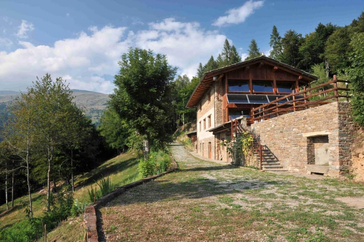
From the square in Frassino we follow the paved carriage road in the direction of Chiaronto and turn left to Borgata Peyracchia. The mule track leads us to Borgata Serre Superiore. Passing under the porch of the chapel of San Sebastiano, we cross the different hamlets always keeping to the right and reach the shrine of Madonna degli Angeli. Just before the building, on the right, the mule track starts, which in a short time takes us to the hamlet of Chiaronto, passing through the hamlet of Borgione. Past the chapel of St. Anthony we cross the hamlet of Chiaronto. Leaving the votive pillar and stone fountain on the right, we follow the mule track uphill to the hamlet Ruera. Still following the path with the ruins of the Ruera hamlet behind us, after a few meters, we take the path on the right that climbs in the direction of the Colletto di Rore meires. Past the pylon and before the fountain we take the path on the left downhill and follow it until the Meira Paula sign with a fork on the right. This is followed by a flat section to the meire where the refuge of the same name stands, which can be used as an inter-tap post, and ends the forest track coming from the Rore valley. Following the same for about 400 meters, we find on the left, just before an obvious clearing, the path that, crossing a beautiful beech forest, takes us to the locality of Sabbione. Following the paved carriage road almost level for a few hundred meters, we leave out the fork on the left downhill that leads to Rore and, passing the houses of Vallone Ricchiardi and the chapel of S. Stefano, we reach the locality Vallone Rostagno, where the road ends. Crossing the partly ruined village, we take on the right, following the signs, the slightly downhill path that crosses the Combe stream at a stone bridleway. Going up the opposite slope and reaching the votive pillar of the "Gardetta," we continue on the level path to reach the church of S.Antonio di Dragoniere. Having crossed the hamlet we take the asphalt road on the right uphill in the direction of Serre and immediately leave it on the left, skirting the wall downstream of the cemetery in the direction of the Rio Cantarane stream. Having crossed the small stream we continue uphill to shortly reach the locality of Becetto.
Tak
you go up the Varaita Valley to the village of Frassino. From the main square on the right starts the route
The Chiaronto Adventure Trail
The crags of the Coup de Roure
Popularne wycieczki w okolicy
-
4,0
Historic Mountain Routes | Cannon Road
ciężkiMountainbike 43,2 km -
5,0
Rifugio Quintino sella - monte Monviso
średniWspinaczka 9,13 km -
5,0
Occitan routes: Stage 6 Elva - San Michele di Prazzo
średniWędrówka 11,5 km -
5,0
Percorsi Occitani: Tappa 4 Frazione Camoglieres - San Martino Inferiore
średniWędrówka 16,8 km -
5,0
01-Monviso Ring. Rifugio Alevè - Rifugio Quintino sella Pontechianale, Piemont/Italien
światłoWędrówka 11,8 km -
3,5
Occitan Routes Stage 5
średniWędrówka 6,86 km -
Occitan Routes: Stage 1 Ciciu di Villar - Frazione Sant'Anna di Roccabruna
średniWędrówka 15,9 km -
5,0
Strada dei Cannoni
średniWędrówka 56,1 km -
5,0
Goldtoni - Alpenbogen A110 Ruata Valle (Stroppo)-Refugio Grongrius Martre
średnidługodystansowy szlak pieszy 28,4 km -
Occitan Routes: Stage 3 Pagliero hamlet of San Damiano Macra - Camoglieres hamlet
średniWędrówka 10,6 km

Wędrówki i tropienie


Nie przegap ofert i inspiracji na następne wakacje
Twój adres e-mail została dodana do listy mailingowej.