







Via Francigena of the Susa Valley from Mont Cenis | Stage 4 Almese - Turin

Poziom trudności: T1
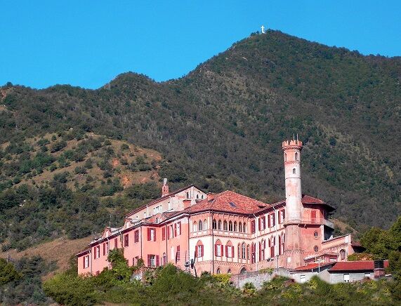
Following the cycle path through the hamlet of Milanere, we continue on a lightly trafficked road, skirting the slopes of Mount Musinè up to the entrance of Caselette: to the right, on a rocky spur, stands...
The Francigena route continues toward Turin. Below Camerletto Castle, near the SS24, a dirt road leads through flat fields bordering the Dora Riparia: also marked as a cycle path, it takes you on a pleasant walk to the Ponte Vecchio in Alpignano, joining the route from Sant’Antonio di Ranverso. In Alpignano, the Church of Saint Martin of Tours holds a remarkable wooden crucifix by the 18th-century sculptor Carlo Giuseppe Plura. The city was a Roman colony and mentioned in the Middle Ages for an important domus hospitali on the Road of France, once under the Abbey of Novalesa; today, it is also known for the Ecomuseum "Sogno di Luce," dedicated to the lightbulb inventor Alessandro Cruto.
Continuing along the cycle path, you reach Pianezza, where the main street features the Church of Saint Peter (12th century), with characteristic Romanesque architecture but frescoed internally in the 15th century by Jaquerio and his workshop. Closely tied to the Francigena route is the Church of Santa Maria della Stella, richly frescoed in the 15th century. The fortified nucleus of the "ricetto," deeply transformed or incorporated into the historic center, is partially visible but still stands the medieval Ricetto Tower, now the civic tower.
In Collegno, noteworthy is the Church of San Massimo, the oldest cardinal church of the bishops of Turin, and the Certosa Reale, with an entrance portal designed by Juvarra.
The route, as in the past, follows the right side of the Dora Riparia along the cycle path until it merges into Corso Marche, marking the start of Turin’s extensive Pellerina area, where the original path of the "Strata Pellerina" passed. Just above Piazza Massaua, it reconnects with the Francigena route of Corso Francia.
Today’s Piazza Statuto corresponds to the area of the ancient Secusina Gate, in the Middle Ages supported by a grand system of domus hospitali, especially for accommodating travelers just outside or near the walls, such as the hospitals of Santa Maria, San Benedetto, and San Solutore Maggiore. The Francigena itinerary in Turin can be traced through the heart of the city from Piazza Statuto along Via Garibaldi, Barbaroux, Sant’Agostino, Santa Chiara, and Via Milano, ending at Largo IV Marzo and Piazza San Giovanni, where traces of medieval buildings can still be seen, and visiting ancient churches like Santo Spirito, San Domenico, Sant’Agostino, San Rocco, San Francesco d’Assisi, SS. Martiri, and Corpus Domini, though some have been extensively remodeled in the Baroque style. Inns and lodgings for merchants and pilgrims were located in the city center and along the Dora Riparia, near the city gates.
The heart of devotion, not only for the city, is the Cathedral of Saint John, the only Renaissance religious monument in Turin, accessed from the square adorned with the Savoy Royal Palace and dominated by the dome built by architect Guarino Guarini between 1668 and 1694 to house the Shroud, the linen that wrapped the body of Jesus Christ. From Piazzetta Reale, you pass into Piazza Castello and Palazzo Madama, now a major museum, concealing behind its Baroque facade the Decumanus Gate and part of the walls surrounding the Roman colony. From here, the modern Francigena route follows Via Po to reach the Gran Madre di Dio, one of the city’s most important and mysterious churches.


T1
L'arrivo indicato dalla mappa su corso Marche può raggiungere il centro di Torino seguendo la variante Rivoli-Torino della Via Francigena che parte dal Monginevro, proposto come tappa successiva. E da qui giungere fino a Vercelli con le successive tappe Torino-Chivasso, Chivasso-Castell'Apertole e Castell'Apertole-Vercelli.
Popularne wycieczki w okolicy
-
4,7
On the summit of the magical Musiné
światłoWędrówka 6,94 km -
Avigliana Lakes - Easy route, ideal for families with children
światłoWędrówka 9,25 km -
CASELETTE - The Musiné loop
średniWędrówka 7,52 km -
COLLE DEL LYS Partisan Trail
średniWędrówka 11,6 km -
VALLO TORINESE Passo della Croce and the Turu
średniWędrówka 4,29 km -
MONCALIERI - Biking on the water: Le Vallere and Valentino Park
światłoJazda na rowerze 17,0 km -
GIVOLETTO Madonna della Neve on Monte Lera
średniWędrówka 6,11 km -
VARISELLA The ruins of the Baratonia castle, churches, and pools of Varisella
średniWędrówka 10,1 km -
COLLE DEL LYS Monte Arpone loop
światłoWędrówka 4,50 km -
Easy route - Monte Cuneo (Moncuni) Loop route from Reano
światłoWędrówka 7,97 km
Wędrówki i tropienie


Nie przegap ofert i inspiracji na następne wakacje
Twój adres e-mail została dodana do listy mailingowej.





