






Between the Sesia and the vineyards of the Novara hills

Between the Sesia and the vineyards of the Novara hills, visiting fortified areas and medieval castles in Carpignano Sesia, Ghemme, Proh and Castellazzo.
Departure is from Castellazzo Novarese (square with...
Between the Sesia and the vineyards of the Novara hills, visiting fortified areas and medieval castles in Carpignano Sesia, Ghemme, Proh and Castellazzo.
Departure is from Castellazzo Novarese (square with a car park). Take the SP 154 on the right, just outside the village, to reach Sillavengo. In the village take the road to Cascine Giannotti. Turn right onto the SP16 to Carpignano Sesia. In the village turn left after 1.5 km (500m before the bridge) towards Ghislarengo. Take the dirt road on the right and go along it until you reach the SP106 (asphalt road). Follow the SP106 on the left to Ghemme.>br /< Cross Ghemme and exit onto the ring road; turn left and take the SP22 on the right. Go uphill along the road as far as Cascine Strona (7% gradient). Here turn right onto the dirt road that goes past the Fornace and arrives at Cascina Bergamina. From here, continue along the dirt road that follows the Strona stream and you will come to an intersection with the SP20 road that comes up from Fara.>br /< Turn left and go along the SP20 for about 2 km.>br /< Turn right and take the dirt road that remains flat for 3 km through the vineyards and then descends rapidly (downhill at a gradient of 10%) to the village of Proh; here, turn right and pass the railway crossing to intersect the SR299. Go along it to the left for 900m and turn right onto the SP14 to Castellazzo.

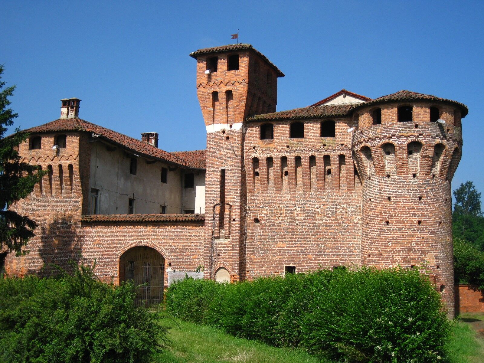


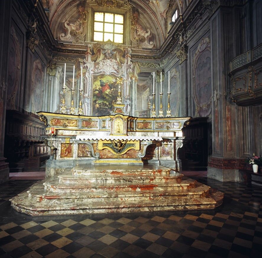
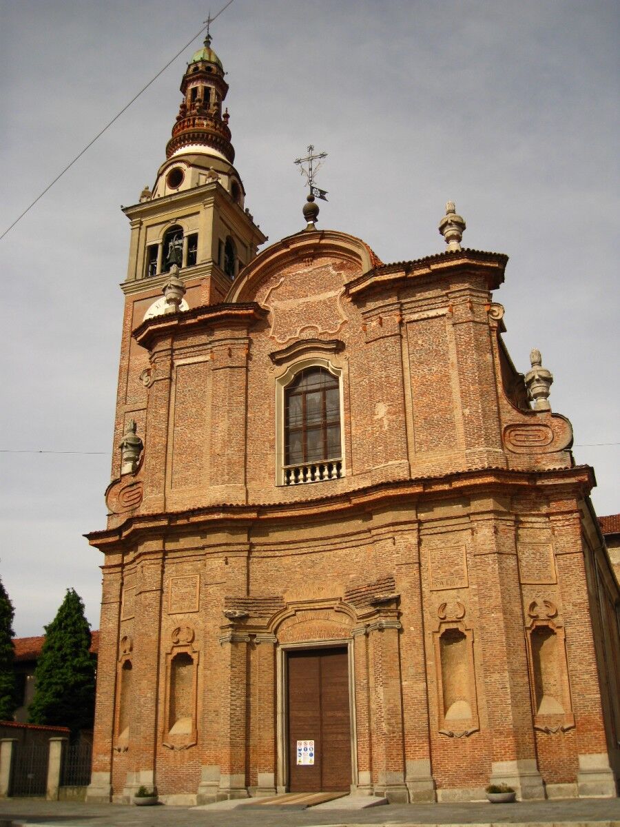


Route of approximately 41 km, of which 16 km are dirt roads; a varied route with ascents and descents and two fairly steep sections. It winds along minor roads or roads with low traffic with only brief unavoidable passages on roads with traffic.
Ghemme - Parish Church of Santa Maria Assunta: construction began in the mid-seventeenth century and was completed in the mid-eighteenth century. The interior preserves valuable masterpieces. Attached to the church is the Scurolo della Beata Panacea (1864-1875), which was a project entrusted by Alessandro Antonelli, a native of Ghemme
Ghemme - Castello-Ricetto: with a rectangular floorplan was built to defend the local populations from raids and incursions. The building was completed in the late fifteenth century. Today the complex preserves the ancient city walls of 4 meters high and 2 meters wide in the most colossal part. Several different buildings with arched windows, decorated with terracotta tiles
The Orientata delle Baragge Natural Reserve: established in 1992 to protect this particular area of nature , you can admire the Molina Cerulea, the grasses, evergreen shrubs and aquatic plants. There are also 167 beautiful species of birds, including the white and black stork, the lesser spotted woodpecker and the shrike capirossa. Foxes, hares and deer are often spotted
Sizzano – Cappella della Madonnina della Pace: the most recent sacred building built at Bergamina, which stands on the site where many partisans found refuge during the last world war
Briona-Proh - Rocchetta and Church of Santa Maria: in the midst of the green countryside of Novara there is the small 16th century fortification. Not far away is the Romanesque cell of Santa Maria which contains an important series of frescoes from the 15th century
Popularne wycieczki w okolicy
On the Hills from Cavallirio and Boca
światłoWędrówka 9,73 kmIn the hills of Borgomanero
średniMountainbike 41,3 kmBicinVigna with Antonelli - Pink Itinerary
średniMountainbike 40,9 kmFrom the rice plain to the hills of Middle Novara
ciężkiMountainbike 45,9 kmBicinVigna with Antonelli
średniMountainbike 25,2 kmLagoni di Mercurago Park
światłoMountainbike 12,5 kmMeina to Arona
E-Bike 31,0 kmTra le Colline e il Parco Fenera
ciężkiMountainbike 39,4 kmMaggiora, Piemonte/Italia
Wędrówka 10,1 kmSaint Bernard Trail | Stage 9 Momo (Holy Trinity) – Novara Cathedral
średniTrasa pielgrzymki 19,7 km
Wędrówki i tropienie


Nie przegap ofert i inspiracji na następne wakacje
Twój adres e-mail została dodana do listy mailingowej.





